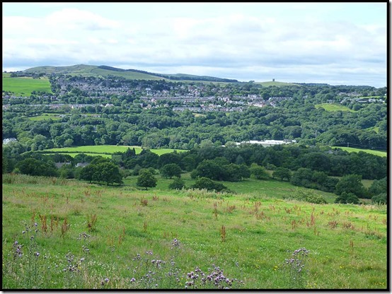
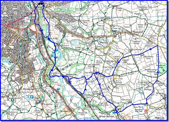
This posting is really to record a 1.5 hour bike ride route from the car park above the Midland Hotel in Marple Bridge. It’s easier to park there than it is to drive down the potholed road to Roman Lakes, although the ride is based on Roman Lakes’ route M1 – ‘Mellor Moor’.
It was a lovely morning for a ride – warm, sunny and calm, and this route has some proper hills.
Start by heading up past the station and taking the first left along Arkwright Road. Then turn left down Paywood Drive which leads past Bottom’s Bridge to Lakes Road and Roman Lakes Leisure Park. This is an alternative starting point with a small café and toilets.
Continue along the track, through a railway tunnel, past a farm building, and along a rough bridleway beside the railway to another farm, immediately before which turn left up a broken road which levels out after a few hundred metres. Turn right up another steep track that ends at a steep junction. Turn right* here – the track passes some houses then becomes a narrow path that soon joins a small road. Bear left up the road and over the top before dropping down to the hamlet of Brook Bottom.
If you time your visit correctly, you’ll struggle to pass the Fox Inn without pausing for refreshment. It’s looking much better than it did in September 2009!
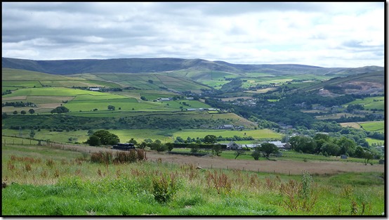
Beyond the Fox, engage low gear and continue along the road for 200 metres to a metal bench from where there’s a good view across the valley to Disley and Lyme Park.
Take a deep breath and turn left at the metal bench, up a steep stony track. I challenge you to ride this section without stopping. I wasn’t able to today, but a much stronger rider passed me and managed it without difficulty.
At the top of the track a left turn along Castle Edge Road allows you to rise more gently to good views across to Hayfield and Kinder Scout to your east.
The road turns into a wide track at the top of the hill, from where an enjoyable descent leads quickly to a junction where you turn sharp left along more tarmac.
Follow this road for nearly 2 km up to a point where a large wooden cross is above you on the left and a very loose rocky track (Black Lane) comes down steeply from the left. Turn right here, down a steep lane that becomes loose at the bottom. Before a gateway into a garden you turn right down a loose path with wooden drop offs (care!).
50 metres further on turn left down a narrower, looser path next to a fence and emerge at the bottom between houses. Turn right down the track and to reach the steep track at the junction where you turned right earlier*.
Retrace the route steeply down, but now turn right at the bottom at a T junction. Continue for 100 metres before taking a narrow track to the left between hedges. At the bottom of this track, turn right along the stony track that leads back to Roman Lakes and refreshments if you need them.
From Roman Lakes, return towards Bottom’s Bridge, before which a right turn along Low Lea Road past the mill renovation works takes you up to a point where a fast descent leads to the tarmac of Town Street in Marple Bridge. Turn left at the lights to return to the car park.
An enjoyable little jaunt with some mildly technical sections – about 15km with 400 metres ascent. Allow an hour and a half.
Here’s the Garmin file for this route:


No comments:
Post a Comment