What a cracking day for a bike ride.
I pootled off to Marple, intending to start the ride from the car park by the Midland Hotel in Marple Bridge, but roadworks encouraged me to park up before that at Rose Hill.
So instead of heading of down the Peak Forest Canal as planned, I decided to make this a ride of two halves, starting with the flat half.
I took the Middlewood Way as far as Nelson Pit (toilets), easily identified by the station platform and a large picnic area where the tracks used to be. The steps up to the left from the Middlewood Way are the only good reason to dismount on this entire ride.
A few metres up the road to the south east you join the Macclesfield Canal at a very busy marina where refreshments are available. The well surfaced towpath then leads easily to High Lane, where the Bull’s Head, pictured above, has often been used as a starting point for our evening walks.
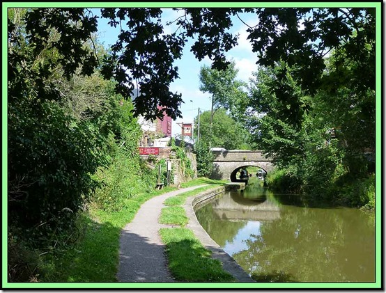
A right turn in Marple brought me to the Peak Forest Canal, heading towards New Mills, where the sweet factory was producing some alluring smells. Here’s a typical view from the towpath.
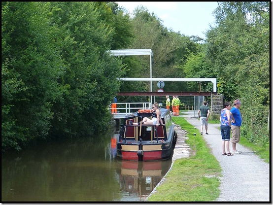
A little further on, one of the several drawbridges and swing bridges on this section of canal was being renovated. I asked them to pose for me, New York style, sitting on the top girder eating their lunches, but they didn’t seem too keen.
A spot of sunbathing whilst waiting for the drawbridge to open seemed in order.
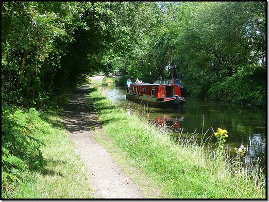
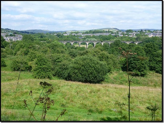
It was a hot day on the towpath, with good views across to a viaduct, home to one of many railway lines hereabouts. The following two pictures were taken from the same spot.
A pause for a cuppa after an hour in the saddle saw me on a bench chatting to a stranger who was feeding the ducks. This is a pleasure (chatting with strangers) that’s so much easier now I’m back from the Pyrenees!
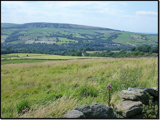
I’ll describe the rest of the route at the foot of this posting, but the second half of the ride – the hilly half – started at Furness Vale where a steep descent led to a 200 metre ascent to the high point of the ride (point 326 metres on Over Hill Road). The only photo I took doesn’t really capture the perspective. I am 200 metres above the bottom of the valley.
It was a lovely fast descent to Birch Vale, despite a minor aberration at Moor Lodge where I turned left by mistake. Then the Sett Valley Trail led to a steep ascent out of New Mills, past a care home for dementia sufferers outside which I enjoyed the rest of my tea and a banana, the reward for two hours of riding.
After rising steeply on tarmac to New Mills Golf Club the descent to Brook Bottom was down the steep stony track that I struggled up on Sunday. It’s much easier in descent! Then down to Brook Bottom and very slowly behind a trailer on which a man was sitting, trying to restrain a large fridge.
“Mountain biker killed by flying fridge” was his headline warning, but by the time we got to the top of the hill I was suggesting “fridge outpaces mountain biker up gentle slope”.
I took the fast track alongside the top of Mellor Golf Course, then the stony track down to Bottom’s Hall for a joke with some lads who were trimming the hawthorn and bramble hedge. After a brief ‘carry’ to avoid a puncture it was then a quick return to Rose Hill on the route described below.
I’d run out of tea, so refreshments at the excellent Railway pub at Rose Hill were most appreciated.
Here’s my route – just shy of 40km with about 500 metres ascent. It took me a leisurely three and a half hours including breaks totalling over half an hour.
The route:
Park near the access point to the Middlewood Way near Rose Hill station in Marple.
Take the Middlewood Way for nearly 6 km, leaving it sharp left up a stepped path by the picnic spot and old platform at Nelson Pit. Toilets are straight ahead after leaving the old railway track.
Turn right to reach the Macclesfield Canal and follow the towpath for nearly another 6 km, crossing a bridge in Marple to reach the towpath of the Peak Forest Canal heading in the direction of New Mills.
Soon cross to the left hand side of the canal and continue for about 8 km as far as Furness Vale, where you leave the canal after a large area where barges are moored on the other side of the canal.
[You have just been cycling along part of a 3000 mile walking route, European route E2, between Galway and Nice!]
In Furness Vale, look right to a level crossing to check you are in the right place, then bomb down the hill to your left and follow the road sharp left at a bridge. A few metres further on, engage a low gear and turn sharp right up Ladypit Lane which rises to a right hand bend where it turns into Dolly Lane. The lane undulates before climbing quite steeply to a high point where a narrower lane goes left up past Laneside Farm.
Follow this narrower lane steeply up to its high point at 326 metres*.
Then relax over the undulating if rough terrain followed by Over Hill Road, to Moor Lodge. Don’t make my mistake of turning left here, but follow the tarmac at breakneck speed to a sharp corner that brings you out at the main A6015 road in Birch Vale.
Turn right, and then first left. Continue down the hill, about 100 metres before the bottom of which a gate on the left introduces you to the Sett Valley Trail.
After about 1.5 km, turn right at a road, then left at the next junction. About a kilometre later, turn sharp right, steeply up Watford Road, past the dementia care home, to a junction where you go straight across and follow Apple Tree Road all the way to New Mills golf course.
Continue straight over Castle Edge Road and along the wide track, taking a narrower track to the left when the wide track forks right.
Take care on the rocky descent to a metal bench on Brook Bottom Road. Turn right to reach the Fox Inn.
There are numerous options from here, but the route I chose on this occasion follows the road through Brook Bottom and up a gentle hill beyond which it becomes a track. A right fork brings you gently up to Mellor golf course, alongside which you continue until just before the club house and car park, where left turns take you to an initially fast descent to a rough track leading over steadily rockier terrain to Bottom’s Hall.
Continue towards Bottom’s Bridge, before which you turn right past mill renovation work up the rough track that is Low Lea Road.
Descend pleasantly into Marple Bridge, where a left turn takes you down to the traffic lights. Turn left here, then first right into Brabyns Park.
Past the car park, take upward tracks that double back a little to cross the railway and reach the Peak Forest Canal. Turn right at the canal then cross it at a narrow bridge by the next lock down.
Go straight ahead up a narrow dirt track that brings you out on Grosvenor Road.
Now follow Grosvenor Road to a left turn up Oakdene Road and another left turn along Manor Hill Road. A right turn at the main road brings you in sight of traffic lights where you bear right onto the main road to Stockport, soon after which you cross the railway bridge and turn left beyond the Railway pub to return to the car park.
* There are lots of potential variations to this route, one of which involves turning right at point 326. Soon afterwards turn left onto a bridleway and stay on this path all the way over Chinley Churn, up to about 430 metres. Finish up on a flattish grass and rock track between two walls. Where the left wall goes left, follow it and then head diagonally down across a field to a gate, where you join a track and descend to a road, across which you rejoin the route I followed today just before the Sett Valley Trail turning.




No comments:
Post a Comment