Sue and Martin in Mallorca 2019

Sue and Martin in Mallorca 2019
On the Archduke's Path in Mallorca

Friday, 30 October 2009

Blowing in the Wind

Rushes on the south coast near LymingtonQuite often, at this time of year, we can be found luxuriating near Lymington, doing a bit of bird watching and country walking in view of the Isle of Wight.

The snap of rushes, blowing in the wind, was taken on 27 October 2005.  It seems a distant memory, as we spent today taking Susan to the airport for her flight to Boston, and then catching up with an assortment of ‘house admin’ on an overcast autumn day.

Leaves for tram, slavering at the prospect of a fine Thai meal…

Thursday, 29 October 2009

Dunham Massey in Autumn (2)

Dunham Massey - the hall, from the entrance path

For Susan’s last day in the UK…

…what better than a trip to Dunham Massey?

Where the Canada Geese were gorging themselves on the half-term holiday offerings, and the beech leaves were turning quite coppery.

Beech leaves at Dunham Massey

A walk around the park saw Sue and Susan admiring the autumn colours.

Sue and Susan in Dunham Massey Park

But the privacy of the rutting deer was respected, and we didn’t get close enough to photograph a fine fellow with his nubile hareem.

Sadly we won’t be consuming any venison tonight, as a ‘third party dietary issue’ has dictated ‘Market Gardener’s Pie’ rather than our more usual carnivorous fare.

I’m sure we’ll survive!

Wednesday, 28 October 2009

Wednesday 28 October 2009 – A Stroll in the Arnside/Silverdale AONB

View towards the Kent estuary from near the summit of Arnside Knott

Today’s 10 mile stroll with Susan brought us to this point for lunch.  Normally the Lake District’s peaks would be laid out before us, but today we sat on the bench with a couple who had escaped from Windermere.

“Torrential rain and huge traffic jams” they reported.

Susan and I reflected on the luck of our easy journey to Leighton Moss RSPB Reserve, from where this pleasant country stroll had started.

(To be continued.)

Tuesday, 27 October 2009

Tuesday 27 October 2009 – A Café Somewhere in Wales

A cafe somewhere in Wales

They stopped serving at 12.20, so we enjoyed our own butties inside this café with no view.

Perhaps on a mountain

Outside, the visibility wasn’t much better, but at least Susan could smile from the highest point she will reach on this trip to the UK.

Susan tries to spot the Lake District, allegedly 100 miles away

Later, we could look back to the vanquished pimple from which the cloud had now dissipated.

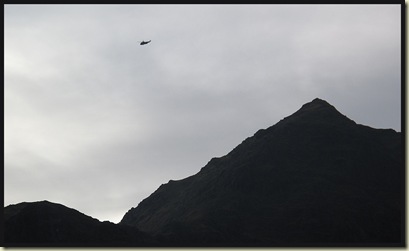
Mountain rescue training in progress

Monday, 26 October 2009

This, That, and The Other

Just a quick entry as life is acceptably busy this week, after a hectic weekend, with Susan over from Connecticut and trying to make the best of our Autumn weather.  More detailed entries will perhaps follow in due course.

This (below) is an image from Saturday afternoon, on the descent to Ingleton from Gragareth, after my six companions for the day had elected to turn back towards our starting point in Dent.

The view towards Ingleton from Gragareth

A view from near Thwaite Lane, by Clapham

That (above) is Sunday morning’s view south, over fields of the Yorkshire Dales, from near Thwaite Lane – by Clapham, where a group of 24 of us fumbled our way across the moorland, eventually emerging from the road to Ingleborough Cave in rather showery  weather.

Most of the 24 strong group

The Other recent activity was today’s ascent of The Matterhorn of the Peak – Shutlingsloe, with Susan, who posed on the misty summit with her posh new gaiters before the flask came out.

Susan on the summit of Shutlingsloe

Next: A visit to a café in Wales?

Friday, 23 October 2009

New Zealand Memories, and Web Site Problems

Sue and I had the pleasure of reliving last year’s New Zealand trip  (still to be indexed) the other day, by way of a slide show to the long term patients and the caring staff of the NHS’s Continuing Care Facility at Dermot Murphy Close.

They all seemed to enjoy it.

Here’s Sue, having climbed through cloud to reach the sunny summit of Conical Hill (1515 metres), just off the Routeburn Track, on 2 February 2008.

Near the summit of Conical Hill - 1515 metres, just off the Routeburn Track

I may even have got around to doing that long overdue indexing, had I not discovered that many of the images created in Fireworks for our website had decided not to show on the web browser.  So the nice little buttons I created seven years ago seem to have worn out.  This left the topwalks.com site (which receives 50-100 visitors a day for one reason or another, although the site is only occasionally updated) looking a real mess:

2201topwalks

So I’ve spent the last day faffing with it as a temporary measure, pending an upgrade of the index pages – all very tedious when the page loading also failed to work properly, leaving us with lots of blank pages.

If you do have occasion to use that site, and find any glitches, please do let us know!

Thursday, 22 October 2009

Tuesday 20 October 2009 – Eel Crag by the Shelf Route with the Knipe Boys

 2001coledale

The Knipe boys had been planning this walk for some time.  It was their third attempt within a year, and there had been recorded failures spanning several decades.  They had got so close that they’d even renamed Wainwright’s ‘Shelf’  route and called it the ‘Ledge’ route.  They had previously nearly fallen off it. 

What’s easier to fall off?  A Ledge or a Shelf?  I wonder?

Anyway, John’s friends Ian and Brian had been in subconscious telepathic communication with me, and our three strong Essential Support Group assembled at Braithwaite with the two protagonists, Mike and John, who then eagerly led us up Coledale, as shown above.

They were panicking a bit as the weather lady had predicted the tops to be somewhat like Himalayan peaks in a monsoon.

They rushed across the ford at the head of Coledale, whilst I fell in trying to take this picture.

2002ford

I’ve cropped out most of the blurry, splashy bits and am relieved that the camera seems to have survived its dunking, even if my knee has severe bruising.

Anyway, that slowed me down a bit for the slog up to the Shelf/Ledge via a welcome stop for a hot drink that was needed to wash down Nallo Lady’s CCS.

Soon we were on the Shelf, romping along its grassy flank.  It was here (see below) that John admitted, “We turned around at this point as it seemed too dangerous.”  It’s about 20 metres from there up to the point where the easy (but mildly exposed) Shelf joins the main highway coming from Coledale Hause.

2003crux

John and I waited, admiring the view (below) back down Coledale, with the (Cole?) mine hidden to the left, Blencathra still clear in the distance, and our descent route to the right.  Mike eventually fought his way up to join us, his vast pie consumption having taken its usual toll on his speed of ascent, and Ian – having admitted to suffering from extreme vertigo – was finally allowed to take off his blindfold.  Meanwhile Brian’s phone had been playing jolly tunes, but he also made it to the ridge.

2003zviewback

It was a breeze, then, as opposed to the predicted Himalayan monsoon gale, to reach the summit.

2004summit

Everyone was very happy. 

Especially Mike and John, who seemed to think they should get some sort of Lifetime Achievement Award.

Then we all trudged off to Sail, Outerside and Barrow (a hill), in continuing fine weather apart from a little drizzle on Barrow, and with even the distant Scafell peaks in good, if grey, view.

2005tosail

Back in the Coledale Inn in Braithwaite the Brothers marveled at their success, and at the (previously hidden) route card that I had managed to produce in anticipation of today’s route.

It had indeed been a grand little stroll, and as I pottered off down to Grasmere for dinner at the Red Lion in the excellent company of Brummie Dave, Connecticut Susan and Wainwright bagging Peewiglet, it never did do anything more than drizzle a bit.

Here’s the 13 km route.  It involves just over 1000 metres ascent and took us about 5½ hours, including stops. (Full route card here.)

2006route

In his widely acclaimed illustrated essay: At Last! Eel Crag by The Ledge Route, Mike Knipe provides further insight into the history of today’s attempt and bemoans the fact that his life is ‘now but an empty vessel.....’.

It was a fairly ‘grey’ autumn day, but for anyone interested my full set of 21 images is here.

Monday, 19 October 2009

Dunham Massey in Autumn (1)

Dunham Massey, just ten minutes from home, is our local National Trust property.

It’s particularly convenient to visit at present, and a good place from which to observe the onset of Autumn.

The following snaps were taken on 12 October.

The mansion at Dunham Massey

Acer trifolium, I think

Sunday, 18 October 2009

Saturday 17 October 2009 – E4 Bike Ride again

After collecting a bag from Susan (looking very fresh after her long journey from Glastonbury CT) at Manchester Airport, and waving her off for a week’s travail in the Lake District with Brummie Dave, I took the opportunity to nip out to Marple for an hour’s exercise on ‘E4’.

It’s only a month since I was last here (report), and I was expecting some Autumn colours.  However, down by the River Goyt at Strines, in rather flat light, the season is drifting very slowly from summer to autumn.

1701GoytStrines

After 30 minutes the sun had emerged and I was enjoying tea and a stilton and salad butty at the picnic benches in New Mills.

1702newmillsbike

The Millennium Walkway is always good for a visit. 

1703walkway1

Today, as I tarried for the following photo, two ladies with a large dog preceded me along the walkway.  I found them, stuck, half way along, with their now terrified dog – it must have looked down and been gripped by a severe bout of vertigo.  It needed much coaxing to complete its walk.  Perhaps there should be a sign ‘We recommend you blindfold your nervous dog on the Walkway.’

Meanwhile, I was saddened by this plaque that I had not noticed before.

1704brewsterplaque

The ride continued uneventfully, with the repairs to the Fox Inn’s roof seeming to be progressing smoothly - I was not accosted here, nor was I stoned by trail bikers….

Friday, 16 October 2009

SWCP – Torcross to Exeter

We have, over several years, walked most of the coast path from Minehead.  Last year’s journey from Plymouth to Torcross was recorded on these pages, the index for which entries is here

This year’s daily reports can be viewed by clicking on the following links:

Day 1 – Torcross to Dartmouth
Day 2 – Dartmouth to Paignton
Day 3 – Paignton to Teignmouth
Day 4 – Teignmouth to Exeter

Here are a few further images and additional observations and links, to supplement the postings made during the trip.

I would reiterate that anyone planning to walk on the South West Coast Path (SWCP) would benefit from the SWCP Association's Guide Book. This is updated every year.

Sadly, having made it all the way from Minehead to Torcross on previous visits, Sue was not fit enough to come this year, my only companion on this trip being Andrew.

DAY 1 – Torcross to Dartmouth

Here’s our route – 15 km, 550 metres ascent, 4.5 hours including 20 mins stops:

Day 1 route

After being waylaid at the start by a café in Torcross, and distracted by the relics of Operation Tiger, we made our way through Strete and along the recently re-routed (to avoid roads) path to Stoke Fleming, before descending to Blackpool Sands in dull weather.

Blackpool Sands

Continuing around to Combe Point, the sunlit sea drew our eyes all the way back to Start Point.

The Devon coast - Start Point from Combe Point

The previously deserted path gradually acquired walkers and fishermen as we rounded a corner to reach Dartmouth Castle, before the pleasant stroll around Warfleet Creek to Dartmouth.

Dartmouth Harbour

Taylor’s Restaurant provided a superb meal at a reasonable price, and our B&B at Brook House, 6 Market Street was clean and efficient, with a good breakfast.

DAY 2 – Dartmouth to Paignton

Here’s our route – 28 km, 1400 metres ascent, 9.5 hours including 1 hr stops:

Day 2 route

The ferry to Kingswear got us off to a good start, then we progressed through Warren Woods to the old Battery Buildings at Froward Point, where National Coastguard Institution volunteers keep an eye on the vessels coming in and out of the Dart Estuary.  On then to Pudcombe Cove, with grey seals in the bay and the delights of the café at the National Trust gardens at Coleton Fishacre.  Undulations continued to make progress relatively slow as we continued above Ivy Cove to Scabbacombe Head, then to Scabbacombe Sands, Long Sands, and Man Sands for lunch.

Andrew refreshed himself sufficiently to storm up Southdown Cliff, nearly keeping pace with some errant mountain bikers.

Andrew hauls his vast bulk out of Man Sands

It was easier going now, to Sharkham Point and thence to Berry Head, where a strange man who had earlier requested advice on walking boots very publicly offered his new mate (Andrew) a Twix bar.  We escaped to the lighthouse to finish off my flask of tea before ambling into Brixham.

From the pleasant harbour of Brixham, where a replica of the Golden Hind reclines by the quay, it’s an easy walk (unless you get misplaced in Grove Woods) around the coast to Broadsands, and the start of many miles of intermittent beach huts.

Beach huts at Broadsands

Goodrington is dominated by some green spaghetti water slides, then after rounding Roundham Head and passing Paignton Harbour - there is no shortage of accommodation in Paignton – we stayed at the friendly and adequate Ambassador Guest House.  We failed to find decent food in the town centre and resorted to the Harbour Light Restaurant.

DAY 3 – Paignton to Teignmouth

Here’s our route – 23 km, 1170 metres ascent, 8 hours including 45 mins stops:

Day 3 route

On a drizzly morning, I ambled along the sea front at high tide, largely on tarmac as far as Torbay.

Paignton

Around Thatcher Point some old signs point the way.  This marks the end of the ‘beach hut zone’ and the start of the ‘memorial bench zone’ of Torquay‘Fawlty Towers’ was inspired by Monty Python’s Flying Circus’s visit to a nearby hotel run by an eccentric.

Signpost on the SWCP

Dropping down to Oddicombe Beach the path then crosses underneath a Cliff Railway then inland to pass a Model Village, where Andrew and I lunched on a bench.  The old coast path is seriously eroded hereabouts, and unfortunately the SWCP has been re-routed inland.

It’s a very pleasant afternoon’s walk to Shaldon, above which there are splendid views to Teignmouth.  On dropping down to Shaldon, I half expected Weird Darren to emerge from this teepee, uttering words like “Hi Martin, do you like my new tarp?”

Hub cap sculpture

The small ferry to Teignmouth was still operating (until dusk), and we were soon installed in Devonia House B&B.

As in Paignton, there’s a dearth of good restaurants, but we struck lucky again, finding a superb Indian meal, though officially there has been no foreign invasion of the town since 1690, when it was the most recent place in England to be invaded by a foreign power (France).

DAY 4 – Teignmouth to Exeter

Here’s our route – 20 km, 310 metres ascent, 5.3 hours including 40 mins stops:

Day 4 route

It was high tide again as we set off in light rain, so we had to head inland on predominantly hard surfaces, much to Andrew’s chagrin.  The tide was too high to follow the breakwater at Dawlish, so up and over we went, to Dawlish Warren and an abortive hunt for a tea shop.  Luckily, as we left the village we grasped the whiff of fresh coffee and were soon able to relax with doughnut and coffee outside an excellent little coffee shop.

The road to Starcross made further demands on Andrew’s delicate feet as we pottered slowly around the harbour at Cockwood.

Cockwood Harbour

He was simply unable to continue beyond The Atmospheric Railway, and pointed to a nearby ferry to Exmouth.  “That’s my Coast Path route”, he exclaimed.

The Atmospheric Railway

As Andrew bussed himself back to Exeter, leaving Exmouth until next year, I continued on along the SWCP as far as the Topsham Ferry, from where I headed across Exminster Marshes to pick up a bus to Exeter from the Swan’s Nest Roundabout.

It had been a pretty route, past Powderham Castle and its deer park, before an easy path beside the Exe Estuary to Turf (lunch) and the final amble beside Exeter Ship Canal towards Exeter.

Fallow Deer Stag

A slide show (about 50 images) can be viewed here, if you have the stamina!

Wednesday, 14 October 2009

Tuesday 13 October 2009 – Around Latchford

This evening’s walk exploring some of our local industrial heritage was not accompanied by a camera, so the images are ‘some I took earlier’.

Andrew, Sue and I congregated at 7.30 pm on a fine, warm evening on the ferro-concreted Kingsway Bridge (SJ 625 880 – easy parking in nearby side streets), which in 1934 provided Warrington with its second road crossing of the River Mersey.
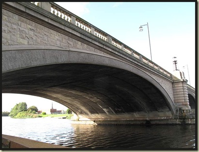
Kingsway Bridge, Warrington

Poking out from under the arch, the soaring 281ft spire of St Elfin’s parish church dominates Warrington, though it is only just visible in the picture above.  Added to the ancient church in 1860, it’s apparently the seventh tallest church spire in England.

Our walk started from the east of the road (furthest away from Warrington), where we went down the ramp to the south (left) bank of the river, then left under the bridge, from where the illuminated spire stood out much better across the amber river, lit by the night sky over the town, than it did in the daylight below.

The River Mersey by Kingsway Bridge

It’s nice to see swans and other bird life here in the lower reaches of the once polluted River Mersey, where there must also be lots of aquatic life, judging by the carefully gouged positions that have been created for fishermen.

Almost immediately, we headed left into Black Bear Park, and down the tarmac lane down which the once busy but now filled-in Runcorn to Latchford canal has been transformed into a wildlife haven.

Passing under Knutsford Road, signs like the one below indicated that we were in the Trans Pennine Trail area, where there’s a proliferation of these delightful waymarks in this neighbourhood.

Typical sign in the Warrington district

Continuing along the well lit path, albeit night had fallen, we passed under a railway bridge and then under Loushers Lane, continuing straight on until reaching the substantial barrier that is the 36-mile long  Manchester Ship Canal, opened in 1894 to give the city of Manchester direct access to the sea, at a cost of about £15 million (£1.22 billion as of 2009).  In its day it was the largest navigation canal in the world; today it’s no longer considered to be an important shipping route, but it still carries about several million tonnes of freight each year.

Anyway, we turned left along the Trans Pennine Trail, heading beside the Ship Canal towards Manchester.  The rustling in the undergrowth was perhaps the scamperings of this little chap.
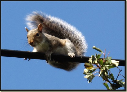
Grey Squirrel

The high level Cantilever Bridge soon came into view.  To reach it we took the last cut through on the left before Warrington Town’s football ground, past Bethel Baptist Chapel which is said to have been built in 1852 but has 1860 emblazoned on its brickwork.

Bethel Baptist Church

The Cantilever Bridge is easy to find from here.  ‘It’s a bit dilapidated and in need of repair’, I thought, as I passed over it a few days ago.  On the evening walk, we noticed that roadworks were in progress, with single file traffic and a closed pavement.  The bridge is at least 70 ft above the canal, allowing ships to pass underneath it.

The Cantilever Bridge, Warrington

Over the bridge an immediate right turn led us down a ramp to Fairfield Road.  Crossing over the road and heading to the right and under the bridge soon brought us to a footpath to the left, where the road veered right, along which footpath we followed the Ship Canal to Greenbank Road and onwards to the swing bridge at Knutsford Road.

Crossing Knutsford Road onto Thelwall New Road we continued along the canal, under the skew railway bridge that looks in fair condition.  However, the need for heavy repairs to this bridge is said to have been a principal contributing factor to the final closure of the Warrington to Altrincham railway line in 1985, it having been closed to passenger traffic since the Beeching cuts of 1962.

Continuing on beside the canal, we soon reached Latchford Locks.  There’s a well lit footpath across the locks – somewhat necessary due to the large drops, but despite its possible dangers the route remains open at night (no doubt guarded by CCTV!).

Here’s the daytime view west along the Ship Canal to the skew bridge and beyond to the Cantilever Bridge in the distance.  There’s a similar ‘straight line’ view to the east, with the M6 motorway passing over the Thelwall Viaduct in the distance.

View west from Latchford Locks

After crossing the canal, my old map indicates ‘Works’, and a guide book refers to Richmond Works, which started trading opposite the locks in 1906 and by 1947 had produced over a million gas cookers.

On seeing the new building work going on below, I assumed that gas cooker production in Warrington had ceased with all that remains of the ‘Works’ being the new building’s neighbour, an Aluminium Can Recycling plant.  However, further research reveals ‘New World Domestic Appliances Limited’, behind the recycling plant, with the new buildings taking the place of some bowling greens.  So manufacturing in Warrington continues, even if some of the works, and its sports facilities, have been sold off!

New buildings going up on Thelwall Lane

One of the new buildings, thin town houses or flats, I presume, has been finished.  It looks slightly odd, not just because of the wide angle lens, but because the building actually curves – its centre being furthest away from the camera.

Finished buildings on Thelwall Lane

As we walked left down Thelwall Lane after crossing the locks. we passed the above houses and took the second right into Nook Lane, where the factory workers used to, and probably still do live.

Terraced houses in Nook Lane

After bearing left along Marsden Avenue, some playing fields are reached.  We now forsook the tarmac in favour of a walk beside the River Mersey, the banks of which at this time of year sport swathes of Himalayan Balsam.

Himalayan Balsam (Impatiens glandulifera)

Our route headed across playing fields to the river, where sufficient ambient light made our torches obsolete on the warm evening, and a pleasant stroll over an inverted ‘V’ in the river took us happily back to Kingsway Bridge.

Here’s our 8 km route.  It’s virtually flat and should take 1½ to 2 hours (it took us 1¾ hours at night time).

Walking route around Latchford (8 km, 5 miles)

This walk is described in Jen Darling’s book - ‘Walks in North Cheshire (Alfresco Books, 1994).