The main purpose of this blog is to keep in touch with friends and family, and maybe entertain others with common interests, particularly in relation to the outdoors. We hope you enjoy it, and your comments are valued....
Sue and Martin in Mallorca 2019
On the Archduke's Path in Mallorca
Thursday, 18 June 2020
Thursday 18 June 2020 - A Walk around Timperley and Brooks Drive
Wednesday, 6 June 2018
Wednesday 6 June 2018 – Another Stroll Around Timperley
What a contrast to my walk over the same ground on 21 December 2017!
Instead of December’s deep mud we were hampered only by stinging nettles and hard, lumpy ground.
A call to JJ suggesting a walk tomorrow drew a blank. It had to be today. So again at very short notice we set off on another lovely day, but not too hot for an enjoyable short walk. We may even have found a path that JJ hadn’t walked before. Just a small one.
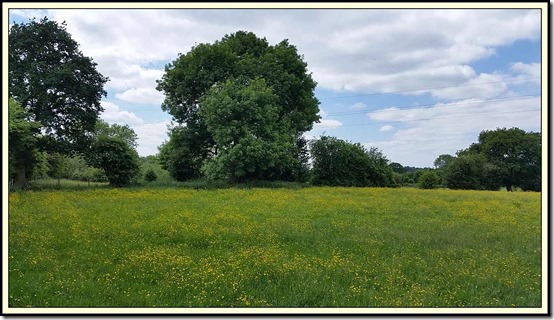
Here he is examining a gatepost from where the header picture was taken. It must once upon a time have supported a substantial gate. I find it hard to picture that scene, given the current view of a buttercup meadow.
The lumpy ground was due to cattle and horses tramping in the mud that has now magically vanished. The horses look a little happier in their temporarily mud free environment.
After quite a long time in the open, we returned to the ginnels of Altrincham, before heading past JJ’s children’s old school and across the busy golf course.
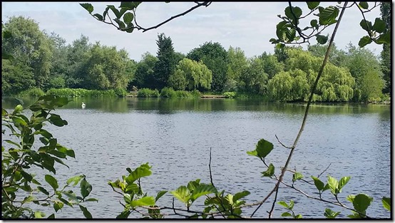
King George V Pool is situated in a secluded spot by Timperley Brook. A haven for wildlife.
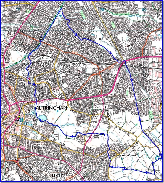
Here’s our route - 13.3 km, with minimal ascent, taking us 2 hours 40 minutes. And that includes a stop for cake.
A very satisfying little jaunt. Thanks for the company, JJ.
Thursday, 28 December 2017
Thursday 21 December 2017 – A Stroll from Timperley
It was a dull day, and perhaps a dull route, for this week’s morning stroll, which I decided to start from Timperley Bridge to avoid having to drive anywhere.
My plan was to follow the ‘Altrincham Circular’ – a 27 km walk devised in the late 1980s – from Timperley Bridge to Roaring Gate Lane, then head across the fields to Altrincham.
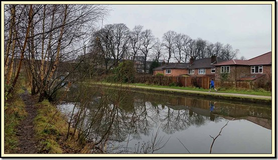
From the Metro station at Timperley a gate leads to a canal side path on the opposite side to the well surfaced towpath. A little slithery here, but nothing to worry about.
The path soon reaches a footbridge over the railway.
From here, a stroll across some playing fields leads to a footbridge over Baguley Brook. Turning left into Woodhouse Lane East, then right beyond the ‘Sylvan’ public house, you enter Milton Drive, then Sylvan Avenue. There used to be a ginnel to Burton Avenue between house numbers166 and 168, but that has now been blocked and you need to turn right then left to reach Burton Avenue, at the end of which a ginnel leads straight on to Rossett Avenue.
Continuing down Rossett Avenue to number 75, take an unmade road to the left, into Crofton Avenue. Cross over and in a few metres you reach Heyes Lane. There used to be a walkable path into Oakdene Road here. That in turn led to a nice ginnel called the ‘Boggart’, but sadly a locked gate now bars the way to the Boggart despite efforts over the years to keep this footpath open against the wishes of the residents whose back gardens were passed. The obvious route nowadays is to cross over Heyes Lane and take Beech Avenue, which leads to the recreation ground. Keeping to the right of the playing fields, a cinder track leading to Stelfox Avenue is eventually reached.
A left turn down Stockport Road brings you to the Brooklands roundabout. Cross over Brooklands Road then Altrincham Road to reach the relative calm of Hale Road, the start of Brooks Drive. You know you’re in the right place when, after just a few metres, you reach the bridge shown below. The railway line linking Altrincham with Stockport lies below. Baguley Station is nearby, but that closed in 1964 and plans to reopen it elsewhere in Baguley to provide a tram/train link appear to have come to nothing.
This marks the start of Brooks Drive, which the Altrincham Circular walk follows all the way to Hale Road, over 4 km away. It’s mainly a recently renovated walking/cycling path, but it’s one of the oldest thoroughfares in the area, dating from the 1860’s and built by Samuel Brooks, a mill owner and banker, and his son. An existing network of roads was used to link the new thoroughfare, which over time became known as Brooks’s road, now Brooks Drive.
After 2 km of pleasant walking, during which I met an old friend with whom to natter for a while, Roaring Gate Lane is reached. This taxi route to Manchester Airport isn’t pleasant to walk along, so after a couple of hundred metres both the Altrincham Circular and my route for the day take a footpath to the right, beyond Chapel House Farm. After a few metres, this is the scene that greets you at this time of year.
A muddy splodge takes you to the hedge at the end of the field, where a left turn, and soon a stile that puts the hedge on your right, takes you to a footbridge, a short while after which you emerge onto Buttery House Lane.
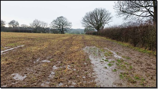
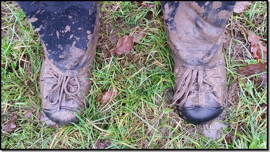
From here, the Altrincham Circular route turns left and soon rejoins Brooks Drive for an easy walk to Hale Road. Whereas I turned right along the lane and soon found myself in the deceptively grassy field pictured at the head of this posting. The grassy appearance belies a few inches of waterlogged earth. I was glad I’d worn waterproof socks with the old trail shoes. This muddy gateway near Well Green was particularly noxious.
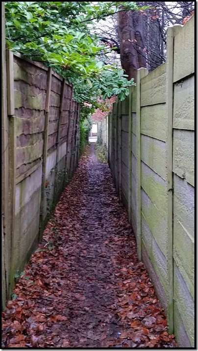
After a couple more fields, the comfort of Altrincham’s suburbia, in the form of Ash Lane, was reached. A right turn took me up the road to this typically tight ginnel, through to Wellfield Lane.
A short way up Wellfield Lane, a signed footpath left leads through more soft ground to reach Thorley Lane. Crossing over the busy lane, another path leads around a secondary school, eventually reaching Altrincham Golf Course. A marked (just about) path leads across the course towards Timperley Brook, which is then followed to King George V Pool, where a colony of coots mingles with the swans and mallards and moorhens, etc.
You can finish the walk in a number of ways. I continued beside the brook to cross Woodlands Road at (another) Timperley Bridge and head down Woodlands Parkway and Navigation Road to the tram station that enabled me to scoot down to Sale for an emergency purchase from Daz, the fishmonger.
Here’s the 12 km route. It took me a couple of hours, but you may prefer a more leisurely pace.
I challenge my readers from Timperley to follow this route and have fun in the mud. I’m up for it again, but only after a hard frost!
Thursday, 20 April 2017
Wednesday 19 April 2017 – ‘Tally-Ho…’
JJ is a member of an exclusive running club, details of which are provided at the foot of this entry. A key feature of this running club is the requirement to jump into a tin bath full of tepid water at the end of the run. First home gets clean, warm water.
I’m not a member, but I was invited (with a couple of hours notice) to join JJ on a recce of the course he has devised for a forthcoming run. Participants simply follow a list of written instructions, and any sawdust arrows JJ deems fit to put in place, in order to navigate the course, which in this instance will be nearly twenty miles.
I got the tram to Altrincham and strolled down to Bankhall Lane in Hale to meet JJ. This is about two miles into his route, but he was confident about the first section being accurately described. For most of the day I was testing JJ’s four pages of directions, and a few alterations were made in an effort to make them easy to follow for mapless runners whizzing through the countryside. If they lose their place in the instructions they could be well and truly lost. I imagine that is not such a rare occurrence!
The Bollin Valley provides a delightful green corridor between Altrincham and the airport. Bluebells adorn the ancient woodland, and a good path manoeuvres through a mixture of woodland and meadow and golf course.
As well as the bluebells, the garlic scented Ramsons are just coming into flower, creating a white carpet in the shade of the trees.
The River Bollin is very slow and sedate just now, following a spell of dry weather in these parts.
For a while the path leaves the river and proceeds along Castle Mill Lane, passing a rather dirty trig point near the junction with Mill Lane. JJ yearns to paint this relic of surveying, which marks the highest point in the area – 60 metres.
(How about pink, JJ?)
Soon we found our way back down to the river and the magnificent tunnel under Runway 2. An impressive piece of engineering.
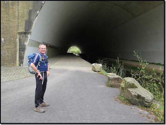
Aircraft spotters will enjoy the next section of the walk (run, on the day) alongside the runway, before winding their way through field paths on the outskirts of Mobberley. With vegetation growing fast, some of these paths will be slow and indistinct for the runners.
JJ has already recce’d the route a couple of times, during which the new bridge shown below has replaced a very rickety section of footpath. He has noted lots of minor changes, often involving fencing, over a short period of time, so a further recce will be needed a few days before the event takes place. There are bound to be a few more minor changes.
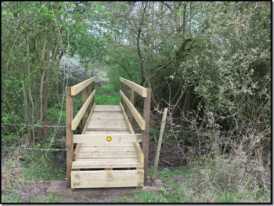
Here’s the view looking back from that bridge, which doubled as a tripod.
After reaching Knutsford via lunch on a tree trunk next to the North Cheshire Way footpath, we enjoyed a long and easy section, heading through Tatton Park to the east of Tatton Mere. Just beyond the Old Hall, the route heads across parkland towards a WW2 memorial. Here, the fallow deer and the red deer reside in separate herds, lazily enjoying the spring weather before the responsibilities of motherhood come to many of them.
Here’s the Parachute Regiment memorial that slowly comes into view. A tea break just here was most welcome.
A small and distant red sign is the next target for the runners. I wonder how many of them will spot that from afar? Anyway it will lead them towards the main car park, past the mansion that dates from 1716, though what you can see below is more recent. There’s currently a WW1 memorial flame that will sit outside the hall until 2018. The hall was owned by the Egerton family until 1958, when it was donated to the National Trust.
Unlike most NT properties, the car park is not owned, so even for NT members it can be an expensive place to visit, especially as members also have to pay to go round the Home Farm, which we passed after narrowly evading the car park.
Soon we were heading along good paths through brightly coloured fields, due north to the small village of Rostherne.
Whilst Rostherne has no public house, which fact probably helps to preserve its status as a small village in a rural backwater, it does have a water pump, which despite JJ’s renowned plumbing skills, could not be coaxed into action. Where were you, Norman?
There was an easy short-cut to our intended path, but JJ will send his runners ‘around the houses of Rostherne’. A pretty thatched cottage is passed, outside which this owl lurks.
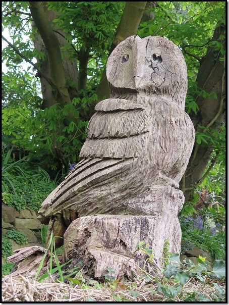
Next up, St Mary’s Church, the grounds of which we enter through a lych gate dating from 1640, claimed by some to be the finest in Cheshire. The yard is full of slabs of grave stones.
Nearby Rostherne Mere is a Nature Reserve, access to which is discouraged.
This is about as close as you can get as an ordinary member of the public. It’s a haven for a wide variety of ducks and other birds, and many other species, including the somewhat unlikely sightings of a mermaid. And there’s no public house in Rostherne!?
When JJ last came this way, the path to Marsh Lane had been completely destroyed by a plough. Thankfully the farmer has now reinstated the path, which passes pleasantly through fields before a kilometre section of unavoidable tarmac that might get JJ sacked as a trail designer.
Some sowing has already taken place. We passed this near Rycroft Farm, after crossing the M60 motorway. Before and after the farm there was lots of fencing work in progress. Hopefully the integrity of all the footpaths will be preserved.
We headed in a loop by way of recce, not quite reaching the final destination – The Swan with Two Nicks in Little Bollington - before returning to JJ’s car and my gentle stroll back to Altrincham.
Our 30+ km route, with minimal ascent, is shown below, JJ having started from the place where the circle is squared, if you know what I mean.
Thanks, JJ, for getting me out for such an enjoyable day.
Historical Notes:
1. Here’s some of what Wikipedia says about ‘Tally-Ho’:
The phrase tally-ho is a largely British phrase, which originated from the activity of foxhunting, and other forms of hunting with hounds, shouted when a rider or follower sees the fox. Today the term has evolved to have other meanings, most of which relate to 'pointing out' or 'spotting' a 'target'. For example, it is sometimes used as slang in air traffic control to verify a radar contact has been visually confirmed.
Tally-ho dates from around 1772, and is probably derived from the French taïaut, a cry used to excite hounds when hunting deer. According to other sources, the phrase may have originated from the second half of the 13th century, from the concatenation of a two word war cry: taille haut; "taille" being the cutting edge of the sword and "haut" translating to high (or 'raised up'), thus the original meaning of this interjection is something close to "Swords up!".
"Tally-ho" had its first recorded use in the Americas in an 1773 hunting journal. From there, its use spread as more British colonists arrived. However, the phrase fell out of favour following the conclusion of the American Revolutionary War (1775–1783).
2. Here’s what the Cheshire club of which JJ is a member has to say:
The Cheshire Tally-Ho Hare and Hounds Club is a traditional running club, founded in 1872. The club holds runs (called trails) from a number of venues around Cheshire and Derbyshire.
A trail consists of the Hounds following a marked trail laid by the Hares in a circular route of about 8 miles. Trails usually start and end at a pub. After the run, members get together and enjoy a meal and a drink in the pub.
The club is essentially non-competitive, and the club’s runs are designed so that groups of runners (packs of hounds) of similar ability set off together at times representing the likely speed of the pack. The trails are cross country, and any time spent on roads, while necessary at times, is looked on as disappointing, and the trail layer is likely to hear some appropriate comments at the finish. The trail layers, the Hares, vary from venue to venue, so that the club members can each participate.
The packs start at various times, the earliest before 14:00. The slow pack leaves at about 14:00, the medium pack 15 minutes later, and the fast pack at 14:30. The run ends around 16:00 or so.
The ablutions vary from the sublime, a leisure centre at Frodsham with showers and sauna, to the ridiculous (normal), namely bathing in a tin bath.
Membership is by election only, and requires two sponsors from the members. If interested in running through cow fields (and other cow things) in all weathers and conditions just for the fun of it please contact the Hon.Sec .
Monday, 19 September 2016
Wednesday 14 September 2016 – An ‘Altrincham Circular’ Walk
My first entry on these pages relates to a walk called ‘The Altrincham Circular’, devised with the aid of then Timperley resident Benny Rothman in 1987 as a WEA (Workers’ Educational Association) project. The description I gave in October 2007 was very brief as, like today, I was in arrears with my entries – a familiar situation. Slightly more information was given in my report on the walk undertaken on 20 February 2010.
The weather in Timperley was brilliant last week. That’s my excuse for allowing these entries to build up an arrears.
Never mind, it’s an overcast Monday morning, so I’ll take a punt at catching up.
With the ‘Altrincham Circuit’ in mind, I wanted a fairly energetic morning walk from home, so I plotted a route approximating to that shown below and put it on the phone so that I could easily check my progress.
Starting before 8 am I soon realised that despite it being a lovely day, I was going to get scratched and soaked, thanks to rampant brambles and a shower in the night. Our resident heron gave me a rather condescending ‘you must be stupid’ look as I passed by.
I more or less followed Benny’s route through Timperley to Brooks Drive, where I chose a path that follows Fairywell Brook through Roundthorn. Despite being just a few metres from Wythenshawe Hospital, this path proved quite challenging, with soaking foliage laden with thorns blocking the path. Wythenshawe Jungle!
Instead of following Brooks Drive all the way to Hale Barns, I ducked and dived along some field paths with deep, wet grass, finally emerging in more grass beside junction 6 of the M56 motorway. This field path led to a ginnel into housing that led quietly and dryly to this typical ginnel at the junction of Rivermead Avenue and Bank Road.
My route then skirted Hale Golf Course and led me into the Bollin Valley, where shafts of light beamed through the tree canopy giving the aura of a magical place. Between Warburton Green and Dunham, many miles further on, I encountered only one person – a certain Roy Keane walking his dogs in the Bollin Valley. (Readers who have heard of Mr Keane won’t be surprised at his choice of dog – alsatian.)
Beyond the Bollin Valley a host of field paths like the one shown below guided me through pleasant Cheshire countryside under a hot sky.
Some field paths are better marked than others, and a 1:25,000 scale map is a big advantage on this walk. A level crossing at New Mills, near Mobberley Station, led me past some enticing tea rooms to Pepper Street and a path across a dodgy bridge towards Kell House Farm. The picture doesn’t really show it, but this slime coated structure slopes at an alarming angle. People like HMP3 and Mike and Marian Parsons* shouldn’t be allowed anywhere near it.
More field paths led to Arden House. I recognised it; I’d been there before.
I decided to avoid the extensive area of road works at the A556/M56 junction and headed to Bow Green Road in Bowden, from where I thought a path would lead me past the Home Farm and into the grounds of Dunham Massey. It did, but not until I’d climbed a large, white, securely locked, spiky gate.
Once over that barrier, I started to encounter humans again, as well as ducks on Island Pool and Fallow Deer snoozing outside the big house.
In Little Bollington the River Bollin was rushing over the weir a little more energetically than usual.
Dinner was needed, so a short diversion to Little Heath Farm shop was in order, soon after I’d joined the Bridgewater Canal towpath.
Another diversion to Asda in Broadheath saw me leaving the towpath for a change and making my way back home via a variety of ginnels, side streets and meadows.
This walk could easily be undertaken over the course of a whole day, but for me it was a morning outing at a brisk pace of about 10 minutes for each kilometre (4 mph) – 34 km with 300 metres ascent, in 5.5 hours. The route shows more clearly if you click on the picture, but feel free to design your own…there are many paths to be discovered.
* These are ‘accident prone’ people from whom squeamish readers should maintain a wide berth, HMP3 being the latest ‘stumbler’ having recently suffered a ‘fibula trip’ in the French Alps.