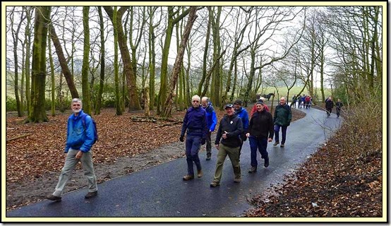
This walk was to be a repeat of the route that JJ, Rick, Alan R and I walked on 24 October 2013.
I hadn’t been concentrating on the route on that occasion, as the walk had been planned and led by Rick in military style, but I wasn’t bothered as only a handful of folk were expected to turn up and we’d be able to muddle our way into town. As it was, I found Alan R all on his own outside Heaton Park Metrolink Station. We chatted whilst an assortment of booted ramblers gathered behind us. I looked around to find an expectant crowd, all raring to go. Just as well for me, JJ and Rick were there as well as Alan R, and during the course of the morning there were lots of ”where did we go last time?” and “I think we may have gone that way” exchanges.
It must have been a combination of Don’s emailed ‘fliers’ and the prospect of This and That’s lunchtime curry that saw the group grow to eighteen before finally declaring itself quorate and setting off into the park.
There’s a lot of information about Heaton Park, with many more links, here, from which I’ve extracted the following snippets:
- covering an area of over 600 acres, it’s the biggest municipal park in Manchester, and one of the largest in Europe.The park includes the grounds of a Grade I listed, neoclassical 18th-century country house, Heaton Hall, remodelled by James Wyatt in 1772.
- Heaton Park was sold to Manchester City Council in 1902, by the Earl of Wilton. It has one of the United Kingdom's few concrete towers, the Heaton Park BT Tower.
- The park was renovated as part of a millennium project partnership between the Heritage Lottery Fund and Manchester City Council. It has the only flat green bowling greens in Manchester, built for the 2002 Commonwealth Games.
- Heaton Hall had been owned by the Holland family since the Middle Ages. In 1684, when Sir John Egerton, married Elizabeth Holland, the hall came to the Egerton family. In 1772, Sir Thomas Egerton commissioned the fashionable architect James Wyatt, to design a new home for his young family. Although Wyatt had already established a reputation for himself as an innovative architect, he was only 26 years old and Heaton Hall was his first country house commission. Wyatt's neo-classical masterpiece was built in phases and was mostly completed by 1789.
- The park was originally laid out by William Emes in the style of Capability Brown. It has long been used for public events such as Heaton Park races which were established by the second Earl in 1827. The races were run on a course on the site of the present day boating lake until 1839 when they moved to Aintree.
- During the 19th century when the railway to Bury was being laid, it stopped short of Heaton Park, as Lord Wilton was not prepared to see his estate disfigured by a railway. As a compromise the line was run under the estate in a tunnel, and a railway station, now Heaton Park Metrolink station, was opened. Subsequently, the decision by Lord Wilton to put the hall and park up for sale was greeted with dismay, especially when it became known that the site was being eyed by a property developer. A pressure group was formed to persuade Manchester City Council to purchase it as a museum and municipal park. The park was purchased and opened to the public in 1902. Unfortunately, the council was not prepared to purchase the contents of the hall and so the furniture and paintings were sold by auction. The hall was considered by the council to be of little architectural or historical significance, and the saloon was initially used as a tea-room. The city council used the hall as a branch art gallery for many years, but eventually the architectural and historical importance of the building was realised. A major restoration programme brought the state rooms back to their original appearance, and period furniture was obtained to furnish them.Some of the original pieces were recovered from store or purchased at sales.
- Unfortunately, the exterior of the hall is still in a bad state of repair with crumbling stucco, peeling paintwork and boarded-up windows. It is hoped that this will eventually be rectified with further grants from the Heritage Lottery Fund and work is currently taking place by way of a partnership between English Heritage and Manchester City Council.
- The park was used as a training depot during the First World War, and several hutted camps were built. It was also used the site of a Royal Air Force depot in the Second World War.
- Manchester Council later used part of the north side of the park for the construction of a large gravity feed reservoir, the terminus of the Thirlmere pipeline – see my entry in these pages on 3 April 2013, employing a contractor's railway from Whitefield railway station. This work was interrupted by the First World War, and only completed in the 1920s. A municipal golf course was also laid out, and a large boating lake excavated. The former facade of the first Manchester Town Hall on King Street was re-erected as a backdrop to the lake.
- The hall has been a Grade I Listed Building since 1952 and has been called "the finest house of its period in Lancashire". It is built of sandstone and stuccoed brick, in a traditional Palladian design with the entrance on the north side and the facade on the south. The landscaping was designed to make the most of the uninterrupted views of the rolling hills across to the Pennines. An important feature of this was the ha-ha, used to keep the grazing animals, so important to the landscaping, away from the formal lawns, with a barrier that was all-but invisible from the house.
- There’s a temple, a Dower House, a ‘Smithy’ Lodge, a ‘Grand’ Lodge, Pleasure Grounds with a tunnel, an Orangery, a boating lake, a Colonnade which once formed the front of the Manchester Town Hall in King Street, a walled garden and horticultural centre, a farm centre and a Tramway.
Perhaps the Park would benefit from a separate visit and a comprehensive and dedicated entry within these pages. On the other hand, that ‘book’ has probably already been written, so maybe the recording of ‘en passant’ snippets, eg about the tramway, is the way to go.
Hopefully in a year or two we’ll be greeted by a more attractive view than this one of the north facade of the great house.

We wandered on past the ha-ha towards a tea shop, which couldn't serve us as it hadn't enough milk! Haha, I think the custodian was just being lazy – he didn’t even offer any alternative.

Across Middleton Road, we entered Blackley Forest, where the River Irk even has a beach, and looks remarkably free of litter...(but see here for what was just behind me!).

Blackley Forest is in fact a Site of Biological Importance and an example of one of the country's first Community Woodlands, planted to commemorate the Queen’s coronation and also the local people who gave their lives in the Second World War. Apparently the area has had woodland on it since the Norman Conquest in 1066, when wild boar and deer roamed and eagles flew above.
The forest path keeps as close as it can to the river, and a convenient bollard provided an opportunity for a roll-call. Despite appearances, (some old-timers were asleep at the back) there were 18 of us.

We emerged outside Blackley’s Hexagon Tower, oblivious of the fact that the hamlet of Blackley was mentioned in the Domesday Book.
By the Middle Ages, Blackley had become a park belonging to the lords of Manchester. Its value in 1282 was recorded as £6 13s 4d, a sum approximately equivalent in buying power to £3,500 today.
The lords of Manchester leased the land from time to time, until the beginning of the 17th century when Blackley was sold in parcels to a number of landowners.
By the middle of the 17th century Blackley was a village of just 107 inhabitants. Today it’s hardly recognisable as the same rural area that it had been at the start of the 19th century. Now only local place names like Meadows School, Plant Hill or French Barn Lane hint at its rural past.
The first industrial enterprise in the area was the Borelle Dyeworks, established in 1785, by an emigrant French industrialist Louis Borelle, who gave his name in corrupted form to Barrel Brow. A contemporary and compatriot of his was Angel Raphael Louis Delaunay, whose Delaunay Dyeworks, famous for their 'Turkey Red' dye, has given its name to Delauneys' Road. After Delaunays' death in 1865, the noted chemist Ivan Levinstein bought the dyeworks. The facility expanded, under Imperial Chemical Industries (ICI) ownership, to employ a large number, many in chemical research. It was in the ICI laboratories that not only dyestuffs but also medical breakthroughs such as the anti-malarial drug Paludrine, and Antrycide to combat African sleeping sickness were discovered.
In recent years the facility has contracted, and the staff level is now minimal, if present at all – a housing development having perhaps replaced many of the industrial buildings. Adjacent to this facility, and formerly an early 19th-century logwood mill, there was another plant, Connolly's (Blackley) Ltd, later BICC, makers of telecommunication cabling.
There have been many changes since I lived here in the mid 1970’s. One of my neighbours told proud stories of his wartime exploits. My dad once appeared from a chat with this neighbour, surprised to have finally twigged that it was the Boer War (1899-1902) that he’d fought in. The neighbour used to get the bus into Manchester every day for a walk around Lewis’s Department Store (Primark now occupy this prime site), and he put up a big banner in his bedroom window on his hundredth birthday. Another neighbour was chauffeur to the then local ICI boss. He (the neighbour) and his son washed and polished their Ford Cortina GT and TVR Sports cars respectively, on a daily basis.
We passed the Hexagon Tower in Blackley, a building that is showing signs of wear, but as ICI’s former research and development facility now markets itself as a ‘Vertical Science Park’. Good luck to it.

A little further on, it became clear that Harpurhey has somewhat of a litter problem.

Although BICC has moved on (I think) from this area, their cables seem to be returning to this traffic free lane where dark nights are presumably the home to small bonfires during which groups of youths discover whether their chosen cable houses valuable copper or worthless steel wire.

Escapism for the local residents takes the form of a 'Psychic Readings Event' at the Smedley Hotel on 18 March 2015. I won’t embarrass anyone, John, by commenting on who looked most interested in this event.

Queen’s Park, Harpurhey, is the home of what my map records as a ‘Museum and Art Gallery’. This page provides some history. Queen’s Park was one of the first parks in Manchester. It opened on the same day in 1846 as Phillips Park, about the same distance from the city centre, beside the River Medlock. (See walk report here). The land included Hendham Hall, which was demolished in 1880. It was replaced by an art gallery and museum in 1884.This is what it looks like today.

I’ve struggled to find much about the current status of this building. It appears to be part of ‘Manchester Art Galleries’ but I can’t find any opening times. There were once lots of dolls on display in glass cases, and the building may now house the Art Gallery’s ‘Conservation Studios’, around which there may be occasional conducted tours.
Leaving Queen's Park, we found some newly refurbished steps leading under the Metrolink line to Oldham and Rochdale.
This area is full of colour in the summer, even in October when we last visited.

Dreadnowt crashed here, narrowly missing a bird bath. The Olympic rings painted on it when we passed in 2013 have been replaced by a more contemporary poppy.

Nearby, this looks new, I wonder what it is?

I know what this is - an Austin A35 van, my old mate Tony’s dad had the car.

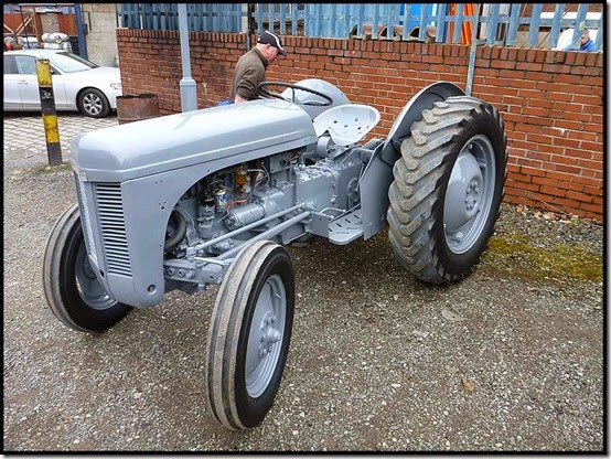
And according to Alan R, this is a Ferguson TE25 tractor – and if Alan says it is that’s good enough for me! PS – see comments – Alan now says it’s a TE20 (I was only 5 out though, which isn’t too bad!).
Nearing the modern edifices that the Co-operative Society/bank have constructed in a bold effort to bankrupt themselves and others, we entered Angel Meadow, which was cleared and landscaped as recently as the early 2000's.

The picture looks across part of a previously flagged area where 40,000 pauper bodies were buried.
Located on a slope between the River Irk and Rochdale Road, the meadow occupies an area of only about 7 acres, but features in the formative history of Manchester. It was once an affluent suburb of Manchester, until the 19th-century Industrial Revolution altered the social standing of the area and introduced poverty and disease.
The land adjacent to St Michael and All Angels' church, built in 1788 and known as one of the ugliest of its kind, became the largest cemetery in Manchester, used for the interment of those who had no family place of burial or were too poor to afford a proper funeral. The population density of Angel Meadow in the mid-19th century was in excess of 350 per acre, and as social and living conditions worsened, some resorted to digging up the cemetery and selling its soil as fertilizer to nearby farmers. The situation became so bad that an Act of Parliament was passed in 1855 to cover up graveyards with flagstones, hence the name, St Michael's Flags.
Ragged schools, such as Charter Street and Sharp Street, and other institutes for abandoned, destitute and neglected children, flourished in the area.
Friedrich Engels, the son of a German industrialist, was distressed in the 1840’s by what he found as the condition of the working classes in England, and this squalid district and other influences led to his collaboration with Karl Marx, resulting in the writing of the Communist Manifesto.
Photos of the information boards, in the slideshow, provide more information on this interesting little park.
Passing through 'Co-op Country', the Two Johns got the whiff of a This and That curry…

But first we passed the site of the old fish market, opened in 1873, before being distracted by Holt’s beer in the Hare and Hounds (still only £2.15 a pint, but drawing memories of the assembled company’s first experiences of £1+ pints!), then a curry at This and That, which because there were 18 of us we enjoyed in two shifts.

Then we went home – it was after all just a short morning’s breath of fresh air.
There’s a 38 image slideshow, here. Click on the first image, then click ‘slideshow’.
Our route - 13 km in a little over 3 hours - mostly gently downhill

Thanks for coming, everyone – an excellent outing. You are all welcome on my next Thursday morning escapade, on Thursday 23 April – billed as ‘Suitable for Tortoises. Meet at Bury Metro Station (SD 804 105) at 10.30 am for a muddled (perhaps muddied) route via Greenmount to the Hare and Hounds in Holcombe Brook. Approx 10 km (6 miles).’ It won’t have been reccied, which may add to the fun…
There’s more background the the Irk Valley area in this fascinating treatise – thanks to Alan R for the link. Alan has also written an excellent piece on our walk, here, and has followed that up with more fascinating research here. But the job isn’t finished – there must be lots more information out there for anyone with the perseverance to find it…
Update on 31 March 2015
Alan R has been in correspondence with a very helpful lady at Manchester City Council, and I feel bound to reiterate her comments here. Clearly the Council takes fly-tipping seriously and is receptive to comments, observations, and information regarding the perpetrators. They are also keen on developing the areas we walked through and they are well aware that they include valuable historic sites that are worthy of a bit of TLC.
Here’s what Alan was told:
“Dear Alan, thanks for your email. I gave HMG a call and they explained that the iron drum is a ball mill, previously used in the manufacture of paint - resins and solvents were put inside together with pebbles to grind and mix the paint. Apparently these were used up to 5 years ago but have now been replaced with more efficient bead mills. As you may know, HMG is a long established company (85+ years) although it was previously sited over the road on Fitzgeorge Street within what is now Sandhills geeenspace, but there has been a dye works and other manufacturing works on the current site since at least 1794 (William Green's map) - the University of Manchester has published lots of old maps online which allow you to look at areas in detail.
http://www.library.manchester.ac.uk/searchresources/mapsandatlases/onlinemapcollection/
Visitors to Manchester's former industrial river valleys are steadily increasing - the former power station ash tip at Clayton Vale in the Medlock Valley is attracting many more local visitors as well as national and international visitors from as far afield as Japan and Malaysia, and will host participants from the Society for Ecological Restoration's World Conference later this year. The Irk Valley is less developed for visitors yet but has been showcased by Jonathan Schofield (writer and city centre guide) on the Manchester Confidential website http://www.manchesterconfidential.co.uk/News/The-Impossible-Bridge-And-The-Improbable-Hill-Irk-Valley-Tour
I agree that St Catherine's is in need of attention. Unfortunately this winter a significant proportion of the trees on site have suffered severe damage by rabbits eating the bark so it is likely that many will have to be felled in the near future for safety reasons, resulting in the site being more open.
In the Irk Valley, some projects just completed or currently in progress are:
- Connecting Collyhurst - Groundwork leading on a project to encourage local use, funded by BIG Local lottery
- Remediation of former gas works waste tip at Harpurhey Reservoirs
- £26m investment in improving water quality in the lower Irk/River Irwell by United Utilities
- Access improvements to riverside land adjacent to Sainsbury's, near Heaton Park
- Site improvements and mass bulb planting at Bowker Bank Woods Crumpsall
- Biodiversity improvements at Broadhurst Clough, Moston
- Restoration of the lake at Boggart Hole Clough funded by Clean City
- Wild Trout Trust survey of Blackley section of River Irk to identify opportunities to improve the river for fish and wildlife
- Improvements to St Michael's Flags linked with development of Co-Op headquarters
Although investments were made to bring Lower Irk sites up to a basic standard around the Millennium, Manchester City Council has plans for large scale future investment and regeneration; this is already underway in Collyhurst and is expected to follow over a 10-15 year period in the Lower Irk Valley, necessitating parallel investment in the greenspace to provide for the significant increase in population.
The Collyhurst and the Lower Irk Valley site measures 135 hectares and includes a large number of development opportunities owned by the Council and Network Rail which provide significant potential to redefine a large and under utilised area to meet the city's economic objectives for future growth.
The area has benefited from a very significant pipeline of committed investment that will completely reposition the northern part of the city centre, ensuring that it plays a key role in the future success of the City Region economy.
Initiatives currently being driven forward in the area at Strangeways, Greengate, Victoria Station and NOMA (the Co-Op estate) will, over the next ten to fifteen years, transform this part of the city creating new office space, new public space, new retail development and new homes.
The vision for Collyhurst and the Lower Irk Valley over the next 10-15 years is to create a sustainable, low carbon community that will provide over 2,000 new homes, the refurbishment of over 1000 existing properties, improved retail and public services provision, new employment opportunities, enhanced transport and pedestrian routes together with open space and local environment improvements. The redevelopment is also expected to contribute to the city's aspiration to become a world top 20 digital city by 2020.
I hope this email answers your queries, please get back in touch if you have further questions.
With regards,
Jo Fraser
Irk and Medlock Valley Programme Coordinator
Manchester City Council
c/o Groundwork Manchester Salford, Stockport, Tameside & Trafford
Timber Wharf
42-50 Worsley Street
Castlefield
Manchester
M15 4LD
And regarding the fly-tipping in Harpurhey:
Hi Alan, unfortunately there is a very persistent problem with fly-tipping on the road to Kingsbridge Industrial Estate and the Harpurhey reservoir site - you might not believe it but it has been cleaned up countless times at considerable expense. There is a CCTV camera nearby which has caught two fly tippers - one case is going to court and the other fled the country. There are no excuses for this disgusting behaviour but clearly people think they can get away with it in this secluded location. In the future we hope that the development of a cycleway through this part of the Irk Valley will improve access and encourage positive use making it less desirable for antisocial behaviour. If you visit Irk or Medlock Valley sites in Manchester and notice any issues, please report them to me as they can often be addressed.
Despite its problems, the reservoir site is a place of natural beauty and important for wildlife.
It’s good to know that despite some appearances so much is going on to redevelop the city whilst retaining key historic sites. I’m sure we all wish Jo Fraser and her colleagues well in their difficult quest.