Hello, I am up to date with postings, some of which have been resent. They are getting the Blackberry tick, but they aren't getting through to the blog. I'm getting the following email from Google's 'Mail Delivery Subsystem':
"This is an automatically generated Delivery Status Notification
THIS IS A WARNING MESSAGE ONLY.
YOU DO NOT NEED TO RESEND YOUR MESSAGE.
Delivery to the following recipient has been delayed:
'Postcard from Timperley'
Message will be retried for 2 more day(s)"
So this is an experiment to see whether the posting works. If it does I will resend the rejected postings, so they may appear several times. Sorry for that if it happens.
Martin
Sent using BlackBerry® from Orange
Sue and Martin in Mallorca 2019

On the Archduke's Path in Mallorca
Saturday, 28 July 2012


Friday, 27 July 2012
On Holiday in the Lechtaler Alpen - Day 2 Württemberger Haus (2220m) to Hanauer Hütte (1920m)


We woke after a good sleep amongst folk who understand the etiquette of life in a mountain hut. Breakfast was provided on a plate so large that we could each make a ham, cheese and jam sandwich for lunch out of what we couldn't eat.
By 8.15 we were ready to go, after friendly exchanges with others who had spent the night at the hut. Brigitt and Marieke were taking the sporting 631 route to Madau, whilst Alex and Konrad were heading down the scenic descent to Zams. Work loomed for them all.
Nobody else appeared to be heading in our direction. We were continuing along the magnificent path 601, which also doubles as the European E4 route, which doesn't seem to be as popular as E5. A rising path with fine views back to the hut and yesterday's descent route (pictured), led to some steep ground over which we knew some children had arrived yesterday. Nevertheless, this path was not for wimps! By nine-o'clock we'd risen 250 metres to Gebäud-Jochl and were in admiration of those children, who probably managed the loose scree above vertiginous drops better than I did. It was a lovely calm, sunny summer's day, though, and I enjoyed the challenge. Sue of course romped it.
Beyond the jochl, from where Steinseehütte was visible in the distance, a lovely contouring path led past snow finches and marmots, with myriads of gentians, orchids and a whole range of other alpine flowers, providing bright splashes of colour to complement the fine rock scenery.
We spotted someone behind us. A man with a staff. He passed, and we followed him up to the next 'col', 2400 metre Roßkarscharte, again over some vaguely technical ground, aided in places by steel wires.
After the breathtakingly steep climb we were rewarded with breathtakingly wide views to the eastern Lechtal peaks and Steinseehütte a few hundred metres below us.
By now we had made a new friend - Heiko, from Cologne - on holiday here, wandering the hills for a few days before taking his elderly parents home. He is of course pictured with Sue on Roßkarscharte, in one of several images gained during exchanges of cameras in this scenic spot.
Whilst Heiko went on ahead, we took our time to enjoy the belvedere to Steinseehütte, via a vertiginous passage through a narrow band of rock, which we eventually reached at 11.45. Schiwassers (raspberry flavoured water) in the sun provided the perfect rehydration fluid.
We lingered a while. After all, we were on holiday, the weather was perfect, and a pretty yellow signpost informed us that today's destination was only two and a half hours away.
Eventually we left Heiko to dry his washing and after looking back to our route down from the narrow band of rock (pictured - we arrived via the lowest point on the horizon) we headed off past fine looking Haflingers to cross into a valley to the north, via what is now known as Vord. Dremelscharte. (My old map says 'Westl Dremelscharte.)
After climbing about 250 metres we stopped for lunch - the butties made a welcome change from tuna salad. Steinsee glittered in the sun below us, with a fine mountain backdrop.
Then it was a steep ascent to the scharte, aided for the final 100 metres of ascent by the longest wire of the trip. I hauled myself up whilst Sue tried to use the rocks, some of which she sent in my direction. It was very loose, but not difficult. The top revealed yet more vistas, and a couple descending from a side route that's not on my map. We saw virtually nobody other than them and Heiko and a couple ascending Roßkarscharte today.
Hanauer Hütte lay in bright sunlight over 500 metres below us, thankfully over easy ground, Dolomitic in character. We spent the final hour of the day's walk descending to the jingle of cow bells, with black redstarts being agitated by gliding ravens.
Reaching Hanauer Hütte at 2.45, we really needed to wash ourselves and our clothes, the limited opportunities for such formalities having been ignored since leaving Zams three days ago. There was some puzzlement when we said we had booked, but production of an email seemed to help matters. We were allocated to room number 6, which we hoped wouldn't be a camp bed in the winter room.
Beer and tea respectively were needed to fuel us for the chores. Others arrived and disappeared to claim their beds, so we did the same. I couldn't really believe my eyes when I opened the door to room 6. Bunk beds (2), a sink with hot and cold water, a power point! Sadly no en-suite, but what could we expect for €11 each! Absolutely brilliant - this 1896 hut has been superbly refurbished and has moved well into the 21st century. We even got chicken for dinner.
Comments:
Alan R - thanks for the HTC offer but I plan to stay with the Orange devil I know. My contract has expired so I can renegotiate. Samsung is the current favourite.
And you know very well from your huge number of followers that many people value your postings on gear etc!
Data:
26 July 2012
10km in 6.5 hours with 1000m ascent
Flower of the Day - Alpine Butterwort
Itinerary - http://www.topwalks.com/E5%20Route.html
Sent using BlackBerry® from Orange
Thursday, 26 July 2012
On Holiday in the Lechtaler Alpen - Day 1 Memmingerhütte (2242m) to Württemberger Haus (2220m)


Manuel told us the hut gets 9000 visitors in the three and a half month summer season, of which he reckons about 100 are English.
We set off after the E5 throngs, with just Andi and two girls behind us. Soon we were pausing to admire a herd of ibex whose passage across the path had been thwarted by the E5 hordes. We were going back up to the narrow defile of Seescharte, from where we had descended in yesterday's lovely afternoon weather. Today, low cloud blighted the view, though the weather was clearer to the east of the pass.
Here we encountered Jason, a New Zealander who had been staying at Memmingerhütte. Hello Jason, do feel free to contact us for trip advice.
We soon turned off for Württemberger Haus along path 601. It was signposted as 2.5 hours away, but it took us three hours. This was old ground for me. Re-reading our diary from 18 July 1980 may be interesting!
Today's conditions, despite the cloud, which remained above us, were fairly benign. First a lovely belvedere path across a huge scree slope, then some easy scrambling (walking poles stashed) to a col and a minor summit at around 2600 metres on the Großberg ridge. Sue is pictured near here with the contouring path just visible high above her head.
The route continued over a knife edge ridge reminiscent of Snowdon's Crib Goch. Quite exposed at times but never particularly difficult, albeit the most 'technical' section of our trip to date, and aided with fixed wires at one point. Eventually a second summit with a small cross was reached, from near where we could look back to the first summit and watch the two girls happily celebrate their safe arrival there.
Continuing towards Württemberger Haus over more of the same, we took a turn to the left along another knife edge before descending over easy ground before a trickier rock band, then across some steep snow before the gentle 'run in' to the hut on another lovely route across scree.
Something of a nuisance was the light rain that started when we were half way down the rock band and not in a position to don waterproofs. Never mind, we soon got them on, the rain stopped, and by the time we had interrupted a flock of snow finches and reached the hut at 1pm we were pretty much dry again. The two girls, Marieke and Brigitt, from Eindhoven, arrived soon afterwards.
Since then we've been ensconced in the hut, watching some less than pleasant weather outside, on what was supposed to be the best day of the week.
During this time a historical foray revealed the entry in the 1980 visitors book (extract pictured, I have an image of the whole page) that confirms that together with Nick, David (he really didn't have a fixed abode in those days), Ruaridh and Colin, I was in the first group to make it over to Memmingerhütte in 1980, as late as 18 July, and so far as I can remember it was a bit snowier then. I seem to recall Rudolf, from Vienna, giving up because he couldn't find the red marks on the rocks that indicate the route. It was our first visit to the Alps; red marks meant little to us. Having covered the same ground today it seems miraculous that we managed it. It must have been terrifying, though I don't recall it as such. We did after all have ice axes. And massive loads. A bit like the couple with the dog that were amongst the eleven people we met on the path today.
How do you remember it, Nick?
Alex and Konrad, from Memminger (the town, not the hut) joined us and B+M for the afternoon and evening. Happily, the common language is English. Thanks for that, everyone.
The bottom image shows Sue with today's friends - from L to R, Konrad, Alex, Sue, Brigitt and Marieke.
All in all a memorable and nostalgic day in the mountains.
Comments:
Jules - thanks, weather is now lovely again and the huttes are fine, actually.
Alan R - you'll be interested to hear that the Saucony Hattoris have become objects of desire!
Data:
25 July 2012
7km in 4.5 hours with 650m ascent
Rain whilst walking to date: 4 hours
Flower of the Day - Round-leaved Pennycress
Itinerary - http://www.topwalks.com/E5%20Route.html
Sent using BlackBerry® from Orange
Wednesday, 25 July 2012
E5 in reverse - Day 20 - Zams (775m) to Memmingerhütte (2242m)


We enjoyed a leisurely start to a hard day. Breakfast at 8am, a quick supermarket visit, and we were on our way, under blue skies, in shorts and t-shirts.
The only flat section of today's walk was on the other side of the Inn river after crossing the motorway. Soon we were climbing and dripping, on the path that skirted the cliff where someone was already climbing, high on the rocks above us.
Beyond a memorial to Alois Bogner (5/11/1862), red and dark red helleborines lined the path, which dipped in and out of the shade of pines, past lizards and backpackers. The path was exposed, high on the walls of Zammer Loch, a narrow ravine where far below the river cut through. (Apparently 'loch' means 'hole' in these parts.)
Surefootedness was required due to the long drops to our left. The trees clinging to the steep sides wouldn't have broken a fall.
Eventually the path entered less precipitous woodland and we reached a wide green pasture, with tall purple monkshood. Haflinger horses were grazing, and a small cabin shortly before the side path to Württemberger Haus was serving drinks and luxurious plates of food. We'd met a group of 26 leaving the cabin but by the time we arrived another group of 20 had taken all the tables.
But huge glasses of Apfelschorle were produced quickly for us. In view of the heat, it was most welcome.
A huge number of people were met on today's route. E5 starters from Oberstdorf on Sunday. Soon after leaving the cabin we met another large group, this time with large dogs - what was going on? During the course of the day we must have met over 200 people. Another couple were going in our direction.
Beyond the burning heat outside the cabin, rickety wooden bridges crossed the river a couple of times, and the gradient for a while, on a path bordered with round-leaved wintergreens, was less steep.
Lunch was a quick tuna salad and chocolate in the shade of some pines. The path followed the river as the trees turned to shrubs and the views in this high valley became more impressive. Just before the gradient steepened again, a yellow bears-ear primrose shone out from below a bush, and pink primroses grew nearby. From here the going was steep and hot, but the flowers were an excellent distraction. From the alpenrose zone there were zones of other flowers - kidney vetch, the yellow primrose, trumpet gentians, then alpine pennycress, purple pansies, rock jasmine and snowbells as we neared the top of the pass, Seescharte, at 2599 metres. It was a narrow cleft, with a new and beautiful view (pictured), down to some small lakes and the Memmingerhütte, with a fine mountain backdrop.
The descent to the hut was steep and narrow, particularly next to a stream, and the final flat stretch across a green meadow and past a small lake was a relief.
Memmingerhütte has about 140 beds, and it was very busy. Manuel spoke good English and showed us two our sleeping place - two 'overflow' mattresses on the floor in the large matratzenlager, but separate to everyone else. It was strange but it worked well.
Others were less fortunate - camp beds in the winter room, mattresses in the basement, etc. Nobody is turned away.
Rehydration was achieved with a litre of teewasser.
The evening was sociable but also strange. The dining room was full, so we sat outside, but grey clouds were building and it began to rain. We managed our soup, and part of our goulasch, spätzle and salad, before thunder and lightning and heavy rain started. This was unfortunate as there was no room for us in the hut. We adjourned to the porch, where we finished our meals on our knees, much to the amusement of others.
When the rain turned to hail the porch was bombarded, so we moved further inside, where our dessert eventually caught up with us. It was washed down with beer, whilst in conversation with new friends from Holland, Edwin and Gertjan (pictured). They were camping nearby and had been walking some interesting paths.
With folk heading to bed around 9pm, we were able to sit at a table for a while before adjourning to our mattresses in time for lights out at 10pm.
Comments:
Alan R - so what should the replacement be? HTC? Samsung? Nokia? i?
Gayle - thanks for your sympathy. I'm still struggling with the space bar but have improved my technique!
Data:
24 July 2012
13km in 7 hours with 1850m ascent
Flower of the Day - Bears-ear Primrose
Itinerary - http://www.topwalks.com/E5%20Route.html
Sent using BlackBerry® from Orange
E5 in reverse - Day 19 - Braunschweiger Hütte to Zams - the reconstructed text

Braunschweiger Hütte, reached via a steep pull past whistling marmots, attentive black redstarts and bright yellow dwarf eyebright, followed by a slithery descent in mist, had hardly been visible the previous night.
Now it was a glorious morning, and in the manner of such places we had breakfasted - basic but adequate, with the lowest score to date - and were 'on the road' again by 7.15am, leaving the 'alpinistes' to their training and peak bagging.
Braunschweiger Hütte - a large, impersonal place, full of groups on Alpine training courses. But curiously not an ice axe or crampon in sight. We got chatting to a friendly German family who were on E5 with their children, but sadly it was a very brief encounter as we were soon moved to the other side of the room. Our companions for the evening there were an elderly German mountain guide and his two clients. We had little in common.
English voices. Sue investigates. A group from Cambridge on an Alpine skills course. Their rope work homework arrives. Sue leaves them to it.
Two toilets for each sex, in a nicely refurbished hut accommodating 120. Adequate supplies of food, but they had run out of toilet paper.
Our first hazard (apart from the toilets) was black ice, not a problem for us, but those ascending to Pitztaler Jöchl would need to be very careful. It was a lovely descent, with fine views across the cloudy valley to the Kaunergrat. A clucking ring ouzel followed us for part of the way. The route led over unnecessary stemples and past the foot of a waterfall, to a seilbahn used by the hütte to transport supplies, and by alpinistes and E5ers to transport their bags.
Down at Mittelberg, lorries were delivering gondolas for a new cableway. This explained why a road had been driven through a glacier below the Braunschweiger Hütte. Perhaps the Upper Pitztal is being developed for skiers, no doubt with mechanised links to the Ötztal ski areas.
Talking of mechanised links, the E5 route marked on our strip map shows it running down the road from Mittelberg to Wenns with a bus next to it. We caught the 9am bus and enjoyed a 50 minute ride, 750 metres down the valley. Had my research been better, we could have chosen an alternative high level route via Kaunergrathütte, Verpeilhütte and Piller, picking up the normal route three or four days later at Galflunhütte on the way to Zams.
After struggling to find Wenns' enclave of coffee shops recommended by Gillian, we were pointed by a local to 'the only one' - Pitztaler Hof. I'm sure there must be more!
Refreshed, and re-supplied, we set off up some easily rising tracks, tarmaced for a while, with fine views back to Wenns and the lower Ötztal. Black redstarts and pied flycatchers watched as we admired the mountain views beyond the flower laden hutted meadows (pictured).
Lunch was taken just below Larcheralm, then we enjoyed coke and cake at Galflunhütte before heading through marshy ground with bistort and cotton grass.
A thrutchy but brief ascent then deposited us, a good 1500 metres above Wenns, on the summit of Glanderspitz (2512m), on the Venet ridge. The going was much like an English Lake District ridge, but the views were massive. High mountains in a 360 degree sweep, beyond deep valleys over 2000 metres below us.
We signed the visitors book and discovered that the Cambridge pair, Adam and Jane, had passed through just five days earlier, on that wonderfully clear day when we crossed into Austria.
Reluctantly, we headed along the ridge and slowly down to the Krahberg cable-car, which whisked us 1450 metres down to Zams for no charge. This is the E5 route marked on our map and is our last planned mechanical aid of the trip apart from some ferrying around Dornbirn and the journey home.
The 'phone's GPS soon located Haus Kurz, where Rosemarie provided a good value B&B.
We enjoyed an excellent meal at Post Gasthof Gemse, built in 1726 but latterly home to the Haueis family. Hermann's proudly displayed awards relating to Haflinger horses date from 1927 to 1992.
The day closed with pleasant valley vistas on a perfectly calm and clear evening.
Sent using BlackBerry® from Orange
Tuesday, 24 July 2012
E5 in reverse - Day 19 - Braunschweiger Hütte (2759m) to Zams (775m)

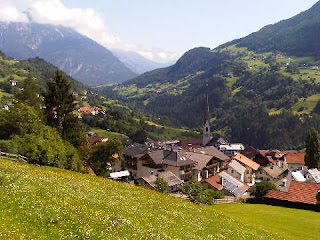

In the meantime, here are the pictures:
Top - descending from Braunschweiger Hütte
Middle - above Wenns
Bottom - on the Venet ridge
It was another great day in perfect weather.
Comments:
JJ - we hope you enjoyed your walk.
Data:
23 July 2012
18km in 8.5 hours with 1650m ascent, plus a 50 minute bus ride and a 10 minute cable-car ride
Flower of the Day - Frog Orchid
Itinerary - http://www.topwalks.com/E5%20Route.html
Sent using BlackBerry® from Orange
Sunday, 22 July 2012
E5 in reverse - Day 18 - Sölden (1500m) to Braunschweiger Hütte (2759m)


There was no hurry, the forecast was for the weather to improve during the day. We woke to drizzle, which stopped when we set off from Haus Wiesenblick. The cable-car delivered us into a cloud, which kindly dispersed upon our arrival. We had soon rejoined the E5 belvedere path to Rettenbachalm, where we enjoyed timely elevenses. The cloud that had followed us down from there on Thursday now parted before us as we ascended back up the E5 route.
The road up to the Rettenbachferner glacier was free of traffic - closed from 9am until 2pm to allow cyclists complete freedom on the road. Not many cyclists seemed to be taking advantage, but those who were seemed to be enjoying themselves.
After strolling on up to the end of the road, which finished near the chapel pictured (top), at a huge car park occupied by a single vehicle, an alfresco lunch in the sunshine was taken whilst watching a couple of walkers struggle to find the route down from Pitztaler Jöchl. Our final few hundred metres of ascent had succumbed to overnight snow.
Anyway, it didn't produce any difficulties in ascent, and by 2pm we had reached the crux of the E5 route - 2995 metre Pitztaler Jöchl.
We had fine views back into the Ötztal (pictured) despite some distant cloud.
The way ahead, also pictured, was less certain. A slithery path led along an alpine ridge walk at around 3000 metres in fresh snow. We were grateful for a few wires. After reaching a junction on the ridge the difficulties subsided and a lovely mountain path led down to this large alpine hut.
It was only 3pm - a short day.
The place is pretty full, but the cloud is slowly clearing, so our hopes for tomorrow are high.
Comments:
Gayle and JJ - where we are now seems so far from the hissing of summer lawns that we could be on another planet. We hope you both get some good walks in the sunshine, and sorry JJ, we can't join you tomorrow.
Data:
22 July 2012
9km in 5 hours with 1000m ascent
Flower of the Day - Dwarf Eyebright
Itinerary - http://www.topwalks.com/E5%20Route.html
[The phone. Has developed an. Annoying keyboard problem involving the space bar, so typing is. Proving to. Be very time consuming. Future. Entries. May be rather shorter!]
Sent using BlackBerry® from Orange
Saturday, 21 July 2012
E5 in reverse - On Holiday in Sölden (Day 2)


Instead - after so much fuel from Erica's breakfast - we felt obliged to take some exercise, but at a lower level. It was drizzling and the cloud base was below 2000 metres. So we jumped onto a bus so crowded that the driver had to 'phone for back up, and headed about 20km down the valley to Umhausen.
English voices were heard as we disembarked. "Hello's" were
exchanged. We had bumped into 008. "My name's Bond" joked Bernie, who apparently quite often gets pulled to one side when travelling. This Master Plumber from Ingleton kept us entertained all day with his stories from life as a 'domestique' cyclist to Alan Ramsbottom, to days spent with Fred Dibnah photographing the mine shaft he dug in his Bolton garden. "Who the *** was Alan Ramsbottom?" we asked. Well, "he was Tommy Simpson's 'domestique'" came the reply.
We'd planned to start the day by visiting a waterfall, the Stuibenfall. It finished up taking all day. It's quite a high waterfall that comprises a series of cascades beside which five viewing platforms have been erected, and for the adventurous there's a Via Ferrata route with thick cables and very solid looking stemples.
We took one look at the height we'd have to climb - part of it anyway - the top was in the cloud, and adjourned for coffees.
Then Sue insisted on having her photo taken with 008 and his lovely wife Janet (top picture), before we set off up the path. It turned out to be a 450 metre ascent (rather pleasant without a rucksack) with frequent pauses to view the various sections of the waterfall, which in a number of places has worn away the rock to create bridges that not even 008 would deign to cross.
One viewing platform in particular was designed to give the viewer a good shower, even if it wasn't raining. Bernie insisted on capturing the moment! We got soaked...
Anyway, when we got to the top it was lunch time. So we nipped into a nearby mountain restaurant and enjoyed a slap-up lunch (we are on holiday after all) before ambling back down to Umhausen for the 3.55pm bus back to Sölden.
[I should mention that when registering in accommodation in these parts you get a receipt that works as a 'Guest Card' and gives certain concessions, like half price bus fares. That would have saved us €10 today if we hadn't lost the card.]
That left plenty of time to shop for provisions for a hearty meal at Haus Wiesenblick, and replace my map number 43 (Ötztaler Alpen) which had decided to become a map of many parts. The new map, whilst still being only 1:50,000, is so different that it looks as if it has twice the detail. On closer inspection, it does have twice the detail! Such as 40 metre instead of 100 metre contour lines.
So my 30+ year old map number 24 - Lechtaler Alpen - will also be replaced on Monday if I get the chance. Unfortunately these new maps come with weighty booklets that I'm loathe to discard, so the heavy map bag will get even heavier. It seems weird that we are still on the same map that we used when setting off from Verona over three weeks ago - trusty old 121, but today's purchase has effectively seen that off.
We've enjoyed our break in Sölden, but will be happy to move on tomorrow. It's a pleasant place with vast opportunities for days out of all sorts, but it does have the air of a winter resort that just ticks over in the summer. Apparently, of the 90,000 or so bed nights sold to tourists each year here, some 80% are in the winter season, when this quiet, relaxed guest house no doubt vibrates with energetic skiers eager for the pistes.
And we never did get around to using the sauna!
Comments:
Gibson - welcome home, if you have had as much rain as Manchester appears to have had, your hedge cutting could take a while! We dread to think what our lawn looks like.
Data:
21 July 2012
2km yesterday, 6km today in 4 hours with 450m ascent
Hours to date spent walking in rain on E5: 3
Other English encountered to date: 3
Flowers of the Day
- Small White Orchid (yesterday)
- Twin Flower (today)
Itinerary - http://www.topwalks.com/E5%20Route.html
Sent using BlackBerry® from Orange
Friday, 20 July 2012
E5 in reverse - On Holiday in Sölden (Day 1)


Sue is pictured outside our hotel before we went into 'town', and the second picture was taken from our balcony when we got back a couple of hours later, looking up the valley towards Zwieselstein and Obergurgl.
What was the most interesting thing we did today? We visited a bank. The ATM worked first time after another bank had failed to accept my Visa card. As we were leaving we noticed an inner sanctum, devoted to an exhibition about the Ötztal people, the development of tourism in the area, and studies on the recession of a nearby glacier which are some of the most thorough ever undertaken. These days they are trying to combat the recession using snow making machines, shovelling snow from nearby rocks, and even by covering the glacier with a sort of carpet. They haven't implemented a solar powered refrigeration system - yet!
We woke to cloud cover, down to around 2000 metres. It slowly cleared and the sun appeared for a few hours. Rain forecast to start at noon came and went with a whimper just as Cavendish was showing off in the Tour de France somewhere else in the Alps.
Comments:
Nick - thanks for that bit of education on the equality of 'oe = ö'.
Jules - there's loads to do around here, of all different sorts. There's a Dutch lad staying in our hotel for a week, doing day walks - there are many to choose from.
Sent using BlackBerry® from Orange
E5 in reverse - Day 17 - Zwieselstein (1450m) to Sölden (1500m)


The phone wasn't working last night. I drafted a sentence denigrating the service in Austria, then turned it off. This morning I turned it back on to find out the time and was bombarded by all manner of bleeps, mainly from Orange, about the wonderful Austrian phone service. I must remember to turn the thing off and on in future when changing countries...
Tea and chocolate wasn't the ideal preparation for a hot 500 metre ascent, but at the end of the steep climb up to Gaislach Alm we had no issue with lashing out for 'Warmer apfelstrudel mit vanillesauce' to accompany our customary Latte Macchiatos.
Before we left Talhütte we had scoured the hut book for English visitors. They just don't come here. An Australian came a couple of years ago, but even he had an East European name.
Today's start caught us out. We should have followed our instinct, but we followed the only E5 sign we could find. That resulted in an unnecessary 20 minute walk along the Obergurgl road, from where the top image was taken. Judging by the traffic, not much happens in Obergurgl! But the river was much lower than last night, presumably because the glacial supply of water freezes overnight.
In that 20 minutes we learnt two things:
1. The E5 in Austria doesn't necessarily follow the most scenic or off-road route, and
2. Whilst the Italian signposting was equally easy to follow in both directions, the Austrian waymarking sometimes assumes that the route is only walked in a north to south direction. So map, compass and educated guesswork are now close to hand at all times, though it would be pretty difficult to veer far off course.
Slow progress on the thrutchy ascent gave us plenty of chance to admire the colourful array of flowers beside the path, including lots of Grass of Parnassus, Nottingham Catchfly, Eyebrights and Cow Wheat, Willowherbs and Wintergreens, and in places whole banks of bright purple orchids.
Having refuelled at Gaislach Alm (a similar 'alm' which we passed a few minutes later is pictured), we found the rest of this short day very easy and amenable. A lovely belvedere path rose gently over some distance, passing through open woodland and hillside meadows, all with fine views, before running a few metres near the road to the Rettenbach glacier and reaching Rettenbachalm in good time for a luxurious lunch of toasted cheese sandwiches and salad. I am pictured just below Rettenbachalm on the path that leads to the glacier.
The easily accessible path was being well used, with day walkers, many with children, in the ascendancy compared with E5ers. There were excellent views back to yesterday's route, where the 2509 metre Timmelsjoch pass appeared for a while to be in cloud. Sölden (spelt in various ways, but I'll now try to be consistent with the Kompass maps and the tourist office) appeared far below us - a rather spread out sort of place in the Ötztal valley.
The belvedere route hosted a number of information boards, some of which may have been quite interesting, but sadly only in German, so we can't read them, whereas their Italian counterparts were very helpfully mainly in Italian, German and English.
With another holiday beckoning, and with a few clouds rolling gently in, we foresook the E5 and headed on along the fine belvedere path to Gampealm, before heading down to Sölden on a mixture of gently descending roads and steep paths (the roads were easier on the knees) to our welcoming host at Haus Wiesenblick, situated near a free 'shuttle' cable-car about 150 metres above the main town.
Arriving soon after 3pm gave us plenty of 'chilling out' time (catching up on the Tour de France - Bradley Wiggins looks very happy) before washing everything, putting some of it back on again, and heading off for a barbecue and salad supper at nearby Pfandl restaurant.
Comments:
Gayle - good to hear from you. You are to blame for this late transmission. With WiFi for the first time since leaving home, I clicked on 'M & G' and got hooked. What a contrast there is between our respective trips, though in some ways they could be considered similar. Ours is much, much easier, and very much a holiday. A holiday from what, though? Is it more a way of life? The pension still rolls in. And, of little comfort, I can still kid myself that I'm carrying nearly as much weight as you, and at times the temperatures are in the 30's...
As for the photos (snapshots) - even if we take 3000, it'll be a struggle to find more than 72 of any real quality. Brace yourselves for a few flowers!
Stay at Home Hazel (aka Anonymous) - it must be really bad if even you are complaining about the weather in Manchester! We hope you find somewhere sunnier for your holidays. If it's any comfort, our friends from western Austria (where we are heading) say their weather has been terrible as well. We hope that we will bring them a change in fortune. We'll enlighten you as to the ice man and the tropical fish when we get home - we think you'd like Bolzano.
Data:
19 July 2012
13km in 6.5 hours with 850m ascent
Cumulative on E5; 316km with 17,250m ascent
Other walkers - lots, it's holiday time
Flower of the Day - Nodding Wintergreen
Itinerary - http://www.topwalks.com/E5%20Route.html
Sent using BlackBerry® from Orange
Thursday, 19 July 2012
E5 in reverse - The End of Phase Three

The sun is shining, all is well, and we are well and truly on holiday.
Beer is to follow, but a pot of tea after today's exertions is our initial choice of rehydration fluid.
Sue is pictured on our balcony with a view up towards Zwieselstein and the route we have recently travelled.
Today's entry will follow 'at leisure'.
Sent using BlackBerry® from Orange
E5 in reverse - Day 16 - Moos in Passeier (1007m) to Zwieselstein (1450m)
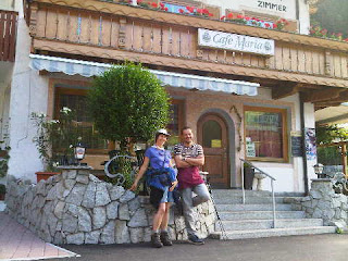

Christian provided the last of the breakfasts we have got used to in Italy - fruit juice, lots of coffee, and a copious plate of cooked meats and cheese, to go with the bread rolls and jams and butter, etc. He speaks German, Italian and English, often in the same sentence, so had no problem in chatting Sue into the above picture outside Pension Maria before the sun hit it this morning.
We were on our way soon after 8.30, heading through shady woods on a lovely path after starting on an ugly quarry road, up to the village of Rabenstein, with its small but dominating church. On the way we passed more legend stories and much evidence of the landslides that frequently alter the shape of this valley. A huge lake was created by one of these landslides in 1401, and it wasn't until 1774 that the waters were dramatically released, leaving the valley roughly as it looks today.
There are also mines up here, claimed to be the highest in Europe, where over 60 different minerals were extracted during the workings that were active from the 13th century until 1967. They also featured a 27km conveyor-belt system - the longest of its type in the world.
After our last Italian coffees for a while, on the warm balcony of Gasthof Trausberg, we headed up above the tree line on the long ascent to Timmelsjoch, on the Austrian border. It was a magnificent walk up to that 2509 metre vantage point with what may have been our last view of the Dolomites for a while. We made just one error - we followed the cycle track by mistake for one km - we didn't meet any cyclists as they had reciprocated the error and were pushing their bikes awkwardly down the steep, rocky path that we should have been on.
On the way up we encountered the two German lads who are walking part of E5 in the same direction as us, and we met the thirty or so folk who were going in the 'correct' direction - mostly couples, plus a group of 17.
A large herd of goats (hundreds) approached seemingly menacingly as we tucked into our herrings in tomato sauce luncheon - in a lovely spot beside a babbling stream, next to a sign (pictured) that purported to claim that we were at the Austrian border (we weren't, unless Austria has recently recovered some ground). The residents didn't seem to care - they just crossed into Italy, hardly pausing to read the sign between munches.
An information tunnel at the summit told all about the building of the Timmelsjoch road, opened in 1968. But the pass is believed to have been used as a trade route for many centuries, long before there is any record of the better known Brenner Pass being so used.
We spent some time at the Timmelsjoch café, but finally gave up on any chance of being served, so relied on some fine Austrian spring water as rehydration fluid.
The scar of the road somewhat marred the fine Ostalalp backdrop as we descended towards Zwieselstein on a fine alpine path.
Once there, past some frantic hay making (the weather must be due to change), the DAV Talhütte was easily located, but we hadn't noticed Gillian's description as 'self-catering' until the guardian pointed to the kitchen and charged us just €30 for our room. So we finally used one of our box of carefully preserved tea bags, and found a nearby restaurant. It looks like being tea and chocolate for breakfast.
Comments:
Alan R - no, it wasn't you, just a generic two stone overweight person dreamt up by Sue. Some of our friends would be pleased to be two stone overweight on your analysis. I can however think of one person who fits the description perfectly. He'll never realise, as these pages fall outside his literary criteria.
Alan, you do seem to attract some weather, but if it's any comfort we lose the daylight by 9.30 in these parts, and sunset in Zwieselstein was at 5.30 today!
Gillian - Christian, at Pension Maria, was a very friendly chap as mentioned above.
Jules - I may do a kit list when I get back. We do need to do one for those joining us on GR54 in September. Our spare clothes are minimal, we just wash things out most nights and let it dry overnight.
Data:
18 July 2012
19km in 8.5 hours with 1600m ascent
Other E5 walkers - 2 going our way, 30 coming from Zwieselstein
Flower of the Day - Sticky Primrose (on the Timmelsjoch summit)
Photos taken to date: Sue - 505; Martin - 985 (approximately the equivalent of 35 slide films!)
Itinerary - http://www.topwalks.com/E5%20Route.html
Sent using BlackBerry® from Orange
Wednesday, 18 July 2012
E5 in reverse - Day 15 - Pfandleralm (1350m) to Moos in Passeier (1007m)

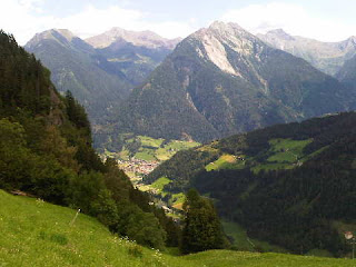
Our room mates at Pfandleralm got a bit of a surprise after breakfast to find that we had dismantled our bed. This had proved necessary to recover Sue's Kindle from behind some seemingly impenetrable panelling. Ikea would have been proud of us. The Germans eventually understood.
Whilst everyone else, including a couple with two young children, set off purposefully up the hill that we had found quite lengthy and steep in descent last night, we meandered on down the same hill towards the vibrant metropolis of San Leonardo in Passiria (aka St Leonhard in Passeier). The full story behind the last days of Andreas Hofer were revealed bit by bit as we descended past information points that related the story, from his untimely execution to the day when he was forced at gunpoint to continue his resistance to Napoleon's forces.
It was another lovely day, fairly cool in the shady woods after our 8.30 start, with lots of gaps in the woodland offering wide-ranging panoramic mountain views.
With frequent stops to read about Hofer (and when he was finished with a nature trail started), and to photograph flowers, gawp at the plunging waters and irrigation channels of the Cascata delle valle Pfeifer, and generally admire a third dead mole and the views, we managed to take rather longer than expected to reach elevenses at St Leonhard. A pleasant little town with an upstanding church sporting normal tiles (as opposed to the multicoloured ones we've been admiring recently) and a finely honed spire.
From there we spent another couple of hours, bizarrely going faster up than we had down, as now there were horse flies vying to rip chunks off our finely honed muscles, tootling through more mixed woodland above farmland with plenty of open sections with fine views.
Stuls was reached at 1.30pm, precisely the time at which the Stullerhof restaurant stops serving lunch. But unlike some of his UK counterparts, the chef didn't refuse to cook for us, instead offering 'toast or soup'. I'm sure his 'toast' would have been different from our normal fare at home, but the alphabet noodle soup was certainly a bit different, and very filling.
After the excitement of trying to make words out of our soup, we made the obvious errer of failing to follow the E5 signs out of Stuls. Our mistake was soon remedied by a bout of eye engagement, and before we knew it we were on our way towards the final destination of the day.
Once down at Moos, having dodged a few places where landslides had taken out the path, we had to decide which part of the rambling village held our accommodation, Pension Maria. The tourist information office seemed a good point from which to start. There was no map outside the door, probably because most of the village can be seen from that point.
We made our way down to this fine establishment, where we were soon installed in a room next to a group of 17 teachers and children. "Just as well you booked in advance" commented Christian, before turning away a couple of mountain bikers.
It remains a puzzle to Christian as to how 'Café' (Pension) Maria happens to be mentioned in Gillian's guide book, to the exclusion of all the other places there are to stay in the village, and that he only found out about it when Bob the All Black passed through last year!
'Comfortable and inexpensive' - Gillian's description is accurate.
Today's pictures were taken coming down from Pfandleralm, with St Leonhard at the bottom right (top) and from near Stuls, with St Leonhard in the valley bottom and some of the morning's route in view.
You'll notice Sue's pictures with men are becoming a rarity. This is because she doesn't have any German chat up lines. In fact she doesn't have many German lines at all. So you'll have to wait for us to enter Austria for the next in that series of images - Sue reckons it should be a doddle to pick up an English speaking Austrian. I wonder if he'll have a felt hat - apparently that's a sign of virility, I had to drag her away from one such person yesterday.
Comments:
Alan R - haha, luckily we had no tent nor any dehydrated food to offer the Haflinger horses, who made do with a furtive and unproductive nibble at Sue's camera case. You're right though, it's a hard life!
Jules - welcome back. We hope you enjoyed your break - I'll probably be commenting on your postings in a few weeks' time. In answer to your question, 15kg is probably my maximum 'carry', whilst Sue's is approaching 4kg. That includes water and lunches, though we don't carry much food as there are usually hostelries en route for lunch. My bag includes a number of maps for the second half of the trip, a file with a page for each day re accommodation bookings and other info (probably 40 sheets of A4 at the start, being discarded as we go), first aid kit, camera, a bag of electrical items such as phone/camera chargers (2) and spare batteries (lots), razor, Kindle, torch, etc. Then there are the down jackets that Gillian was quite sceptical about - mine hasn't been worn (yet?) but Sue's new holofill jacket (bought as a present for this trip) was brought into use for a concert at Levico Terme - quite over the top, but nice to see it used. Sue's trail shoes are on board as her boots may not last the trip. We have a weighty Alpine flower book, and a diary and Gillian's guide book, loads of sun tan lotion, and various other kit, including heavy wallets. I didn't do a list for this trip, I just threw it all in. Shame I forgot to empty the bag first, as I found various items from my last backpacking trip when we arrived in Verona. The windshield has been discarded as we have no stove, but the chopping board came in useful during an al fresco meal in Bolzano. So we are probably carrying about 19kg absolute max between us, usually quite a bit less, and my 15kg or so share of that seems to get lighter as the weather gets less humid. We are still in shorts and t-shirts, so all our other clothes are being carried. My rucksack is a similar size to that of many E5 walkers, but we don't get recognised as such because Sue just ponces around with her bum bag. As on the TGO Challenge, this is regarded as being a little unusual!
So, since I don't actually have much of a problem carrying the rucksack (except in extreme heat, etc, when carrying anything would be a bind) I don't really care how much it weighs. I suppose I'm a bit like someone who is two stone overweight but can't be bothered to get in trim because he seems to get around ok anyway! Having said that, it does sometimes feel a bit on the heavier than desirable side...
Nightbird - we did see a glacier today, but the risk of being caught in an avalanche was rather less than the risk of seeing a naked German fraulein playing table football in an aquarium. We did hear about the Chamonix avalanche and we do hope that none of our friends were involved.
Data:
17 July 2012
16km in 7 hours with 850m ascent
Other English - none
Flower of the Day - Cobweb Houseleek (on the way up to Moos)
Itinerary - http://www.topwalks.com/E5%20Route.html
Sent using BlackBerry® from Orange
Monday, 16 July 2012


E5 in reverse - Day 14 - Meranerhütte (1930m) to Pfandleralm (1350m)
A magnificent mountain day.
Today had everything you could wish for as a walker high in the Alps.
Overnight rain finally cleared the atmosphere, leaving perfect visibility all day apart from a vague puff of cloud drifting around the summit of Ingleborough.
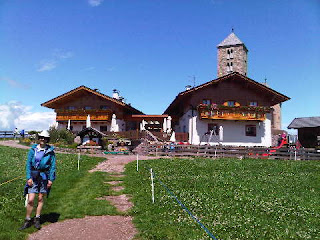
Belvedere paths (Sue is pictured on one) past swirling swifts, mountain lakes and squealing marmots led to an easy scramble up a high peak - Hirzer (2781m) with an even higher cross (pictured) and 360 degree views.
The steep descent led to a sumptuous lunch of pasta and mushrooms outside a popular farmhouse (Roseggeralm) that appeared to be hosting a yodeling contest.
After that we said goodbye to the crowds in this popular area (imagine you are in the Langdale valley on a summery Monday) and enjoyed remote paths that led eventually to the home of Louis and Steffi, our hosts at Pfandleralm. The beer is cool and the food excellent, enjoyed outside the hütte in the warmth of a perfect alpine evening.
It's full tonight so we are in our first shared dormitory, but I'm sure we'll sleep well.
Sue's knees are tired, but the weight on my back seems less noticeable every day, perhaps because we are making serious inroads into the large box of washing powder.
The meadow in which Pfandleralmhütte is so pleasantly situated is rich with history, as this is where Andreas Hofer, a local hero who led the South Tyrol's resistance against Napoleon in 1809, was captured by French troops in 1810. A memorial tablet was vandalised during the fascist period, but in 1983 a new granite memorial was built by the Passeier company of marksmen. I can see it from where I'm enjoying my beer outside the hütte.
English speaking visitors: so far, Josh is the only English speaking person we have encountered. A perusal of Meranerhütte's visitor's book revealed Adam and Jane's passage towards Bregenz, still a week ahead of us, so they must also have had some rest days. Before that, the only English speakers we could identify were Bob Cyffers and Janet McMenamin, two All Blacks who passed through on 22 July 2011. Curiously, all these English speakers were travelling from south to north, and no doubt, like us, working backwards through Gillian's guide book!
Comments:
Gillian - Trafoi brings back great memories of al fresco dining at the shady camp site during the heatwave of 2010, with nightly walks into the village where we admired the acrobatics of the swifts around the church. We suspect your conditions were somewhat different, but hope you got some good walks in. Did you notice we visited Fabrizio and even got him some business!
Nightbird - my head is too confused with messages from 'The Path of Legends' to devise jokes about naked Germans and football machines, but we find it quite funny that mention of "we are from Manchester, home of Signor Ballotelli" makes them go very quiet. Sue is envious of your shopping trips. She's trying to lose as much as she can in order to be able to go shopping with a purpose, but losing her debit card was a bit of a faux pas in that respect. Btw the apricot croissant is mine - don't give it to Sue, she eats everything else!
Data:
16 July 2012
18km in 9 hours with 1400m ascent
Other E5 walkers - lots - unless we report otherwise, assume we are on the main Oberstdorf to Bolzano route that enjoys the patronage of the German speaking nations of the world
Flower of the Day - Mossy Saxifrage (beside the high mountain paths)
Itinerary - http://www.topwalks.com/E5%20Route.html
Sent using BlackBerry® from Orange
Sunday, 15 July 2012
E5 in reverse - Day 13 - Bolzano (262m) to Meranerhütte (1930m)

We noticed that most other people at breakfast were rather fat. I wonder why?
I enjoyed my caffe latte and an apricot croissant.
That set us up for the short walk to the cable-car up to the village of Jenesien. We rejoined the E5 route at the foot of the cable-car, as the route very sensibly uses this means of descent/ascent to/from the heat of Bolzano. The cable-car runs every half hour, but luckily we arrived a few seconds before the 9am car was due to depart, and ten minutes later we found ourselves in the cool air of Jenesien, after gaining 800 metres with very little effort.
Gillian suggests staying in Jenesien rather than in Bolzano - cooler and cheaper, with easy access to Bolzano, and ideal for a visit to Runkelstein. We commend her suggestion.
It was only 15C! We could walk comfortably uphill without boiling over! Overnight rain had cooled things down, and thick cloud still cloaked many of the mountains that surround Bolzano, with just the jagged summits of some of the Dolomite massifs visible.
Gasthof Edelweiss was reached after less than an hour - it was only 10am but we couldn't walk past its enticing refreshments. An early elevenses.
Outside, it was now even cooler, with a little light rain in the air, so we donned our anoraks despite the bluish sky and the generally clearing weather. Progress was slow. The 'Path of Legends' had reappeared. Many photos were taken. I have vowed not to re-tell these legends just now, but readers (victims) may be subjected to them on those wintry days when I have nothing else to write about.
A posse of Haflinger horses cantered past. These horses roam wild hereabouts, but those passing us were well tamed. Apart from the seemingly never ending stream of legends, we passed a Noah's collection of animals - goats, sheep, donkeys, cows, chickens, etc, as we moved through green meadows full of well-spaced fir trees.
Langfenn farm at St Jacob (pictured) was reached at 11.50. Too early for lunch, but not too late for a second elevenses. We sat outside in the sun, the air now being free of moisture - probably the least humid since we started. Jagged Dolomitic peaks struggled to display their profiles above distant clouds.
We drew ourselves away for the easy hike past a three-pronged cross dated 2006, next to a shrine, and up to Möltener Kase, another farm cum restaurant where the cheeky goats taunted a large dog at the next table. Massive bowls of soup filled with frankfurters would guarantee we wouldn't starve this afternoon. I was glad that we'd been unable to take on extra supplies!
After our late lunch we detoured away from E5 to follow Gillian's recommendation of a visit to the three-pronged cross dated 1980 at the summit where there's a proliferation of 'Stoanerne Mandlen' (Stone Men). There are huge numbers of small stone cairns, some of which apparently date back to prehistoric times. They reminded me of some similar (memorial) cairns that litter one of the minor summits near the Berlinerweg trail, high above Mayrhofen.
It was cool. We donned fleeces for an hour or so after lunch, for the first time since leaving Verona. They still smell freshly washed!
Now well and truly above the tree line - quite a novelty after the last few days from Cembra - we romped along the last few undulating miles to Meranerhütte, arriving at 4.30, just before an afternoon shower.
The shower soon moved away, but in the deep valley to our west a storm appeared to be raging all afternoon and evening.
The E5 brigade are here - several groups going north to south. All German speaking, Josh remains the only native English speaker we have seen since leaving Verona. They say that unlike us they have had some rain every day.
It's a smart Rifugio, and we have a spacious room for four to ourselves. The showers are token operated from outside the cubicles, and on entering the washroom for the first time I thought I'd walked into a scene from a third rate sex film, but it was just a confused, stark naked German lady looking for somewhere to put her token. Gillian records the showers as being 'unreliable'. Sue and I found them to be great, but others agree with Gillian. However, the table football machine on the verandah seems to work fine...
Too full for beer, we've made do with red wine tonight, to wash down our salad, pasta bolognese, veal in breadcrumbs with sautéed potatoes, and apfelstrudel with cream. We'll need to walk a long way tomorrow to shed the calories from that lot!
Comments:
Gayle - sorry to hear of your return to a 'mudfest' - it's another three weeks before we get back with the sun, so perhaps you should nip over to Italy for a while...
Dot - we don't think we've ever been to Fondo, so you are one up on us there! It's true that we are eating well, but we are burning it off quite energetically. We actually only have one more full rest day planned. Strangely, the black squirrels are just like the ones that live in Ken and Helen's garden in Ottawa. We've now seen red ones as well.
Data:
15 July 2012
27km in 8 hours with 1350m ascent, plus a 10 minute cable-car from Bolzano to Jenesien (1087m), including a 2km walk to the cable-car from Hotel Post Gries
Other E5 walkers - quite a few coming the other way and lots at Meranerhütte
Flower of the Day - Globe-headed Rampion (rampant around Meranerhütte)
Itinerary - http://www.topwalks.com/E5%20Route.html
Sent using BlackBerry® from Orange
Saturday, 14 July 2012
On Holiday in Bolzano (Day 2) - Runkelstein Fortress


Today's plan was to take the cable-car up to the Renon plateau, which is cooler than the Bolzano valley and offers great views towards the Dolomites. But with lots of cloud, and rain forecast, we decided instead to visit the nearby fortress of Runkelstein. Path 9 from near the hotel took us high above Gries to the belvedere Passeggiata del Guncina, with fine views down to the Murie-Gries monastery, virtually next to our hotel, and the Adige valley as a whole.
After a while, path 5 took over and we descended to cross a road via a precarious diagonal pedestrian crossing. Care was taken not to hamper the progress of the vintage cars taking part in the South Tyrol Rally, which I'm sure we've encountered in the past.
The Cascata e gola del rio fago (pictured) was passed, before we crossed the E5 route and took a riverside path up to the old fortress (also pictured) on the outskirts of Bolzano. But it feels well out of town and was a relaxing place to spend a few hours.
The fortress was started in the 13th century by Baron Wangan, and is built of and on an outcrop of porphyry rock that retains its heat better than most rock but is subject to degradation. So there have been many repairs and additions over the years, most notable after bourgeois brothers Franz and Niklaus Vintler bought it in 1385 and commissioned unique frescos for the whole structure. Many of the frescos survive, and they reveal aspects of courtly life in the fourteenth century that can't be found elsewhere.
The fortress, which became a castle fairly early in its life when it ceased to be an armed fortification and assumed a life as the home of noblemen, also has an exhibition about the Jews in the Bolzano area. It seems that they were allowed to play a greater part in the life of the town than were Jews in other parts of the South Tyrol area.
So, a fairly leisurely day, culminating in a pizzeria around the corner. We thought about trying the Hopfen & Co slow food restaurant in town, but the gathering clouds and rumbling thunder put us off.
Back to 'work' tomorrow!
Comments:
Markus - I may have misled you, next Friday is less than a 'short' day, it's a 'zero' day, perhaps the last of our trip!
Data:
14 July 2012
10km and 250 metres ascent around Bolzano
Flower of the Day - Orange Mullein, on the path to the fortress
Itinerary - http://www.topwalks.com/E5%20Route.html
Sent using BlackBerry® from Orange
On Holiday in Bolzano (Day 1)


After managing until 11am without doing very much at all, we strolled at least ten yards from the hotel to a coffee shop, before braving the elements for a tour of some of the sights of this interesting city.
Eventually we gravitated to the shopper's paradise called 'Sportler', recommended by Gillian, where €30 was removed from my wallet in return for a rather basic replacement compass. I will try to take more care of this one!
Meanwhile, Sue was engaged in a long conversation with her bank, as her debit card was being rejected by ATMs. However, a duff debit card is better than no debit card at all, which is what she found in her wallet (or more accurately didn't find in her wallet) an hour later.
We soon forgave Sportler for the expensive compass when their concerned and courteous staff produced the missing card from one of their tills.
That left us free of worry to explore the excellent Natural History Museum (top picture) before returning through the busy but interesting streets (middle picture) and via a Spar shop for the ingredients for a luxurious supper in our room (more Tour de France - the Brits seem to be doing rather well!), reached via the road across the river (bottom picture) that leads to our current home in Gries - a town known mainly as a health resort, with many hotels, villas, gardens, parks and vineyards, that was incorporated into the city of Bolzano in 1925.
We certainly feel somewhat rested...
Comments:
Laura - hello, you seem to have sent us your storms!
Data:
13 July 2012
4km around Bolzano
Flower of the Day - Dwarf Soapwort (we've seen it quite a lot in the mountains but only identified it today via a picture in the Natural History Museum)
Itinerary - http://www.topwalks.com/E5%20Route.html
Sent using BlackBerry® from Orange
Friday, 13 July 2012
Titch the Giant

Many courageous men accepted the challenge but nobody was able to defeat the giant and they went away in disgrace.
The emperor's daughter would have to wait a long time for her husband.
Finally, another giant from the edge of the empire, named Titch, (the giant, not the empire, and he kindly posed with Sue yesterday) got in touch with the emperor. He loved adventures and looked forward to fighting the emperor's undefeated giant. When the emperor started the duel, Titch took his opponent's right hand with lightning speed and squeezed it so hard that the blood squirted out of his finger nails. It was bright red. The emperor's giant writhed in pain and roared terribly, but Titch pressed even harder. So the emperor's giant shouted "Let me go, let me go; you're the winner!"
So Titch was able to win against the emperor's strong giant with weak fingers.
But Titch did not want to have anything to do with the marriage of the princess. "Give your daughter to whoever you want, she's already too old to bear children because of your stupid delays, and I already have a wife" he told the emperor.
So the emperor sent Titch back to Bolzano from where he organised a coup when the emperor died and his childless daughter became a nun. It had really bugged Titch that he had won the duel so quickly, after which he had whinged: "if only the emperor had a stronger giant, the fight was much too easy!"
So Titch installed his own giant son, who he had named Arnold, as emperor. Then he went back to Bolzano to live happily ever after in a beautiful woodland glade.
Sent using BlackBerry® from Orange
E5 in reverse - Day 12 - Weißenstein (1527m) to Bolzano (262m)


After the excitement of the photo shoot with T and M we had a look around the sanctuary, which apart from the church, with its huge collection of ex votos (offerings made in fulfilment of vows), has the hotel, with views east to major Dolomitic peaks and west to even higher snow-clad Alpine summits, a youth hostel, a cultural centre and a congress hall.
By 9.30 we were on our way again, on the short last lap of this stage of our walk. A pleasant stroll through fairly open woodland took us down the Forstweg Alte Säge, a pilgrims' route past the Twelve Stations of the Cross, unassuming shrines that lead up to the sanctuary.
Today we started for the first time on the second side of our now well worn Kompass 121 strip map. This second side will take us to beyond Solden, so whatever reservations we may have about the dated nature of the paths marked on the map, we certainly can't complain about the weight - and we have no maps to send home at this stage of the trip.
Easy paths through woodland steaming on the clear day with Dolomitic views then led past fifteen mountain bikers having a morning chat and around the head of a valley, to the sprawling village named after its seventh century Bavarian tribal settlers - Nova Ponente, or Deutschnofen (we are now in dual language territory). It was a lovely sunny day with temperatures in the low 20sC. Ideal for walking, and also for sitting outside a café with caffe macchiato and Mohnstrudel, a local delicacy - poppy seed pastry (pictured).
It's on these occasions that Gillian's guide book is at its most useful. Anyone can walk the E5 armed with the 1:50,000 scale strip maps and a compass, simply by following the waymarks, but the research into local history and culture carried out by Gillian and conveyed in her writing couldn't all be picked up by casual walkers of the route like us. Thanks again, Gillian, and we hope you don't mind a selection of the fruits of your labour being reiterated on these pages. So, thanks to our guide book we had been able today to plan an 11.00am elevenses at a place where we could sample a local delicacy.
Luckily, route finding for the rest of the day was simple in our south to north direction thanks to the copious waymarking, as I'd somehow contrived to lose the compass we use when waymarks are sparse or uncertain. [I think Josh said he got a little misplaced coming north to south, so it may not be quite so easy in that direction, but it may be that having started from Bolzano he just took a little while to get into his rhythm. It was good to hear from him today.]
After Nova Ponente we continued amiably past a children's camp ground, following The Path of the Legends, one of which we may recount later. The terrain was to a large extent more of the same, as pictured in the previous posting, but with frequent fine mountain views to treat us in between the welcome shade of the woodland sections.
All too soon, at 2.30pm, we reached the Colle/Kohlern cable-car station at 1135 metres. The brainchild of a local hotelier, this cable-car dates back to 1908 and was the first such system in the whole of the Alps, though nowadays the original double-tiered bench system has been superseded by a conventional cabin. As such, we felt bound to use this ancient form of transport to perform our 'landing' in Bolzano, especially as the E5 route takes this 'path'!
But not before cold drinks at the café and a visit to the nearby huge wooden watchtower, which sadly was locked, preventing access to its expansive views over the Bozen basin and its surrounding attractions and peaks.
At 30C, the 3km walk across Bolzano to our comfortable hotel was a slow affair. I'll be pleased to give the 15kg load a little rest in a wardrobe and enjoy the pleasures of Bolzano without the encumbrance of its company for a couple of days. Not that I mind carrying it. After this short break I'll be raring to go again on Sunday morning, when the initial straight line of the E5 route looks very appealing!
After enjoying a rare visit to the Tour de France on TV, we popped round the corner for an excellent pizza.
Then we 'crashed out'.
Comments:
Patrick - thanks for the path advice, but we decided to avoid the heat of path 4 and take the cable-car, which after all is the route taken by E5!
Josh - it was great to hear from you. We were delighted to see that you made better use of Fabrizio's hospitality than we were able to...
Nick - thanks for the Constance info, and good luck with the move (keep cool, Daniella!).
Ethan - good to hear from you. Good luck with any exams you may have, and I hope you have an interesting summer planned.
Data:
12 July 2012
17km in 5 hours with 400m ascent, plus 10 minute cable-car to Bolzano from Colle (1100m), and then 3km+ walking around in Bolzano
Cumulative on E5: 223km with 11,200m ascent
Other E5 walkers - none in evidence
Flower of the Day - Grass of Parnassus
Itinerary - http://www.topwalks.com/E5%20Route.html
Sent using BlackBerry® from Orange
Subscribe to:
Posts (Atom)