Sue and Martin in Mallorca 2019

Sue and Martin in Mallorca 2019
On the Archduke's Path in Mallorca

Friday, 5 May 2017

Friday 5 May 2017 - Puerto de Pollença to Timperley

Top picture - early morning in Puerto de Pollença.  

It was overcast and warm as we set off for the 7.05 bus to Palma - there's not another one until 8.30, which could have been a bit tight for our 11.45 Jet2 flight.

Anyway, that wasn't too onerous, and it gave us plenty of time to enjoy some more excellent coffee and chocolate croissants outside La Parada by the bus station in Palma. Nearby they were setting up about 200 games of chess, beside which hordes of uniformed (if only by way of distinctive baseball caps) children were gathering to compete.

See next picture.

Palma airport has ripped us off with horrendous food prices too many times, so today we avoided that issue by sourcing a tasty lunch from a patisserie just off Placa Espanya before catching the bus to the airport.

Having finished Tove Jansson's delightful story, The Summer Book, about a grandmother and granddaughter who spend the summer on a Norwegian island, I've moved on to Colin Dexter's Inspector Morse books. I've seen the TV series but never read the books, so here goes, and this journey provided plenty of time to enjoy getting into the first book, Last Bus to Woodstock.

I never realised that Lewis was older than Morse!

We were in Manchester by early afternoon - lovely weather so we got the tram to Wythenshawe Park and walked home through the meadows by Baguley Brook from there.

The view of the Bridewater Canal from Timperley Bridge is mundane, but it's home, and we like it.

Thursday, 4 May 2017

Thursday 4 May 2017 - Lluc to Pollença via Camí Vell

This is the final stage of the six (or so) day walking route along the backbone of Mallorca, known as GR221. We followed the official low level route, rather than going over 1104 metre Puig Tomir. Our route is described in walk number 24 in June Parker's Cicerone guide that was updated by Paddy Dillon in 2006. Essential literature for anyone planning a walking holiday in Mallorca.

Cloudless skies greeted us once more from another late rise. Well, the bus to Lluc (pronounced 'yeauch') didn't leave until 10.30, so why rush to dispose of the giant chocolate croissants we found yesterday in Palma.

The driver of the 10.30 bus was a patient chap. He had to be in order to negotiate the hundreds of bicycles grinding their way up to the 600 metre pass. I noticed that some of these bikes were state of the art road bikes but others looked a bit chunky. They had auxiliary power units! I wonder how long it will be before we see Lyn leading Robert up this hill on her electric bike?

The walk was an easy 17 km stroll from the café at Lluc Monastery on good tracks and paths. When we lost the view we gained the aroma of the pine forest. An eagle soared above the Monastery at Lluc, and again later over Pollença. Chaffinches waited impatiently for the crumbs from our a la carte lunch on a stone picnic bench in the forest.

Some men were repairing the stone walls beside the track, on which a large grasshopper sunned itself until provoked by Sue's camera lens to fly away.

Four Czechs were encountered, on their last day of five on GR221. They had been 'sleeping out' and were tired but pressing on quickly given the prospect of ice creams in Pollença. We wish them well.

A wait for the bus gave Sue and me time for cold drinks before spending another evening with Paul, whose wine needed finishing before we hit the streets of Puerto de Pollença, where Can Pescador supplied us with an excellent paella.

Today's pictures:
Outside Lluc Monastery 
A view from our path
Dinner - looks like earth, but is actually a superb paella

Wednesday, 3 May 2017

Wednesday 3 May 2017 - A Day Out in Palma

9.15 bus - an hour to Palma and La Parada cafè for refreshments.

The 14th century cathedral (pictured top), one of Europe's tallest Gothic structures, is nothing short of imposing, both inside and outside.

Equally imposing is the Palau de l'Almudaina, directly opposite the cathedral. The museum and public rooms were interesting, and I was pleased to see that a lot of the building is still in use as a legislative and military headquarters.
 
Lunch at Bar Coto Dos. Tapas rules ok.

A stroll past expensive yachts and cruise liners, then up a hill to Castell de Bellver, a grand 14th century royal fortress, royal summer residence and later royal prison (a former king's widow and sons were imprisoned here for most of their lives).

It's a wonderful place, with fine panoramic views that may feature in some future slideshow. For now though, we have to make do with the lower picture, taken in the central courtyard of this magnificent building.

The 3 km walk back to Placa Espanya took us nearly 5 km. The Garmin GPS download will no doubt reveal why in due course; the lack of a map didn't help.

The bus to Puerto de Pollença didn't arrive, so we got on one to Alcudia. This bus then became full, so there was irritation amongst queueing would be passengers. Meanwhile the Puerto de Pollença bus arrived, very late, and set off whilst we were still trapped on the immobile Alcudia bus. Anyway we got to Alcudia and were immediately whisked off to Puerto de Pollença by the ever efficient number 2 bus.

Meanwhile, Paul had enjoyed a hilly 70 mile bike ride and was waiting, bottles of wine in hand, for the meal that we managed to concoct within a few minutes of arriving home.

A good time was thus had by all...

Tuesday, 2 May 2017

Tuesday 2 May 2017 - Cala de San Vicenç and Puig de l'Aguila

After another long sleep (ie lie in) the easy agenda for today involved a walk from the apartment. It was a simple decision to choose to stroll over the Coll de Siller to Cala de San Vicenç for coffee and cake, then on up a beautifully constructed quarry track to enjoy splendid views from the 214 metre summit of Puig de l'Aguila.

The last bit of ascent was on a rocky, cairned path bordered with the lovely scent of rosemary.

Panoramic views were again the order of the day. The descent back to Cala was rewarded with an excellent lunch of crab and prawn sandwiches with chips and salad, at the Marinas restaurant.

It was a relatively easy walk from there back to base, via cairned paths over the Coll de Siller in the presence of the area's ubiquitous feral goats.

We were back home for beer o'clock, for which we were joined by Paul from parkrun, who has flown in for a few days of what he wouldn't but I would describe as 'extreme road biking'. We met up with him again later at Osteria N15 for an excellent meal in Puerto de Pollença's main square.

Today's pictures:
Cala Molins at Cala de San Vicenç
The view to Serra del Caval Bernard from the finely constructed path up Puig de l'Aguila - can you spot the arch/window?
The view back to today's and yesterday's routes from the summit of Puig de l'Aguila

Monday, 1 May 2017

Monday 1 May 2017 - Alcúdia and Puig Sant Martí

After a long lie in, our valid excuse being that we were up early yesterday AND we are one hour ahead of UK time, we enjoyed a pot of tea that didn't quite taste as much of dirty dishwater. Could someone have washed out the kettle using lots of washing up liquid?

Then the local Spar shop provided breakfast. Just like home! The Spar shops are really quite similar, and very close to us both here and at home.

The 352 bus that runs every 15 minutes took us efficiently to Alcúdia for a walk around the walls that offers good panoramic views from its high points. Before we knew it we were outside
Can Polit restaurant and were enticed in (well, to a table in the sunshine) by its offer of a mixed Majorcan tapas meal. The restaurant was busy with a mixture of pensioners, grizzled cyclists on their lunchtime break, and families with pre school children taking advantage of the cheaper fares available outside school holiday time.

Duly satiated, we then embarked on the more energetic phase of our day. Mostly pavements took us to Playa Alcúdia and to the end of Avenida Pere Mas 1 Reus. On a bench opposite the ruby and white Edificio Siesta apartments, we scoffed the last of our provisions before braving a crossing of the bypass and, helpfully guided by route description number 41 in Charles Davis's Discovery Walking Guide, heading steeply up a pathless watercourse to the 268 metre summit of Puig Sant Martí. Yesterday's asphodel was vaguely still in flower; today's must have been caught by warmer sunshine as it had all gone to seed. There were a few other flowers amongst the scrub but it was wise to concentrate on making progress safely on ground studded with exposed rock and gnarly boulders.

Kestrels and paragliders competed for our attention high above us.

The summit consists of bare rock overlooking vertiginous rock faces up which, unbeknown to us at the time, a German climber was ascending. After yesterday's slither I took great care to pause whilst admiring the great panoramas, whilst descending safely to a lane at the col between our higher southern summit and the lower northern one which is adorned with telecommunications towers.

Then it was a gentle stroll, with the German climber precariously perched above us, through lovely pine woods interspersed with mountain bikers, back down to the bypass.

Across the road we came to the impressive grotto of Cova de Sant Martí. Sadly it was enclosed in a locked compound so we couldn't get in. Beyond that, a winding path through olive and pine woods brought us back to Avenida Pere Mas 1 Reus, along which a supermarket was found. Dinner provisions thus sorted, a bus stop at the end of the road was reached simultaneously with a number 2 bus that returned us to base.

Salad and burgers in the apartment were delicious. We thought the burgers would give off some fat and shrink a little. Not a bit of it - they remained an inch thick and were very tasty.

Our day's walking totalled about 15 km with 300 metres ascent, plus another few km by way of an after dinner stroll along the sea front.

Photos are pretty self explanatory - Alcúdia, summit of hill, dinner.

Sunday, 30 April 2017

Sunday 30 April 2017 - The Bóquer Valley

An easy journey from Manchester courtesy of Jet2 and Mallorca buses saw us at the apartment in Puerto de Pollença by about 2pm despite 'losing' an hour and strolling around the music laden pedestrian precincts of Palma for an hour or so.

It's so nice to avoid the hassle of hiring a car, and to have time to buy pies in the centre of Palma. We had no idea about the pie contents and were delighted to find it stuffed with ham and peas.

This is a hand luggage trip, so it took very little time to unpack and then head off on the short walk up the Bóquer valley to the stony beach at Cala Bóquer (pictured). It probably took me more time to clean up afterwards, as a result of my finding the only damp patch for miles around and undergoing a slither that coated all my clothes and my rucksack in a layer of light brown slime. I can't remember ever having to conduct such a comprehension laundry session on the first day (let alone hour) of a holiday.

There are supposed to be rare birds up here, and we did pass some long lenses. But we also encountered lots of noisy locals. The only bird of note that I saw looked like a cross between a greenfinch and a yellowhammer.

As you ascend the valley, an 'eye' appears up on the ridge to your left. There's a possible extension to the walk that rises towards this 'eye' or arch. We didn't bother as I was covered in slime and may have made the rocks slippery. I note from our guide book that on a previous visit on 3 June 2010 (no doubt recorded in this diary) we enjoyed the same walk with Al, Hazel, Andrew and Kate. We didn't go to the arch on that occasion either. (Given Sue's recent 'interesting' attempts to witness that family's passport applications they may struggle to go abroad again!)

Anyway, on the way back from our 6 km jaunt that was actually 8 km due to us setting off in the wrong direction along the esplanade, we had a successful diversion for beer, olives, crisps and water (the tap water in Mallorca tastes like used dishwater).

There's no other food in the apartment so we enjoyed dinner at the highly rated Little Italy restaurant, just round the corner.

So, Where are we now?

That wasn't difficult was it? We were up at 4.30, but pleasantly installed in the apartment by soon after 2 pm. 

Sunny and warm...

Saturday, 29 April 2017

Saturday 29 April 2017 – Ralph’s Return to Wythenshawe parkrun

2901parkrun1

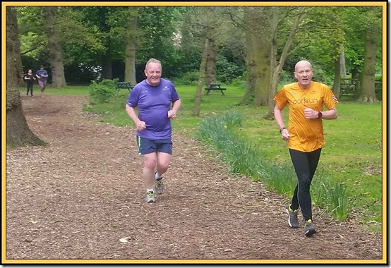
Today was Ron’s 100th parkrun and his 92nd at Wythenshawe. To celebrate the occasion his old mate (they met at parkrun) Ralph returned from exile in Yorkshire to enjoy the chippings of Wythenshawe Park that have recently replaced the infamous ‘muddy passage’.

The above picture was taken near the finish, so I was puzzled not to find Ron’s name next to Ralph’s (the latter came home in position 309 out of a record 381), but I’ve now discovered that Ron finished earlier, in his 3rd consecutive Personal Best time, and must have jogged back out to meet his mate.

Ron went for years running in times of well over 30 minutes for the 5 km, but now he’s under 27 minutes and heading south. Well done Ron, again.

The conditions were good. Sue was close to her PB, and I managed my best time since October 2015. And shortly afterwards my current bout of root canal treatment was concluded. Hooray, but the tooth now needs a crown…

Today’s results are here – there are lots of great performances.

Thursday, 27 April 2017

The TGO Challenge 2017

2301TGOC

Last year I completed my tenth TGO Challenge. There’s a tradition that after one’s tenth you either help with the organising in some way or take a break for a year. My ‘organising’ services weren’t needed, so I submitted an application for this year’s Challenge on the basis that I’d be ‘last standby reserve’. I was in standby position number 80.

By the time of the Snake Inn reunion in March, the dropout level meant that I was ‘in’, so a route was quickly devised and vetted without amendment by Bernie Marshall. Thanks Bernie. At 290 km (180 miles) with 9,500 metres ascent it’s my easiest route to date and is shown on the map above, which may appear as a slightly larger image if you click on it. The arrows are at 10 km intervals, the red or black triangles are summits, and the camping or house icons mark where I intend to stay.

Here’s a summary:

Day 0: Thursday 11 May - Train to Oban (Regent Hotel)

Day 1: Friday 12 May (21 km, 830 metres ascent) – Ferry to Lismore > Port Appin > Airds Hill (Ma) > Appin > Strath of Appin > camp to the west of Beinn Churalain around NM 986 464

Day 2: Saturday 13 May (28 km, 1520 metres ascent) - Wild camp > Beinn Churalain (Ma) > NE ridge dropping to join minor road N of Fasnacloich > NE to Elleric > Glenure > Glen Ure > Airigh nan Lochan > S to Beinn Trilleachan (C)(Ma) > N and E to Gualachulain > Druimachoish > bridge at NN 140 468 > S towards the Robbers Waterfall (wild camp around NN 138 449)

Day 3: Sunday 14 May (21 km, 1360 metres ascent) - Wild camp > Allt Mheuran to col at NN 163 433 > Glas Bheinn Mhor (M)(Ma) > return to col > Stob Coir an Albannaich (M)(Ma) > return to col > SE below Sron na h-Iolaire to join track at NN 197 409 > past Loch Dochard > Abhainn Shira > Clashgour Hut > N beside Allt Toaig to convenient wild camping spot around NN 254 429

Day 4: Monday 15 May (19 km, 430 metres ascent) - Wild camp > Abhainn Shira > Victoria Bridge > Mam Carraigh > Bridge of Orchy > West Highland Way > Tyndrum (Pine Trees Caravan Park)

Day 5: Tuesday 16 May (13 km, 920 metres ascent) - Tyndrum > West Highland Way > Kirkton Farm > NE > South top (MT) > Ben Challum (M)(Ma) > E to Stob a' Bhiora > N to wild camp by Allt Challuim around NN 399 332

Day 6: Wednesday 17 May (23 km, 420 metres ascent) - Wild camp > tracks roughly NE to join minor road near Kenknock > minor roads > Botaurnie > Tullich > fork L at Lochay Power Station > Killin (Killin Hotel, meet Sue)

Day 7: Thursday 18 May (22 km, 1750 metres ascent) - Killin > A827 > turn N towards Meall Liath > join track at top of pipeline > NE to minor road at NN 605 383 > S to parking spot for ascent of Lawers massif > Ben Lawers traverse - Beinn Ghlas (M), Ben Lawers (M)(Ma), Creag an Fhithich (MT), An Stuc (M), Meall Garbh (M)(Ma), Meall Greigh (M)(Ma) > N to wild camp around NN 677 447 (or stop earlier)

Day 8: Friday 19 May (14 km, 330 metres ascent) - Descend E > Boreland > Fearnan > forest track above A827 > descend to Kenmore, try to get meal in hotel and wild camp nearby

Day 9: Saturday 20 May (20 km, 600 metres ascent) - Kenmore > minor road E > Tombuie Cottage > Rob Roy Way > Garrow (River Quaich) > track to Wester Shian > Auchnacloich > L to Turrerich > NE shore of Loch Freuchie > Wester Kinloch > Amulree (camp here or nearby – NN 900 366)

Day 10: Sunday 21 May (24 km, 580 metres ascent) - A822 > track to Girron > Meall nan Caorach (Ma)(G) > NE to join track at NN 939 346 > around Findowie Hill to Auchmore > SE to Little Glenshee > track to Loch Tullybelton > Glack > Balquharn > minor roads to Bankfoot Inn

Day 11: Monday 22 May (22 km, 510 Metres ascent) - Bankfoot > Ardonachie > New Ardonachie > Airntully > Honeyhole > Ballathie House > cross River Tay (see query) > Cargill > Meikle Whitefield > Redstone > Saucher > Collace > Dunsinane Hill (O) > Black Hill (O) > wild camp near Broch by Little Dunsinane around NO 223 324

Day 12: Tuesday 23 May (22 km, 380 metres ascent) - Wild camp > King's Seat (Ma) > NE to join track > SE then N to Glenbran > E and N to Dundriven > Littleton > SE to Redmyre > Dron > Flocklones > Benvie > Denhead of Gray > Camperdown Country Park > Dundee Hotel Travelodge

Day 13: Wednesday 24 May (16 km, 150 metres ascent) - Camperdown Country Park > fort and memorial at Dundee Law > join coastal cycleway at Tay Road Bridge > Broughty Castle > Monifieth (campsite at NO 497 321)

Day 14: Thursday 25 May (22 km, 150 metres ascent) - Monifieth > coastal cycleway > Carnoustie > East Haven > Arbroath > Dickmont's Den

Back to Arbroath for bus to Montrose (Links Hotel)

Friday 26 May – return to Manchester for Manchester Half Marathon on 28 May.

I’m planning on taking my Phoenix Phreerunner tent that dates from the 1980’s, if I feel it won’t weigh me down excessively. Here it is on Beinn na Caillich, enjoying some morning sunshine at 6 am on 18 May 2010.

tgo2010g

I may not be rising so early on this year’s easier route…

To fellow Challengers – see you in Glasgow, Oban or Montrose, and maybe a few of you along the paths between Oban and Montrose, but I may be a bit to your south!

Wednesday, 26 April 2017

Tuesday 25 April 2017 – A Walk to Stockport

2502simons2

JJ was yet again to blame for this morning’s outing. He had booked tickets to Mallaig to start his TGO Challenge in a couple of weeks time and needed to visit Stockport station to collect them. There are many ways of reaching Stockport from Timperley, on foot being the most scenic.

It was a lovely morning, so Sue and I jumped at the chance of a stroll through Wythenshawe Park then the Mersey Valley to Stockport.

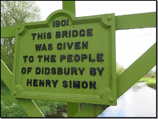
One of the river crossings, in Didsbury, is by Simon’s Bridge, recently repainted. The plaque records its origin in 1901, after Simon’s death.

2503simons3

Henry Simon (1835–1899) was a German born engineer who revolutionised Great Britain's flour milling industry and in 1878 founded the engineering companies Henry Simon Ltd and Simon Carves. His second son, Ernest Simon went on to become the first baron of Wythenshawe in 1947. There’s more about this remarkable man here.

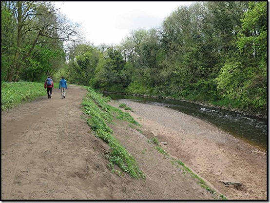
This stretch of river has lots of bends. Kingfishers can often be seen, but we didn’t spot any today. Greenfinches, jays and magpies mingled with the swallows, all busily following their own agendas.

2504mersey1

A little further on we crossed a stretch of road that forms the most northerly stretch of the old Manchester to Oxford route. In 1753 the Manchester and Wilmslow Turnpike Trust was created by Act of Parliament, with powers to build, maintain, and improve this stretch of the route, funded by the collection of tolls.

In 1755 the Trust built the first stone bridge over the River Mersey at this point. The river flows 70 miles (113 km) from Stockport to Liverpool Bay.

This part of the River Mersey is prone to flooding and the original bridge collapsed in 1756 and was rebuilt in 1758. The bridge was replaced in 1780 and again in 1861 with this current bridge.

2506mersey3

The River Mersey here historically formed the boundary between the counties of Lancashire and Cheshire and there is a boundary marker in the middle of the bridge.

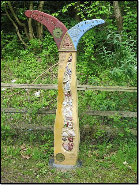
The Trans Pennine Trail follows the Mersey Valley at this point. It’s a 215 mile cycle route between Southport and Hornsea, completed in 2004. There are some ornate ‘mileposts’ like the one below, many of which feature on these pages in previous postings.

2507tpt12508tpt2

Stockport is eventually reached. The offices perched on the side of the buildings across the river at this point always amuse me. I imagine foremen or managers with a high regard for their status occupying these exclusive sites above the river!

2509stpt1

It’s a land of bridges and viaducts and even, nearby in Marple, aqueducts.

2512stpt4

We were soon ensconced in Rosies Tea Room with coffees (tea for Sue) and toasted tea cakes after our ten mile walk. A busy place.

2599route

Sue and JJ went in search of train tickets whilst I picked up some Essential Supplies from Alpenstock, where Jose and Hugh informed me that they would shortly be closing as the lease expires and Jose wants to retire. Our favourite outdoor shop has been there for about 40 years. It’ll be the end of an era. There may be some bargains to be had as Jose tries to get the best prices she can for her remaining stock.

The train to Navigation Road saw us nearly all the way home, via a short stretch beside the canal, where this family was braving the cool breeze.

2514ducks2

It was sunny enough to enjoy a cuppa in the garden.

2301tea

Happy Days…

Saturday, 22 April 2017

Saturday 22 April 2017 – Wythenshawe parkrun number 285

2203parkrun3

An auspicious occasion, as in the background above, you can just spot our good friend JJ trying to hide behind an under 11 runner in his first ever parkrun. Well done, JJ, on getting registered and taking part.

JJ’s time was pretty sensible, as he took things easy and, as advised, left himself plenty of scope for a PB next time out.

Meanwhile, a couple of stalwarts were spotted zooming to speedy finishes, and the indefatigable Ron Carter managed his second consecutive PB on his 91st run at Wythenshawe. Well done Ron.

2201parkrun12202parkrun2

As you can see, it was a lovely morning for a run, as shown by the second highest turnout at Wythenshawe (341) to date, after which coffee was taken in the sunny courtyard outside the tea rooms.

2204parkrun4

The results are here.

Thursday, 20 April 2017

Wednesday 19 April 2017 – ‘Tally-Ho…’

1902bluebells2

JJ is a member of an exclusive running club, details of which are provided at the foot of this entry. A key feature of this running club is the requirement to jump into a tin bath full of tepid water at the end of the run. First home gets clean, warm water.

I’m not a member, but I was invited (with a couple of hours notice) to join JJ on a recce of the course he has devised for a forthcoming run. Participants simply follow a list of written instructions, and any sawdust arrows JJ deems fit to put in place, in order to navigate the course, which in this instance will be nearly twenty miles.

I got the tram to Altrincham and strolled down to Bankhall Lane in Hale to meet JJ. This is about two miles into his route, but he was confident about the first section being accurately described. For most of the day I was testing JJ’s four pages of directions, and a few alterations were made in an effort to make them easy to follow for mapless runners whizzing through the countryside. If they lose their place in the instructions they could be well and truly lost. I imagine that is not such a rare occurrence!

The Bollin Valley provides a delightful green corridor between Altrincham and the airport. Bluebells adorn the ancient woodland, and a good path manoeuvres through a mixture of woodland and meadow and golf course.

1903bollin1

As well as the bluebells, the garlic scented Ramsons are just coming into flower, creating a white carpet in the shade of the trees.

1905ramsons

The River Bollin is very slow and sedate just now, following a spell of dry weather in these parts.

1906bollin2

For a while the path leaves the river and proceeds along Castle Mill Lane, passing a rather dirty trig point near the junction with Mill Lane. JJ yearns to paint this relic of surveying, which marks the highest point in the area – 60 metres.

(How about pink, JJ?)

1907trig

Soon we found our way back down to the river and the magnificent tunnel under Runway 2. An impressive piece of engineering.
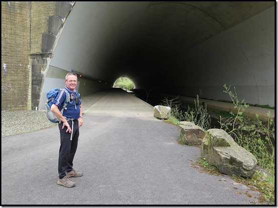
1908tunnel

Aircraft spotters will enjoy the next section of the walk (run, on the day) alongside the runway, before winding their way through field paths on the outskirts of Mobberley. With vegetation growing fast, some of these paths will be slow and indistinct for the runners.

1909meadow2

JJ has already recce’d the route a couple of times, during which the new bridge shown below has replaced a very rickety section of footpath. He has noted lots of minor changes, often involving fencing, over a short period of time, so a further recce will be needed a few days before the event takes place. There are bound to be a few more minor changes.
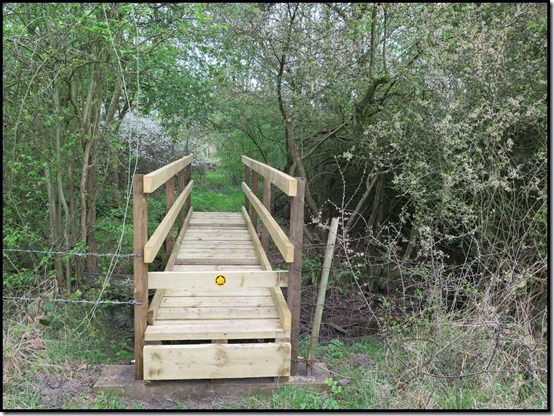
1910bridge

Here’s the view looking back from that bridge, which doubled as a tripod.

1911group

After reaching Knutsford via lunch on a tree trunk next to the North Cheshire Way footpath, we enjoyed a long and easy section, heading through Tatton Park to the east of Tatton Mere. Just beyond the Old Hall, the route heads across parkland towards a WW2 memorial. Here, the fallow deer and the red deer reside in separate herds, lazily enjoying the spring weather before the responsibilities of motherhood come to many of them.

1912deer

Here’s the Parachute Regiment memorial that slowly comes into view. A tea break just here was most welcome.

1913memorial

A small and distant red sign is the next target for the runners. I wonder how many of them will spot that from afar? Anyway it will lead them towards the main car park, past the mansion that dates from 1716, though what you can see below is more recent. There’s currently a WW1 memorial flame that will sit outside the hall until 2018. The hall was owned by the Egerton family until 1958, when it was donated to the National Trust.

1914tatton

Unlike most NT properties, the car park is not owned, so even for NT members it can be an expensive place to visit, especially as members also have to pay to go round the Home Farm, which we passed after narrowly evading the car park.

Soon we were heading along good paths through brightly coloured fields, due north to the small village of Rostherne.

1915rape

Whilst Rostherne has no public house, which fact probably helps to preserve its status as a small village in a rural backwater, it does have a water pump, which despite JJ’s renowned plumbing skills, could not be coaxed into action. Where were you, Norman?

1916water

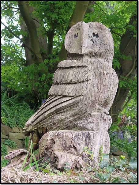
There was an easy short-cut to our intended path, but JJ will send his runners ‘around the houses of Rostherne’. A pretty thatched cottage is passed, outside which this owl lurks.
1917owl

Next up, St Mary’s Church, the grounds of which we enter through a lych gate dating from 1640, claimed by some to be the finest in Cheshire. The yard is full of slabs of grave stones.

1919church2

Nearby Rostherne Mere is a Nature Reserve, access to which is discouraged.

This is about as close as you can get as an ordinary member of the public. It’s a haven for a wide variety of ducks and other birds, and many other species, including the somewhat unlikely sightings of a mermaid. And there’s no public house in Rostherne!?

1920mere1

When JJ last came this way, the path to Marsh Lane had been completely destroyed by a plough. Thankfully the farmer has now reinstated the path, which passes pleasantly through fields before a kilometre section of unavoidable tarmac that might get JJ sacked as a trail designer.

1922field1

Some sowing has already taken place. We passed this near Rycroft Farm, after crossing the M60 motorway. Before and after the farm there was lots of fencing work in progress. Hopefully the integrity of all the footpaths will be preserved.

1924field3

We headed in a loop by way of recce, not quite reaching the final destination – The Swan with Two Nicks in Little Bollington - before returning to JJ’s car and my gentle stroll back to Altrincham.

Our 30+ km route, with minimal ascent, is shown below, JJ having started from the place where the circle is squared, if you know what I mean.

Thanks, JJ, for getting me out for such an enjoyable day.

1999route

Historical Notes:

1. Here’s some of what Wikipedia says about ‘Tally-Ho’:

The phrase tally-ho is a largely British phrase, which originated from the activity of foxhunting, and other forms of hunting with hounds, shouted when a rider or follower sees the fox. Today the term has evolved to have other meanings, most of which relate to 'pointing out' or 'spotting' a 'target'. For example, it is sometimes used as slang in air traffic control to verify a radar contact has been visually confirmed.

Tally-ho dates from around 1772, and is probably derived from the French taïaut, a cry used to excite hounds when hunting deer. According to other sources, the phrase may have originated from the second half of the 13th century, from the concatenation of a two word war cry: taille haut; "taille" being the cutting edge of the sword and "haut" translating to high (or 'raised up'), thus the original meaning of this interjection is something close to "Swords up!".

"Tally-ho" had its first recorded use in the Americas in an 1773 hunting journal. From there, its use spread as more British colonists arrived. However, the phrase fell out of favour following the conclusion of the American Revolutionary War (1775–1783).

2. Here’s what the Cheshire club of which JJ is a member has to say:

The Cheshire Tally-Ho Hare and Hounds Club is a traditional running club, founded in 1872. The club holds runs (called trails) from a number of venues around Cheshire and Derbyshire.

​A trail consists of the Hounds following a marked trail laid by the Hares in a circular route of about 8 miles. Trails usually start and end at a pub. After the run, members get together and enjoy a meal and a drink in the pub.

​​The club is essentially non-competitive, and the club’s runs are designed so that groups of runners (packs of hounds) of similar ability set off together at times representing the likely speed of the pack. The trails are cross country, and any time spent on roads, while necessary at times, is looked on as disappointing, and the trail layer is likely to hear some appropriate comments at the finish. The trail layers, the Hares, vary from venue to venue, so that the club members can each participate.

​The packs start at various times, the earliest before 14:00. The slow pack leaves at about 14:00, the medium pack 15 minutes later, and the fast pack at 14:30. The run ends around 16:00 or so.

The ablutions vary from the sublime, a leisure centre at Frodsham with showers and sauna, to the ridiculous (normal), namely bathing in a tin bath.

​Membership is by election only, and requires two sponsors from the members. If interested in running through cow fields (and other cow things) in all weathers and conditions just for the fun of it please contact the Hon.Sec .