Sue and Martin in Mallorca 2019

Sue and Martin in Mallorca 2019
On the Archduke's Path in Mallorca

Saturday 6 October 2012

Pen y Fan - Marilyn Number 260

Pen y Fan, which tops out at an impressive 886 metres, is the highest place in South Wales. It was highly populated today, with all manner of folk, from small children to ancient grannies and muscular army cadets on a training exercise. Cosmopolitan and friendly; it was great to see so many people enjoying themselves on such a glorious day.

We had made our way slowly along the ridge from Waun Rydd, pausing to watch a paraglider soaring past - he finally landed in Cwm Oergwm, from where he proceeded to walk back up the hill.

Frequent chats with other walkers also punctuated our progress.

The crowds thinned once we got onto the flatter but less popular Craig Gwaun Taf ridge, for a final high level stroll before the sharp descent to the lower of the Neuadd reservoirs, which were full today.

A pleasant stroll on good tracks then led back to the car park at SO 027 178, from which point The Red Cow Inn's Wye Valley bitter was mercifully nearby.

Sent using BlackBerry® from Orange

Waun Rydd - Marilyn Number 452

The short drive to the free car park at SO 027 178, past hordes of mountain bikers on a challenge event, set us up for the steep climb past roaring waterfalls to the pleasant paths over Craig y Fan Ddu and Graig Fan Las.

There were lots of people about on this sunny summery day - perfect weather for walking.

On reaching the northern escarpment we headed north east to a small pile of stones that marks the summit of Waun Rydd, with fine views over the Brecon Beacons and in all other directions on this perfectly clear day once the early morning mist had dissipated. Those camping overnight up here must have enjoyed some fine inversions.

We trudged to and fro to a grassy area that looked higher but wasn't. You could easily return to the car park from here, probably taking less than two hours for the return trip. We chose to make a day of it by carrying on along the ridge.

Sent using BlackBerry® from Orange

Bryn Bach Parkrun (not a Marilyn)

Parkruns are a great way of starting an otherwise lazy weekend.

They are not addictive....

Today's 5km Parkrun venue for M1 was planned with M2's Marilyn bagging addiction in mind, as it was en route to several such hills. However, M2's interest in the Parkrun concept lies several octaves below zero, and being unable to handle the idea of a half hour break in the journey whilst M1 parkran, he elected to forgo a walk in favour of a Saturday morning lie in!

He was only just about out of bed when M1 returned at 9.45!

Sent using BlackBerry® from Orange

Friday 5 October 2012

Rhiw Gwraidd - Marilyn Number 1122

There may be shorter ways up this hill, but after returning from Gwastedyn Hill we left the car in Nant-glas and strolled on to SO 006 654, where there's a perfectly good lay-by for those with a lazier disposition.

At SO 010 645 a signed path leads through the woods. But it doesn't. It takes the unwary Marilyn bagger on a unique jungle experience, almost within sight of a nearby forestry track. We eventually decided that the only way of reaching the security of this track was to retrace our steps to where we'd left it in the first place!

A bit further on we came to a hairpin bend from where we could access a field through undergrowth and over a barbed fence. We should have noted more carefully where we entered the field, as this seemingly minor lapse afforded us another jungle experience, featuring a new species - the Himalayan Bramble - on our return journey.

In the meantime we slogged up a steep field, past glissading sheep, to reach, over more rippingly vicious wire, the stunningly unspectacular summit that nevertheless enjoyed good views of the surrounding countryside.

As always in these circumstances, M2 trudged around the plateau collecting evidence as proof of his conquering of the true summit of this minor hill, before turning tail and glissading like a sheep to his next jungle experience.

Marilyn Bagging - it's not addictive. No!

Sent using BlackBerry® from Orange

Gwastedyn Hill - Marilyn Number 1036

This hill towers above the pleasant town of Rhayader. We accessed it from Nant-glas, where the road through the village has plenty of room for parking.

It's a steep ascent, at this time of year through a towering jungle of spent Willowherb, Foxgloves and Bracken, with red kites poised to make off with unwary mammalian visitors.

To the north west of the main summit, overlooking Rhayader, is a large cairn commemorating the queen's jubilee, inscribed in English in 1977 and in Welsh for more recent landmarks. A large fire pot stands nearby, used as a beacon.

Returning down a narrow lane to Nant-glas, we met a car - containing the owners of a smart house above which our path had passed. "We need more walkers around here", they commented whilst chatting to us. They were English.

Sent using BlackBerry® from Orange

Garreg-hir - Marilyn Number 1025

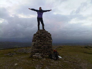
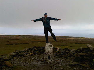
A narrow lane off the A470 leads to a Nature Reserve (Warchodfa Natur) by Llyn Mawr. A track between Llyn Mawr and Llyn Du took us gently to this pleasant summit.

We tried to make it into a circular walk, but the footpath to the north west of Llyn Mawr had been blocked with barbed wire, so it wasn't worth the hassle.

A pleasant excursion though, despite the nearby wind farm. (At least all the blades were turning - a rare sight indeed!)

En route, we'd enjoyed coffee and cake in the café at Llanbrynmair. Highly recommended, with toys supplied by www.timberkits.com, and a unique rabbit village.

Thanks, as ever, for your comments. They are much appreciated even though some may not be read until I get home as I allowed the minuscule Blackberry mailbox to briefly overflow.

Alan, I'm glad we found a hill you'd been up, even if it was foreign. Today's are true collectors items - you won't have been there!

Nick - M2 says you must have a good memory, and that 'faded' look pulls so many Louises that he's confused as to which is which (or should that be 'witch is who'?).

JJ - your knees are in no worse state than is average for your advanced yearage! We all have bad knees! And are you sure it wasn't a case of beer that you won, you surely wouldn't have run that far up a huge mountain for just a few bottles of wine?

Sent using BlackBerry® from Orange

Holyhead Mountain - Marilyn Number 1487

At 2220 metres this would be quite a Mountain!

The nice man in the tea shop at Holyhead Country Park pointed us in an anticlockwise direction for what turned out to be a short stroll.
We headed along a good path above the north coast, past a strange artefact and on towards North Stack. From this north western point the mesmerising flashing light from South Stack's lighthouse held our attention for a while.

A left turn here took us neatly up to the fine viewpoint despite its modest stature. From the Isle of Man to much of Snowdonia. A choice of paths guaranteed an easy descent brought us quickly back to the Park.

Sent using BlackBerry® from Orange

Thursday 4 October 2012

Mynydd Bodafon (formerly Yr Arwydd) - Marilyn Number 1525

A short way up the road from St Michael's Church in Brynrefail (worth a visit), a track to the right and a path to the left lead quickly to this modest 178 metre summit.

Modest it may be, but this is the highest point on the main island of Anglesey.

We left a lone radio enthusiast to caress his aerial, and headed back on a circular route under the watchful eyes of circling buzzards, past Red Campion, Herb Robert and fading Brambles.

Sent using BlackBerry® from Orange

Moel Eilio - Marilyn Number 536

An easy 4km ridge leads from Moel Cynghorion to Moel Eilio. Today we met various folk who had come over Moel Eilio from Llanberis. First, two fell runners, 'training' for the coming winter's ski mountaineering - they were having a bit of a problem running uphill but put on a good show for us. Then a couple of lone but chatty walkers, and on the summit, a group of backpackers with a summitmountainguides.co.uk guide. They were enjoying their training and were happy to take the above photo for us in the spacious summit windbreak.

We enjoyed fine views down to Caernarfon and Anglesey from this lofty perch on the far western ramparts of the Snowdon massif. Snowdon was still in cloud, and we were the first visitors of the day to Moel Eilio to enjoy a clear view as the cloud lifted from the summit just before we arrived.

We retraced our steps for a while, past a disappointed Raven, keeping to a contouring path around the base of Foel Goch, before reaching three chatty mountain bikers at the 467 metre col that links Snowdon Ranger with Llanberis.

Everyone we met today was chatty. Perhaps the bright sun, clear air, and lack of wind made it that sort of day. That's great, even if it does result in a mountain guide nagging for a chance to guide us up Monte Viso!

The circuit, including the ascent of Moel Cynghorion, made for an excellent half day excursion from Snowdon Ranger, where cash is needed for the Pay and Display car park.

Sent using BlackBerry® from Orange

Moel Cynghorion - Marilyn Number 644

The gentle ascent up the Snowdon Ranger path to the col above Llyn Ffynnon y-gwas was a pleasure on this sunny morning. Except perhaps for the blinding sunshine that was dispersing the remnants of low mist.

It was nearly a good day for Brocken spectres, but sadly none came our way.

With Snowdon cloaked in cloud it seemed more than reasonable to head steeply north west, up to the amorphous summit of Moel Cynghorion.

M2 tramped around the grassy plateau for some time to satisfy his conscience about knowing that he had gone to the true summit.

Sent using BlackBerry® from Orange

Wednesday 3 October 2012

Foel Fenlli - Marilyn Number 969

About half a kilometre to the south east of the Pay & Display car park at Bwlch Penbarras lies the hill fort of Foel Fenlli, site of a 2000 year old village. M2 romped up the direct route and was long gone by the time I arrived, some 15 minutes after we'd both set off. Hence the 'arms length' photo, in which the pile of stones that marks the summit can just be seen by my left shoulder.

Another sunny summit in the company of runners, walkers and curious bright white sheep!

Not the hardest of walks.

Sent using BlackBerry® from Orange

Moel Famau - Marilyn Number 866

From Bwlch Penbarras it was an easy stroll along a wide track, past faded Gorse and Bell Heather, in the company of dog walkers, as well as hikers and runners, to Queen Victoria's Jubilee Tower that spreadeagles itself across Offa's Dyke on the summit of Moel Famau.

There were views far and wide, though dark grey clouds limited what might have been visible in Snowdonia, some 35 miles away.

Sent using BlackBerry® from Orange

Raw Head - Marilyn Number 1480

There's plenty of space to park outside Harthill's pretty village church. From there a lovely walled lane to the right of a cookery school leads up to a wood. Shafts of today's bright sunshine lanced the woodland as the path contoured past butterflies and pheasants before climbing to the Sandstone Trail.

Raw Head's trig point was soon reached, with fine views west from the top of the escarpment. This is the high point, albeit at a mere 227 metres, of the 35 mile trail between Frodsham and Whitchurch.

There's a large cave just below the summit that may be worthy of exploration. We enjoyed our lunch by the trig point, before completing a short figure of eight, arriving back in Harthill in time with its mobile library.

Those with a bit more time may enjoy more of the Sandstone Trail by taking in Bickerton Hill and Maiden Castle, before returning to Harthill via Brown Knoll and Fullers Moor.

Sent using BlackBerry® from Orange

Winter Hill - Marilyn Number 1088

Winter Hill may be the closest Marilyn to Timperley. We don't often go up it as there are much better walks to be enjoyed in this part of the world. It's a bit boggy and boring, and covered in an assortment of masts, including a very tall one.

Today we arrived at Hordern Steeps just as the last of a series of heavy showers was abating. A short walk up the sometimes spongy path soon brought us to a tour of the summit plateau, culminating in a visit to the trig point, which appeared to mark the summit.

The patchwork of Lancashire fields, villages and industries below us actually looked quite photogenic in today's low sun. Not that my own photos will demonstrate that point.

Sent using BlackBerry® from Orange

Tuesday 2 October 2012

Yarlside - Marilyn Number 705

A good path leads from The Calf into Bowerdale, where we lunched beside the beck before tackling Yarlside's steep slopes. These soon led to a pleasant ridge, on which the summit cairn arrives surprisingly quickly.

Ingleborough was visible from here today, and sunny intervals lit much of the farmland below us. The brief squalls had subsided by now (we did enjoy better weather than you, Alan, I think you must be attached to some sort of rain magnet!) and we enjoyed a leisurely descent down Ben End to the Cross Keys, with fine views back to Cautley Spout, and to a variety of summits in the Yorkshire Dales.

Sent using BlackBerry® from Orange

The Calf - Marilyn Number 640

M2 had never visited the Howgill Fells. Until today.

Fortified by coffee and tea cakes from the excellent Cross Keys Temperance Inn, we headed up the Cautley Spout Staircase to Great Dummacks and Calders, where we joined the motorway from Sedbergh. That led quickly to The Calf, where we briefly shook hands with The Sky, which presented us with its own moist offering, as can be seen.

Sent using BlackBerry® from Orange

Hutton Roof Crags - Marilyn Number 1420

Previously my routes up this hill have been from Burton-in-Kendal, usually on summer evenings.

On today's sunny morning we chose to go up from the top of the lane that divides Farleton and Hutton Roof Fells. Our legs were soon soaking from the overnight rain that was clinging to the deep vegetation that lined our path leading to the eastern boundary of Hutton Roof Crags.

The summit clearly lay elsewhere, so we retraced our steps to a helpful stone arrow, and soon found a way along slippery pavements to the summit.

A lovely spot. We saw one other person - a dog runner.

Returning by a circuitous route, we were pleased by the inability of the bbc and mwis to provide an accurate weather forecast.

Alan, Conrad - thanks for your comments. I didn't know about that café near Beck Head, Conrad - we'll have to investigate. And we've seen many a runner on Whitbarrow, and wished that we lived a bit closer to that gem of a hill.

Sent using BlackBerry® from Orange

Whitbarrow - Marilyn Number 1493

The size of Whitbarrow's summit cairn belies the small stature of this 215 metre hillock. However, it's a favourite walk of mine - a 9km circuit from Raven's Lodge.

Rawsons Farm had been newly painted, the woodland path wasn't too muddy, and more Harebells mingled with sundry thistles guided us over a broad limestone pavement to M2's fourth 'new' Marilyn of the day.

Soon afterwards an icy squall lashed down as we proceeded along the pleasant pavement, making the last half kilometre down a sloping quarry floor somewhat slippery.

By then it was nearly dark, so we took a two minute drive to the fleshpots of a nearby hostelry.

All in all, an excellent day out!

Sent using BlackBerry® from Orange

Black Combe - Marilyn Number 772

A grassy stroll over Harebell strewn Stoneside Hill and Stoupdale Head led above a rocky escarpment to Black Combe's broad summit. Here we saw our first and last walker of the day through a veil of mist that briefly superseded the sunshine and sleet.

Sent using BlackBerry® from Orange

Monday 1 October 2012

Lambrigg Fell - Marilyn Number 1310

A path leads up this hill from the west of Wythmoor. It's not difficult. A strange looking obelisk sparked our curiosity, but it turned out to be the stationary blade of a wind turbine. Most of the turbines were stationary today, despite the brisk breeze.

Martin (M2) wandered around for some time trying to identify the highest point, on which he sat down and demanded chocolate in compensation for his efforts.

The snaking black line of the M6 glistened in the sunshine.

Sent using BlackBerry® from Orange

Grayrigg Forest - Marilyn Number 998

Our approach from Fellgarth got the trip off to a good start in fine weather. I was last here in June 2009 on a Dales Way walk, albeit a little off course. There were good views as we rose through meadows of Tormentil, but the higher summits to the east were deep in cloud.

More female company to come, Gibson.

Sent using BlackBerry® from Orange

Sunday 30 September 2012

The Relative Hills of Britain

A good base for Marilyn Bagging

I was (relatively) unaware of ‘The Relative Hills of Britain’ until 8 July 2000, when I attended a friend’s celebration of the ascent of his 800th such Hill.  During the course of this event a stranger called Alan Dawson thrust a Cicerone Guide into my hands in return for a modest sum.  His book lists, in various ways, all the ‘Relative Hills’ of Britain.  They are assiduously numbered, from 1 – Ben Nevis, to 1542 – Muldoanich (an obscure island off Barra). 

The book, published in 1992, lists all British hills with a height of 500 feet relative to the height of the surrounding area.  Alan christened them Marilyns. 

A rather eccentric namesake of mine has slowly been ticking off his ascents of these summits, mainly in Scotland as he lives in Aberdeen.  His tally currently exceeds 1000.  I go up hills quite a lot, but I’ve only climbed 400 or so Marilyns, so this guy could be considered a bit of a fanatic.  He contacted me recently to tell me he’d booked a few Travelodge rooms, with a view to climbing a few English and Welsh Marilyns.  Would I like to come along?

We meet later at Kendal Travelodge.  What exactly happens after that is anybody’s guess, but it is probable that we’ll climb a few Marilyns.

It should be fun – this blog may feature one or two summit shots.  Feel free to skim over them if you get bored!

The picture, BTW, is from one of our bases during the course of the week, from where there is a vast array of nearby ‘Relative Hills’.