Sue and Martin in Mallorca 2019

Sue and Martin in Mallorca 2019
On the Archduke's Path in Mallorca

Saturday 11 June 2022

Saturday 11 June 2022 - Babbs Mill parkrun #78


On a lovely sunny morning Sue and I enjoyed this scenic parkrun just to the east of Birmingham, en route to a family gathering in Solihull.

It was just the 78th running of this event, with 132 folk taking part. And despite starting slowly, we both finished fairly near the front in respectable times.


Friday 10 June 2022

Friday = Isabella Day (10)


Would you believe it! Four weeks since we last had Isabella for the day, and it was only a short visit from her today as her mum wanted to spend part of a day off with her daughter...

A routine visit to Walton Park found Isabella eschewing some of the delights of the children's playground in favour of kicking a ball around the tennis courts.


Then a few minutes playing ball with a couple of friendly chaps who were also enjoying the freedom of the park.


Time for home. Unseen, in the pushchair, is the ball that has to be carefully returned to its home.


"This roundabout makes me dizzy!"

"Look, that's our house up there..."

Back at home, some new toys handed down from her cousins went down very well with Izzie. Thanks to Jacob and Jessica, and their mum, for providing these.


Then lunch, a sleep, and a trip home - another day with Isabella has passed in a flash.

Time then, to re-read the final two chapters of a book that I've been lucky to discover through Sue's book club. I can't think of a book with a more apposite final sentence.

Thursday 9 June 2022

November 2004 - The Annapurna Circuit - Day 6


Saturday 6 November
Tal to Kodo
Itinerary: DAY 6 Kodo (2,629m) Walk at the foot of the towering rocky peak to cross the Marsyangdi again to its west bank to Dharapani (1,943m). So far we have been heading north but from Dharapani we turn west. The vegetation changes into tall trees of fir and pine. We are now in the mid-alpine zone. A little further we reach the village of Bagarchhap (2,164m) where you may see firewood stacked on the roof of the houses, a preparation for the long winter. Up the valley from here we get an excellent view of Lamjung Himal, Annapurna II and Annapurna IV, and looking down the valley to the west, Manaslu and Peak 29 dominates the skyline. Then we ascend gradually along the south bank of the Marsyangdi to Kodo. (7 - 8 hours walk). 

[Diarist: Sue]
Usual routine before setting out from Tal.

The trail was level to start, on the left bank of the river, entering more narrow gorges after the relative openness of Tal. 
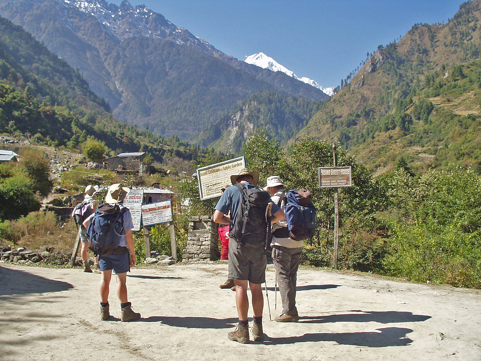
Fewer people on the trail, but still quite a number. The trees have thinned out now, and pine trees have started to appear. As the sun arrives from over the mountains, shorts etc go on. 

A break at a small restaurant allows suntan cream to be applied. This morning the sky is cloudless and deep blue. We cross three suspension bridges, all well constructed, over the roaring and foaming river. High waterfalls tumble either side of the trail, some cascading over rock.

Porters descend from the Manaslu Circuit

View to teashop

Above and below: Bridge before Karte

Where the valley splits, near Thonche, after Dharapani, Manaslu comes into sight at the end of a pine-lined valley. It stays in view whilst we drink lemon tea and snack on Radisson apples and yoghurt coated bananas at a rooftop restaurant, in hot sun.

Manaslu from near Thonche

The trail continues through pines and rhododendron, then we round a corner and get our first view of Annapurna II, 7900 metres. Shortly after, we reach the gateway to the village of Bagarchhap, with three chortens on top. In the village was a large white chorten. On top are 13 yellow rings which signify the 13 levels to Nirvana.

Annapurna II from Bagarchhap

In 1995, a landslide at night had taken much of the village into the river. Many locals and several trekkers were killed. It was 10 November, a similar time to our trek.


Another gateway similar to the first indicates we are leaving the village. More undulations and some more of today's overall height gain of 900 metres.

Chorten in Bagarchhap


Gateway leaving Bagarchhap

View to Annapurna II


Flour grinder

Water Mill

At the village of Danaqye is a stone hut, inside which is a huge prayer wheel, and around the walls, paintings. The prayer wheel is surprisingly heavy when I turn it, using wire handles on the bottom. A bell rings at the top. Adjacent to the hut is a wall of prayer wheels with colourful prayer flags along the top. The Buddhist influence is becoming greater. This morning has also seen mani walls, stones covered in prayers. 

Lunch is in a memorable setting. The sun blazes onto a courtyard where we sit around the table. The air is now cooler. Looking back, we see the snowy peaks of Manaslu and Peak 29, behind towering rocky ridges. Lunch is rolls, sardines, curried potato and coleslaw, with an apple to follow. The courtyard is surrounded by marigolds.

Buddhist prayer wheels at Danaqye


Soon after lunch, we go into the shade caused by the steep-sided and wooded hillside, crossing a bridge over a tributary. Soon afterwards, a superb torrent crashing down a wonderfully carved gorge, with a wooden bridge from which we looked down on the rushing water. 

The path undulated above the river, and in several places it narrowed where there had been landslips. Some of these narrowed sections plunged straight down to the river. Martin and Sanjeev watched a Himalayan rat (pica) going to and fro from its burrow beneath the path, eating leaves. 

Through binoculars, we watched 6-8 langur monkeys across the river. 

The last hour or so was spent in pinewoods where the autumn colours became more obvious. A furry animal hanging outside a wooden house was identified as a mongoose.

Manaslu and Peak 29 from above Danaqye


Goats by the river near Kodo

Camp at a tea house in the village of Kodo was reached at 5 pm. The location is stunning. Back down the valley, Manaslu shines in sun which down here is long gone. Ahead, there's a shapely snow covered mountain, whose tops send plumes of spindrift into the sun.

Manaslu, from camp at Kodo

The cold drives us into tents, still in shorts. The washing water is really hot and arrives at 5:30, just as it gets dark. Tea is in the dining tent at 6 pm. All of us are wearing more clothes than last night. Dinner at 7 pm starts with vegetable soup and prawn crackers, then a Nepalese meal of rice, dhal, potatoes and cauliflower, salad of cucumber and carrot, and buffalo and cashew curry. Mango to finish. We feel warmer after dinner, but it still feels colder than the 9C shown on the altimeter.

More Uno from 8:15 to 9:00. Mary won.

Next Day
Previous Day
Index

November 2004 - The Annapurna Circuit - Day 5


Jagat from the south

Friday 5 November
Sange to Tal (1707m)
Itinerary: DAY 5 Tal (1,707m) We start to climb gradually to Jagat (1,314m) which used to be an old custom post for the salt trade with Tibet. Our trail then follows a cut in the vertical cliff high above the river. The vegetation starts to change into rhododendron followed by pine. Enjoying the view of some beautiful waterfalls we arrive at Chamje (1,433m) where we cross the Marsyangdi again and follow the east bank. From here the valley begins to narrow and our trail begins to be steep. As we reach the top of the zig-zag trail, the valley widens again and on a beautiful meadow nestled among the fields of potatoes, wheat and barley appears the village of Tal. It is the starting point of Manang district and our camp for tonight. (5 - 6 hours walk).

[Diarist: Martin]
6 am prompt - tea boy calls. He seems surprised that our tent wanted two cups. We were out at 6:30 on a clear morning. Not too cool. Breakfast 7 am - cereal, porridge, toast, omelette. Quite adequate, but nothing like the luxurious breakfasts we got in India. [There's another diary project! - Ed] 

Ablutions: some used the blue toilet tent with the dodgy seat; I used the local 'shithouse'. 

8 am and we were herded off, across a superb suspension bridge then up the west side of the Marsyangdi river, roaring noisily below. The sun reached us surprisingly early at 8:15. Time to stop for t-shirt and shorts, allowing the others to continue ahead with Hosta. Rare moments of calm as we ascended slowly through jungly country in the deep sided valley.

Leaving camp


Then a shady section where I found myself alone. But soon we reached a tea shop - Marco Polo - at 9 am. 'Rested' there for about 30 minutes. Mark's solar panel camera battery charger was used for the first time. It seemed to work, and drew attention from a French party. 1300 metres, 21C. Too soon for tea, so we continue on to Jagat - 10 am. A pleasant village with boys playing shove halfpenny and women styling hair and sweeping the streets.

View from Marco Polo restaurant

We seem to be beyond the power lines today, so everything is gas or kerosene powered. Or solar powered, as is this restaurant - 10:45 to 12:15. 


Jagat

Then we continue on up towards Chamje to around 1345 metres. Lunch in the shade in a meadow just beyond a bridge. En route a huge waterfall with its spray embraced by a rainbow. Lots of photos.


Continue gently up to Chamje - a nice village. The school playground had a splendid four seater swing. Still lots of people today - those coming down have probably done the Manaslu circuit - a similar trip to ours. Some people rush past. Other faces become familiar, eg the small French group. 


Leaving Jagat

We left this nice spot at 1:45 and took just over 2 hours to reach our destination - Tal - 1707 metres. We were surrounded by other groups, mostly moving quicker than us. Lots and lots of people. Occasional tea houses. Marijuana plants at our lunch stop were just brown scrub.

View to Tal from the gateway to the Manang District

Mules at Chamje


View to Tal from 1730 metre col

And so, after passing a campsite with lots of groups camping on it, we arrived at a Tibetan tea house at Tal. Our tents were pitched tightly together in the garden between beds of marigolds and a garden border of upturned bottles (bottle bottoms). Chickens abound (maybe one less by dinner time) and a small black cat peers through a fence, purring.


We stop our altimeter logbooks and decide that Andrew's 1-minute interval as compared with my 10-minute interval gives him a more accurate measurement. (See 7/11) 836 mb and 20C when we arrived. 

Hot water soon arrives, then a call for tea, fortunately in the tea house where it is warmer, then a pleasant hour and a half with tea then beer before our meal.

View from Tal