Sue and Martin in Mallorca 2019

Sue and Martin in Mallorca 2019
On the Archduke's Path in Mallorca

Saturday 15 August 2020

16 July 1989 - Alta Via 2 - Day 2 - Passo Rodella to Camp near Rif Puez

Camp near Passo Rodella (note that I've had difficulty in placing the images correctly with regard to the text in this posting - Ed)
 
Sunday 16 July (Diarist: John)

7:00 reveille for a 8:35 start! Sunny. Down from campsite to road, then on to path up to Peitlerscharte (2361 metres) (aka Forcella della Putia). Stop for a brew.
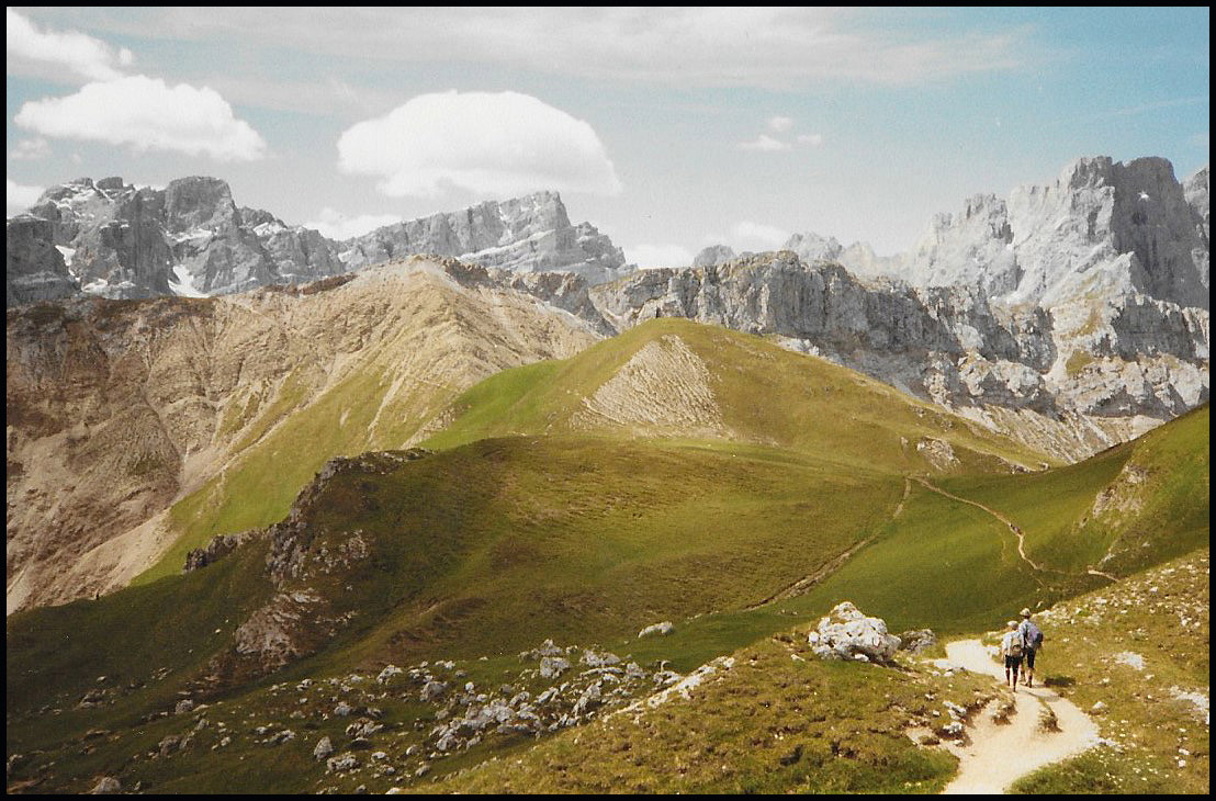


Follow the paint SW along route 3 to Kreuzkofeljoch, plus a detour to Rifugio Genova. Up along route 3 (one route finding error) along the top of Medalges Alpe for lunch on some steepish grass at about 12:30.


Set off at about 13:15. Hard work ahead. No surface water except for a small spring. Gain height gently to arrive at the bottom of Forcella della Roa.
 
Zigzags up scree. Some late, slushy, gritty snow. Reach the top of the Forcella at 14:30.
 
Hang around for 30 minutes for Laurie and Martin W. Then down on the other side of pass along route 3 to pick up AV2 in a rocky corrie.


Follow route through boulders and scree to more zigzags leading to the top of Forcella Forces de Sielles (2512 metres). We are at the top of the pass, but Laurie and Martin are still at the bottom.


Set off NE then E, first along a ridge with fixed ropes (and a 4-year old with his parents), then above scree, then over cliffs and down to the pastures of Puez Alp. Very green grass, damp soil, but no surface water. To make things worse, we can hear running water higher up. Continue, and come across a stream, which determines where we are to pitch our tents.

Descend from path to find a fairly level pitch near the edge of the alp. Also, a convenient stream. 17:00.

Laurie and Martin decide to forgo a visit to Rifugio Puez  and arrive at 18:00. Campsite is at over 2400 metres. Hope a) no high winds, b) no storms.


 Here's our route - 16 km, with 1300 metres of ascent. 
 

Friday 14 August 2020

TGO Challenge - Wild Camps (No 26: 16 May 2010)

 
The plan for this day was just a bit too ambitious, so after climbing a couple of Corbetts, Sgurr Ghiughsachain and Stob a'Bhealach an Sgriodain, I found myself at a decision point on Meall Mor.
 
Slippery scrambles over two more Corbetts in dodgy weather didn't appeal, so I took the long, undulating ridge walk to Druim Leathad, setting up camp at about 450 metres at NM988694 (Sron a'Chorra Bhuilg).
 
There were good views to Loch Linnhe and Inverscaddle Bay.
 
 
The following morning dawned bright and sunny. It was soon hot in the tent.
 

Thursday 13 August 2020

Easter 1972 - A Trip to Skye

 
Here's a trip with a few photos but no diary entry. I'll do my best to remember it, and Mike may provide some additional comments that I'll add later.
 
I'm pretty sure it was Easter 1972, and we probably travelled up to the Loch Lomond area on the Thursday or Friday. I'll assume Thursday. I would guess that the top picture was taken the following morning, 31 March, possibly at the Ardlui campsite by Loch Lomond.
 
My companion was my schoolmate Mike, who has appeared previously on these pages as 'Poor Michael', my hapless mate on the rather inclement TGO Challenge of 2011, and on an earlier 'training' walk in the Lake District
 
I think the next picture was probably taken looking back to the Ben More range, site of my first Munro 'bag' in 1968, from north of Crianlarich.
 
 
We were traveling in my first car, a 1964 Mini 850. I had it from 1971 to about 1976, and took the mileage from 30,000 to 100,000 before crashing it. At this point in 1972 the passenger floor leaked, so I'd waterproofed it using a unique blend of glass fibre and the old metal 'Marvel' tins. This worked a treat, but didn't stop the leak into the car. On this trip, Mike found the water level in his footwell steadily rising as we progressed north in the rain. Eventually he found a pan with which to bale out. Unfortunately the sliding window didn't open wide enough, and he managed to empty the pan all over himself. When I got home I drilled a hole in the floor of the car.
 
 
We headed north, through Glencoe.


We stopped at the War Memorial, and admired the view towards Ben Nevis.
 
 
By the time we reached Loch Cluanie, we were ready for a walk. So we headed up the Five Sisters ridge, aiming for Sgurr an Fhuarain.


We didn't reach the summit, but it was a good walk in the mountains. Here's a panorama constructed from the last two images - a fine view - click on the image...
 
  
Then we headed onto Skye, and the single track road (most were single track then) to Glenbrittle, pausing on the way at a viewpoint.
 
 
The next day (Saturday?), I think we must have toured around on a dreich day, during which we undertook a short coastal walk and I took just one picture.
 
 
Then on Sunday we enjoyed a walk in the Cuillins, heading up Coire Lagan. We set off from where we were camped, at Glenbrittle. I think there were others in the party, whom we met up with at Glenbrittle, but I can't recall who they might have been.
 
 
Mike is on the left in the next picture, next to an unidentified friend.
 
 
We gradually worked our way up into Coire Lagan.


There were rocky views all around, but when we turned around we were still some way off reaching the ridge, which in the next picture is dominated by the In Pin.
 
 
Here, we are looking back down into Coire Lagan.
 
 
The next two pictures were taken in the direction of Sgurr Alasdair, with the Great Stone Shoot looking formidable.


Whilst I've been up that since, on this occasion we were happy to reverse our steps and head back to camp, from where I presume (in the absence of evidence to the contrary) we headed back home the following day, Monday, in time for work on Tuesday.
 
 
I must have dropped Mike off somewhere. Perhaps his memory is better than mine - I'll add his comments, if any, in due course.

Wednesday 12 August 2020

15 July 1989 - Alta Via 2 - Day 1 - Bressanone to Wild Camp near Passo Rodella

 
Saturday 15 July (Diarist: Dave)

Woken by the resonating chimes of Martin W's alarm tower, against which the synchronised peep of my alarm seems puny.

Lots of repacking. John runs a bath for Laurie, but draws a line at scrubbing his back. Maps purchased at 5,000 lire. Good and varied serve yourself breakfast.

Final packing, then we set off at around 9 am. Laurie with his familiar grip not yet attached to his rucksack, but carried in his hand - makes it look very natural.


Cross river and lose Laurie. Martin W stays behind and the rest of us plod on.
 
 
We are aiming for the Seilbahn that will get us up the hillside. Dave gets a 1½ litre container of apple juice. MB looks for container to prevent his butter running over everything. John doesn't like the roads and traffic. Laurie looks for camera battery. The rest of us are given directions to the Seilbahn - we need to get to San Andrea. This involves 500+ metres of ascent - very hot and sweaty.
 
 
Fortunately the cable cars are running and we rapidly climb from 1040 to 2040 metres, where we have an extended stop for food.


It's much cooler up here. Then it's a 400 metre slog up to Plose-Hutte.


Plose-Hutte (below) is the official start of the walk. [The hut is now named Rifugio Citta di Bressanone.]
 
 
Our book was stamped thus:
 
 
At this point Laurie is struggling. Dave, Martin B and John go on ahead. Martin W and Laurie follow after a drink at the hut. Down route 6 to Sporthotel and along a road. gently rising. Many people. Gruss gott seems to be the favourite opening line, as in Austria.

Eventually go down a path through forest and find stream and campsite as per the Cicerone guide - 'possible wild camping'.
 
 
Here's our route - 14 km, with 550 metres of sweaty ascent. 
 
Back to the start