Sue and Martin in Mallorca 2019

Sue and Martin in Mallorca 2019
On the Archduke's Path in Mallorca

Saturday 17 October 2020

TGO Challenge - Wild Camps (No 39: 21 May 2011)


During an easy FWA day from Ruigh-aiteachain bothy, Mike and I met various folk in Glen Feshie, most of them heading from the Linn of Dee to Mar Lodge or Braemar.

It was another wet afternoon and evening. Out of nine days' walking, we had been in rain for six of them.

After turning away from the fleshpots of Braemar, we headed up Glen Lui to a slightly damp camping spot near Clais Fhearnaig. We met Judith, who was slightly puzzled by our direction of travel, and in front of whom 'Poor Michael' did his 'jelly' impression (see above).

I realised the need to stop as soon as possible, and we were able to set up camp just a few metres up the glen at NO 057 923.


I took these two pictures in the rain, before we sealed ourselves inside our tents for a good meal and a long rest during another rainy night.

Friday 16 October 2020

Friday 16 October 2020 - Around Tegg's Nose

Click on the image for a slideshow

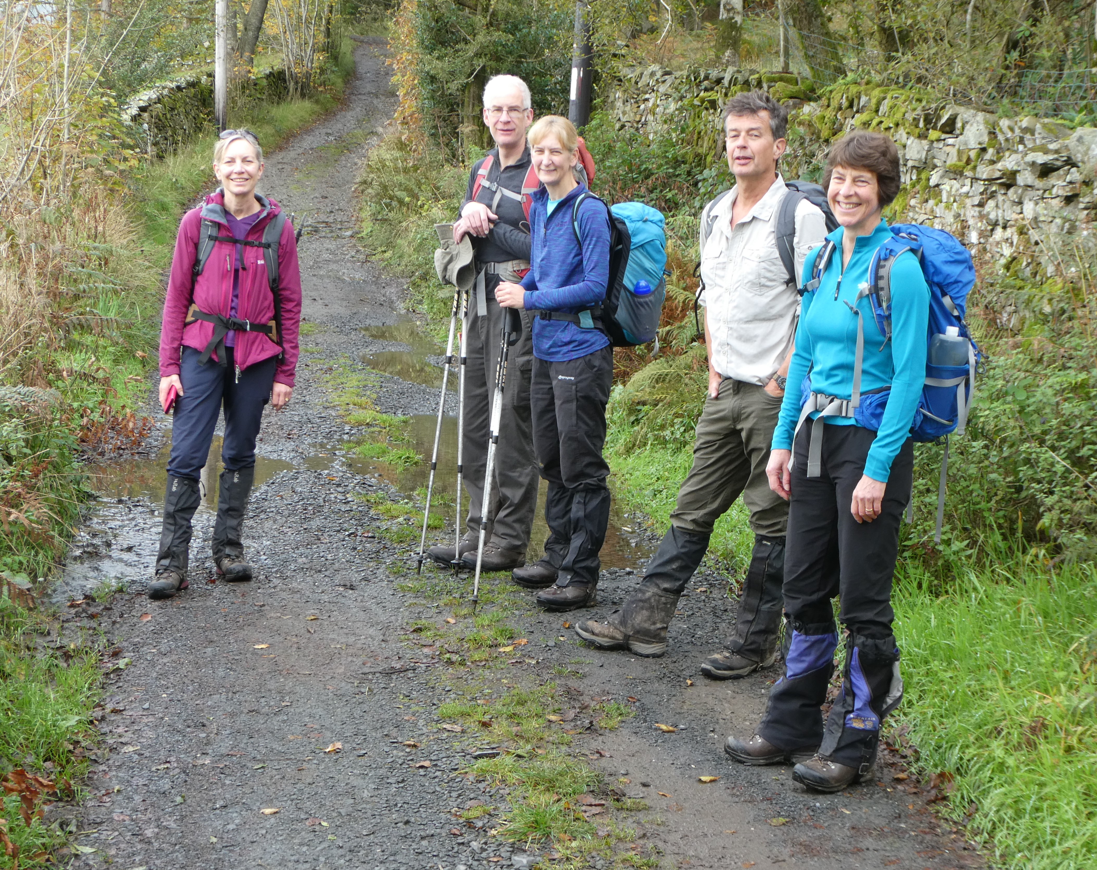
Whilst it wasn't sunny, the weather did behave itself for this lovely autumn stroll, with Sue and I being joined by Paul, Graeme, Cary and JJ. We wrestled our way to Tegg's Nose Visitor Centre, despite a road closure, and put our coins into the machine (well, we put in Graeme's coins as Sue and I had forgotten ours. Thanks Graeme.)

The view of Shutlingsloe from the car park is shown above. There's a bit of history to the place where we were standing; the name, Tegg's Nose, may originate from a time when a local Norseman named Tegga owned the land (naze). Or you might prefer the theory that 'tegg' is an old name for a lamb, and it's said that before the extensive quarrying, the hill's profile resembled that of a sheep.

The millstone grit rock of which Tegg's Nose is composed is an especially hard sandstone that is excellent for building both roads and houses. The whole area is home to many quarries. Tegg's Nose Quarry closed in 1955 and reopened as a country park in 1972. The site is 'littered' with displays of an assortment of old quarrying tools and machinery and plentiful information boards.

The area has been a hive of industry in the past, with quarries for stone which was crushed on site by heavy machinery, the relics of which have been preserved. As have the quarry walls, which are now fitted with abseil points and are used for training aspiring climbers.


We made our way slowly to a viewpoint.


It's a fine view over Cheshire, from Mow Cop to our far left, past Jodrell Bank telescope (seen in the picture below), to White Nancy above Bollington on our far right.


Then from another viewpoint overlooking our route, the reservoirs above Langley stand out, with Shutlingsloe to their left.


We made our way down to the reservoirs, and admired the autumn colours as best we could without the added vibrancy that a bit of sunshine would have provided.


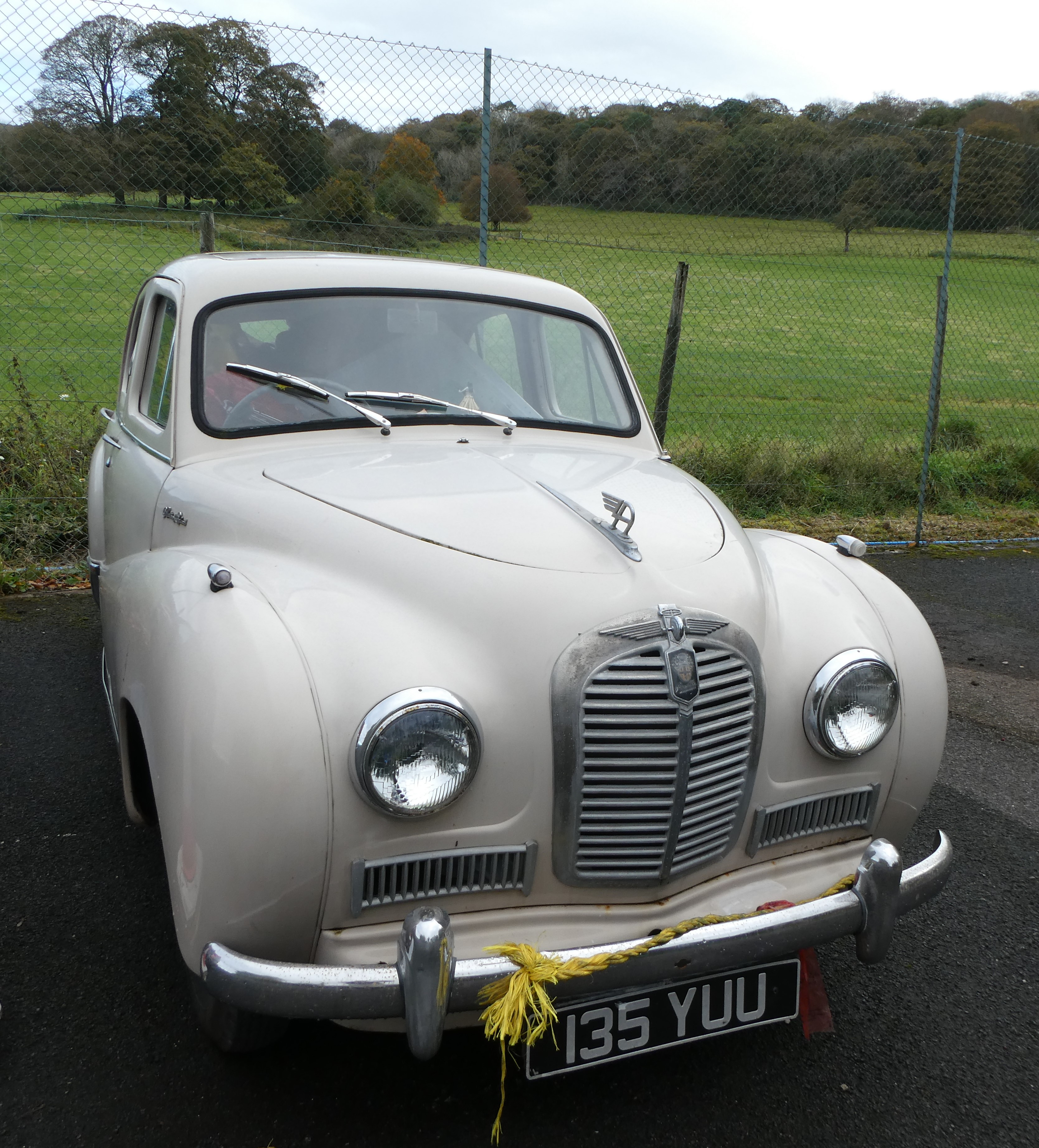
Here's a tractor for Alan R.


We'd been on the Gritstone Trail since the start of the walk, and we could look back past a flock of Canada Geese and other birds to the modest protuberance of Tegg's Nose.


We then deserted the Gritstone Trail and made our way to the picnic benches outside the Leather's Smithy for elevenses. 

The pub takes its name from the first licensee, William Leather. There's a plaque dated 1821, but the building may be older than that. For a while it was called the 'New Inn'. This stems from the mid 1800s, before which time ale houses only sold ale, usually home-brewed, and porter (a dark brown bitter beer brewed from charred or brown malt - originally made for porters). When a new law was passed allowing licences to be granted for pubs to sell wines and spirits as well as ale and porter, many pubs changed their names to the 'New Inn' to show that they had the new licence.

My stock of brownies had long been eaten, but Sue brought some of her chocolate caramel shortbread and JJ handed round some lovely chocolatey tiffin. The only problem was my flask of tea, which Sue pronounced "disgusting"!


After a lengthy break that contributed to today's (not)parkrun time for 5 km of 1:51:14, we took easy paths through Macclesfield Forest up to the main road at Walker Barn. 

The mature plantations that form the forest were first planted by Macclesfield Water Board around 1928, and consist mainly of larch and spruce, which do well on the poor soil. It's maybe a similar story from many forests, but the last wolf in England is reputed to have been slain while prowling through Macclesfield Forest.

En route we passed a tumbledown building that JJ went to investigate. It seems that a war veteran may have lived there, or even built it.


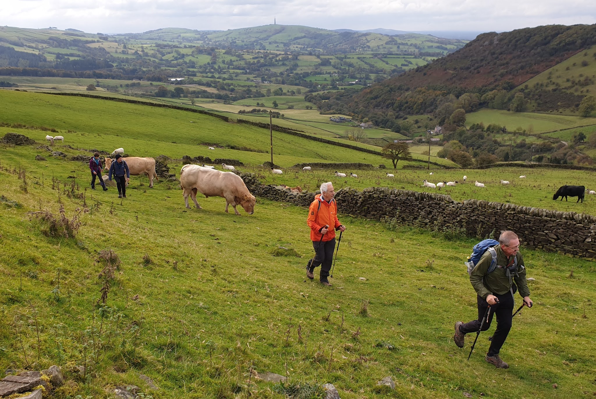
Pleasant field paths led on after we left the forest, with JJ and Graeme hurrying past the bull.


Sue fed it some grass. She was quite oblivious of its sex.


Andrew J may not have appreciated the descent from this stile leading onto the road to Walker Barn. Luckily he wasn't with us, but our thoughts were with him and with others currently leading difficult lives.


From Walker Barn we could have strolled up the road to the car park, but we chose to continue along the path to Gulshaw Hollow.


And a very nice path it was too, leading past Hordern Farm and re-joining the Gritstone Trail to double back to Tegg's Nose.


Here's the excellent route, which was based on Jen Darling's 'Around Tegg's Nose' route from the Leather's Smithy in her book 'More Pub Walks in Cheshire and Wirral. It was about 11 km, with 400 metres ascent, taking us three and a half hours at a very leisurely pace.


Thanks go to Jen for the route and for some of the historical information that I've cadged from her book.

Here's JJ's report, which includes more on the occupant of the tumble down building.

Thursday 15 October 2020

5 to 8 October 2020 - On Holiday in Bowness

This posting supplements last week's daily postings from Bowness, by way of a pictorial overview. There's also a Dropbox folder with 91 images for those on this trip. (Try clicking on these images for a slideshow.)

Monday's posting is here.

After parking up at the Ryebeck Hotel, we enjoyed a 10 km dawdle to a viewpoint above Bowness, via Barker Knott Farm.


Then we passed Ash Cottage, on the way to a puddle near Lindeth.


Here's the viewpoint above Bowness.


A sharp (for me, the day after running a marathon) descent led to the start/finish of the Dales Way route.


We strolled beside Windermere as far as the ferry, then found a novel way back to the hotel, avoiding the main road.


The afternoon sun lit up the leaves on the lakeside trees.


Here's our route - 10 km with 200 metres ascent. A pleasant afternoon stroll followed by an excellent meal in the hotel.


Tuesday's posting is here.

Sue and I drove to Troutbeck to meet Richard and Jenny, and Sue and Phil, for a walk up to the summits of Sour Howes and Sallow, returning via Kentmere.


Here's the view back to Troutbeck.


There were good views up the Troutbeck valley, and back to Windermere.


We met a chap on the summit of Sour Howes, who kindly took a photo of us all.


After contouring to Sallows for lunch, we descended to Kentmere, where Kentmere Hall is a 14th century tunnel-vaulted pele tower with five-foot thick walls. There's more information on the building here.


Soon afterwards, a sharp shower hit us, and as you can see below, the sun was shining despite the rain!


After a while, the rain moved on and we enjoyed a long break in the sunshine before rambling on back to Troutbeck.


En route we passed this magnificent display of mushrooms. They were large and they smelt gorgeous.


There was a good view across Windermere from Orrest.


Here's our route - 23 km with 750 metres ascent. Quite a long day for me, only two days after the exertion of running a marathon.


After this, Sue and I returned to the Ryebeck for a pleasant evening with good food and wine in the company of Paul and Jeanette.

Wednesday's posting is here.

Sue and I drove to Pooley Bridge. Whilst she went back to Troutbeck over High Street with S+P and R+J, I joined Paul and Jeanette for a very pleasant walk beside Ullswater, returning via a higher level path and the modest summit of Heughscar Hill.


The bridge that has been built to replace the one destroyed by floods in 2015 is nearly finished.


We weren't likely to get wet feet on the Park Foot path.


Whilst the alpacas were enjoying the views along Ullswater, we simply faced a post on which the camera was precariously perched.


We passed this magnificent specimen of Fly Agaric.


From Wainwright's Sitting Stone we got good views along Ullswater.


Then we passed a stone circle before heading up to the summit of Heughscar Hill (see the next two pictures), near where we enjoyed lunch in a more sheltered spot. 


Here's a final view along Ullswater before we returned to Pooley Bridge for welcome coffee and cake at a cafe, before P+J went home and I went back to do some shopping for the High Street team before locating them just in time for Sue and me to get back to the Ryebeck in time for dinner. (It was a shame to drive past Mike and Marian's house in Patterdale without having time to stop and say hello.)


Here's our route - 16 km with 400 metres ascent. A really pleasurable walk.


Thursday's posting is here.

Sue and I parked in the RSPB car park at Leighton Moss and took the path through the grounds to the causeway. We'd never before been asked to produce our membership cards, and despite the fact that we would remain outdoors, on our own, throughout our visit, we were made to register our visit for 'Track and Trace' purposes. Pointless. And who knows whether it works anyway. (Enough said, I'll avoid a rant.)


The robin seemed cheerful enough, but the Austin A40 Somerset at Leighton Hall looked as if it was just being used for storage. Rather sad. I remember my mum and dad selling their house in Wolverhampton and moving into a cottage that came with dad's new job in Ryton, when in 1954 they spent the proceeds from the house on a buff coloured A40 just like this one. MJW 770, I expect Dot remembers it well, and it lasted for many years in the Albrighton area after we had sold it.


Our route climbed high above Leighton Hall, with good views across Morecambe Bay and towards the Lake District, whose hills could be seen very clearly today.


There's an ancient 'cairn' nearby, and a good path leads past Hyning Scout Wood to a lime kiln.


We made our way to the shore, and the path to Silverdale, stopping for lunch near the chimney at Jenny Brown's Point.


Dappled sunlight through the trees illuminated our walk through Scout Wood, even if we did go wrong a couple of times.


Then it was back to Leighton Moss, past a series of back gardens, where we stopped for a long chat with a resident, and across Silverdale golf course on some handy paths.

Here's our route - 15 km with 300 metres ascent.


So that's it from this trip - I've just included a few of the photos here, having taken over 100 altogether.