Sue and Martin in Mallorca 2019

Sue and Martin in Mallorca 2019
On the Archduke's Path in Mallorca

Saturday, 28 September 2019

Friday 27 September 2019 - Around Hockenhull Platts

 
This was a walk in an area that hadn't previously felt the tread of our boots. Good paths in a pleasant farming area to the north east of Chester.
 
The parish car park at Guilden Sutton (SJ 448 680) proved a good place to start, and I can see from the map that I'll choose this starting point for another walk in the future.
 
Today I was joined by Sue, and by Paul - who generously provided the transport. They are seen above, marching across the field path near Oxen Bridge. The correct line of the path near here had been destroyed by a plough (Cheshire farmers rule ok!) but we were generally impressed by the state of the paths, stiles and signposting.
 
The route was taken from Jen Darling's 'More Pub Walks in Cheshire and Wirral'. Soon we passed Greysfield, described by Jen as "an attractive, half-timbered building".
 
 
Maybe, one day...
 
We then strolled through the hamlet of Great Barrow, past The White Horse.
 
 
It was a little early for us to be tempted inside, so we continued down Mill Lane and the along good paths to Tarvin, a small town that seemed to me very similar to Eccleshall in Staffordshire.
 
We diverged from the planned route, as the town looked as if it would be a source of refreshments. It was. Coffee and cake all round in the small front room of The Café.
 
 
Imaginatively named?
 
Back on route, we strolled down Hockenhull Lane, crossed the A51 after passing a small nature reserve in memory of a local man, and headed along good paths that skirt the C17 buildings of Hockenhull Hall.
 
A large fungus caught our eyes. Beefsteak? It felt like it.
 
 
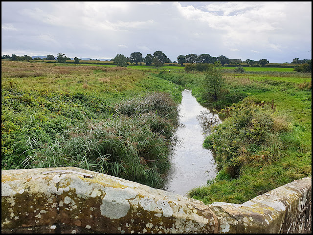
Soon we arrived at the highlight of this walk, three packhorse bridges at Hockenhull Platts. They span the River Gowy and its tributaries, and are medieval in origin. Apparently, this was once the main road from London to Chester. As the bridges weren't wide enough for carts, they were superseded by other crossing points by the eighteenth century.
 
It looks as if the bridges have been restored to their original condition, or better!


Today, despite recent storms and our walk taking place in gentle rain, the River Gowy was clearly not in spate.
 
 
At Cotton Hall we took a left turn to pass through several fields of sweetcorn, along a path strewn with Pineappleweed.


A burst of heavier rain ensured that the camera was stashed somewhere dry as we continued across the A51 and then on a well marked path through Vicars Cross golf course and back to Guilden Sutton, where we eschewed the promised (by Jen Darling) delights of the Bird in Hand pub, and went home for our lunch.

Here's the route - about 14 km, with very little ascent. It took us about 3 hours plus our coffee break..
 

Friday, 27 September 2019

Pyrenees HRP - 2004 - Day 32

 
Sue and Martin's Big Adventure
 
Day 32 - Thursday 26 August 2004 - Stage 25

Postcard Summary 
Snore Zone to Upper Mulieres Lake
Fantastic day with 3000 metre peak and epic finish above Hosp de Viella – 10.25 hours, 11 km, 1200m ascent
We enter Spain, leaving French cloud behind.  Climb up a beautiful valley under the Maladeta massif and up to the highest col of the trip at 2928 metres.  From there, only 15 minutes to a summit at 3010 metres with magnificent views.  The descent was tricky – a vertical scramble then steep snow – made camp at 6.30! 


Diary Entry (by Sue)
We slept ok at the 2200 metre refuge, getting up just after 7 am. Outside, there was cloud, but it was thin, giving occasional partial views of the mountain tops above. Breakfast at 7.30 - bread, jam, and a sort of cold bread and butter pudding.
 
Once on our way at 8.20 (Sue and Julie are pictured above), the cloud cleared, and it was only a short climb to the col  - Port de Venasque (2444 metres), past the lakes.
 
Looking back from Port de Venasque

This is on the border, and the view into Spain is completely clear. Ahead, the Maladeta massif with its glaciers.
 
Ascending, with a view to the Maladeta Massif
 
View to Rio Asera
Tuca d'Aiguallut ahead
 
We then take a grassy pass down to a plateau. Then a zigzag path down to a road, where we see a full coach every half hour or so.
 
During a stop for changing into shorts, mountain mix, etc, Martin's rucksack rolls a few times down the hill - he misses the entertainment! Not long on road, and another ascent begins. The valley and the day are really beautiful, and so think the tourists walking up to the Trou de Toro, where the blue river disappears underground. Martin even has to tap someone's ankles to be able to get up the path!

 
Trou de Toro
 
There is a lovely (Aiguallut) cascade, with a backdrop of the Maladeta massive, before the green plateau, where, fortunately, all the tourists stop. Today we all feel privileged to be in such a wonderful landscape. Our path weaves up the rocky hillside, with streams and small tarns, and behind, we had a view of the pass crossed first thing.  
 

Despite the clear blue sky, the wind is cold and we escape it behind a rock for a brew and lunch, next to a stream. I use the opportunity to wash underwear and hang it off the rucksack to dry.  


The afternoon proved eventful. The path reached a tarn, where a Spanish couple were helpful in providing a weather forecast, and guidance for our next section. Despite intending to turn round where we met them, he overtook us, not being able to resist the temptation of a peak! The Col de Mulleres was the next goal - it was the highest pass we could see, and will probably be the highest of the trip at 2928 metres.
 
The terrain was solid rock, with some sections of boulders.
 
 
The path was cairned, and after seeing no one for some time, there suddenly seemed to be a few folk around. We stretched calves on the sloping rock, for what seemed like ages. It was hard going on the final section, contouring on large boulders, and we finally reached the col at 3.30 pm.
 
After some rejuvenating mountain mix, the rucksacks were left at the col, and further cairns guided us for 15 minutes to the summit of the Tuca de Mulleres, wear a cross marks the top at 3010 metres. The view was stunning - cloud in France, spilling over the border ridge, and clear in Spain to the Maladeta massif and the lakes below, where we planned to camp.
 
Summit views, and a view from the summit of Tuca de Mulleres


The view east showed the size of the mountains decreasing! Getting back to the col gave us no difficulty, but then the route became tricky. Whilst Martin tried one way, Julie and I tried the direct descent, following the waymarks and scrambling down vertical stretches of rock, then down a steep, but small snowfield.
 
 
Eventually, an hour later, we were in a position to continue the descent, with Martin's trousers in a state, and our nerves jangled. A rough, steep descent for a further hour before we pitched at the highest Mulleres lake (2450 metres), at the first opportunity (6.30 pm).
 
 
The sun had already gone, but we sat outside on this still evening, to cook soup, and pasta with ham and chorizo, and as we drank hot chocolate, the sun set from the mountains we looked across to. A fabulous day, with a sting in the tale. Saw good animals too, a stoat, deer high on the rocky peaks, and marmots. Bed 9.30 pm.
 
Stats and route (Viewranger):
15 km, 1400 metres ascent, 10.25 hours


Thursday, 26 September 2019

Pyrenees HRP - 2004 - Day 31

 
Sue and Martin's Big Adventure
 
Day 31 - Wednesday 25 August 2004 - Stage 24


Postcard Summary 
Laundry Camp to Refuge de Venasque
Easy 1800 metre ascent in nice surroundings and weather – 7 hours, 16 km, 1800m ascent
Today dawned clear after being overcast all yesterday.  We discovered that if we had gone on our planned route we would have been in thick mist all day.  So off we went up the huge ascent from Luchon, up to Refuge de Venasque, culminating in a huge series of zigzags.  After we reached the refuge the cloud from France engulfed us and we adjourned to the ‘mess tent’.  This small refuge sleeps 14 people, on two bunks taking 7 each.  We three are next to a family of four.  One of them snores.  The toilet is a concrete hole in the ground in a metal shack.  The soup is warm and needs salt.  The main course is adequate but not as good as our ‘home cooking’.  It’s cold, so we are all in bed by 9 pm.


Diary Entry (by Martin)
Back on the road today after a long 1½ day "half term holiday" in Luchon. One call for concern is a damaged tent pole - we'll examine it next time the tent goes up.
 
After yesterday's cloud, today dawned sunny and clear. We got a very slow start due to major repacking after restocking, and lethargy on my part. I have a slight bowel problem. Eventually, at 8.30, we say au revoir to our attentive campsite "guardian" and head up the road towards de l'Hospice de France. 640 metres, 12°C, 947 mb.
 
After a good half hour we opt to leave the road in favour of path 20, just after crossing the La Pique river, to Barguères, Plan de Campsaure, and Hospice de France. It's a good path, taking us through dark woods despite the bright day. Lots of dew, so Sue and I change to boots. The path is deserted. We reach 1250 metres by 10.30, and have a lovely brew spot above Barguères Cabin from 10.50 to 11.20,  at 1370 metres. (The view from here is shown above.)
 
Continuing along a dew laden path surrounded by gorse and grasshoppers, we (I) make a 4th navigational error by turning south west sooner than I should have done. This took us steeply down to 1100 metres, much further than expected. We should have continued up the track around a zigzag, and then taken a more substantial road to the right.
 
We did eventually reach an old road, thoroughly blocked as a right of way for traffic. We plodded on up, eventually joining our correct route and gaining the big car park at Hospice de France (1370 metres) at 12.35.
 
 
We ascended a few metres to a magnificent lunch spot above the ruinous hospice, with a good view of the zigzag path above us. 12.45 to 1.30, and we got rid of our first baguette (Sue), and tins of pâté and fish (Martin). Julie washed her feet in the bubbling stream next to us (very cold).


The path up to the Refuge de Venasque was busy but not crowded - 850 metres of well graded zigzags, with excellent views down on the route, once we got higher.


The signs said it should take 2 hours 15 minutes, but despite resting for 10 minutes half way, we managed the ascent in 2 hours, with Julie a few minutes behind. 3.30 pm.
 
 
The refuge sleeps 14 people. We are to share the bottom bunk (there are just two bunks) with a French family of four. The visitors' book indicates we are the first English people to stay here this year. It's quite warm and sunny at first, so we wander around the scenic environs (the Refuge is not an architectural masterpiece), with most of Sue's clothes and sleeping bag put out to dry (they are habitually in this state).
 
 
Between 5 and 6 pm cloud gradually engulfs the area and we move from the outside benches to some in a tent where we will eat at 7 pm.
 
 
An easy day, but it sets us up for our attempt on the Mulieres ridge tomorrow, weather permitting. Some Scottish day walkers (they had a good route) gave encouraging news about the weather predictions.....
 
Cloud comes in from France. Cold. We adjourn to the food tent with a nice couple from Paris. Food arrives at 7 pm but is only warm, and lacks salt. Disappointing. We manage to drag out the meal and preparations for bed until around 9 pm. There is a loud snorer and the woman next to Julie has smoker's breath. Julie retaliates with a coughing fit...