Sue and Martin in Mallorca 2019

Sue and Martin in Mallorca 2019
On the Archduke's Path in Mallorca

Saturday 23 June 2012

A Mercy Mission

The Blue Limo

Readers may recall that I spent Wednesday with Gary and Andrew on their meticulously planned C2C walk from St Bees to Reeth.  They had dropped Andrew's car off at Reeth, carefully positioning it in preparation for today's drive back to St Bees to reunite Gary with his own transport.

These best laid plans were foiled when Andrew's top of the range limo (pictured above in its final resting place) expired as it entered Reeth last Saturday.  A shame, as it had 'done good'.

So after a rather slow 5km Parkrun (tired legs!) today I pottered up the A1 to the pretty village of Reeth to empty the Volvo of its dog box and other contents, deliver Neil and Liz - who had walked with A + G today - back to their car in Keld, return Gary to St Bees, and then return Andrew to Deepest Cheshire.

The weather was much better – I was only driving in rain for about 6 hours, but given that the constantly lashing driving rain where we were in Calderdale yesterday was the worst in their living memory, that doesn't mean an awful lot!  I’ve now discovered that they actually did get a month’s rain in a day, and that the puddle we left in the cafe is probably nothing compared with the river that was flowing through it later on in the day.  So we were possibly wise to beat a retreat when we did.  We did notice sandbags being put out as we drove home, not necessarily with any great effect from what we hear on the news.

Incidentally, I’ve known that car about as long as I’ve known Andrew, as it was his last company car at the time we first met, thirsty but durable, and very comfy for many journeys over the years. 

Old Blue Limo – RIP!  Thankfully its thirsty but durable owner is in better health.

Friday 22 June 2012

A Nice Day For A Bike Ride - The Mary Towneley Loop

First, a short mention of last night's mini adventure. An evening walk had been planned from the Silverdale Hotel, so after Sue had picked me up from the station we headed off for a bite to eat at the hotel. 7.30 came and went, and nobody had turned up for our traditional mid-summer's walk. Not really surprising given the torrential rain outside.

"I've already done 30km over mainly pathless ground with a heavy pack..." I muttered.

My inferred plea to go straight home didn't work.

"I've come for a walk, so I'm going for a walk" dictated The Boss.

So we enjoyed a pleasant circuit - along the beach then across to Far Arnside to the path up Arnside Knott, which is a good viewpoint - recommended when the rest of the Lake District is engulfed in cloud. Tonight Arnside Knott was itself engulfed in cloud. We took some photos in the rain. I may get time to download them one day.

A steep descent through dark, wet woods (Jenny wouldn't have liked it) and a pleasant if rather damp stroll back via Arnside Tower, Elmslack and the Cove, ensured that we got back to the car in time to get home from this rather energetic three day trip by 11.30...

The alarm went at 6.30 today. It was still pouring down, but Mike, Robert and I had a long standing engagement with 'The Mary Towneley Loop' - a 47 mile bike ride in the South Pennines, all off road, with about 2300 metres of ascent.

A tough day out.

We met at 8.30 as planned at a picnic site in Waterfoot, despite being baulked by a closed motorway and a lack of signage to the picnic site. It was raining hard but we set off in good spirits and after quite a while we reached the plaque to Mary Towneley, pictured above with a picture of Robert and Mike at the same point. The phone with which the pictures were taken spent the rest of the day in a waterproof bag. My wet weather Ixus (once drowned) camera decided not to work - again - it was fine afterwards (again).

It was at this point that Mike started to shiver. "I may not get all the way round" he offered. I thought about this whilst cruising down the next section of 'path', or should I say 'river', as today the Pennine Bridleway that forms the basis of the Loop had acquired the persona of a river bed, with the contents in spate. Perhaps that's why we didn't see any other cyclists today...

I had a wet bottom. "Probably because your overtrousers have split" observed Mike, between shivers.

"You might have a wet bottom" chipped in Robert "but my waterproofs from Aldi have a 'fit for purpose' issue".

So I was nice and warm, if a bit tired, and therefore on the slow side, Mike was cold, and Robert was wet. We'd been going for over two hours and were less than a quarter of the way round the Loop. It was 'tipping down'. We felt as if a whole month's rain was being dumped on us in one go.

"I didn't get wet at all on the TGO Challenge" commented Mike, "but I am now!" "Same here" I muttered, from a wet bottom.

So, on reaching Long Causeway Road, a long straight road beside a windfarm, we decided that as the camera I'd brought to record our exploits had failed, there was no real reason to continue.

We left the Loop and headed down the road to Todmorden, where a café was remarkably understanding and fed us with tea and coffee and huge baked potatoes, in return for very few notes and a large puddle on their floor - "Don't worry, we have a mop" they jested.

It's quite a pull over to Bacup and Waterfoot from Tod. The wind was gusty and the rain at times torrential. Rivers were full to capacity or more. I walked on the verge for a mile or two - safer, I thought. I didn't want to be blown into the path of an HGV.

By the time we got back to the picnic spot at about 3pm we'd covered about 47km (30 miles) in about 6 hours. Had we attempted to continue around the Loop.... we may still have been there (waiting for the camera to start working, obviously). The rain didn't abate until much later.

A sort of heroic failure, can perhaps describe our day. But some might think us foolhardy to have set off in the first place with a camera that was known to be a bit dodgy.

I really rather enjoyed it. I hope Mike and Robert did.

We'll crack it one day!

Sent using BlackBerry® from Orange

Thursday 21 June 2012 - Shap to Burneside

After a still night, light rain started shortly before the tent came down. It rained all day, so the phone was stashed after snapping Obi (above - pitched better than it looks!).

Thanks for your comments, Alan and Gibson. The media card is working again - I must have knocked it when changing the battery. Good to hear from you Norma, and Gibson - you will be pleased that we've seen off some of this summer's wet weather before you venture in this direction.

After seeing a dozen or so folk on the fells on Tuesday, and a crocodile of over a hundred on the C2C path yesterday, I saw just two other walkers today, ascending steeply into the mist on my last hill of the day, Great Howe. Before that I'd spent some time extricating myself from the environs of Shap, which is a very long village surrounded by an intricate network of footpaths.

Wet Sleddale had lived up to its name as I rose up to the (sadly locked) Lunch House, where signs indicated that I was welcome so long as I used the footpaths. There were no footpaths so far as I could see. Which was only a few metres, so the footpath police would have struggled to see me breaking the rules. At least the sign wasn't as threatening as the one in Patterdale threatening to shoot dogs, and do untold damage to cyclists bold enough to venture onto a particular footpath. Not all farmers are uncaring though - on yesterday's approach to Shap we found a bucket of cold drinks and a large slab of ice, courtesy of the local friendly farmer. Good value for a pound, but where were the ice creams?

Anyway, today's soaking wet walk involved intricate navigation through deep bogs and over peat hags, eventually reaching the stupendous summit of Sleddale Pike. Well, it may have been stupendous if you could have seen much. I was soon on a roll and the mighty peaks of Wasdale Pike, Great Saddle Crag, Harrop Pike and Grey Crag all saw my soggy boot prints before the final descent from Great Howe and the long but satisfying walk along footpaths and bridleways to Burneside from Sadgill.

A quick train journey to Silverdale followed, for the next action packed episode, for which you'll have to wait as there's not time at present to do stuff and write very much.

Hiya Gayle - good to hear from you, and yes the cuckoos have been in good voice in the Lakes this week.

Sent using BlackBerry® from Orange

Wednesday 20 June 2012

Wednesday 20 June 2012 - Patterdale to Shap

Another fine day's walk in lovely sunny weather, over Angletarn Pikes, Brock Crags, Rest Dodd, The Knott, Rampsgill Head and Kidsty Pike, some of which Andrew and Gary (aka Cramp + Blister - and that's just Andrew) also ventured up.

I rejoined their less vertiginous route after this little bout of summiteering, for lunch in the sun by Haweswater, which appeared to have been invaded by Canada geese.

A gentle walk to Shap followed. I'm camping at A+G's B+B, which happens to be at the opposite end of town to our chosen eatery, the Greyhound. There we encountered John K - a TGO Challenger who is leading a HF (Holiday Fellowship) group along the C2C route. If his better half, Norma, is watching - 'Hello, we hope you are continuing to recover from your back op'.

Sadly the phone's media card seems to have suffered a 'fatal error' so today's image is one of Brothers Water from Brock Crags, saved to the phone by some fluke this morning.
.
Sent using BlackBerry® from Orange

Tuesday 19 June 2012 - A Backpack! - Staveley to Patterdale

At last, a 'proper' backpack, but as Sue is at work I've been on my own today.

The Trans-Pennine Express and a local train delivered me efficiently to Staveley by 9.30, from where I enjoyed a delightful stroll north to Patterdale, via Sallows, Yoke, Ill Bell, Froswick, Thornthwaite Beacon, Stony Cove Pike, John Bell's Banner, and Hartsop Dodd.

A fine high level route.

I'd planned a wild camp, but the attraction of a beer in the White Lion and a flat 'pitch' on a lawn won the day.

Whilst there was evidence of showery weather as I travelled north, the sun shone as I set off from Staveley on the gentle - until the final kilometre - ascent of Sallows, the first of today's eight 'high points according to Bill' (Birkett).

My walk continued fairly joyously in lovely weather, despite a heavier pack than that to which I have softened to in recent weeks. I passed above a major traffic accident in the Kirkstone area, and heard lots of cuckoos as I wandered over the remaining lumps and bumps and down to Hartsop and the fleshpots of Patterdale, for Mike and Marian's warm welcome and freshly mown lawn.

Obi 1P was soon up - not too midgy - and after dinner a stroll to the White Lion revealed my companions for tomorrow, Andrew and Gary, who are on the 'Coast to Coast' (C2C) route.

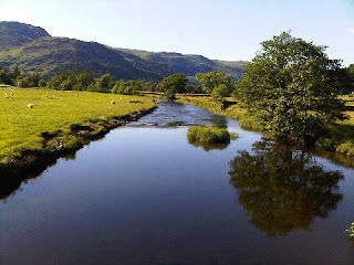
Whilst I saw a smattering of folk, they weren't close enough to act as photographic foregrounds, so today's snaps comprise mountain scenery. Each picture is different. To the connoisseur! Those chosen for this posting are the view of Hartsop and beyond from the descent of Hartsop Dodd, and Patterdale from a bridge over the river that runs past the village.

Sent using BlackBerry® from Orange