Sue and Martin in Mallorca 2019

Sue and Martin in Mallorca 2019
On the Archduke's Path in Mallorca

Saturday 6 November 2021

Thursday 4 November 2021 - A Rivington/Anglezarke Bike Ride


Don joined me for this repeat of a route devised by Greg Barber and taken on 23 March 2016 together with his dad, Paul. I reported on it here.

On a lovely autumn morning, we enjoyed a coffee, then set off from Rivington Great House Barn at about 10:30, soon arriving at the scaled down ruin of Liverpool Castle.


A pleasant woodland stretch then led to the long ascent to the heights of Lever Park.


The rough track becomes a little more forgiving after its high point, beyond which we descended the middle track through the Terraced Gardens, passing under this ornate bridge.


Once the tarmac is reached, there's a great descent to Alance Bridge, and a good view across Yarrow Reservoir.


Heapey Fold Lane is a rough track that ascends above Anglezarke Reservoir, with views across to the reservoir.


Don and I diverted to the top of Healey Nab, where we paused for a 'coffee and cake' break.

Good tracks then led us to a right turn down a narrow bridleway to a bridge over the River Yarrow. Luckily, on this occasion, no punctures were sustained.


Here's the track before it crosses the river.


After crossing the M61 motorway, we continued to enjoy a brief rest next to a pond outside the Bay Horse. Can you spot the lazy heron?


The undulations that are a feature of this route took us along tarmac to the dam at the end of Anglezarke Reservoir, where a host of black-headed gulls glinted in the foreground.


Back at Yarrow Reservoir, there was a fair amount of water cascading down the steps from the reservoir.


Don's chain had been increasingly annoying as it failed to adhere to its allocated cogs, and here it gave up completely, by breaking.


Luckily, with less than 2km to go, we could walk/free wheel back to the barn.

Here's the route - 19km, 400 metres ascent, taking 2.5 hours. A lovely way to spend a morning, and thank you Don for your company.


Next:
Monday 8/11 - Meet at Timperley Bridge at 8:30 for a 70km circuit via Pennington Flash, Sankey Valley and Trans Pennine Trail.

Wednesday 10/11 - depending on weather - a ride of up to 40km from Ramsden Reservoir (SE115056), over Holme Moss.

Let me know if you plan to come along. 

Friday 5 November 2021

Wednesday 3 November 2021 - Around Alvanley


This was a short walk to check out Jen Darling's route description in her 'Walks in West Cheshire and Wirral' book, so that any changes since 2007 can be incorporated into the next print of the book.

The village of Alvanley is just a few minutes from juncion 14 of the M56, and the obvious place to park is in the White Lion's capacious facility. But not without permission. Jen suggests parking about 100 metres up the road, opposite Rose Cottage. My car is shown there in this next picture, taken from outside the pub. 


Church House Farm, pictured above and below, has an impressive Georgian facade. Nearby is a church dedicated to St John the Evangelist. It has a tiny spire. I didn't investigate the church on this occasion.


A path beside Rose Cottage, labeled as the North Cheshire Way, skirted a field of winter greens and soon crossed a lane called Commonside, along which alternative parking is available where the Sandstone Trail crosses the lane.


The route then hugged a hedgerow on the left, and passed through a couple of old wooden kissing gates that haven't yet been replaced.


Eventually a bridge across a stream is reached. Jen's route eschews that and follows the sign to the right - 'W'DHSE HILL', or the 'Longster Trail'.


This path leads to The Ridgeway, an ancient route through the hills, beside which a pony sanctuary nestles in the quiet countryside.


A little further on, opposite a caravan site, the Sandstone Trail is joined at a point where it heads up steep steps, on this occasion to the sound of mewing buzzards.


The path leads past Cliff Farm (unseen thanks to dense foliage), below the heights of Alvanley Cliff, eventually turning right by a timber-framed house that was apparently transported from the Nantwich area and reconstructed in this pleasant spot.


The Sandstone Trail is a delightful path at this point, here looking back to the timber-framed house.


A narrow path beside a field of crops (potatoes?) leads to a country lane, with Simmond's Hill looming above to the left. 


Then a T-junction with Manley Road presents a dilemma, as it would be an easy stroll along the road back to Alvanley. However, a stile opposite presents the opportunity for a minor adventure. 

The path rises through a tussocky field to reach a muddy track to Manley Old Hall, home to a large herd of cows. This track has been covered with a carpet of green baize. This in turn is covered by a layer of mud. All the way to the farm. It's slithery.


After being redirected along 'Permitted Paths' to avoid the cattle, it's possible to make your way around the buildings (the route I took is shown on the map below), through a number of electric fences with wire 'gates', and down a well disguised path to a bridge over Moor's Brook. Editing Jen's description of this section of the walk will be tricky, and a slightly different, longer, route may be sensible. You can see from the state of the stile before the footbridge that the 'Right of Way' furniture is not being maintained here.


Beyond the footbridge, the 'path' rises, soon coming into sight of a post with a yellow marker in the distance, confirming that this overgrown area does in fact house a path, and after a while you emerge onto Manley Road near the village.


The path goes through the gap on the far right...

Here's the route, only about 7.5 km, with not much more than 100 metres ascent. It took me two hours. Only the brave should attempt the loop at the bottom of the route! (Click on the image for a better version.) At least I kept away from the cows by using the route taken.


Thursday 4 November 2021

Tuesday 2 November 2021 - A Bolton/Bury Bike Ride


I've enjoyed this 60ish km bike ride several times before, most recently on 1 September 2019, when I reported here, with links to other reports, so I don't need to reiterate the route and other information in this posting. There are also plenty of photos in those earlier reports, but as it was a 'good weather' day, I felt obliged to take some more, starting with one (above) as I was leaving Sale, heading towards Dane Road soon after 8:30am.

Rather than repeat previous images, I decided to stop every time the Garmin gadget clocked another 5km - here are the results:

After 5km, by the Bridgewater Canal in Stretford

After 10km, approaching Barton upon Irwell, where the canal crosses over Manchester Ship Canal

After 15km, on the loopline near Roe Green, shortly before the branch right to Bolton

After 20km, shortly before crossing the M61 motorway in Farnworth - the loopline has been destroyed here, but good tracks lead back to it

After 25km, crossing an enclosed bridge in view of the centre of Bolton

After 30km, a picnic break at Nob End, accompanied by the twittering of a flock of long-tailed tits

After 35km, on the Irwell Sculpture Trail (National Cycle Route Number 6) near Ringley

After 40km, past new housing on Kersal Vale Road on the outskirts of Salford (a reminder of the Preston Guild Wheel)

After 45km, past open land by the River Irwell in Salford (above and below)

After 50km, after a short section in town, back beside the Bridgewater Canal near the 'Theatre of Dreams'

After 55km, at the bridge under Dane Road by the Bridge Inn, looking ahead towards the houses pictured in the first image shown above

There is no 60km image, as the Garmin only clocked 58.4km, with 460 metres ascent, in 4 hours 24 minutes, including a 15 minute break at Nob End. Here's the route, shown in more detail in the earlier postings referred to above.


So that's my report on a largely uneventful bike ride. No incidents, a few pleasant chats with folk, swans and ducks on the canals, just a pleasant sunny morning ride.

Wednesday 3 November 2021

October 30 and 31, 2021 - A Weekend at Langdon Beck Youth Hostel


Note that if you click on an image (PC or tablet) you get access to a slideshow that shows the
images in a better light and eliminates the need to put up with my wittering commentary

This was a 'Ramsoc' weekend with Sue's University contemporaries. Eighteen of us assembled at Langdon Beck youth hostel on Friday evening. Saturday morning brought a lie-in and a very leisurely start due to driving rain.

Departure was eventually fixed for around 11 o'clock, at which point, having seen us all dressed for the weather, the rain ceased to fall.

 
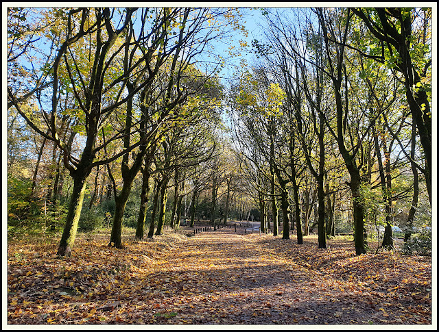
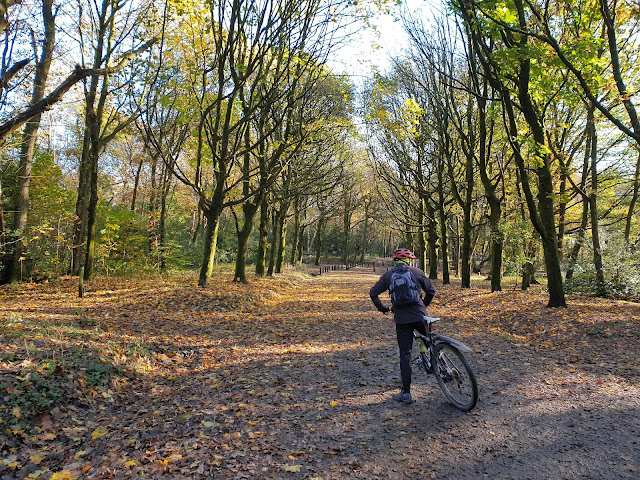
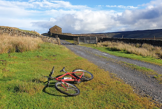
Most of those present went on a nine mile circular walk to Cow Green and Cauldron Snout, returning beside the River Tees, with just Neal opting for a visit to the museum at Bowes. Pete and Mary were on their eTandem, and I was on my old Shogun Trailbreaker mountain bike. (Still unable to walk far due to Plantar Fasciitis.)

The walkers set off first and 'sold a dummy' to an anxious lady the other side of a ford at Langdon Beck hamlet. No, it wouldn't be wise to cross here!


The walkers were soon passed by the eTandem, heading up the steady gradient to Cow Green.


Well, I wasn't there yet, but it would appear that the tandem paused for a group photo.


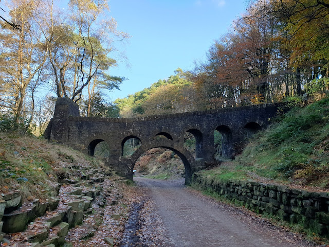
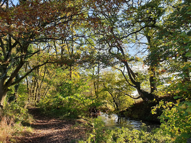
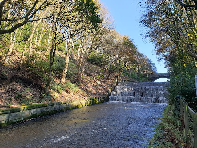
Meanwhile, having set off and then returned to base to collect waterproofs (which were not needed), I pedaled along the road to Langdon Beck hamlet, and watched the waters of Harwood Beck flowing under the bridge that serves as a sensible alternative to the aforementioned ford.


The walkers soon appeared as dots in the distance as I headed on up the slope towards Cow Green.


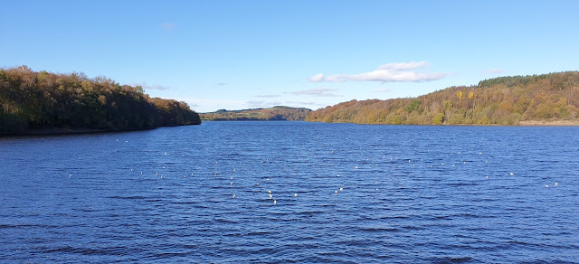
I carried on to the car park, near where I got a view of the rather depleted reservoir.


Meanwhile, on a different road barred to traffic that leads to the dam, the others were making steady progress on their stroll.


The road to the dam stretched ahead. I was pleased to be on my bike rather than be walking along the tarmac.


The overnight rain was trying hard to replenish the reservoir.


A view from the dam shows the gush of water being released despite the need to retain as much as possible.


Here's a view back along the dam. I remember this being constructed. Perhaps I'll add some of the scanned images to this posting if and when I get to them.


The grassy slope to the left of the next picture provided an interesting (very slithery) descent.


I soon joined Pete and Mary, shivering under their tarp but looking happy enough.


The other foot soldiers soon arrived, and we moved down to a good picnic spot in view of the Cauldron Snout waterfall. The next few images of views at Cauldron Snout were taken by various people and may not be in order. It's a magical place.


There was a brief shower of rain, during which I sheltered in an old barn, having headed off towards Birkdale.


Here's my view towards Birkdale. I soon realised that in order to follow my desired route along a bridleway to Holwick, I'd have to cross Maize Beck. That clearly wasn't possible, so I turned round and headed back to Cow Green.


Meanwhile, the eTandem was returning to base, and the walkers were making their way slowly down below Falcon Clints.


Can you see them in my picture, littered at the foot of the descent.


It's rough going down there, and though I wasn't there I wasn't surprised to hear of some 'stumbles', thankfully not requiring  'rescue'.


Someone found a couple of fungi - perhaps of the 'puff-ball' genre. Did I detect them later in Tom's ratatouille?


My picture (above) looking down to the river was taken from the barn on the hill, where I sheltered from the brief shower.


I then went back to the Cow Green car park and took a track north west above Backside Fell, with Cross Fell and its companions in the distant view ahead.


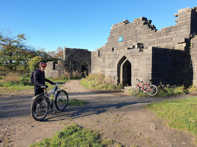
I passed the site of an old mine, in lovely weather with clearing skies.


The easy track rose gently from the height of the reservoir at about 500 metres, to join the B6277 road at Harwood Common, at around 600 metres.


I met a couple of mountain bikers near the high point, and it was probably they who flew past me on the descent to Langdon Beck a little later, and I was doing nearly 35 mph at the time. They must have taken my route from the car park in reverse.

A lovely green lane led to Harwood, and another crossing of the beck there.


After admiring the afternoon sunlight on the white walls of the houses, I rejoined the Cow Green road for that final speedy descent and a short ride back to the hostel along the main road.

I got back at around 3:30 pm after a 4 hour outing, a few minutes ahead of the walkers, who told me they had walked a 9 mile circuit.

By the end of the day my tyres had wheeled their way over 37 km (23 miles), with about 500 metres ascent. Here's my Garmin 'track'. Click on it for a better image.


On Sunday morning we were greeted by even heavier rain than on Saturday. We'd enjoyed a lie in thanks to the clocks going back, and we took our time leaving, as nobody would be occupying the hostel after us for a while.


Most people went home, but seven of us decided on a short walk from Bowlees, past Low Force to High Force and back.

There was a fair amount of water coming over Low Force, though I'd hesitate to describe it as being 'in spate'.


We crossed the Tees by way of this 'one at a time' suspension bridge, high above the river, just below Low Force.


The local fire brigade were out, practicing their river rescue techniques. (Elsewhere in the country, other teams were engaged in the real thing, with some paddle boarders losing their lives.)


There were also some kayakers enjoying the fast flowing river, but they always appeared at the wrong moment for my camera.


Here we are near Low Force, at about the time it stopped raining - Martin, Sue, Dave, Sal, Sue, Phil and David.


For some reason the authorities have deemed it appropriate for walkers between Low Force and High Force to be greeted by a couple of stone sheep.


Here's the river a bit further upstream, where we later saw the kayakers.


When I lived on Teesside, and the Pennine Way was in its infancy, this once lovely path was transformed by Pennine Way walkers into a boggy morrass. The duck boards that were put in place and which soon became submergered in the mud have long since been replaced by a more durable surface, though a far cry from the grassy path of the 1960's.


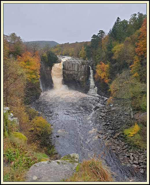
On reaching High Force, a sequence of pictures was taken. When the river is truly in spate, it flows over the entire rocky prominence shown below.


Looking upstream above the waterfall, you can see that when the river is lower it's quite easy to boulder hop to the other side of the river, from where you can descend to the foot of the waterfall and admire it from below. We couldn't do that today and had to be satisfied with our views from the high path on the south bank.


Just off our path, Holwick Head House, accessed via the Holwick road, looked a fairly desolate spot today.


Back near Low Force, we spotted some very healthy specimens of Fly Agaric fungus (Amanita muscaria). Not so healthy for anyone foolish enough to taste it!


Our short outing concluded after a couple of hours, having seen us stroll about 7 km with 80 metres or so ascent.


Some went to Bowlees Visitor Centre for refreshments. Sue and I went home, stopping for a picnic lunch in a sunny spot on the high road to Brough, before enduring more heavy rain on the M6 nearly all the way home.

An excellent weekend, and thanks go to Alison, Sue W, Sue B and Tom, whose photos have enhanced this posting.