Sue and Martin in Mallorca 2019

Sue and Martin in Mallorca 2019
On the Archduke's Path in Mallorca

Saturday 29 August 2020

Thursday 30 May 1991 - A Bike Ride from Dartmouth

 
Here's an extract from a week's family holiday in Dartmouth, recalling a time when the Shogun Trailbreaker bike was only one year old and had only covered about 250 miles. Not to say that it didn't have technical problems!
 
30 May 1991 - A Dartmouth Bike Ride

A short trip around Dartmouth got off to an inauspicious start at Worden, when the chain jammed as I entered a bog. Mud up to both ankles. No cloth. Lots of oil. Shortly afterwards I came across a buzzard searching the ground for food in a little frequented field by some woods.

I continued on and the front pannier did its usual trick of jumping off the handlebars and zeroing the timer, so what is shown by way of statistics is approximate. [And that's why I now use a small rucksack instead of that handlebar pannier, which still lurks in my bike box.]

Shortly afterwards I ignored a 'Road closed' sign and struggled up a really steep hill to find a resurfacing machine completely blocking the high banked lane. On retracing, more hills were encountered before reaching the main road. It was cloudy and cool, though not unpleasantly so.

I missed out a planned visit to Blackawton and headed for Slapton. A car passed just before a pleasantly steep hill into the village - and held me up all the way down, though I did get up to 34 mph. I eventually passed the car when a passing place was needed for oncoming traffic.

Once on the main road at Slapton Sands, I became aware of a strong northerly wind. This kept me to 8 mph until I reached the hill before Strete, where my pace reduced to 6 mph.

A nice run to Blackpool Sands followed, though I nearly misjudged the hairpin bends at the bottom. I had a brief rest at the Sands, and eventually, after waiting for a gent who seemed to be trying to exhaust the kiosk of supplies, I got an ice cream and a Mars bar. Not many people around because of the cool weather. Return to Dartmouth via back roads - Bowden, Venn crossroads, then the white road past the water tower.

Good views of Dartmouth - the concrete wall above our swimming pool at Ford Bank is prominent. Back soon after 1 pm in improving weather.

Approx 18 miles in 3 hours.


This is my best guess as to the route I took.
 
I won't bore you with the rest of the 50 or so pictures or the other diary entries - they have been dropboxed to the participants.

Friday 28 August 2020

Thursday 27 August 2020 - Around Shutlingsloe (yet again)

 
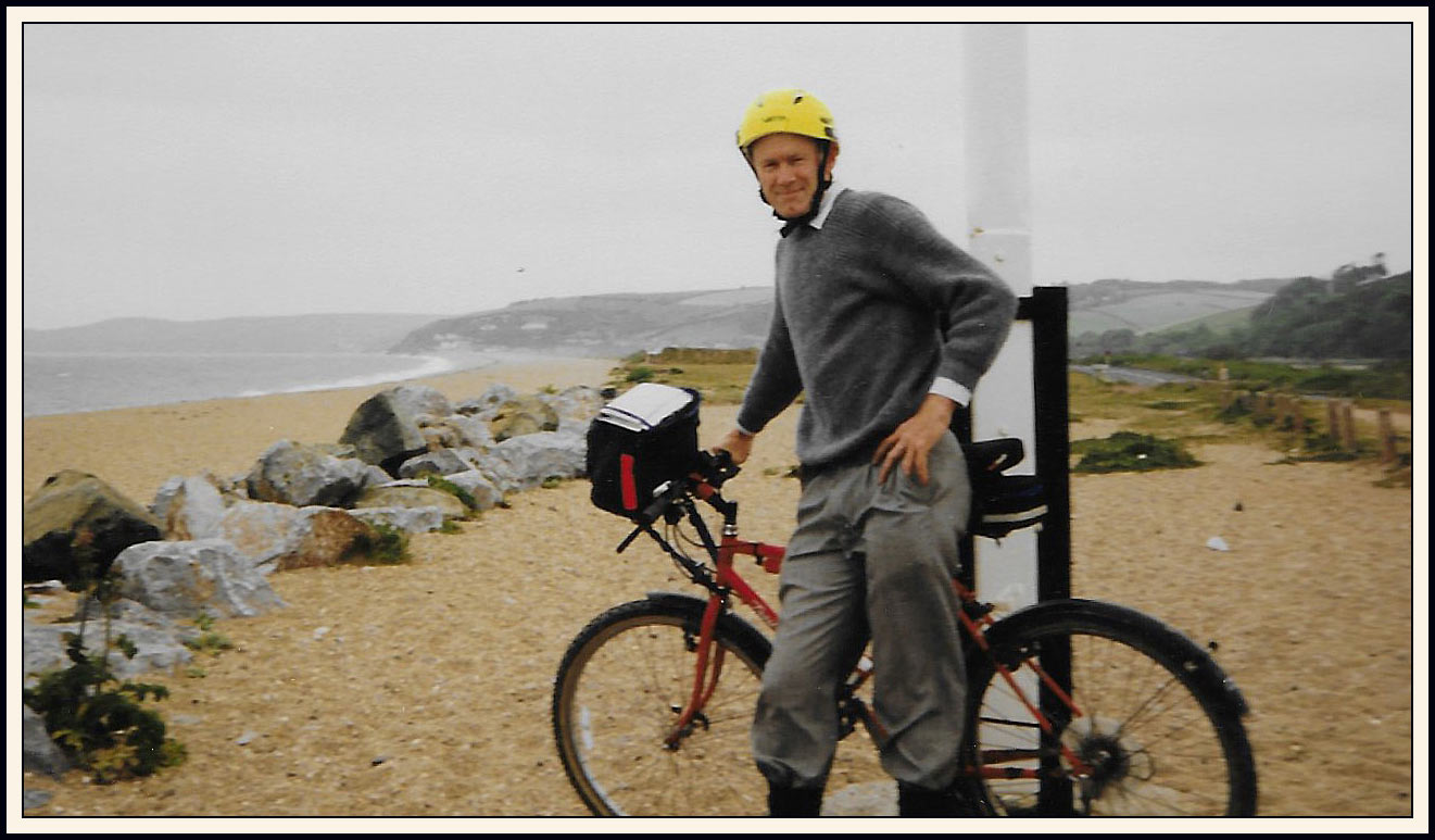
I make no apologies for repeating this excellent walk. We last walked it in the rain on 19 July l2019, but Graeme wasn't present then, and though he knows the area well, the last section of today's walk along the Gritstone Trail was new to him.
 
We've been up Shutlingsloe on numerous occasions since this blog was started in 2007, and you can find most of the reports here.
 
Today we assembled rather late due to a road blockage in Macclesfield and a navigation error on my part. We were thankful that the current intermittently rainy weather took a break, albeit cloudy, from precipitation for the duration of our outing, after which we returned home in a fresh shower..
 
We were soon on our way on the good path around Ridgegate Reservoir, with views back (above) to our rendezvous point at the Leather's Smithy, with its Tegg's Nose backdrop.
 
We soon left the reservoir to the cormorants who were airing their wings, and took to the ascent of Shutlingsloe where kestrels and buzzards rule the airways.
 
Once out of the forest we could look back and admire the purple hue of the heather, sadly not illuminated by the sun today.
 
The next picture (click on it for a better image) shows some of a long row of shooting butts on High Moor, with a line of vehicles on the horizon. A 'shoot' was in progress. We wondered whether it was driven birds or clay pigeons. The slopes of Shutlingsloe don't appear to be home to very many game birds. I can't find evidence of any shooting club in this vicinity, so Graeme's theory that it might be driven pheasants could be correct.
 
 
If you go through the archives, you'll probably find many pictures taken from around this point, on the lovely path that gently ascends this iconic hill.
 
 
On his previous visits, Graeme had noted a possible route to the west, through a Nature Reserve. This probably goes across the area in the photo below that is to the left of the heather, near the green pasture. The white building is Oakenclough.
 
 
As usual, we assembled for photos at the trig point. A grey squirrel frolicked nearby.
 
 
Thanks to Graeme for the next one.
 
 
There was a cool wind on top, so we sheltered just below it, amidst rocks with a view back to Tegg's Nose, for our first elevenses and cake break.
 
 
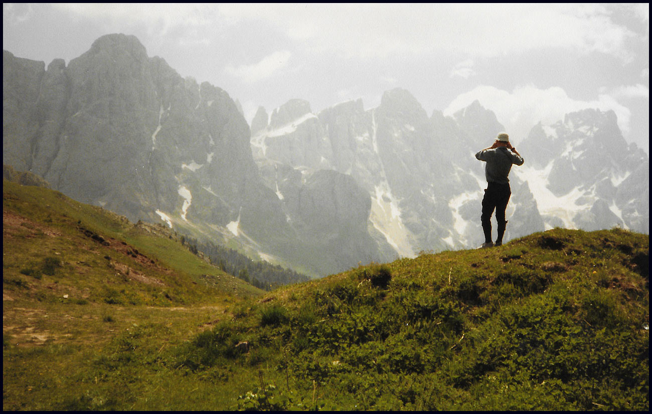
From the top, we admired the view north east, towards the Cat & Fiddle, re-opened during Lockdown, to which we must soon arrange a visit.
 
 
To the south east, the Roaches and Tittesworth Reservoir. Wonderful UK countryside.
 
 
We descended pleasantly to Wildboarclough, where we passed the once thriving Crag Inn. On the blackboard outside 'The Crag Kiosk' was announced as currently being open between 12 noon and 4 pm on Friday, Saturday and Sunday, with the patio open but car park and toilets closed. So, sustenance here for weekend walkers, if no more.
 
 
After strolling through several fields on a well marked path, we emerged onto a lane above Lower Nabbs Farm, where Graeme spotted an entry point to Piggford Moor Nature Reserve. From here you could probably take a direct cross country route over open access land to the summit of Shutlingsloe along the line suggested in the earlier photo towards Oakenclough. Obviously not at times of ground nesting birds. Buzzards mewed, and a kestrel hovered, menacingly.
 
 
Beyond Oakenclough, which is just outside the next picture to the right, we were beyond the boundary of open access land, as per a clear notice that states:
'High Moor Conservation Reserve - NO ENTRY - To protect this reserve this land has not been designated "open country" by the (legislation) so "Right to Roam" access is not permitted.'
This is the area where the shooting was taking place, so "no access for the Plebs, but we'll call it a 'Conservation Reserve' and do what we like with it." Or am I being overly cynical?
 
 
Anyway, the path we were following was delightful, so no need to worry about No Entry to an area we wouldn't want to enter anyway. We continued to the top of the hill for a second tea, coffee and cake break, before descending the walled track to cross a road by the once thriving Hanging Gate pub. It looks little different from a year ago, but there was somebody there, covered in dust, as were the items (such as mountain bikes) we could see inside.
 
 
There's a path that links the pub with the Gritstone Trail. It's in the process of being neatly paved. One day, hopefully, this place will once again thrive. I wonder what input Hydes Brewery have into all this. It's a shame that I've lost contact with Phil Hyde, who used to be responsible for their property portfolio.
 
 
From this spot, there's another fine view of the Cheshire countryside.
 
 
After joining the Gritstone Trail by a familiar 'No sledging' sign, the path passes through lovely countryside all the way back to the Leather's Smithy. Here, it looks as if someone has been practicing dry stone walling on this tiny section of wall that abuts barbed wire fencing.
 
 
Near the end of the walk, an unclear side path to the right leads through a short, deep valley, then rises until the pub comes into view, as you can see it below (far right). At that point we disturbed a herd of red deer, within which a couple of fallow deer seem to have made their home.
 

Here's our route - 12 km with about 400 metres ascent, taking us rather less than four hours on this occasion. The open access land is within a brown border in which Piggford Moor is shown.
 
 
We adjourned to the Leather's Smithy, where we were allowed coffee/tea in the beer garden, but were evicted when it came to eating our 'Take out' bacon butties and burgers! Luckily there are some conveniently placed picnic benches nearby. We wondered about who owns the pub - brewery or private family? Their website doesn't elucidate, simply stating:

Dating from the 18th Century and standing in beautiful surroundings on the edge of Macclesfield Forest and Ridgegate Reservoir, this stone building inn formally a smithy gets its name from William Leather, a local Farrier who in 1821 obtained the first license to sell ale and porter. His portrait can be seen on the pictorial sign.

I hope this report is sufficient for my readers, including Graeme's sister Maureen, and his children. Feel free to comment; it's always nice to hear from readers....

And finally, we discussed the Langley 11, on which I reported here, for anyone who may be interested.

Finally, Graeme has provided a 'must see' link to five minutes of unmissable music. Thanks Graeme, it's great.

Thursday 27 August 2020

Wednesday 26 August 2020 - A Bike Ride to Rawtenstall

 
This bike ride was from Bacup, not Timperley!
 
Jacob and Kate led me down the good bike tracks from their house at the top of Bacup, to the end of 'off-road ' near the centre of Rawtenstall, where they are pictured above after 10 km of mainly downhill riding.
 
Meanwhile, Sue was in charge of Jessica and Rocko, the dog that is terrified of strangers.
 
 
The bike route follows, in the main, the ongoing line of the railway that has been restored between Bury and Rawtenstall. At one point the cycle track goes through a factory, and there are a couple of good tunnels.
 
 
We managed fine for two thirds of the return journey. Then we stopped at Stubbylee Park to play in the skateboard enclosure - which can also be used by bikes, etc, before moving on to Moorlands Park. This park has all manner of swings and slides and roundabouts, etc. Sue and Jess had made their way there, and after an afternoon of fun they drove home, leaving me and Jacob to pedal back - Kate having already left to take up dog duties.
 
This last section is rather uphill. Jacob did manage to cycle all the way, in brief sprints between long rests. Ah well, he's only 9.
 
 
Here's our route (click on the image) - 20 km with 300 metres ascent, in an afternoon.
 
 
Later, Sue and I enjoyed our first meal out since the start of Lockdown in March, with a £20 discount thanks to the Government trying to help the restaurant trade get back on its feet.
 
We walked (we haven't used the trams since March for Covid reasons) into Altrincham to the Nahm Prik establishment. They took social distancing seriously, and the food was excellent, as shown for example, by our starter for two.
 
 
Delicious.

Wednesday 26 August 2020

Recovered!


I've not much time tonight, but am pleased to report that Jessica seems fully recovered from her broken leg, as illustrated in today's picture.

Well done Jess, and do take care...

Tuesday 25 August 2020

20 July 1989 - Alta Via 2 - Day 6 - Rif Fuchiade to Rifugio Mulaz

Leaving Rifugio Fuchiade
 
Thursday 20 July (Diarist: Dave)

A restless and stuffy night was had by most of us. Unfortunately every time Dave turned over (~ 10 times/ hour) he kicked the window shut. An interesting problem here is that the ladder to the top level blocks the route to the shower and toilet and to get there you have to crawl under the ladder. This will no doubt bring masses of bad luck to Dave - who was constantly coming and going.

Simple breakfast of bread, jam (plum) and coffee/tea.

Off by 8:10.
Walked down road to Passo di San Pellegrino.
 
Typical meadow, dominated here by yellow rattle
 
John in trainers. We were joined by our friend from Hull. At the pass, Laurie and Martin B bought maps.
 
 
Set off from car park. Before we could get to our path there was an electric fence to negotiate, with a sort of gate.

John went over the fence, Martin B went over the bar. Laurie and Martin W discovered that the bar was hinged and walked through. Didn't tell me, did they. When I arrived they told me to watch the electric fence at the top, so I crawled through, much to the childish amusement of Martin B and Laurie.
 
 Dave is not amused, the fence is to his right - how could he miss the 'hidden' hinge?


Easy path until a junction. John went wrong and had to retrace. After a while the path became a ski piste. Really vile scree. Best over quickly, then there followed an easy route to Passo di Valles (2031 metres).
 

Ice creams and cappuccinos all round. The advertised St Bernard's dog made an appearance. Also two goats and a tethered long eared lamb - a hit with the kids.
 
 
Headed up to Forc Venegia. Good gradient.


Leopardsbane
 
Alpine toadflax
 
Stopped for a brew (Dave had two) and food. Much amusement at Laurie's suntan oil placemat.
 
Forcella Venegia
 
There then followed an outstanding path to Passo di Venegiotta. Many stops for good views. Good speed. The path went from valley to valley, up and down a fair bit, but still an excellent path.


One dodgy bit in an area of rock falls. At John's request we went through this bit very quickly. Two small obstacles followed, with wire rope. No great problem - lots of sadistic photos. Then a sharp climb up for many hundreds of feet - again several stops. Finally at the top we saw the hut - Rifugio Mulaz.
 
 
No campsites (except for the desperate), so we decided to stay in hut. Arrived at 4 pm, about an hour ahead of 'standard time'.
 
 
After arranging our accommodation we went up Mt Mulaz (2904 metres). Superb views. Many photographs.


Pleasant to climb without packs. Back down. Dormitory very crowded. Beds with no gaps. Reminds me of Austrian huts. Looks like we will have a large dog for company.

Problems with ordering food - helped by English speaking guest.  Minestrone / spaghetti / meat and beans and salad. More cheese for Martin W, and coffee.

John complains of no pudding. Lots of cigarette smoke in unventilated room.

Very early night (9:30). Dog slept in the room.

An outstanding afternoon's walk - good, well-marked path and very good views.


 Here's our route - 19 km, with 1500 metres of ascent.