Sue and Martin in Mallorca 2019

Sue and Martin in Mallorca 2019
On the Archduke's Path in Mallorca
Showing posts with label Silverdale. Show all posts

Sunday, 15 June 2025

Thursday 5 June 2025 - Silverdale


Andy W joined me and Sue on this long overdue visit to one of our favourite places, Silverdale. We parked at RSPB Leighton Moss and enjoyed their coffee and cake whilst waiting for the rain to abate. Donning of waterproofs at the start of our walk did the trick. After that there was just one light shower all day.

We paused in the public hide on the causeway, where the view was pretty ordinary - just a variety of common ducks and gulls in the middle distance.


However, on the path that leads out of the reserve towards Leighton Hall, the fog-horn like call of a bittern drew our attention as we passed some friendly swans.


A sharp gradient took us past Leighton Hall and up the hill towards Yealand Conyers via a convenient bench, on the designated path past cows and sheep.


There's a good view back past the hall to Morecambe Bay.


The path we needed involved a right turn just beyond a large cairn.


Heading downhill now, we passed an old kiln before heading into the woods towards Crag Foot.


We chatted for a while with a couple heading in the other direction on a route that was partly the reverse of ours.


Descending to Crag Foot, there are good views over the wetlands of Leighton Moss.


Crag Foot appears to be on the boundary of the Silverdale district.


A pleasant coastal walk took us towards Jenny Brown's Point, before which we reached the chimney that we used to think was part of a lime kiln. An alternative theory has now been put forward, as explained on a helpful information board. (Click on the image for a better version/slideshow.)


After enjoying our lunch beside the chimney sheltered from the cool breeze, we continued to Jenny Brown's Point, where the remains of an embankment stretch out across the bay.


There's currently a major construction site on the quiet lane that leads past Gibraltar Farm to the Wolf House Gallery.


These rental properties  at the front of the gallery conceal work which is going on in the gallery which is currently closed for the renovations to take place.


Someone at Gibraltar Farm has produced a lovely sign that advertises their eggs.


I used to bring the children here for a camping experience (there's a children's playground and pub nearby) - the facilities were minimal and you could just roll up and camp anywhere in the big field. I suspect booking is now advised...

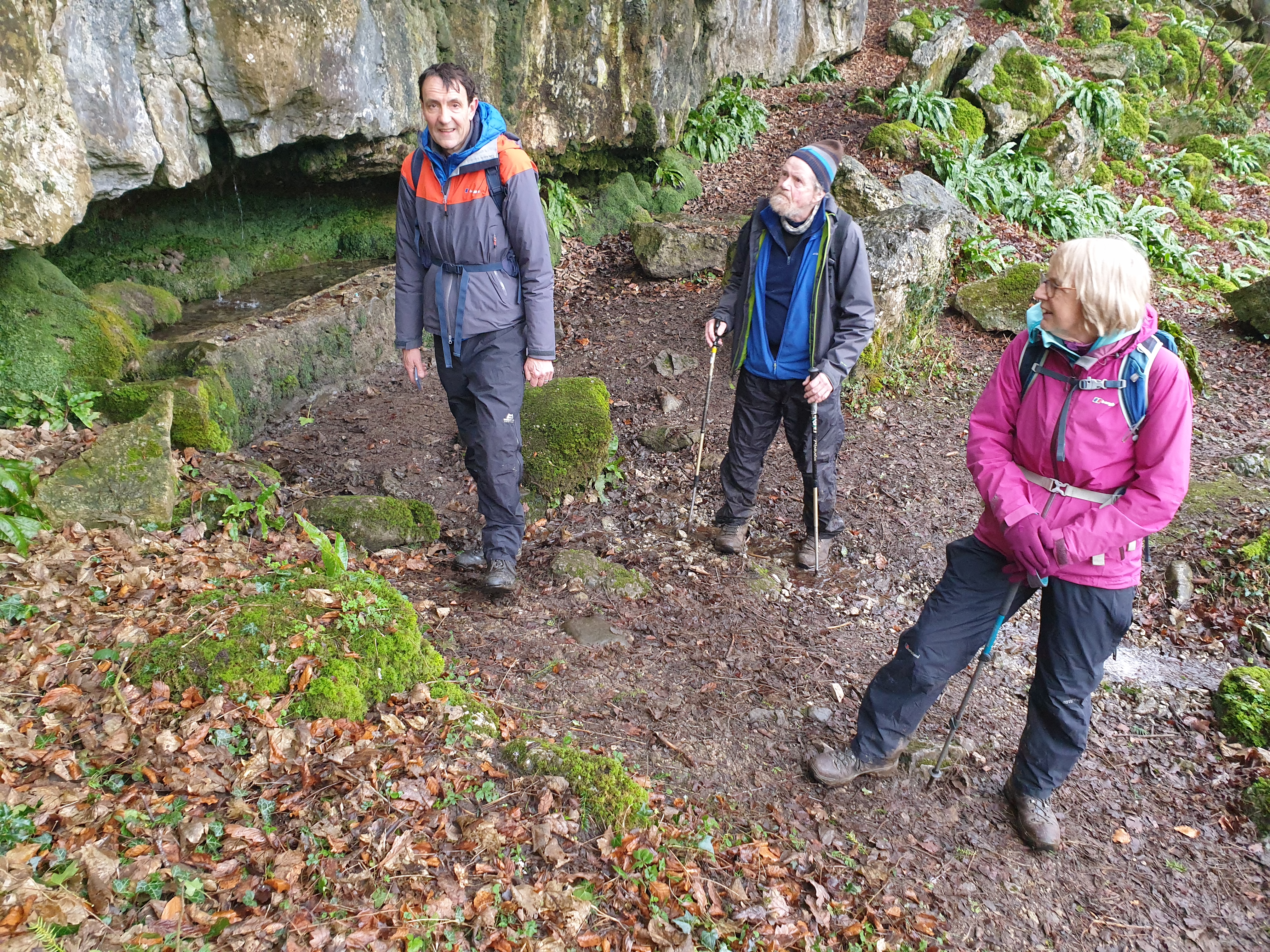
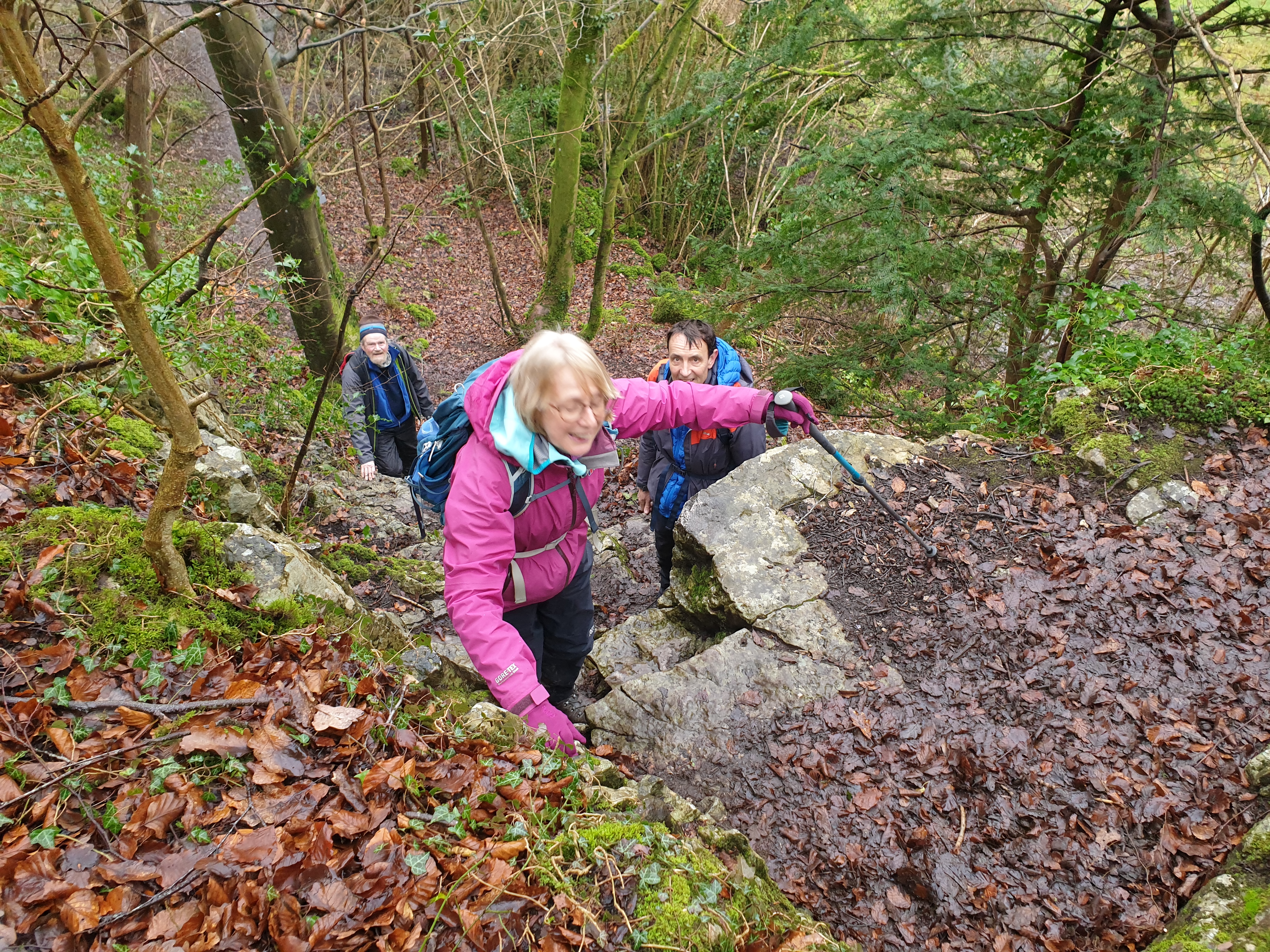
Anyway, we passed the gallery entrance and strolled up the road to a path that leads to Wood Well, where the water drips from the roof of a small recess in the base of the cliff and is collected in a small trough from which it flows into a large basin used originally for watering cattle.


We continued past a brand of Martagon Lily and some nice properties, to a left turn that took us down a back ginnel of Silverdale to the shore road.


The tide was out, so we enjoyed a stroll on firm sand to The Cove, where Sue and Andy explored the small cave.


Then it was up the lane and a right turn to Elmslack, where Elmslack Well is hidden behind a litter bin (as it has been since I discovered the beauty of this area in the 1980s).


The  camera went away for a while as we made our way across the railway and past Waterslack to Hawes Water.


On the approach to Hawes Water we passed what I can only describe as a 'curious stone building', suitable as a lunch hut. My 1986 Cicerone guidebook describes it as 'ruined', which it is no longer. A fine place for lunch on a rainy day.


With the camera out again, a sense of mystery as to the interior of the building, and Andy's lost foot.


Ah, that's better.


Rounding Hawes Water, we passed several properties and acquired some duck eggs for a small donation (they were delicious). After a campervan park we passed a campervan that was perhaps what motivated the farm to set up the park. This van is over 50 years old and perhaps not such a good advertisement for the park.


That took us to Red Bridge, where a wrong turn then led us into Trowbarrow Quarry, now disused and apparently a haven for rare plants such as Bee Orchids and Fly Orchids. Sadly we could find neither, despite a search.


There are climbing routes here, and Orpine flourishes.


The path back to the RSPB reserve is inhabited with curious robins.


That was a lovely walk of just over 18km, with 300 metres ascent, taking a little over 5 hours. Here's the route.


Apologies for the delay in this posting. It has been a busy week with no time for diary entries, which should now follow in quick succession.
Note that this posting just touches the surface of the interesting Silverdale area - other postings with more information are here.

Wednesday, 13 December 2023

Tuesday 12 July 2005 - Silverdale

 Here's the result of indexing a few old pictures:


On return from Geneva (see here), Sue and a colleague, Richard, on a month's visit from Perth, Australia, and I enjoyed one of Sue's excellent veggie lasagnes before heading up to Leighton Moss for a 7:30 start on a lovely warm summer's evening.

We went down to the public hide and saw mainly Coots, Mallards, and Black-headed Gulls. A Coot with very small young, looking after them on her own. All very relaxed.


Then, a diversion whilst we wandered around a disused quarry, before getting onto the correct path to Hawes Water.

This was Trowbarrow Quarry, which has some interesting climbing routes. I've posted the next picture before, here, by way of a report on a blunder. Note the comments.


Whilst we had passed through an area of serious mosquito infestation, beside Hawes Water bikini clad women were enjoying an insect free barbecue! 

We continued on, the sunset being nice but not spectacular given the clear sky (I failed to take a photo due to problems with my new Canon Powershot S70 camera - the shutter intermittently fails to open).

 Then through fields of buttercups to reach the church at Silverdale.


We adjourned to the Silverdale Hotel for drinks outside, near a large party of people. Still very warm here - 9:45 to 10:15.

After that a stroll back to the car in the dark along the road, and home around midnight after dropping Richard off at his rooms at the hospital.

Here's the 10km route.

A lovely evening, if not the best route in the area.

Saturday, 11 February 2023

Friday 10 February 2023 - The Wells of Silverdale


I had the pleasure of the company of Carol, Keith and John (aka BC) for this stroll on an overcast, slightly drizzly day. I'd done this walk before (see links at the foot of this posting), but not for a while.

We met at Leighton Moss RSPB, where Keith and Carol (not members) were treated with disdain and told to leave the car park. Martin and John (both members) to the rescue - "they are with us".

A short walk past Silverdale station brought us to the small pond formed by our first well of the day, Bank's Well.


The house opposite has a quaint letterbox.


Dogslack Well was our next objective, along a path with an unknown destination (the pamphlet says 'retrace' but I think we should have continued along the path). Anyway, the pump has lost its handle since we were last there.


Retracing our steps to The Row, we continued to a good parking spot (especially for RSPB non members), then a path across a traffic lighted railway crossing (that's new) to Waterslack and around Middlebarrow Quarry to Arnside Tower.


John and Keith plod their way up to the remains of the tower

Through a mobile home site and then pleasant woodland, to Elmslack, and our third well. Elmslack Well is situated under a litter bin that was carefully removed by those wanting pictures of all seven of today's wells.


Next, we wandered down to the cove, in search of Cove Well. The next picture confirms that there is now little (no) trace of the old well. Here the well would comprise a spring arising from the main water table, whilst most of the other wells on this walk are in essence springs rising from perched water tables. It's all to do with the differing permeability of the layers of rock.


Here's the view to Grange over Sands. (Honestly.)


I tried walking along the beach - the tide was out, but the beach surface comprised glutinous mud, so we changed tack and went past the blown woodland pictured below, then through the fields known as The Lots, to Silverdale village.


Bard's Well, pictured below, is on the beach beside the car park. Clothes used to be washed here. The well (spring) doesn't flow in dry weather. The weather is dry(ish).


In search of Bard's Well

The walk back up to Silverdale village took us to a path to Wood Well, where a special tree provides a habitat for hawfinches (we didn't spot any). Water drips from the roof of the small recess in the base of the cliff - clearly shown in this picture.


The water is collected in the small trough shown below (it's empty due to the dry weather). Then it flows into the large basin visible in both pictures. This was used in the past for watering cattle.


With Wood Well at our backs, we surveyed the next section of path.


I'd included this path on our route in order to try to please John (BC - 'Bowland Climber). He is sadly not at the peak of climbing fitness, but we did all make it up safely.


Our route then progressed through Silverdale Green and along a signposted path to Burton Well, which was just as green as it had been when Sue and I visited it in December.


Burton Well supplied water to the local residents for many years, until they fitted gutters and downpipes to their homes and collected rainwater, stored in basement tanks.
 
Beyond this last (seventh) well of this visit, lies the rather damp expanse of Lambert's Meadow, a haven for wildlife and home to orchids. Our path, on the right, took us back towards Bank Well and the start of our walk.


Earlier reports on similar excursions are here (21/11/08) and here (20/2/13).

Here's today's route - about 11km with 200 metres ascent. It took us nearly three and a half hours.


Then I enjoyed lunch in the RSPB cafe with Keith and Carol, before paying Conrad a visit in Arnside, whilst BC visited another friend who lives nearby. 

A very pleasurable morning stroll... - BC's excellent commentary is here.

Next Week - Friday 17 February:
Bollington - a 10km circuit via White Nancy and the Saddle of Kerridge. Meet at Adlington Road car park in Bollington (SJ 930 780) at 10am