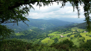
Sue and Martin in Mallorca 2019

Sue and Martin in Mallorca 2019
On the Archduke's Path in Mallorca

Saturday, 20 June 2015

Friday 19 June 2015 - Pyrenees GR11 - Day 5 - By Argintzo (1150 metres) to Burguete (900 metres)(Hotel Loizu - end of Stage 4)


Distance: 26 km (Cum: 105 km)

Ascent: 1100 metres (Cum: 4800 metres)

Time taken: 8 hrs including 1.2 hrs stops (Cum: 35.1 hrs including 6.6 hrs stops)

Weather: woke in a cloud, spent most of the day in a cloud, rain all day (what do you expect from a rain cloud?)

It took me an hour and a half from waking at 7.20 to leaving the campsite with a view I never saw, partly due to faffing with emails and other stuff in the confines of the tent.

I'm sure there were great views from today's high ridges, but the Basque country likes to keep its little secrets.

I made my way uneventfully over well grazed turf, following waymarks that appeared through the mist if you looked ahead with optimism, to reach the road at Puerto de Urkiago in a little over two hours. This is the end of Stage 3 in my guide book, but there are no facilities and wild camping would be difficult. There is accommodation, with free transport, at a hostel 6 km down the road.

The woodland path from there passed some impressive concrete bunkers. One of them comprised a tunnel about 10 metres into the hillside, then a right angle turn to 50 metres more tunnel, and given the presence of padlocked doors I suspect it was much more extensive than that.

Nearby, two men were chopping their way through a vast pile of logs in the rain.

The path rose to over 1200 metres again. Not a pleasant place to be today, albeit only a t-shirt was needed under the waterproof jacket. The slithery plunge through steep woodland to the Barrack Odia wasn't all that pleasant. Nor was the bridge at the bottom - shaped like the top of a small sphere, I had to hang onto slippery wooden railings to avoid sliding down from the apex.

Soon after that, Albergue Sorogain provided a hearty eggs and ham lunch, the energy from which I needed to get through the rest of the day.

First, there was a fairly brutal ascent to the top of a hill at 1181 metres. Then, and this will amuse Gibson if he turns to page 54, I mistakenly navigated from the top half of the page, not realising that was the morning's route. I even noted some 'incorrect' heightings! So I was on line 9, turning right and dropping down steeply when I should have been going straight on. I bumbled about for quite some time, gradually getting more frustrated until after half an hour I realised my error and returned to the fence with a stile. It didn't help that my GR11 strip map shows an old route that I may have been on, but even that is no excuse for heading west.

The  summit of Menditixipi, at 1213 metres, may be a good viewpoint. I was there but I wouldn't know.

Soon after the less than dramatic summit I got a shock. Having seen nobody all day, I suddenly found myself walking next to another rucksack clad hiker. This was Mitxel (Michael in Basque). He is on his first long walk at the age of 60, having got his children off his hands and sent his wife to work (the latter are not his precise words). He is ardently Basque, living in Bilbao, whose football team he admires. We walked and chatted all the way to Burguete (also known as Auritz, its Basque name). Mitxel walks a bit quicker than me and his English is good but limited, so whilst we may not walk together again we may enjoy the occasional encounter. His ardent Basque identity contrasts with my comfortably regarding myself as European.

I found the Hotel Loizu and Mitxel went off for a beer, then he may sleep under a plastic sheet in the churchyard. He says he is not strong enough to carry a tent.

Washing is done and hopefully drying, and it's now time for dinner.

I hope to be able to transmit this sometime, but my emails and Internet connection aren't currently available - it seems the server doesn't want to talk to me. 'No response from server' is the message I get. But if this does ever see the light of day I must have got a response!

Today's pictures:
A typical hunting cabin scene
Mitxel on the descent to Burguete

Next Day - Day 6

Back to Index

Thursday, 18 June 2015

Thursday 18 June 2015 - Pyrenees GR11 - Day 4 - Collado de Iñaberri (795 metres) to just below summit of Argintzo (1150 metres)


Distance: 22 km (Cum: 79 km)

Ascent: 1160 metres (Cum: 3700 metres)

Time taken: 8.3 hrs including 2 hrs stops (Cum: 27.1 hrs including 5.4 hrs stops)

Weather: woke in a cloud, overcast all day with cloud base 900 metres, hence camping in a cloud tonight

Another good day's walking on excellent paths. If anything I prefer this route to the French one, but are the first few days quite tough compared with the HRP and GR10, or am I feeling my age?

Waking in a cloud doesn't do much for inertia. So today I found enough to occupy me for two hours before leaving after a chat with Carol and Tobi, who were even more leisurely than me. I set off along the track without a care in the world (as they say). Soon I did care about the fact that I was heading west rather than south. Rather than continue towards the coast, which I thought had disappeared for good once I'd left Irun, I returned to the two campers to find them quizzically looking at their map trying to decipher the route and wondering why I'd continued along the track.

The GR11 signpost appeared briefly through the cloud. Problem solved. I'll try to be more careful in future.

Pleasant woodland paths with lots of bracken led eventually to a picnic spot that would have been much too far to go to fetch water for our campsite. I continued past Bell Heather, Brambles, White Clover, Trefoils, etc and down to the small town of Elizondo. The supermarket provided a few items that were running low, and a later than usual visit to a coffee shop saw me enjoying a hot sandwich rather than a croissant with my 'café con leche por favor'.

From that café, on the corner where GR11 heads right, I went up past the church, after which a relentless ascent climbed over 900 metres up old packhorse and hunting tracks past orchids and tormentil to the cloud in which I'm now ensconced. It's pleasant enough - I just can't see anything. It's another 'dry camp' to which I've had to bring enough water to last the night. I only had to carry it for a steep thirty minutes today.

On the way I passed a few of the 600 or so boundary stones placed across the border with France in the 1860s. That was after the Treaty of the Pyrenees was signed in 1659 to end the 1635-1659 war between France and Spain, but the border wasn't properly settled until the Treaty of Limits in 1856.

Interestingly, the only views today from the high ridges, albeit limited, were into France. Spain was completely engulfed in cloud. It's usually the other way around. But I suppose this is the Basque country.

Other features of the day:
- Goldfinches in the hedgerows and more vultures and kites and other birds of prey.
- A lone person ahead of me - true or was it an illusion? There are quite a few footprints in the ubiquitous mud.
- Two backpacking girls coming the other way at Collado Zaldegi. "Where are we?" They spoke English; I spoke 'map'; everyone was happy - but I didn't envy them the long walk down to Elizondo! They should be there by now.
- Above 900 metres, above the tree line, in the mist... just like the Yorkshire Dales. Why have I come all this way just to see countryside like mid Wales or Yorkshire?

Today's pictures:
From the descent to Elizondo
Woodland *
Border stone 129 and the view into France

* At this point, despite the mist, I felt at one with the world. Warm, dry, knew where I was, with others to find me if I slipped (which I immediately demonstrated), in beautiful surroundings. ..etc

Have I only been walking for three days? It seems longer!

Next Day - Day 5

Back to Index
   

Wednesday 17 June 2015 - Pyrenees GR11 - Day 3 - Collado de Telleria (415 metres) to Collado de Iñaberri (795 metres)


Distance: 31 km (Cum: 57 km)

Ascent: 1500 metres (Cum: 2540 metres)

Time taken: 10.4 hrs including 2 hrs stops (Cum: 18.8 hrs including 3.4 hrs stops)

Weather: overcast, turning to sunny periods; perfect walking weather

After yesterday's deluge it was nice to wake to the sound of .... nothing. Camping next to a cattle grid had produced the inevitable - a flock of sheep who would prefer to be the other side and were going to broadcast that fact as loud as they could. It was quite amusing although I was on the same side as the sheep, who eventually wandered off into the rainy night.

It took me just an hour from getting up at 7 to leaving at 8 for the pleasant ridge walk down to Bera, a sizable town.

Jays were floating in and out of the trees, whilst Griffon vultures were gliding above them. They came very close. I must have looked like carrion...

I stopped at length in Bar Miljar in Bera, after entering the town via an ancient bridge with a memorial plaque to the men of the Rifle Brigade who died defending the bridge from the French in 1813. Avenues of plane trees then led to the town centre.

Socks and trail shoes, soaked from yesterday's rain, were slowly drying, and a sort out in the café failed to reveal any other wet items. The 'new dry bag every year' policy had worked. The Keen trail shoes had kept my feet dry for most of the day but had given up towards the end.

From Bera, a hot ascent to the summit of Santa Bárbara had the sun tan cream out for the first time. Shorts and t-shirt had been deployed early on and were ideal for today.

The paths were excellent. Most would fall into 'bridleway' or unsurfaced lane categories in the UK. A few motorbikes and trial bikes were using them. Fair enough, the riders were polite.

Hunting towers, rickety as ever, appeared at intervals, as they had yesterday in this rolling, forested landscape that always reminds me of mid Wales.

A couple of day walkers were seen after I'd lunched on a grassy sward beside a track lined with foxgloves and lizards. Then I came across a couple, relaxing in the grass below the Usategi bar-restaurant (closed), a give away Cicerone guide beside them. Tobi is from Germany and Carol is from the USA. This is their first major backpacking trip so they are learning as they go. They set off on GR11 on Monday, but had a very short day yesterday after they reached Bera during the deluge and had the sense to find a hotel.

They are camped next to me tonight on this broad col where my tent is shown. It was well worth carrying an extra two litres of water for three hours to be able to halt at this splendid spot. Though (and Conrad's right) I do hope the jangling horse bells will take a break at some point - or maybe they'll just lull me to sleep in the absence of the sound of running water. The shepherd has visited and he doesn't seem to mind us being here. "Aren't you cold?" he asked!

Both vultures and red kites are investigating our presence.

Other features of the day:
- The route is very well signposted - a map is arguably superfluous as each turn is also described in the Cicerone guide.
- Eyebright and Mullein lined many of the hedgerows.
- Black redstarts and many other small birds appeared to cheer as I passed their gorse top perches.
- Horse flies were briefly encountered; the first of many? Thankfully both campsites have been insect free.

Next Day - Day 4

Back to Index
 

Wednesday, 17 June 2015

Tuesday 16 June 2015 - Pyrenees GR11 - Day 2 - Prologue, then Cabo de Higuer to Collado de Telleria


Distance: 26 km (including Prologue: 4 km)

Ascent: 1040 metres (Prologue: 40 metres)

Time taken: 8.4 hrs including 1.4 hrs stops (Prologue: 1.4 hrs including 0.4 hrs stops)

Weather: light rain at first, deteriorating to monsoon like conditions; I noticed the temperature was 11C at one point, though it's a comfy 14C in the tent at 8pm, still raining but the blackbirds are singing

After yesterday's 22 hours of more or less constant travel, and the euphoria of arrival into a small but perfectly formed bedchamber and an excursion to a classy eatery, today was somewhat of a contrast. After two days of very little exercise, any shortfall on that score was certainly eliminated.

I took my time getting sorted out after a good sleep, then wandered down to a café for coffee and a croissant. My waterproof jacket was soon needed, but the trousers remained stashed until after I'd officially started GR11 from above the beach beyond the lighthouse. The lighthouse, pictured, is about as close as you get to an official start.

There were luscious strawberries and banks of a white flower with just three petals and dark green leaves. Dripping. (Perhaps a Trillium [a North American and Asian plant] escaped from former ornamental gardens?)

By the time I got back to Hondarribia I was also dripping. I sought refuge in another café for half an hour - enjoying one of the biggest and best chocolate croissants that I can recall.

That was after finding a hardware shop (Marinel) that sold me a large tub of camping gas, thus obviating the need for an excursion to Decathlon in Irun. Very handy - solving the only ongoing problem from yesterday's Eurostar delay. I had been planning to buy the gas after my original train had arrived in Irun, before going to the hotel.

It won't take long to relate my encounters after leaving the streets of Irun and lunching under a motorway bridge in view of the first GR11 information board I'd seen. One mountain biker passed me, and I passed a small tent near one of several totally deserted picnic grounds. That's it.

The camera was stashed in a waterproof bag fairly early on, so there are no  photos between Hondarribia and Ermita de St Antón, where a covered seating area enabled me to sort my map etc out in the dry. Here I decided to fill my water bottles and walk up what appeared to be a stream bed but was possibly a path, to the col where I'm now camped in the shelter of some trees. I could have continued to Bera, but I'd have arrived late and maybe have struggled to find adequate lodgings. Anyway, I fancied camping despite the weather, and my food mountain could be reduced.

The views may have been good, had the cloud base been higher than 200 metres. When it did clear a little through the rain there were mainly steep sided hills clad with trees and a liberal daubing of mist. Quite atmospheric really...

Cattle cowered next to cow sheds, but on the way to this col I passed a group of goats and Shetland ponies who looked a bit more cheerful. They'll probably visit me tonight...

Unfortunately the Solar Competition tent pitches tent first, so whilst it was only subjected to the deluge for a minute or two, there was quite a lot of mopping up to be done once the flysheet was in place and the rucksack was inside.

Anyway, that's all done, it's now 8pm and I've succeeded in reducing the weight of my load a little. It seems to be getting dark so I feel a long sleep coming on.

Next Day - Day 3

Back to Index

Monday, 15 June 2015

Monday 15 June 2015 - Pyrenees GR11 - Day 1 - Getting to the Start


Weather: cloudy until south of Paris, then light rain, then vaguely sunny, then a showery evening

I set off from Timperley at 10.30pm last night. It was strange to be without Sue. Quite different from the feeling when she went home from Luchon in 2013, leaving me to continue along GR10 with Graham.

The midnight bus to London Victoria from Chorlton Street turned out to be tolerable. The brand new bus arrived in London an hour early, at 5.30, despite pausing between 2 and 3am in Birmingham.

That gave me lots of time to squander with a coffee etc before hopping onto the 7.55 Eurostar to Paris.

'Henry in Trouble' - I remember reading a Thomas the Tank Engine story in which Henry breaks down and Thomas comes to the rescue. We could have done with Thomas today. By the time our broken Eurostar had limped back to St Pancras and we'd transferred to another vehicle we had lost over an hour and there was no chance of me getting my connection to Irun.

Eventually we arrived in Paris nearly two hours late. There was no hurry for me as I was told the next train to Irun was the overnight service leaving after 9 pm and taking twelve hours. So much for tonight's hotel booking.

My ticket was endorsed by the guard 'Eurostar delayed - Hop on the Next Train' and I used a left over Metro ticket (thanks David R) to get to the Montparnasse station. Waiting to get a replacement ticket to Irun, I spotted a '14.21 - Hendaye' about to depart. Hendaye is very close to Irun - an acceptable destination. After some debate with the ticket clerk and her boss it was agreed that I could travel on this more expensive route via Bordeaux. Within minutes, a long afternoon in Paris and a second night of travel had been replaced by a TGV whizzing through the damp French countryside.

Hendaye is on the French side of the border with Spain, south of Biarritz, with Irun very close across the border. I expected a short taxi ride to deliver me across the border and through Irun to my hotel, Txoko Goxoa, in Hondarribia. And it did just that, together with another English chap on a work visit who turned up just as I was negotiating with the driver.

Great - I made it in time to have a good chat with 'Patchy' at the hotel, then get some dinner at his recommended restaurant, Zuloaga. (I can't get used to these weird Spanish names.) These days I find it handy on such trips as this to spend the first night in a hotel where I can spread everything out and change my rucksack configuration from 'travel mode' with everything including walking poles inside the sack, to 'walking mode' in which many items such as water bottles, waterproofs and snacks are more to hand.

Gear for this trip is trusty old gear apart from some new Berghaus Paclite overtrousers that I know from previous experience will be ideal.

Dinner was excellent - cod croquettes, perfectly cooked hake in green sauce with clams, washed down with half a litre of nice rosé, etc. It's a 'good food' destination.

I didn't get much chance to take pictures today, not really being in the mood until I reached here, so they comprise Hondarribia's walls and harbour, and a rather uninformative snap of my gear, most of which is unidentifiable in bags. The psychology behind the picture is the weight involved - over 15kg. If I brag about it perhaps it won't seem so heavy!

Next Day - Day 2

Back to Index
    

Sunday, 14 June 2015

Another Pyrenean Adventure

1400pyrenees

In a few minutes I’ll be embarking on another Pyrenean Adventure, this time on the Spanish side, in an attempt to walk from the Atlantic to the Mediterranean, mostly along the GR11 waymarked route, if I can find it.

I’ll try to report in the usual manner as my journey, for which I’ve allowed nearly eight weeks, progresses.

1401map

Next Day - Day 1

Back to Index

Friday 12 June 2015 – Hale and Knutsford, A Walk with JJ

1216melchett5

This was a stroll at the behest of JJ, at short notice, taking advantage of the last of our summery weather for a few days.

JJ called for me around 7.30 and we were on our way from Bankhall Lane in Hale by 8 o’clock. A broad path led to a footbridge over the M60 motorway.

1202ashley

Various brooks drain into the River Bollin. This is Mobberley Brook, crossed twice today.

1203mobbrook

Whilst JJ disappeared with a shovel, I tried to use the Canon G16’s macro facility, failing spectacularly apart from this image of a bramble flower.

1205bramble

I now have some instructions from Sue, so hopefully the next outing will yield better results.

Spring has matured into summer, as indicated by the uniform green of trees such as these lining the northern driveway leading to Tatton Hall. The screeching swifts that live under our eaves, and the lonesome lady mandarin on the nearby canal are also a sure sign of summer.

1206tatton1

DoE Award camp? We didn’t find it!

1207tatton2

A convenient bench allowed JJ to show off his latest award.

1209jj1

There was lots of cake. It all got eaten.

1210jj2

We continued our stroll along the eastern bank of Tatton Mere.

1211melchett11214melchett4

Here’s the team, on a lovely morning.

1215group

The Canada Geese have enjoyed their usual breeding successes.

1220tattonm1

We entered Knutsford by the back door and knocked up the first house we came to. The residents were munching their muesli whilst wiping the sleep from their eyes, but mugs of coffee were produced and JJ and I were treated like family for half an hour.

Thanks, Linda and Brian, for your unexpected (you, me but not JJ) hospitality.

We returned by a more easterly route through fields of buttercups, a riding school, and crops through which the farmers hadn’t really left much space for a footpath.

1226crop2

Mobberley Brook was again crossed by a rickety footbridge.

1227bridge

Field paths led us past the impressive building of Arden House. I tried to find out who owns it, but could only discover that in recent years the six bedroomed mansion has been offered for rent at about £5000 per month.

1228arden

We were back in time for a welcome pint at the Moss Trooper before returning home for our lunches and other duties.

Here’s our four and a half hour route - 19 km with 190 metres ascent.

1299route

A splendid morning. Thanks, JJ.