Sue and Martin in Mallorca 2019

Sue and Martin in Mallorca 2019
On the Archduke's Path in Mallorca

Friday, 30 May 2025

Friday 30 May 2025 - Ben Tianavaig


Others went back to the Cuillin ridge or to the Quiraing, whilst Sue and I paid a second visit to Ben Tianavaig, some 20 years after our previous visit. That one was marked by long waits for my former work colleague, Garry Scholes; today it was me who was slow.

This time we passsed some guilty looking deer before starting up from Tianavaig Bay, whereas last time we started from Penifiler, so whilst Sue had no recollection of the previous visit, it was irrelevant as the only common point with today's walk was the trig point.

The picture above is just a reminder of the lush foliage at the start and finish of the walk. We were soon rising gently up the southern flank of the hill, amongst Ring Ouzels, Wheatears and melodious Skylarks.

There were a dozen or so folk on the hill this morning; various nationalities and a resident of Dunvegan with her North Devon parents.


As summit photos were reciprocated we listened attentively to the call of a Snipe, swooping and climbing nearby. In the grass just below the summit another call drew us to observe a Golden Plover just a few metres away.

The Cuillin summits were in and out of cloud. It would be a good day for those attempting to reach the summits and the ridges over there.


There were great views from our relatively lowly summit. 


On our way down to a conspicuous rock, we noted that we'd also seen Sea Eagles far below, as well as the following:
Cuckoo, Black-backed Gull, Hooded Crows, Oyster Catchers, Great Northern Diver, Kestrel, and other smaller birds.


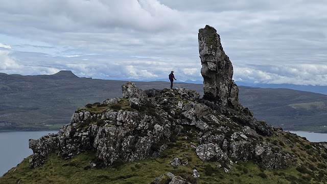
The huge rock has some distinctive features.


A Sea Eagle, on what appeared to be a favourite perch, was some distance away.


The route down to the coastal footpath was mostly gentle in gradient.


We found a good spot to enjoy the last of our tea and we broke the back of today's Squaredle puzzle. A recent addiction. Blame Sue.


We took the last section very slowly in the hope of spotting Otters. Without any luck. Plants, including English Stonecrop, were easier to locate.


We were back at the car at around 3pm after our 7.6km walk with at least 420 metres* ascent, taking us about a very leisurely 4.5 hours.


* Garmin says 413 metres ascent.
OMN mapping shows 571 metres ascent. 
Thus all ascent figures mentioned on these pages are very much just estimates. 

Thursday, 29 May 2025

Thursday 29 May 2025 - Talisker Bay

After a rainy morning - the first prolonged rain we've seen for many weeks, Sue and I drove a short way to Talisker Bay. The others went to Dunvegan. 

The first thing encountered on the walk to Talisker Bay is a colony of peacocks. The males, including a couple of albinos, have free range whereas the hens are contained in chicken pens, roof and all.


Before the track gives way to fields, it passes a large white building - Talisker House. The house dates from the 1720s. Dr Johnson and James Boswell stayed here and admired the location, which for centuries was the home of the next-in-line Macleod clan chief.


A fine looking mountain lies to the left of the path.


We walked along the beach of sooty sand, with foamy waves gently coming in as the tide approached its low point.


A waterfall gushed from the northern ramparts.


The mountain to the south showed its full mettle.


The sea stac, Stac an Fhucadair is prominent as you round the bay.


Crossing a section of the beach was quite fun, as it equated to a significant river crossing. But our feet stayed dry after successful rock hopping and we were soon enjoying the stroll back to the car.


Today's route: 5km, 70 metres ascent, taking 1.5 hours.


Wednesday, 28 May 2025

Wednesday 28 May 2025 - Beinn na h-Iolaire

Whilst others headed for the Black Cuillin, where Sue knocked off her final Skye Munro summit (Am Basteir) on a solo trip, I joined Julie, Hilary and Karen on a visit to Raasay.

A flotilla of Belgians was embarking on a week long canoe trip around Raasay. We took the 25 minute ferry.

Once on Raasay, we drove to the end of the road to the north of the island and took the footpath beyond the small car park.

There were good views towards The Storr.


A little further towards the northern summit, a gateway post enabled the camera to be set up in self-timer mode.

The terrain is rugged.


The summit trig point of Beinn na h-Iolaire marked Julie's final Marilyn summit on Skye. Well done Julie! That's quite an achievement. 


We continued along the well constructed path (who by, why, when?) through some interesting geological features. 


Yesterday we saw Sea Eagles. Today, a noisy Cuckoo.

We returned along the path and took a right turn to Fladday, an island that we could have visited as the tide was out.


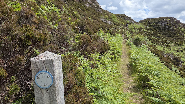
Soon we were on the lower path to Torran. There's a good signed network of paths on Raasay.


Back at the car, an elderly lady with a laden bike (we'd passed her on the footpath), set off before us - she was almost the only person we saw on this walk.

Here's our route - 10 km, 500 metres ascent, taking 4.5 hours.


On the way back, we passed a ruined castle...


We were in plenty of time for the 5pm ferry.

Home Sweet Home.


That's all for now. It's nearly 10pm and some of our group have yet to return from their Cuillin adventures. (Sue was back from hers at about 4:30.) Stories will be told.

Later: They got back soon after 10pm, with Simon nursing a damaged ankle. Luckily not quite serious enough to involve Mountain Rescue.

Tuesday, 27 May 2025

Tuesday 27 May 2025 - Dunvegan Castle and Biod an Athair


Sue and I drove up to Dunvegan for a look around the castle and its splendid gardens.

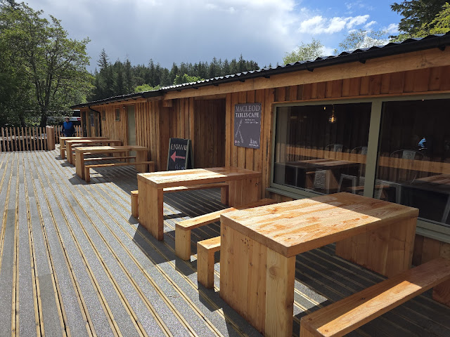
After a tour of the castle (photos elsewhere), we adjourned to the recently extended café for refreshments. Excellent chocolate croissants. Lots of foreign tourists in the castle. Cruise ship nearby.

Then we enjoyed a tour of the gardens.


A view from the seal trip balcony.


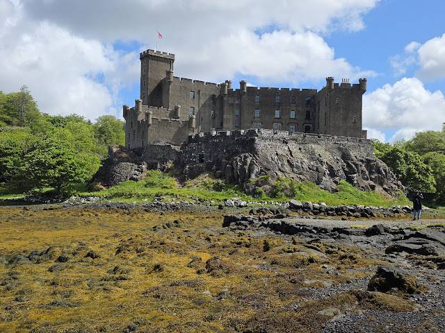
The castle, from the beach.


Above - Crinodendron hookerianum, in the Rhododendron Garden, some undergrowth from which is pictured below.


Then we drove, in a shower, to the end of the road at Galtrigill. We enjoyed lunch in the car whilst watching a pair of wheatears assiduously feeding their young, and then headed directly to the summit trig point of Biod an Athair


The 313 metre summit rises directly from The Little Minch. Photos were taken before a squall swept in.


When the weather calmed down, we descended to the north, towards Dunvegan Head, with spectacular cliff top views and Sea Eagles in flight.


On arrival at Geodh' an Tairbh we turned to the east and headed towards a natural arch, Am Famhair. We failed to locate it despite splitting up to get into the position we both felt was best.

Sue then found an easier way back to the car than the lower level route that I took. The heather and bracken bashing took me some time.

Here's my 8.5km route that involved 350 metres ascent and took 3 hours.