Sue and Martin in Mallorca 2019

Sue and Martin in Mallorca 2019
On the Archduke's Path in Mallorca

Friday 10 September 2021

Wednesday 8 September 2021 - The Kentmere Horseshoe


Click on any picture for a better version/slideshow

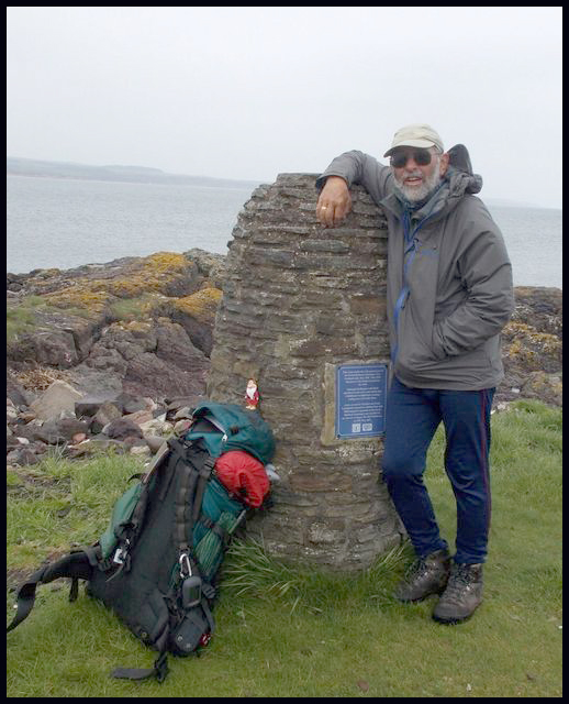
My university contemporaries, David and Linda, and Don and Liz, chose a tremendous day for us to join them on this circuit of the hills above Kentmere. We left a car in Staveley, failed to find a parking spot in Kentmere, and finished up starting from a lay-by a couple of km south of the village.

There were fine views ahead, as we walked up the road to start the 'Horseshoe' outside St Cuthbert's church - seen in the centre of the picture above.

We were soon toiling up the rough track to the Garburn Pass, oozing gallons on the hot, humid day. Beyond that, I briefly took a break from languishing at the back to snap the others on the path up to our first summit - Yoke.


Moments later, I was getting left behind again.


I wonder whether Conrad can identify the hills on and near the far horizon in this view from Yoke; I'm sure BC could name them all.


We only saw a dozen or so people all day, but I had to find an unusual angle in order to exclude people on the top of Yoke. The rest of my party, heading eagerly towards Ill Bell, have become dots on the path ahead.


There's a small tarn just beyond Yoke. I expected to find Sue swimming in it, but she was too busy dashing on ahead.


Onwards, onwards, towards Ill Bell...


We paused for a while on the summit of Ill Bell, with good views all round.


From Ill Bell, the path ahead swoops down to a minor col, before rising again to Froswick.


Ravens danced in the thermals as we enjoyed our lunch just below the summit of Froswick.


There were good views ahead (above) towards Thornthwaite Crag and the other High Street summits, and back to Ill Bell and Windermere (below).


Here we are at Thornthwaite Crag (above), with a view across Lakeland (below).


Another picture was taken at the high point of the day - Racecourse Hill, 828 metres, the summit of High Street.


From there, we trundled on to Mardale Ill Bell, the climbing of which didn't extend us. Sue posed, with her hat under Froswick.


We had a jolly time on top of Mardale Ill Bell.


The descent to Nan Bield pass follows another good path, as they all were today after a period of fine weather in the Lake District. There's a very substantial windbreak at the pass, which our party is just reaching in the next picture. For those lacking in energy, there's an easy descent to Kentmere from here.


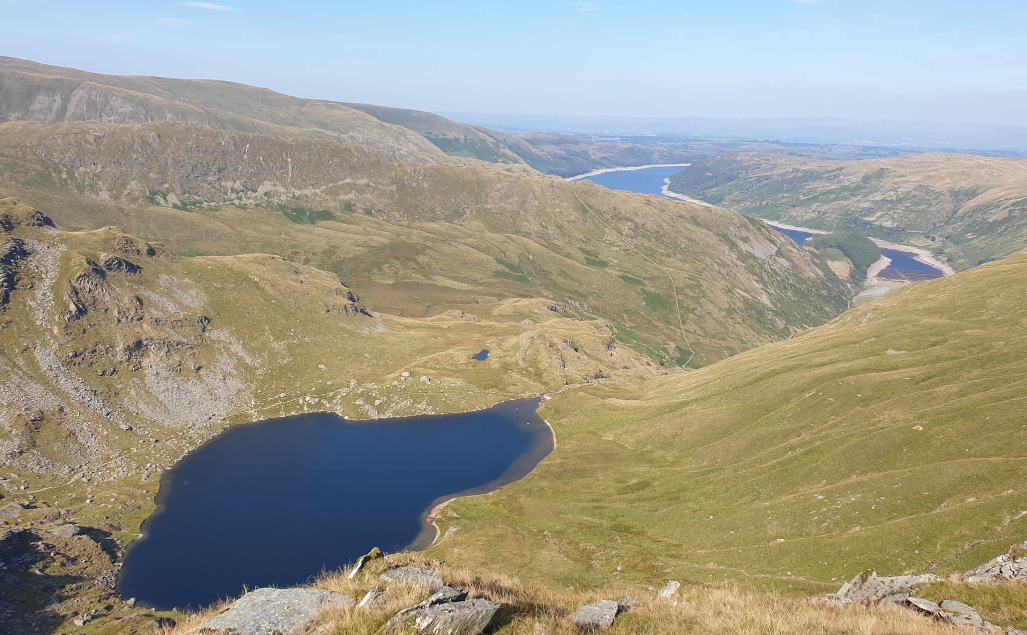
We, of course, were not lacking in energy despite our encyclopaedic list of medical conditions, mainly associated with old age, and we proceeded happily up Harter Fell, with fine views of Small Water and Haweswater far below. The recent dry spell seems to be reflected by a low level of water in the reservoir.


The others raced ahead, you can see them on the path shown below, whilst I lingered to enjoy the views.


Beyond Small Water, Blea Water is just visible below the bulk of High Street

It's quite a pull up to the summit of Harter Fell, but that brings the serious ascent on this walk to an end, so here we supped the last of our provisions. "It's all (mostly) downhill from here!"


A little further on, the summit of Kentmere Pike offers some nice spots to 'park your bum' for those with declining energy levels.


Eventually we reached the track that emerges from Stile End onto High Lane, where there are possible parking options, along which we marched towards Green Quarter, before taking a path through the trees to reach the road back to Staveley along which the cars were parked.

The misty look is due to the camera lens misting up on the humid day

The Watermill Inn at Ings provided welcome sustenance at the end of this energetic day's walking.


Well, that was all very jolly, and great to meet up after so long and still be able to partake in a fairly long day out. My Garmin clocked 26 km (16 miles) and 1200 metres ascent, in a little over 8 hours - including 1.5 hours of 'resting'.


AWOL: Don's sunglasses and my orange cap that goes back to Nick's days as the Nike 'hat man' in Taiwan.

Thanks to David, and Sue, for some of the photos.

Thursday 9 September 2021

Monday 6 September 2021 - Harmony Hounds at Eagley Jazz Club


Another jolly evening at Eagley. The last time this band played here was on 18 November 2019, and I think the 'flier' for tonight's performance has been taken from then:

"Andy Henderson - cornet, Willy Entwistle - reeds/violin, Colin Turner - bass saxophone, Chris Howse - banjo, guitar and vocals, John Smith - drums, a band of first rate musicians producing a sound which can best be described as a miniature version of the Pasadena Roof Orchestra, playing jazz and dance music as it would have been heard in the hotel, dance halls and clubs of 1920's America. Their music draws on the repertoire of Jimmy Noone, Clarence Williams, Bessie Smith and even Bing Crosby among many others, with vocals to the fore."

This time there was no drummer, and Andy Henderson has been replaced by a chap whose name I can't remember (nor could Chris Howse remember it when he was doing the introductions - perhaps one day he'll have to resort to "My name's Chris, and this is my band.")

Anyway, about sixty folk turned up for a most pleasant evening of trad jazz. Excellent.

Tuesday 7 September 2021

A 5km running (or walking) route in Timperley

Here's a 5km route for anyone in the Timperley area:

Start at the footbridge between Frieston Road and Walton Road.

Go down Crossway Road, opposite the path to the canal.

Take the first left down Manley Road, following a blue sign to the A56 road.

Then go left at the end to reach the A56, which is crossed at the pelican crossing.

Turn left for 20 metres past a parade of shops, then turn right through a metal kissing gate before the bridge over Sinderland Brook, passing a Woodheys Park sign.

Continue along the woodland path, initially beside De Quincey park, eventually reaching a green bridge.


Go left, over the green bridge (1.4km). Keep left, then straight on across a minor road.

Pass benches, then turn left immediately after a children's playground. Reach the entrance to Turnbull Road, where you turn left along the main road (also called Turnbull Road).

After 200 metres, cross over and go down the ginnel marked by a footpath sign. Cross the railway line, turn left then immediately right to continue down the ginnel to reach Lindsell Road.

Turn left and go to the end of the road, where it meets the A56. Turn right, and cross over the A56 to take the first left, Hartington Road (2.6km).

Go to the end of this road, and through the bollards on the right to reach Timperley Flood Storage Basin.

Turn right along the embankment. At the furthest point, turn left beyond the football pitch and follow the gravel track, which after a while veers left, away from the canal.

Go beside Timperley Brook to Kingfisher Bridge. Turn right over the bridge. (3.6km)


Follow the narrow path straight ahead all the way to the canal, passing a green bench on the way.


Turn left along the towpath, soon passing under a bridge housing the disused railway. (3.9km)

Go under Timperley Bridge (4.3km). Continue to the first set of white railings on your right. Turn left here (4.8km) then follow the earth path to the right, before the ginnel and behind the houses. Dodging the tree roots, this path returns you to the start in just a few metres more than 5.0km.

Here's the route - the blue line, anticlockwise. Obviously, you can start and finish at any point on the circuit, and there are lots of minor adjustments available - such as going through the beautiful De Quincey Park when the Woodheys path is muddy.

Monday 6 September 2021

Sunday 5 September 2021 - Tailbridge Hill, in memory of Peter Goddard


For a better version of any of these images, click on the image - that also gives access to a slideshow

An hour and three quarters' drive from home to Kirkby Stephen's Christian Head car park, and I was soon setting off at 9:45 through the town.

Frank's Bridge saw me briefly following the route of Wainwright's Coast to Coast (C2C) walk.

A view from Frank's Bridge

The signpost at Frank's Bridge

The path leads pleasantly under a leafy canopy, past a bench on which I finished my lunch a few hours later.


Whilst the C2C route heads boringly up past Hartley Quarries, I favour a more scenic alternative that passes the old barn pictured below, on its way to a footbridge across Pod Gill.


The path soon went over a railway bridge, under which folk were strolling along the disused track, then it entered woodland in the vicinity of Ewbank Scar, from where the hills beyond Brough grace the horizon.


The path continues in an easterly direction to Ladthwaite. Not all the stiles are in good condition, and the broken fences are trip hazards.


Ladthwaite

Below Birkett Hill I briefly rejoined the C2C path, with views across Hartley Fell to Nine Standards Rigg, seen on the horizon in the next picture (click on it to view it properly).


Now, to my right, I could see my distant target, with people gathering on the summit of Tailbridge Hill.


It was a circuitous route to get there, passing around the head of Dukerdale.


Now to the purpose of this walk - to join the congregation of Peter Goddard's family and friends at 12 noon, to celebrate his life at one of his favourite places. Peter sadly passed away a few weeks ago.

Peter - not on Tailbridge Hill!

The next few pictures were taken at the picnic, during which there was a toast in memory of Peter. 30 to 40 folk were in attendance, including members of the local mountain rescue team, and a good number of TGO Challengers. Peter was a veteran of many Challenges, and an esteemed vetter of routes. He will be sadly missed.


Select your dram...

... and raise your glass in a toast to Peter


Two and a half hours later, we were down at the car park and heading off in our various directions. When will we meet again?


I walked back to Kirkby Stephen, initially down the road, passed by many motorcyclists, with a view back up to the now deserted summit.


To the south west, there was a somewhat atmospheric view towards Wild Boar Fell.


Little used paths beyond Lockthwaite led past an isolated barn.


These sheep welcomed me back to Kirkby Stephen, where I consumed the remains of my lunch on a bench, and purchased refreshments for the drive home.


Here's my route - about 18 km in total, with around 450 metres ascent.


RIP Pete Goddard, and very best wishes to Avril.