Sue and Martin in Mallorca 2019

Sue and Martin in Mallorca 2019
On the Archduke's Path in Mallorca

Saturday 25 September 2021

Saturday 25 September 2021 - Dolgellau parkrun


A short drive found us at a new parkrun for Sue and me. We assembled next to the main car park in Dolgellau. A river flowed gently past as 85 runners and walkers, together with numerous volunteers, prepared for two laps of a 'there and back' course along the track of a disused railway line. 


This was my training for next week's marathon. I hope I'm not as out of breath then as I was here today! Sue and I usually finish in about the same time these days, but despite being first in her age group she was two minutes behind me! And I wasn't first in my age group... and in fact I spent the first 4 km dicing for position with a five year old, Idris, before he faded a little more than I did over our final kilometre.


It took me a while to recover, then the post run coffee and cake was excellent. From a quality establishment that used to house an ironmongers shop.


Later, gin and tonics in our Timperley garden couldn't really match beers on the deck at Porthmadog that we've enjoyed this week. Never mind, it was just as warm here.


Friday 24 September 2021

Friday 24 September 2021 - Cwm Ratgoed from Corris


Cwm Ratgoed was today's objective, accessed via the village of Corris, where there's free parking outside the steam railway museum that was closed today.

Corris is endowed with a mixture of buildings. At the top of the tree, fine constructions like that shown above, graduating to tumbledown cottages at the end of the row shown below.


A footpath through the woods next to the meandering stream, Afon Dulas, was soon located. The weather was drizzly and we had driven through cloud on the way here, but it was warm, and the damp air was slowly dissipating. My old trail shoes didn't stand up to the wet grass as well as Sue's sparkly new ones.

This view from the path shows how the cloud was down; this would have been a viewless mountain day. 


The river tumbled down over a series of rapids and small waterfalls. Sue spotted some good swimming pools, but today was not the day.


The area has been home to slate mining since the 14th century, and there are countless derelict reminders that the mining heyday of the 19th century is long past.


As we strolled through the wet grass we passed a tree that held hundreds of apples, each not much more than an inch in diameter.


What looked at first to be just another carcass of a mine building turned out to be the remains of a chapel, with a stained glass window still vaguely intact.


We passed extensive ruins at Ratgoed Hall, where a more modern building is also crumbling.


A little further on we reached our turning point in Cwm Ratgoed, where a conveniently placed picnic bench overlooked Dolgoed, which looked to be a fairly idyllic, if rather remote, working farmhouse.


Today's lunch of crisps and chocolate was somewhat hampered by a manky apple that Sue had chosen to bring along, and by the excellent cheese and cucumber sandwiches that I had contrived to leave behind in Porthmadog! We observed tits in the trees enjoying their lunches - they seemed to be finding lots of insects. Buzzards toured the skies.

Our planned route back down the other side of the valley was clearly out of bounds due to very active forestry workings. We didn't need to continue to inspect the inevitable sign. So we retraced our route for a little way before rejoining the planned route on a narrow road where a massive load of timber rumbled past. On the way, we got a good view from a walled pathway.


Before retracing our outwards route back to Corris, we entered woodland at Foel Friog, where we finished our tea at a picnic bench in the empty car park. We saw no other walkers today.

A signposted route in red, using forestry tracks not marked on our map, is available from here.


Our route is shown below in blue (click on the image for a better version), it was about 15km, with 200 metres ascent, taking a shade over 4 hours.


This concludes our walks in Snowdonia for this trip, during which we've been blessed with fine weather. I won't miss the cumbersome manner in which these postings, using (no WiFi available) just a mediocre phone signal, have to be composed, each picture taking several minutes to load.

We'll be back in November...

Thursday 23 September 2021

Thursday 23 September 2021 - Two Walks from Bethesda


Today we enjoyed two separate walks from the free car park in the centre of Bethesda. 

The first of them started past an impressive Town Hall building and crossed the Afon Ogwen to enter the woods of Coed-y-parc, where sunlight rippled through the trees on what was otherwise a grey day.


We soon found ourselves on a good path around the bottom edge of the Penrhyn Slate Quarry, with a good view back across the town. 


We seemed to be walking below a wall of slate. This is the bottom end of the vast quarry, from where slate has been extracted since the 16th century. Its heyday was in the 19th century, but the site is still in operation, as various hooting sounds confirmed today.


Our path left the vicinity of the quarry and at one point we walked between a stone wall and one of many slate fences that grace this part of the world.


The fence marked a high point of this walk, with good views despite the greyness of the day.


On return to Bethesda we admired some graffiti and enjoyed elevenses in a community garden. We learnt from an information board that there were once 27 chapels on the local Penrhyn Estate, where alcohol wasn't allowed. However, on non Estate land, public houses were built - 40 or so hereabouts.


Here's our route. 5km with no difficulties, and a good way to spend an hour and a half or so in this area. The paths were quiet apart from a couple of dog walkers and a dog runner who assured us that his dog would not be taking part in the Lleyn ultra marathon for which his master was training.


After our short tea break we set off again, this time from the other side of the main road, past the Jerusalem Chapel and a stone commemorating the great strike of 1900 to 1903.


The first section of this 'there and back' walk up to Cwm Pen-Llafar was along a lane through the hamlet of Gerlan, from where there were good views across the valley to the area in which we had been walking earlier.


We eventually left the road and continued on a good path up into the Cwm. Four Welsh hikers studiously avoided eye contact with us.


Lunch was taken near the Afon Llafar, where across the river are the remains of an old dam. Nearby, a shepherd was sounding more and more hoarse as he zoomed around on a quad bike trying to gather some sheep.


The mist was down, but a Navy helicopter flew manically around us, eventually practising landing in a nearby bog.


We got to our high point at around 500 metres - the end of the path. Sue went a little further and claims to have got a better view. 

I watched as another couple and their dog slogged their way up a steep slope that may have given them access to the main Carneddau ridge in the vicinity of Carnedd Dafydd.


After that, for us, it was all downhill on the well graded path.


We noticed several feral ponies in the Cwm, which was also inhabited today by a lone heron and a large number of crows.

During the day we noted various wild flowers, including several that we'll have to identify later. There were swathes of Himalayan Balsam at one point, and elsewhere St John's wort, various ragwort type flowers, etc - as well as loads of berries, chestnuts, and rose hips.


Here's our there and back route - 11km with 350 metres ascent, in about 3.5 hours.

Wednesday 22 September 2021

Wednesday 22 September 2021 - Around Barmouth


Today we drove in drizzle to Barmouth, where £2.20 in a car park machine allowed us to stay for 4 hours - just long enough to enjoy a 10km walk.

We started along the promenade, passing a dolphin statue, and a fine sculpture of men rowing.


Steep steps led up to an area owned by the National Trust. 


Cae Fadog leads on to a small hill, Dinas Oleu, with fine views over the estuary. We paused for elevenses near here. In 1895 this was the first property donated to the National Trust - by philanthropist Fanny Talbot, who donated it because she wanted it 'secure for the public forever'.


Further along the path, a diversion to see 'the Frenchman's Grave'. On the right in the picture below is a plaque with Auguste Guyard's epitaph, and ahead is his grave, with the epitaph faintly visible on the headstone. This Frenchman escaped from the Franco-prussian war of 1871. He made friends with Ruskin and made a home as a plantsman here in Barmouth. 
His epitaph reads as follows:
"Here lies a Sower who
Sowed right up to the grave,
Truth, Goodness and Beauty, 
with idolatry,
Through a thousand battles of
the pen and of the hands.
Such works in this world are not compensated for."


Further along the grassy path, sheepsbit scabious made a brief appearance, and later a red kite graced the airways. 


A circular stone enclosure provides good shelter from the wind, as well as being an excellent viewpoint. The post in view below has a QR code that can be scanned to reveal a website with lots of information about the area. I'll insert a link in due course.


Further up the hill, another post with a QR code gives access to information about the ruins of the mine buildings at Cell-fechan. 


There are also dark, wet, low tunnels disappearing into the hillside - signs of the former industries of the area. Tourism and farming are much 'cleaner'!

There are several different walking routes here.


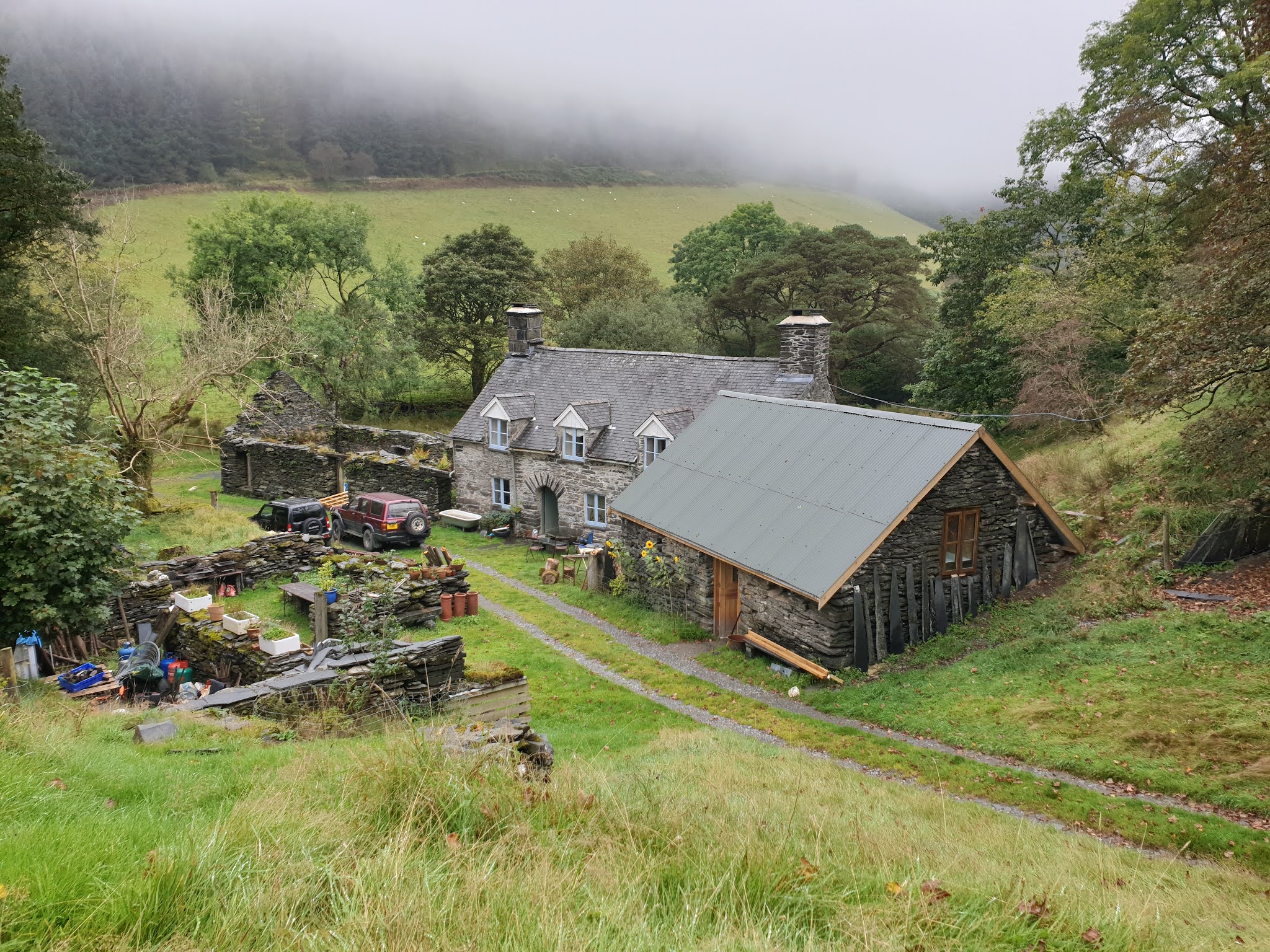
Rising paths lead to the isolated cottage of Gellfawr.


Beyond this, grassy tracks (sadly embossed with the tyre prints of trial bikes) took us to a high point of the walk, with views down to stone walls that reveal the natural features in a sinuous series of field boundaries. 


Here, we met and chatted to another couple - doing the same walk, but from an earlier, Kittiwake, guidebook. (A number of Alex's routes are identical to those in other, earlier, publications!)

Another couple, going the other way, needed reassuring as to their ability to find their way, mapless, to Barmouth. I'm sure they would have made it. These were virtually the only other people seen on these paths today.

Next to our 'chat spot' was an ideal lunch spot with a fine view once a drizzly shower had dissipated. 


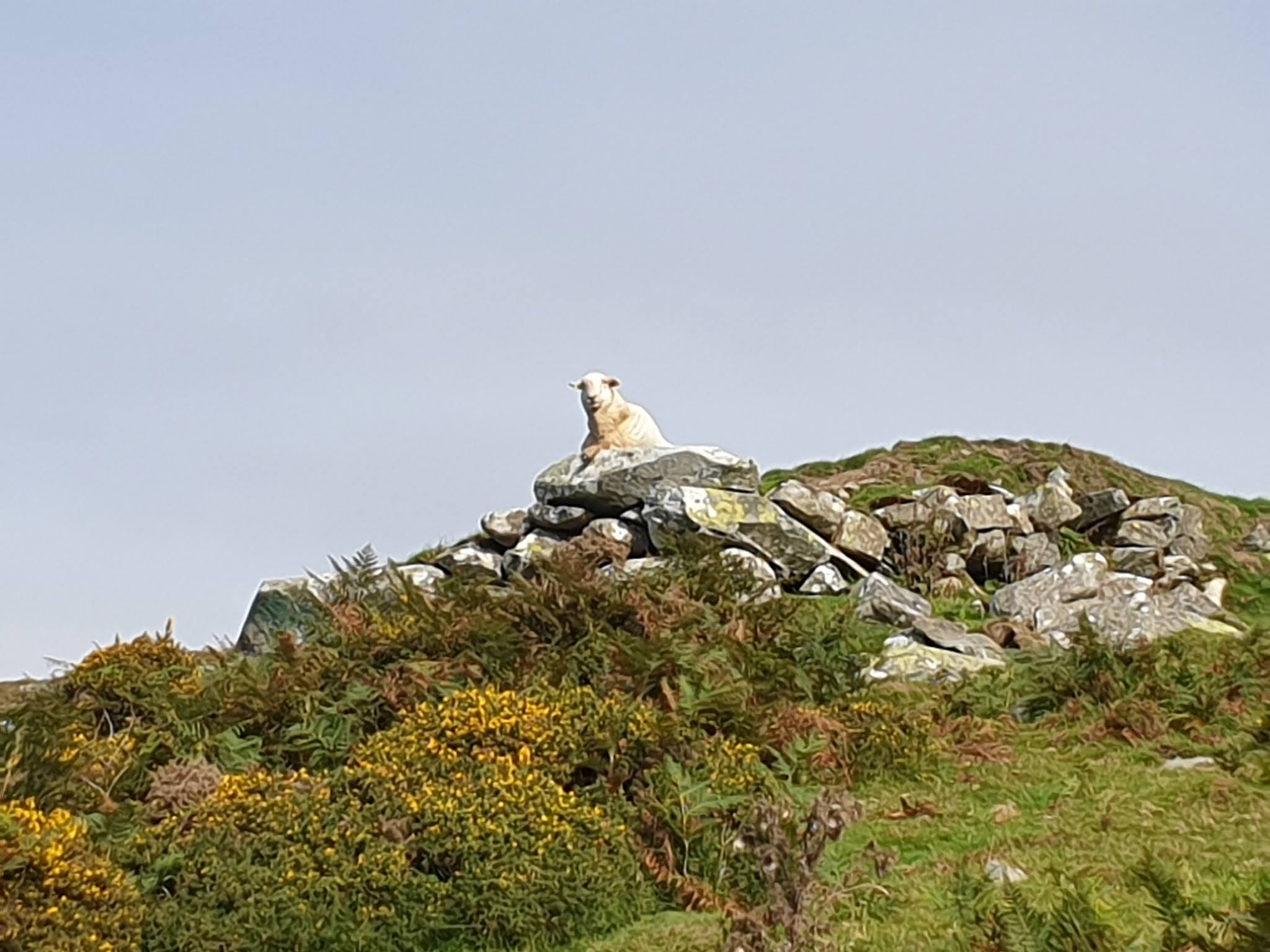
Soon afterwards, another sheep with a view - just like the one we saw on Cnicht a couple of days ago.


Now on the descent, views stretched along the coast, with all its caravan parks, across to the Lleyn peninsular. 


A walled lane with a very rough surface led down to meet the main road outside St Mary and St Bodfan's Church in Llanaber.


Delicious sweet blackberries distracted us.


The present church dates back to the 13th century, and the site has a rich history dating back to the 6th century, when St Bodfan, a Celtic missionary from Bardsey Island, first founded a church here.


Our first attempt to reach the beach was foiled by a closed (for no apparent reason) railway bridge, but we found a way down soon afterwards and concluded our day's walk with a pleasant stroll along the beach.


Here's our route - 10km with 300 metres ascent, taking a leisurely just less than four hours.