Sue and Martin in Mallorca 2019

Sue and Martin in Mallorca 2019
On the Archduke's Path in Mallorca
Showing posts with label Cheshire Ring. Show all posts

Monday, 14 April 2025

Friday 11 April 2025 - A Bike Ride around Manchester


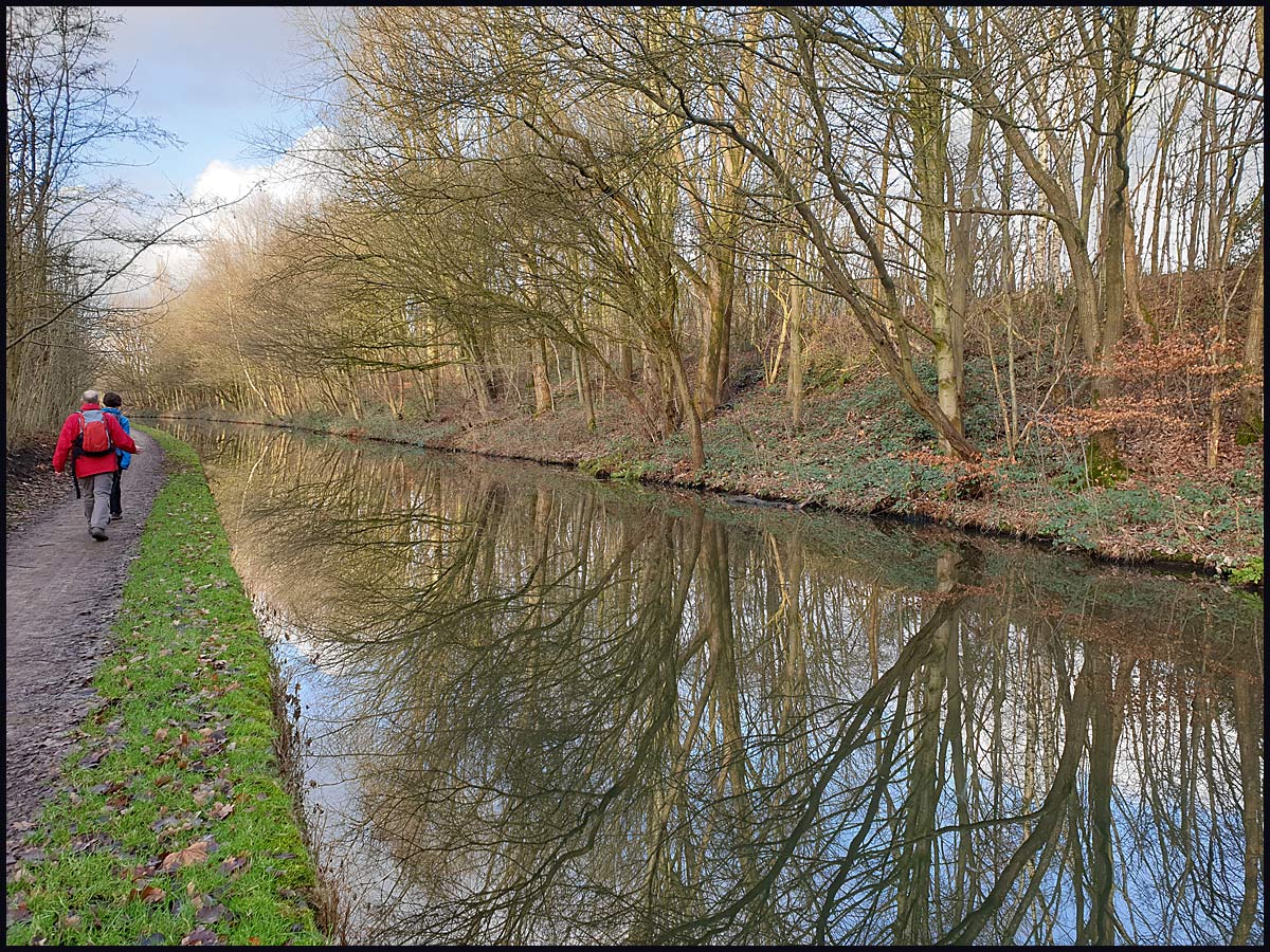
It was a 9am start from Timperley Bridge, where nobody else turned up despite the continuing sunshine, and a pause more or less opposite our house, for a first photo of the glassy canal.

I took a familiar route to Didsbury, sticking to the Trans Pennine Trail (TPT) - picked up in Stretford -  and soon passing through Chorlton Ees on the way to Jackson's Boat Bridge.


The River Mersey is low at present thanks to a lack of rain, but debris in trees the height of the upper embankment are a reminder of January storms. 


Workmen were removing debris that was caught in the weir at Northenden.


With the lower path being impassable by bike in places of deep sand, I took the narrow path on the high embankment bordering the golf course. Banks of Dandelions glittered beside the river.


At Fletcher Moss the TPT heads into Didsbury where the well signed route passes beside the Metrolink railway for a little way to its terminus at East Didsbury station.


The TPT then takes to a fairly new path near the River Mersey, with lots of freshly spouted Cowslips in evidence.


After this a narrow path beside the M60 motorway leads to a choice of routes. On this occasion I chose to avoid the fleshpots of Stockport Town Centre and headed past the Decathlon store and to the north of the centre.

I fumbled my way past Heaton Norris and soon reached the comfort of the old railway lines in Reddish Vale. Time for a break after an hour and a half in the saddle.


After pausing at the Visitor Centre in Reddish Vale, where the café was open today, I continued along the TPT and under the railway viaduct in Reddish. The next two pictures were taken from the same place, in opposite directions.


On leaving the Country Park, the TPT crosses the M60 motorway by way of a bridge that houses an old farm track.


The track emerges into housing at Haughton Green, from which a ginnel leads briefly to more housing and a right turn onto the A6017 main road. After a fast descent to a left hand turn into the woods, the road is left for the remainder of the route apart from a short section in central Manchester.

The TPT now enters Haughton Dale, once a hive of industry, now a Country Park where the path continues beside the River Tame, which feeds into the Mersey in Stockport.


Several weirs remind of an industrial past hereabouts.


After pleasant paths with the occasional bench or picnic table if needed, the TPT rises to reach the Peak Forest Canal. My route leaves the TPT after a bridge across the river and ascends to the canal towpath, leaving the TPT to find a way to Broadbottom and beyond.

The towpath switches banks a couple of times as it makes its way past Hyde and Dukinfield to reach a junction in Ashton-under-Lyne.


A left turn at the junction ahead takes us onto the Ashton Canal.


There's a café and museum across the basin from this junction. I didn't visit on this occasion, having plenty of refreshments and a break from the saddle nearby after three hours.


The Ashton Canal takes us into the centre of Manchester on a route that's familiar, apart from muddling through city centre roads on Whitworth Street where the towpath has been temporarily shut. It's the same route as that taken by the Fallowfield Loopline bike ride.


Approaching Manchester, there's also a problem with the towpath near Piccadilly, where I found myself on a bike lane on an unfamiliar street with sculptures.


The rest of the ride passed uneventfully. I stopped by the Merchant's Bridge to finish off my provisions, then pedalled home at a gentle pace along the Bridgewater Canal towpath.

A  'jiggle' at the end took my mileage for the morning up to 60km, and my Garmin gadget optimistically reckoned on 350 metres ascent during the five hour outing that was followed by lunch in the garden at 2pm on a sunny afternoon. Here's my route.


Next bike ride:
Thursday 24 April - A 70km circuit starting at 9:00 from Timperley Bridge. Bridgewater Canal > Pennington Flash > Mucky Mountains Nature Reserve > Sankey Valley > Trans Pennine Trail > Timperley. All welcome.

Friday, 1 November 2024

Thursday 31 October 2024 - The Fallowfield Loopline - A Bike Ride


Despite it being a damp morning, a record number of eight people turned up for this bike ride, which I've done at least four times before (see here), though not recently. That's my excuse for being a bit vague about the route at times. Only a couple of photos were taken on the outward leg as we pressed on through Fallowfield, across the A6 and into Reddish, where a convenient bench marked an opportunity for a coffee break. Sadly only Sue and I had brought such refreshments, but we were able to hand out a few chocolate digestives.


By the time we reached Audenshaw, on the outskirts of Ashton-Under-Lyne, we had left the loopline and hit the cobbles of the Ashton Canal. More photos could now be taken, as the cobbled areas next to the locks weren't really suited to those with skinny tyres.


We eventually made it for a long coffee break/chat at the Velodrome's café. All very civilised.


So we had plenty of energy for the ride home. Here I'm with Sue and Jenny, waiting for others to negotiate a steep descent in the background.


Soon after this, we came to a place where the towpath was closed, and we had to use roads to get through Piccadilly (where the towpath is good fun when open), and soon after we had regained the towpath another closed section sent us down Whitworth Street. Anyway, we made our way to the Castlefield Basin and crossed the distinctive bridge that leads to our route home.


I just managed to catch some of the laggards as they crossed over the bridge.


A clear run saw us regrouping at the Throstle Nest Bridge, from where the others can be seen on the towpath as I look back towards town.


Jenny took a picture of us on the top.


Further on, we all reached the bridge at Waters Meet without incident.
 

We regrouped, and I took my final picture of the day.


We then headed on to various points at which we left the towpath to arrive at our various homes. Richard and Jenny would be first to peel off, but they got stranded at Waters Meet thanks to a thorn in Richard's tyre. Never mind, they got home, like the rest of us, in time for a slightly late lunch.

I recorded 42km, with about 150 metres ascent, in around 4 hours, quite a bit of which was spent in the velodrome café.


A lovely outing despite a bit of damp in the air. Thanks everyone for your company. The next ride is on Thursday 14 November - Laureen's Ride - a convoluted route in Cheshire of up to 60km, starting from Timperley Bridge at 9.30am or the centre of Hale at 9.45. Café en route. We will probably do just about 30km. 
There's a walk up Shutlingsloe on Tuesday (5 November). Details here.

Tuesday, 9 March 2021

Tuesday 9 March 2021 - The Fallowfield Loopline


                                           The Bridgewater Canal in Stretford

After a year of mostly short bike rides, I'm now trying to do a longer one each week, starting last week with the Moore Lane circuit. This week, today seemed to be the best bet weather wise, but what looked like a fine morning was really rather cold and dank, with a misty precipitation for a while.

I chose the 40 km Fallowfield Loopline circuit, described in this posting

The River Mersey at Jackson's Boat Bridge

It's an easy route to follow, and pretty flat. The Loopline is well signed, and some of the roads it crosses have distinctive features, such as Stockport Road, crossed by way of a tunnel on which there's a building.

That's the Stockport Road tunnel in the distance

In places the cherry blossom is out, and in sheltered spots blackthorn is now in flower. Beside the Loopline, woodpeckers were hammering, and wood pigeons were transporting twigs.


The Ashton Canal (pictured below) is joined at roughly the half way point on this ride. The canal is followed all the way back home. I was slightly surprised to find the towpath completely open through central Manchester. That was after I'd stopped at the rather sad looking velodrome, where the cafe and the Evans shop showed no sign of life, though I'm sure there must be some 'bubbles' of cyclists training somewhere within. As I sat outside in the drizzle I could have bemoaned the fact that the tea in my flask was a bit cool and weak, and the banana-guard that I'd hurriedly placed in my bag turned out to be empty. But neither were really needed, as this 40 km ride took only around two and a half hours, and I was home for elevenses.


Saturday, 11 January 2020

Friday 10 January 2020 - A Walk from Stockport to Ashton

 
I did this walk on my own back in September, reporting on it here, where you'll find a bit more greenery in the pictures, and a map.
 
Today's outing was for the benefit of Sue and Paul, who I think were as surprised as me to discover that there's a completely off-road route through the suburbs of Greater Manchester between these two towns, thanks largely to the River Tame, and the canal engineers from over 200 years ago.
 
We travelled by train from Navigation Road, and it took a few minutes to extricate ourselves from Stockport Town Centre, where the frog pictured in September by the railway station has been removed. We soon found ourselves in woodland beside the River Tame, near to where it joins up with the River Goyt to form the Mersey.
 
 
It was a wintry view today, with greenery provided courtesy of the mosses and lichens that cover almost every bit of bare wood.
 
 
I dutifully showed Sue and Paul Harrison's Weir, dating from the early 1780s. It's in need of a bit of repair.
 
 
We normally cross the bridge leading to Reddish Vale Visitor's Centre on our bikes, without noticing the carved inscriptions at either side of the bridge, denoting the old border between Cheshire and Lancashire. Interestingly, there's a bee emblem on the Cheshire side, and a rose on the Lancashire side. I've rather amateurishly stitched a few photos together. If you click on the images you'll get a better version.
 
 
Amongst other information, these plaques state that Lancashire was formed in 1351, and that the Heatons and Reddish were transferred to the Borough of Stockport in 1916. They also state that since 1974, wherever you stand on the bridge you are in Greater Manchester. That makes these plaques quite recent.
 
 
From the bridge, there's a view over a small nature reserve - lots of varieties of ducks on view - and to the impressive Reddish Vale viaduct.
 
 
Our route headed east, under the massive arches of the viaduct.
 

We then passed under the M60 motorway and crossed some waterlogged fields that challenged the trail shoes that Sue and I were wearing.
 
 
Eventually, after more pleasant walking (and lunch on a convenient bench) beside the River Tame, we took a pretty walled path (see top picture) up to the Peak Forest Canal. The sun came out and provided some lovely reflections.
 
 
Reaching the Portland Basin, the Peak Forest Canal meets the Ashton Canal and the Huddersfield Narrow Canal. Some of the street furniture there looks in need of renovation!
 
 
From the same spot - a rather better view towards the Portland Basin Museum (open) and its attached café (closed).
 
 
Ashton Metrolink Station is nearby, so we strolled along to it and caught a tram home.
 
We had walked about 16 km, taking around four hours, on this enjoyable excursion.
 
Next:
Friday 24 January
Day Walk
A 15 km circuit from Irlam Station, visiting The Salford Trail, Great Woolden Moss, and the Glazebrook Trail. Meet at 10 am. Lunch at the station (SJ 713 931).