Sue and Martin in Mallorca 2019

Sue and Martin in Mallorca 2019
On the Archduke's Path in Mallorca

Saturday, 7 December 2019

Friday 6 December 2019 - Buxworth Basin and Eccles Pike

 
Friday morning walks returned with this outing from Whaley Bridge on a dull day, but at least the rain held off until we reached a café at the end of the walk.
 
I thought we'd walked this route one evening some years ago. We may have done, but I've also recorded it on 1 October 2008, here.
 
We started along the towpath, passing Tesco before turning right over the footbridge from which the next picture was taken.
 
 
Buxworth Basin has become an industrial archaeology site, as shown by the following images. (Click on any image for a better version.)


After crossing the busy bypass by a footbridge, we took one of a number of possible paths up Eccles Pike, with a pleasant view back towards Whaley Bridge.
 
 
There are good views from the summit.
 
 
Combs Reservoir is backed by Combs Edge.
 
 
Llamas and alpaca live here, as well as some very happy looking free range chickens.
 
 
The reservoir is full, and luckily it doesn't suffer from the same problem as nearby Toddbrook Reservoir, which is currently empty due to its defective dam.
 
 
The rain held off, but judging by the nearby rainbows, it wasn't far away...
 
 
There are some lovely footpath signs around here, like this Peak & Northern Footpaths Society sign number 424 near Cadster.
 
 
Whaley Bridge is the home of some classic cars, including a Rolls Royce on sale for £50,000. The car shown below may well have been 'luxury' in its day - as indicated by the sunroof - but it may not have been as well maintained as the Rolls.
 
 
The last section of this walk follows the disused track of the Cromford and High Peak Railway Company, for whom there's a plaque that celebrates its incorporation in 1825.
 
 
Back near Whaley Bridge station, we sat outside a café under a heated canopy, savouring coffees and some excellent mince pies, before heading off home whilst the roadside puddles were replenished from the sky.
 
Here's the route - 10km with about 300 metres ascent - it's easy to follow and took us two and a half hours - it's described by David Frith in his 'One Hundred Walks Around Manchester' - Route number 63.
 
 
Click on any image for a higher resolution version and access to a slideshow.
 
Next week, all are welcome to join me on:
A 13 km walk from Heaton Park Metrolink station to Manchester, via the Irk Valley, starting at 10.45 am to allow for OAP free passes! Lunch options in Manchester, and optional walk home along the Bridgewater Canal towpath.

Friday, 6 December 2019

Pyrenees HRP - 2004 - Day 50

 
Sue and Martin's Big Adventure
 
Day 50 - Monday 13 September 2004 - Stage 41

Postcard Summary
Convivial Refuge to Batere Mines

Lovely scramble up Canigou (2784m) before a 4 hour contouring path – 10.2 hours, 25 km, 1400m ascent
A memorable ascent of Pic du Canigou, with a lovely clear sky until the afternoon.  From the summit, a sea of white clouds to the East, and views back to Pic Carlit to the West.  Towns with red roofs a long way below.  A lovely balcony path right round a valley in the afternoon, and another convivial evening in a gite with an English speaking French couple.


Diary Entry (by Sue)
An ascent of Pic du Canigou. All five of us were up soon after 7 am, all destined for Canigou. After the mists of yesterday, it was with relief that we looked out, over breakfast of brown bread and jam, onto a clear sky. The Catalan couple were away first, shortly before us at 8.10 am, and Daniel soon after.
 
Today's walk is one of the longer days in this section at an estimated 9¼ hours' walking, with 1400 metres of ascent. The mountain is the Catalan sacred mountain, and the path is well trodden.
 
We started past a foresters' hut, with the sun about to rise (see top picture.)
 
Initially through pine woods in a steep sided valley it was cool and we were both feeling fit and energetic. Martin even remarked that his rucksack felt like a day sack!


Streams were crossed before we made a turn to ascend above the trees and into the sun. As we climbed higher, views of other mountains widened. It was the perfect day - even a cool breeze to avoid sweating too much on the climb. After two hours, mountain mix at Cabane Arago, a small stone cabin smelling of wood smoke and suitable for three.
 
 
Lots of zigzags on the path higher up, keeping the climb fairly gentle. There were now quite a few people on the path behind us. Just before the summit, an excellent section of scrambling up the 'Brèche Durier' a rock staircase, the route indicated by yellow flashes on the rock.
 
Looking back, below the 'Brèche Durier' scramble
 
The summit of Pic du Canigou (2784 metres) suddenly arrives, and the wide views have a big impact after the enclosed staircase. There is a huge metal cross draped with the striped Catalan flag (red and yellow) and an orientation table, with colourful top. There is a Scots couple to chat to, and photos to be taken on this, our last main obstacle.


To the west, Pic Carlit is clearly visible and the route from there can be seen, including yesterday's misty plateaus.
 
 
To the east, a sea of small white clouds, obscuring any view we might have of the sea.
 
 
The route down is well graded zigzags and some rock steps, and we're soon at the Refuge Cortalets, where we see the Catalan couple and buy some cokes. This is the base from which most people climb Canigou, and it sleeps 85 people. Below the refuge on a grassy plateau, it's lunch time and the last of our bread, pâté and fish. We regret sitting in the sun, as this spot is sheltered from the wind and really hot! However, during some dirt road walking, cloud starts to float around and becomes thicker during the afternoon.
 
The majority of the afternoon is spent walking along the 'Balcon du Canigou'. This level path goes right around the valley, over some streams at its head, for some miles.
 
 
Towards the end, it descends to a forestry cabin in the woods, then climbs a further 250 metres to a col - this was hard work.


The atmosphere thickened to the extent that beyond the immediate woodland, everything was swamped by a grey blanket, seen just beyond the trees in the above picture

 
Mist consumed us on the col and for the remainder of the way to the gîte at Mines de Batère (an iron mining area until the 1980s), where we arrived at 6.20 pm. Despite its harsh looks, this was a good stay. A hot shower, then we adjourn to the restaurant next door, where we eat with Vincent and Ann, the only others at the gîte. Having lived in Reading, their English is excellent. Over pâté and salad, confit de poule, and watermelon and apple cake, we chat about backpacking and music. Vincent has a licence to play the fiddle in the Paris Metro. They are walking some of GR10, using a baggage transport service.
 
As it is the gîte lady's day off tomorrow, we take breakfast next door when we head for bed - 9.30 pm, for a well-deserved long night's sleep.
 
Stats and route (Viewranger):
28 km, 1700 metres ascent, 10.2 hours


Wednesday, 4 December 2019

Tuesday 3 December 2019 - Dusk in Timperley


Here we are, satisfying all those suffering from 'canal deprivation', with a much requested update on the state of our local canal.

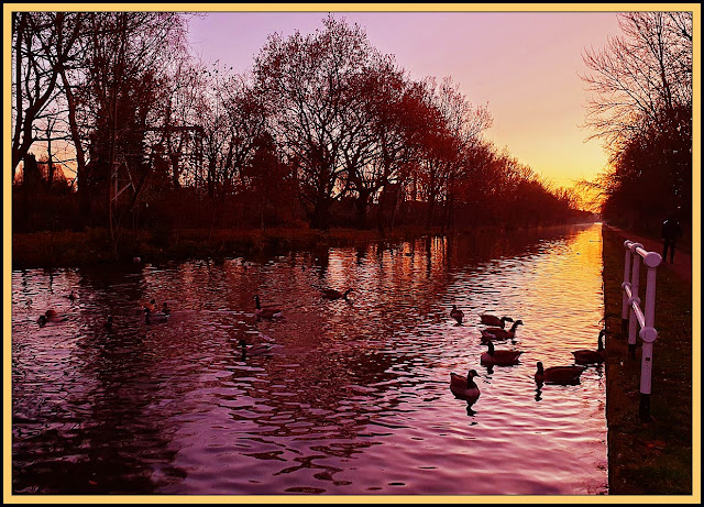
Yesterday, after a hard day in front of a computer screen, I was allowed out briefly by way of a transitional interlude between study and kitchen, for a few contemplative moments beside the Bridgewater Canal, where the Canada geese were choking on their breadcrumbs after being released from the ice, which had thawed during the course of the afternoon.

The 250 year old canal runs absolutely straight for 3.5 km in this section between Sale and Timperley. The recently renewed towpath is one of the busiest pedestrian/cycle ways in Greater Manchester.

Normal service will shortly be resumed...

Tuesday, 3 December 2019

Pyrenees HRP - 2004 - Day 49

 
Sue and Martin's Big Adventure
 
Day 49 - Sunday 12 September 2004 - Stage 40

Postcard Summary (on tomorrow's card)
Spanish Refuge to Marialles
High level contouring, dodging the mist – 7.4 hours, 22 km, 600m ascent
We spent the day with the compass and altimeter out trying (and succeeding) not to get lost on some high ground ~ 2200 metres.  The paths came and went, scenery changed from Lakeland to Derbyshire (but in metres not feet, of course) and we did get occasional views before descending to a nice refuge – only 5 staying – good food and company despite the language barrier.
 
Diary Entry (by Martin)
'Dodging the Cloud'
After a good meal, help yourself from a counter, sort of, Spanish refuge style (even baffled some Spaniards)* we slept with five others in a hot dormitory for 10 people. The hut must have been about two-thirds full, with thirty or so in residence.
 
Breakfast was supposed to start at 7 am so we were up as it became light and breakfast was served from about 7.20 - just as we arrived for it. Tea/coffee, toast and jam - not a great selection, but we stuffed ourselves as there was no limit on quantity, just help yourselves. So we got away commendably early - 8 am - into a cloudy environment.
 
Before very long the cloud came right down and waterproofs were donned. They were on and off all day. The cloud came and went but mostly came, with occasional glimpses above and below us as we progressed along a route that contoured at 2200 - 2400 metres for most of the day. (See top picture.)
 
The promised views of Canigou were very elusive, let alone any chance of seeing the Med (which probably wasn't visible today anyway). We saw two people breakfasting under an umbrella on the Pla de Coma Armada, soon after which, at a stop for mountain mix, we spotted mouflon for the first time.

 
We saw mouflon from here
 
Cloud, sun, breeze, waterproofs (first time in ages) all came and went. Today's scenery could have been Derbyshire, if the metres were converted to feet.
 
We lunched at a picnic table made of granite, in a cloud, at Collade des Roques Blanches.


The rocks looked uniformly grey! And so, we continued without difficulty, eventually emerging from the mist at Pla Guillem, where we easily found the huge cairn pictured in Joosten's guide. We passed two unmanned refuges and headed down easily to reach the excellent and friendly Marialles Refuge by 3.20 pm, at about 1700 metres, the lowest we have been for some time.
 
And so, a warm misty refuge. Few people appear to be staying. A Spanish trio wait for lost walkers who eventually arrive. Two English walkers turn up. they should have been back at Cortalets by 3.30 (it's now 5.30), so they shoot off in the direction of Vernet, hoping that promised transport will pick them up....#
 
Some Catalans arrive and help with translations re 'Rescue of the Lost English' before departing to Barcelona, and work tomorrow. Then more English turn up with a girl who wants a shower. They converse fluently in Spanish and French (or Span/French = Catalan), even with each other! One is based in Barcelona, whence they return having consumed half a bottle of wine.
 
So we are left with two shy Catalans, Daniel, a retired architect from Strasbourg with a new granddaughter, and the jolly guardian, who soon supplies us with Catalan soup. A stew with huge carrots, black pudding and big chunks of pork. Excellent. Followed by lettuce and goats cheese, home baked apple cake, and her reading from a book about a Buddhist priest in Thailand ("Tres philosophique"). We tried hard to understand. Sue spoke more French than they spoke English. We all love the mountains.
 
Stats and route (Viewranger):

22 km, 600 metres ascent, 7.4 hours


* I remember this clearly. We sat with a French couple from Paris. "We have no idea what is going on" they offered, "we live much closer to you in Manchester than we do to these people", as we puzzled over how many pieces of fruit we were allowed to collect for our dessert.
 
# Another clear memory is of these two chaps turning up in a state of panic, muttering "where are we? ...wonder if anyone here speaks English". I was conveniently sitting near the entrance writing this diary, so could help - much to their relief. It transpired they were on a self-guided walk and had descended from Pic du Canigou down the wrong side of the mountain. They were quite distressed with this diagnosis. I calmed them down and fed them Mars bars, while the guardian arranged for a taxi to meet them at the road head from Vernet.