Sue and Martin in Mallorca 2019

Sue and Martin in Mallorca 2019
On the Archduke's Path in Mallorca

Saturday 5 September 2009

Saturday 5 September 2009 - A Second Home (from Home)


With six Belgians now settled in to Peter and Anne's pristine apartment in Kandersteg, we have been obliged to find pastures new.

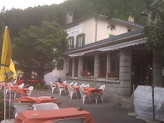
"It needs an airing" said Janet, as she and John handed over the keys to their flat in Chamonix a few weeks ago.

So here we are, airing it. We've been here for a few days now.

We look out onto the Savoy Fields (nursery ski slopes) and over the rooftops of Chamonix to the pointed snout of the Glacier des Bossons, which draws the eye upwards towards the summit of Mont Blanc.

Today's postcard is this view from our living room window. We are so lucky. Often trainee paragliders can be seen frolicking on the lawn; in winter these are replaced by novice skiers. There's usually a wagtail, crow or pigeon grubbing around in the grass, and lots more to entertain the watcher having a lazy day in the flat.

Yesterday's sojourn in Italy allowed the French skies time to clear sufficiently to justify our catching the Brevent cablecar this morning to its mid station at Planpraz (2000 metres) and enjoying views towards Mont Blanc that we only briefly glimpsed through the cloud on our previous visit.

Even today, these views were hard won, as the cloud slowly cleared from our Grand Balcon Sud trail.

The path to La Flégère is fairly level. We romped along it in an hour and a half. Time for lunch! We've developed a habit of late starts and short days...

The binoculars revealed a procession of 'ants' heading down from Mont Blanc's summit towards the prominent spike of the Aiguille du Midi.

Then it was a gentle 500 metre ascent up to Lac Blanc - apparently one of the most famous walking destinations in the Chamonix valley. The path lived up to that reputation. It was crowded. A lower pond gave excellent views whilst we enjoyed a second lunch, but the vistas from the Lac Blanc area were all a bit much. The sun was too high to allow for any particularly good images, but we tried our best, next to a jovial Englishman with a huge tripod.


Sue's muscle problem forced her to retrace her steps and return via the La Flégère cablecar and a stroll beside the River Arve.

Meanwhile I enjoyed a longer descent via Les Tines - a beautiful route over mixed ground - including some ladders - then lovely woodland, with Mont Blanc all the while looming high across the valley.

During the descent I managed to escape from the multitudes. Over a two and a half hour period I saw just half a dozen people - English mountain bikers. They said they were enjoying it. They were walking their bikes down a gentle slope. For some reason, at that point I was going uphill towards La Flégère!

Sue had managed to acquire some grub, and a salad nicoise was quickly knocked up whilst we oo'd and ah'd at the sight of the sun's shadow slowly slipping up the side of the highest peak in Europe.

Time to turn out the lights.

I have a funny feeling that tomorrow we may bump into somebody we know!

Oh, and Alan, you should be aware that Sue is inclined to accept your kind offer - given its date, presumably to join you on next year's TGO Challenge. She travels light these days, Alan, but sadly does not come without 'baggage'. About 12 kilos, which she assumes you will carry in the manner to which I am becoming accustomed (without protest).

Thanks mate!

Next day

Friday 4 September 2009

Friday 4 September 2009 - A Day Out In Italy

During last year's two month hike along an 'Italian Border Route' we spent several days, if not weeks, high above the Aosta Valley, crossing many of its side valleys as high in the mountains as practicable.

Today we visited the town that gains its name from the valley. Aosta dates from around 2900 BC, when the it was the military centre of the population of Salassi. Since then it has passed through many hands (it is known as the 'Rome of the Alps') and is full of antiquities.

Today's postcard shows the Arch of Augustus; it was built in 25BC and is the symbol of the town of Aosta.

We had a full day amongst the sights of the town, but en route we felt compelled to visit our old friend Alessandro, at his hotel (Hotel Aigle) in Entrèves near Courmayeur.

Alessandro was his usual laid back smiley self, and immediately offered us cappuccinos and cakes. They were delicious.

Alessandro was discovered for us last year by Nick, who assisted with our bookings at the time. Nick now works in Shanghai and has difficulty accessing these pages due to Chinese censorship, but an email to him brought an immediate response 'say hello to Alessandro for me, and enjoy a glass of wine with him'.

So we returned to Hotel Aigle this evening to enjoy one of their excellent dinners, a glass of wine, and a surprise offering from Alessandro - a film of the 2008 Ultra-Trail du Mont Blanc. We thought this was an excellent documentary, certainly worthy of commendation should it be entered in any of the upcoming mountain film festivals.

Alessandro was a most generous host tonight, treating us as friends rather than as customers. Thank you, Alessandro, it was a pleasure to meet again, and we do hope to join you for a walk when that can be arranged.

For the record, and in keeping with the tradition of these pages, tonight's delicious menu was:

Calamaretti in olio e limone

Risottino di Cogne

Filetto di trota nel cartoccio con melanzane al funghetto

Insalata mista

Strudel di mele

Next day

Thursday 3 September 2009

Thursday 3 September 2009 - Hotel Restaurant de la Forclaz

This is familiar ground.

Sue and I started and finished the Tour of Mont Blanc here in 2000, and I more recently spent a night here with The South Africans on the Walkers Haute Route.

I've been here in scorching heat, with cold beers being downed ten to the dozen by hordes of folk enjoying the mountain views from the tables pictured in today's forlorn scene.

I've seen the furled brollies flapping in wind and rain enough to terrorise the hardiest of campers.

I've never camped here, despite carrying a tent - the draw of the cosy hotel has always overpowered my more frugal or 'love of being outdoors' instincts.

We passed by today. The weather was moderately benign (we saw only one careless hat being blown away), no fleece was needed over the t-shirt, only a few spots of rain flecked past us, and there were some pleasantly sunlit views amongst the grey uniformity.

Most patrons were inside, sipping beer or tea, some reading papers; others were arriving from the low level route from Champex. They were hugging their hats.

A typical afternoon at the Hotel Restaurant de la Forclaz, I suppose.

Next day

Wednesday 2 September 2009

Wednesday 2 September 2009 - Relaxing in Kandersteg

Not to say we didn't get Some exercise.

This morning the storm had passed and the sun was shining, so we got back to some 'path bagging'. First, route 2 to the foot of the ski jumps. Their heyday was short, from 1979 to 1991 - a plaque names the winners of an international competition, but since then it seems that Kandersteg has dropped off the international ski jumping circuit. The equipment looks dilapidated but servicable. From above it looked like a 'dry' facility, with a synthetic landing strip and steel runners for skis, but the run off area is just grass, so either a synthetic carpet or a blanket of snow is needed for the jumps to be operational.

Today's image was taken on the way to the ski jumps, a few metres from home actually, with the 2502 metre summit of Bire, to the north east of Kandersteg, looming high above the valley meadows.

We explored the quaint road bridge over which a cross country ski trail passes in winter. There is no summer footpath here, and the bridge timbers are very slippery. Nor is their much evidence of the rest of the ski route. The geography of the village must be altered somewhat when winter activities take over!

Retracing our steps, we enjoyed a variation of the panoramic walk to the west of the village, taking the paths nearest to the cliffs rather than last Saturday's higher route to Höh. Today's route gave better views; all of Kandersteg's landmarks being laid out below us in the sunshine.

We were down in time to enjoy lunch outside the Marmotte Tea Rooms, during which it began to cloud over.

Next, route number 8, a delightful woodland path with a 'vita-parcours' - exercise route - involving various keep fit equipment being placed strategically by the path for fitness freaks.

The sky darkened and before we knew it the rain had started. It lashed down. We sheltered in a very small but conveniently placed brick shelter until the worst had passed, before adjourning to the Co-op and inadvertently purchasing (inter alia) a supply of 'tax paid' rubbish bags that will possibly last Peter and Anne several years!

Then house admin, a lovely meal (cordon bleu chicken - still hanging on from the 1970s), and a dossy evening....

...and that's all for today.

Oh, BTW between the two of us we have now walked 20 of the 60 routes annotated on our 1:25000 map. Target achieved! What next? 

Next day

Tuesday 1 September 2009

Tuesday 1 September 2009 - Kebabed in Kandersteg

 
Blue skies have reigned supreme for most of today, so we felt obliged to take advantage of them despite being a bit tired.

The Öeschinensee cablecar whisked us expensively up the first 500 metres (perhaps we should have bought passes, but we didn't expect to be using the cablecars so much), and an easy 20 minute stroll brought us to the lake, where we luxuriated in a restaurant with cold drinks.

It's people watching territory. We observed as family groups and bunches of youths played in the blue boats, jumping in and out of the lake. Clearly my thoughts yesterday that the holiday season was drawing to a close were premature! Sue thought it reminiscent of Nice, but here the bikinis were more like the traditional two piece items, as opposed to the Nice variety with the missing tops.

It was amusing to see the bathing area shared with a somnolent herd of cows - especially as there were lots of dogs wandering about (no traffic = no dog leads). I noticed one bemused animal get a friendly lick from a cow.

Today's picture was taken amidst this scene of domestic tranquillity. I didn't realise at the time, but Sue appears to have been speared by the boatman's canopy!

We'd spent all morning getting this far, and there were paths to bag. So we ambled (and I use the word 'ambled' advisedly) off towards Hohtürli - a high 2778 metre pass that we had no intention of reaching. Our plan was to head up 400 metres to Ober Bergli, then walk back to the cablecar station via a high level belvedere that just HAD to be walked.

Movement in an uphill direction soon became a problem for me. Nausea set in and frequent stops were needed. Heat stroke? (it was 32C even up here), dehydration? - I'd just had a long drink. It was a mystery that Sue attributed to a toboggan ride that I'd enjoyed at the top cablecar station having addled my insides. [It was a good ride, especially for one who has an aversion to braking whilst speeding down such a metal causeway!]

Everyone, yes Everyone, overtook us as we struggled up to our 1980 metre high point, pausing on the way for drink stops, lunch, people coming down wired sections, people overtaking, photos of the view, photos of flowers, and for me to catch my breath and overcome the waves of nausea. I felt as if I'd been wound around a long stick and was being toasted or kebabed under the hot sun.

We made it. Eventually. And our pauses should result in some pleasing images despite the height of the sun and the heat haze. (Here's Sue at our lunch spot above Under Bergli.)

A fountain (spring coming from a tap) at Ober Bergli was used to refuel our water bottles. Sue's transparent bottle gained a leech; mine is opaquely green; the water was lovely despite any chewy bits.

The path contouring above the lake was a delight, absolutely brilliant - a wonderful path with immaculate views. Blighted initially by aircraft noise, the huge bowl in which the lake sits then reverberated to the melodic sound of an alpenhorn. It became louder as we reached a rocky promontory overlooking the lake. The sounds were emanating from a couple with a huge horn - 10 feet long at least. After listening for a while I was about to record one of their numbers when they packed up the horn (it concertinaed into a package less than a metre long) and wandered on along the path.

By 3.30 we were back near the cablecar. Sue used that for descent whilst I stumbled down path 13, through pleasant woods with cows sheltering from the heat, and steep meadows where locals were busy bundling their harvested grass ready for it to be taken down to the valley by helicopter. (Hire cost less value of grass = subsidy? I wondered.)

Interestingly, from a near cloudless sky at 4 pm, half an hour later the whole sky had clouded over, and by 5 pm the friendly ginger cat had joined us under our canopy to watch the first drops of tonight's storm. We were expecting it.

We need a rest! 

Next day

Monday 31 August 2009

Monday 31 August 2009 - First and Stand

To the west of Kandersteg the relatively low summit of First (2549 metres) towers over the village a bit like Ben Nevis towers over Fort William. The relative elevations are similar, but First is much closer (just over 2 km) to Kandersteg than the summit of The Ben is to Fort Bill (a good 5 km).

Hot summer days in the Alps make initial ascents by cablecar irresistible, so today we used the Allmenalp cablecar again to get us up the first 600 metres, leaving only 900 metres of ascent for the rest of the day (plus a bruising 1500 metres of descents!).

Last week's empty playground was full of children as we passed by at 10 am, a sure sign that the central European holiday season is over. In fact we only encountered two other people doing today's walk - a far cry from yesterday's busy paths.

Even the cablecar 'cheat' and the well graded paths didn't make the stiff ascent up First very easy. It's an extremely steep hillside, so pretty difficult to devise a non-energetic route. The jangle of cow bells slowly diminished as we rose steadily, with Öeschinensee soon coming into view across the Kander valley. A small bird of prey with white plumage floated overhead. (A peregrine, perhaps.) The flowers were wonderful, with huge banks of deep blue monkshood as we neared the summit. It had taken just over two hours.

Time for lunch. It's a narrow ridge, with steep drops, so I strapped my rucksack to my leg! The views were splendid - today's image was taken from here and shows Öeschinensee, with the Blümlisalp massif above it. To the left (top centre) are the Eiger and the Jungfrau, and the white slashes of Kandersteg's dry ski jumps show clearly near the bottom (centre) of the image.

Mont Blanc and the Matterhorn were also in (somewhat distant) view from here.

Poles were stashed for an interesting descent over steep ground, aided in places by wires, and backed by the sound of whistling marmots. With such a fine mountain backdrop it was hard to have to concentrate on 'micro foot placement'!

Difficulties over, we mounted Stand (2320 metres), and admired its gentians before toiling down steep slopes in hot heat to reach Kandersteg around 4.30 pm - in plenty of time to buy beer and salad to enjoy on our patio in the company of a somnolent ginger cat. 

Next day

Sunday 30 August 2009

Sunday 30 August 2009 - Blue Skies over Switzerland

The Alpenglow has just faded on one of those idyllic Alpine days that encourages us to return again and again to enjoy the settled spells of weather that so frequently prevail at this time of year.

We started slowly - I blame the shutters - rising at 9 but then, moving quickly in a relaxed sort of way, we managed to get to the top station of the Sunnbüel cable car, suitable daubed with sun tan cream and ready for a good mountain day, by 10.45.

We ambled off amongst the hordes deposited up at 1900 metres by the crowded cable car. There's a motorable track across the Spittelmatte plateau, but we soon left this to explore the Arvenseeli, a small lake set amongst pines. The narrow path was deserted, with everyone else bashing on along the main arteries. I tried to picture the scene of my last visit to this spot, on skis in March 2006, when we spent some time watching a group being taught about such topics as avalanches, and how to make a snow hole.

Anyway, today there was hardly a patch of snow in sight. We returned to the main drag (hardly a drag in this weather!) and admired the view back over the Spittelmatte towards Kandersteg, hidden in the valley beyond. This is the subject of today's image.

The day rushed on. Coffees outside a busy mountain hut; lunch on a high col - Schwarzgrätli - 2400 metres. Then Sue headed along the airy Höhenweg Ueschenegrat ridge whilst I took a longer route, rising to 2639 metres on a broad unnamed summit overshadowed by a mountain that looks as impossible to climb as it does to pronounce its name - Tschingellochtighorn.

Fabulous views to far corners of the Alps.

Having encountered some slow sections along slippery vertiginous scree, and I reckoned Sue would have been waiting at our rendezvous point for a good hour by the time I got there. I waited there for 30 minutes - no sign of her. 'Must have gone down for a beer' I thought. So I returned to the lower cable car station - a 1300 metre descent altogether. No Sue. Luckily our meeting point was on a narrow toll road, so I hastily drove back up 500 metres to find Sue waiting, unperturbed, enjoying the last of the afternoon sun and pleased not to have to walk down the final 500 metres, much of which duplicated yesterday's pleasant woodland descent.

The shops were shut (we cater on a day to day basis) so we enjoyed a pizza at Pizzeria Antico tonight, before enjoying the stroll home in still warm mountain air, with the fading Alpenglow.

...I think that's where we came in...

PS Pleased to hear you are feeling better, Dot. Robin - I think you'll find things here have moved on a bit since your childhood - you should plan to revisit. (We know of a nice apartment you could rent!) Actually, for a period we were horrified to think that all the scouts may be staying in the International Scout Centre - a huge sort of Alpine Hut/Refuge - but today we were relieved to spot a few tents as well. (Better here than in the Carneddau!) 

Next day