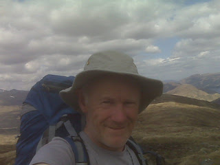
It's hot down here, though. Need to gain height.
Sent using BlackBerry® from Orange

Martin’s planned route and statistics for today are shown below:
1 Loch Tummel Inn
2 Campsite
3 Road junction
4 Garry Bridge
5 Killicrankie
6 Path junction
7 Ben Vrackie (Corbett)
8 Meall Breac
9 Watershed at 440 metres (NN 974 656)
Statistics
23 km
1221 metres ascent
10.1 hours
(1 Corbett)
Enjoyed a lie in then headed down through a cloud inversion, past a female black grouse on her nest (I got to within a metre - she'd have pecked me rather than leave), then strolled along the B846 road for a while, beside the tumbling waters of the River Tummel, before hitting forest tracks at Easter Bohespic.
In contrast to the uplands of previous days, the riverside woods were full of the twitter of songbirds, whilst oyster catchers, grouse and chickens competed for space in the neighbouring fields.
Wood sorrel and primroses lined the hedgerows.
The pinewoods after Easter Bohespic were a little oppressive on the hot day, but the scent of fresh pine was gorgeous.
A long brew stop and early consumption of my last tin of fish was enjoyed overlooking Loch Tummel and Schiehallion.
A great spot.
After a further diversion by way of a phone call home whilst I had a signal, the inevitable happened. It was just 12 noon when I reached Loch Tummel Inn - much earlier than originally planned. That gave me time for a tasty lunch outside, watching goldcrests in the fir trees and the reflection of hills in the placid waters of Loch Tummel, before setting out on the task of washing all my clothes. There aren't many. It didn't take long!
Annoyingly, there's no phone signal inside, but whilst lunching outside I perused the activities of some of my fellow bloggers.
(Since I've hardly met anyone, this is the closest I can get by way of a feel for how others are getting on.)
I'm not going to insert links (until back home) but you can easily Google them or pick them up from the TGO Challenge message board (to which I can't seem to respond to comments using this phone, but thanks Gibson for the mention).
The blog report will certainly 'mature', but here's my current take on them, and no criticism should be inferred - I know it's much harder to make postings on the move than it is from your keyboard at home.
'London Backpacker' (George) seems marooned on Day 2 - where 'Tales from the Riverbank' hint at an easy, low level, meander across Scotland.
Bellavist (Aussie Mike) tells of a wild camp at Glen Tromie yesterday - a brief report on a long day, but I can't see any evidence of what he got up to during the intervening week.
Alan Sloman's reports are punchy, entertaining and up to date. The F16s (was that what they were?) flew very low yesterday - far below me - they must have been quite scary for those beneath them. Whilst Alan may be putting more energy into blogging than into actually walking, he has at least tried to go high - baulked by the bad timing of the only two poor bits of weather on the Challenge. He has bagged a Munro, which is more than I've done. That's 1:0 to you Alan. Well done!
Phil Turner is up to his Day 4 (Tuesday) and seems marooned in the Monadliath with Humphrey, no doubt at one of Humphrey's many 'secret places'. So they may never be found. His blog is hard to view on this Blackberry phone.
'Sheddweller' (new to me) is up to his Day 5 (also Tuesday). He must be in a completely different climate to me. He has been cold! With two sleeping bags and a down jacket! Is his blog a work of fiction, I wonder? Or has he forgotten to bring a tent/shed? He seems to be on a low level route with lots of roads and erratic distances. A novice?
Litehiker (Geoff), who I met on the train, is blogging like a professional and is up to his Day 6 (Wednesday). He has rushed across on an easy, low level, route - choosing to ignore even easy summits like the one from the top of the Burma Road. He has reached Loch Morvich and will next report on his Cairngorm crossing - by the easiest route available, I presume. Is Geoff's route much of a challenge for such an experienced backpacker? I think not, but he seems to be enjoying it.
Steve Horner is supposed to be blogging, but it appears I am not authorised to access his website!
Sectionhiker (an American) has posted a route but doesn't seem to be blogging about his progress along it.
UKmase - another on the list, but he doesn't seem to be posting anything.
So there don't appear to be many of us active, just Geoff and Sheddweller, and maybe George, on low level routes, Phil Turner lost in the Monads, me taking my (excessively?) exclusive high line, and dear old Alan pretending he's Paul Theroux. His blog is the pick of the bunch, and it's impressive that he's doing it whilst carrying on various other nefarious activities. He must be keeping 'his man' busy.
I'll do a gear report tomorrow, but after this afternoon's rest in the sun beside Loch Tummel, and this evening's sumptuous feast...
Zzzzzzz
Sent using BlackBerry® from Orange
Martin’s planned route and statistics for today are shown below:
1 Duinish
2 Col by Gualann Sheileach
3 Creag a Mhadaidh (Graham)
4 Bridge (I hope!)
5 End of ‘path’ (if there is one)
6 Beinn a’ Chuallaich (Corbett)
7 B846 at Drumglas
8 Road junction
9 Track junction
10 Track junction
11 Track junction
12 Loch Tummel Inn – 220 metres (NN 818 602)
Statistics
30 km
1151 metres ascent
12.3 hours
(1 Corbett, 1 Graham)

The predicted rain came, gently, in the middle of the night. I woke to a gloomy, mizzly world of mountains draped in cloud.
So I lay in bed and did some washing. I may have no 'Linolight' (see Alan Sloman's blog) but I can do my washing whilst still in bed. I think Alan has a 'man' to do his washing for him, and from what I can see, his Challenge is to get across Scotland using as many hotel rooms as possible and never camping for more than one night at a time..
(I'm just bitter, Alan, that nobody is being sociable on this route with no hotels - yet.)
Setting off towards Corrour Station, I discovered a path. I'd inadvertently camped on it.
The station was deserted.
Loch Ossian Youth Hostel had a few tents outside. Challengers having a lie in?
I stumbled on along a nice green lane to Peter's Rock - marked on OS maps. It's a small rock with a rather sad plaque:
In Memory of Peter J Trowell
Born Sept 1949 -- Died March 1979
At Loch Ossian
I have a friend a song and a glass
Gaily along life's road I pass
Joyous and free out of doors for me
Over the hills in the morning
My overnight temptation to traverse Carn Dearg from here, only an extra 400 metres ascent, was quelled by the low cloud, though by now it had virtually stopped raining. I'll keep the memory of my ascent on a lovely summer's day, with Nick before his globe trotting days.
There were cuckoos in the Ossian woods, but it was otherwise very calm and quiet apart from the occasional trickle of a stream under the soft blanket of cloud that cloaked the moor.
Further on, the extensive ruins of what must once have been a magnificent sight, and a hive of activity - Corrour Old Lodge. I enjoyed a second breakfast there and, on the advice of my vetter, explored the ruins. The Lodge possibly entered into disuse before the age of photography, but if there are photos, or even paintings, these would be very interesting and would certainly not feature the Blackwater Reservoir in the background.
Over the past few days I've walked on paths shredded by the recent passage of trial bikes. This fine old path, or 'mule track', as it would be known in the Alps, is a prime example. It was not, and is not, built for trial bikes. I know that it's all above board - part of an annual event based in Fort William - and that the bikers are enthusiasts, passionate about their sport, and their routes can be as challenging as many a TGOC route, so I'm reluctant to make an issue of it. It's an observation, then; the paths have been 'shredded'.
In contrast, the walk up Sron Smeur was pathless and pleasantly easy.
"You can't walk past Sron Smeur" opined my esteemed vetter.
Correct. It's a fine little hill with tremendous views to all points of the compass, with lochs and reservoirs radiating as if this were the centre of the world. Not surprising then that a phone signal miraculously appeared as I approached the summit - giving me all the more reason to linger at this special place. It was the highlight of the day.
However, I missed a trick. By blinkeredly following my planned route, and forgetting how dry it is, I missed the opportunity to take a short cut over some no doubt boggy terrain. It would have saved a lot of road walking.
Anyway, after confirming that my planned camping spot would have been fine, with the 'camping spot beside track' waymark ok in an emergency, I had lunch in the sun (not that enjoyable due to a nose bleed) then headed off down the road to Bridge of Gaur.
"Mr Ellis, I presume" - I was greeted warmly by the Challenge Friendly proprietor of the Bridge of Gaur Guesthouse, whose Linolights most definitely work. He was looking out for Les Ellis and assumed I was his man. We chatted, as a result of which my trial bike comment appears above - I wasn't going to say anything, by way of a quid pro quo for the privilege of being allowed to wild camp. But wild camping doesn't shred paths.
Then after a pre-planned call to 'Uncle Roger' at TGOC Control to confirm I was alive and well, I set off up this rather ordinary glen along a metaled estate road, to camp in another excellent spot - at 400 metres - across the river from the ruin of a two roomed house.
A heron is fishing nearby as the sky reddens. Is this a 'volcanic ash sunset'?
Martin R - thanks!
Louise - I heard you met Sloman - no doubt whinging about his Linolight. It seems to be Most Important to him at present. I hope we meet up - I still owe you a prize.
Mark - thanks - I never cease to be amazed that a 'proper writer' should be interested, especially when one blogger comments disparagingly "I prefer to write it up properly when I get home" - you never know what's going to happen next doing it this way, and it has greater 'immediacy'. Will we see you on the Challenge next year?
Sent using BlackBerry® from Orange
Martin’s planned route and statistics for today are shown below:
0 (Not shown) Path junction below Sron Smeur
1 Possible camping spot beside track
2 B846 road
3 Bridge of Ericht
4 Head of Loch Ericht
5 Path junction
6 Beinn Boidheach
7 Beinn Mholach (Corbett)
8 Duinish – 430 metres (NN 617 669)
Statistics
31 km
960 metres ascent
11.6 hours
(1 Corbett)
A fabulous day in perfect weather. If only we'd had such weather on Sunday...
I joined the nervous lemmings and headed unerringly east. Didn't see any though. There must be some close by?
After a night without a breath of wind on the high balcony of dry grass with no deer poo to be seen, it was a shame to move from such a perfect spot, but I headed over Beinn na Caillich, feeling sorry for Gayle and Mick who had missed out on this a couple of weeks earlier due to bad weather, and back down to the deserted West Highland Way, which was a surprise on such a lovely morning.
Any lingering cloud cleared as I wandered along the track to the Mamore Lodge Hotel, sadly a dilapidated shadow of its former regal splendour. The tenants had left Ann Ansell in charge as house-sitter, with clear instructions as to how to deal with the 4 kg package left outside their front door a couple of weeks ago. If she hadn't been in, it would have migrated to the back door, but that wasn't necessary, and we enjoyed a chat over a cup of coffee. Thanks, Ann, it was a pleasure to meet you.
This is Mamores country. Five Star Walking Country.
First I met Sandy and Nadia, who were steaming along in the direction of the main ridge, until they paused on a bench to admire the classic view down Loch Leven, with the Pap of Glencoe on the left. Good to meet you both, I bet you had a great walk.
Then there was Elwyn, from North Wales, picking off the two eastern outliers whilst his son was traversing the whole ridge. Elwyn would need to climb just 52 more Munros after today to gain admission to that most exclusive of places, The Munro Society.
Four English backpackers were setting off to enjoy the ridge before descending down that stern prow of Stob Ban and camping near the WHW..
So, after nearly an hour with Ann, and these three encounters all within a few minutes, I was feeling quite sociable.
I haven't seen a single person since then.
My route to Corrour took in a couple of Corbetts and a Graham. Good exercise, despite the extra 4 kg tugging painfully on my (frozen?) shoulder. Anyway, it didn't really feel any heavier than yesterday - probably only about 16-17 kg today.
Boot prints, all heading in the same direction, led me to conclude that other Challengers have passed this way. I may eventually catch them.
They won't have shared my delight in savouring the giddying panoramas from the peaks I visited, as most Challengers seem to eschew Peak Bagging in favour of Glen Slogging, which has its place in poor weather, but not on days like today.
I reached today's planned destination, Meall na Cruaidhe, around lunch time. There were plenty of spots to camp, but you'd have to collect water from a stream on the way up. The Pap of Glencoe looked exceedingly 'Papy' from here.
Glas Bheinn, with a deer studded profile, was an easy ascent, despite the peat hags, and the Graham - Beinn na Cloiche soon followed. The views from these hills are extensive - my 1:250,000 scale map was handy for confirming the identities of various mountain ranges. Wonderful panoramas to feast the eyes. The unmistakable profile of Schiehallion has appeared to the east and will be with me for days to come.
With a prediction from Sue (thanks - v helpful) that a band of rain would arrive overnight, and encouragement from Notchy from his stravaiging on Mull, I abandoned a plan to camp near the bothy by Loch Chiarain and tackled the steep ascent of Beinn a' Bhric. It turned out to be easy and pleasurable. (Most ascents are after a spell in Ardgour!)
I debated continuing until it got dark, but common sense prevailed and I descended gently towards Corrour from the final Corbett, heading off to the left to reach this excellent nook by the stream in Allt Coire a' Bhric Beag at around 7pm. My knees and shoulder chorused "thank you for stopping" even if my head didn't.
A wonderful day. There will be delirious Challengers spread all over the Highlands as they wend their ways east. If they travelled high today they will have enjoyed giddying panoramas that will long remain with them.
Sent using BlackBerry® from Orange
Martin’s planned route and statistics for today are shown below:
1 Meall na Cruaidhe
2 Glas Bheinn (Corbett)
3 Beinn na Cloiche (Graham)
4 Path junction
5 Beinn a Bhric
6 Leum Uilleim (Corbett)
7 Corrour Station
8 Path junction by SYHA
9 Corrour Old Lodge
10 Path junction
11 Sron Smeur (Marilyn)
10 Path junction at 360 metres (NN 435 609)
Statistics
29 km
1480 metres ascent
12.9 hours
(2 Corbetts, 1 Graham, 1 Marilyn)
Martin’s planned route and statistics for today are shown below:
1 Edge of Forest at NN 075 645
2 Blar a’ Chaorainn
3 Lairigmor
4 Path Junction
5 Mam na Gualainn (Corbett)
6 Beinn na Caillich
7 Junction with West Highland Way path
8 Crossing Allt Coire na Ba
9 Path junction (for ascent of Na Gruagaichean)
10 Path junction (for ascent of Sgor Eilde Beag)
11 Path junction to the south of Loch Eilde Mor
12 Meall na Cruaidhe – 558 metres (NN 249 627)
Statistics
27 km
1580 metres ascent
12.2 hours
(1 Corbett)
Thanks, everyone, for your messages/comments. Keep them coming.
Nick - following your return to Europe (news that Stuart and Maria were pleased to hear) are you up for this (TGOC) next year?
Paul - the view from this camp site is to die for. It matches the one Sue and I had of Monte Viso on our IBR trip (go on - click that label!). You'd be very happy here, as well, Sue.
Susan.... next year?
Lyn - glad you made it home. I was wondering whether you would survive the ash. It was about 3 inches thick on my tent Glad you had a rewarding trip.
Alan - thanks for your comments. It's the usual score re Challengers heading east like lemmings (see below). It's actually good to have a few challenging days in the west and catch up with the rabble towards the end.
It was with some sadness that I escaped from the wild country of Moidart and Ardgour this morning. This is wilderness of the highest order, rarely visited because the hills rise to just under 3000 feet, denying them Munro status. Perhaps this is a good thing. They rise from the sea and are finer hills than many Munros. I commend them. But take your time - don't expect to move quickly.
It was t-shirt weather this morning for my 2 km descent to a bridge and track. Even that took well over an hour - there were all the normal obstacles, plus an unexpected cliff, to negotiate.
Eventually I made it down through the wet tussocks etc, past anxious wheatears and plovers, carefully avoiding the caterpillars and small jumping frogs amongst the lousewort, milkwort and wood anemones, all clinging on to the steep crags.
Lower down, more deer scooted off, whilst bluebells and lesser celandine joined the wood anemones in their struggle to fight a way through the bracken. Butterwort is also abundant, but not yet in flower.
It was a relief to get to the bridge and end the yomping for the time being. My progress east had been slow and needed some inertia. The main road to Ardgour is single track with passing places. Not busy. There were lovely reflections of the mountains in Loch Linnhe.
I took advantage of the phone signal and caught up with some of the other bloggers. Alan and Phil appeared becalmed in Lochailort (but have since resurfaced - bloodied but not beaten), and others seemed to be nervously dashing to the east rather than savouring the delights of the western summits. This dismays me - they are missing out on so much. These are world class summits with fine routes and views. Why dash past? This comment obviously doesn't apply to those who for medical reasons are faced with an extreme challenge in getting across at all. I thought about such folk yesterday when agonising about amending my planned route. That was easy for me to do, but others don't have such options. I admire their tenacity.
I discovered why they want to work on the Corran Ferry slipways when I watched a coach leave the ferry. The back underside of the bus scraped the ground, damaging the rear end.
A pot of coffee and a huge slab of chocolate cake went down well at the Corran Inn. My first human contact since Glenfinnan.
" Why don't you go by bus?" I was asked.
"My pass only works in England; yours will only work in Scotland" I countered.
A plan was hatched. I will become a resident of Corran. He will be resident in Timperley. We will get bus passes based on those residencies. We will travel free throughout the UK. Does that make us dual nationality? And what about Wales? Is it still a suburb of England in the world of pensioners' bus passes?
I continued on my way, along a short section of the A82, fortunately lined by a pavement. Goldfinches flitted in the hedgerow and some goats paused from their munching to watch me go past.
Beyond Inchree, a spectacular waterfall, mewing buzzards and a heron overhead, and an easy track to my planned camping spot at the edge of a forest. It was an idyllic location - flat turf in a sheltered spot beside a gentle stream. But it was only lunchtime. It rained whilst I brewed up. One of those annoying showers from an apparently blue sky. I'd just applied sun tan cream.
I continued on to join the West Highland Way for a few km. Easy going. I counted 11 (I'm sad like that) tourists. Most said hello.
I passed an information board about the Battle of Inverlochy. Inverlochy is up near Fort William, so this board is at the site of the retreating Campbells, defeated by the MacDonalds in 1645, commemorating the retreat of the luckless Campbells to the soup kitchens of England.
Soon my attention was drawn to the magnificent profile of Stob Ban, as I rounded a corner leading to the ruin of Lairigmor. Then it was a final ascent to the 796 metre summit of Mam na Gualainn, about 600 metres beyond which I am ensconced in this brilliant spot overlooking Loch Leven and Glencoe, whose mountain summits are arrayed before me. Brilliant. It's a lovely evening; I'll leave the door open tonight.
(I'm a bit ahead of schedule now; this afternoon's map will follow in the morning. Sorry about that.)
Sent using BlackBerry® from Orange
Martin’s planned route and statistics for today are shown below:
1 Lochan at 690 metres
2 Beinn na h-Uamha (Corbett)
1 Lochan at 690 metres
3 End of track
4 Beinn Bheag (Graham)
5 Lochan at col
6 Garbh Bheinn (Corbett)
7 A861 road
8 Sallachan
9 Corran
10 Corran Ferry Jetty
11 Glean Seileach
12 Edge of Forest at NN 075 645 – 150 metres
Statistics
31 km
1533 metres ascent
14.0 hours
(2 Corbetts, 1 Graham)
Martin’s planned route and statistics for today are shown below:
1 Lochan at Col (NM 885 750)
2 Sgurr Ghiughsachain (Corbett)
3 Meall nan Creag Leac
4 Bealach
5 Stob a’ Bhealach an Sgriodain (Corbett)
6 Meall Mor
7 By Lochan Dubh
8 Carn na Nathrach (Corbett)
9 Bealach
10 Point 803
11 Bealach
12 Sgurr Dhomhnuill (Corbett)
13 Sgurr na h-Ighinn
14 Bealach
15 Sgurr a’ Chaorainn (Graham)
16 Lochan at 690 metres near Beinn na h-Uamha (NM 911 664)
Statistics
18 km
2453 metres ascent (oh dear!)
12.5 hours
(4 Corbetts, 1 Graham)