Sue and Martin in Mallorca 2019

Sue and Martin in Mallorca 2019
On the Archduke's Path in Mallorca

Saturday 20 November 2010

Saturday 20 November 2010 - A Great British Ridge Walk - Number 8 - The Nantlle Ridge - from Garnedd-Goch to Y Garn

Today's lingering cloud didn't put us off. By 10.20 we had dropped off a car at Rhymes and had set off towards Cwm Silyn. We soon met a local Ranger who explained how we could have arranged a cheap taxi service had we not had our own transport for this linear walk (details later).

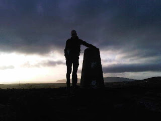
Elevenses were late today - enjoyed after a 400 metre ascent, in the shelter of a wall by the summit of Garnedd-Goch, with fine views over the Lleyn Peninsula. Our own route ahead was obscured by nearby Craig Cwm Silyn, the highest point on the ridge. Snowdon, now free of snow but with an intermittent cap of cloud, shone brightly to the east.

Our traverse of the 6 km ridge commenced with an easy stroll over broken rock to Craig Cwm Silyn, where a bank of cloud provided much entertainment, with Glories and Brocken Spectres in abundance - see previous posting and the comments (thanks Gibson and Paul) - it'll be interesting to see how the 'proper' photos turn out.

The ridge slowly yielded to our slow but pleasurable progress along it. I am prohibited 'on pain of death' from revealing the principal culprit, but until that person mentioned it I wasn't really aware of a laggard other than myself. Anyway, all six of us managed to negotiate the greasy rocks and vertiginous knife-edged ridges with no more damage than brown bummed Rohans.

The whole 11 km episode included around 900 metres of ascent and took us just under 6.5 hours. We finished at 4.40, just as darkness was falling. We had seen about 20 others on the ridge today, all revelling in the excellent conditions.

Anne, Sue and Jenny then enjoyed refreshments at the highly recommended (by that trio) Cwellyn Inn, whilst the rest of us retrieved the cars.

By some miracle we all finished up back in Porthmadog with sufficient groceries and 'medical supplies' to last us the evening. The latter were much needed by a faction intent on monitoring a former politician's progress through an early evening offering from the BBC.

Hic....!

Sent using BlackBerry® from Orange

Brocken Spectre or Glory

There's debate as to which this is ...
... On the Nantlle Ridge this morning.

Sent using BlackBerry® from Orange

Friday 19 November 2010

Friday 19 November 2010 - Carn Fadryn & Garn Bach

Improved weather brought with it a dilemma. Shall we walk the Nantlle Ridge (a Great British Ridge Walk), or should we continue our exploration of the Lleyn Peninsula?

Lingering cloud and the prospect of a persistent cold wind on the Ridge drew us to the Peninsula, but it was a close call. Ken, Anne, Sue and I enjoyed a short walk to Carn Fadryn, whose 371 metre summit sports a conspicuous yellow trig point, a recent addition to the Iron Age walled hillfort containing stone huts, and a small fort reputedly built by Roderic and Maelgwyn, the sons of Owain Gwynedd in 12thC.

Low cloud over the Peninsula inhibited the views, but the sun shone and K & A, fresh from sunny Portugal, were able to top up their tans.

A peregrine, and then a buzzard joined the ravens in following our progress to the lesser summit of Garn Bach. That proved to be another excellent viewpoint (pictured, with Sue looking to the east).

From here we headed north to a small crag that offered superb lunchtime views, before aiming for a boggy path next to a finely preserved stone wall to the north of Coed Garn Fadryn. This led conveniently to a green lane and back to the car. Just 7 km and 350 metres ascent, taking all of three and a half hours.

We've noticed that whilst most trees in the area have now lost their leaves, a few (not just the firs!) remain virtually untouched by the ravages of autumn. Similarly, most flowering plants have had their day for 2010, but a few - for example, herb robert, red campion, several thistles, gorse and clovers - soldier on, showing a healthy disregard of the season.

We had plenty of time to revisit Plas Glyn-y-Weddw tea room and gallery (see Wednesday's posting), but not before a short stroll along Llanbedrog's sandy beach, where we encountered numerous scallops and an octopus on the tide line, lots of oyster catchers and black-headed gulls, dog walkers and a man with a metal detector who was digging furiously in the soggy sand.

Then it was back to more à la carte cookery in the nearly overflowing cottage in Porthmadog, where R + J arrived later, as planned.

Sent using BlackBerry® from Orange

Thursday 18 November 2010

Thursday 18 November 2010 - Portmeirion

Today's highlight, given that it was blowing a hoolie on the tops, was a visit to the Italianate village of Portmeirion. Constructed over a period of 50 years by Clough Williams-Ellis, the village is perhaps best known for its pottery and for being the setting for the cult '60s TV series - The Prisoner.

It was Sue's first visit.

Better late than never!

[Mark, and others, I'm glad you are enjoying this series of postings. Sorry to be so brief today. We have now been joined by A and K, and with J and R due to arrive tomorrow I'm afraid that postcards from this small cottage will be brief for the rest of our stay, with further observations and an annotated slide show next week to fill in the gaps.]

Sent using BlackBerry® from Orange

Wednesday 17 November 2010

Wednesday 17 November 2010 - Mynydd Tir-y-Cwmwd, and the Iron Man

A thoroughly wet morning drew us to overdue domestic chores, albeit whilst watching egrets, goosanders, grebes, a heron and many more birds foraging in the harbour outside our living room window.

However, by lunch time the sun was shining again, so we ventured once more to the Lleyn Peninsula, which according to the map houses lots of excellent short walks.

It was sunny at Llanbedrog, between Pwllheli and Abersoch, and from there we could see that the 'mainland' was engulfed in dark cloud, so heading west was a good call today.

From the beach we headed south east along the shore to reach a steep path leading up a cliff. A barrier blocked our way. The path was shut due to a landslip. We looked around; the place was deserted. So we ignored the sign and climbed easily and safely up the steps to the top of the cliff, where we negotiated another barrier to escape from the closed path, and admired the Iron Man, a sculpture that looks out over a dangerously exposed (but freely available to the public) precipice.

The wrought iron man was a millennium project to replace a Tin Man that had looked out over Cardigan Bay to Barmouth and the Rhinogs since the 1980s.

Continuing along the path and around the headland into a blinding sun, the holiday town of Abersoch and its long sweeping beach came into view. Neither of us had seen Abersoch before. From this angle we didn't feel we had missed very much.

Gradually we progressed around the headland to a position where the low sun was behind us.

This was the signal to turn right and ascend gently to the trig point and cairn that mark the summit of Mynydd Tir-y-Cwmwd, a mere 133 metres in height but commanding views in all directions - west to Abersoch; east to Pwllheli and the mountains extending south from Snowdon along the periphery of Cardigan Bay; north to the Rivals (Yr Eifl and its outliers).

Three people followed us up - we didn't surprise them Mark, unlike the middle-aged couple who we startled the other day whilst they were engrossed in their lunch.

We lingered at this summit (pictured) admiring a Toposcope that confirmed that on a clear day much of Snowdonia is visible from here.

A short descent back to Llanbedrog took us past St Pedrog's Church Hall, home of St Pedrog's Knitting & Sewing Guild, then past the church itself to Plas Glyn-y-Weddw, a dower house built in 1856 by Lady Love Jones Parry. The Gothic mansion became an art gallery and ballroom in 1896 and was served by a horse-tramway from the railway terminus at Pwllheli until 1927. It remains a vibrant gallery, and is one of nine locations that houses the Celtic Neighbours partnership, a group of visual artists from native Celtic communities.

Their art, unlike their tea and cake, was sadly not to our conservative taste.

Sent using BlackBerry® from Orange

Tuesday 16 November 2010

Tuesday 16 November 2010 - A Great British Ridge Walk - Number 6 - Cnicht and Moelwyn Mawr, The Cwm Horseshoe

The large car park at Croesor was empty when Sue and I arrived at 9.30am this morning.

But there were vocal residents in the form of flitting sparrows, chirpy robins and tweeting tits.

The route up Cnicht (pictured) from here requires no description. From this direction the 689 metre summit justifies its 'Matterhorn of Snowdonia' tag. It's a straightforward hour and a half's stroll, with ever more expansive views and some very easy scrambling up the final slopes to the airy summit.

The sun was bright; as we strolled along the easy ridge, with improving views across to snow-capped Snowdon, we pondered today's breakfast TV's 'happiness' survey. 5.3 out of 10 was (I think) the average, but hey - it was carried out before 8am - it must be skewed...

Our average was 8.5, marked down as a result of cloud on Snowdon's summit, and problems with our shadows invading our nicely framed images.

Half an hour beyond the summit, a cairn alerted us to a thin path to the east that snaked its way for fifty minutes or so over occasionally boggy ground to the abandoned quarry of Rhosydd. This occupies a huge area and has one wondering about what the place must have been like in its heyday.

I felt a 'Jim Perrin Moment' coming on, and scratched fervently in my notebook (edited out of this report!) during our lunch break at the top of the tramway incline behind the quarry buildings.

The route up Moelwyn Mawr is simple from here. There are no technical difficulties and the walker is afforded many excuses to pause whilst the whole of Snowdonia gradually appears on the wide horizon, with Cnicht now in Snowdon's foreground.

A thin veneer of ice below the 770 metre summit required care, and served as a reminder to stash my Yaktrax crampons in my day sack as a precautionary measure over the winter months.

We lingered on the summit, spotting seven walkers on Cnicht's fine ridge, the only people seen all day. From here, an easy knife edge then grassy slopes lead down the WSW ridge of Moelwyn Mawr, along Braich-y-parc, to join the road to Tan-y-Bwlch near a gate on the edge of Croesor.

The 12km walk with 930 metres ascent took us just over five hours.
It was a lovely little excursion in great weather.

Sent using BlackBerry® from Orange

Monday 15 November 2010

Yr Eifl and Tre'r Ceiri

After settling in at the cottage and enjoying a stroll into town, Sue and I packed a flask and a buttie and set off along the Pwllheli road.

At 564 metres, Yr Eifl is the highest point on the Lleyn Peninsula. It's a short excursion, suitable for a winter's day with a late start.

We parked in the spacious car park at SH 353 440, virtually empty today but perhaps busy in summer.

A stony track led easily towards the top of Bwlch yr Eifl, before which we headed up by a wall to some disused buildings (where we surprised a couple) and on up steps to a transmitter mast. Turning left at the perimeter fence, we soon found an excellent path carved out of the rocky crest of the hill. This brought us up to a cairn at 444 metres that commanded a fine view over the Peninsula, across to Anglesey, and inland to snow-capped Snowdonia, where the mountains sat below a deep blue sky.

Our own local weather was more problematical. After lunching in a disused building carpeted with sheep poo, we set off into the cloud that had been skirmishing with Yr Eifl all day. A storm arrived to test our newly proofed waterproofs. The sleety rain was thick and cold. Even the crows were cowed into silence. But not the aircraft of the RAF, training for missions in far off lands.

On the summit we found a chap with a camera, looking for a café. He headed down. The cloud had cleared just as we arrived, giving us more fine views. A stroll over rocky terrain led us to the magnificent Tre'r Ceiri (Town of the Giants). This is an Iron Age hill fort built on a long, narrow summit at around 485 metres. It covers 2.5 hectares (big) and is encircled by a massive dry stone wall rampart that's about 3 metres high. The fort houses about 150 round stone huts. It pre-dates the Roman invasion of Wales in AD 78 and it was used throughout the Roman occupation, eventually being abandoned in C4 AD.

There was sunshine and shade up there today, and with more showers approaching it was hard to get a good picture. Today's image was taken from the fort, but however closely I look at it I can't see the huge waterspout that was featured on today's local news, and was pictured within a very similar view.

A pleasant heathery path took us over the rocky outcrop of Caergribin (more fine views) and back to the car after 8 km, 500 metres of ascent, and 3 hours of exertion.

In the car park, our friend with the camera confirmed that he had found the café. I wonder whether he saw the waterspout.

Sent using BlackBerry® from Orange

A Room With a View

This is the view from our living room for the next few days.

Maps and currency have been purchased and coffee and CCS has been savoured at leisure. It has been a lazy morning, but boots are now being donned for a short venture into Showell Styles country.

Sent using BlackBerry® from Orange