Sue and Martin in Mallorca 2019

Sue and Martin in Mallorca 2019
On the Archduke's Path in Mallorca

Saturday 4 August 2012

E5 in reverse - Day 27 - Dornbirn (450m) to Rheineck (399m)

How often do we walk 24km in a day, with zero ascent. I can't remember the last time, or indeed whether it has ever happened. But it did today. The steepest climb we've had was the stairs to Wolfgang and Jutta's first floor flat!

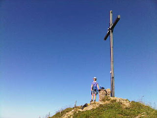
The day started well for us - breakfast with Markus at a nice bakery in town. Markus is exceedingly camera shy, so Sue's pose with her Austrian pin-up has had to be adjusted, as the pin-up took fright, and with a look of panic insisted on being behind the camera, not in front of it. (See top picture - I couldn't even fix it to get his reflection!)

We were then deposited at a bridge over Dornbirn Ache, one of many rivers that accompany the Rhine in dumping their contents into nearby Bodensee (Lake Constance). That lake then feeds the mighty Rhine on its journey to the North Sea.

We had hoped that Markus could join us for a day on the trail, but he had to take Silke to a Swiss railway station to start her journey to Lischana Hütte in the Engadine, where she will be cooking for the visitors for the next couple of months, and then he had to go to work, and also resolve a technical problem involving fuel.

Despite an overnight storm, the atmosphere was sultry, with rain in the air, but not enough for waterproofs. It was evaporating on landing.

A pleasant stroll took us through woodland inhabited by Dornbirn's fitness fanatics before crossing a bridge and entering open countryside leading to the northern fringe of Lustenau. On Schwatzer Ried a farmer ploughing his field had attracted a colony of storks, and large birds of prey floated overhead, whilst long-tailed tits and a variety of warblers fussed in the trackside trees. Sue is pictured en route near here. We were annoyed to have left our binoculars behind today - our loads had been culled, just for one day, given that we would be returning to Wolfie's flat.

An interesting covered bridge had been passed en route, and now a new bridge under construction over the Rhine caused a minor detour from our planned route. But we soon found a somewhat overgrown path beside the Rhine that led eventually to a bridge across the river, where we rejoined the (not waymarked) E4 and E5 routes.

Whilst there was little evidence of the path being used as a walking route, it's clearly a popular cycling route, as we discovered for the rest of the day's walk. But first we ambled into the village of Fußach and enjoyed lunch on a long bench under the church eaves, whilst it decided whether or not to rain.

The sun scored a decisive victory, resulting in further diminution of our increasingly meagre stocks of sun tan cream.

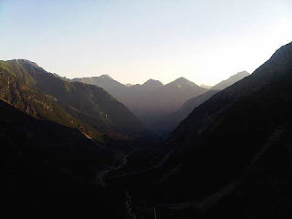
We then entered a nature reserve that runs to beyond Rohrspitz, where a campsite café provided welcome cold drinks. The view from here forms today's bottom picture.

It was hot and humid again today, and as yesterday care was needed at times to avoid picking up melting tar from the soft surfaces.

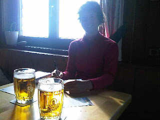
A call to Markus gave a slightly ambitious ETA at Rheineck, so the pace was stepped up for the last few kilometres alongside Lake Constance and then south along a pleasant lane to the bridge into Switzerland and on to Rheineck station, where Markus lay in wait to whisk us back to Wolfie's flat and later join us for beer and pizza.

Comments:

Dot - the hard days are over. We are entering the 'ice cream' phase of the trip - the home run...

Data:
3 August 2012
24km in 7.5 hours with minimal ascent
Flower of the Day - Great Burnet

Itinerary - http://www.topwalks.com/E5%20Route.html

Sent using BlackBerry® from Orange

Friday 3 August 2012

E5 in reverse - Day 26 - Lingenau (685m) to Dornbirn (450m)

A fine day in the Vorarlberg, if rather hot.

Overnight road noise and mossies at the Adler were more than compensated by its fine breakfast. We took our time, so it was 9.30 before we set off on our scenic walk to Dornbirn.

Gently downhill through pristine farmland, past an aviary where Sue attracted wolf whistles and I set off a barking dog. Through mixed woodland with buzzards and long eared deer, and down to the River Bregenzerach that flows down the gorge from Egg.

The bridge we planned to use was closed due to forestry work. There was no sign of any work going on but we played safe, taking a detour along the lovely riverside path towards Langanegg, passing far underneath a road bridge spanning the gorge, before doubling back to Müselbach by 11am.

Sadly no venue for elevenses was spotted so we continued on up the drippy hill, with fine views back over our recent route (pictured, top), to Kaltenbrunnen for an hour's break. They were busy with mountain bikers and holidaymakers, but we were quite happy to laze in the shade of trees whilst waiting for our rosti. When it arrived it was a top notch offering.

Leaving Kaltenbrunnen at 1pm, we soon gained Lorena Pass and our first of today's many views of Lake Constance. Heading onwards to Bödele we gradually paid our farewells to the higher alpine peaks of recent days and settled for hazy views of nearer, albeit dramatic looking, hills and villages (pictured, bottom) above Lake Constance, and of the town and lake as we finally descended to Dornbirn.

We were met at 5pm by a Lazy Austrian camera shy pin-up (aka Markus) who whisked us a few metres to Wolfie and Jutta's flat, which they have kindly lent us for a couple of nights. Hopefully they are enjoying their Tyrolean holiday and won't be worrying too much about our wrecking their home!

A quick turnaround then saw us returning up the hill for ice cream and fruit with most of the rest of Markus's family, including Silke, with whom he completed the TGO Challenge in 2011.

Then it was back down to Dornbirn's beating heart (really, it was) for an excellent Austrian chicken dish and some fine beer from one of Markus's sponsors, the local brewery, who are in the process of labelling three million of their bottles with information about one of Markus's environmental campaigns.

Comments:

Alan R - apologies for the error, we just saw Rebecca in the olympics - we should have realised we were on the German countryfile channel when the sheepdog trials came on after the fencing, and we know that isn't an olympic sport!
I can just picture you fumbling with your tablet in a plastic bag on an LDWA walk!

Nick - I don't remember anything vertiginous either. Perhaps a read of our diary from 1980 will reveal more...

Anonymous - some food for thought there. Certainly worth considering photographing important documents on a separate memory card.

Data:
2 August 2012
21km in 7.5 hours with 1000m ascent
Flower of the Day - Giant Bellflower, lots of it!

Itinerary - http://www.topwalks.com/E5%20Route.html

Sent using BlackBerry® from Orange

Thursday 2 August 2012

E5 in reverse - Day 25 - Staufner Haus (1600m) to Lingenau (685m)

Another tough day.

We enjoyed a leisurely start after chatting to Timo and Lydia and their children, eventually leaving Staufner Haus after 9am. It's a great place, and it was lovely to be somewhere where folk were enjoying the ambience rather than rushing off at the crack of dawn.

We chose to ignore the E5 route, and despite later rejoining the route marked on our map, we saw no evidence of E5 signage or walkers today. The weather was perfect, if rather hot, so we felt compelled to continue our stroll along the 24km knife edge switchback of a ridge that we started along yesterday. I'm pictured on it.

'Nur fur geubte' (only for experts) signs told us that care would be needed on the final stage to Hochhäderich. We soon encountered Alexander and his nine year old son Oscar. If they could do it, so could we. It was easy enough in the warm, dry, calm conditions, with plentiful wires to grab on the more vertiginous sections.

Alexander told us over 300 alpine peaks can be seen from this ridge. We believed him, the views were stupendous on this clear day.

We disturbed a black grouse as we stumbled over tree roots that blunt the knife edge in places, and we passed a man who was taking panoramic pictures of the area using special equipment on a tripod above Falkenhütte. Sue posed under the blue sky that accompanied us all day at the 1581 metre summit of Falkenköpfe (picture). Sadly we won't be that high again until September.

Views towards Bodensee (Lake Constance) improved as we moved west along hot wires fastened to hot rocks resembling badly mixed concrete in texture, past border posts indicating that we were walking along the German border with the Austrian region of Voralberg, and the brilliantly clear mountain vista to the south remained with us.

The restaurant at Hochhäderich was closed - Wednesday is their day off - but their cool crate of drinks and an honesty box was most welcome. We'd already savoured our tuna salads and chocolate at the final summit just above the restaurant.

Alex and Oscar had been telling others about our exploits, and we seemed to be greeted not by the usual 'Hallo' or 'Grûß Gott', but by 'Respect', which in North American terms may be the equivalent of 'Awesome'!

The descent to the valley via Lochalpe (pictured, bottom) was steep but easy, with eagles or buzzards, and constant 'dripping' caused by temperatures in the low 30's Centigrade the only real distractions. Hittisau was soon reached and we thought we were nearly home.

We weren't!

The route through the woods past the 994 metre summit of Rotenberg was well signed at first but lacked a crucial indicator at a left fork, sending us circling on up the hill when we missed the turn. Then, having relocated the path, we found that it took us on a pretty comprehensive tour of the woods, past 14 information boards, going all the way past the Voralberg village of Lingenau before finally giving way and depositing us in the village centre.

Hay making in this pristine alpine farmland scenery was in strident progress, and tractor dodging became our main concern on the final stages of the descent.

Gästhaus Adler, where Frank, a Dutchman, speaks very good English, provided beers and an excellent meal, though Sue's eloquent request for 'boiling water' (for tea) was unfortunately misinterpreted as bubbly water - she should have asked for teewasser!

Later we were joined by an Austrian pin-up and cartography expert who kindly produced a 1:25,000 scale map and a route through the Voralberg for tomorrow, as the E5 route suffers from a massive cop out in this lovely area, by taking the bus to Bregenz.

Comments:

Alan R - erudite as ever, but the 'olympic' comments are completely over our head. In three viewings of about 5 minutes maximum we've seen Rebecca win a bronze and two German fencers ... fencing, I think. Just think yourself lucky that Sue wasn't wearing her turquoise jacket(she has a complete wardrobe) or using her Yorkshire tea bags!

Anonymous - it's always good to hear from you. The tablet idea may be a good one, but how robust/heavy/waterproof are they? I'd already thought of using the camera to store images of emails etc relating to B+B and hotel bookings as we haven't really needed the pieces of paper we brought along.
I've never really had a biro problem since few of our trips (if any!) are at zero gravity!

Nightbird - great to hear from you too. Shouldn't you be soaking up the sun somewhere?!

Jules - your comments are flooding in as I write, and are always appreciated. After the annoying technical problems it's nice to return to normality.

Alan S - we hope you are ok.

Data:
1 August 2012
18km in 8 hours with 800m ascent
Number of E5ers seen today: 0
Flower of the Day - Fox and Cubs (lots in the woodland along the ridge)

Itinerary - http://www.topwalks.com/E5%20Route.html

Sent using BlackBerry® from Orange

Wednesday 1 August 2012

E5 in reverse - Day 24 - Gunzesried (889m) to Staufner Haus (1600m)

Possibly the toughest day yet, starting with an 800 metre climb to a long ridge that Sue has likened to a knife edge version of the South Glen Shiel ridge, with fewer summits (five) but bigger drops (250 metres between each summit). And the Scottish ridge doesn't have a scary 20 metre ladder to negotiate!

We've arrived at what appears to be the northern edge of the Alps. There's a great sense of satisfaction in having walked right through this wonderfully varied range of mountains. Today's ridge gave immense views back to the Allgauer Alps that we've recently passed through, and beyond them to the Lechtaler peaks. The most prominent mountain in the huge vista was Zugspitze, but in the far distance there was a further panorama of snow covered peaks.

However, to our north, the plains of Bavaria confirmed that our mountain days were nearly over.

It's interesting that our most challenging day should be in the 'foothills' between 1500 and 2000 metres, where a path is feasible over a long knife-edge roller coaster of a ridge, whereas such a route is rarely feasible for any length in the higher alps, though we did find one on day 1 of our Lechtal holiday, and others earlier in the trip.

Frau Beck, Annie, was a lovely lady in her 80's. She provided this morning's breakfast whilst we admired skiing trophies won by her three sons from the 1970's to the 1990's. They had taken part in several winter olympics.

The bustling village of Gunzesried, with its ancient tractors, had abruptly quietened at dusk, and was still silent when we set off along the E5 path at 8.30. It was already warm, so our 800 metre ascent to the first summit on the long ridge, Steineberg (1661m), was fairly laborious, especially as we were fully laden with water and lunch supplies. We did however enjoy an unexpected drinks break at Vorder Krumbach Alpe farm (1332m).

People coming this way should note the presence of a 20 metre ladder a little to the east of the summit of Steineberg. It's not quite vertical, and it has a hand rail, but be warned. We followed some children up it. Beyond Steineberg, four more main summits and several minor ones await those who want to traverse all the way to Staufner Haus. There are a number of wires to assist we of nervous disposition, but in poor weather the ridge is probably best left to the cows that graze on it and the hawks and choughs that use it as a sort of nursery. There is an excellent alternative valley route. We were fortunate to enjoy perfect, if rather' drippy' weather.

There were quite a few folk on the ridge. It has numerous escape routes so can be used for shorter walks than ours. As we progressed, our final destination, Lake Constance, slowly came into view. The flora on the ridge is wonderful at this time of year, with butterfly orchids, clovers, saxifrages and gentians all flourishing. In the early wooded sections nutcrackers, their beaks crammed with goodies, seemed to be everywhere.

We reached Staufner Haus at 5pm and expected to be in a dormitory, but we aren't complaining about our twin room for €28. It's very cosy.

A hefty rehydration session, plus a good meal soon followed, and after watching a golden sunset over Lake Constance, we enjoyed our final reward for the hard day - an early night.

Today's pictures:
Top - on the knife edge ridge
Middle - descending to Staufner Haus
Bottom - rehydration fluid in the sun drenched mountain hut

Comments:

None since the technical problems. Perhaps everyone is on holiday, watching the Olympics, or simply bored to death.

Data:
31 July 2012 (what a fantastic way to spend July)
16km in 8.5 hours with 1850m ascent
Number of E5ers seen today: 10 to 20 on the ridge (good for them), and several in the hut
Flower of the Day - Great Masterwort (exercising its dominance today)

Itinerary - http://www.topwalks.com/E5%20Route.html

Sent using BlackBerry® from Orange

Tuesday 31 July 2012

E5 in reverse - Day 23 - Oberstdorf (814m) to Gunzesried (889m)

A semi rest day.

We savoured a lie in, then the most delicious breakfast of the trip so far, featuring smoked salmon, scrambled egg with bacon, boiled eggs with caviar, a fine selection of cheeses and cold meats, sundry jams and different types of bread, etc. We stuffed ourselves in preparation for the day ahead, replenished our dwindling funds, and dragged ourselves away from the pleasant town of Oberstdorf at 10am.

Within minutes we were on a delightful woodland track (top picture) that doubles as a cycle route all the way to Sonthofen, 15km away.

What a contrast to the past few days! This morning we ambled slowly along the pleasant, flat track near the Trettach river. Cyclists and day walkers passed by, and we paused for a while in an area where red squirrels were feeding out of children's hands. The collared doves were almost as tame, and blackcaps and willow tits flitted around expectantly.

This was after we had passed the confluence of three rivers, the Stillach, Trettach and the Breitbach, which join to form the Iller, which flows north to join the Danube at Ulm. A sculpture of three converging nymphs marks the point of the confluence.

After just three hours we reached the Bavarian town of Sonthofen. Like Oberstdorf the lovely old part of the town is pedestrianised. We spent a couple of hours there, firstly in Tourist Information where I spent some time deleting unwanted messages from our webmail as the in box was full, then we enjoyed cokes and hot baguettes outside a café, before heading to a supermarket to buy our lunches for the next two days, as it looks as if hostelries are sparse.

The signposted E5 route to Gunzesreid appears to follow roads, whilst Gillian in her book suggests a 30 minute bus ride. We weren't in a hurry. We didn't want to arrive at our B&B too early. Our strip map, Kompass map 120, shows a more direct cross country route using minor roads and footpaths. So we followed that route, meeting nobody.

It was a delightful 6km, which took an hour and a half. We were baffled as to why anyone would prefer a road walk, or indeed a bus ride. As we gained height, views to the Iller valley and the Allgauer Alps beyond opened up (pictured, second image) behind us in increasingly sunny weather.

The path passed through farmland reminiscent of my visit to Zug (was that really two years ago?), with small guest houses bedecked with flowers, and ancient tractors carrying churns and small children. This is a cheese making area. We hadn't seen a weather forecast for a while, but hay cutting was in progress - better than a weather forecast in our book, and a good omen for the next few days. Hüttenberg came and went, as did the smell of muck spreading. Little used footpaths drew us through beech woods with nuthatches, until Gunzesried came into view (pictured, third image) - a pretty village in a natural bowl.

We have a spacious low ceilinged panelled room in Frau Beck's rambling old house, where we spent some time enjoying tea on the balcony before dealing with the usual chores (washing selves and clothes) then heading across the road to Gasthaus Goldenes Kreuz for a really excellent infusion of Bavarian specialities.

The bottom image was taken from the 'tea balcony' towards the village church, next to which is a tall pole decorated with painted wooden depictions of village life, at the very top of which is a small fir tree.

Tonight we have the fluffiest duvets we've ever seen, so perhaps it's a shame that it's rather warm.

Comments:

Gayle - thanks for your help in sorting out the postings. As regards your deleted comment, we get bread, ham, cheese and jam for breakfast in the mountain huts. I put a bit of each in my butty, but Sue just uses the jam and cheese.

Data:
30 July 2012
22km in 6.5 hours with 250m ascent
Number of E5ers seen today: 0
Flower of the Day - Touch-me-not (found in alpine as well as UK woodland and uncultivated places)

Itinerary - http://www.topwalks.com/E5%20Route.html

Sent using BlackBerry® from Orange

Monday 30 July 2012

E5 in reverse - Day 22 - KemptnerhĂ¼tte (1846m) to Oberstdorf (814m)

Although the light in the matratzenlager went on at 6am, people were slower to move than the previous night, so it was well after 7am before we went down for a well organised breakfast with no queuing. Memmingerhütte could learn a lot from this place.

Some German girls from near Cologne, students who we met over dinner last night, were munching massive cheese sandwiches outside. We usually meet people over dinner - the previous night it was an older Dutch couple, whose English was very limited compared with that of the German girls.

There had been rain in the night, and soon after we set off down the hill that leads into the snow choked Sperrbachtobel gully, the skies darkened threateningly. So we took one look back to the high summits of the Allgauer Alps (pictured, and there is much more here than E5), donned our waterproofs, and headed down the thin footpath beside the spectacular gully. For a while the rain was torrential and care was needed on the slippery path. A surprising number of people were descending - perhaps having just spent the night at Kemptnerhütte, or perhaps returning from peak bagging, or the Heilbronerweg, which looks an excellent route.

After the best part of an hour the rain eased and the sun came out, so our good weather statistics didn't take too much of a bashing.

Luckily we met very few of the day's E5ers on the narrow path that led eventually to a lovely woodland track before a lane leading to the Spielmannsau hotel and restaurant. We enjoyed an expensive coffee whilst watching a motley group of over 20 E5ers disembark from taxis and assemble for a roll call from one of their guides. Their other guide, rather worryingly, was carrying a large ice axe. We had to wonder whether he had been here before.

Although we have another week on the E5, this was the last of the E5 crowds, (we think) as the German tour companies seem to start their trips from Spielmannsau, which they mistakenly call 'Oberstdorf'. (Well, perhaps that's a little harsh, as they may meet up in Oberstdorf.)

We spent the rest of the morning strolling down lovely woodland paths that were being well used by holidaymakers, before wandering into Oberstdorf, a pleasant alpine town with a huge ski jump, at around noon.

Oberstdorf (pictured) seems to us a bit like Germany's rather larger equivalent of Cortina d'Ampezzo in Italy.

An easy day!

Lunch was taken at great leisure under the canopy of Stehcafé, from where we could watch the next torrential bombardment from above at close hand but without risk of wetness.

Then it was off to beat the next shower and find the Kurparkhotel. Sure enough - there it was, in the middle of Kurpark, by the church in the centre of town. After five nights in mountain huts it was a great pleasure to enjoy a hot shower, and soon all our clothes were washed as well. Sadly the odour from our socks has been a little more difficult to dispel than the dirt that was on them.

While Sue was doing the washing I was trying without success to sort out the blog posting problem. I'd have preferred the manual labour of doing the washing.

Later, we adjourned for pizza and zabaglione at a restaurant close enough to be able to nip back in the rain without getting too wet.

Even later, many exchanges took place with Gayle, who identified the problem behind the rejection of my postings and kindly uploaded some of them by a different means. Then overnight on Sunday/Monday Google seemed to recover from their technical problem with mail2blogger functionality and some of the postings were duplicated. More would have been duplicated if I hadn't 'lost' Lechtal Day 3, but since the following day (21) has now been published I may as well try to upload day 22 from the phone and leave the missing day until I find or rewrite it!

Thanks again to Gayle for the help provided last night.

Data:
29 July 2012
12km in 4 hours with 100m ascent
Cumulative on E5 to date - 392km, 22,750m ascent
Cumulative other (on holiday from E5) - 69km, 4,400m ascent
Time spent walking in rain - 5 hours
Flower of the Day - Streptopus (in the woods below the Sperrbachtobel gully)

Itinerary - http://www.topwalks.com/E5%20Route.html

Sent using BlackBerry® from Orange

Sunday 29 July 2012

E5 in reverse - End of Phase 4

We are now enjoying a brief rest in Oberstdorf after a fairly energetic seven days.

The gemischter Brotzeitbrett (pictured) that we enjoyed for lunch set us up for a very lazy afternoon!

Sent using BlackBerry® from Orange

E5 in reverse - Day 21 - MemmingerhĂ¼tte (2242m) to KemptnerhĂ¼tte (1846m)

After a reasonable sleep in our full dormitory for 15 (thankfully the windows stayed open), and after queuing for some time for breakfast (everyone got up at the same time - it's hard not to do that), we were on our way again along the E5 route by 7.45.

Last night's summit, Seekogel (2412m) looked most impressive as we passed below its northern flanks. Sue is pictured on the descent. Rain was forecast, and the sultry weather with gathering cloud supported that prediction. Not to worry, we were starting our fifth week 'on the trail' and our rain tally to date was a paltry 4 hours.

As we approached the track to Madau, two minibus taxis roared up and disgorged the day's first batch of E5ers. We passed them as they were being briefed by their guide on the highly technical ascent to Memmingerhütte (there is a metal bridge without a hand rail to cross) whilst rucksacks were loaded onto the goods lift.

Anyway, we continued down the quiet lane and Sue continued to find flowers, such as Alpine Bells, that we had not previously identified on this trip.

Beyond Madau we took the 'Hohenweg' to the north of the river, in preference to the E5 road walk. A couple of landslipped gullies were negotiated as the trail followed a lovely narrow path through horse fly woodland above the Madau gorge. Eventually we descended to the Mateiler Brücke, for fine views of the gorge (sadly the atmospheric condition of an impending monsoon prevented any good snapshots), which continued as we carried on down the minor road on its south bank.

After passing near to the village of Bach, we carried on to Stockach, where everything seemed shut apart from the excellent Pension Stockacherhof, a splendid turreted affair that welcomed us in for lunch as the skies blackened.

It was indeed a good lunch, though the businessmen who arrived in their hi-spec Mercs and conducted a business meeting next to our odorous bodies (the washrooms at Memmingerhütte are not conducive to getting clean) may not have been so impressed. However, they smiled as we adjusted our packing for the wet weather that had now arrived, and we set off into light rain.

Pleasant lanes led to Holzgau, a much more vibrant place than Stockach, with the prettiest Spar shop in the world. It was shut for lunch. Luckily all we needed was water, which was readily available from the village fountain.

A track led us up a gorge towards a huge waterfall, Simmswasserfall, named after a London businessman who at the turn of the 20th century spent much time hunting in the Tyrol. A long suspension bridge, possibly very new, is strung above the gorge, sadly too far above our path for a visit.

We'd been looking out for salamanders on Day 1, four weeks ago, when we left Avesa. We'd failed to spot them then, but now we came across one on the path above the waterfall. What a surprise!

As we approached the Roßgumpen Alpe café, much to our surprise the rain stopped. The monsoon was over! The sun came out, the air was clear, and we enjoyed perfect weather for most of the rest of the day's walk.

We decided to skip the fleshpot and continue, via a visit to another fine waterfall, towards our destination. It was a long, slow climb through beautiful scenery (pictured - middle) with very few people about. Obere Mädelejoch (1974m) is a fine spot. A large sign welcomed us to Germany and border post number 132, dated 1844, confirmed our position on the border between 'T' (Tyrol) and 'B' (Bundesrepublik). The only slight disappointment was that, looking ahead towards our route for the next few days, we could see mountains, but they all appeared to be lower than the point on which we now stood.

The weather started to look dodgy again so we hastened down to this massive hütte (pictured from our descent towards it) where we have beds numbered 7 and 8 in a dormitory of 36. The washroom is less than conducive to getting properly clean (lots of naked young Germans showing off their private parts) so certain jobs will have to wait until tomorrow's hotel!

On the other hand, the a la carte food served here is excellent.

The hütte seems full to its capacity of 290, and is rowdy, full of E5ers who have just walked the short distance from Oberstdorf, and they aren't yet tired. Judging by their physique, some of them may be a little quieter after tomorrow's walk up to Memmingerhütte!

This is our last night with the E5ers, as most start from Oberstdorf. Will we miss them? Readers should not be put off by my comments about them, it's probably much like the start of the Coast to Coast or West Highland Way trails, and the scenery, flora and wildlife are all great. But when I get back I will suggest some alternative routes that may avoid the worst of the crowds that we've encountered in just three places - here, Memmingerhütte, and Braunschweiger Hütte.

I should note that just before reaching the hütte we came across a marmot, five metres away on the path. I'll try to insert a link to a short video when we get home.

Comments:

N/A due to technical problems who knows when this entry will become public.

Data:
28 July 2012
24km in 8.75 hours with 950m ascent
Flower of the Day - Burnt Orchid
Amphibian of the day - Salamander

Itinerary - http://www.topwalks.com/E5%20Route.html

Sent using BlackBerry® from Orange

On Holiday in the Lechtaler Alpen - Day 3 Hanauer HĂ¼tte (1920m) to MemmingerhĂ¼tte (2242m)

We woke to a perfect 'blue sky' day (the early morning view from our bedroom window is pictured), and were soon up and enjoying breakfast with Heiko.

Whilst others headed to the valley and onwards to home, we had the pleasure of following the cow track back to Memmingerhütte to resume the E5 route. 'Cow track' because the shepherds use it - otherwise known as path 621. The 15km day posed no technical difficulties other than a shaley scramble to get round some late snow. Sue is pictured by a shepherd's hut on the ascent from Hanauer, in scenery typical of this three day interlude.

It was more of the same - similar to the previous two days - a wonderful undulating high level path through an alpine garden with stunning mountain views. Nobody else was going our way, though we did meet ten or so folk during the course of the day, one of whom told us that 10,000 people walk E5 each year (presumably just the Oberstdorf to Bolzano or Merano section). If that is true, not all stay at Memmingerhütte, if Manuel's estimate of 9,000 bed nights is accurate.

I wonder how many walk the West Highland Way?

Some highlights of today were the fascinating geological twists and turns in the rock formations, magnificent cirques that we contoured around in between crossing over three mountain passes, huge erratics lying on lumpy glacial moraine, the wonderful flora as always (moss campion is pictured), whistling marmots and attentive wheatears.

We paused on the final col before the short descent to the more manic environment of Memmingerhütte, where we now have spaces in a row of seven in the huge matratzenlager (dormitory with mattresses) and this time we've bagged a space at a table inside the hut. Not that it looks like raining, but we don't really want to repeat Tuesday's experience, memorable though it was.

Who knows when this posting will appear - I seem to be blighted by technical problems at present, hopefully just due to weak phone signals in the mountains, but perhaps more serious. Today we've been deep in the mountains with only a momentary signal when Alex's comment came through. Yesterday's postings from Hanauer are marked as successful, but I have my doubts!

Comments:

Alex - great to hear from you. We trust everyone had a good trip home. We can provide some better quality images after we get home on 6 August.

Later - a quick trip up Seekogel, the hut's resident hill, gave great views but no solution to the technical problems.

Data:
27 July 2012
15km in 7.75 hours with 1700m ascent
Plus 1km up and down Seekogel, with another 200m ascent
Cumulative for Lechtaler 'holiday': 33km with 3550 metres ascent
Flower of the Day - Large-flowered Leopardsbane (in colourful patches on the rocky terrain)

Itinerary - http://www.topwalks.com/E5%20Route.html

Sent using BlackBerry® from Orange

Dremel-Spitze (2733m) from Hanauer HĂ¼tte (1920m)

Here's a view from tonight's dinner table. We arrived through the 2434 metre gap to the right of the mountain. The small white blemish is the moon.

Sent using BlackBerry® from Orange