Sue and Martin in Mallorca 2019

Sue and Martin in Mallorca 2019
On the Archduke's Path in Mallorca

Friday 25 August 2017

A Canadian Adventure - Day 22

Thursday 24 August 2017

Sun Peaks Resort

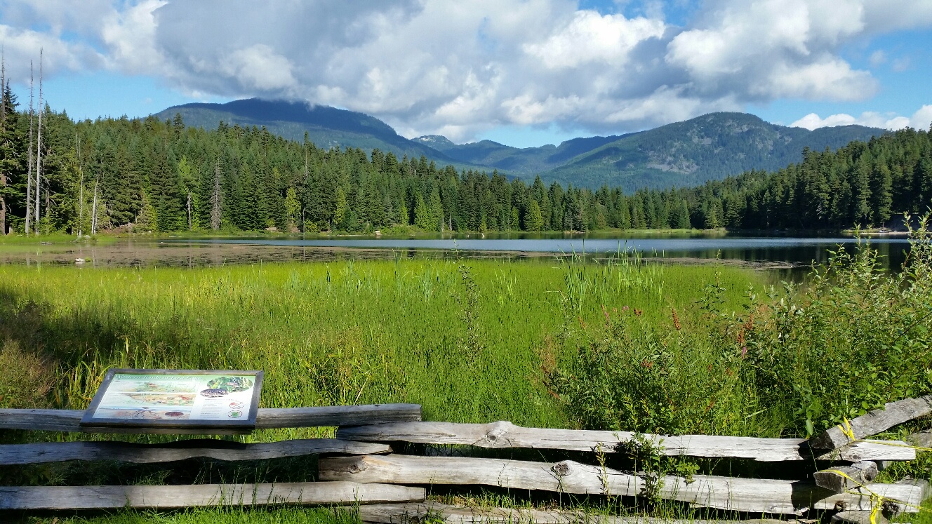
We have yesterday's cyclists to thank for suggesting today's visit to the Sun Peaks Resort, rather than head up to Wells Gray. It was good advice. The top picture shows how 'closed' is Wells Gray Provincial Park.

After waving goodbye to Gary (we were his only guests last night) and stocking up in Safeways, we enjoyed a 45 minute (57 km) drive up to this small resort where Sue had booked a cheap but smart room last night through booking.com.

We arrived in time for elevenses, during which a trail guide was obtained and a hiking route planned. Then it rained. So we took a breather before mounting a chairlift that took us above some scary looking mountain bike trails and a pair of Mule Deer (they have big ears and a short black tipped tail) from 1250 to 1850 metres. That placed us in a great position for an enjoyable 13 km circuit including two summits - Top of the World (2080 metres), near which summit we enjoyed our lunch, and Mount Tod, at 2152 metres the highest point in the area.

The paths were excellent and offered good views over a landscape a little different to others we have viewed. I think it's described as 'sub-alpine'. No jagged mountains except in the far distance, but expansive views in all directions, albeit a little hazy. The alpine meadows would recently have been blue with lupins, but now they have been taken over by pinkish willowherbs (known as Fireweed here but we would call it Rosebay Willowherb) and the yellowing leaves of great yellow gentians. There were also light blue bellflowers like Harebells, Red Paintbrush flowers, and Ragworts,  Fleabanes and Louseworts similar to those seen as weeds at home. Also Fringed Grass of Parnassus, Sue tells me. 

Apart from a few folk near the top of the chairlift, we encountered just two people - a couple of ladies at the far point of our circuit. We joked about the rather black cloud that was heading towards us.

Afternoon tea was taken just as the blizzard started. The temperature dropped to 0°C (it had been 20°C earlier) and a good inch of snow fell. We were on a joint hiking/biking trail but saw no bikers - it wasn't an easy path to ride and would be tricky in the snow.

After about four hours on this walk we emerged from path number 9 at The Alpine Shop, where we were accosted and told that the chairlift had been closed due to the risk of lightning. A truck driven by Aussie Tom was on its way down so we bagged a lift in that together with three others after telling the concerned staff about the two ladies we had seen earlier. The chairlift soon started up after the storm had passed, by which time we were installed in this excellent room with two double beds at the Sun Peaks Lodge.

Our salad ingredients proved as tasty as ever.

It's now quite possible that we will spend the next two nights camping on a site with no WiFi, so you may not hear from us again until Sunday evening (Monday morning in the UK).

Today's pictures:

• The Wells Gray debacle
• Kamloops Backpacking Hostel
• The chairlift to Top of the World
• The view from Top of the World to Sun Peaks Resort
• Lunch near Top of the World
• A Fireweed view
• Storm in view
• Tramping through the meadow away from the storm
• On Mount Tod
• The storm starts
• Snow!
• Sun Peaks Lodge

I have been reading other blogs but I'm reluctant to make many comments as they seem to appear in duplicate. Sorry about that if I have commented, and if I haven't you may yet hear from me when we get home.

Today was another most satisfying one, despite not being part of the original plan.

13 km hike with about 500 metres ascent, plus 4 km by the North Thompson River in Kamloops in 21.30. 

Thursday 24 August 2017

A Canadian Adventure - Day 21

Wednesday 23 August 2017

Paul Lake and Kamloops

First, to echo Conrad and Alan's comments on yesterday's entry, if you click on an image you should be able to see a bigger version and scroll through the day's other images, if you so desire. (I'm sure some readers do just that and ignore the text - that's fine.)

After posting yesterday's entry, in which I forgot to mention that there might be a five day hiatus in postings due to our plans to camp in a remote park, Jenessa arrived from the smoky north and Sue did some Internet research.

We had planned to camp for four nights in Wells Gray Provincial Park, but the extreme fire risk is such that whilst the campsite is open, most of the walking trails are closed. Moreover, the area is still blighted by lingering smoke from earlier fires, which apparently are now considered to be the worst in recorded Canadian history.

So we decided to stay for another night at Gary's comfortable hostel and explore a small local Provincial Park - Paul Lake. This turned out to be a good move. This area has also been affected by smoke and the locals we met told us today was the clearest day of the summer. We enjoyed a lovely walk through shady but not too dense woodland, up to a bluff, Gibraltar Rock, that overlooks the lake in both directions.

For lunch on a shady bench with a view from the bluff, we were joined by three very active and playful chipmunks. They reminded me of our trip to Killarney, north of Toronto, in 2002.

Then it was down through the trees to a lovely walk alongside the lake to its western end. We met a couple of ladies who gave us a valuable lesson on the use of the bear spray that we carry all the time. It's like we advise people who carry compasses:
"Carry bear spray at all times and know how to use it."
(Not that most people ever need it.)

A couple of Loons were fraternising on the lake, and an Osprey flew overhead. Once we'd got to the end of the lake and established that there were no refreshment points, we turned round and walked back, this time with good views of the bluff ahead of us.

Earlier we'd been to Pinantan Lake, where a lady in the General Store sorted us out with three coffees for $4 from a fancy new machine; the quantity being dispensed was less than she thought appropriate so she shared a third cup to fill both our cups, and she gave us advice on the Paul Lake hiking trail. Four cyclists on a 90 km outing from Kamloops were also very helpful with suggestions as to how to get round our Wells Gray predicament.

On return to the beach, Sue went for a swim. Then we returned to Kamloops. A Canadian Pacific train entertained us for a while, especially since the drivers appeared to be standing on a balcony in front of the train, just chatting! A taster of the 'Heritage Tour' took us past a couple of cathedrals and various other 'old by Canadian standards' buildings. The Catholic cathedral looked more like a very ordinary church. It was built in 1921 and has some lovely stained glass windows that were made in Canterbury. We can't comment on the interior of the Anglican cathedral as it was all locked up.

Dinner in an Irish pub (Kelly O'Bryans) staffed by Canadians wearing kilts, with a baseball game (thankfully on 'silent' but nevertheless interesting given our new found understanding of the game) on TVs in the background was a little bizarre, but the food and beer were good. Sue's portion was gigantic. 

We adjourned to the Riverside Park, where a free 'Music in the Park' concert is put on every night in July and August at the Rotary Bandshell. We took our place on our camping chairs (thanks Shak) together with around three hundred others - a number that impressed Gary when we told him later. Tonight's show was performed by the classic rock band - Dodie Goldney's Instamatics. With rhythm and bass guitars, a drummer and Dodie's vocals, it reminded me of live bands I saw in the '60s. Some of their repertoire was indeed from the '60s and when Dodie wasn't singing I could picture myself back in the presence of Eric, Jack (RIP) and Ginger.

The concert ended at 8.30 (no chance of the aforementioned trio even making an appearance by that time). Thompson River had a silver sheen under the vestiges of the sunset as we strolled back to the car past an active bowling green and returned to the comfort of Gary's hostel. 

Today's pictures:
• The beach at Paul Lake
• A view to the beach from Gibraltar Rock
• The view west from Gibraltar Rock
• A lunchtime 'chippie'
• Looking towards the Gibraltar Rock bluff from the walk back to the beach
• In the trees above Paul Lake 
• Canadian Pacific at Kamloops
• Sacred Heart Cathedral (1921)
• St Paul's Cathedral (1888/1924)
• Graffiti in Kamloops 
• Sue's giant meal
• Music in the Park
• The silver Thompson River, with Overlander Bridge

(Lots of pictures as Gary's broadband is excellent. We decided not to connect to the nearby open WiFi named 'FBI Surveillance Unit.)
 
9.5 km hike with about 250 metres ascent, plus about 3 km around Kamloops. 

Also of note today was a message from Simon with a lovely picture of my grandchildren with their great grandma Dot. Thanks for that Simon.

Wednesday 23 August 2017

A Canadian Adventure - Day 20

Tuesday 22 August 2017

Whistler to Kamloops

It was virtually cloudless all day, with afternoon temperatures rising to 35°C. Far too hot to go for a walk, so we went for a drive to Kamloops. It was very scenic, passing through an increasingly arid landscape over undulating terrain past an assortment of mountains and lakes.

Our first stop was beside Green Lake, where we could look out to a reflection of Whistler and the mountains behind the town (top picture).

We continued to Nairn Falls, where a select band of people were enjoying the 1.5 km walk along a good path to these modest but interesting falls. Erosion of the fabric of the narrow gorge has produced some interesting effects (next four pictures).

Pemberton provided a petrol station where we met a group of Scottish motorcyclists enjoying an annual indulgence. Then we moved on to a café, where a couple of Canadian motorcyclists were also enjoying their trip.

Further up the road, a pause near the end of Duffy Lake offered photo opportunities of the lake and of the log jam that it's known for - the First Nation people know the lake by the name 'Teq', which apparently means 'log jam'. (Pictures 6 and 7)

Naxwit Picnic Area provided a perfect venue for lunch at a shady picnic table. Sadly I left my camera in the car, but luckily the sighting of a large brown bear with two small black cubs is indelibly printed on my retina. They were on the far shore of the river but soon moved away when they spotted someone bathing nearby.

We then passed by Lillooet in increasing temperatures and aridity. Now the tree line was half way up the mountains, with the trees above that line rather than below it.

It came as something of a surprise to reach a city in the middle of this rather desolate landscape. Kamloops offered a large supermarket where we stocked up with provisions for supper. We've just demolished those provisions at the very homely Kamloops Guesthouse Hostel, a private house with four twin rooms for visitors. We are the only visitors tonight so we have a large en-suite room and a separate private bathroom. Quite a contrast to the last four nights' curtained cubicles! And much cheaper.

Before eating, and in rather high temperatures, we got our exercise for the day by way of a short jog beside the North Thompson River, a stone's throw from the hostel. We were still dripping half an hour later, but that offered an excuse for rehydration fluid, and our clothes are all washed, and dried by the hot breeze. The last picture was taken during our jog and shows the inverted tree line phenomenon around here.

Our host, Gary, an elderly  gentleman of oriental origin, is very attentive and has refused to allow us to do our washing up. 

We will sleep well tonight.
 
3 km hike with about 50 metres ascent, and 4 km by the North Thompson River in 21.25. Not forgetting a 305 km drive.

Tuesday 22 August 2017

A Canadian Adventure - Day 19

Monday 21 August 2017

The High Note Trail and Flute Summit

At last, a high level alpine walk on a path more akin to a well used alpine path than to a badly engineered pile of Canadian rubble.

In exchange for only half a gold bar we were able to secure a gondola ride up to the Roundhouse Lodge at 1850 metres on Whistler Mountain. This was above the tree line! We were accompanied in our gondola by a chatty family from 60 miles east of Vancouver. It was the first of many chatty interludes with like minded walkers. There wasn't an oriental face to be seen.

Coffees were savoured as the sun dimmed due to a 90% eclipse. Somebody kindly lent us some suitable spectacles with which to view the eclipse despite the bright sunshine through minimal cloud.

We then ascended a further 300 metres or so by a chairlift over scary gaping chasms. Then we enjoyed by far the best walk of this trip. Was that because of, or despite the lack of trees? I'll let the reader judge that one.

The High Note Trail is a popular walk, there's no doubt about that. There were lots of people, but it wasn't just we who were comparing the mountain etiquette with that encountered on the Joffre Lakes paths. There were numerous viewpoints worthy of a pause. We kept encountering the same people albeit our walking speeds differed.

The mountain etiquette extended to the resident marmots, one of whom spotted me from a distance and kindly came to a nearby rock on which to pose for me. The chipmunks weren't quite so obliging.

There were fine views down to Cheakamus Lake, some 800 metres below us, and yesterday's route and summit could be seen clearly to the west. The Black Tusk visible on yesterday's last picture takes on a different persona from Whistler Mountain, appearing more like a giant tooth.

Our 13 km walk comprised a standard loop plus a there and back extension to Flute Summit, at 2012 metres my second summit, and Sue's third of the trip. We continued a little further, to an idyllic lunch spot and beyond. A mere 7.5 km beyond Flute Summit, at the end of the Musical Bumps Trail, lies Russet Lake, where wilderness camping is allowed. It's just below the nose of the Overlord Glacier. We met people going to and fro from this reputedly wonderful spot. Sadly we've not brought a backpacking tent on this trip, but this would be a good venue for anyone with such a tent. We were told that bears aren't known to visit this spot, so precautions are minimal.

On the way back to the main trail from Flute Summit we had the pleasure of meeting Kelly and Adam, a couple from Cheshire who are over here working and (when they get a chance) playing. They hope to be able to earn a living from travel writing and associated activities. We wish them well. Their website (under construction) is www.destinationaddict.com

It was a delightful walk back, despite a drippy ascent from Symphony Lake and another one to Harmony Meadow, to the Roundhouse Lodge, past more posing marmots and great views in all directions, if a little hazy.

Lauren was our companion in the gondola returning to Whistler. It's a half hour ride, which is just about long enough to get to know someone and more than enough for a first impression. So, Lauren, we are genuine about the offer to help you with any European trip planning, and you are welcome to get in touch/visit if you come to the UK. And the guys in the outdoor shop where you left us were most helpful. I exchanged the other half of this morning's gold bar for some shiny new walking poles, having inadvisibly left mine in the UK.

Lauren also provided a little insight into the Joffre Lakes debacle. Apparently it used to be a tough and not very popular trail, but a combination of social media postings that went viral, and the sanitising of the path with unsightly rubble, have changed all that. There are now better alternatives.

Regarding mountain biking, I may have been too harsh in my earlier comments. Lauren confirmed what others have told us, in that there is something for everyone. But I still think the high tree line would be a problem for me. 

Today was a brilliant day, concluding with another excellent self cooked meal and a few beers at the Whistler Lodge Hostel.

Today's Pictures:
1. Ascent by gondola
2. Roundhouse coffee
3. Brandywine Mountain and part of yesterday's route
4. Roundhouse Lodge
5. At the Stone Man, with The Black Tusk to the left
6. A posing marmot
7. Cheakamus Lake
8. Lunch with a view towards Overlord Mountain
9. Afternoon tea at Symphony Lake
10. Whistler
 
13 km hike with about 500 metres ascent, in around 6 hours. 

Monday 21 August 2017

A Canadian Adventure - Day 18


Sunday 20 August 2017

Brandywine Mountain (aka mosquito hill)

Two missed items from yesterday:
• our walk involved ascent of about 500 metres - quite a feat for many of the tourists
• on our return journey to Pemberton the traffic suddenly stopped. We thought it was an accident, until we saw the black bear, chewing nonchalantly on something in the drainage ditch. It looked a bit hot

Richard, Diana and Joe had recommended today's outing. So they are to blame for today.

We set off on a short drive down Highway 99, which is a road between Vancouver and Whistler a bit like the A9 north of Perth, and found the correct Brandywine turn off (not the one to the falls) without too much difficulty.

Soon after leaving the tarmac a wolf was spotted, wandering confidently around an area of wasteland. Then began a rather long and tedious drive for 5-6 km up a dirt road. Charlie wasn't happy. Nor were Martin and Sue. After a long drive at near walking pace we eventually managed to deposit Charlie in a relatively save spot a good 500 metres and a steep climb before the lower trailhead for Brandywine Mountain. Everything there looked a bit dilapidated. We started walking around 10 am. My boots were deployed for the first time this trip. A mountain chicken guided us up the road.

The trail thrutched relentlessly steeply up a forest - apart from a short boardwalking interlude - for an hour and a half, before reaching an alpine meadow. We paused for elevenses. There were lots of orchids and gentians as well as pretty yellow and blue leopardsbane type flowers. 

Another feature of today's walk was the mosquitoes. It was alright if you kept moving, but as soon as I stopped they always found me, despite the spray.

Above the tree line we soon joined a grotesquely engineered motorway of a path from the nearby Upper Trailhead, only accessible by 4WD. This path was busy with hikers and dog walkers. It came to an end about a kilometre up the valley, where we stopped for lunch with good mountain views.

An easy river crossing led to another thrutch upwards through heather. I was going very slowly. And I didn't fancy the scramble ahead that was promised by our guidebook. So Sue went ahead and we agreed to meet in the bowl of a small amphitheatre later. It was 1.30. Sue hoped to be back by 4 pm.

A group of four soon arrived at where I'd  stopped and I followed them up to a point where it got too steep for them. They were wearing trainers that they realised were unsuitable for the terrain. I went a little higher, but turned round at about 1850 metres as I couldn't be sure which way Sue had gone from there. The terrain was complex. The bottom picture was taken from my high point. A view that I enjoyed all afternoon whilst pacing around a small flattish area as if in a prison cell full of mosquitoes but suspended over a sublime view.

Several people came past whilst I was waiting. Most of them were carrying skis. Apparently there's a bowl of snow higher up where you can ski. "It's not the best skiing experience, but it has to be done" commented one of them.

Sue turned up again at 3.45, having successfully reached the 2213 metre summit. By now the weather had improved into a lovely sunny afternoon. We ambled our way down to the car, reaching it at 6 o'clock. Then the battle with the rough track recommenced, the first 5 km taking us 35 minutes. At one point a chipmunk played chicken with one of our front wheels.

It was a late meal of pasta and sausage back at base. Thankfully (unlike Richard, Diana and Joe), we hadn't booked a posh restaurant.

Today's Pictures:

• the start of the trail
• a boardwalk interlude
• the Brandywine meadow (2)
• the view from my high point

13 km hike with 1000 metres ascent, in 8 hours. An extra 3 km and 400 metres ascent for Sue.

Sunday 20 August 2017

A Canadian Adventure - Day 17

Saturday 19 August 2017

Whistler parkrun and the Joffre Lakes

Thirty people turned up for today's parkrun, a fair sprinkling of whom we'd met two weeks ago at Richmond. The first four pictures were all taken at the parkrun, which took a scenic route around the Lost Lake. Well named, as several of the Brits got temporarily misplaced and nearly went round the lake twice.

The run director has to put up with a constant supply of tourists, some of whom forget their bar codes. That's no problem here so long as you can remember your name and number. He's also very relaxed about unaccompanied children, though I think he might have had something to say if four year old Sebastian had not dragged his dad around with him in 43 minutes.

Shrewsbury Paul was pleased to be first home. His GPS indicated ascent of about 600 feet, so we are all excused for going a little slower than usual. Some of us have additional excuses.

We enjoyed a slow coffee surrounded by rental mountain bikes. That's the major activity hereabouts. There are apparently some good routes, though the emphasis seems to be on downhill adventure riding rather than the touring that I prefer. Given that a lot of the routes are no doubt in trees I don't feel I'm particularly missing out by not hiring a bike here if the weather is suitable for walking, which it was today.

So Sue and I headed off to Joffre Lakes, about 60 km away. Many others were also headed there and parking required patience. There seemed to be thousands of people crammed onto the narrow but very well surfaced trail. I couldn't be bothered to change out of my parkrun trainers. Sue donned three season boots and walking poles as our guide book said there was a tricky bouldery section. There might have been in the past, but it has now been sanitised almost to wheelchair friendly status. Sue looked a bit out of place; trainers or sandals were the norm. There were large numbers of Oriental and Indian folk on this trail, as well as the usual Caucasians.

There are three lakes, all of which sport fine views to nearby summits and glaciers that were free of cloud on this warm, sunny and Clear day. The smoke seems to have dissipated from this area. In between the top two lakes the water plunges down some falls. Given that we'd been parkrunning today, their name, Holloway Falls, seemed quite appropriate.

There were queues of people waiting to pose on tree trunks in front of the views. One enterprising chap from Oxford was using a drone to take pictures. He could get all three lakes into one frame. "The middle one is the bluest" he confirmed. Some folk were showing off their swimming skills. The water looked very cold; it was after all emanating from a glacier.

After the 3.5 hour 'there and back' stroll, we adjourned to the Mile One Eating House in the nice town of Pemberton. Their burgers were excellent despite some of the names (out of deference to AlanR I chose a 'Rusty Tractor' burger). We were lucky - early enough not to have to queue - by the time we left there was a long queue of customers who would have to wait an hour for their meals. At least they could listen to the jazz and blues classic soundtracks that were playing.

A chat with our waiter had him chuckling at our having been suckered in by the Joffre Lakes hype. He reckoned there were much more scenic walks in the area that didn't involve walking through a forest on a crowded sanitised path. Pemberton could be a good alternative base to Whistler.

Today's Pictures:

1 to 4: Whistler parkrun number 7
5: A Joffre Lake view
6: Crowds at the upper lake
7: Holloway Falls
8 and 9: Dinner at Mile One Eating House

5 km parkrun, 8 km hike in trainers, and 4 km wandering around Whistler and Pemberton.