On a day of warm weather (plus 15C as opposed to minus 15C in Ottawa), I was joined by Rick, Graeme and Paul for this pleasant saunter from the Adlington Road car park in Bollington.
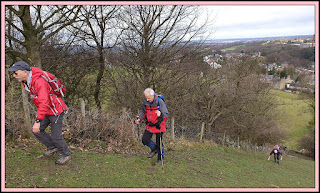
The path to White Nancy is steep. Paul habitually zooms ahead, but here he gave the distinct impression that he had forgotten to install his ‘winter tyres’.
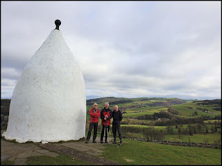
The dog walker knew the route that offered friction. Nevertheless we were soon assembled at White Nancy, having knocked off virtually all the climbing on today’s walk in the first few minutes.
There’s a good view from here to Billinge Hill and beyond – Gritstone Trail country.
By way of a reminder, not least to myself, here’s what I’ve written about White Nancy in the past:
‘The structure was built in 1817 by John Gaskell junior of North End Farm to commemorate the victory at the Battle of Waterloo. It originally had an entrance to a single room which was furnished with stone benches and a central round stone table, but the entrance is now blocked. It has been described as a summer house or a folly.
In the mid-1940s, the Royal Signal Corps Trials Unit based at Catterick would apparently drive a truck-mounted dish-shaped transmitter/receiver up to White Nancy, where they tested cathode-ray tube transmission and reception (data-based, not images), to a mobile receiving station on another truck. The receiver would be driven further and further south over time, until eventually the lads at White Nancy were sending a signal to the south coast of the country. Locals told the signallers that the landmark was named after the lead horse that had transported all the materials for the building of the folly.
White Nancy is circular in plan with its shape described as that of a sugar loaf, and is surmounted with a ball finial. It is built in sandstone rubble which has been rendered and painted. It is about 18 feet (5 m) high. Stone paving has been laid around its base which is inscribed with the points of the compass.
According to its Wikipedia entry, White Nancy was unpainted until at least 1925, since when it has been painted in a number of different colours over the years, most commonly in white. In 2005 vandals painted it partly in pink. In March 2009 it was repainted in white with the ball finial in black.’
We continued along the Saddle of Kerridge to Kerridge Hill, from where there’s a good view down to the village of Rainow.
Whilst there are excellent walks to be had by continuing to the end of the ridge before turning to head through Rainow, we chose to pause at the summit of Kerridge Hill – there were good panoramic views on the clear day – before heading down the western slopes to some footpaths across muddy fields leading to the Macclesfield Canal. A tea and banana break was taken en route.
The canal towpath between Macclesfield and Bollington provides very pleasant walking. A fleet of Canada Geese was encountered.
The outskirts of Bollington bring sights of all manner of garden decorations on the east side of the canal. Stone herons jostle for position with plastic pandas. And that’s just the start of it.
There were numerous patches of gaudy crocuses beside the path.
We continued through Bollington to a footbridge that led to an excellent café, shown below with an appropriate icon. Superb carrot cake.
The ‘8 km’ walk turned out to be 9.5 km, with about 200 metres ascent. It took us about two and a half hours.
Next week, it’s the Bollin Valley, all welcome:
The Bollin Valley and Ashley. Meet at Bankhall Lane in Hale, near the junction with Ashley Road (SJ 773 858), at 10.15 am (to allow time for a 9.30 tram from Timperley!), for a 13 km outing in pleasant countryside.
Don’t worry, Dot, Sue will take you to your eye appointment.
To view the images at a reasonable resolution, you may have to click on one of them and scroll through the slideshow that appears at the bottom of the screen.


No comments:
Post a Comment