28 April to 3 May 2005 - A Visit to Skye
Thursday 28 April
I
picked Sue up from work at 4:35. A quick journey in the Peugeot 206 took us to
Tesco's in
Friday 29 April
After
a good night's sleep we wandered across to the ablution / kitchen block and
breakfasted at leisure (leaving my toilet bag in the kitchen, to be recovered
four days hence), before loading up and driving out past the hopping Pied Wagtails,
and on up to Skye.
8:20
- wigwams
9:20 -
12
noon -
1:00
pm - Glenbrittle campsite.
We had a leisurely couple of hours in dry but gloomy (cloud level under 1000 feet) weather so we couldn't see the hills. There were just a handful of people on the site. By 3:30 we had got the tent up, lunched, rested, and were ready for a stroll towards the point to the south - Rubh an Dunain. This is Ralph Storer's route number 34 and we've done it before - just a gentle stroll to the point. We didn't go all the way this time - just past the wall for another 15 minutes - past Carn Mor to a good viewpoint, then back to camp for 6 pm and a good meal - and a good read of 'The Villain', Jim Perrin's biography of Don Whillans for me, and the Da Vinci Code by Dan Brown for Sue. Then an early night and a good sleep. Showery.
Saturday 30 April
It
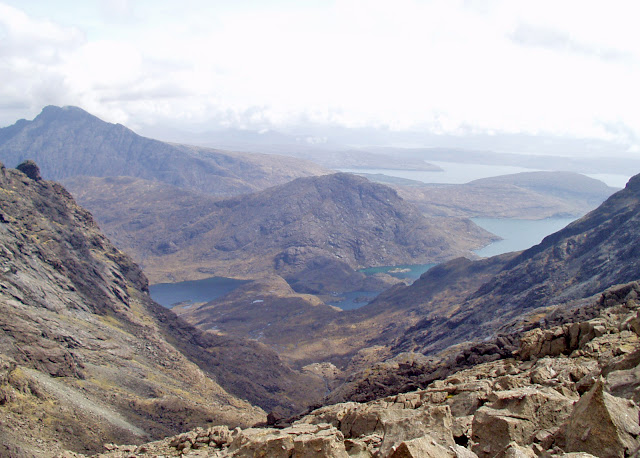
dawned fine, and the cloud rose to reveal the Cuillin peaks above the campsite.
We decided to base ourselves at Glenbrittle and head for Sgurr nan Eag. We recalled
navigational problems on our last visit led by Ian Inch, some nine years ago.
This time we had no difficulty with the route. We had Ralph Storer's '50 Best Routes on Skye' book, open at routes 11 and 12, to help us. This time we managed to round Sron na Ciche and head up into Coire Ghrunnda with only a minor error - we should have gone sharp left at a conspicuous boulder, to gain a higher path. We joined it later at the foot of the coire.
Start 9:30 (after sausages watched over by campsite thrush)
290 metre rock - 10:20
Sgurr nan Eag (924 metres) - 1:00 to 1:30
Bealach 2 pm
Lochan - 2:30
Campsite 4:30, where Garry Scholes (a former work colleague of Martin's) was there to greet us. Pleasant evening with him. Outdoor cooking was even possible.
On
a cloudy day, Sue and I headed off to Sligachan whilst Garry went on the stroll
we had done on Friday, down the coast. Cuckoos at camp. The forecast was
excellent, but not matched by conditions on the ground. However, we decided to
head up Marsco, not high enough to be a Corbett, but a nice looking hill.
A
pleasant stroll from the Sligachan Hotel in the company of many foreigners took
us to a path to the left up Allt na Measarroch. A short way up here we headed
directly up the north face of Marsco. It started to drizzle. The serious rain
held off until we were on the descent. Just as well as it got very steep
towards the summit ridge, at which I for one was very pleased to arrive. I
don't think a slip would have caused a serious fall, but it was at times a case
of hanging onto tussocks. So we lunched just below the summit, in a sheltered
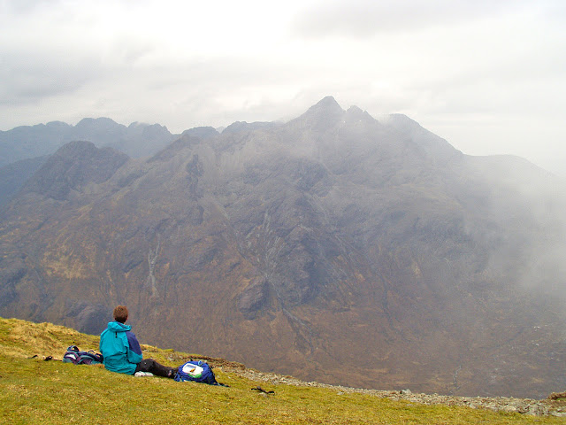
spot with good views towards the Black Cuillin ridge. It was just about clear,
but very dull, 'black' being a correct description.
Then
it was back to Glenbrittle, then off to the Old Inn at Carbost for a meal with
Garry on a cool but fine evening.
Slig
- 10:55
Turn
to Measarroch - 11:40
Turn
up north face - 12:00
Back
at Slig - 5 pm.
Monday 2 May
After
a leisurely start we drove with Garry to Penifiler, just south of Portree, from
where Ben Tianavaig was our target for the day. Garry didn't realize this and thought
we were going on a coastal walk. He is out of condition so timings were Naimith
x 2! Whilst cloudy on the Cuillins, it was nice here despite a cold wind.
We
left at 10:30 and fumbled our way past a radio / telephone mast and down a
small valley over pathless ground to reach Camus Ban bay.
The
first bit of the bay was sandy but had a dead sheep in its centre, so we stayed
high and headed down to the rockier second bay via a precipitous path through
thick vegetation. Lots of gorse and silver birch as well as the ubiquitous
primroses. And so we headed on past the bay. Continuing higher on the coast,
there was a huge crashing sound ahead as some large boulders crashed down from above
about 50 metres ahead of us. A narrow escape - they could have been very
damaging!
Lots of seabirds here - cormorants and even a lone mallard. We soon left the coast to head south towards the summit.
Sue
went by a slightly longer route with sea views and got there nearly half an
hour before Garry and me, the former having needed lots of rests. (He later expressed
regret at his lack of condition, but was pleased to have gone up the hill.)
There
were splendid views from this small peak - notably towards The Storr and the Trotternish
ridge to the north, Raasay to the south, and to the red and black Cuillin with veils
of cloud.
A
wizened man joined us and related unlikely stories about a planned laser show
on The Storr and a planned closure of Glenbrittle campsite as of this year
(though we know it's open). Another couple lower down we're watching a pair of
sea eagles, but we didn't spot the birds despite passing on the way down a
solar powered camera used for viewing them in the visitor centre outside
Portree.
We didn't take Storer's direct route west, but headed along the ridge to the north - looking down on Trotternish like pinnacles, before turning left to join our route of ascent and ambling back to the car by 4 pm on a fine afternoon.
The shops in Portree had little to offer except venison sausages, but we had enough food for a good pasta and tuna meal on return to camp, then a final stroll on the lovely beach before another early night.
Tuesday 3 May
An
uneventful journey home after nice venison sausages. 9am to 7pm including six
stops. Very leisurely. Picked up the forgotten toilet bag from the Wigwams.
An excellent trip.


No comments:
Post a Comment