Sue and Martin in Mallorca 2019

Sue and Martin in Mallorca 2019
On the Archduke's Path in Mallorca

Friday 5 August 2016

Meall a'Phubuill and Meall Onfhaidh

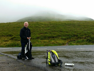
Margriet joined me and Iain for this final stroll of the trip on an overcast day with the local cloud base around 1200 metres.

It was an easy walk in from Fassfern along Gleann Saileag, then a steepish ascent to the summit, with good views to Gulvain and beyond. (Pictured, top.)

The steep descent to a 380 metre col was slowly accomplished. Many frogs and spiders were in evidence, with lizards scurrying to avoid our Scarpas. Yellow mountain saxifrage (pictured) graced the waterways.

Meall Onfhaidh presented no difficulties other than for Margriet, who found it necessary to don a bee keeper's outfit to combat the midges.

We enjoyed fine views into Ardgour from the summit (third picture).

It was clouding in. The descent past wheatears back to the path above Gleann Saileag was easy. It started to rain. An industrial scene lay below us, near a small bothy. A relic of this industry is pictured (the last picture).

The rain continued as we strolled back to the car after walking 20 km with 1100 metres ascent in 7.5 hours. (Yesterday was 11 km, 800 metres, and 5.75 hours.)

Another fine meal was served by two more volunteers back at Borrodale House, where the lack of 'phone signal and sporadic wifi may delay this posting.

Tomorrow, it's 'back to Timperley'.

Back to Index

Today's route:


Thursday 4 August 2016

Stob Coire a'Chearcaill

Iain went off to experiment with an interesting looking ridge* near Lochailort, so today my companion on Stob Coire a'Chearcaill was Jon.

The last of the drizzle cleared as we drove east past Glenfinnan and a short way along the Lochaline road to a cattle grid. This hill is gained by way of a 5 km walk directly south from a gate just beyond the cattle grid, over initially tussocky ground. Tedious but rising only gently. I'd planned to walk alone and take lots of flower pictures, but low on this north facing slope I could only detect heather, bog asphodel and tormentil. So keeping up with Jon wasn't a problem.

Tea and cake fuelled us for the steepening slopes over easier ground. I fell behind here. It's hard to get good pictures of flowers like milkwort and eyebright when they are embedded in deep grass. We saw a few red deer today, but they must be slow munchers. 

Looking back (top and bottom pictures), there were good views towards cloud cloaked Munros to the north. The Fort William to Mallaig steam train puffed its way slowly across the foreground, hauling about eight carriages of sooty tourists.

Ravens argued above us as we reached a fence junction at about 700 metres, with good views into the depths of Coire Chearcaill to the east. Veering right, we soon reached the trig point and massive summit cairn at 770 metres. Lunch occurred in the shelter of this cairn, our heads just poking into the cloud.

A few metres lower down we had good views of both the cloud engulfed summit and the extensive vista below the 760 metre cloud base.

Jon spotted a forest track to the west of our ascent route that wasn't on our map, so we headed for that in order to avoid the awkward tussocks through which we'd ascended. The plan worked, apart from a deep hole that claimed Jon and destroyed his trousers.

The new track led down to a pleasant stroll past dandelion meadows and back to the main (albeit single track) road.

Today's self appointed task of taking pictures of some of the flowers mentioned in earlier postings enjoyed partial success. The images will be included in a slideshow that I'll produce next week.

*Iain's 'ridge' turned out to be a series of hills with very rough going and a tough descent to the coast, and a MBA bothy near a cottage that can only be accessed by sea. A footpath led back to the main road from the bothy, so Iain was pleased not to have to retrace his rather cumbersome steps.

Next Day

Today's route:


Wednesday 3 August 2016

Ben Hiant (Ardnamurchan) on a Driech Day

Six of our fifteen strong group left for a day trip to the island of Canna. Five hours on a small boat in the Minches. My idea of hell. Another seven were missing in inaction, so Iain P and I set off for the Ardnamurchan peninsula.

After a break for coffee and cake and a present for Sue near Glenbeg, we continued to battle our way along the single track road towards Lochaline, finally halting at a 171 metre col below Ben Hiant. 

It was raining. The top picture shows Iain getting ready to depart. There was a path - a novelty by this week's standards. We followed it, taking about 50 minutes over the 400 metre ascent. There were no views; a shame, as the summit of this hill is reputedly a fine viewpoint. We satisfied ourselves by taking a few photos for the record - of dubious quality due to rain on the lens.

Then we returned down the path. The entire walk was 5 km with 400 metres ascent, in an hour and a half. Just right for a driech day.

We descended a mile or so to a lunch spot overlooking a beach, with Ben Hiant in the background in clearing weather (bottom picture).

Next Day

Today's route:


Tuesday 2 August 2016

Fuar Beinn and Creach Beinn - a classic round

Iain and I drove round to Strontian and beyond on a fine morning, parking near the bridge over the Galmadale River. The ascent of Beinn na Cille started steeply via the edge of a forest then some uncomfortably steep rock bands.

There were lots of orchids again and during the day we observed the following flowers in addition to most of those mentioned in the last two entries:

Cross-leaved heath
Foxglove
Silvered
Red clover
Pyramidal bugle
Northern knotgrass
Various berries (fruits not flowers)
Devil's bit scabious
Roseroot
Yellow mountain saxifrage
English stonecrop
Cotton grasses, sedges and mosses

Around 1pm a short shower confirmed that the steady increase in cloud wasn't an illusion, but the day remained largely dry and the local summits stayed free of cloud.

Lunch was taken on Fuar Beinn, sheltering from a cool breeze behind the summit cairn. Ptarmigan in winter plumage were seen at the broad col before the long ascent of Creach Beinn, on which summit we lingered before diminishing views before heading on to Maol Odhar and a flock of at least twenty golden plover.

After the lumpy ascent, the undulating descent over Meall nan Each on cropped grass (there were a few sheep here) was a delight. We made good speed and got back to the car in light rain at 5.30 after 17 km with 1500 metres ascent in 7 hours.

It was an easy drive back along some interesting single track roads to another convivial evening with fine food at Borrodale House.

Next Day

Today's route:


Monday 1 August 2016

High Summer on Braigh nan Uamhachan (Slope of the Caves)

A fine hill on a fine day.

This walking club (XXL) seems to be a bit past its sell by date as not much walking seems to be done. Various excuses have been made, and a few old bikes seem to have been pressed into use. Having said that, Jon and Margriet both enjoyed nine hour days on their respective hills (Beinn an Tuim and Gulvain).

Luckily Iain P only retired a few weeks ago and is still healthy enough to enjoy a longish stroll. Also, he has been up all notable Scottish peaks so is quite relaxed about where he goes. He accompanied me today on a circuit I'd not walked before.

We parked up at the end of Glenn Dubh Ligne and walked up to the bothy. Someone was chopping wood outside. Soon after that we left the track beyond the forest and ascended a steep 400 metre slope to the long Na h'Uamhachan ridge. Milkwort, alpine lady's mantle and harebells were added to our flower list as we ploughed through high wet grass and bracken mingled with orchids.

After a lengthy traverse, lunch on the summit gave rise to Iain's 'High Summer' comment. Not quite true as there were no midges. Lots of spiders and frogs. Long grass, no deer or sheep.

After a lengthy break we descended to Gleann Fionnlighe, meeting the only other person we saw today, a runner/cyclist on his way up Gulvain, where Margriet was descending some way behind us. It was hot. Thirst quenching spring water was most welcome. 

The final half hour along the main road back to the car was a little tedious but it was good to have walked a circuit rather than a 'there and back'.

24 km with 1100 metres ascent in 7.5 hours. A fine day out.

An excellent dinner, courtesy of Angus, preceded by drinks outside, watching bats, swallows and house martins harvest the midge free air. Then some folk went to a concert in the village hall.

Next Day

Today's route:


Sunday 31 July 2016

Beinn Resipol

Yesterday's pictures:
Penrith parkrun
Buachaille Etive Mor (3)
Borrodale House

An fine day on Beinn Resipol with Iain, Dave, Paul and Dawn, from the excellent Resipol campsite where we enjoyed morning coffee before our 15 km stroll with 900 metres ascent.

Cool and a bit showery on the top. Iain and I were down first after traversing to Beinn an Albannaich via an intermediary 'summit', whilst the others retraced their steps.

Paused on the ascent to admire common spotted orchids, bog asphodel, bog myrtle, eyebright, tormentil, ling, bell heather, wild thyme and several more flowers. An eagle floated past during our traverse; cows munched on the deep grass; not a deer in sight.

Drinks outside Borrodale House, which we have rented for the week, in the sunshine before dinner. With the assistance of an international team I managed to produce a meal for 15, which was followed by an infinite XXL Club slideshow.
Goat's cheese and beetroot salad
Steak and Guinness Pie (Happy Days with the Naked Chef)
Fennel and Lentil au Gratin
Chocolate Mousse (aka Whisky Cake)

Perhaps I'll have more time to relax tomorrow.

Next Day

Today's route: