This was another 'Cicerone Lancashire' walk before exercising Oscar - see previous posting.
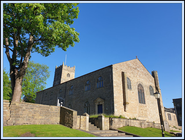
There's plenty of free parking in the centre of Accrington, from where I soon found my way to St James's church and some smart memorial benches and a plaque.
The 'Accrington Pals' were members of a volunteer battalion that suffered huge losses in the battle of the Somme in July 1916. This walk was littered with monuments to their bravery.
The market building's facade is impressive, but a chap I met bemoaned the current situation whereby rents are not sufficiently low to attract vendors, so the market is not thriving.
Mark Sutcliffe's route description is a bit vague, but it's easy enough to locate Burnley Road, which I joined outside the Broadway pub.
I soon passed St John's church, where a farewell service was held for the Accrington Pals in February 1915 when they were sent to new quarters in Caernarfon.
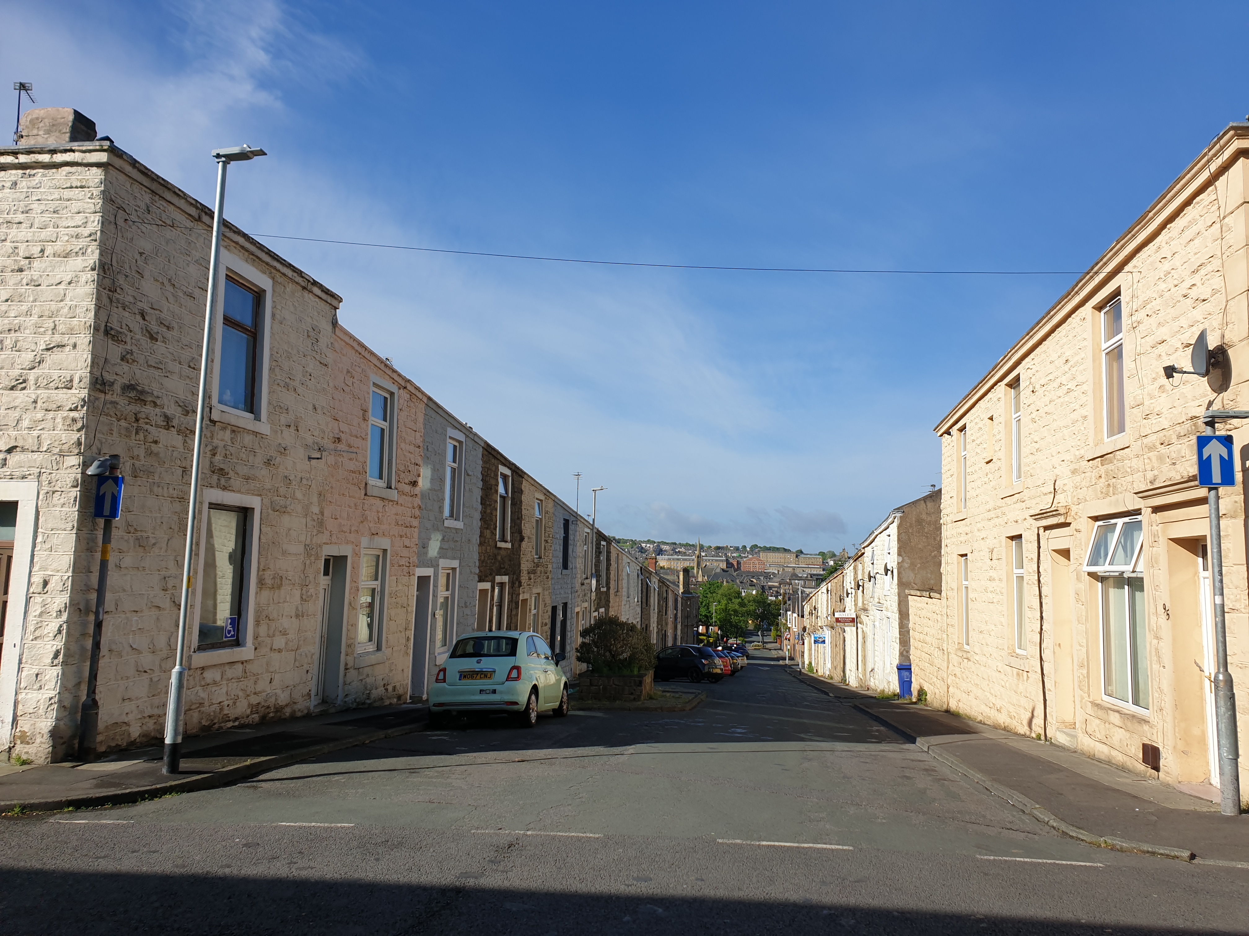
This part of Accrington is home to streets of two-up two-down houses that were presumably built for mill workers. Elsewhere, towards the end of the walk, I passed through some smart, modern housing areas, especially near Laund Clough.
After passing around a busy school via Alice Street and Turkey Street, I passed the Peel Park pub, beyond which woodland beckoned.
The path zigzagged uphill to a viewpoint that could be reached by a variety of paths, which were today lined by mixed woodland and verges full of Garlic Mustard and Cow Parsley.
This was Peel Park and the Coppice, a local nature reserve. Whilst the centre of Accrington may be starved of funds to smarten it up, the budget seems to have run to some new signage in the nature reserve - probably a different budget?
Beside the monument was a chap with two pug dogs. We discussed recent controversy re pugs. He had decided not to use them for breeding. One had cost him £1000, the other nothing. I enjoyed a coffee on the bench in front of the monument that commemorates the donation of the Coppice land by William Peel to the people of Accrington. Swallows harvested the air. Apparently the 'Pals' trained here in 1915 before heading for the front. Mark says there's a map on top of the monument that explains the views, but vandals have destroyed that. Maybe a replacement is planned, to go along with the other new signage.
Here's the view across Accrington from the bench - I won't attempt to describe it, but I suspect BC may know all the landmarks as I think the view may be towards his home near Preston.
A little further along the path is an unobtrusive trig point.
Past more dog walkers, a runner and a cyclist doing laps of a bridleway route, and I walked high above the A56 as the path turned right and gained views across a buttercup field and some small ponds.
An underpass saw me safely across the busy A56 road. I saw nobody until after I'd re-crossed the road a couple of hours later.
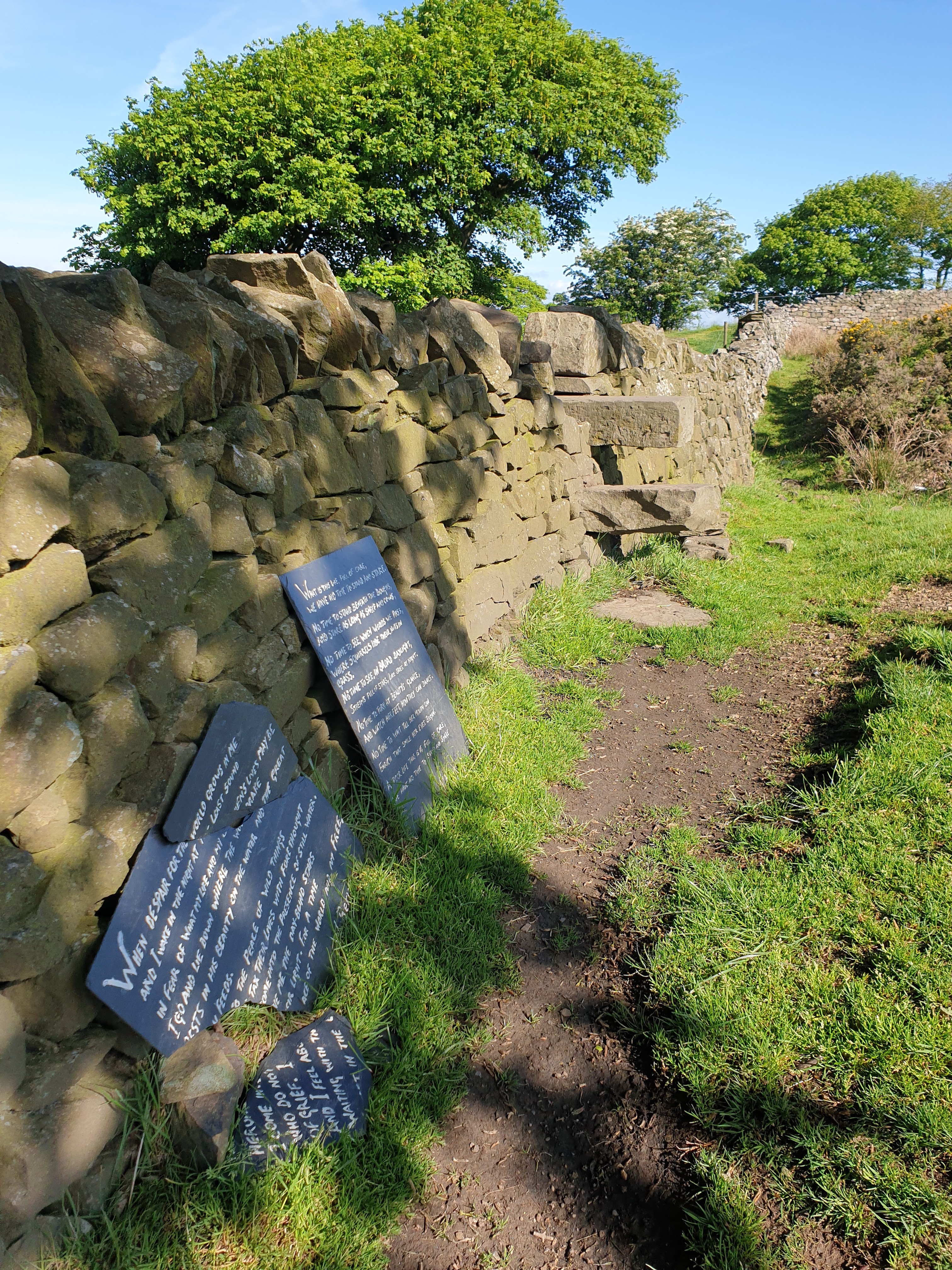
Before reaching a farm I turned left through a wooden gate (not a stile, as Mark describes) and rose to a stone stile, on the far side of which are a couple of poems on pieces of slate, one of which has unfortunately broken. (Click on the image for a better version.)
Looking back to the stile, I should have proceeded half right, to take a path to the north of Moleside Moor.
Instead, I took an obvious path that skirted the southern slopes of Moleside Moor and rejoined Mark's route at the start of a very boggy, pathless, ascent of Great Hameldon Hill (409 metres).
The route was very boggy, with tussocks not really big enough to be of much help. I'd noticed the 'bog' description when reading Mark's notes on the route, and my boots had been stashed in our porch. Unfortunately they never made it to the car, so my Keen Targhee trail shoes were seriously tested. They passed with flying colours - I was really surprised to rise out of a zone of bog and cotton grass onto an area of bilberries and wheatears below the summit, with perfectly dry feet.
There were extensive views here, with both the Peel Tower and Darwen's Jubilee Tower clearly visible.
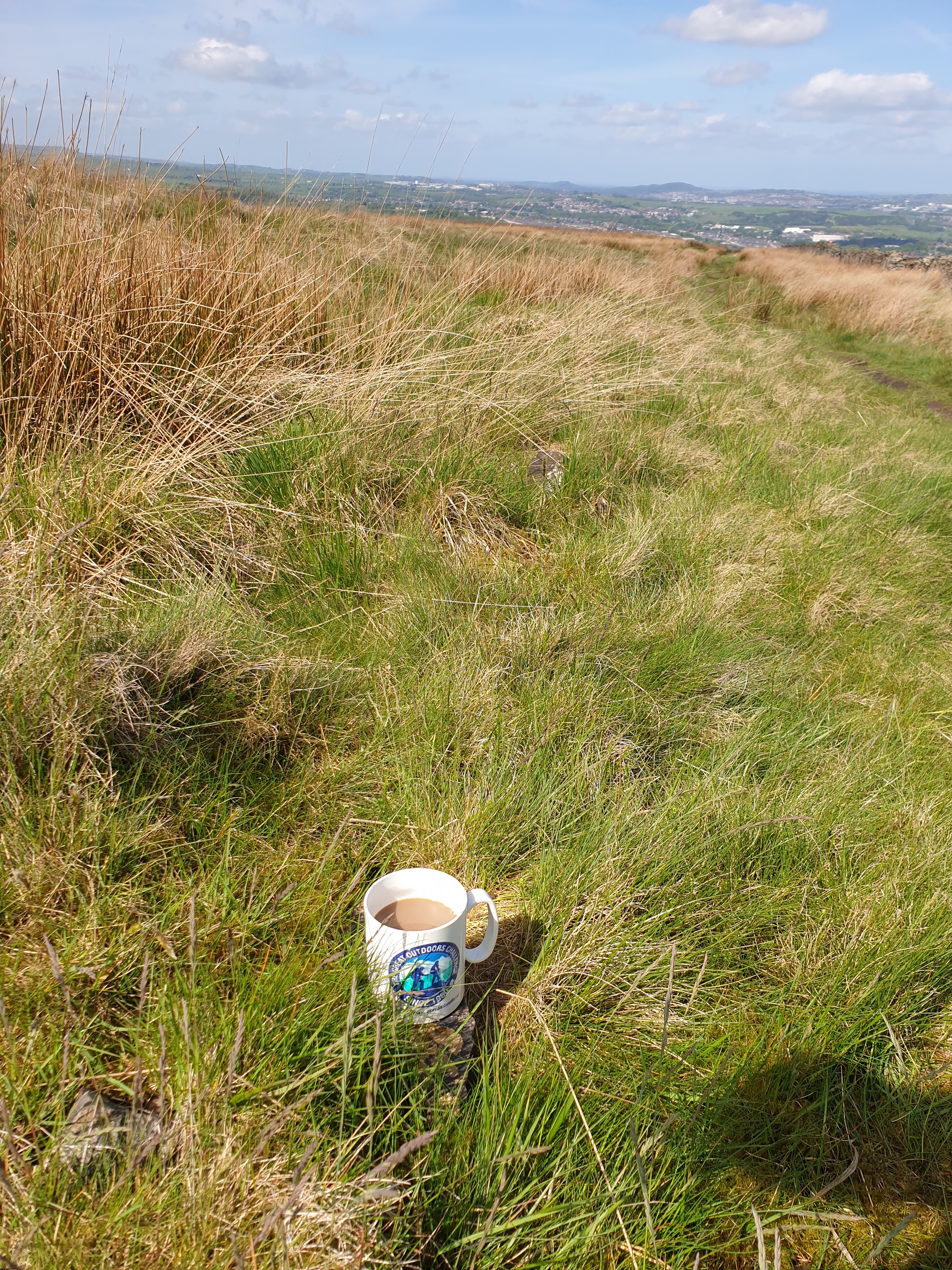
The descent via the southern slopes to May Road Well was slightly easier, with the same tussocky conditions but not quite so much bog. Beyond that, a grassy path led past a drained reservoir, next to which I paused for elevenses, using the TGO Challenge mug that should really be crossing Scotland just now. At least I was able to get out for a good walk today. It was a pleasure to laze below singing skylarks and harrassed buzzards.
Soon I turned left down a bridleway reminiscent of the Pennine Bridleway. The cobbles really do encourage the use of a bike with full suspension if you were to cycle along here.
Before re-crossing the A56, lined with Bush Vetch and Ribwort Plantain, and reaching more urban scenery, I took a look back to the embankment holding back the Mitchell's House Reservoirs.
I followed Mark's route past verges of Lady's Smock, Buttercups, Clovers and Dandelions, to Meadow Top Farm, where the farmer told me the path had been re-routed to the left of the farm and a wooden stile leading to the golf course. Here's the view back to the farm from the golf course side.
I then went down past the Club House, eventually emerging into a housing estate. The path here was signed as the 'Jubilee Walk'. I don't know what gives the golf club the right to block a nearby public footpath. Walkers are clearly not welcome here. Luckily that path was off my route.
Mark's route describes using a footpath through Laund Clough woodland. There are two paths off Southwood Drive to choose from, the one on the left is the one intended to be used, the one on the right, signed 'Laund Clough' is the one I took. It's a lovely section of woodland, from which I exited and found my way up to the Art Gallery.
I'd planned to visit the gallery, but it didn't open until noon, so I was too early, even after chatting with another chap who had two pug dogs (I think they look horrible, but they seem to be good natured animals), and eating my lunch.
The gallery is in Haworth Park, where another monument in memory of the Pals has been constructed.
Descending into Accrington after exiting Haworth Park soon brought me to Oakhill Park, and a huge stone obelisk in memory of... yes, you guessed it ... The Pals, and the town's fallen in other wars.
From this park, where there's a large stage at the bottom of a grassy amphitheatre, there's a good view across to the summit to reach which I'd earlier beaten my way through the bog.
A short stroll then returned me to the car, and thence a trip to Bacup for dog walking with Oscar and Kate.
Here's my route - not quite as described by Mark Sutcliffe - about 13.5 km, with 350 metres ascent, taking me around 4 hours including breaks.
I know that BC has already walked and reported on this route. I deliberately left re-reading his blog entry until I'd written this piece. BC's excellent take on the same walk is
here, and is well worth reading, as he visited the gallery and he provides more historical information of interest.


3 comments:
A typical West Lancashire walk with all those historical connections.
I’m glad you found the slate poems tucked away behind the wall.
I went a little wrong near that farm and golf course.
Pleased that your daughter is making progress.
I also covered some of this ground fairly recently but you got more out of it than I did for my post:
https://conradwalks.blogspot.com/search?q=Great+Hameldon
Yes Conrad, I think the route that BC and I took probably has the edge over yours. Unless you are a trig point bagger of course.
BC's report is excellent. Next time I'll get to see inside the interesting gallery.
There will be no 'Isabella Day' for a couple of weeks as she has a stomach bug today and we will be away next week. We will miss her.
Post a Comment