Sue and Martin in Mallorca 2019

Sue and Martin in Mallorca 2019
On the Archduke's Path in Mallorca

Tuesday, 17 May 2011

Sunday 15 May 2011 - TGO Challenge Day 3 - Meall nan Uan to Col at head of Coire an Dothaidh (NN 328 398 - 705 metres)

Route: exactly as planned, subject to dropping down a few metres to a sheltered spot (famous last words) to camp.
See http://www.topwalks.com/tgoc2011.html Day 3 for map

Distance: 21km (Cum 73) [Mike 21 - Cum 66]
Ascent: 1100 metres (Cum 4135) [Mike 1100 - Cum 3420]
Time taken: 9.8hrs including 2.7hrs stops
Weather: drizzly rain all morning with a brief respite this afternoon before we entered a zone of cloud at around 500 metres.
Challengers encountered: after rejoining the 'trade route' on the track by Loch Dochart, we met first timers but experienced Munroists Frank Kelly and Jim Martin and walked with them to Lunch No 1 - at the Inveroran Hotel, from where we walked to Bridge of Orchy with Nik Lawcock, on her seventh Challenge for Lunch No 2.
Others encountered: lots of people on the West Highland Way, which appears to be a principal source of income for the above establishments. Some looked quite miserable. Mike tried to cheer them up by offering them packets of muesli that make feel sick.
Flora and Fauna: lousewort, creeping azalea, flitting meadow pipits (but Frank and Jim reckoned they'd seen two golden eagles.
Best bit: all three lunches.
Worst bit: looking at the weather forecast at Bridge of Orchy.

The only food we had for today was lunch. The planned big meal at Bridge of Orchy was scuppered by lunch at Inveroran, so we had another lunch at B of O before scooting up here to eat the goodies we'd been carrying since Oban, before picking up fresh supplies at B of O.

I'd like to say we are on an airy verandah. (Today's picture shows Mike making the finishing touches to his perfectly pitched tent on the verandah.) We are, I suspect, on an airy verandah if we were brave enough to look outside and could see through clouds. However, we are beside a gently burbling stream that will no doubt lull us to sleep.

Today's walk started with the long, rough plod up Beinn Suidhe. Nobody else was up there today; it was cloudy.

Back on the main track, Crocs were used to cross Allt Ghabhar - not really necessary if you crossed with care, I concluded. "I crossed with care" commented Nik later, adding that she got a wet foot.

That's all for now. Normally I would scoot back up to the col and look for a signal to send this tonight, but it's dry and warm in here and just a little inclement out there!

Thanks for the messages btw; we are sorry to hear that it has been raining in Manchester...

Sent using BlackBerry® from Orange

Sunday, 15 May 2011

Saturday 14 May 2011 - TGO Challenge Day 2 - Creag an Fhithich to below Meall nan Uan (NN 190 365 - 504 metres)

Route: virtually as planned, with Mike omitting Meall Garbh.
See http://www.topwalks.com/tgoc2011.html Day 2 for map

Distance: 19km (Cum 52) [Mike 15 - Cum 45]
Ascent: 1815 metres (Cum 3035) [Mike 1395 - Cum 2320]
Time taken: 10.4hrs including 2hrs stops [Mike 7.8hrs, 1.3hrs stops]
Weather: Cool, with a few blustery showers. Cloud base around 800 to 900 metres but occasionally higher. The sort of day when you keep your waterproofs on all day.
Challengers encountered: None
Others encountered: None
[That was easy!]
Flora and Fauna: last night's camp was on a bed of Milkwort, which is probably today's most seen flower. Herds of deer roam this area, and startled ground nesting birds scurry away from under your feet.
Best bit: good views and dry feet.
Worst bit: setting off from Beinn Eunaich in the wrong direction!
Strangest bit: doing a restaurant review on the top of a Munro.

Another relatively easy day in fine (ish) weather, with an enjoyable sting in the tail - Meall Garbh - for me. A long haul up to the first Munro, but we were rewarded with occasional views from the ridge.

This after the restaurant review of Light of India, apparently needed urgently for Stockport Walking Group!
"Average sort of curry house. Fine for a hungry group.
Others enjoyed the fish restaurant that did nice lobster etc" - that was enough, my hands were cooling down...

We could see that someone with small feet had walked ahead of us - probably Ali and Sue - and we wondered how they were doing on Ben Cruachan. Then we heard from Heather, who after bottling out of her 'high route' was regretting the decision as she was now sloshing up the north shore of Loch Etive.

Mike did fine today, managing to maintain the planned pace, though the cool weather meant fewer stops than usual as he chills easily. He kept muttering something like "M'i duggereb"; I'll have to consult someone intelligent like Alan Sloman or Mike Knipe for a translation and then take appropriate measures such as increasing the daily distance.

Today's picture was taken on the descent from Beinn Eunaich; Meall Garbh is prominent on the left.

We are camped on some ledges below the summit, facing east, in the shelter of any breeze, but this evening it's dead calm. Very quiet as the water is a few minutes away, but my pitch is pretty much perfect, Mike's is further up the hill.
Strange that after the buzz of excitement and expectation on the train, then yesterday's sociable string of ants, we should see absolutely nobody today!

Sent using BlackBerry® from Orange

Saturday, 14 May 2011

Friday 13 May 2011 - TGO Challenge Day 1 - Oban to Creag an Fhithich (NN 068 344 - 220 metres)


Route: virtually as planned, with Mike omitting Deadh Choimhead.
See http://www.topwalks.com/tgoc2011.html Day 1 for map

Distance: 33km (Mike 30km)
Ascent: 1220m (Mike 925m)
Time taken: 9.5hrs including 1.5 hrs stops (Mike 2+hrs)
Weather: cloudy with sunny periods and a light westerly breeze in exposed spots (surprisingly, no rain!)
Challengers encountered: Heather, Ali, Sue, Roger, Robert, Susan, Des, Frank, Jim, Lou, Phyllis, Ian, Christine, Peter, Ursula and more. Quite a few in fact...
Others encountered: very nice ladies who served a bottomless pot of tea and delicious toasties at the Robins Nest tea shop in Taynuilt.
Flora and Fauna: cuckoos, lots of orchids and red deer on the ascent of Deadh Choimhead, and much more.
Best bit: no rain, lots of friendly Challengers.
Worst bit: the Deadh Choimhead maze - where a zone of felled trees had to be negotiated.

This was an enjoyable and easy first day, with Morven's team at the Kathmore Guest House fuelling us amply for the day ahead.

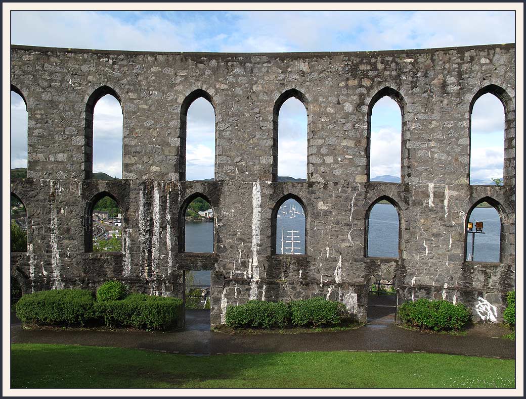
After signing out at a friendly portacabin we strolled up to the folly, McCaig's Tower (pictured), before joining a slow trail of heavily laden ants along the country lanes to Taynuilt.

Mike gracefully declined to join me on the 300 metre ascent of Deadh Choimhead, the decision being made when he saw the shin deep river that had to be crossed to start the ascent. He wouldn't have liked the tree maze either, but red deer came very close, the flowers were lovely, and the views expansive despite Ben Cruachan's head being in the clouds.

My diversion, after which I continued to enjoy wearing the Crocs I'd used for the river crossing for a few km, put us behind various folk and was a reason for seeing so many Challengers today. All very jolly. But after the tea shop we headed a short way up Glen Noe and then to this spot, which is a good but not a fine site, being a bit lumpy but close to a good water supply.

It has started to rain (9pm) and that at least has shut up our resident cuckoo.

Sent using BlackBerry® from Orange

Thursday, 12 May 2011

Thursday 12 May 2011 - TGO Challenge Day 0 - Montrose to Oban

Despite Heather T-S's best efforts - text messages in the middle of the night relating a tale of rain in Lancashire - Chez Alison provided a good night's sleep before a stroll, with a rucksack that feels very heavy, to the station for the 9.18 to Glasgow in the esteemed company of legend Ron Reynolds and three generations of the Foulkes family, including Bernard and his big rucksack. Bernard will be 83 in a couple of weeks time. This will be his and Margaret's 19th Challenge.

The usual melée at Queen Street station was followed by a most sociable train journey to Oban, waved off by Messrs Smith and Shiel, in the company of the majority of the 57 Challengers who are starting from there tomorrow morning. I forgot to buy a baguette, so lunch included Stilton and crisps, washed down with a very palatable bottle of red wine, courtesy of Poor Michael (Mike) who turned up dutifully on the platform at Queen Street.

It has been a day of sunshine and showers. We suspect that the latter may prevail over the days to come.

Then Gordon managed to gather a quota of about a dozen Challengers in the Light of India restaurant here in Oban for an amenably sociable preamble to the walk.

Great to meet up with friends old and new, today. There's a bit more effort needed tomorrow...

Sent using BlackBerry® from Orange

Wednesday, 11 May 2011

Coast to Coast in Three Days


I'm sitting at the Park Hotel in Montrose, waiting for Alison to return home. She has kindly offered her flat as my final sorting zone before heading off on the TGO Challenge. I'm getting into the mood for that, having enjoyed the company of 'Team Foulkes' in the fish & chip shop (I think I must have had Bloater).

Final packages have been delivered to a very cheery receptionist at the Park - they always give me the impression that they feel honoured to be involved with the Challenge (they are, of course!).

After an evening in the excellent Habitat bunkhouse in the company of a very jolly Cairngorms footpath maintenance team (say hello if you pass them), a leisurely day saw me finally reach the coast - pictured from the scenic road to Fettercairn, showing the type of terrain we will pass through on our last two days of the Challenge in a couple of weeks' time.

A 12km stroll brought final confirmation that the new HI-TEC boots are not sufficiently broken in to risk on the Challenge, so instead I'm resigned to damp feet in my old Scarpa Infinities. Never mind - it's entirely a misjudgement on my part - the new boots will probably be fine when the bruise they've given my ankle subsides.

Next stop: Oban.

Good luck on the Challenge, everyone, and I hope those who can't do it this year will be vicariously entertained by the various bloggers.

Sent using BlackBerry® from Orange

Tuesday, 10 May 2011

Craigendarroch

First, thanks go to Alan Sloman for pointing readers towards some information regarding wind farms. The prospect of these blots on the landscapes of Scotland and elsewhere in the UK is particularly distressing in the knowledge that whilst their 'Renewable Energy' tag appears to be unjustified, influential politicians of all leading parties have vested financial or political interests in rapidly blighting the landscape with these short term projects that are doomed to failure in the long term. Nobody seems brave enough to tackle the long term solutions to energy production in the UK.

Anyone interested in this subject will find LOTS of salient information on Alan's blog: http://www.alansloman.blogspot.com and its links.

After a good breakfast, and after admiring the resident Short-eared Owls, a leisurely departure from Heather and Eddie's excellent hospitality at Bridge of Gaur found me on the road to Pitlochry in violent rain, pausing only to pick up a message from 'Drenched in Kinlochleven' aka JJ.

Café Biba in Pitlochry provided welcome respite from the rain, which then eased as I trundled on towards Ballater. The campsite here willingly accepted my TGOC parcels delivery and confirmed that the office is manned all day except when on 'cleaning duties' elsewhere on the site.

A quick trip up Ballater's small hill, Craigendarroch, saw the afternoon off, then I booked in to Habitat, a swish bunkhouse that puts Bridge of Orchy's version to shame. And it's cheaper. And there's a good pizzeria next door.

Today's image from Craigendarroch shows the view east down the Dee valley. There are also good views (into the sun at this time of day) towards Lochnagar and the Cairngorms National Park. Thankfully these views are unlikely for several reasons to be blighted by the sight of windfarms for the foreseeable future.

Sent using BlackBerry® from Orange

Monday, 9 May 2011

The View Across Loch Ness

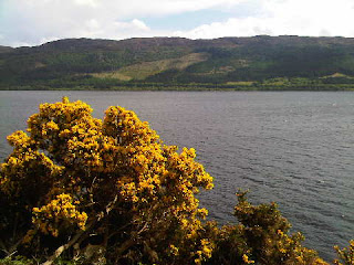
Here's the view across Loch Ness towards the Monadhliath hills, where huge windmills are planned to desecrate the landscape.

The picture was taken from near Drumnadrochit on a day of sunshine and showers, on my route from Bridge of Orchy to Bridge of Gaur via Inverness. Several TGO Challenge participants will be pleased to hear that the car boot is now virtually empty as their food parcels have been successfully delivered.

Tonight I have the arduous task of not assessing the Bridge of Gaur Guest House's food and accommodation (I know it will be excellent).

Later: it was excellent. We will return next week...

Sent using BlackBerry® from Orange

An Encounter with Mick and Gayle


Today my role is as a courier.

Parcels are being deposited at various places in The Highlands.

One such parcel was for Mick and Gayle - their dehydrated meals for the first section of their TGO Challenge. I did not expect them to collect it in person, but having completed their Lowestoft to Ardnamurchan walk yesterday our passage through Fort William coincided sufficient for the courier service to be extended briefly to a Glen Nevis taxi service.

M+G are pictured here, deliriously happy after completing their 'East to West' walk, and looking forward to their TGOC adventure which starts from Strathcarron on Friday.

Well done, both of you, and enjoy your rest in Fort Bill.

Readers may be relieved to know, as were M+G, that their maps for the TGOC were in the package that Gayle is clutching. My own maps have now been posted to Oban, so their fate is in the uncertain hands of the Royal Mail. Thanks, Sue, for coming to the rescue!

Thanks also to everyone, especially the Alans and Louise, for your messages of encouragement. They are all very much appreciated.

Now then, next stop - Drumnadrochit...

Sent using BlackBerry® from Orange

Sunday, 8 May 2011

A Weekend at Bridge of Orchy


The rest of the team have now departed for home after a successful 'bagging' weekend for Alastair.

A smooth journey with Sue on Friday, via Glasgow Airport to pick up Lyn, found three of us (Alastair was following close behind) enjoying fish 'n chips at the Real Food Café in Tyndrum. That was excellent, a word that cannot be applied to the bunkhouse at the Bridge of Orchy Hotel.

However, the hotel staff were friendly enough, and were happy to take in a TGO Challenge food parcel for a week or so.

Once the brainless Glaswegian rabble that had kept us awake for most of the night had transferred their reign of terror to the West Highland Way in the direction of Kings House, calm descended and we enjoyed the rather average hotel breakfast before setting off down Glen Etive.

It was raining - the forecast for the whole weekend was pretty dire.

Leaving Alastair's car at Coileitir at 10am, we headed east to an unrelenting 700 metre ascent. Luckily it stopped raining before we started up the hill, but it was hard work anyway. The pretty pink flowers of creeping azalea were hard to miss as we climbed steadily with eyes to the ground, where young frogs were also jumping, friskily.

Elevenses were taken (pictured) with a pretty excellent view.

We lunched in the lee of the wind before heading on up to the summit of Stob Coir an Albannaich - Munro number 201 for Al. Despite the MWIS forecast of 10% chance of a view from the summit, we nearly got one! (1.20pm).

Heading east for 500 metres, we came upon the small cairn that indicates the ongoing route - steeply down to a col at 754 metres. This could be tricky in winter.

After that, it was an easy stroll over Meall Tarsuinn to our second Munro summit, the grassy hump of Meall nan Eun (2.40pm). This summit was completely clear of cloud, with fine views. A leisurely descent down Glen Ceitlein got us back to the car by 5.20pm, in deteriorating weather with thunder echoing around the valley.
We had met just five people all day on this 18km stroll with about 1300 metres ascent - 7hrs 20mins.

Saturday night, thankfully, was much quieter, and we all slept well after a good meal in the hotel and a very sociable time with JJ and Viv, who turned up by chance on their West Highland Way jaunt.

Today (Sunday) was forecast to be better weather. It wasn't. After waving goodbye to JJ+V, we embarked on a five minute drive to Achallader. A path to the south of the river led us into a forest and over a railway footbridge. The path then ran boggily beside the railway to the edge of the forest, from where another unrelenting ascent took us to a grassy col below Point 961, from where Beinn a' Chreachain was ascended up a blustery ridge in driving rain. A splendidly coloured pair of ptarmigan paid close attention to our progress.

The rain lasted for about three hours. It was windy, but visibility was pretty good. The stroll along the ridge of Beinn Achaladair was pleasurable, especially the scrambly ascent from a col at 813 metres. We headed on to the next col before descending back to Achallader, with fine views north to Ben Nevis.

Today we met just two people - at the start, half way, and at the end. They did the same 21km walk with 1300 metres ascent in the reverse direction (sensible in view of the wind direction), taking, like us, 7hrs 20mins for the two Munros, the same as yesterday, but we stopped less today.

The others then left and I joined them at the Real Food Café for chicken curry and chips, before returning for a third night in the bunkhouse.

I was to start the task of naming waypoints on my downloaded GPS route for next week's TGO Challenge, but I couldn't find the maps. I think they are still on the desk at home after my hurried manufacture of a web page on Friday. This is a mildly distressing faux pas on my part.

Hopefully Sue will post them to our B+B in Oban...

...and hopefully she will note the details of that B+B before she posts the package, and let me have those details.

Tomorrow? I have a boot full of packages to courier around Scotland, and a possible rendezvous with some proper long distance walkers.

Sent using BlackBerry® from Orange
Friday, 6 May 2011

TGO Challenge - 2011

Our TGOC 2011 route - 365km (227 miles) with 16,300 metres ascent

This year’s TGO Challenge starts next Friday – for me in Oban.  But the journey actually starts in a few minutes time when I set off with Sue for a weekend at Bridge of Orchy.  I’ll be staying up north after that weekend, doing the TGO Challenge, the planned route of which is shown above, then returning south for a few days on the Devon coastal path.

So the rest of this month’s entries will be via ‘mobile blogging’ – a telephone.

I’ll be doing the Challenge with a carefully selected victim, ‘Poor Michael’, who should know better really as he’s known me for nearly 50 years!  It’s his picture, taken during a practice on Catbells, that you can see on this month’s background image to the blog (I hope readers can see the text more easily than last month, when Lud’s Church was the chosen background).

Our route is described in vivid Technicolor here.  This year I’ve decided not to set up ‘Planned Route’ postings on a day to day basis as they often tend to get out of order due to phone signal problems, etc.  Readers should be able to follow our progress quite easily using the web page, to which I’ll try to provide a link on the daily postings, which may not be daily due to phone signal issues. 

I’ll do my best, though!

Comments will be directed to my phone, so please do keep in touch – I’ll reply by way of observations in the text of the postings, as Gayle does.

The route is a challenging one.  I think that’s the general idea of the TGO Challenge, but it has many options for short cuts and omissions, which I expect to be taken from time to time due to weather and tiredness.

‘Poor Michael’ is very competent in the hills, so we may not stay together all the time if one of us feels better than the other about going high; we are independently self-sufficient.

I’ll finish with the last ‘decent’ image you’ll see for some time over here, the phone images being necessarily of rather low resolution.  It’s a self-timed image taken on last year’s Challenge on the summit of Ben Vrackie.  At least this year I’ll have Mike to take some pictures and avoid the 10 second sprints needed for ones like this!

On the summit of Ben Vrackie - May 2010

Thursday, 5 May 2011

Wednesday 4 May 2011 – Three Shire Heads

Sue, Paul and Graham near Knotbury

Last night’s evening walk from Flash Bar was an excellent little outing on which Sue and I were joined by Paul, just back from The Tropics (aka Kintail), and Graham on a day out from The Tropics (his garden).

Pleasant lanes took us past rusting farm machinery to the place where Staffordshire, Derbyshire and Cheshire meet.  Three Shire Heads, often thronging with folk, was pleasantly deserted tonight.

Three Shire Heads

After Graham had expounded to Sue on the technicalities of growing tomatoes, we turned to the west, where the setting sun left a pleasantly silhouetted view.

Sunset at Three Shire Heads

Looking in the other direction, up the path towards Hawk’s Nest, it looks as if there’s plenty of daylight left.

The path to Hawk's Nest

Just enough to get us back to the pub at Flash Bar for refreshments before it went completely dark.  We saw no hawks but the unmistakable call of a Tawny Owl greeted us on the path up to Flash.

What a pleasant stroll.  7 km, 373 metres ascent, in about an hour and three quarters.  Aren’t these light summer evenings wonderful…

Here’s the route, equally (or even better) do-able from the New Inn at Flash.

The evening route - 7km, 273 metres ascent, in under 2 hours 

Thanks for the tomato plants, Graham – your parcels will be wending their way north tomorrow.  And thanks for the link to your photos, Paul – they are superb.

Wednesday, 4 May 2011

Xsocks Trekking Expedition Short Socks – A Review

Xsocks Trekking Expedition Short Socks

[Note that on 5 September 2012, Webtogs Limited went into liquidation, but its business has legitimately been continued in the name of Dorset Mountain Sports Limited, t/a Webtogs, with whom I have had no contact whatsoever, nor did the liquidator of Webtogs Ltd respond to my enquiry as to whether any members of the public had lost money as a result of the liquidation.]

Webtogs sell a range of quality socks.  Recently they were kind enough to send me a pair of Xsocks Trekking Expedition Short Socks for review.

I’ve been wearing these socks for the last couple of weeks.  (Yes, they do get a bit smelly after about three days!)  I’ve also been using a pair of a sister product, Xsocks Trekking Light Short Socks, for the last three years.

Made in Italy, the socks come with a two year guarantee.  They are certainly hard wearing.  The socks I’ve been using for three years – just the one pair, all year round, are only just starting to show signs of wear.  The new socks, at 54 gm just 5 gm lighter than the Trekking Light socks, are just as comfortable and look to be equally hard wearing.

The socks come with anatomically shaped footbeds for the right and left feet.  They feel odd if you put them on the wrong feet!  There are numerous other features that I’ll reiterate below in the product specification, and the composition is a mix of nylon, merino wool and other materials.
My favourite ‘feature’ is the capacity of these socks to dry quickly.  Even on a wet day, they can be washed by a backpacker in a pot of warm water and a few soap flakes (or shampoo, etc), wrung out, rolled a few times in a hand towel to remove most of the water, and hung in the tent to dry overnight.  Obviously they may dry more quickly outside in fair weather, but even inside the tent, if the wearer puts them back on in the morning they should be perfectly dry by the time he or she needs to start walking.  Using this method, I walked the entire two week TGO Challenge last year using just the one pair of Xsocks and some thin liner socks for the evenings.  Some Goretex socks I’d taken in case my boots leaked were not used at all.

The Xsocks are not uncomfortable in the wet, but personally I prefer to avoid fungal infections by keeping my feet dry by way of a Goretex liner either in my footwear or my socks.

I appreciate there are other issues relating to the wearing of socks.  As a youth I always wore two pairs, or even three in the winter, but many years ago I discovered that life became much easier with just one good pair of socks, and even in cold conditions I find that adequate so long as I remain active.  I’m not sure how people who wear multiple pairs of socks would find this fairly snug product – perhaps they would use a liner sock underneath, or a larger pair over the top.  Either way, in my opinion all you actually need is just the one pair of socks, and these Xsocks are perfect for that purpose.

So, to summarise:

Fit and Finish:
  • the EU size 42-44 socks fit my size 43 feet perfectly, and pleasantly snugly with no uncomfortable tightness or loose ‘wrinkles’
  • the Italian construction is excellent.  I can verify that the Trekking Light socks are extremely durable (the most durable hiking socks I’ve ever possessed) and I would expect the Expedition socks to be the same
  • the socks come in a choice of two dark colours and could be worn with any sort of footwear.  Mine will be worn with anything from 4-season boots to casual shoes
Features:
  • Xsocks stated features are reiterated below
  • I like the anatomically shaped footbeds
  • these socks are much quicker drying than other hiking socks I’ve owned – a great advantage on a long trek
Weight:
  • at 54gm (59gm for the Trekking Light version), they are not going to be the straw that breaks the camel’s back.  They are the lightest hiking socks that I have ever owned
Practical Use:
  • these socks are ideal for… well, hiking and trekking!
  • their quick drying and hard wearing qualities make them an excellent choice for long trips
  • the two year warranty is testament to the manufacturer’s confidence in their durability  
Price:
  • the Trekking Expedition socks are available from Webtogs for £15.49, whereas the slightly heavier Trekking Light socks are just £12.49
Alternatives:
  • there are lots of alternatives to these socks, a good selection being available as part of Webtog’s product range.  As in the case of all footwear, different products suit different feet.  But I haven’t found anything better than the Xsocks products I’ve been using for three years
Conclusion:
  • these socks are excellent.  They are my personal first choice for hiking, backpacking and trekking
__________________________________________________________
  
Note: Whilst the gear was provided by Webtogs, this review, over which I have total editorial control, is totally independent of that on-line retailer.

FEATURES of the Xsocks Trekking Expedition Short Socks
  • Self-adjusting Cuff – adapts to any size leg without slipping or constricting.
  • AirConditioning Channel – ventilates and dries
  • Toe Protector – protects against blisters and chafing
  • Instep Protector – distributes pressure
  • Stretching Rib – for an optimised fit
  • Anatomically shaped footbed – for a precise fit
  • Achilles Tendon Protector – reduces the incidence of pressure points and the risk of scraping and bruising
  • X-Cross Bandage – cushions and stabilises the sensitive ankle area without restricting freedom of movement
  • Heel Protector – reduces friction and the risk of blistering
  • Traverse AirFlow Channel System – lateral ventilation under the sole

Technical details

TECHNICAL COMPOSITION
33 % Nylon
28 % Merino wool
14 % Robur
12 % Mythlan
9 % Silk
4 % Elastane
MATERIAL
45 % Nylon
28 % Merino wool
14 % Polypropylene
9 % Silk
4 % Elastane

Monday, 2 May 2011

Grandad (2)

With Jacob - 1 May 2011
Back from our holiday in Mallorca, the first thing Sue and I did was visit Jacob, now eight days old (although not technically due to be born until 17 May) and quite sleepy.

Saturday, 30 April 2011

Saturday 30 April 2011 - Puig Sant MartĂ­ and S'Albufera de Mallorca Natural Park

A short bus ride found Sue and me in AlcĂºdia by 10.40 on a cloudy morning with a cool breeze.

We soon warmed up by way of the rough and direct 266 metre ascent of Puig Sant MartĂ­. A view from the summit is shown above. The hill was otherwise deserted, but judging by the amount of rubbish it does receive regular visits from the less environmentally conscious brand of visitor. Judging by the tacky streets in this part of AlcĂºdia, such visitors wouldn't have to stray far from their digs to reach this splendid little hill and its panoramic view.

The rest of the morning was spent negotiating our way without the benefit of a map to S'Albufera de Mallorca Natural Park, via a piece of waste ground with an abandoned chair that provided a suitable venue for lunch.

R+L were duly located after their 30 mile bike ride via Muro, and we spent a happy afternoon with Crested Coots and more Bee Orchids, to name just two of the plentiforous fauna and flora that will no doubt appear at some point by way of a link to a slide show.

That's all for now, as the demolition of a food and drink mountain is getting into swing, after which I'll be in no state to continue.

So it's goodbye from Mallorca for the time being...it has been an excellent trip.

Sent using BlackBerry® from Orange

Friday, 29 April 2011

Friday 29 April 2011 - The Mountain Road to Lluc Monastery


Pictured today at 10am, Robert, Lyn and me setting off from outside our apartment at the start of our journey on the road to Campanet.

Sue stayed at home to wallow in ... (most men would prefer to go to the pub, I suspect).

It was slightly cloudier today, but excellent conditions for cycling. It's a popular road for cyclists that leaves Puerto Pollença in the direction of Campanet. We by-passed that town in favour of some quiet lanes to Binibona, where morning coffee was not readily available.

However, a little further on in Calmari, we found a suitable café, which also for some reason was showing a 'royal wedding'. Robert was eventually dragged kicking and screaming from the TV, and our merry trio embarked on the gentle 400 metre climb up to Coll de sa Batalla. Robert went first and I thought I was behind him, but I got in with a group of seven road bikers from Surrey and didn't notice Robert coming back down the hill in search of Lyn.

So after a long wait at the coll, the easy descent to Lluc was most welcome. We lingered there for some time - lunch, botanical gardens, monastery, etc, before heading off along the scenic mountain road to Pollença via Coll de Femenia, at 640 metres probably the highest point I'll reach this trip. We kept stopping to snap the lovely views, so progress was agreeably gentle.

By and by, after a relaxing descent past Mortitxet, we cruised into Pollença, with Robert's bike seemingly on auto pilot. Straight to the ice cream kiosk. More tasty ices. They set us up for a final potter through the lanes back to the apartment for another thrilling episode with the barbecue.

Today's excellent route was about 64km and took a very leisurely less than seven hours.

Sent using BlackBerry® from Orange

Thursday, 28 April 2011

Thursday 28 April 2011 - Three Walks in One Day!

Sue and I don't possess any notable guide books or maps of Mallorca. Despite it being my third visit, I've always wondered whether I'd enjoy repeat visits, and my companions have always been heavily armed with literature. So my own library is unusually bare when it comes to Mallorca.

This time Robert and Lyn have everything you could want to know about cycling on the island, and Sue has borrowed the 'Walk Mallorca (North & Mountains)' Discovery Walking Guide, by Charles Davis. Thanks Nightbird. This week's walks have been based on some in that excellent guide book. We have no walking map.

Today Sue and I were kindly transported by R+L to Kilometre 12 on the scenic road to Cap Formentor on another beautiful warm, sunny morning.

This placed us in a fine location to tackle three of Charles's walks and be home by bus for 4.30.

Walk number 38 was our first target. Setting off at 10am, the easy stroll down to Cala Figuera, on a good track through the pines with tuneful chaffinches, hardly prepared us for what was to come.
The route from the beach up to the 299 metre summit of El Morro de Catalunya was rough and tough. Marked by cairns, it's easy enough to find the way, but very slow going. Not that one would want to hurry, given the fine views that unfold during the ascent through beds of Rosemary and St Johns Wort. Cap Formentor soon comes into sight, then from higher up there are views to the green fields of Casas Velles and, in the distance, the Torre de Albercutx. Today's picture was taken on the summit, looking west.

An hour later we had descended back down past chatty stonechats to the sparkling sea at Cala Figuera, where a few bathers were now installed on the rocky beach. It's a steep haul back up to the road, especially in this heat. We comforted ourselves in the knowledge that the heavily tattooed group of Brits in flipflops that we encountered may have found it tougher than we did.

That got us up to the car park at Kilometre 13 on the PM-221 road, the starting point for walk number 39.
Our 12.45 start took us down a pleasant lane towards Cala Murta. After 15 minutes, spot on 1pm, a picnic table appeared under a canopy of pine trees. Perfect timing for a picnic!

After lunch we headed along rough paths all the way up to Coll de Olivares. Near here the guide book describes having to climb a fence to enter privately owned land (ie trespass), but we were pleased to be able to negotiate the high fence by way of a sturdy new ladder stile. Mallorca has not always welcomed walkers, but I suspect the activity is now recognised as producing good income for the island, whose landowners are gradually becoming more tolerant. I suspect that thanks are due to in part to the numerous German visitors who love to walk on the island, for this gradual improvement.

Anyway, this potentially unwelcome barrier having been surmounted, we strolled on up the rough track to Coll de la Geneta, from where a trail of cairns led us directly over a rough limestone pavement to the spacious 332 metre summit of Na Blanca.

More fine views, especially towards this morning's summit.

On the cairned way up we had passed two Brits, the only two people seen out walking today. They had Charles Davis's guide book in their hands. Maybe the German guide books don't recommend today's routes?
Walk number 37 starts at Playa Formentor and covers the ascent of Na Blanca. Since we were already on that summit, all we had to do was follow walk 37 in reverse. This is pretty simple so long as you follow the basic rule about following cairned routes where there is no path as such. (If you lose the cairns retrace to the last cairn you found and start again.)

Not even a 'lost cairn' incident prevented us from achieving the descent to the bus stop in around an hour, though a 'low branch' incident did cause Sue to falter for a while, muttering "Why didn't you tell me about the low branch?" Simple - I didn't notice it!

A word of warning to potential passengers - the 15.45 bus back to Puerto Pollença left Formentor rather early!

We had been on our feet in the heat for nearly 6 hours, ascending around 700 metres in total, covering only about 13km despite 'ticking off' three walks in Charles's book.

R+L have now arrived back from a 47 mile peramble on their bikes, including a couple of hours in Manacor looking for lunch.

'Paella' is calling from our local restaurant...

Sent using BlackBerry® from Orange

Wednesday, 27 April 2011

Wednesday 27 April 2011 - A Ride to and a Trip to Pollença


A glorious sunny morning greeted us today. Robert, Lyn and I were quick off the mark, with a cycle ride to Cap de Formentor planned before the traffic got too heavy.

The plan worked, and we enjoyed a great four hour ride to the point and back. 44km with 860 metres ascent. Lovely views (Lyn and I are pictured at the Cap, where we also enjoyed coffee and cake).

Meanwhile, Sue got the bus to Pollença and climbed Puig de Maria before meeting us for tapas.

The rest of the day disappeared in a blaze of activity involving Pollença, a misplaced car, some fizzy wine and an adventurous barbecue.

Sent using BlackBerry® from Orange

Tuesday, 26 April 2011

Tuesday 26 April 2011 - A Stroll to Penya Roja

Woke to a cloudy day and a clumsy kitchen (still haven't cleared the broken bottle from behind the 'fridge!). Light rain fell as we breakfasted, wondering how those at home were coping with the UK's heatwave.

Good news has arrived on the grandparenting front - Kate and Jacob are back at home and the lad is getting on well with his new surroundings.

This morning Sue and I got a lift in Robert and Lyn's taxi, and after a few false trails in AlcĂºdia we were dropped off at the beach near Campamento de la Victoria. A 40 minute stroll up to Ermita de la Victoria was rewarded with a coffee at the otherwise deserted restaurant. But the narrow path to Penya Roja was really busy. It runs alongside cliffs to some fortifications that overlook Cap del Pinar. After squeezing through a small tunnel we clung on to a chain fastened to the rocks above a 250 metre plummet into the sea (one bounce or two?) for the unwary. Having survived thus far it was an easy scramble to a lonely cannon that has spent the last 400 years perched atop Penya Roja. It wasn't so lonely today though, with hundreds of German tourists clambering all over it.

After retracing our steps for a while, we returned to the track that narrows to a steep mountain path for the ascent to our highest point of the day, Talaia D'AlcĂºdia, an excellent spot for lunch amongst the asphodel - 445 metres, with fine views in all directions on this now clear day.

It's was a sunny hour from here to Coll Baix, down at 130 metres. The path crosses the bare slopes of the Puig d'es Boc before descending in zigzags. A vertiginous view (pictured) at the top of these zigzags affords one the pleasure of the sight of the churning waters on the beach at Platja de Coll Baix, which can apparently be a dangerous place to bathe.

From Coll Baix, pleasant woodland paths led us all the way back to AlcĂºdia, via an incident with a bus that had mislaid its 20 passengers (we had seen them) and a rare encounter with some Bee Orchids that were flourishing in an innocuous ditch at the gates to Parc de la Victoria.

The old town of AlcĂºdia was a fine place to finish this walk, after 23km of strolling with around 800 metres ascent, in around 7 hours including breaks. A pot of tea at one of many cafĂ©s went down very well before we tracked down a bus back to Puerto Pollença. Provisions had been laid out by R+L for us to construct a meal, which was duly wolfed down after that duo had returned at 8pm from a 55 mile bike ride.

So today turned out to be a lovely day, despite the early drizzle, but we have heard the sad news from SAHH that there has been a temporary hiatus in Timperley's April heatwave.

Sent using BlackBerry® from Orange

Monday, 25 April 2011

Monday 25 April 2011 - A Bike Ride to Muro

Firstly, thank you, everyone, for your messages, including an entire tome from Clive Dunn's department of literacy, concerning grandparenthood. Everything is going well and we'll be visiting the youth as soon as we return to the UK.

Today Sue set off early for a walk to Cala de Sant Vicenç, including a scrambly diversion to a summit.

Meanwhile the three cyclists headed off in a fairly random direction, past the Parc Natural de S'Albufera de Mallorca, towards the small town of Muro.

Avocets and egrets entertained us in the Parc, but there was no sign on this route of the rare crested coots that we saw here last year.

Muro was reached after Robert had got through another inner tube, and the café where R+L planned to enjoy lunch was eventually found after several tours of the environs of the church pictured above. It sits on top of a small hill that is visible from miles away. The desired café was less visible.

Excellent vegetable pasties and delicious cake were 'on tap' when we eventually found the place.

A few drops of rain reminded us of the overcast day, before we were further distracted, beyond the hilltop village of BĂºger, by another of Robert's punctures. This time the culprit was found - a small piece of glass in a tyre, persistently rubbing through a whole batch of inner tubes.

Even into a head wind, the journey past Campanet along a pleasant valley between two ranges of hills was most enjoyable. Our 65km ride was completed by 5pm, in plenty of time for a visit to Bruce's ever more crowded bike shop. We depleted his dwindling reserves of inner tubes and grabbed a big spanner to move my saddle into a less cramped position.

There were lots of bikers out today, many on hired bikes. Few will have enjoyed such a splendid evening meal as our quartet's home cooked fayre of pork tenderloin with cauliflower cheese and much more, followed by pears in red wine.

Sent using BlackBerry® from Orange
Sunday, 24 April 2011

Sunday 24 April 2011 - Overcast in Puerto Pollença

Yesterday disappeared in a surreal puff of time. Kate's early "I've just had a baby" call was of course the highlight, but in no time at all we had planted some onions in Barney and Carmen's massive garden, then 'Uncle Mike's' taxi zoomed us off to Terminal 1, and before we knew it we were toasting the new parents from a table at 'can Cuarassa'. It's an excellent restaurant just a few minutes walk down the road from the apartment here in Mallorca that we are sharing with Robert and Lyn for the week.

The weather here is temperate. We have moved from a UK heatwave to April showers in Mallorca.

After waving Sue off on a scenic walk in the BĂ³quer Valley, and a trip to the local bike shop to collect my hybrid bike for the week (R+L have already been here for a few days so have their bikes), the three of us set off on an undulating 45 km tour of the Alcudia peninsula.

A coffee at the Mirabel de la Victoria set us up for the afternoon's trip to Port d'Alcudia, where various more produce was scoffed and Lyn tried to resuscitate a dying horse (pictured). A planned 'long way round' route home was rejected after spots of rain appeared from ominous black clouds.

Luckily, we made it back before the rain started. Sue had returned, loaded with pictures of flowers, and we enjoyed an exciting evening in the apartment.

Sent using BlackBerry® from Orange