Sue and Martin in Mallorca 2019

Sue and Martin in Mallorca 2019
On the Archduke's Path in Mallorca

Saturday, 3 November 2012

27 to 29 October 2012 – The Annual TGO Challengers Weekend in Fort William

Buachaille Etive Mor from Beinn a' Chrulaiste

Last weekend numerous stalwarts of the TGO Challenge congregated at the Alexandra Hotel in Fort William for an annual reunion bash organised by Les and Issy Silkowski.  And very well organised it was too.

Whilst the majority of attendees were happy to potter about in Fort William*, a few of us chose hills on which to enjoy the autumn weather.  On Saturday Graham Brookes mopped up his last Munro in the area – Beinn Sgulaird, whilst Emma and Stan pottered up Beinn a’ Chrulaiste.  Others may have ventured elsewhere, but I’m not aware of any epics.  On Sunday the rain seemed to dampen enthusiasm, with Emma and Stan perhaps making the best call with their visit to the ice climbing centre at Kinlochleven.  By Monday, everyone either had or was wending their way home, though Emma and Stan were going via The Fara.  Good on them!

All this meant that unlike last year, when Graham B and I walked together, I was on my own for the walking aspect of the trip, which was otherwise highly sociable.  At least that meant I could potter along at my own pace rather than continually battle to keep up with Graham!

Here’s what I got up to:

Saturday 27 October 2012

Parking up at the bridge beyond Spean Bridge before reaching Corriechoille, there was frost and bright autumn colours as I headed along the road before turning up the good track that leads to Rannoch and many other enticing destinations.

Berries nearCorriechoille

The River Spean was low, with a rather monochromatic look in the low sun.  The path to Rannoch is a long one – 26 miles according to the sign.  Much closer, Aonach Mor stood high above the frosty fields and The Grey Corries slowly came into view.

A little way along the path, beyond the turn off to The Grey Corries, I looked up and was surprised to see this gentleman winking at me.

The Wee Minister

After being rather taken back by this unusual encounter, I realised he wasn’t moving.  I’m sure that had he been alive, he would have responded to my greeting, but today his response was by way of a small plaque at his feet:

THE WEE MINISTER
A stone statue of the Wee Minister dating back from the 1900s once stood on a site near here and was said to bring good luck to climbers and walkers.
The statue, believed to be of the Rev. John McIntosh, was destroyed in the 1970s.
However in May 2010 the local tourism group decided to resurrect him and replace him with this replica crafted in cedar wood by Peter Bowsher, champion wood carver.
Good fortune to all who pass this way.

Today’s first hill, Cruach Innse, soon drew close as the excellent track wound its way up The Lairig and onwards to cross Allt Leachdach, beyond which I enjoyed elevenses before forsaking the path and heading up grassy slopes with fine views across to The Grey Corries.

It was quite breezy on the 857 metre summit of Cruach Innse.

Cruach Innse (857m) with The Grey Corries

It’s a short but pleasant ridge walk that cuts down to the south to reach the 593 metre col that divides Cruach Innse from its puny looking neighbour, Sgurr Innse.

However, the Sgurr is quite craggy so more care is needed on this modest hill.  Three ptarmigan kept me company for a while.  They had already dressed for winter, and indeed there was a sprinkling of snow on the summits, but even in winter plumage with no snow these birds are well camouflaged.

Ptarmigan on Sgurr Innse

Sgurr Innse’s 809 metre summit was soon gained.  An eagle soared far above, and whilst the weather was clouding over there were good views across to The Grey Corries, and to the south to the Achallader summits beyond Rannoch Moor.

View south to the hills beyond Rannoch (Achallader area)

Returning down Sgurr Innse’s craggy slopes to the 593 metre col, I then headed directly down to the wide track, and down to the Wee Minister, then past ornate gateposts at Corriechoille, to reach the car minutes before the rain came.

Here’s my route - approx 20 km, 1000m ascent, 5 hours.

My route - 20 km, 1000 metres ascent, 5 hours

Later, some lucky raffle winners are pictured below – thanks go to Ian Cotterill for the image he placed on the TGO Challenge Message Board.  There were some great prizes, thanks to John Manning’s efforts, and those of organisers Les and Issy, whereby TGOC sponsors and friends donated some very generous prizes.  There was even £150 left over after payment of the band (a reason for the raffle) which will find its way into the coffers of Lochaber Mountain Rescue.  Thanks also to John Donohoe for updating those gathered on several TGO Challenge administrative matters, which he conveyed with great humour, as always.

Raffle winners at the Alexandra Hotel

The dance floor (I keep away from such places) later claimed some victims.  The arrival of an ambulance alerted those of us at the bar of a major incident.  Janet was concussed and required an overnight stay in the local hospital, whereas Pauline’s thumb injury failed to hospitalise her.  What the two of them were up to remains a mystery.  I’m sure everyone would wish them a speedy recovery.  When I left the hotel on Monday morning the staff were compiling a claim for compensation for a serious dent in the dance floor!

Sunday 28 October 2012

It was raining, but not too hard, and it wasn’t particularly windy, so I adjusted my plan to one of modest ambition, the ascent of Garbh Bheinn, from Caolasnacon beside Loch Leven.

The path relentlessly ascends 800 metres, over the short distance of 3 kilometres, to gain the 867 metre summit of Garbh Bheinn.

Luckily the cloud base was around 800 metres, so there were views, if not that ‘good’ for most of the way up, especially looking back to the Pap of Glencoe (742 metres) and Loch Leven.

The Pap of Glencoe, from the slopes of Garbh Bheinn

Waterfalls streamed off the back of Aonach Eagach, but there was little to see from the cloud laden summit of Garbh Bheinn.

There was nothing there to give reason to linger, so I turned on my heels and slithered carefully back down to Caolasnacon, and back to Fort William for lunch.  It was still raining.

Here’s my route - 6km, 860 metres ascent, 3 hours.

My route - 6 km, 860 metres ascent, 3 hours

Monday 29 October 2012

A pleasant evening with the small residue of TGOC visitors was followed on Monday morning by some au revoirs as we all headed off after an excellent and highly sociable reunion.  The Alexandra Hotel is an excellent venue.

I parked up near Kings House Hotel, from where the Stob Dearg summit of Buachaille Etive Mor stood proud in the winter sunshine.

Stob Dearg from near King's House

Beinn a' Chrulaiste was my target for this quick excursion on my way home.  Whilst a longer walk than yesterday’s, my 600 metre ascent over 5 km was easy and pleasurable, as I took the good path up Coire Bhalach to reach the minor col that overlooks Blackwater Reservoir, then ambled west then south to reach the broad 857 metre summit.

There were red deer on the summit ridge - noisily rutting today – and the three ptarmigan I saw on Sgurr Innse on Saturday seemed to have recovered my scent up here!

From the ridge there were good views to Blackwater Reservoir and the Mamores; this is a great viewpoint for TGO Challengers as many will be able to trace their routes across the northern horizon.

However, the best views are arguably those across to the summits of Buachaille Etive Mor, pictured at the head of this posting, and below.

Buachaille Etive Mor from Beinn a' Chrulaiste

Panoramic views extending from the Black Mount, across Glencoe, and around to the Mamores, make this summit a brilliant viewpoint.

A vague path leads easily down the hill’s ESE flank and back to Allt Bhalach for the final stroll down to Kings House, of which establishment the path provides a bird’s eye view.

Kings House Hotel

Here’s my route - 8km, 600 metres ascent, taking about 2.5 hours.

My route - 9 km, 600 metres ascent, 2.5 hours

Later.... a Lake District sunset from Tebay Services.

A Lake District sunset from the M6 Services at Tebay

There’s a 49 image slideshow for this trip, click here.

* Some had walked to Fort William.  Colin Tock, for some reason, had arrived from Ardnamurchan, and John and Sue Plume arrived hotfoot from Inverness.  Well done all concerned.

Friday, 26 October 2012

Wednesday 24 October 2012 – Another Curry Walk

JJ and Mick - Runners

We’ve been on Curry Walks before.  A couple of times in my case.  The reports, including route and other details, are here.  JJ has been on many more such walks.  He’s a Professional.

Alan arrived first, after receiving invites from both me and JJ.  The carrot had been dangled, and he was selected to test my first attempt at a cake (carrot, of course) for some time.

Coffee and Carrot Cake

It was quite a large cake.

There’s only a sliver left just now.  (Pauses to eat more cake…)

JJ and Viv soon arrived, then Mick turned up on the train from Litchfield.  The walk had been Gayle’s idea, but the fact had escaped her mind, so she was left to work in the Midlands.  She came for tea though!

No sooner had we left the house than we bumped into Rick and Pete.

“Fancy a curry?” asked Rick.

“That’s a fine idea” – JJ led the chorus before setting off at a trot with Mick (see above).

Sue was soon lagging behind, out of breath.

The Bridgewater Canal, by Walton Park

The Sustrans improved towpath of the Bridgewater Canal in Sale is a pleasant place, even on a dull and overcast autumn day like this one.

The Bridgewater Canal in Sale

Striding seemed to be the order of the day – certain members of today’s team may be catching bad habits from their LDWA friends (not the Plodders, of course!).

I suppose it was too early to stop for a pint, though I know how many readers would respond to that comment.

The Bridge Inn

Autumn leaves

After passing through a shrubbery, over the River Mersey, under the M60 motorway, and alongside the Theatre of Dreams, we crossed to the other side of the canal near where a branch of the Metrolink system heads off to Salford and Eccles.

The Metrolink line to Eccles, at Cornbrook

“That’s one of Brindley’s Circular Weirs”  - someone observed - “it’s an overflow weir that takes excess water from the canal and drains it into the River Medlock (in a tunnel).”

This weir and it's companion at Potato Wharf were apparently the first of Brindley’s Circular Weirs, predating those found on the Staffordshire and Worcestershire Canal.  It needed a clean!

Brindley's Circular Weir

We soon reached Castlefield Junction, where the futuristic Merchant’s Footbridge guided us in to our objective, with JJ rather lagging behind at this point.  The pace had got to him?!

Salford Quays

Here the Beetham Tower comes into full view, and the duck house pictured on earlier visits seems to have been moved.

The Beetham Tower Gypsy Ducks

The canal reaches an area that is unrecognisable from a few years ago, with many derelict buildings having been restored.

Lock 92

Eventually, as Oxford Road and Whitworth Street are reached, more modern tall buildings crowd in on the towpath.

Buildings in Manchester

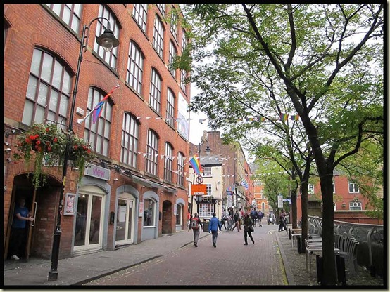
We decided to leave the canal on reaching the Gay Village, as its route to Piccadilly is a little unsavoury at times (see previous postings).  There’s always some party or other going on in the Gay Village – a very jolly place.

The Gay Village

City streets then led inexorably to This & That, in about two and a half hours from Timperley.  The standard fare here is ‘rice and three curries’ – currently £4.40 – and very good it is too.

This & That

Sue had eaten most of hers before I took this photo.

Curry Sue

Alan then stormed off, with the rest off us hot on his heels, to one of his favourite Holt’s establishments, the Ape & Apple, for an alcoholic afternoon whilst he waited for Sheila to finish work.  His beer stained report on the walk is here.  The rest of us joined him for a while before embarking on a variety of tasks (eg Sue and I bought a new television) and reconvening later in Hazel Grove for Mick and Gayle’s excellent slideshow relating their adventures on the Pacific Crest Trail earlier in the year.  There’s no ‘label’ on their reports, but if you start reading here, then move to here and here, and even more recent postings, you could spend an entertaining hour or two…

PS JJ’s report is here – very good it is too.

Thursday, 25 October 2012

Ramsoc Weekend at Kettlewell – 20/21 October 2012

Outside Kettlewell Youth Hostel on 21/10/12

This is the fifth Ramsoc weekend to be mentioned in these pages – it’s Sue’s University Rambling Club reunion, ably organised by Sue W, this year for the 12th and last time, and before that by Mark and Janet, who cleverly absconded to Singapore in order to avoid the organisational stress (largely caused by a single person who was absent this year).

Click here to view all the Ramsoc postings.

Saturday

By about 9.30, twelve of us were strolling through Kettlewell on a misty morning with autumn colours well on the way as we crossed the Wharfe to ascend gently above Knipe Scar, before heading down to Hawkswick and the River Skirfare.

A good path took us up beside Cote Gill, with good views back to Hawkswick and beyond.  Elevenses were taken on a grassy bank before a stream crossing, after which the cleft of Cote Gill deepened to our left.  We passed hundreds of slightly curious residents on the gentle ascent to Lee Gate.

Mother and daughter on Low Cote Moor

An old lime kiln came and went and we got a bit spread out. Great Whernside’s summit lurked in the cloud behind us.

Lunch was taken at a path junction by Goredale Beck.

Lunch by Goredale Beck

A splinter group then headed off in an abortive attempt to find a pyramid from which to view Malham Tarn, the day’s objective.

Others took the Monk's Road to get a view from there.

Malham Tarn

We soon caught up the main party again, beyond Middle House, having been delayed as much by an abortive lesson during which Mike failed to teach me how to plot a route on the Satmap GPS.  (Well, I did plot a route, but immediately ‘lost’ it!)

The party was led by three wise monks on the road to Arncliffe, leaving any thought of the need for a GPS seeming curiously stupid.

Three Wise Monks on the road to Arncliffe

Views up Littondale opened out as the skies cleared.

Llittondale

Arriving in Arncliffe at 3.30pm, there was no beer to be had as the Falcon’s landlady gleefully slammed her front door on twelve thirsty ramblers.  Earlier, other members of our party had managed to gain sustenance here, on the strict understanding that ‘no hot drinks are available’.  The feeling that soft drinks are also discouraged places this place into something of a time warp.

The Falcon, Arncliffe

Arncliffe, a village of quirky pub, chickens on the village green, and all manner of domestic pets.

Arncliffe pets

Soon we were labouring up the steep ascent of Old Cote Little Moor, and finally, with the exception of an exhausted backmarker, staggering in his Scarpa Manta winter boots under the weight of a fully laden 65 litre rucksack, the jolly band found themselves dancing back down to Kettlewell for much needed tea and cake.

Here’s our route - approx 23 km with 850 metres ascent, in 7.5 hours.

Our route - 23 km, 850m ascent, 7.5 hours

Sunday

The cloudless morning view from the YHA’s fire escape was stunning.

Morning view over Kettlewell

As usual in such circumstances, we got off to a slow start, but eventually most of the group assembled outside the hostel for a photo call (see header image).  I wonder how many of the group Mark and Janet will now recognise?

By around 10am, we were on the road to Grassington, soon stopping for views back to Kettlewell in the bright light.

We didn’t hurry, and there was certainly no need to do so, as a group of 20 of us lingered in Grassington’s car park for half an hour or so before the latecomers joined us at around 11 o’clock.

Sedber Lane, an ancient walled lane, leads down to the River Wharfe,

Sedber Lane

where a narrow suspension bridge and a series of weirs facilitate images of gleaming white water on a day like this.

Weirs on the Wharfe at Grassington

The riverside path to Hebden showed the river in a more reflective mood.

Wharfedale near Grassington

Soon it was time for a geocaching interlude – Horatio Puddleduck now has over 500 caches to his name -  and elevenses, with CCS and other delights.  Lots.

Elevenses by the River Wharfe

A Wharfedale tree

Then we left Wharfedale and passed a cafe at Hebden, where some chose to take a short cut back to Grassington.  It had already been a long day for them.

Seven stalwarts, freed from the constraints of distracted teenagers, chose to zoom up the lane by Hebden Beck to a convenient picnic table for lunch. Near here a bird of prey, probably a hen harrier, sat nearby, munching its own lunch.

Crossing the beck led to wet feet for some, but otherwise it was an easy stroll up through the debris of old lead workings to Yarnbury.

Lead workings at Yarnbury

Then Moor Lane, a quiet road even on a busy Sunday, led happily downhill all the way, past a strange skeleton, to the fleshpots of Grassington and our onward journey home.

Descending Moor Lane to Grassington

Here’s our route - 11 km, 200m ascent, 4 hours (feasibly quicker) – an easy half day stroll.

Our route - 11 km, 200m ascent, 4 hours

There are more pictures (and commentary) for anyone interested, in this slideshow.

Friday, 19 October 2012

Sunset in Timperley

Sunset in Timperley - 19/10/12 We don’t have a ‘Mountain View’ here in Timperley, but occasionally we do enjoy a nice sunset whilst scoffing our dinner…