Graeme joined Sue and me on the last of the current series of Friday walks, which as in March to June this year are now curtailed by virtue of Lockdown requirements. (I'll still be walking, but companions will be limited in number.)
It's a pleasant walk alongside the Peak Forest Canal from Marple Station to the aqueduct that dates from 1800. The canal is in a brick-built channel lined with puddled clay, 100 feet above the River Goyt.
A fancy new fence has been erected on the opposite side of the towpath.
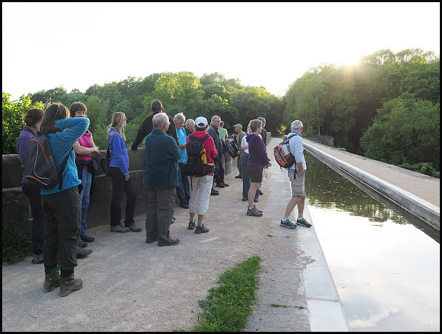
Sue claimed that there had previously been a wall here, but this picture taken during an evening walk with Stockport Walking and Outdoors Group confirms my recollection that there was no barrier at all on that side of the canal, where a tossed banana skin would land 100 feet below in the river.
Marple Aqueduct is supposed to be the tallest in Britain. It was later dwarfed by the neighbouring railway viaduct. That dates from 1865 and took just a year to construct, compared with five years for the aqueduct.
At this time of year there's a pretty ubiquitous feature of many country walks in Cheshire, and this one was no exception. Mud. After leaving the secure surface of the towpath, we dropped under both the aqueduct and the viaduct and headed up very muddy fields to Upper Watermeetings Farm, with a good view back to the viaduct.
Beyond Lower Watermeetings Farm, where a friendly lady was busy keeping the yard in (very welcome) pristine condition, another muddy field led to a well signposted path that in turn led to the slithery bank of the River Etherow, shortly before it joins the Goyt.
I nearly missed the steep steps that lead up to the west of Compstall Hall and cross a main road. Beyond that, there's a pleasant meadow in which we paused for coffee and fudge, before continuing on an undulating path, with a slippery footbridge over Gigg Brook.
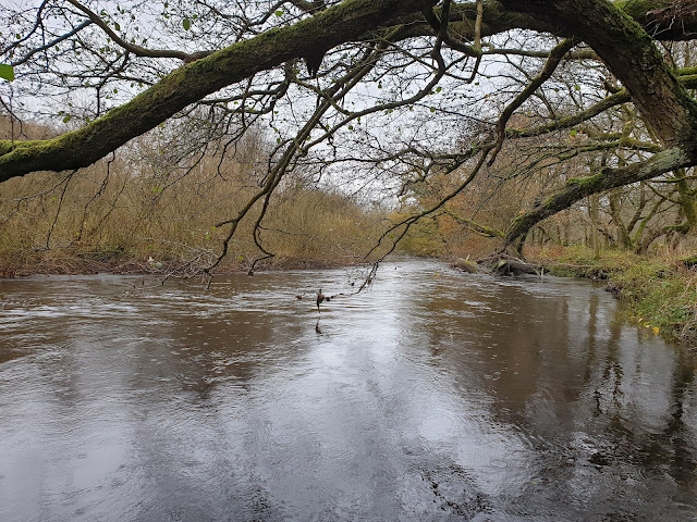
We soon found ourselves on the narrow lane to Campville Farm, from where a path leads in to Etherow Country Park, where we took in a loop around Keg Pool to reach a path that runs between the pool, and the River Etherow that is pictured below.
At the end of the Pool there's a large tap that can presumably be used to release water into the river, which flows at a lower level.
We soon found ourselves on the main thoroughfare of the park, where a chap was throwing bird seed at the mandarin ducks.
There's a lot of bird life here, including cormorants and a range of ducks and gulls and smaller water fowl like coots and moorhens.
The long closed George, once a great little pub with an immaculate bowling green, is showing signs of a new life, with a bright blue front door and a sign that says 'VIP Pet Supplies will be Opening Here Soon'. Here's hoping that this run down enclave of Compstall will soon have a fresh lease of life, if not as a pub.
Brabyn's Park is entered by way of a cast iron bridge dating from 1813 (the iron bridge in Ironbridge was built in 1779), a notable structure built for carriages to access the estate from Compstall, that has recently been transformed from a health and safety risk to a solid structure that will last for many more years. There's some interesting history in this pamphlet dated 2006. There's a listening post that we wound up and listened to, that according to this website was installed in 2012, when there was also a sculpture and information plaque on a viewing platform. Sadly that sculpture etc have now gone and the viewing platform is closed off.
By now the weather had turned a little drizzly, but at least there was a firm path through Brabyn's Park and back to the car park next to the Midland.
Here's our route - just a shade under 11 km, with 250 metres ascent. It took us an amiable 3.5 hours.


No comments:
Post a Comment