

A trip to Lower Withington found me Lucy (dog) walking with Andrew on a pleasant footpath from his house, notable for the view towards Jodrell Bank.
Then I went to Bickerton to check one of Jen Darling's shorter routes in her 'West Cheshire' guide book. I parked in the lay-by on the A534 opposite the end of Coppermine Lane.
Adjacent to the lane is a chimney that belonged to the pumping house of a copper mine that operated here in the 18th century. Sadly, there wasn't enough copper to make the mine viable.

The path leaves the field with the chimney to cross a stream and climb uphill. Today, the only bit of mud on the entire walk was here, and it was easily avoided, so this walk is suitable for wet conditions.

The path borders a tractor graveyard that is also home to relics like this Austin A35.

Beyond the relics (no tractor pictures I'm afraid as I was in the way of a nervous couple with face masks who were vaguely distressed by my presence), I joined the Sandstone Trail - a well signposted path - for some distance.
There were good views across to Bulkeley Hill, along which I would walk later.

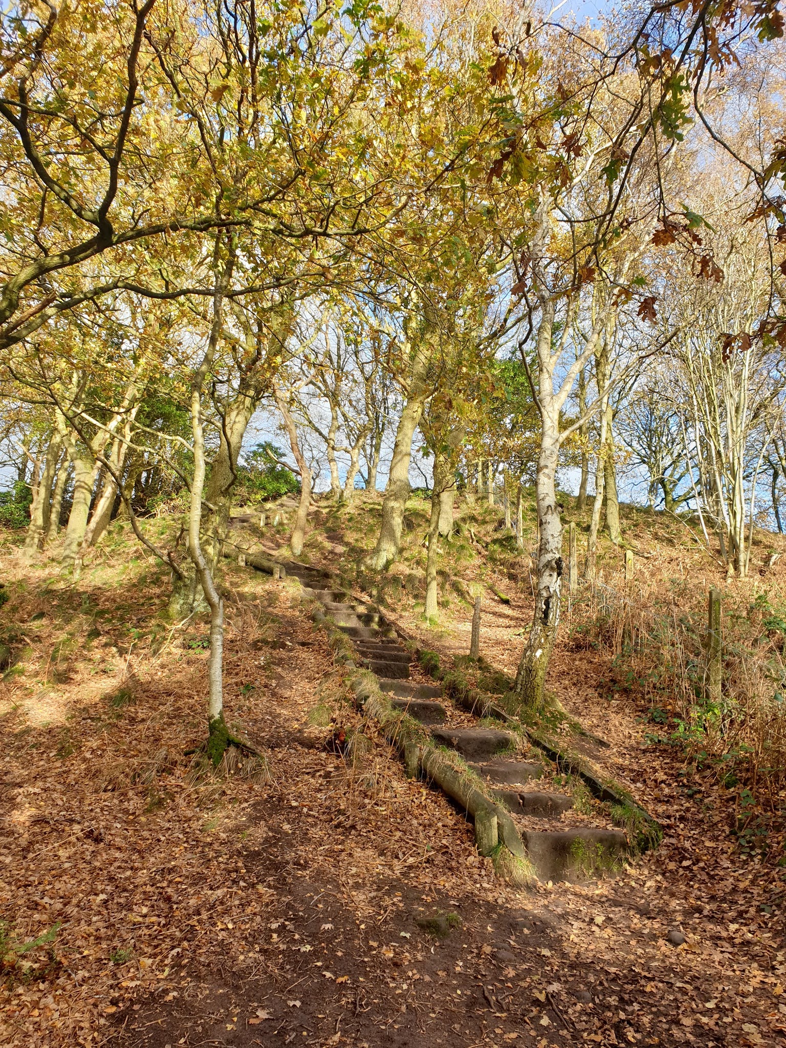
The mixed woodland along the Sandstone Trail route glimmered in the sunlight, and there were fine views in the clear air across the Cheshire plain to the Welsh hills.


Signs announcing 'Cliff Edge' indicated that I'd arrived at Muskets Hole, where the narrow path works its way around the head of the gully and up a series of rough hewn steps.

The trig point at Rawhead, at 227 metres the highest point on the Sandstone Trail, was soon reached, occupied by a chatty couple who were enjoying their lunch.

After a while I turned left, leaving the Sandstone Trail in favour of the extension of Coppermine Lane after it becomes unsuitable for vehicles.
Cottages along this lane are serviced from the north. A post office van may just have crept into the next picture, taken along the lane shortly before the Sandstone Trail is regained via a path heading steeply up to the right.

This being a circular walk, I was now heading along the Sandstone Trail in the other direction, in the lovely woodland of Bulkeley Hill.
Throughout the walk I met loads of people. It was more like a summer Sunday than an autumn weekday. No matter, we were all well distanced from each other.
Some of these people had congregated, exhausted, at the top of the steep tramway in the next picture, which fails utterly to portray the steepness. Two girls were comforting their friend who had thrown up due to an unfamiliar amount of exercise.

The tramway was built to transport heavy materials during the construction of a water pipeline that taps the reservoirs on the summit of the hill, from which the villages of south west Cheshire are supplied with water.
It seems strange to me that the reservoirs should be so near the top of the hill, but apparently they collect rainwater that percolates through porous sandstone and collects on reaching a layer of non-porous clay.
My path went past a reservoir and descended through pine trees to regain Coppermine Lane and an easy stroll back to the car.
This is an excellent short walk on outstanding paths. About 7 km with 200 metres ascent. Allow a couple of hours.
Jen's 2007 description is still easy to follow. Any amendments will be largely cosmetic.
I didn't turn the mapping software on today, so I'll leave you for the time being with Garmin's satellite view of the walk. A proper map may follow.

No comments:
Post a Comment