Sue and Martin in Mallorca 2019

Sue and Martin in Mallorca 2019
On the Archduke's Path in Mallorca

Wednesday, 4 April 2018

A Short Tour of the Vanoise – Tuesday 28 August 2007 - Day 3 – Refuge du Plan Sec to Refuge de l'Arpont

16-Day3-Early-morning-at-Plan-Sec

Here’s Sue’s diary record for Stage 3:

Tuesday 28 August 2007

A warm, sunny morning. Breakfasted on sugar puffs/cornflakes, and bread and jam, with plenty of tea/coffee.

Morning yoga

17-Morning-yoga

The start was downhill until we joined a wide, contouring path, high above the valley, dotted with pines.

18-On-the-GR5-path

Spotted marmots enjoying the warm sun. The views changed as we rounded the hillside. The path was well graded, making light of the climbing.

181-Zigzags-up-Grasse-Combe

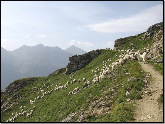
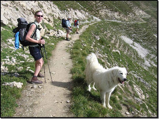
We regroup at the sight of two large white dogs standing sentinel in front of us. Signs had warned of these. We continued uneventfully, finding the large flock of sheep that was being guarded. Four of these dogs herded the sheep on the hillside, providing protection from wolves.
21-Jenny-and-a-Friend

Jenny's Friend guards His Flock

22-Jenny's-Friend-guards-His-Flock

Our morning coffee/tea break was at the top of a small hill with views to the Doron gorge, the valley, and to our continuing route over scree slopes.

Brew stop at La Loza

23-Brew-stop-at-La-Loza

Cloud was heavier now - the forecast was for rain today. The cooler air makes for pleasant walking. The trail undulates, with lots of folk coming the other way. A few spots of rain fall and we decide to lunch at around 12.30, finding a pleasant spot next to the Bonne nuit stream. Here, our three 'picnics' are shared out and enjoyed.

The path veers away from the populated valley, and I eat a few handfuls of sparse bilberries en route to abandoned farm buildings at Le Mont.

255-Le-Mont

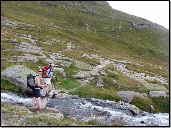
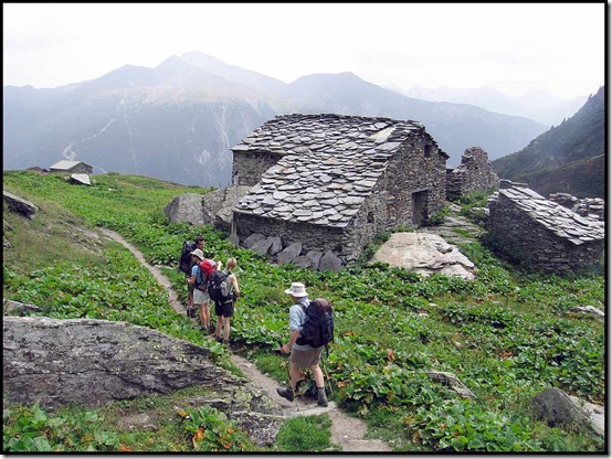
The 'Combe d'Enfer' gives us views of our destination - the Refuge de l'Arpont, and we cross an area of waterfalls, crags and roaring streams - no ibex or 'bouquetin' to be seen - just several small parties out for an afternoon walk.
26-Sue-and-Jenny

Final stream before l'Arpont

27-Final-stream-before-l'Arpont

More spots hasten the last stage to the refuge - arrival 2.45pm.*

But the weather was good enough for a drink outside before we adjourned to the refuge.

28-At-Refuge-de-l'Arpont

Showers, hot drinks, etc. Watch very fat marmots on nearby rocks - pairs cavorting together. As it's cool, we occupy the dining room, doing Soduko, reading, diary writing, and trying to stay warm.

Dinner is welcome - pea and ham soup is an instant warmer. Pork (surprise!) with pineapple and pasta, a cheese course, then pears for dessert. No lettuce! All are warmer now. The sky has cleared and the surrounding mountains appear closer as a result.

Sue

* Martin and Sue seem to have changed their name to 'Van Field', which provokes some interest among the Dutch party sitting at our table. (This is the refuge's interpretation of our surname - we soon clarify the we are not Dutch - but from Manchester.)

Jenny
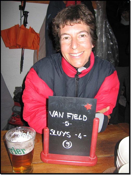
281-the-Van-Field-table

St John's Wort, puffballs, etc today. Also a stove incident. I mis-threaded it onto the gas cylinder. The whole lot caught fire and the igniter melted. Nobody else noticed! The stove still seems to work, but I'm not sure about the seal with the canister. It may now leak.

Tonight Sue resumed her winning ways at Uno.

Martin

[Stats: 8.45 to 2.45 including 1.5 hours stops = 4.5 hours walking today, 18.0 km with 715 metres ascent, compared with Kev's estimate of 5.5 to 6 hours + 486m ascent.]

(Anquet: 16 km, 1472 m ascent)

Map3

Vanoise flowers identified on this trip

Bilberry
Alpine Birdsfoot Trefoil
Bittersweet
Mountain Clover
Common Cow Wheat
Meadow Cranesbill
Autumn Crocus
Common Eyebright
Field Gentian
Golden Rod
Grass of Parnassus
Harebell
Mountain Houseleek (pictured below)
Knapweed
Alpine Lady's Mantle
Pansy
Puffballs
Raspberry
Mountain St John's Wort
Biting Stonecrop
Reddish Stonecrop
Strawberry
Alpine Willowherb|
Mountain Willowherb
Rosebay Willowherb
Yarrow
and many more

25-Sempervivum-montanum-or-Mountain-Houseleek

Tuesday, 3 April 2018

Easter Monday 2 April 2018 – A Little Ray of Sunshine (aka Around Rivington)

0201Montcliffe

JJ and I braved the elements to drive to the outskirts of Bolton, a test for JJ’s winter tyres, and join 16 others on an East Lancs LDWA walk advertised by Norman as ‘A Little Ray of Sunshine’.

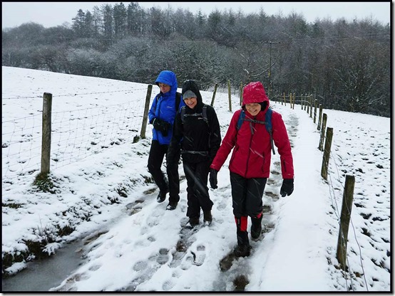
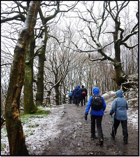
Rain in Timperley turned to snow as we approached the environs of Winter Hill, and by the time we arrived at the 9 o’clock start the planned walk over snow clad Winter Hill had been abandoned in favour of an easier circuit to White Coppice and back. Wimps!

Actually, given that Norman is nigh on 80 and there were other elderly participants, the decision may well have saved the local mountain rescue folks a call out as the planned descent route from Winter Hill is notoriously steep and slippery.

So we took a gentle route past Ormston’s Farm.

0202rivington10203rivington2

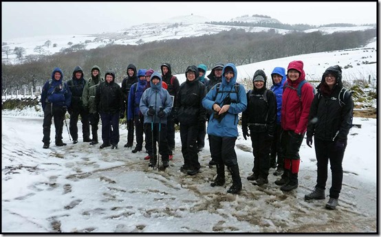
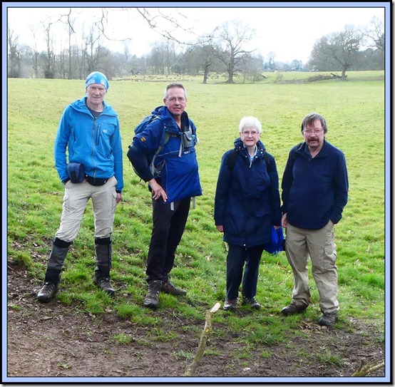
A suitable spot for a group photo was found. Despite dire warnings regarding the weather, it was only slightly inclement, the worst of the rain coming after we had set off back home.

0205group

It was however rather damp underfoot. Some of those wearing trail shoes got rather cold and wet feet.

Small waterfalls were encountered.

0206waterfalls

Whilst the Camellia in our Cheshire garden is in full bloom, spring seems some way off in Lancashire.

0208path

A random point above Anglezarke Reservoir was chosen for a five minute elevenses break. Well done Norman – it was spot on 11 0’clock.

0209elevenses

Suitably refreshed with coffee and cake, for some the pain of stream crossings became more like a jolly splodge.

0211stream2

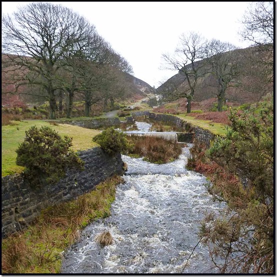
The familiar environs of White Coppice were reached well before noon, after we’d passed the aqueduct draining water from Anglezarke Moor.

0213byWhiteCoppice

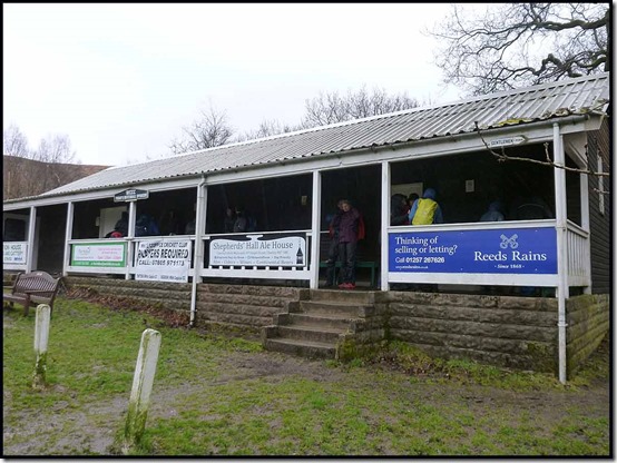
Despite Norman’s earlier promise, the café was shut, so we made do with lunch on some benches under the cricket pavilion.

0214pavilion

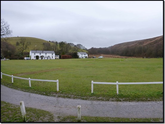
In a week or two folk in deck chairs under a hot sun will be watching athletes all clad in white testing the sound of leather on willow just here.

0215cricket

Nearby, after we’d departed from our lunch break, we noticed that a few daffodils have sprouted next to a small reservoir.

0216resr

LDWA walks are judged by their length. Summits rarely feature. So it was something of a surprise to arrive at a summit – Healey Nab, an outlier of Winter Hill – 208 metres tall. Wow!

0219healeynab2

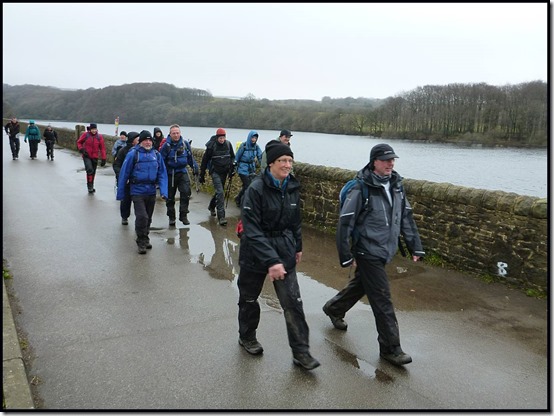
The walk progressed in fine weather past Anglezarke Reservoir then alongside Upper Rivington Reservoir.

0223anglezarkeres3

I thought they were speeding towards one of the cafés in Rivington, but it was not to be – Norman carefully avoided the fleshpots, in favour of a visit to the remains of 'The Castle', an incomplete scaled down replica of Liverpool Castle, intended as a ruin. Another five minute break was declared, but most of us were bereft of provisions and only sustained by Hilary’s generous hand out of a variety of sweets.

0225livcastle2

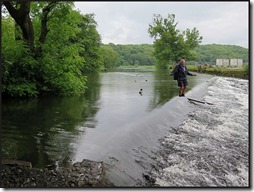
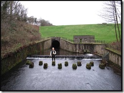
The congregation was enthralled by Norman’s stories of his youthful exploits on escapades like crossing the weir at Whalley and the stepping stones at Jumbles. Happy Days!

0449weir3norman3036dam

All good things come to an end, and after more pleasant paths on the edge of Horwich’s housing estates we reached our outward route for the last few minutes back to the start of the walk, and a drive home in driving rain. Thanks to JJ for the lift.
Here’s our route – about 25 km with 500 metres of ascent, taking us six and a quarter hours including breaks.

0230route

Thanks to Norman for leading this walk in excellent company. It was good to be back with the LDWA crowd after a long break. Hope to see you again soon…

Monday, 2 April 2018

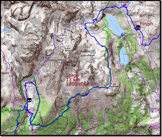
A Short Tour of the Vanoise – Monday 27 August 2007 - Day 2 – Refuge d'Orgère to Refuge du Plan Sec

11-Day2-Richard-above-Modane

Here’s Martin’s diary record for Stage 2:

Monday 27 August 2007

Up at 7.15 (apart from mid night escapades) and after a good breakfast we leave the refuge at 8.30 on Stage 2 of Kev Reynolds' Vanoise route. Soon down to the start of yesterday's nature trail, and then into woods high above Modane for a gradual 400 metre ascent above the valley, where cars trundle like toys below and a helicopter wheels overhead.

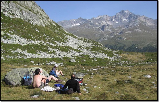
It's a hot day, but it's some time before we emerge from the cooler environs of the trees, having risen from 1880 to 2270 metres. We enjoy a welcome break - 10.00-15, with superb views south, before continuing to reach Col du Barbier at 10.50, where we enjoyed a 40 minute brew stop in the heat.

12-Brew-on-Col-du-Barbier

We got good views of the Aussois Valley.

124-Aussois-Valley

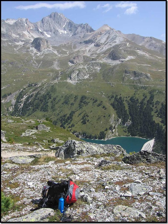
From here we had superb views of La Dent Parrachée (3697m). This mountain created some cloud today - the only local cloud.

122-Plan-d'Aval-with-Dent-Parrachee

As we headed along the superb belvedere path and descended to the head of two lakes, both Richard and Andrew began to flag in the heat. To their rescue came the Refuge La Fournache.

13-At-Refuge-la-Fournache

We sat inside ("for the heat") and enjoyed ham salads and an omelette, with some (sheep's?) goat's cheese yogurt. 1.30 to 2.30.

From here a short 30 minute stroll led to Refuge du Plan Sec.

14-Arrival-at-Refuge-du-Plan-Sec

A place converted into a refuge from three farm buildings. All very tasteful. We soon get installed, showered, and the washing dries quickly in the sun. My crocs have a mishap, as a strap staple goes missing. I have to improvise with one of Jenny's hairgrips* (*yes, I have brought enough to spare!!! - Jenny). And, what with sitting in the sun, chatting to an English teacher from Paris, and watching a sad pair of lads fumble their way off the hill, whilst an assortment of others come and go, the four hours to dinner soon pass.

15-Bill-or-Ben-or-Andrew151-Outside-Plan-Sec152-Plan-Sec-vista

Pre dinner: 1664

Dinner:
Asparagus ('mountain vegetable') soup with croutons
Pork fillet in sauce with garlic potatoes and ratatouille
Lettuce
Ice cream (vienneta) + fruit cake and cream
1.5 litres red wine

  • Quite a few people seen today, even a couple of English on GR5, but only about 20 staying at the refuge
  • Marmots seen today - fat ones - kept popping into holes
  • Birds of prey near Plan Sec
  • Unfriendly guardian at Fournache
  • Nice at Plan Sec
  • Good streams at head of valley
  • Interesting shower with unstable temperatures (esp for whingeing Martin)

Full moon lights the way to the toilets.

Martin

[Stats: 8.30 to 3.00 including 2 hours stops = 4.5 hours, 11.0 km, 700 metres ascent.]

(Anquet: 13 km, 1200 m ascent)

Map2

Sunday, 1 April 2018

Saturday 31 March 2018 – Wythenshawe parkrun number 332, and A Marathon Fundraising

3101parkrun

Whilst Sue and Jeanette chatted their way around the 5km course, walking it in a shade under 40 minutes, Paul blasted round in 22.30 (those were the days – I used to be able to do that!), and I struggled home in a bit over 25 minutes. If I could keep that pace up I’d do next Sunday’s marathon in under 4 hours. But I couldn’t keep it up for another one km, let alone 37!

The results are here.

That’s my last timed run before the Manchester Marathon on 8 April. I’m hoping to enjoy that event, but it’ll be extremely hard work for a good five hours.

I’m using this marathon as my annual fundraising effort for the Levana School Partnership – a small charity that supports two township schools in Cape Town. My JustGiving page is here. All contributions, however small, are very much appreciated. The money goes a long way when spent in South Africa, and it does make a difference for a lot of children.

Friday, 30 March 2018

Thursday 29 March – A Short Walk from the Wizard

2906alderwoodonNCW

Time travelling back to the present (see previous entry), at last I’m now fit enough to be able to arrange a few morning walks. This one was at very short notice, so it was great that JJ, Rob and Pam were able to join me for this pleasant amble. We are pictured above, near Alder Wood, on the North Cheshire Way.

Setting off along the NE path to Mottram St Andrew from the NT car park by the Wizard café (£4 for 2 hours, £7 for longer – the National Trust subscription soon pays for itself), we soon got good view over Cheshire towards the Peak District.

2901alderley1

Before setting off, I’d warned the others that it might be a bit muddy in places!

2902alderleymud

Generally, the paths to Mottram St Andrew were pretty good. A short stretch of quiet road through the village led eventually to the North Cheshire Way footpath, through fields bulging with new-born lambs.

2903treesnralderley2904alderleylambs1

This post in Alder Wood pointed towards Alderley Edge, but the wood carving indicated our closeness to Hare Hill, which I’d have visited if there was a good off-road route back to the car park.

2907alderwoodcarving

However, we chose the direct route to Mount Farm, then on to Edge House Farm, which has for some considerable time been the subject of a major construction project. I expect the locals will be pleased when it’s finished.

2909edgehousefarm2

Rob’s photo seems to show me pondering something technical. The route?

rob2

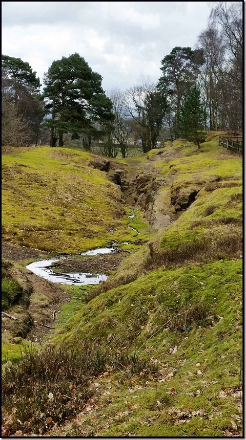
We returned past the Engine Vein, pictured below, which a few years ago was an ugly open scar, where a line of early mining pits was excavated in around 1900.  After being fenced off, it now looks grassy and benign, hiding centuries of mineral excavation.

2910alderleyenginevein

Numerous old tools, dating back as far as the Bronze Age (2500 to 800 BC) have been found hereabouts.  Many minerals are found here in the space of a few acres, including copper, lead, iron, zinc, silver, arsenic, silicon, barium, vanadium, and magnesium, in a variety of forms, mainly as thin films coating the pebbles and grains of the porous sandstone.  From the Engine Vein, later galleries and levels amounting to 22 miles in length, reach out beneath the Edge.

After about 100 minutes of walking, and having covered all of 7 km, JJ elected to drag us in to the Wizard Tea Room to continue his cake training regime for this year’s TGO Challenge, whilst I set about calculating how long the marathon I’m doing on 8 April would take at this pace. Ten hours – I think the finish may be closed by then!

2911NTmemberJJ2912cakemanrob12913wizaedcafe

An excellent little outing; thanks everyone for turning up, and to Rob for his photos. Here’s the route we took – 7 km with about 150 metres ascent, taking rather less than 2 hours.

2920route

There’s a longer version of today’s outing described here.

I’ve planned a couple more morning walks – all are welcome:

Thursday 5 April - A short morning walk from Lindow Moss car park opposite the Harvester Boddington Arms on Racecourse Road, SJ 888 863. Meet at 10.30am for this 6-7km stroll.

Wednesday 11 April - A morning walk around Bramhall and Poynton. Meet 10.00am at Bramhall Hall, SJ 888 863 for a 14km stroll.

Saturday 14 April
The Calderdale Hike - 22 or 40 miles around Calderdale. (I’ll will be doing the 22 mile route.)

There’s also a 15 mile LDWA walk near Rivington on Easter Monday if anyone is interested. JJ and I will be in attendance.