Sue and Martin in Mallorca 2019

Sue and Martin in Mallorca 2019
On the Archduke's Path in Mallorca

Wednesday, 15 June 2022

November 2004 - The Annapurna Circuit - Day 8


Monday 8 November
Pisang to Manang
Itinerary: DAY 8 Manang (3,351m) Passing some prayer wheels we ascend gradually to a pass from where a wide Manang Valley comes in full view with peaks of Chhulu East on the north and Gangapurna in the south. After a short descent from the pass we follow the valley to an airstrip at Hongde (3,322m). We are now in the alpine zone with scattered scrubs of juniper. Due to the poor soil here only one crop per year of wheat, barley, buckwheat and potatoes grow. After lunch we continue to Manang via the village of Braga (3,505m), which houses the oldest monastery in the area (about 500 years old), perched high on the valley cliff. (5 - 6 hours walk). 

[Diarist: Sue]
It was slightly below zero when I got out during the night, frost on the tent but a beautiful starry sky. 

At 6 am, the usual routine, and I get out of the 4-season sleeping bag at the last minute. Painful hands resulted from air-drying them after washing them, and rubbing by Mary helped to resolve this. 

It was really chilly waiting for breakfast, but while we ate porridge, scrambled eggs and apple pancakes, the sun hit the tent and a gradual thaw began. 

This campsite was quiet, away from the river, and dominated by the snowy peaks of Annapurna II and IV. Today's is a short walk to Manang, and we start in down jackets, soon to remove them in the sun. The dirt track rose through shady woods. Quite a few people on the trail, including porters. On the north facing slopes, the first patches of snow, which Sanjeev tells us fell on October 17th and 18th. The waterfalls are now all frozen.

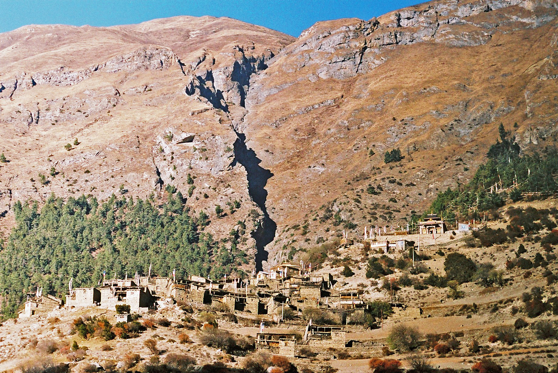
On the hillside the other side of the river is the medieval Tibetan village of Ghyaru at 3670 metres. Above us, its brown buildings blend in well on the brown, barren hillside.

Striking camp at Pisang, below Annapurna 11

A rise brings us to a superb view point, Norodhara. Looking back, Pisang Peak, and forward down the valley to Hongde, where the airstrip can be seen. Coloured prayer flags flutter in the breeze and a Twin Otter comes in to land. In the distance, Tilicho Peak (7134 metres), and the valley floor covered in pines.

Two pictures of the same tree beside the path to Hongde


Hongde airstrip, and Tilicho Peak

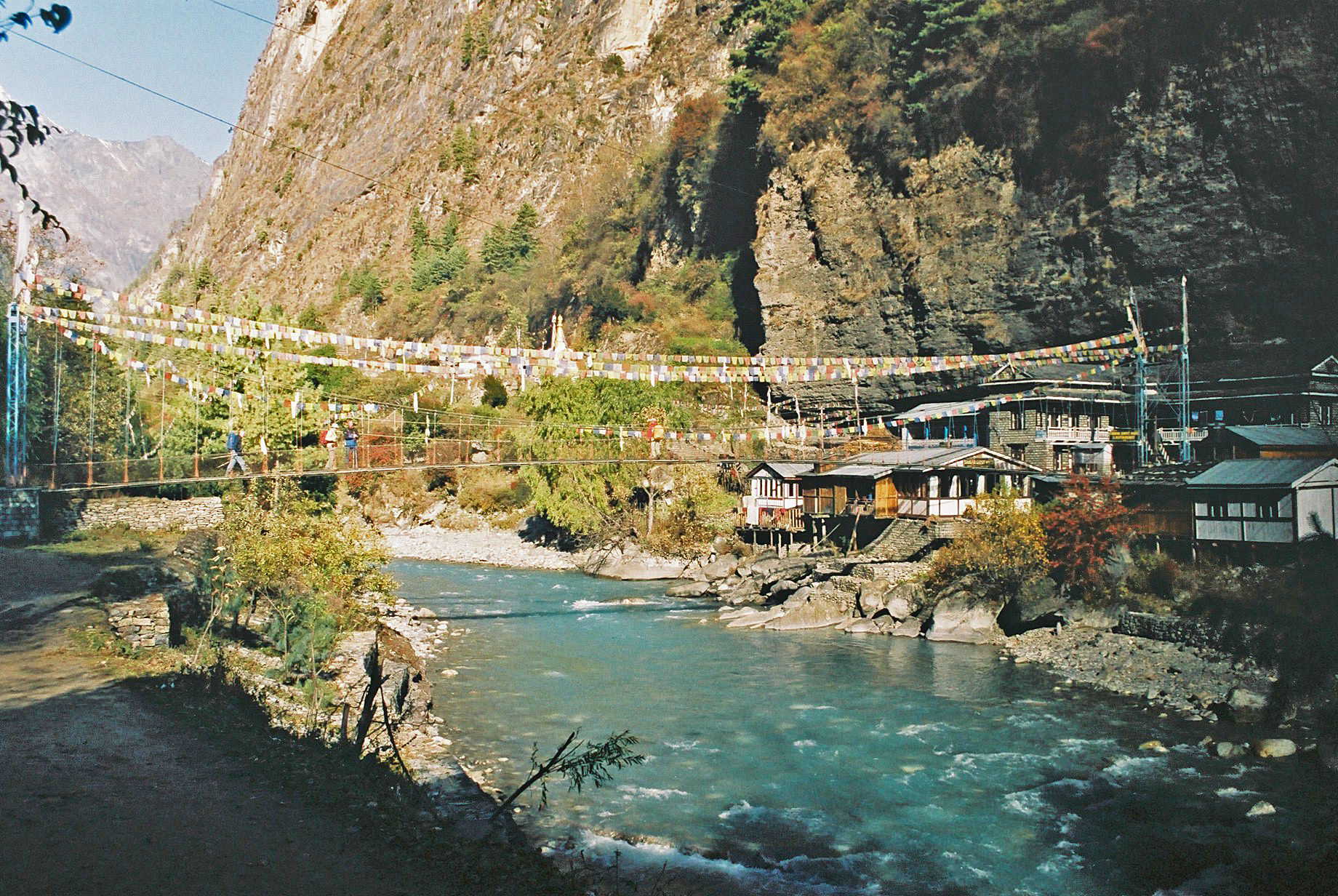
Bridge into Hongde, with Annapurna 111

Dropping down, a frosty path, before the trees are changed for scrub, then a wide level track heads to Hongde. It seems strange to have telegraph poles next to the path! 

Mules pass again, and today horsemen appear for really the first time. They move along at a fast trot.

Hongde flags

The village of Hongde has a long mani wall down the centre of the main street, and soon after this we stop for lemon tea at another sunny rooftop restaurant. From this eyrie are superb views of Annapurna III. Our trekking permits are checked at a police checkpoint at the end of the village and we continue uneventfully. Around us are wind-sculpted rock formations that dominate the scenery around the village.

Hongde mani wall

Hongde teashop

Hongde

Leaving Hongde

The next section was stunning - Annapurna III and IV are 'just' to our left, albeit 4000 metres higher. The valley is wide and there are pines and scrub. 

Ahead is Tilicho Peak and behind, Pisang Peak. The sky is azure blue and cloudless again all day. Just after the few buildings of Mungji, a Himalayan griffon landed close by, then soared off again after close inspection through binoculars.

The path beyond Hongde, with views to Annapurna 111


Views from the path beyond Hongde


View towards Manang


Chorten and Tilicho Peak, nearing Braga

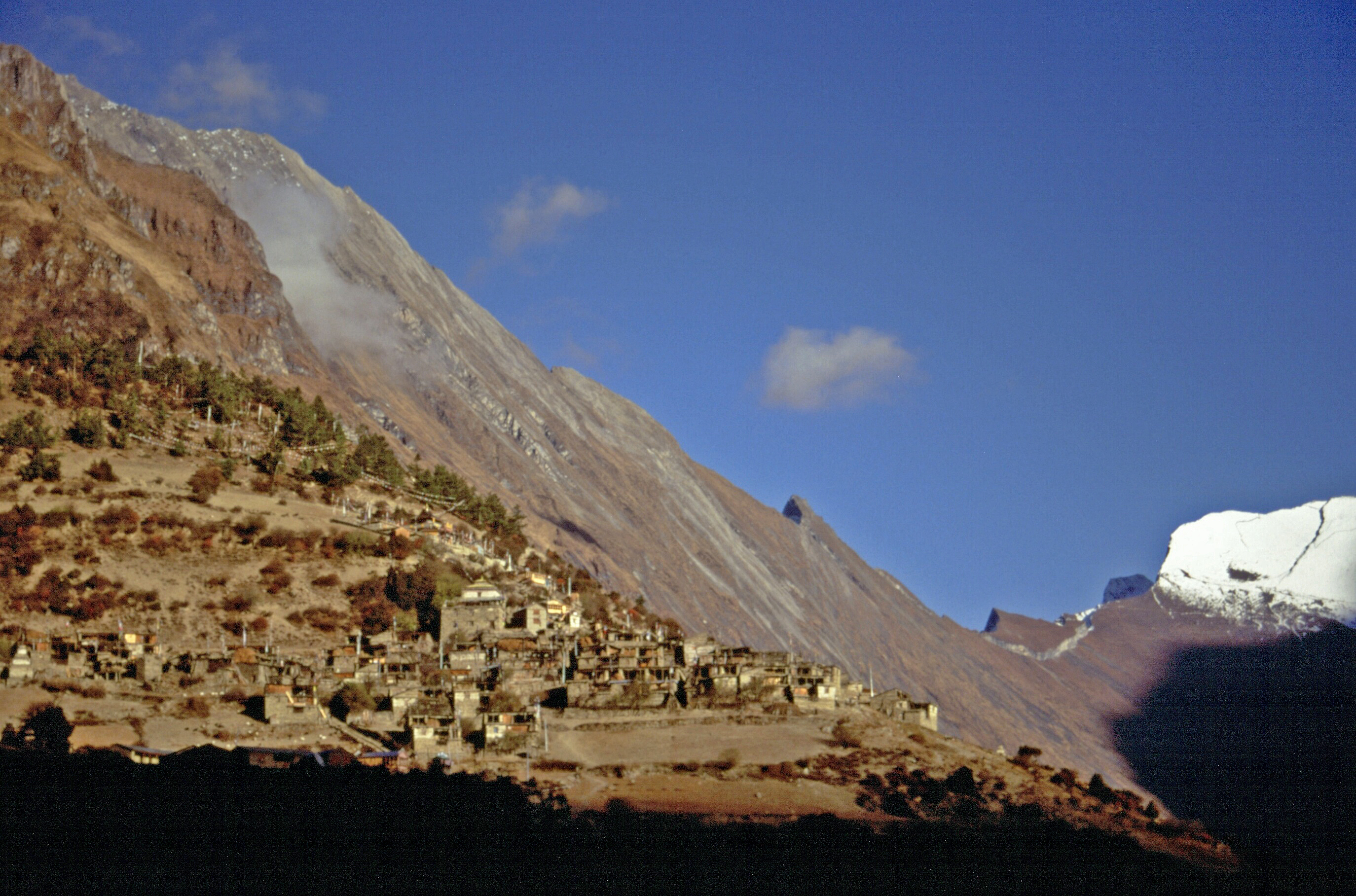
Braga was reached at about 12:30 (3505 metres). It has a 500 year-old monastery above Tibetan style stone houses built on the steep hillside. We notice the altitude during the climb up steps to the monastery, after having waited a few minutes for Manesh to find someone with a key. It was a fine place to linger, looking down on the white gompa and across to another village, then on to the Annapurnas across the other side of the Marsyangdi and fields. The sound of bells and flapping prayer flags was memorable.

Views from Braga Monastery

Shoes were removed before we stepped through a dark doorway and into a room about 12 metres square, lit by a skylight. It was very colourful, with coloured flags hanging down, painted carved wood near the edges, and walls were cabinets with two rows of statues behind glass - the lower teachers, the upper one gods. A Buddha sits at the front, with the senior monk's chair to one side. In front of the Buddha, a 24-hour flame burns and offerings sit. Thanka paintings line the walls high up, some faded with age. Behind the Buddha, lots of prayer books line the walls.

At Braga Monastery


To reach the upper floor, we climb wooden ladders - tree trunks with steps cut into them. Two beasts guard the entrance to another smaller room where a large Buddha sits, with gold hands and coloured dragons behind. This, apparently, is a very good example of a monastery, still used twice a day by locals.

Despite the morning's gentle walk, lunch was welcome - curried potato, paratha, tuna, carrots in cinnamon, and coleslaw, followed by pomegranate, eaten in a room with a sunken floor, covered in stones, on chairs cut from trunks, with small tables. It resembled a council chamber! 

Only 40 minutes walk to Manang remained after lunch. Despite the sun, the wind was cold - no shorts for any of us today. Manang, at 3550 metres, is quite a metropolis, and it is where trekkers stay for a day or so to acclimatise before going higher. So we have a 'rest day' tomorrow. The main street where the hotels are is wide and it looks like there are furrows where it is not paved.

Braga village and monastery

At Braga

Mani wall between Braga and Manang

We spot the yellow tents in town at 3:10 pm and enjoy a few minutes sun on the tent before it goes, and clothes are pulled on. We look across at Annapurna III and Gangapurna, and the huge Gangapurna glacier. The tents are pitched on dust, which has blown across the trail at several points today. kicked up by wind, people and horses. 

Washing water at 4:00 and tea at 4:30, then Martin and I stroll through darkening streets to the end of town, through stone buildings. 

Dinner was at 6:30, with a few surprises. Tomato and garlic soup with poppadoms, then rice, carrot and cucumber salad, beans with cumin, and pizza with cheese, mushrooms and tomato. A warm pudding of custard and peach slices. Hot drinks followed. To our amazement, hot water bottles were produced and were secreted under our down jackets. whilst a few Uno hands were played. Sue won today. 9 pm to bed. 

Today's Stats:
Start: 3205 metres
Ascent: 500 metres
Descent: -155 metres
Finish: 3550 metres
Time: 7.5 hours
Stops: 3 hours
Walking time: 4.5 hours

Bridge near Braga

Monday, 13 June 2022

November 2004 - The Annapurna Circuit - Day 7


Sunday 7 November
Kodo to Pisang
Itinerary: DAY 7 Pisang (3,185m) A short walk brings us to Chame (2,713m), the administrative headquarter of Manang District, which is relatively a wealthy village. We cross the Marsyangdi and following the north bank we continue to move westward through pine forest and arrive at an apple orchard village of Bhratang (2,919m), a former settlement of Khampas (Tibetan refugee warriors). From here our trail goes through a cut in the cliff high above the river. Then while ascending we suddenly reach a clearing that reveals a huge rock slab of about 1,500m high. Again after crossing the Marsyangdi to the south bank we steeply ascend through fir forest to a wider valley. Then an easy walk along the valley takes us to camp just before lower Pisang at the foot of Pisang Peak towards the north and Lamjung Himal and Annapurna II to the south. (5 - 6 hours walk).

[Diarist: Martin]
6 am wake up call with tea from Sagar. Cool this morning with a light ground frost. Washing water soon arrived. Usual packing and ablutions before breakfast at 7 am. Rice porridge with nuts in it, then omelette and toast (a bit cold). 

Diamox was taken by Sue and me; I had no pins and needles after effect, just a diuretic reaction - six pee stops by the 11 am tea shop stop! 

7:45 departure from the 'Superb View Hotel' (it was), then a pleasant forest stroll to Chame, where army and police check our permits and get us to sign two registers. We speed through. Sangeev says he recognised from a name badge that one of the men was of his family name - that helped.

Arriving at Chame

View to Lamsung

Sue with Lamsung, from Chame

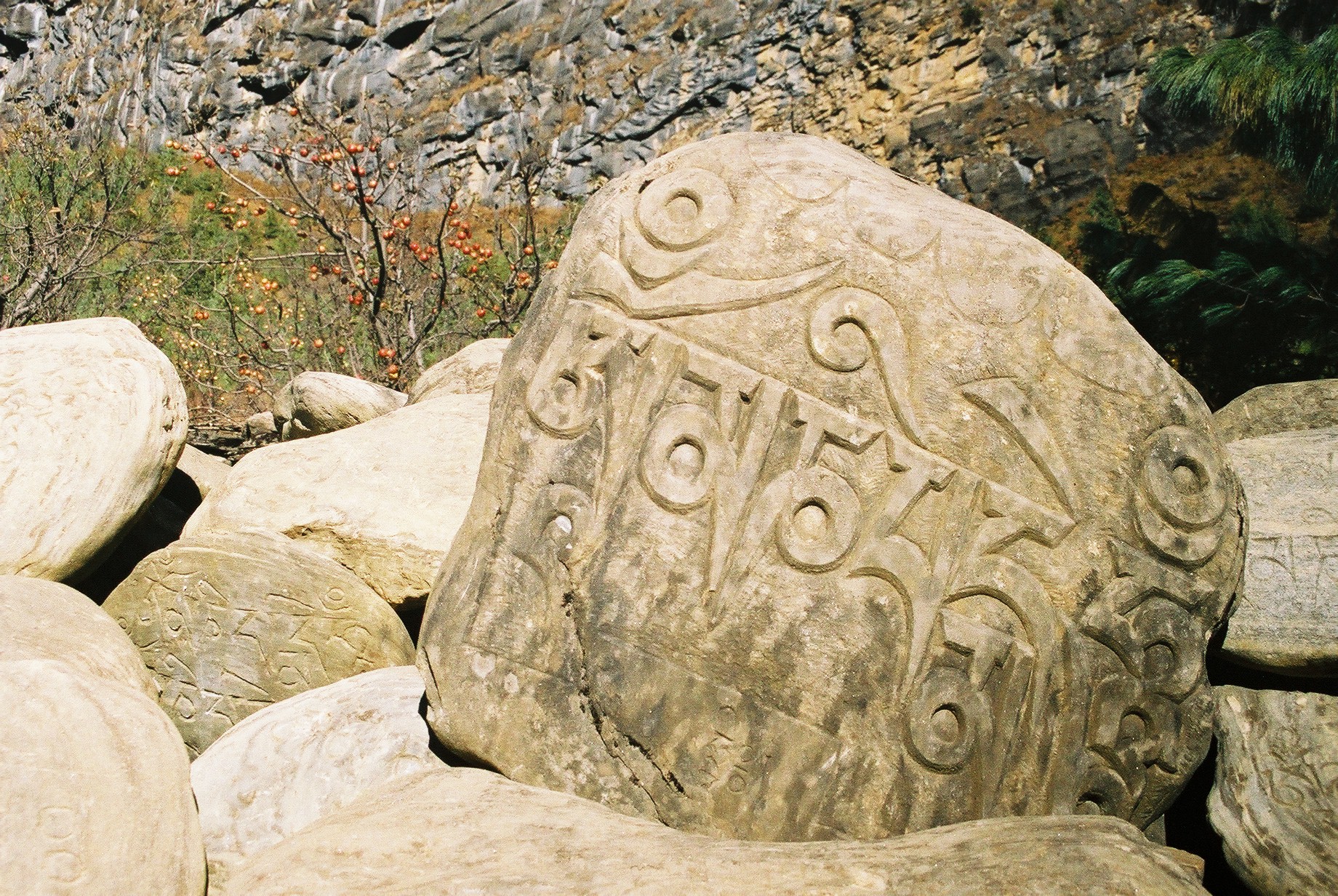
Mani wall at Chame

The sun is up by 8:45 and those who set off in full winter gear divest their down jackets. Lindy was cold last night so buys two more tops.

Entrance gate to Chame

Chorten at Chame

We continue on a delightful forest path. Quite busy. Mani walls and chortens before we leave Chame after lots of prayer wheels. We walk at roughly the same pace as our one-eyed, flipflopped, coughing table man. 

The woodpecker like bird in the pine trees maybe a 'Babbler'.

Pine forest above Chame

A flat section takes us to a nice tea shop at Bhratang - 2900 metres, 18C (it was 20C at yesterday's tea shop). The mountain mix takes a bashing and is washed down by lemon tea for everyone.

Mani wall at Bhratang, with Manaslu in view

Mani stone and ripe apples after Bhratang

Mule train

Pine forest stop, with Annapurna 11

Superb views en route - back to Manaslu, with Lamjung high on the left, and we have glimpses of Annapurna II ahead. 11:15 to 11:45.

Orchard beyond Bhratang

The blasted path to Pisang

Lunch by a river crossing at 3060 metres, 12:10. Sunny, but the blue tarpaulin is in a rough patch in shade. 13C. En route, a section where the rock has been blasted - like a giant via ferrata path. This is a path shown on our newer map, but not on the older version supplied by Sanjeev. Two other groups have their blue tarpaulins nearby (in better positions, they must have got here first!).

Blue gentians

Lunch on the path to Pisang, and (below) two views from the lunch spot


The juice arrives quickly but the veg is still being chopped when we arrive. Sanjeev claims there is a climbing hut high above. It looks like a rock. (It is a rock.) The place is overlooked by the huge face of Paungda Danda - a sheet of curving rock scraped clean of vegetation and towering more than 1500 metres above the Marsyangdi River

Lunch is fried luncheon meat, vegetables fried in butter, chips, vegetable chapattis, followed by fresh pineapple. It was excellent. We sat in the sun (not on the blue tarpaulin) until 1:55, making it our longest lunch break yet.

Very pleasant. Then a 2-hour stroll up to our camp at Lower Pisang (3185 metres) via pine forests as far as a place called Dhukurpokhari, with a couple of tea shops, then down to and along an arid area to the left of a tarn, with stunted pine trees.

View to Upper Pisang

View from 3200 metres

Camp is on dusty earth, which the team are watering to make it more acceptable. Up at Dhukurpokhari we had a first view of Chulu West, and Annapurna II was prominent, high above to the left. 

Towards Pisang, Pisang Peak (6091 metres) came into view. Apparently it is a trekking peak via a snow plod, but our view is so foreshortened that this looks impossible from here. 


4 pm, and the sun has gone down and we have lost our superb views of Upper Pisang, a Tibetan type village a bit above us to the south. Children have found us and chatter outside. 


5 pm: hot washing water.
5:30: tea and biscuits
6:30: chicken soup and huge excellent croutons; spaghetti and tuna with egg on top; potato cake; lady's fingers; aubergine fritters; buffalo and vegetables - fried. 

Then a chat with Sanjeev before another round of Uno - Mark won. Bedtime as usual at 9 pm. A cool evening - we all (except Mark) wore our down jackets tonight, and Sue and my Canadian boots were great for keeping our feet warm. 

Altimeter notes:
Andrew and I have decided to rely on the 10-minute reading interval as the 1-minute interval may give rise to movements during our long stops due to 'hunting', with the meter frequently changing up and down 5 metres while we are stationary. So we now think the following is a best estimate of our journey to date:


 4 Nov

5 Nov

 6 Nov

 7 Nov

Start (m)

800

1105

1705

2610

Ascent (m)

545

785

1050

710

Descent (m)

-240

-185

-145

-115

Finish (m)

1105

1705

2610

3205

Time (hrs)

8.00

7.75

9.00

8.25

Stops (hrs)

2.50

2.50

1.50

2.75

Walking Time (hrs)

5.50

5.25

7.50

5.50


Wednesday 8 June 2022 - Cicerone Lancashire Walk 6: Langden and Hareden Valleys


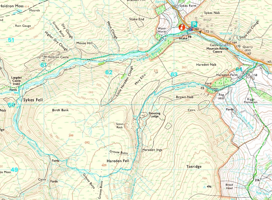
This three hour walk starts from the large lay-by at Langden, in the Trough of Bowland beyond Dunsop Bridge. It starts up a lovely avenue of trees beside a tarmac track to some Water Works buildings by the Langden Intake. A cuckoo was in fine voice, and grey wagtails tracked my progress.

Beyond the buildings, a sort of welcome to the 'open access' but highly restricted 'Forest of Bowland', where raptors are still persecuted by grouse murderers.


United Utilities have a second information board regarding Langden Intake.
 

There had been some heavy overnight rain, and as I walked along the track beside Langden Brook I was pleased to be wearing boots rather than the usual trail shoes today, as there were rivers to ford, and those rivers were in spate.


Never mind the rivers... the footpath was in spate!


I soon passed a memorial to the victims of three separate nearby air crashes involving the RAF, the Polish Air Force and the Royal Canadian Air Force.


The path rose above the valley for a while, and before dropping down to the confluence of Langden Brook and Bleadale Water it offered a view down to Langden Castle (right), Langden Brook (centre) and Bleadale Water (left). Curlews, oyster catchers and lapwings all made their presence known.


I stood in the marsh to take a picture of Langden Castle, which is simply a barn with two ornate windows and an arched doorway!


The view up the valley towards the heights of Greave Clough Head was nice enough, but my concern was one of 'how to cross the river without getting wet feet?' (and without taking my boots off).


Well, my long jumping skills triumphed, and I could look back across the river to the castle.

A mallard - very shy compared with our local towpath birds who come to us for food - tried to distract me from her young by adopting a 'broken wing' pose, and wheatears chirped from any post they could find on which to monitor my progress.


But now I was trapped, as I couldn't easily get back the way I'd come, and Bleadale Water, which I needed to cross, was more in spate than was Langden Brook. In the end I splashed my way across at the point shown below, and despite the water being knee deep my overtrousers, gaiters and boots combined to repel any thought of water ingress!


The path then rose gently up the Bleadale valley to the plateau of Hareden Fell.

A suitable spot for elevenses offered this view back down the valley.


The path came to an end at a white post, after which a plod just south of east, past peat hags, led past a couple of small tooth like rocks to the top of Hareden Fell and some grouse butts, to the left of which it was easy to locate the 'shooters' track' on which the grouse murderers are transported when the time comes for those crusaders to attack. Today there was nobody around until I met a sole walker near Hareden Intake.

It was a 3 km walk down the track to a footbridge, with Whin Fell and other heights of the Forest of Bowland in view beyond a red roofed shooters' shack.


I was glad of the footbridge! Hareden Intake is visible in the distance.


Beyond the intake, my path passed through a farm where sheep were looking for a paddle and the Jubilee bunting was still fluttering in the breeze.


A left turn beyond the farm saw me on a pleasant riverside footpath back to the car parking area at Langden. The small white blooms of heath bedstraw, together with tormentil and thistles, lined the path.


An Airstream caravan took pride of place in the lay-by, here pictured from a distance before I made my way over conveniently placed footbridges to a sheltered spot for an early lunch before adjourning to Bacup, and dog walking with Oscar.


If you click on the next image you can view both Mark Sutcliffe's route and my route in anticlockwise pale blue lines, and if you look carefully you can see that I followed Mark's route pretty accurately on this occasion. My Garmin gadget recorded 11 km, with 300 metres ascent, taking (as Mark suggests) about three hours. A classic walk - a great way to spend a mizzley morning in deepest Lancashire.