Sue and Martin in Mallorca 2019

Sue and Martin in Mallorca 2019
On the Archduke's Path in Mallorca

Friday, 2 June 2017

Thursday 1 June 2017 – Cadair Berwyn (2)

0104pistyll3

Cary’s text message on Wednesday: ‘…are you interested in joining me?’ he was going to the Berwyns to recce a Sunday walk for SWOG members.

‘Yes’, I was up for that, especially as he planned to walk from the opposite side of the range of hills to the approach I made on 16 August last year. My report on that excellent outing is here.

It took an extra half hour (2 hours from Timperley) to get round to Tan-y-pistyll and the impressive road head waterfall.

There’s a small lay-by in which to park. A chap was setting up a chocolate shop there, so it must get busy. The only alternative is to pay £4 to park at the waterfall, where there’s also a café, B&B and campsite.

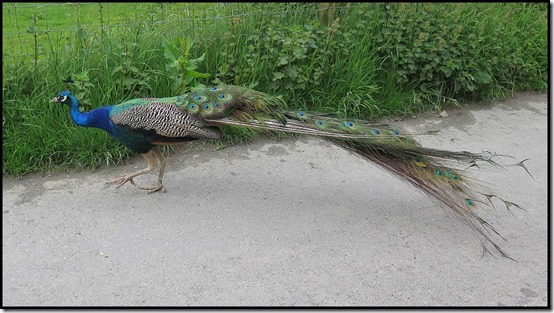
A guard was on patrol as we set off at 10.15.

0102peacock

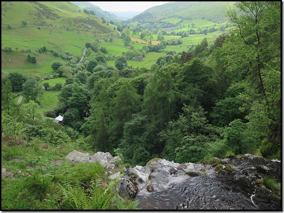
Compared with the Llandrillo start, this one is brutal, with a steep ascent to the top of the waterfall being rewarded with a fine view down the valley.

0107pistyllview2

What with Cary’s tired legs from climbing Scottish mountains and my tired legs from lugging 15 kilos of luggage across Scotland for two weeks, we took a while over the first, steep, three kilometres. Then the ground levelled a little, so apart from having to make our way around numerous marshy hollows we found the next kilometre of ascent up to Moel-Sych a little easier, especially given the orchestra of skylarks.

0109toSych

Here we are, from the top of Moel-Sych (827 metres).

0110Sych2

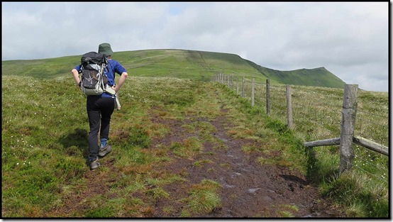
A chap from the Midlands joined us for a while, before we romped off to the main summit of Cadair Berwyn, the highest point of the walk. Here’s Cary on the ridge.

0112berwynridge

From Moel-Sych there’s a good view down to a lake, Llyn Lluncaws.

0114LlynLluncaws

Cary led the way to the high point of Cadair Berwyn (830 metres).

0115toCadair2

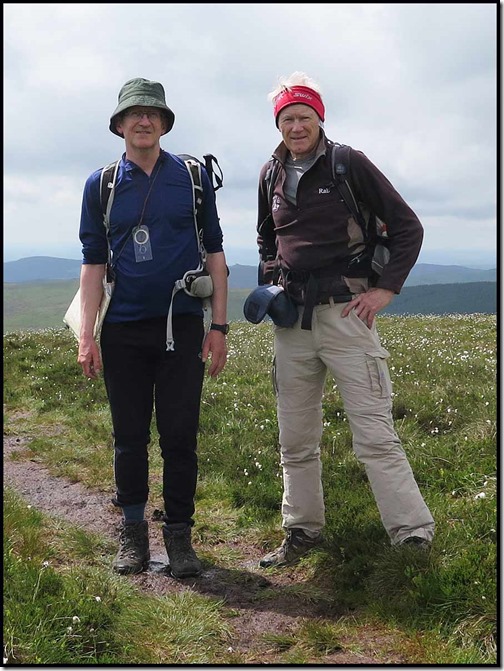
Beyond the high point is a fine shelter, and nearby at the North Top, a trig point at which Cary and I are pictured (via some passing strangers and a camera swap). It was a lovely day with a refreshing breeze high up.

0116CadBerwynsummit1

From here we continued over Craig Berwyn and down to a minor col that houses a path from Llandrillo, before ascending to the summit of Cadair Bronwen – a dogleg extension for us today.

Eight people and a couple of dogs mingled briefly on the summit. Cary and I enjoyed some lunch and then set off back down a boardwalk through bog and cotton grass. This took us back to a contouring path towards our next objective, Tomle.

0121fromBronwen

Here we are (below) looking back to the main ridge from the path to Tomle just beyond the end of the contouring path. From this point on we saw no other walkers. Everyone else must have returned by a shorter route. I hope they didn’t try to pass through any of the forests, which looked like deep green plush carpet mats thrown over threadbare matting.

0122toTomle

We plodded gently on, trying to avoid the boggy bits, passing over Foel Wen and Foel Wen’s South Top, before descending beside Mynydd Tarw (pictured below), where Cary and I somehow misplaced each other for a while, before descending with Cary whingeing about his sore knees. It was t-shirt weather; Cary realised this by the time we got to a farm at Waen, where we lazed for a while on a nice flat rock. Here’s the view.

0124viewfromWaen

A steep ascent brought us onto a good track for a while, but beyond Rhyd-y-gau a jumble of tussocks on a blanket of bog led to the corner of a felled area of forest and a vague path beside then through the forest to another track. The going was hard at times, but the views were wonderful, with almost every shade of green being represented. Bluebells, buttercups and plantains struggled to breathe in the deep grass that will presumably soon be converted to silage. The next picture was chosen with difficulty from a series of similar images.

0126view2

Eventually we reached a good track that led down to the valley road. After a kilometre or so of road walking we turned south along a good path through the remnants of a small quarry to reach Tan-y-pistyll. On the way we encountered a young farmer who was trying to train a young sheepdog, Sam. It was early days, and Sam’s intelligence seemed limited, unlike the farmer’s. ‘You need an incredible amount of patience’ he confessed, before we embarked on a mutual session of consolement regarding the expected disastrous consequences of ‘Brexit’.

Through the late afternoon haze, you can see in the picture below our ascent route, and a curious rock formation in the middle of the campsite. The waterfall is hidden in the trees. This is a lovely path, and a highly recommended alternative to the tempting (for tired legs) attraction of the quiet road walk back to the car park.

0128viewtoPistyll

This way you get a splendid view of the massive waterfall. It must be really impressive when in spate.

0131pistyllpan0132pistylltop

It was nearly 6.30 by the time we reached the car, so a halt for sustenance at this hostelry on the way to Oswestry was considered compulsory.

0133limekiln

Here’s our route – 24 km with 1200 metres ascent, taking rather more than 8 hours.

0199route

That concludes a very successful ‘recce’, but as the SWOG walk won’t start until after 11 am, and may be further delayed by a local road closure, I don’t think Cary will risk leading them to a 7 pm finish, or he might have a rebellion on his hands.

Back to the drawing board?

Wednesday 31 May 2017 – An Evening Walk in Stockport

3105goyt2

The ‘SWOG’ evening walks got under way a while ago but this was the first that Sue and I were able to attend.

Very good it was too, ably led by Campbell around the paths of Woodbank Park. But not on the parkrun route!

There were about thirty participants, including new faces via Meetup. But also a lot of familiar faces.

3101woodbank1

It was pretty dark under the leafy canopy, which acted as a good shelter from the light shower that was all that the steely grey clouds could offer.

3102woodbank2

The young cricketers weren’t affected.

3103cricket

Down by the river, Campbell called a halt and went prospecting for new members …”age no barrier”, (see top picture), but both the prospective members and a number of barking dogs ran away into the river.

3106goyt3

If you have an hour or so spare, this is a delightful stroll from the car park on the corner of Turncroft Lane in Stockport. It’s about 4.5 km – shown below.

3199route

The Gardeners Arms at the southern end of Turncroft Lane provided suitable post walk sustenance. Excellent.

The SWOG programme is here. All are welcome. (You may need to email for rendezvous details if you are not a member.)

Monday, 29 May 2017

Sunday 28 May 2017 – Great Manchester Run – The Half Marathon

2801start

I ran in this event, over the 10 km distance, once before the days of this blog, and in 2013, when it didn’t clash with the TGO Challenge. This year it didn’t clash, and the organisers introduced a Half Marathon event. It seemed a good opportunity to try to raise some more much needed funds for the Levana School Partnership, so I entered the longer event, albeit in the knowledge that I would be hampered by tired legs from the TGO Challenge.

Yesterday’s events were somewhat overshadowed by last week’s terrorism in Manchester. A minute’s silence was held before each event and the mood was a little sombre. Just being there was all that was important to many people.

Here’s what the start looked like last year. This year will have produced a very similar image.

2016-05-22b

Sue and I caught the tram into town and she relieved me of any warm clothing before taking the picture at the top of this entry. Then she headed off to the Etihad Stadium whilst I waited in an area marked for people who expected a time of around two hours, although my target was 2.10.
With about 2000 runners ahead of me, once the hooter had sounded it took two or three minutes to reach the start line, then it was fairly easy to run at your own pace in the near perfect conditions until the Mancunian Way was reached. Unfortunately all the runners were contained in just half of the dual carriageway, and then in just half of that, to leave space for runners coming the other way.
Sue took this picture of the leaders at the Etihad Stadium. The chap on the right came home first in 1 hour 12 minutes. I met them coming the other way a few minutes later.

2802leaders

There’s a narrow bridge at the Etihad that proved to be something of a bottleneck. Sue wasn’t able to spot me but this picture shows how busy it was.

2803etihad1

The slow start did me no harm, and I was able to speed up a bit after getting back over the bridge (9 km).

It was good to receive support from parkrunners Andy and Kate at Old Trafford (16 km), by which time the running was becoming much harder.

It’s uphill to the finish, even if it doesn’t look like it. After having overtaken many people during the second half of the race, in the last few metres a whole crowd of folk went sprinting past when I could only just maintain my own modest pace…

All those pictured below went past me and I was only a few metres from the tape.

2805finishing1

The finishing time of 1.50.16 was really most pleasing. Position 1451 out of 5777, and 4th out of 37 in my age group. Another Wythenshawe parkrunner, Hugh Mckenna, finished just behind me.
My split times were:
1st 5 km – 27.16
2nd 5 km – 26.18
3rd 5 km – 25.19
4th 5 km – 25.26
Last 1.1 km – 5.57, so I slowed down at the end. Couldn’t have gone much faster.

2808afterwards2

Sue appeared to meet me, as did a most appreciative trustee of the charity.
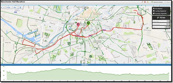
Here’s the route – click on the image for a slightly larger one.

2809route

So it was a successful outing, and I’m very pleased with the fund raising aspect. After recently donating in relation to my Toulouse Marathon effort, far more people than expected have put their hands in their pockets again. It really is much appreciated.

I’ve noticed a couple of friends were taking part in the day’s events.

John Hazleton managed 1.38 for the half marathon, making him the fastest athlete over the age of 60.
Michael Dunne, my parkrun sparring pal (our birthdays are a week apart) took part in the 10 km race and finished in an impressive 44.48, making him the fastest athlete over the age of 65.
Well done, John and Michael.

Friday, 26 May 2017

TGO Challenge 2017 - Day 14 - Monifieth to Dickmont's Den

Date: Thursday 25 May

Route: as planned: Monifieth > coastal cycleway > Carnoustie > East Haven > Arbroath > Dickmont's Den (then back to nearby car park)

Distance: 23 km (Cum: 303)

Ascent: 150 metres (Cum: 9000)

Time taken: 6.25 hrs including 1.5 hrs breaks

Weather: blue skies, hot and calm

Leaving the campsite at 8 am I was surprised to be accosted by another Challenger. Simon Sawers had been on the same site with his wife Fiona. He had come via the Sidlaw Hills, a bit to the north of my route. It was good to see this fellow XXL Club member, albeit briefly. My third Challenger since Day 1.

Soon I passed through The Parish of Barry, another ancient place with a long history.

Then, via a track beside the busy main line railway to Aberdeen, lined with red campion, hawkweed,  forgetmenots, plantains, buttercups, vetch, bugle, speedwell and the ever present gorse and broom, a well groomed golf course introduced Carnoustie.

The source of the name Carnoustie is uncertain, but it originated long before the town of Carnoustie that I passed through next. Folk etymology suggests that the name has an Anglic origin. It is supposed to derive from the scots 'Craws Nestie', referring to the large number of crows that inhabit the area. This tradition is alluded to in the coat of arms of Carnoustie, which includes a pair of crows.

Carnoustie grew rapidly throughout the 19th century due to the growth of the local textile industry. It was popular as a tourist resort from the early Victorian era up to the latter half of the 20th century, due to its seaside location, and is best known for the Carnoustie Golf Links course that often hosts the Open Championship.

The area surrounding Carnoustie has been occupied continuously since the Neolithic period, blah, blah.

Numerous short cist burials have been found in the area, including one found in 1994 at West Scryne, a mile north-east of Carnoustie, that was radiocarbon dated to between 1730 and 1450 BC. The presence of Bronze Age round barrows at Craigmill is also indicated by cropmarks. From the Iron age, perhaps the most prominent remains are of the Dundee Law Hill Fort that I was on yesterday. Several brochs are also found in the area, including the ruins at Drumsturdy and at Craighill. Roman remains are also found in the area. Particularly notable are several temporary marching camps, and Roman coins have periodically been found nearby. 

The path had become more interesting after parting with the firing ranges that accompany it to Carnoustie, and by the time I reached East Haven the temperature had also soared. It was a pleasant surprise therefore to find a jug of cool orange juice and a stack of plastic cups, with an invitation to imbibe in return for a small donation. Thank you.

Nearby were a squad of volunteers busy perfecting a garden on a random piece of land, and a toilet block. No ordinary toilet block. This one was decked out as an art gallery, with brochures and all sorts!

On to Arbroath then, past Elliot Links, an area of regeneration of wildlife after a bitumen factory was removed from the site - these days the only indication that there was ever a factory here is the signage.

Wiki interlude: - here's a highly edited precis....

Arbroath's history as a town begins in the High Middle Ages with the founding of Arbroath Abbey in 1178. 

The town grew considerably during the Industrial Revolution owing to the expansion of firstly the flax and secondly the jute industries, and the engineering sector. A new harbour was built in 1839 and by the 20th century, Arbroath had become one of the larger fishing ports in Scotland.

The town is notable as the home of the Declaration of Arbroath, as well as the Arbroath smokie. The town's football team, Arbroath Football Club, holds the world record for the highest number of goals scored in a professional football match. They won 36–0 against Aberdeen Bon Accord in the Scottish Cup in 1885.

(Wiki has lots, lots more on Arbroath but you may be pleased to hear that it has now been put to bed for this trip. I hope some of you enjoyed its informative interludes.)

By now, Sue had parked up beyond the town and had walked back down the cycleway to meet me. Lunch was taken outside a restaurant overlooking the small harbour.

Then, after a brief encounter with John Woolston, who had finished the Challenge earlier and was now visiting relatives, Sue and I strolled on towards my finishing point, meeting Sam and Terry en route - they had already been to Dickmont's Den.

There's apparently a ballad - 'The Piper of Dickmont Den', and tales of smuggling concerning mostly the monks from the Abbey using the underground caves from the Abbey to the Cliffs...closed now for safety reasons....

Wouldn't it be wonderful if they could be made safe again...think of the fun and the tourist trade.

Sadly they aren't, so we made our way past a large group of youths who were enjoying the sunny day by undertaking sundry acts of bravado on the rocks that make up this interesting section of coastline. There are rock arches and caves, accessible with varying degrees of difficulty from the coast path that runs about 30 metres above the high tide line.

Dickmont's Den turned out to be a finger of water between the red rocks, just the sort of place smugglers would have used, with a good supply of caves. We left the rucksack at the top of the cliff and scrambled steeply down for feet in the sea and the picture used in the last posting.

Then it was back to the car park, and a short drive to Montrose after picking up Sam and Terry and stopping off for some freshly cooked Arbroath smokies.

The Links Hotel provided some post Challenge luxury, and a most enjoyable afternoon with Markus and evening with all and sundry followed.

The pictures:
Typical coastal view from today
Arbroath harbour
Looking down to Dickmont's Den
Outside the Links Hotel

Thursday, 25 May 2017

TGOC 2017 - Finished - Dickmont's Den

2 pm  - Thursday 25 May.

With Sam and Terry in close order.

Wednesday, 24 May 2017

TGO Challenge 2017 - Day 13 - Dundee to Monifieth

Date: Wednesday 24 May

Route: as planned: Camperdown Country Park > fort and memorial at Dundee Law > join coastal cycleway before Tay Road Bridge > Broughty Castle > Monifieth (campsite at NO 494 320)

Distance: 18 km (Cum: 280)

Ascent: 150 metres (Cum: 8850)

Time taken: 6.25 hrs including 2 hrs breaks

Weather: sunny and warm

Dundee is Scotland's fourth-largest city and the 51st-most-populous built-up area in the United Kingdom. So why would a TGO Challenger want to walk through it?! Because it's a place steeped in history. Whilst the mid-year population estimate for 2015 was 148,000, which gave Dundee a the second highest population density in Scotland, we know the city developed originally in the late 12th century when it established itself as an important east coast trading port.

Between the 16th and 18th centuries the town had many ups and downs. It was even destroyed by Parliamentarian forces led by George Monck in 1651 and was held by the Jacobites in the 1715–16 rising.

Rapid expansion was brought on by the Industrial Revolution, particularly in the 19th century when Dundee was the centre of the global jute industry. This, along with its other major industries gave Dundee its epithet as the city of "jute, jam and journalism".

One of our correspondents, Wuxing Nick, knows all about this as he spent a few years here in the employ of Dundee Textiles Limited (RIP).

Today, Dundee is promoted as "One City, Many Discoveries" in honour of Dundee's history of scientific activities and of the RRS Discovery, Robert Falcon Scott's Antarctic exploration vessel, which was built in Dundee and is now berthed at Discovery Point.

Biomedical and technological industries have arrived since the 1980s, and the city now accounts for 10% of the United Kingdom's digital-entertainment industry. In 2014 Dundee was recognised by the United Nations as the UK's first UNESCO City of Design for its diverse contributions to fields including medical research, comics and video games.

A unique feature of Dundee is that its two professional football clubs Dundee United and Dundee F.C. have stadiums all but adjacent to each other.

With the decline of traditional industry, the city has adopted a plan to regenerate and reinvent itself as a cultural centre, to which the errant TGO Challenger may be attracted!

In pursuit of this, a £1 billion master plan to regenerate and to reconnect the Waterfront to the city centre started in 2001 and is expected to be completed within a 30-year period, with the Dundee Victoria & Albert Museum opening by 2018 at a cost of £80 million. 

From about 1854, there had been plans for a Tay crossing, to replace an early train-ferry. The first bridge, opened in 1878, was a single-track lattice design, notable for lightness and low cost. Its sudden collapse in a high wind on 28 December 1879 was, with the loss of 75 lives, one of the great engineering disasters of history, and its causes are still debated today.

The second bridge is a double-track construction of iron and steel with a 2.75 mile span, opened in 1887 and still in service.

In 2003, a strengthening and refurbishing project was recognised by a major award for the scale and difficulty of the work.

The most destructive fire in the city's history came in 1906, reportedly sending "rivers of burning whisky" through the street.

The jute industry fell into decline in the early 20th century, partly due to reduced demand for jute products and partly due to an inability to compete with the emerging industry in Calcutta.

This gave rise to unemployment levels far in excess of the national average, peaking in the inter-war period, but major recovery was seen in the post-war period, thanks to the arrival first of American light engineering companies like Timex and NCR, and subsequent expansion into microelectronics.

The city lies within the Sidlaw-Ochil anticline, and the predominant bedrock type is Old Red Sandstone. Differential weathering of a series of igneous intrusions has yielded a number of prominent hills in the landscape, most notably the Dundee Law that I visited this morning, and Balgay hill.

After setting off at 9 o'clock I managed to negotiate my way to Dundee Law on a pleasant day, before making my way down to the cycle track by the Tay Bridge. That track would basically provide my route for the rest of this Challenge, all the way to beyond Arbroath.

Passing through the centre of Dundee was an agreeable experience, from the latte and scone at Coffee & Co ('Down Town' - Petula Clark) to an encounter with a 'Dundee Ambassador'. Yes, they have people roaming the streets, accosting tourists to tell them more about the town. But I'd already walked past the medieval site that this chap was recommending. And I'd (just for you, Nick) paid a visit to the sparkling statue of Desperate Dan and his cohorts.

Once on the bike route I wandered around the environs of the new museum. Work is progressing apace and hopefully it'll be a great place to visit by sometime next year.

Sadly pedestrians aren't allow on the cycle track through the docks, so pavements had to suffice. This was after a visit to the Harbour Café. I sat outside with a £1 mug of tea feeling like a left over from a losing team on The Apprentice.

Beyond Stannergate, it was a most agreeable stroll to Broughty Ferry, past a display dedicated to sea eagles. Between 2007 and 2012 about 85 chicks from Norway were released here and the reintroduction of this previously hunted bird appears to be enjoying success. I next passed through Broughty Ferry, a separate burgh from 1864 until 1913, when it was incorporated into Dundee.

Formerly a prosperous fishing and whaling village, in the 19th century Broughty Ferry became a haven for wealthy jute barons, who built their luxury villas in the suburb. As a result, Broughty Ferry was referred to at the time as the "richest square mile in Europe".

Broughty Castle also has a long history. It has been restored as a museum piece and that was well worth 45 minutes of my time.

Onwards then to Monifieth, a large town situated on the north bank of the Firth of Tay, and my destination for today.

It was a lovely afternoon, and the rock gardens at Barnhill looked delightful as I strolled past, trying to absorb information from some of the many boards that litter the place.

At the outflow of Dighty Water an assembly of over 80 swans was enjoying something in the estuary.

The presence of a number of class II and III Pictish stones points to Monifieth having had some importance as an ecclesiastical centre in the early medieval period. Until the early 19th century, Monifieth remained a small village but grew rapidly due to the expansion of the local textile industry.

The earliest evidence for occupation of the area surrounding Monifieth dates to the Mesolithic period. Indeed, antiquities are found in abundance from here all the way to the end of my Challenge route.

Midden pits, worked flints, cropmarks, stones incised with cup and ring marks, the Iron age ruins of a broch and vitrified fort, artefacts including a quantity of gold coins, iron spear heads and a stone lamp, domestic remains from the late Prehistoric period, souterrains at Carlungie and Ardestie, etc, etc.

I ignored all this and timed a rendezvous with Sue perfectly - 3.15 at the campsite entrance. The Phreerunner went up to 'air', but as it's  £15 per tent I'm a guest tonight in the Nallo, which is just a bit bigger and makes tomorrow morning's logistics easier. 

Today's pictures:
Looking back to King's Seat from Dundee Law
A present for Nick
Last erection of Phreerunner for a while - drying it out.

Finally, in case you are not already bored, here's a Wiki take on Monifieth - optional reading:

Prior to the thirteenth century, the church and lands of Monifieth were possessions of the Céli Dé monastic order. The church was endowed to the recently founded Tironensian abbey of Arbroath by Gille Críst, Mormaer of Angus, around 1201-1207.

A hoard of 700 coins dating to the reigns of Edward I and Edward II were found in this area in 1854.

The present building of St Rule's Church (built 1812) originally incorporated three Class II and Class III Pictish/Early Medieval sculpted stones, recycled as building stones, including one that had previously been used in the pre-reformation building it replaced. These stones were removed in the mid 19th century and, along with a fourth stone found in an adjoining garden, were donated to the National Museums of Scotland in 1871. They represent some of the latest Pictish era monuments and can be confidently dated to the late 9th/early 10th centuries.

Monifieth remained a small village, comprising a number of turf huts until the early 19th century. In the eighteenth century, the economy of the parish was mainly dependent on agriculture. Other industries included quarrying, weaving within the home and the start of manufacturing of linseed oil at a water-powered mill by the Dighty burn, supporting a small community, 'Milltown', later named as 'Milton of Monifieth'.

Although Monifieth had no harbour, cargo was off-loaded from vessels on Monifieth Sands (in the relatively sheltered Firth of Tay) at low tide and horse-drawn vehicles would move the cargo to nearby destinations.

During the 19th century, the village gradually expanded following the introduction of larger scale industries to the area, including manufacture of machinery for flax mills in 1811.

James Low and Robert Fairweather had set up their foundry in the village at the start of the nineteenth century and in 1815 developed the first carding machine for flax tow in the area. With the growth of the textile industry in Dundee and Angus the business grew rapidly, and, by the late nineteenth century, James F Low & Co Ltd was producing a wide range of machines used for the processing and spinning of jute, flax and similar fibres.

As well as building machinery for local use, the firm attracted orders from across the world and by the 1880s the Monifieth Foundry employed about 300 workers. The expansion of Monifieth's industrial economy was aided by the opening of the Dundee and Arbroath Railway on 6 October 1838. This railway, which was originally intended only as a local line, was constructed with an unusual gauge of 5 ft 6 in (shared only with the Arbroath and Forfar Railway), later being converted to standard gauge when it was incorporated into the national Rail system.

A tramway service was introduced in 1905, with cars journeying into Dundee City centre at regular intervals. This service was welcomed by the many who travelled daily either from the Burgh into the City on business, or the many hundreds who commuted daily to work in the factories and mills.

In 1905 Monifieth gained a Cottage Hospital via a provision made in the will of the Reverend James Gerard Young DD. The Reverend Young had been Minister of Monifieth Parish Church from 1855 until his death in 1899. The funds he left were used to establish the Gerard Trust which managed the Gerard Cottage Hospital from its opening until it passed into the control of the new National Health Service in 1948. The hospital closed in 1969 and subsequently became Mary's Residential Home for the elderly.

In the First World War, Monifieth was the site of a Red Cross Hospital. During the Second World War the Monifieth Foundry was used for the production of war supplies including bombs and aircraft parts.

Amen!

Just off for some fish 'n chips.

TGO Challenge 2017 - Day 12 - Little Dunsinane to Camperdown Country Park - Dundee Hotel Travelodge

Date: Tuesday 23 May

Route: as planned apart from diversions due to non-existent or private paths: wild camp > King's Seat (Ma) > NE to join track > SE then divert to Balloleys Farm > South Latch > Littleton > divert to Little Ballo > Dron > Flocklones > Benvie > Denhead of Gray > Camperdown Country Park > Dundee Hotel Travelodge (NO 362 322)

Distance: 23 km (Cum: 262)

Ascent: 500 metres (Cum: 8700)

Time taken: 7.5 hrs including 1.5 hrs breaks

Weather: sunny periods

It was a surprisingly comfortable camping spot, given that on arrival in heavy rain last night I just threw the tent up fairly randomly. But the Karrimat soon nestled into a 'perfect fit' position.

After a late storm, the rain stopped and the clouds dissipated, giving the coldest night of the trip. Apart from my tent, my next most important luxury is the RAB 400 sleeping bag. So cold nights are actually cosy nights.

There was no rush to leave, but by 8.45 all that remained of my presence was a dry patch of grass.

The ascent of nearby King's Seat was unexpectedly tedious. King's Seat is one of the principal hills of the Sidlaw range. At 377 metres, it is classified as a Marilyn, and there may be a simple way up to the cairn and trig point. But I don't think people regularly traverse these hills. The heather is, when it's not burnt and acrid, deep and lumpy. So it was a fair old yomp for 35 minutes to reach the summit that wasn't much higher than my starting point at the broch.

Anyway, it was good to be there and admire the expansive views for a while. A distant long bridge across the Tay estuary would grow imperceptibly closer, as would the city, as the day progressed. Birds were twittering after the silence of the night. All except the melodic skylarks were keeping a wary eye on the gliding buzzards.

Looking ahead, there was an array of different shades of green broken by patches of golden yellow gorse and swathes of ugly grey plastic sheeting.

Soon the news of terrorism in Manchester dulled the brightness of the day. Thoughts are with all those involved.

A lumpy descent brought me out at a good path. Hopes of an easier route than yesterday's soon dissipated at an electric fence, a 'Beware of the Bull' sign, and no evidence whatsoever of my planned route beyond NO 234 334. So after mishandling the fence ('ouch') I made my way around the perimeter of some fields, studiously ignoring the bull, to reach Balloleys Farm and access to a road.

Narrow lanes through rolling (hilly?) countryside were happily designated '40 mph, Walking and Cycling Friendly Road', and led past a curious castellated concrete tower. They took me all the way to Littleton, where I rejoined my planned route but was immediately baulked by a 'Private' sign.

So I continued along the road to Little Ballo. Red campion and broom graced the hedgerows, pied wagtails ran along ahead of me, and goldfinches flashed golden in the foliage above.

I was dreading that the path from Little Ballo to Dron would be another no go area requiring a much larger diversion than the 2 km I had suffered so far. But no! A magical signpost announced 'Dron 2+' (I can't find a quarter sign on this keyboard). It was a delightful path, passing walker friendly signs in the Redmyre estate and even a red squirrel hide, a real pleasure, rewarded with good views towards Dundee and a lunch of tinned mackerel on a sward of grass in Dron.

Quiet lanes led to a tree lined footpath bordered by vast swathes of wild garlic between Benvie and Denhead of Gray. Then footpaths led into Dundee, passing an industrial estate and an Asda store before a narrow path beside a wall led to the western entrance of Camperdown Park. The footpath by the road by Liff may have been a better route for that last couple of km.

Once in Camperdown Park it was an easy stroll through the spacious grounds, past the decaying mansion, to a recently built café. I lingered outside there with a pot of tea and a piece of cake before making my way past a children's play area to exit the park a couple of minute's stroll from my accommodation.

Today's pictures should be self explanatory, (the middle one is on the path to Dron) and here's some optional Wiki reading:

Camperdown Country Park, often known as just Camperdown Park, is a public park in the Camperdown area of Dundee. The park comprises the former grounds of Camperdown House, a 19th-century mansion, is "the largest Greek Revival house remaining in Scotland." The park was bought by the city in 1946 and is home to a wildlife centre and recreational facilities. It is the largest park in Dundee, stretching to 400 acres. Over 190 species of tree are found in the park.

The Camperdown estate was originally known as Lundie, and was bought by Alexander Duncan in 1682. A 16th-century house stood on the estate at this time. Several members of the family served as Provost of Dundee during the 18th century. In 1797, during the French Revolutionary Wars, Admiral Adam Duncan (1731–1804) commanded the Royal Navy fleet that defeated the Dutch at the Battle of Camperdown. He was rewarded by being raised to the peerage as Viscount Duncan.
In 1820, his son Robert, 2nd Viscount Duncan, commissioned William Burn to design a new house in the Greek Revival style. The earlier house was demolished, and the new house was completed in 1828. Lord Duncan renamed the house and estate Camperdown in memory of his father's victory, and in 1831 he was created Earl of Camperdown by William IV.

The parklands surrounding the house were laid out by Lord Camperdown, with the assistance of his forester David Taylor, who along with his son planted most of the estate's trees between 1805 and 1859.

After the death of the 4th Earl of Camperdown in 1933, the earldom became extinct, and Camperdown was inherited by a cousin. On her death in 1937, the contents were sold, and the house followed, being bought by the Corporation of Dundee in 1946. Camperdown Country Park officially opened to the public in 1949.

Camperdown is notable in horticulture as the origin of the Camperdown Elm (Ulmus glabra 'Camperdownii'), a short, broad, "weeping" variety of elm.  The tree was discovered in around 1835-1840 by Lord Camperdown's head forester, David Taylor, who noticed a mutant contorted wych elm branch sprawling along the ground. The earl's gardener produced the first Camperdown Elm by grafting it to the trunk of a normal wych elm (Ulmus glabra). Every Camperdown Elm is from a cutting taken from that original tree.

Tuesday, 23 May 2017

TGO Challenge 2017 - Day 11 - Bankfoot to Little Dunsinane

Date: Monday 22 May

Route: as planned plus an extra 10 km to get around non existent paths... Bankfoot > Ardonachie > New Ardonachie > diversion via Stewart Tower > Honeyhole > diversion via Knockshinnan > Ballathie House > diversion via Ballathie and Bridge of Isla > by Cargill > Meikle Whitefield > Redstone > Saucher > Collace > Dunsinane Hill (O) > Black Hill (O) > wild camp at Broch by Little Dunsinane at NO 222 325

Distance: 32 km (Cum: 239)

Ascent: 600 metres (Cum: 8200)

Time taken: 8.25 hrs including 1.25 hrs breaks

Weather: dull to start, rain between 11.00 and 13.00, bright afternoon then rain after 16.00 (finished walking ~ 17.30)

Some local knowledge would have helped today. The Ordnance Survey isn't much good when it comes to Scottish footpaths. Details of paths are available on a website that Alistair Pooler has mastered but which I found so difficult to navigate I gave up on it. The long and short of it was an extra 10 km of road walking. Not a nice road. 5 km was because there is no access across an old railway bridge at Ballathie. So I had to go over main road bridges over the Rivers Tay and Isla instead.

The Bankfoot Inn provided a good breakfast with some chatty Australians. They were very envious of old coaching inns like this one, which retains much of its original ambience.

I got away soon after 9.15 and passed happily under the A9 road whilst conversing with Conrad and Markus. The good path had verges rich with ribwort plantain, bistort and yellowhammers. But it came to an abrupt end when the first 'blockage' occurred at NO 083 350. The pain of my 2.5 km diversion past Stewart Tower was somewhat alleviated by that landmark housing a coffee shop. It was the only such amenity I passed all day, so the coffee and cake was appreciated. By the time I left it was raining.

The next 'blockage' occurred at NO 122 368, where a track to the right simply didn't exist. Pleasant forest tracks delivered me 2.5 km 'out of position' on a busy road.

Soon I was heading for Ballathie, and an old railway bridge that Bernie (my vetter) confirmed would see me across the River Tay. Shortly before the bridge I checked it out with a ghyllie. I was told it was too dangerous to cross - closed after several guests at Ballathie had fallen in! So I opted for the alternative route - instead of 1 km of disused railway, 6 km of busy roads. Perhaps that's what caused my heal to blister and my stomach to churn.

I didn't see much of Ballathie House, but according to Wiki it was built in 1886, and since 1972 it has operated as a country house hotel. There's much more, but apart from the amusing golfing story below, let's just say the place has a rich, in more ways than one, history.

Apparently a 9-hole golf course was laid out here by professional golfer Ben Sayers but this was ploughed up as part of the campaign to provide more food during World War II.

Once off the main road, I passed Sidlaw Grain Store and realised why so many HGV's were rumbling up and down the country lanes.

It started to rain again after a bright spell with good views of the Sidlaw Hills.

After the rather drab village of Collace, my route finally left the tarmac for the last 3 km of today's efforts. A steep grassy path led to a conspicuous summit overlooking a quarry.

Dunsinane Hill is of course mentioned in Shakespeare's play Macbeth. "Macbeth shall never vanquished be, until Great Birnam wood to high Dunsinane hill Shall come against him."

It has the remains of two early forts. This is believed to be the site of a battle where Malcolm Canmore defeated Macbeth in 1054. In reality this was only a limited defeat for Macbeth. He was finally beaten and killed by Malcolm Canmore in 1057, at Lumphannan near Aberdeen.

The correct spelling of the name is Dunsinnan, Gaelic meaning "The hill of ants."; possibly a reference to the large number of people it took to build the fortress.

The impressive ramparts are still very obvious (to some - I wasn't really in the mood to appreciate them!), though the interior was much disturbed in the 19th century by antiquarians attracted to the site by its Shakespearean connection. Little of value was learned about the history of the monument from these unscientific excavations.

Black Hill, at 360 metres, is a little higher, and after a steep descent and ascent I found myself on top of that amongst the acrid smell of recently burnt heather. If it hadn't been raining there were probably good views. But it was decidedly murky so I'll leave those for tomorrow.

As the intensity of the rain increased while I descended to a pond, I found a good spot for the tent beside the broch, with reasonable looking water coming from the outflow of the very weedy pond. The Travel Tap water filter was deployed. There was no sign of Chris Peart, who had planned to be here, so I didn't after all get to meet my third Challenger since Day 1! Never mind.

Later, after further showers the rain has stopped and I'm appreciating the perfect silence and stillness of my last wild camp of this year's Challenge. Despite toothache, a painful shoulder, a blistered heel, weary knees and an upset stomach.

Would I prefer to be with Sue in Newtonmore Hostel?

Today's pictures:
The road bridge over the River Tay where I spent some time mending my heel,
The Sidlaw Hills - I'm pitched around the gap at the far right,
Phreerunner, next to the broch, with Black Hill behind.

(No proper signal so transmission will be delayed.)

Sunday, 21 May 2017

TGO Challenge 2017 - Day 10 - 3 km beyond Amulree to Bankfoot - Bankfoot Inn

Date: Sunday 21 May

Route: as planned  > Meall nan Caorach (Ma)(G) > NE to join track at NN 939 346 > around Findowie Hill to Auchmore > SE to Little Glenshee > track to Loch Tullybelton > Glack > Balquharn > minor roads to Bankfoot Inn

Distance: 22 km (Cum: 207)

Ascent: 520 metres (Cum: 7600)

Time taken: 6 hrs including 1 hr breaks

Weather: warm, calm, no midges, dull until 11 am with 600 metre cloud base, then rain, becoming heavy

I woke to heavy cloud, but the rain seemed to have passed for the time being, so it was easy (after another very early night) to be up and away by 7.45. It was 6°C outside but the barnacle geese appeared to be on heat.

After 45 minutes I was standing in a cloud on top of Meall nan Caorach at 623 metres. The cloud base was about 600 metres. So no chance of an inversion today!

The scenery was good (apart from a nearby sea of wind turbines) - rolling hills rather than jagged peaks - and I admired that as I yomped north east through clumps of cloudberry flowers, accidentally missing out the acclaimed summit of Creag Ghorm. I'll  leave it for Gibson to do as my proxy at some future date.

After yomping through an area full of mountain hares and the occasional startled deer, a grassy track was picked up. This headed to an abrupt conclusion at the head of Glen Shee.

Another quite easy yomp took me into Glen Shee to another track leading past a farm to a roadhead beyond Little Glenshee.

By now it was raining again, but I'd had three hours of dry weather and the path past Loch Tullybelton and Drum Tick to the Glack was a delight.

The bird life on the lochans was impressive, with swans, ducks, geese, sandpipers and numerous other birds. I'm out of my depth identifying them all, but I know a black grouse when I see one, and there were plenty here.
Another destination for Ken and Anne.

I reached the Glack only to be surrounded by barking dogs. They were soon under the control of a local man, and the owner, a retiree from New York, arrived. They wanted to know what I thought of their expensive new metal stiles over the deer fences. There had been complaints that they are too steep. I found them fine, albeit steep. The American had owned the place for nine years and claims responsibility for turning it into a sanctuary for wildlife. But as I walked the final 3 km down a dead straight lane to Bankfoot, past numerous (probably justified for farm access) no parking signs, I wondered about the lack of parking facilities for visitors. The car park at the roadhead by Little Glenshee would need to be used to avoid the walk in from Bankfoot.

Bankfoot is a village approximately 8 miles north of Perth and 7 miles south of Dunkeld. It had a population of 1,136 in 2001. We usually rush past on our way north, but tonight it's my home.

I'm in the Bankfoot Inn, a restored 18th-century coaching inn which has  real ales (I like the Hogs Back Ale), and a lounge bar with fire and a restaurant. All very convenient as it's still raining.

Until 1931 Bankfoot had a railway station, but now the trains take a different route north. So with the A9 also out of sight, it's a fairly peaceful backwater.

The inn was quite busy with diners. My lasagne with chips and salad definitely had the edge over last night's pasta and tuna twist.

It was good to hear that Don had enjoyed today's 80 mile Rannoch bike ride, despite the rain, and Sue managed to climb the four Glen Lyon Munros - not without incident!

Today's pictures:
The summit of Meall nan Caorach
Glen Shee
Loch Tullybelton
The long road from the Glack
Bankfoot Inn 

TGO Challenge 2017 - Day 9 - beyond Kenmore (NN 802 431) to beyond Amulree (NN 914 349)

Date: Saturday 20 May

Route: roughly as planned: minor road 5 km on from Kenmore > minor road E > Garrow (River Quaich) > track to Wester Shian > Auchnacloich > L to Turrerich > NE shore of Loch Freuchie > Wester Kinloch > Amulree > A822 > track to Girron > continue to grass by gate at NN 914 349

Distance: 18 km (Cum: 185)

Ascent: 310 metres (Cum: 7080)

Time taken: 5 hrs including 1 hr breaks

Weather: light rain overnight continued all day, intensifying into heavy showers

I woke up to a damp morning. The Lochan was doused in cloud, with visibility very limited up here at 500 metres.

After two hours of Morse (book 2 - Last Seen Wearing - was finished) and a slow breakfast I finally faced the rain and struck camp. Thanks to the tent's spacious interior it's easy to pack everything up indoors before taking the tent down.

I'd already done most of the day's climbing, so it was an easy stroll up to the top of the pass and a pleasant descent, with no traffic, into Glen Quaich.

The glen could be designated a nature reserve. It's absolutely full of birds - snipe, curlew, lapwing, oyster catcher - these were the commonest but there were also birds of prey and various medium/small birds that I couldn't identify. Ken and Anne would love it here. Rabbit would be on the menu for the birds of prey.

The glen is however marred by a battalion of huge power lines that march through it.

Beyond Turrerich Farm I stopped for a brief chat under a leafy canopy with three day walkers. Nearly every group of hikers you meet on this sort of trip know someone who has done the Challenge, which many recall as the Ultimate Challenge, from the days of its first sponsor. It's now in its 38th year.

After the very amenable path to the north of Loch Freuchie I drifted past some nice properties and into the hamlet of Amulree.

The place was a disappointment. It used to have both a hotel and a coffee shop. There was no sign of the latter, and the hotel was largely boarded up and in a state of serious disrepair. I sat under the porch and ate some mackerel and oatcakes next to a foundation stone dated 1714. To my surprise there must have been somebody inside, unless the hotel was somehow generating its own Moody Blues.

Setting off again into the rain, I passed the parish church that contains copies of records of the large number of people who stayed there prior to mass emigration - mostly to North Easthope, Canada - in the early 19th Century. The church is linked with Aberfeldy Parish Church. An interesting history "Amulree and its Church" was written by a resident Nancy Enniskillen in 1990.

Amulree is mentioned in the song Drover Road by the Western group Cowboy Celtic. Perhaps today's sad spot - albeit perhaps a haven for those who live there - had a lively past.

I was soon heading along a tussock lined path signed 'Harrietfield 7 miles', not that I'm going that far along it.

About a kilometre past Girron, as the skies blackened, a good patch of grass next to a gate forced a quick decision. The tent was up and the rucksack inside before the deluge arrived, soaking me as I pegged the tent out and chatted to a couple of curious dog walkers.

It was 2.30 and I am 3 km into tomorrow's route.

Despite the inclement weather I've enjoyed today. It's always interesting going on 'new' routes, and I've walked only a very small proportion of this year's route before. That's good!

Today's pictures: Looking down Glen Quaich, in Glen Quaich, the sad hotel, my tent with tomorrow's summit in view.

Dodgy signal here, so who knows when it'll post. Meanwhile Morse (book 3) calls - I'm glad I brought the Kindle.