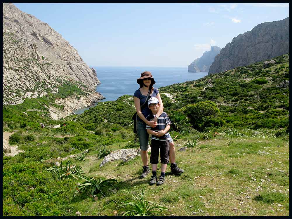
Sue and Martin in Mallorca 2019

Sue and Martin in Mallorca 2019
On the Archduke's Path in Mallorca

Saturday, 19 June 2010

Thursday 17 June 2010 – Standedge to Crowden – Blue Skies on the Pennine Way

Gayle kindly provided the impetus for today’s little excursion.  We met her at 9.30 at Standedge and left her around 3 pm at Crowden, to return home whilst she continued towards Bleaklow to enjoy a wild camp by Torside Brook.

We chose a good day to join her on her FAT (Football Avoidance Trip), the weather being typical  for the UK in June – why would anyone wish to be elsewhere at this time of year?

Sue and Gayle stride out from Standedge

At Black Moss Reservoir we chose an easy route across White Moss and Wessenden Head Moor, rather than the more undulating Pennine Way route.

New flagstones across White Moss are giving the previously heavily eroded moorland a chance to recover.  Gayle was puzzled by the vocal opposition she had heard to such flagged paths; but I’m convinced that the majority of us are in favour of properly constructed pathways across such moorland, enabling the eroded vegetation to recover.

Newly laid flagstones on Black Moss

The white bags on White Moss contain bundles of heather and seeds, to help with the regeneration of the natural moorland.

Heather bales and seeds

The short section across Wessenden Head Moor to join the Pennine Way before Black Hill is little used and would be very boggy in wet weather.  But with the current paucity of Pennine Rain, Sue and I found it quite easy to hop across any damp patches in our trail shoes, though Gayle got slight ingression due to wearing Flip8s (which she likes, but which do at all times attempt to act as sponges).

An anxious curlew wheeled around us.

Curlew

We spotted this prone object beside the path, and realised the cause for concern, before hurrying on.

Curlew chick

The summit of Black Hill was a sun trap today.

Norman, doing the Pennine Way on a B&B basis, but with a bigger rucksack than Gayle, kindly took this photo for us.

Black Hill summit

Gayle was astounded by how much the area, which used to be a 365 days a year quagmire, had recovered since her previous visit two years ago.  Her observations are here.

The sceptics would have us walking through deep bog in a 100 metre wide section of eroded moorland.  I like this newish path towards Dun Hill.

The path to Dun Hill

A long lunch stop in the sunshine followed, and then a buzzing helicopter dropped a team to attend to a lady with a twisted ankle.

As we descended past Laddow Rocks towards Crowden, numerous Mountain Rescue personnel rushed past, in various states of breathlessness.  We half expected a medic to be following them up in case they collapsed themselves.

A busy aircraft ‘motorway’ was in operation above us – obviously no volcanic ash problem today!

Eventually, at around 3pm, the path to Polly (our car) led down past the ice-cream haven called Crowden, whilst Gayle’s route to Glossop (she never did get there) headed off in the other direction.

So sadly our ways parted, but it had been an excellent little outing.

Parting ways at Crowden

Gayle’s report is here, and her Black Hill observations are here.

Our 15 km route (see below), with 350 metres of ascent, took a leisurely 5.5 hours, though Mr Slowman Naismith would have cut nearly two hours of that time!

The day's route - 15km, 350 metres ascent, 5.5 hours

The full slideshow (29 images) is here.

Wednesday, 16 June 2010

Stalwart TGO Challenger Models 2011 Dress Code

TGO Challenge 2011 Dress Code Presumably TGO Control approves of this dress code, which should enable the Austrian Challenger, Markus, to feel more at home than usual in Scotland next year.  Though Markus had threatened to attend in a kilt.

This was brought to my attention by one of the early Challenge bloggers, who will no doubt be spending a couple of weeks next May chasing around Scotland looking for cheese and wine parties, as explained by another stalwart outdoors blogger in his 30 May 2010 posting.  [Having managed nine wild camps on this year’s Challenge without meeting a single other Challenger, I have to admit to being somewhat baffled by the latter posting.]

Thank you, everyone, and I hope you’ll forgive me for borrowing the image in order to convey this important news.

Monday, 14 June 2010

Saturday 12 June 2010 – A Trip to Dunham Massey

Dunham Massey House
The House looked good, on a busy day at this National Trust property.

Sue and I enjoyed a 5 km stroll around the grounds and along the canal.  The ponds are full of Yellow Water Lily.

A pond full of Yellow Water Lily

The fallow deer range in colours from white to very dark brown.

Fallow deer at Dunham Massey

One stag was lying a few metres away from a family who had set up a badminton court.  He was studying them closely!

The spectator

It was a lovely day for eating outdoors, but we had a commitment, so delayed the BBQ for a day.  No photos from that, as it was abandoned due to ‘inclement weather’!

Sods Law!

Sunday, 13 June 2010

Mallorca – 29 May to 5 June 2010 – Casa (Villa) Galvany

In the garden at Casa Galvany

Here’s a final posting for our recent trip to Mallorca.

There’s a full slide show (218 images) here.

Highlights (100 images) are here.

Images in and around Casa Galvany (27) are here.

Our trip was organised through James Villa Holidays.

It wasn’t a walking trip as such.  But earlier starts could have taken us to some higher parts of the island, where the temperatures would probably have been amenable.  It was pretty hot where we were near sea level.

We used a Cicerone guide and also a Discovery Walking Guide and map; this conveniently links in with the walks, which are numbered on the 1:40000 scale map.  I also found this Guide useful on a visit in November 2006.

It’s a lovely part of the world.

Friday, 11 June 2010

Thursday 10 June 2010 - A Great British Ridge Walk - Number 22 – Helvellyn by Striding Edge and descent via Swirral Edge

A planned (at very short notice) stravaig over Place Fell was foiled by a ‘steering rack that was leaking hydraulic fluid faster than that leaky oil rig in the Caribbean’. 

So, no Pie Man or Bruno today.

But I couldn’t let this stop me from enjoying a day in the hills, especially as I now have my own independent means of transport.  Just as well, as Sue was to enjoy her first taste of work for many months today.

Some folk I’d bumped into on this year’s TGO Challenge just happen to live by the start of a Great British Ridge Walk, which coincides with the start of the aborted stravaig.  Moreover, Marian was happy to join me for a day in the hills.

So after a leisurely coffee in Patterdale with Mike and Marian, the two of us set off along an exclusive route to Lanty’s Tarn and thence to the fellside above Miresbeck.

Bluebells seemed to be getting the better of a section of bracken steeped hillside, but for how much longer, I wondered?

Bluebells

The forecast had predicted that the low cloud would clear.  The ‘Place Fell’ plan would have seen us out of the cloud for longer than this back-up plan, as demonstrated by this last view to Glenridding and across Ullswater to Place Fell, before we entered the thin cloud.

Glenridding, Ullswater and Place Fell

It wasn’t unpleasant, though gloves and a windproof top were deployed for a while.  We traversed Striding Edge in a fairly purist manner, Marian being an accomplished climber, meeting and parting with a variety of folk who were avoiding the ‘airier’ sections.  Eventually a large party of schoolchildren, queuing to descend the final steep little chimney gully before the easy ascent to the summit of Helvellyn, briefly held us up.  We were happy to wait, but their attentive leaders insisted on us passing through.

Once on the summit plateau, we passed the Gough Memorial, erected in 1890 after both Walter Scott and Wordsworth had alluded to the death of Charles Gough in their poetry.  The memorial reads:

Beneath this spot were found in 1805
The remains of Charles Gough
Killed by a fall from the rocks 
His dog was still guarding the skeleton

Today the wind was light.  Nobody would fall.  A happy bunch munched in the mist at the trig point.

Helvellyn Summit

Marian and I didn’t attempt to locate the other memorials, one of which commemorates the first landing of an aircraft on a British mountain on 22 December 1926.  We headed down Swirral Edge and on to Catstycam, where we enjoyed Part Two of a lunch that had been commenced in a sheltered spot above Bleaberry Crag.

The route down the steep north west ridge of Catstycam seems to have become popularised since Marian last used it (I’d never been there before – I think), and a clear path ran most of the way down.  We paused for a while after emerging from the mist below a steep, slippery section above Kepple Cove Dam, abandoned in October 1927 after after a cloudburst caused it to burst, resulting in devastation to Greenburn lead mines and Glenridding.

  Kepple Cove Dam

Marian, on the lower slopes of Catstycam

After traversing a disused leat (an open watercourse conducting water to a mill, etc) to join the path from Red Tarn, we descended to Glenridding Beck, where a group of helmeted youngsters were in the beck, making their way up the gorge.

We found some Starry Saxifrage and Cuckoo Flower here, as well as this little cutie, who turned out to be a champion jumper.

A common frog

The cloud never really cleared, despite the encouraging forecast, but Rake Cottages, on the Greenside Road, did seem to be basking in their own little private oasis of sunshine.  I’m sure they deserved it.

A Glint of Sunshine over Glenridding

Near Lanty’s Tarn, Marian pointed out the small Round-leaved Sundew plants.  They were everywhere!

Round-leaved Sundew

Well, not here, but I am probably standing on some Tormentil whilst posing for this photo with an Ullswater backdrop.

A dull day, with Ullswater

I’m glad that Marian could join me today.  We enjoyed a good chat – the opportunity for that eluded me for most of the TGO Challenge – spotted a few items of interest, and I would never have discovered her excellent routes between Patterdale and Lanty’s Tarn, returning down one of which we passed a rich collection of wild flowers and some exotic trees.  You’ll have to go to the short slide show to see them, if you’re interested…

Here’s an overview of today’s route.  Bill Birkett’s version starts from Glenridding, but the start and finish at Patterdale has lots to commend it.  It was about 16 km, with 1100 metres of ascent, and took 6.5 hours, though you could easily knock an hour of that timing.

Our route - approx 16 km, 1100 metres ascent, in a leisurely 6.5 hours

We saw not so much bird life, but lots of wild flowers today, including:
Bluebells
Bugle
Buttercups
Butterwort
Cuckoo Flower
Greater Stitchwort
Herb Robert
Lousewort
Common Milkwort
Wavy Bittercress* (Cardamine flexuosa)
Round-leaved Sundew
Starry Saxifrage
Tormentil
Umbellifers - various, including Pignut* (Conopodium majus)
Wild Pansy
Wood Speedwell* (Veronica montana)

* = as subsequently confirmed by Marian.

Tuesday, 8 June 2010

Thursday 8 June 2006 – Dinas Fach and Newgale Sands, from Dinas Fawr

Dinas Fach and Newgale Sands from Dinas Fawr
I didn’t get out much today, but I can offer this glimpse of a trip that topwalks.com’s archive simply refers to as ‘cloudless’. 

The whole week was cloudless.  We walked from Milford Haven to Trefin.

It was a busy time….trips, work, etc.

Must write it up sometime!

But for now I’m happy to recall that cloudless day from exactly four years ago, when six of us walked from Little Haven to Solva, via a long stop in the Duke of Edinburgh Inn at the end of Newgale Sands, where we sought refuge from the blistering heat. 

The UK coastline certainly takes some beating, especially in places like Pembroke and the South West Coast Path.

Monday, 7 June 2010

Monday 7 June 2010 - Back at Home


It’s not so bad though. The proud swans of Lymm have been busy in our absence, and the swifts arrived much earlier than they did last year – they’ve been living under the eaves of our house since mid May. This morning a large family of newly fledged great tits enjoyed a spell in the garden, where the flowers are blooming nicely.

Saturday, 5 June 2010

CĂºber Reservoir


Here we are at CĂºber Reservoir on another hot, cloudless day.

Luckily we were up near 700 metres, so the heat wasn't as stifling as it would have been lower down.

The walk was only 3 km, with no ascent, so that made life easy.

Can anyone identify the peak in the background?

Sent using BlackBerry® from Orange

Friday, 4 June 2010

A Trip to L'Havanor


The Pixies demanded an 'at home' day. So Sue and I disobeyed by heading off (the statutory 15 minute drive) along the SĂ³ller road as far as Mortitx.

Today's 3 hour, 11 km stroll with about 350 metres ascent was along a good track with fine views.

Starting from the Mortitx vineyard, it soon crossed a stile to pass an allegedly dangerous cave system accessed through a locked door, before meandering through groves of ancient olive groves (pictured) with a Mediterranean backdrop.

The cloudless day may have been sultry at sea level, but up at heights of 300 to 500 metres it was very pleasant. As long as you didn't move too fast.

On the way to L'Havanor are two dams on the Torrent de Comes. The 'torrent' was scarcely a dribble today, though both the small reservoirs were reasonably full. The upper dam was being patrolled by a large blue dragonfly that was seeing off all other visitors from its personal feeding ground.

Beyond the dams the track undulated past a surprisingly flat ploughed field before reaching a fine viewpoint. We lingered there, well beyond the branch path that led down to the small L'Havanor house (Rifugi), absorbing the views before returning by the way we had arrived.

The countryside hereabouts is rough and rugged, but surprisingly green, with lots of spring flowers still in bloom. The sea was mirror-like today. Flat calm. It's an area where there's a breeding programme for rare Black Vultures, and that's what the ever closer black specks in the azure sky that were floating towards us near the end of our walk turned out to be.

Superb.

Sent using BlackBerry® from Orange

Thursday, 3 June 2010

The BĂ³quer Valley


Today we enjoyed another little escapade from the rigours of living in Casa Galvany, situated just below Puig de Maria, with its dovecote, budgie sanctuary, 'goldfish' pond, exotic pot plants, BBQ area, pool, pizza oven (not yet used) orange, lemon and fig trees and neighbouring horses, sheep and chickens.

This time our customary 15 minute (or less) drive took us to the pleasant resort of Port de Pollença. Our 'there and back' stroll comprised all of 6 km and less than 200 metres ascent. We headed up the BĂ³quer Valley, through a narrow defile to the broad 80 metre Coll del Moro, before descending to a small stony beach speckled with patches of tar and strewn with piles of flotsam.

However, the narrow bay (pictured beyond Hazel and Andrew) is unspoilt and in today's fine, hot, windless weather proved irresistable to Sue and Al, who retained more modesty than some of our European neighbours who had also found the prospect of a swim irresistable despite their lack of equipment.

The rest reserved their swimming energy until after lunch in the shallower waters of Puerto Pollença, whilst I replenished our supplies of Vino Collapso Rosé (aka Faustino V11 Rioja 2009) ready for later consumption by pool and BBQ.

It's a tough life!

Sent using BlackBerry® from Orange

Wednesday, 2 June 2010

Parc Natural de S'Albufera


Apparently Pliny wrote about the Night Herons we saw here today being sent to Rome as a gastronomic delicacy.

These days it is such species as the Crested Coot (pictured - very similar to a common Coot, but with two red headlamps and a bluish beak) that are sent here from places like South America to set up breeding colonies in a bid to avoid extinction.

The wetlands were drained for agriculture in C19. What land was left has now been restored and turned into the Mediterranean's largest wetlands nature reserve.

Apart from the Night Herons and Crested Coots we saw quite a few of the remaining 301 different species to be found here. Presently there are numerous egrets and other herons, lots of ducks and grebes, many small waders, and small birds like the Sardinian Warbler.

Fish jump in the rivers and lakes. Ospreys and other birds of prey soar high above, no doubt awaiting suitable opportunities.

It's flat. We stayed at sea level today. For the heat...

Sent using BlackBerry® from Orange

Tuesday, 1 June 2010

The Ascent of El Calvari


The Pixies counted 408 steps up Pollença's Via Crucis (pictured), a carved stone stairway lined by ancient cypress trees which ascends El Calvari (Calvary Hill) to the north of the town centre.

At the top some religious art from the Neanderthal Period surrounds a much revered C13 statue of Mare de Deu del Peu de la Creu (Mother of God at the Foot of the Cross) in a simple, courtyarded chapel.

Lunch at La Scalinata restaurant back down in one of the main squares seemed to take up most of the rest of the day...

The BBQ is warming up for a long evening.

The ascent data for this week's trip, if you hadn't noticed, has gone from 300 metres on day 1, to 200 metres on day 2, to about 100 metres today. Snorkeling equipment has been laid out by one member of the party in anticipation of the continuing trend.

Sent using BlackBerry® from Orange

Monday, 31 May 2010

The Ascent of Puig de l'Aguila


Today's ambitious target was the 214 metre summit of 'Eagle Peak'. It's a short stroll from Cala Barques, in Cala de Sant Vicenç.

The walk up the gently graded and finely constructed old track passes an ammunition store tunnel which was good fun with the Pixies. It goes at least 30 metres into the mountain before opening into chambers with a short circular route between them.

Our little group is pictured close to the summit, which Sue and I then visited on a hot and blustery day before recommencing our determined bout of R + R.

Kate appears to have hidden her body behind Andrew so as to create the scary impression of a child with two heads.

Believe me, it's as scary as it looks!

Sent using BlackBerry® from Orange

Sunday, 30 May 2010

The Ascent of Puig de Maria


Here's the view from this ascent towards the market town of Pollença.

We are happily installed in Villa Galvany with Al, Hazel and the Pixies, from where this modest summit is just an hour's stroll.

After the intimacy of Pollença's Sunday market, Al and I enjoyed the quiet 300 metre ascent to the Santuari de la Mare de Deu des Puig, home to various religious houses from 1348 to 1988.

Nowadays, luckily, it's a bar-restaurant-refuge. We enjoyed a beer, chatted to the goats, tried to peer down to our villa (failed, it was too close) and explored the chapel and its magnificent refectory.

Then it was back to the villa to test its impressive barbecue.

All very relaxing...

Sent using BlackBerry® from Orange

Saturday, 29 May 2010

Raining in Timperley


But it's 25C at dusk after a sunny day here.

The wine is cooling.

Even the red wine.

The cheese is on its way.

Life is good. Let the R + R commence.

Sent using BlackBerry® from Orange

TGO Challenge 2010 – Index and Links

Glencoe from Beinn na Caillich on 18 May 2010
I’m inserting this entry now, to be completed when I return from the next trip.  It will index all this year’s Challenge postings to make them more readable, and will include links to other blogs, slideshows, web pages, etc.

In the meantime, if you wish to view the entries chronologically you can click here, go to the oldest posting, and rather tediously scroll upwards for newer postings.

I’d like to thank those who have made kind comments on the rather hurried postings made as I tried to maximise my enjoyment of long days in the hills over the past couple of weeks.  They really are appreciated.  You are not the only readers – in addition to the thirty or so ‘followers’ the readership doubled from its normal 100 page loads a day over the duration of the Challenge. 

The photo was a self-timed effort taken from the summit of Beinn na Caillich, just after 7 am on Tuesday 18 May, featuring the Pap of Glencoe.

Friday, 28 May 2010

A Tale of the Unexpected

Route of the Year Award - 2010! Chuffed?

Yes, just a bit.  But congratulations to all those short-listed for this unheralded new award.  I’m sure their routes were every bit as well planned as mine in their varying ways.

Wow!

TGO Challenge 2010 - Day 14 - A Wet Day around Montrose

Having walked Day 14's route on Day 13, an enjoyable and relaxing time was had around Montrose with Graham B, chatting to both old friends and complete strangers as they drifted in to the Park Hotel from their various finishing points.

We popped out to St Cyrus, in the hope of a stroll along the beach. But the heavens opened. The café by the bus stop had been expecting its annual surge in business a week earlier, so they were relieved to get it today. My 'ploughmans' was excellent. A stream of Challengers passed through before heading to the bus stop. A lucky trio - Andrew, John and Norma - all part of this year's 'Lochailort Tribe' enjoyed being delivered to the door of the Park in Graham's charabanc.

More of the same - rain, chats, to and fro from the camp site, refreshments, etc, until the bar gradually filled prior to the traditional Thursday evening dinner attended by over 200 Challengers and the great and good from TGO magazine.

MC Roger Smith conducted proceedings impeccably as always, with all Challengers in the room being called upon to take a bow according to the number of Challenges they have completed, plus a special mention of certain individuals, absent friends and overseas participants.

Then special awards to those who had just completed their 10 crossings - including Mike Knipe, the infamous Pie Man of Crook Town, followed by just two awards for those who completed their 20th crossings this year - to a very Proud Scotsman and an equally proud (not to say eloquent) Englishman from Settle.

After that, before more time in the bar and a very late stagger back to the camp site - a surprise - a new award.

More of that later.

So, that's almost it. The 31st TGO Challenge is nearly over. Stragglers will arrive on Friday and proceedings will draw to a close. Then preparations for next year's event will swing into process. It's a year round job for Roger Smiith, the stalwart organiser of the event.

I should also mention Cameron McNeish's announcement that Emily Rodway will shortly be taking over from him as editor of TGO magazine. Cameron will become 'Editor at Large', whatever that is.

There will be a short further posting and the insertion of an index and a few more images and tidying up of information, with links to a web page and a slide show. It'll be a couple of weeks before that happens. In the meantime I plan to rest and recuperate in sunnier climes far away from the Montrose Rain, which seems strangely absent from today's snap of a small section of the final camp - it's an illusion!

Sent using BlackBerry® from Orange

Thursday, 27 May 2010

TGO Challenge 2010 - Day 13 - Tarfside to Montrose - Dash to the Bash

Distance walked: 43 km (Cumulative: approx 340 km, 212 miles)
Metres ascent: 400 (Cumulative approx 15,600 metres
Time taken: 11.1 hours including 2.7 hours stops
No of TGO Challenges now completed: 4

A leisurely start saw me strolling down to The Retreat (aka Glenesk Folk Museum) for breakfast with Tim and Kate.

Then it was on down the picturesque Esk valley, along pleasant paths in good company (Tim, Kate, Bernie, Martin, Jeremy and others) to Edzell. The last section, on my own through beech glades beside a river gorge, was particularly scenic.

A field ginnel led to the main street, where rucksacks outside the Tuck Inn revealed one of the Challenge's favourite pots of gold. Lunch, with Steve Gough and later joined by many others, including Alan Kay, who was the first person I encountered on my first Challenge three years ago, was sumptuous, delicious and lengthy. The chocolate nut sundae was wonderful.

It's not far to North Water Bridge from here, and despite the leisurely day so far it was only 2pm. Phone messages indicated there may be a small 'Bash' tonight with Heather T-S and others, with Heather having to leave for home early on Thursday.

It would be rude not to make the effort to say hello to an old friend...

So, a quick change of gear, on a full tank of fuel, saw me zooming on, past North Water Bridge, along the planned route, almost exactly as shown on the previous posting, to the dunes at Montrose.

Of all my approaches to the coast, this was the most direct and had the least road walking. Very satisfactory, with nice woodland interludes between quiet lanes, though there was a narrow passage of prickly gorse towards the end.

It also provided a last taste of solitude before the Fleshpots of Montrose and next week's partying with the Pixies of Hale.

A storm that hit me for an hour or two after passing North Water Bridge eased sufficiently for me to take a self-timed picture at my finishing point.

The firm sand steadily became softer as I approached the camp site via an increasingly laborious 3 km plod down the deserted beach, its pristine sands glistening in the low sun. Then it started to rain again. Quite hard. So when the camp site was finally reached at around 6.45pm it was good to see the familiar faces of David Albon and Heather T-S and accept their offer of porch space for the rucksack whilst I whipped up the Phreerunner.

Graham Brookes also arrived after a 'bagging' trip in the Arrochar area, so after saying hello to him, experiencing a warm dribble in the 'shower', and gathering my few valuables, I set off to The George for a beer with a select band of Heather, David, Skippy and Julie. Numerous other Challengers were enjoying the George's good food, but we were to move on.

It was a short stroll to the excellent 'Indian Cottage' restaurant, where we saw the day out in style. This included an 'awards ceremony' during which David Albon conducted a 'toast' for all Challengers present, depending on the number of times they have finished. Cameron McNeish's table yielded the largest number of 'first timers' (including Cameron), with today's toasts culminating in one for Skippy and Humphrey, who had just completed their ninth crossings.

The picture is of Julie, David and Heather, who all finished today (Wednesday), at Montrose camp site in Thursday morning's sunshine.

Sent using BlackBerry® from Orange

Thursday 27 May 2010 - TGO Challenge Day 14 - Plan – North Water Bridge to Montrose

Martin’s planned route and statistics for today are shown below:

1 North Water Bridge
2 South of Marymill
3 Hillside
4 Dunes at Montrose (THE END)
5 Montrose Campsite

Statistics
16 km
119 metres ascent
5.0 hours

TGO Challenge 2010 - Day 14 - Plan