Sue and Martin in Mallorca 2019

Sue and Martin in Mallorca 2019
On the Archduke's Path in Mallorca

Thursday, 12 December 2013

Ghyll Head – 1 to 5 December 2013

0201group

This was the second time Sue and I have had the pleasure of attending Reg’s Ghyll Head Bungalow ‘meet’. Last year’s visit is described here.

We were sorry to hear that ‘Little Ann’ was unable to join us, and Cathy was no doubt working; otherwise it was a similar team to last year’s.

Having arrived on Sunday afternoon, we spent the first two days in dull but warmish weather.

Monday involved a well attended walk to Staveley and back, described very briefly at the time, here.

0204vieweast

Another picture from this walk is shown above.  We enjoyed a fairly lavish lunch at Wilf’s Café in Staveley, before following Peter Haslam’s request to turn on our heels and head back to Ghyll Head, initially along the Dales Way, bringing back memories of my 2009 walk from Windermere to Ripponden.

A very chilled evening at Ghyll Head concluded proceedings – I seem to have found very little time to record much detail of the walk, but more photos were taken – see slideshow link below.  And thanks to Peter for leading this bimble.

We walked about 25 km, with 600 metres ascent, in 6.5 hours.

0299route

On Tuesday, Reg led a crack team along a section of the Thirlmere Way, which the Plodders have been ‘plodding’ since leaving Heaton Park on a sunny day in April.

Meanwhile, Sue and I were joined by Barbara for a round of Seat Sandal, Fairfield, Great Rigg and Stone Arthur from Grasmere.

0306group

Garry joined us for lunch.  He was ravenous.

0314raven2

I wrote a short piece on the day at the time – here.  I suppose that was marginally more than on the previous day!  The slideshow reveals more…(see link below).

Here’s our route – 13 km with 950 metres ascent, in about 5 hours.

0399route

Wednesday was a brighter day.  The rest of the team went off to explore more of the Thirlmere Way, but Sue and I didn’t want to be valley bound, so we headed up Longsleddale to Sadgill.  From there we enjoyed the gentle ascent to Tarn Crag.  I wrote about that here.

0409track

It turned out to be a lovely day for this 11 km, 500 metre ascent, excursion taking about 3.5 hours, after which we had a very leisurely afternoon at Ghyll Head whilst the others struggled on along the Thirlmere Way in the dark (or so it seemed to us).

0499route

Thursday dawned powerless and stormy at Ghyll Head.

Others copped out of their concluding section of the Thirlmere Way, but Roger and Barbara bravely joined me and Sue for a wander around Stang Hill, Arnsbarrow Hill and the 335 metre summit of Top O’Selside.  I wrote about it here.

0501Nibthwaite

The weather actually cheered up quite a bit as we descended back to Nibthwaite with fine views across Coniston Water to the Coniston Fells.

0511ConistonW

Here’s our 7 km route.  Ascent was about 300 metres, and it took us 2.3 hours.  An excellent blow of fresh air.

0599route

Later, as John had been sent home due to serious misbehaviour in the dormitory*, Allan was obliged to co-opt Neil as his replacement assistant ‘chef du jour’.  He seemed happy enough with the arrangement and got on with the cooking whilst Allan chatted.

0518Neil

There’s a slideshow covering the whole trip – here.

Thanks go to Reg for organising the trip.  We hope to see you all again next year, and we hope John and Don and whoever else has been afflicted with ‘John’s Lurgy’, are recovered by Christmas.

* John’s nasal cords are legendary, and very vocal.

Thursday, 5 December 2013

Thursday 5 December 2013 - Top O'Selside

Emergency lighting at 5.30am signified a power cut. Wet and windy outside, it was soon dark again inside the Ghyll Head bungalow. A candle-lit breakfast of fruit salad and hot bread got us under way. 

Sue and I were joined by Roger and Barbara for a thirty minute drive through assorted debris to Nibthwaite car park. We then enjoyed a two hour tramp over Stang Hill, Arnsbarrow Hill and Top O'Selside. It was a little windy. We had to employ a crawling technique to reach the summits, though the rain abated and we enjoyed some winter sunshine. Today's image was gained, with some difficulty, on Stang Hill, with The Old Man of Coniston engulfed in thick cloud behind the summiteers.

We managed to rendezvous with the remaining seven Ghyll Headers, Peter and John having left for home yesterday. The Brown Horse Inn proved a suitable venue. Good food sourced within a three mile radius, and real ale brewed on the premises. 

Wednesday, 4 December 2013

Wednesday 4 December 2013 - A Saunter from Sadgill

On a fine, bright day, Sue and I eschewed the attractions of the final stage of East Lancashire LDWA's assault on the Thirlmere Way, in favour of a short walk from Sadgill Bridge. 

The forty minute drive from Ghyll Head passed quickly, and we parked by Sadgill Bridge (pictured) next to a sign that might make anyone thinking of proceeding further by car think twice.

The sun skittered in and out of the cloud all day, resulting in hasty, often futile, grabs for the camera, which on this trip is my waterproof Lumix FT4 as the Canon G12 has broken. Hopefully there will be some pleasant images - to be made available by way of an 'overview' posting about this trip once we get home. (My apologies to complainants about the brevity of this week's postings, but socialising has come first.)

Anyway, Sue and I headed up Longsleddale into an Arctic breeze, meeting a lone dog walker with two delightful puppies near Brownhowe Bottom. We saw nobody else all day, though our route did look well walked.

We were soon on a drier than expected path beside a fence, leading to the 664 metre summit of Tarn Crag on Sleddale Fell. I'd not been there before. There's a large survey tower, and excellent views in all directions, with the track over Gatesgarth Pass to Haweswater dominant in the foreground. 

The path to Harrop Pike wasn't as wet as expected, and the expansive views from that summit were rather better than on my cloudy visit in June last year. Sue is pictured here. 

The onward path to Grey Crag, where we enjoyed lunch, then Great Howe, seemed easier than last time,  perhaps because I wasn't carrying camping gear.

Finishing at Sadgill Bridge was also somewhat easier than continuing to Burneside!

A lovely walk in great weather - 11 km with about 540 metres ascent, in 3.5 hours.

Tuesday, 3 December 2013

Tuesday 3 December 2013 - Fairfield in Cloud

Whilst others wrestled with the intricacies and rendezvous logistics of the Thirlmere Way, Sue, Barbara and I enjoyed a five hour escapade from Grasmere. 

I don't think I've been up Seat Sandal before. A pleasant hill with a steep finale. It was cloudy on top.

Down and up to Fairfield took us past Grisedale Tarn and some long views to Ullswater.

Lunch was in a cloud on the summit of Fairfield, with a cheeky Raven for company.

Then we enjoyed the easy path over Great Rigg before dropping down a delightful path to Stone Arthur (pictured) and thence back to Grasmere by soon after 3pm. 

An excellent day out - approximately 13 km with 1000 metres ascent. 

Monday, 2 December 2013

Monday 2 December 2013 - A Dull Day in the Lake District

It was cloudy on the tops, so nine of our group of fourteen enjoyed a circular walk from Ghyll Head, where we arrived last night, featuring lunch at Wilf's Café in Staveley. 

It was an excellent day out, and very sociable to boot, despite the incessant trading of insults!

Sunday, 1 December 2013

Saturday 30 November 2013 – Another Visit to Center Parcs

 Sunset

It’s that time of year.  We join eight friends for a day at Sherwood Forest’s Center Parcs complex.  This year we confused everyone by joining them for the Saturday, rather than our usual Sunday visit. We had to be somewhere else on Sunday.

After an easy drive from Timperley and a leisurely coffee in the village, Sue and I were joined by Louise and Chris at 9.30 for a bit of geocaching.  This is ‘Center Parcs’ geocaching, not the real thing.  It went quite well and we enjoyed a walk around the entire site looking for messages in bird boxes.  Sue even managed to master the use of the Garmin E-trex 10 GPS with which we were issued.  It has to be said we dawdled a bit and came second in the contest.  Possibly it was just as well that only two teams had entered!

Geocaching

Anyway, after a frantic session of American Pool, during which Louise blew away all opposition and was crowned champion of champions, the four geocachers went off to enjoy their second place prize, whilst the others did some strange drum beating exercise activity.  Stuart joined us for the 18 hole golf prize that we’d won, and was allowed to join our prize winning quartet, saving a total of £35 of entrance fees.  It was rather galling for the rest of us when he won.  The golf was simply crazy.

Lunch featured lettuce soup. Delicious.

Lunch

Most of us then went swimming and played floodlit tennis after that. Some went swimming on bicycles (Aqua-Spinning).  It’s amazing what activities they think up here!

The house had a sauna, which most of us enjoyed, before a lavish barbecued dinner.  Roger was particularly hungry.

  Dinner (1)

Dinner (2)

Thanks go to Robert, Lyn, Jim, Peggy, Stuart, Roger, Chris and Louise for putting up with us yet again for a rather full day, rounded off by our ‘Pyrenean Adventure’ slideshow before we sloped off to Alfreton’s Travelodge.

Thursday 28 November 2013 – Dog Walking with Heather

Heather, Rowan, Millie and Daisy 

It had been a while since my last visit to Long Preston, so it was good to find Heather on good form.

One of her regular duties is the exercising of Millie and Daisy, two very good natured and well behaved spaniels belonging to a neighbour. They get on with Heather’s own dog, Rowan – a bouncy one-year-old.

Today’s 14 km circuit from Long Preston was one that has been described before on these pages. We set off on this occasion from near Long Preston’s church.

Long Preston Church 

The morning passed quickly as we gobbled up the kilometres, pausing occasionally to pass the time with a selection of Heather’s neighbours.  Some stiles had to be negotiated, and my lack of skill in photographing people and animals is demonstrated below.

 Heather and Rowan

Before we knew it, we were back in Long Preston for a late lunch, then it was a swift return to Timperley for me, for dinner in the local students’ excellent Aspire Restaurant, with Sue, Amedea and Scott.

I may add route details later – I’m a bit pressed for time just now.

Friday, 29 November 2013

Tuesday 26 November 2013 – A Walk from Tideswell

2614tree

I popped out to Tideswell and Monsal Head to check out a route – a worthwhile trip as I now have to shorten the plan.  We’d otherwise have a very late lunch on 8 December.

Anyway it was a good day for a walk – 18 km with about 800 metres ascent according to Anquet (further distance and less ascent per Garmin).

There were lots of ducks on the River Wye – Coot, Moorhen, Mallard, Gadwall, Tufted Duck, Goosander, Little Grebe, etc, and the riverside path by Cressbrook wasn’t too flooded.

Many of the trees have lost their leaves hereabouts, especially those higher up, as pictured above.  The leaf litter is still producing lovely colours though, even on overcast days like this one.

2629toTideswell

My route, starting from the Vanilla Kitchen in Tideswell, is shown below. It took me about four and a half hours, including a chat with Hannah at the Monsal Head Hotel.

2699route

Thursday, 28 November 2013

Wednesday 20 November 2013 – A Medlock Meander

2013group

The weather forecast was terrible, so only the hardy turned up for this East Lancs LDWA midweek walk that I’d volunteered to lead. Five Plodders and a rather jolly couple from Glossop.

As it turned out, the weather was fine and sunny.  Most of the time.

The route started along the Bridgewater Canal in Stretford, where new signage for the Bridgewater Way glinted in the sunlight.

Here’s the view towards Sale - no barges today.

0403stretfordcanal

We set off under the bridge, towards Manchester, in an area where Canadian geese rule the towpath and the swans are used to being fed. After passing under the A56 road at Gorse Hill, a small canal basin with newly built houses was negotiated before reaching the canal junction in Old Trafford. Here we waited for a while as Bernard had failed to make the 10 am start time and might have rushed headlong to Worsley if we hadn’t paused to guide him over the bridge and onto the unrefined towpath that heads into central Manchester, linking the Bridgewater Canal with the Rochdale Canal. He soon joined us, perspiration from his valiant efforts to catch up dripping from him like a Chinese wrestler’s jock strap cooked in chip fat on a greasy afternoon.

The onward route normally passes containers stacked high in Trafford Park, as well as a large stadium, but currently a footpath diversion forces the towpath walker onto the busy roads of Trafford Park where, every May, the Manchester 10km race takes place.

The diversion did enable us to take a glance at some Trafford Park sculptures. Entitled "Skyhook" this is one of two 17 metre high hook and chain sculptures, unveiled in 1995 as part of the regeneration of the Trafford Park Industrial Estate.

2002chain1

The diversion re-joins the canal shortly before the towpath passes under, then over, Throstle Nest Bridge. I used to live very close by, with The Throstles Nest being our local watering hole.

2004throstles

Trams to and from Eccles rushed past as we continued relentlessly towards the city centre.

0418tram2

Beside Pomona Docks, only the graffiti gave away the fact that we were viewing an industrial, not a rural, scene.

Water, perhaps from the River Medlock, gushed from a culvert and under the canal, entering the River Irwell/Manchester Ship Canal.

The towpath headed under freshly painted bridges and over a lift bridge that must have seen much use over the years, towards Castlefield, where the canal basin is now overlooked by the Beetham Tower, and Merchants Bridge introduces a modern take on bridge architecture.

0423bridge8

This area has been cleaned up quite impressively, and a heron was seen fishing from below the balcony of a new apartment block.

After a tea and cake break we made our way slowly past Dukes 92 (named after the lock number), and through the long Deansgate Tunnel, with the Beetham Tower slowly coming to dominate the aerial scene, overlooking the ubiquitous sight of a brightly painted duck house in the garden of a local MP.

New and renovated buildings in Manchester city centre are passed as the towpath approaches Oxford Road.

0430oxfordrd1

Behind Whitworth Street we passed an old mill chimney that has avoided demolition, then the towpath is briefly impassable as the canal proceeds through Manchester’s Gay Village.

The historic site of Sackville Gardens, with its modern ‘Time for Action’ sculpture, is soon reached, just near the old main building of UMIST, home to much scientific innovation and early computer development.

The towpath recommences at Minshull Street Bridge, built in 1806, and follows a trail of patterned bricks through the centre of Manchester to the horrid squalor of an underground route through Piccadilly.

The canal now divides, with our route on this occasion heading towards Ashton and leaving the Rochdale Canal to the Canadian geese.

Less restoration has taken place on the Ashton Canal.

0439mill

But there are some new buildings, and a restored lift bridge, before the towpath passes attentive fishermen under the shadow of the City of Manchester Stadium.

0440newbuildings

Soon after passing under a water pipe, the provenance of which Reg would no doubt have expounded upon had he been present, we left the Ashton Canal and headed into Philips Park, 'one of Manchester's finest green spaces', opened in 1846 as one of the world's first municipal parks.
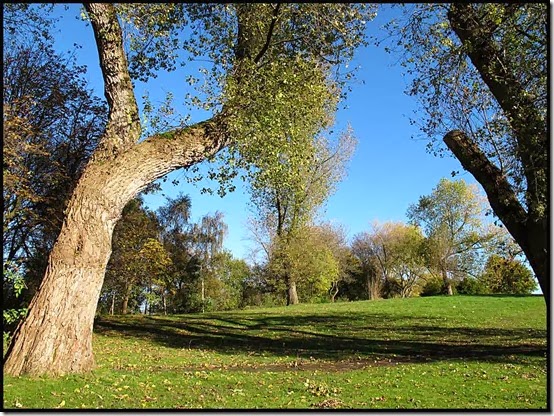
0445parksun

Here today’s team comprising Bonnie, Neil, Don, Bernard, Barbara, Clyde, and Martin (pictured above), lunched on some children’s picnic benches. No children were disturbed or photographed.

Philips Park witnessed our first encounter with the River Medlock, firmly confined within a deep culvert.

0446medlockculvert

We traipsed through a massive multi-denomination cemetery across the river, before returning to the south side of the Medlock, where Philips Park gives way to Bank Bridge Meadow.

The towpath was no longer there to guide us, but there were plenty of footpath signs. Who knows where they all led to…

New singletrack mountain bike routes are also well signed, but I struggled to explain that they are forbidden to walkers.  Mountain bikers should enjoy a visit. Parking and bike washing facilities are available at the nearby Velodrome (National Cycling Centre).

Beyond Clayton Vale, narrow paths full of leaf litter continue beside the railway line, above Medlock Vale.

0452leaves1

Our route took a strange turn in Clayton Vale, where only Bonnie and Barbara followed the correct path.

2016exercising12018exercising3

Others got stuck on what they thought was a giant roundabout controlled by a midget plumber.

2021exercising6b

Our path continued high above the river above Medlock Vale, and views towards our destination opened out.
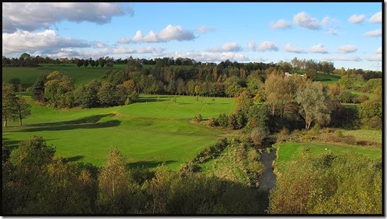
0454medlock

Another canal was reached - the Hollinwood Canal, which links the Ashton Canal with tram roads from the Oldham coalfields.

The Hollinwood Canal has not yet been restored, though in places the towpath and canal are pretty much intact. Elsewhere, there are major obstacles to restoration. The M60 motorway, for example.

Berries glinted in the sunlight.

0460berries1

After crossing the motorway by a high footbridge, we were welcomed into Daisy Nook Country Park, where drinks and ice creams are always available, of which facilities we availed ourselves.

I should have paid more attention to the signage, as shortly after the Visitor Centre, with the distraction of Clyde’s intent on showing me how unlock the mysteries of my Satmap GPS unit, I took an inadvertent diversion to Crime Lake, when we were heading for Park Bridge!

Here, after the minor obstacle of the M60 motorway, the Hollinwood Canal continues on its merry way.

0468bydaisynook

We passed a sculpture masquerading as a footbridge, or was it the other way around? And approaching journey's end, as the weak light faded, the River Medlock seemed to widen as we proceeded towards its source!

The light was just adequate for this final photo of woodland near Bardsley, on the edge of Oldham.

0473oldhamwoods

Then, with some of the team members showing signs of wear, (or should that be weary?) we joined a cycle route for the easy walk to Alexandra Park, before ultimately gravitating to the delights of Oldham Mumps Metrolink Station, by which time all bar Bernard and Barbara had peeled off onto alternative routes home.

The route - excluding diversions it's 24 km, but the GPS showed 28 km.

2099route

An excellent day out in surprisingly clement weather.  Thank you, everyone, for coming along, and please accept my apologies for the Crime Lake diversion, which can only be described as a *****.

Here’s a huge slideshow with a complete set of images.

Monday, 25 November 2013

Tuesday 26 November 2013 – Lindow (Wilmslow)

1905lake

Last Tuesday evening was allocated to an 8 km walk around Lindow, in Wilmslow. It’s not far from home, so I decided to recce the route, which was planned to cover a few ‘new’ paths. The pictures in this posting are from that recce, which was more of a jog than a walk, as the 8.5 km were completed in a shade over an hour.

Black Lake, pictured above, is home to a wide range of wildlife, including water voles and great crested grebes. The plaque pictured below relates that the Common was purchased from the Countess of Stamford and Sir Humphrey de Trafford, and presented to the residents of Wilmslow in 1897.

1901plaque

In the hard times of the war years and subsequent decades, such places received little maintenance and became overgrown and unpleasant (perhaps not for the wildlife!).

By the 1980s Wilmslow’s prosperity was evident, and Lindow Common was recognised as a potential amenity, albeit adjacent to a huge peat farm which is still present (Lindow Moss). A restoration scheme resulted in the revival of the land and it was opened as a Nature Reserve in 1988.

It’s now a very pleasant area, especially with the autumn colours on these fine November days.

After heading down Battery Lane I found myself outside the Plough & Flail, which claims to be in Mobberley.

1907plough1909tree

Returning to the Common, some of the trees looked wonderful in their autumn plumage.

My route is shown below – click on the link (‘View Details’) for more details.

Later on I was joined by Sue, Graham, Alistair and Andrew for the evening walk. It rapidly became clear that I’d not really been concentrating on the recce. The others noticed this when, 15 minutes after I’d so helpfully pointed out the plaque to them, we passed it again, having managed a complete lap of Black Lake.

Then we emerged from the Common and inadvertently proceeded down Newgate Lane rather than Battery Lane. This meant I would have to negotiate several boggy fields ‘in reverse’ compared with my recce. So I chickened out and fumbled my way round a more familiar, and much drier, route through the peat fields of the Moss.

It was a lovely moonlit evening, so nobody seemed to mind, though they did get a bit fed up when on re-entering the Common, I failed twice to find the car park, returning us each time to the wrong place on the perimeter of the Common.  So we gave up and took the road to the Boddington Arms, for welcome refreshments after about an hour and a half in the moonlight.

The route shown below benefits from Garmin converting my 6.8 km ‘track’ to a 5.3 km ‘route’. There must be some sort of ‘smoothing out’ software that has eliminated all the extra loops!

Great fun!

My next challenge will be to find my way up Shutlingsloe on Tuesday 17 December – leaving 7.30pm from Trentabank Car Park – all welcome.