Sue and Martin's Big Adventure
Day 9 - Tuesday 3 August 2004 - Stage 8
Postcard Summary (on yesterday's card)
Midge
zone to Col
Ascent of Pic D'Orhy (high point
Climbed back up to the col, where the
shop was terribly stocked, so we have to go without brews for a while. Then headed up out of the cloud to our
highest point to date. Views were
amazing as there was cloud beneath us over France
Diary Entry (by Martin)
Ascent of Pic d'Orhy (2017 metres)
Woke at usual
time. 7 am. Darker than usual due to thick mist everywhere. Eventually got up
and found hot water for a wash and shave, then we got going without paying at 8.40.
Back at Bagargui
col we found the food store sadly lacking and we improvised with food for a
couple of days. They didn't sell gas, so we bought very little that needed
heating, as our second gas is nearly kaput. They would only sell us one
baguette, as we hadn't reserved any! We were rather rude to them and said their
shop was "terrible".
After eating a cheese and small piece of bread
breakfast outside the lack of Information Centre (shut), we headed off up Pic
d'Orhy. Our mood improved after 15 minutes when we emerged from the mist to a
beautiful sunny day. We took photos of the Pic and beyond.
All went well
until I took a wrong turning (quite difficult - lost concentration). We went
too high and went unnecessarily around a bluff. I then took us too low and we
finished up bashing through steep grass and gorse bushes to reach our correct
path. (Anything the sheep can do, we can do too!)
This took us onto
the ridge leading to Pic d'Orhy (2017m), which we ascended at a leisurely pace,
arriving on the summit at 2.15. This wasn't the hottest ascent of the trip - it
had been only 16°C at Bagargui col. The ridge was a mini Crib Goch - easier, but
a similar amount of effort as to get up Snowdon .
The big difference is that despite starting from a tourist centre, no-one else is
climbing the mountain from this (the interesting) side, and there are no signs
encouraging them to do so.
We had found
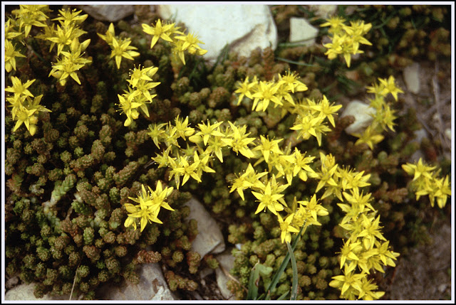
lovely spring water at 1600 metres - a delight. Lots of alpine flowers seen
today - perhaps there may be time to record them later, but some Dwarf Columbines
and some Saxifrages and Stonecrops were seen, and lots of others.
 |
| Biting Stonecrop |
The tuna salad
was surprisingly tasty. We admired the circling vultures together with four day
walkers. Horses and sheep live here. Good views down our steep descent to Port
de Larrau (1585m) and to the ridge (our
route) beyond. It had the look of a Lakeland

We dropped down
the sunny hill to reach Port de Larrau at 3.20pm. Two French families were
lunching in thick mist, oblivious of Spanish sunshine about half a mile away.
We were hopeful
of regaining a sunny ridge, but the cloud foiled us and we spent the rest of
the afternoon carefully following Ton Joosten's instructions as to how to
continue along the ridge. Despite only about ten metres of visibility, and with
the aid of altimeter and compass, we arrived at Col
The gamble paid
off, as we found a spring 100m down on the Spanish side and we returned to flat
ground on the col to set up camp above the cows at 7 pm. (Lesson: in mist when
dropping down for water, take a bearing and reverse as per descent - we wasted
time trying to find the col after collecting water.)
The sky over Spain
Note: this
particular border is patrolled by an electric fence, as Sue discovered to her
cost.
Stats
and route (Viewranger):
29
km, 1500 metres ascent, 10.3 hours

Index


2 comments:
Quite a day Martin. At the shop in Scourie, 1980s I think, we were told they had no bread despite it being visible on a low shelf behind the counter. It was for locals only apparently. We left.
The fabulous 'inversion' views (it's a shame the photo quality is so poor, but at least the pictures haven't been left in the box) soon cheered us up, and I only recall one instance, before we entered Andorra - we'll come to that - when we would have welcomed a bit more food on board.
Post a Comment