Sue and I drove up to Patterdale on Saturday and spent a relaxing couple of hours chatting about routes, etc, before setting off on this backpacking trip. For us, this is an annual trip to check out gear etc that hasn't been used for a while - in this case mostly not used for two years. For Mike, it was a chance to check out the efficacy of certain items in preparation for the TGO Challenge - postponed this year until 18 June - Sue and I have bottled out of that due to midge and logistics issues that we are reluctant to face.
The view above is towards Place Fell, from Mike and Marian's garden. Are we not envious!?
Setting off around noon, after a bite of lunch, we took a path to the south of Grisedale Beck.
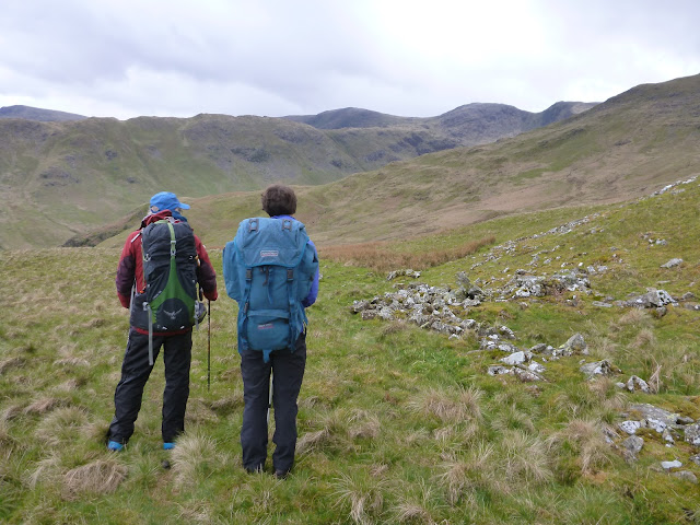
Soon we were heading over rough ground towards Trough Head, with good views back to Ullswater.
A high wall was spanned by a metal ladder that reminded me of via ferrata ladders that we haven't had a chance to experience for too long now.
Mike reminisced about this tree, which he fondly remembers when it was still alive. Now it still serves a purpose as a rubbing point and windbreak for sheep.
Looking ahead to the Fairfield summits, a sheep and its lamb on the top of a small rise watched studiously as we passed by below.
Looking to our left, the twin peaks of the Angletarn Pikes were prominent in the view across Brothers Water.
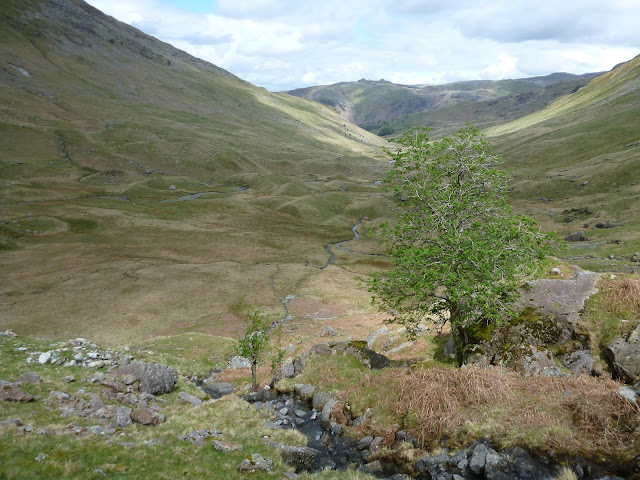
Looking ahead again, we continued to contour over rough ground, towards our target, Link Cove, hidden in a small dip above the steep slope that two becks cut through in the middle of the next two pictures.
Several waterfalls were encountered on the way up to the cove. A rare bout of sunshine dazzled us as we looked up to these falls.
Here's the view back, from near our objective, with Angletarn Pikes still prominent.
Later, after drizzly showers on the way up, we could enjoy sunnier views for a while - the next wave of bad weather arrived during the night.
Link Cove, reached at around 3.30pm, presented numerous good camping spots at about 500 metres heightwise.
I found a comfy rock on which to admire the view whilst I wrote and dispatched the day's blog posting.
We enjoyed our soup outside, with a view to Place Fell, before the sun left us to dip behind the Fairfield summits and we adjourned to the trusty Nallo tent for our main course of pasta and tuna, and a dessert of Angel Delight. Delicious.
Here's our route - 7km, with 550 metres ascent, taking a leisurely three and a half hours.
Sunday arrived in a stormy manner. Having forgotten to tighten the guys earlier, I was up at midnight to do that job and stop any flapping of the tent, so we slept well until our first brew at 7am.
The rain had turned to snow in the night. You can see the remains of it around the base of our tent, with Mike's tent just visible through the murk.
We got going soon after 8am, and could soon enjoy a view back into the cove.
It was a steep ascent to the ridge between Hart Crag and Dove Crag, past a Priest's Hole that is best viewed from this route (but there's no picture as it was raining hard and my fingers were too cold to take pictures, albeit I had my waterproof Lumix camera - not used for three years - on this trip).
After slogging our way up to Dove Crag, we enjoyed the gentle descent towards Ambleside, slowly warming up as we continued.
We were not alone - some hardy folk had started early from Ambleside to do the Fairfield round.
Lunch was taken in a pause from the rain, just outside Ambleside, while we watched the next pulse of wet weather approaching us over the Langdale Pikes. At this point a combination of the continuing bad weather forecast and an infection for which Sue needed to get medication, brought us to the decision to abandon the trip at Ambleside. The testing was sufficient, and the decision was justified to Sue and me as we drove home with the windscreen wipers on 'fast wipe', when we would otherwise have been continuing our walk in torrential rain.
We passed a bubbling brook and a smart grey tractor before reaching the fleshpots of Ambleside and catching a bus to Bowness, from where the Penrith service took us back to Patterdale.
Here's our route - 11km, with 350 metres ascent, taking aroround five hours.
An excellent little trip, and thanks to Mike for his company and route planning. He will use a different tent on the Challenge, pack some matches or a lighter, and make a few other minor adjustments. I will take better gloves next time, and a proper first aid kit (I had strips of plasters, but no scissors!).


2 comments:
Glad you enjoyed your trip. Hope Sue is ok. A nice Ferguson TE20 but the paint is not right. Wrong RAL number.
Sue is fine thanks - antibiotics on Monday sorted her out. The tractor looked as if it had been dunked in a vat of grey paint!
Post a Comment