

Wednesday 17 November
Lete to Tatopani
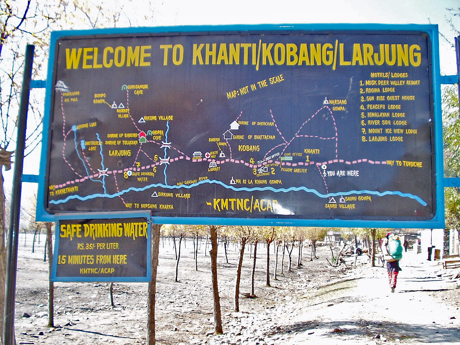
Itinerary: DAY 17 Tatopani (1,189m) Crossing Lete Khola on a
suspension bridge we follow the valley through pine forest down to Ghasa
(2,013m) where we cross the Kali Gandaki and descend along the east bank.
Descending further south we again cross the same river before reaching a huge
waterfall at Rupse Chhahara (1,631m). By now we have descended almost 4000m
since the
[Diarist: Martin]
Usual 6 am tea. The
nights are drawing in so it is now still dark at 6 am. But by the time washing
water arrives a few minutes later it's light enough to wash and to pack our duffel
bags and day sacs for the day ahead.

For the first time
for ages there is no frost, so last night was probably the last for the winter
sleeping bags on this trip. There is a view of
An indoor breakfast
of porridge and omelette - in the tea house with pollarded trees that we camped
outside - preceded a 7:40 am start. Suria led us away - he has been invisible
to date, leading the porters to the correct place. We started across a long bridge
with poorly tensioned cables, so the handrail flopped to the side and would not
be available unless one fell over.


The path is busy
today with trains of ponies, the pantechnicons of the path, carrying cement and
building materials and provisions up the valley and perhaps to as far as Higher
Mustang, but not as far as Tibet. We descend into a warm fertile climate and
soon reach Ghasa, where tomato like fruits - red and green - dangle from shrubs.
They are used for making pickle. We pass vegetable gardens, still seeing
occasional chortens (pass to the left).


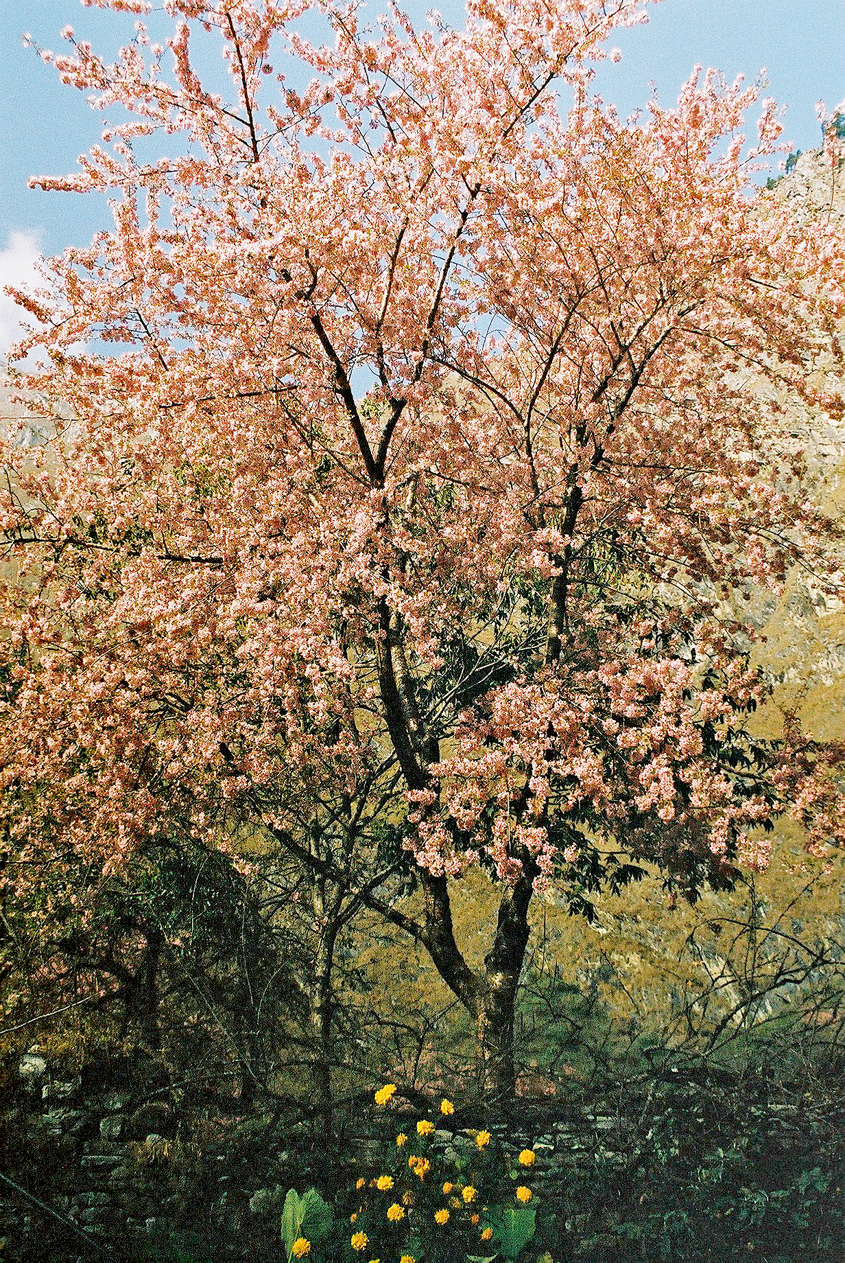
Cherry trees are in blossom here. We see the sun at 9 am, fleeces come off, there is a huge waterfall up to the right. Views (glimpses) of high peaks through the cloud. Luxuriant cabbages, nicely paved path (motorway), poinsettia and marigolds line the track, and the noisy buzz of Cicadas and the rush of the river below, make it a less than quiet section.
11:00 to 11:30 -
tea at Kopchepani - and we now have left Lower Mustang and entered the Myagdi
district - we had sped through the police checkpoint in Ghasa.


Lunch is taken at
We set off past the
ubiquitous sleeping dogs, passing huge rocks and a big slab of a rock face. The
vegetation changes as we pass through areas of bamboo, oranges, sugar cane, aloes,
bananas etc.


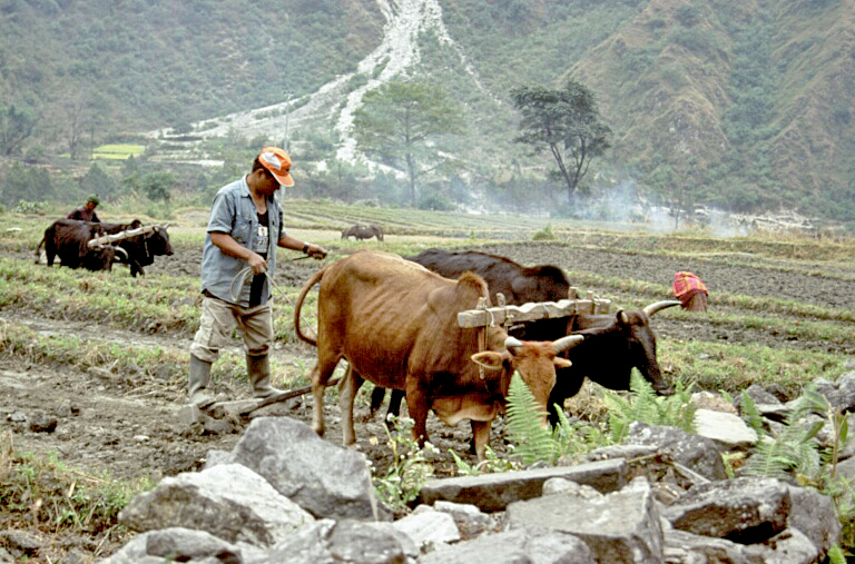
Old men by the path
side are flattening, seeding and ploughing the land, using ancient tools,
buffalo and a lot of strength. We rest by a huge bouganvillia tree. Past a
hydro plant capturing the energy of water coming off


There are many people
ascending today, few seen going down. Well swept stone paths through villages.
Eventually at 4 pm we arrive in the nice


After that we enjoy
the highlight of the day - a trip to the nearby
And so, to another
nice meal - vegetarian - pasta and additions, potato cake, pumpkin, pizza etc,
preceded by delicious pumpkin soup. Hot custard for dessert.
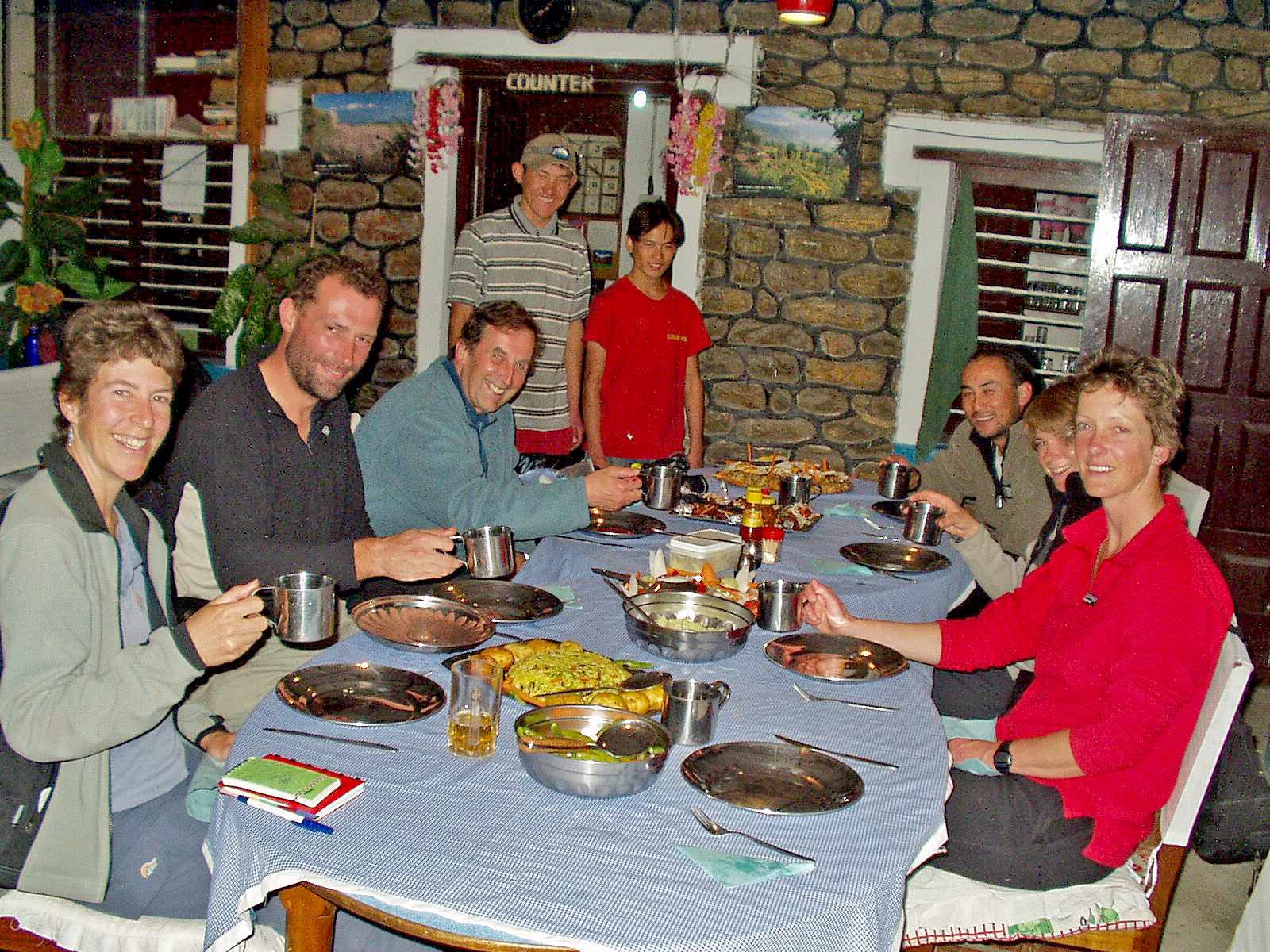
Then we headed downtown and found a bar which promptly emptied then closed, so we took the rest of our beer back to the dining tent, evicted some porters who were just about to go to sleep in it, and downed the rest of the beer whilst enjoying a game of knockout whist (Mark won).
9pm bedtime.
Statistics:
Start: 2390 metres
Ascent: 55 metres
Descent: -1095
metres
Finish: 1350 metres
Time: 8.5 hours
Stops: 2.5 hours
Walking time: 6
hours
No comments:
Post a Comment