I've reported on this route before - here (26/12/21) and here (9/11/21), and have failed (so far as I can see) to record other visits to the route, which was originally devised as a 10km route for a sponsored run for Bollin Primary School. [Step by step instructions are available, but most folk should be able to follow the route plotted on the map below.]
I'd been planning a 'Cicerone Lancashire' outing, but the weather forecast was poor. So, needing to get out somewhere, I donned waterproofs and jumped in the car for a four mile drive to Ashley Mill Lane, and set off along the track towards 'Into the Wild'. By now the sky had cleared and the waterproofs were superfluous.
'Into the Wild' had not yet opened - not a big surprise at 7:30 - and it was a bit early for a coffee break anyway.
Some of the crops have been harvested hereabouts, as per this typical Cheshire scene near the river Bollin. Wood pigeons and buzzards are overhead, with many smaller birds pecking in the stubble.
The sweetcorn has yet to fully mature, but the path left by the farmer through this field is impressive.
Just beyond the sweetcorn, the Bollin is crossed again. The river is very low compared to its level on my 2021 visits (see link at the head of this posting).
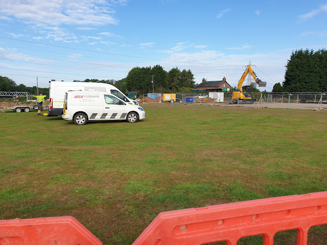
Something is going on next to the path by Ryecroft Farm. I couldn't work out what work is being done.
Very soon the path re-entered woodland near the M56 motorway, which was soon crossed by way of a convenient footbridge above the Monday morning traffic.
A good path continues beside the motorway, before heading beside a tall hedge towards Birkin Farm. This often boggy path was bone dry today. The prediction of rain had clearly been erroneous, and I wondered what it would have been like on my aborted 'Deepest Lancashire' planned walk.
I also wondered where the path went before the M56 was built. I wish my old 'quarter inch' maps from 1945 and 1946 showed a bit more detail.
Soon, a tree lined lane led me to the Ashley Hall complex.
There's even a tea room here that looked as if it was just opening up - 9am on a sunny morning. Being so close to the end of the walk, and a ten minute drive home, I passed by on this occasion.
At the entrance to the Ashley Hall estate is a small building with a door at the back. I've noticed this on many occasions and am still puzzled as to its use, and why the entrance should be at the back.
It's just a short stroll from here beside Ashley Road to Ashley Mill Lane, reaching the car after exactly 10km.
Here's the route, with a strange loop by the start, where my GPS must have been short of satellites. As usual, click on the image for a better version.


No comments:
Post a Comment