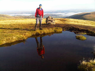
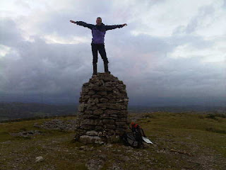
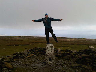
Sue and Martin in Mallorca 2019

Sue and Martin in Mallorca 2019
On the Archduke's Path in Mallorca

Tuesday, 9 October 2012

The Cloud - Marilyn Number 1303

M2 and M1 concluded their eight days of 'Travelodge Bagging' with a visit to this pleasant spot overlooking the Cheshire plain.

After refreshing ourselves at Rushton Spencer's excellent Knot Inn, we parked just north of Timbersbrook for this easy final circuit, taking the Gritstone Trail path to the summit and returning via the escarpment trods.

The late afternoon views were excellent, if a little hazy - Jodrell Bank, just eight miles away, was only just visible.

Then it was back to Little Italy (in Timperley).

All in all an excellent trip during which we appear to have bagged 5 Travelodges, 27 Marilyns and 1 'sub Marilyn' or HuMP (hill with a HUndred Metre Prominence). I now need to look for a pencil to mark up, and update, Alan Dawson's book.

I'm sure there's more to follow when I've downloaded some photos and the data from my Garmin Gadget.

Bye for now...

Sent using BlackBerry® from Orange

Gun - Marilyn Number 1227

After driving through Midlands rain we found the Staffordshire countryside delightfully bathed in sunshine.

There are plenty of parking spaces on the road around SJ 968 609, from where a ten minute stroll to the north leaves you in the vicinity of Gun's trig point, with fine views towards Shutlingsloe (pictured) and over the countryside of Staffordshire, Cheshire and Derbyshire, which three counties meet at nearby Three Shire Heads.

Sent using BlackBerry® from Orange

Mynydd Llangorse - Marilyn Number 954

Having parked at SO 160 283 to climb Mynydd Troed we felt unable to shun the opportunity of climbing this little hill as well.

A father and his young daughter romped down the hill towards us as we took a short break on some rocks by the cars. We thought perhaps they thought we were car thieves (such thefts are common in this area), but it turned out that the little girl was in a rush to get to a nearby indoor climbing wall as soon as it opened.

We saw nobody else on the hill as we rose past Harebells and Tormentil, and sadly over lovely turf that had suffered recent damage from trail bikes despite a 'No Bikes' sign at the foot of the hill. Such a shame for those who regularly try to appreciate this otherwise quiet and pretty countryside.

A trig point that we visited appeared to be lower than the pile of stones (pictured) that marks the summit area. As usual, we tramped around a bit to ensure that M2's Marilyn Bagger's 'tick' could be entered in his copy of Alan Dawson's book without any question or doubt.*

By then one of the layers of cloud had either risen or lowered to envelope us for the rest of this pleasant amble as we retraced our route back to the car, and another cuppa.

* I'm writing this having returned home and spotted some messages from another inveterate hill bagger, Mike Knipe, who has pointed out that the list of 'Marilyns', like the list of 'Munros' (Scottish mountains over 3000 feet high) is a dynamic thing, which changes as more accurate surveys are carried out. So Alan Dawson regularly updates his list. Consequently the 'original' numbers used in this series of postings are probably all now wrong, and Raw Head no longer meets the criteria for inclusion in the list. That doesn't of course stop it being a good walk though! Thanks Mike, and I hope you agree that whilst on one hand 'ticking' these lists of hills can become a little compulsive, they do without doubt provide a stimulus for us to visit different hills rather than deepen the grooves in just a few favourites. Certainly the variety afforded by this current trip has been remarkable.

Sent using BlackBerry® from Orange

Mynydd Troed - Marilyn Number 759

There's a good parking space to the south of this hill at SO 160 283. By the time we arrived there the Monday morning rain had stopped and we were able to climb steeply between layers of cloud, one of which (as you can see) nudged the summit of the hill.

There's evidence of lots of pony trekking hereabouts, though we saw nobody engaged in that activity today. The hill was empty.

We made the walk into a pleasant circuit of around an hour by continuing down the hill's northern ramparts for a short while, before turning sharply to the WSW down a path that led to a good bridleway around the bottom of the hill and back to the car.

Sent using BlackBerry® from Orange

Sunday, 7 October 2012

Mynydd Carn-y-cefn - Marilyn Number 881

Put 'Nantyglo' in the SatNav and then follow signs to the 'Round Towers' to reach the start of this walk.

We concluded that signposts to Welsh antiquities must be compulsory, whereas there is no requirement for parking facilities or even access to such antiquities. Here, roadside boulders and 'No Vehicles' signs made the parking issue clear, whilst a snarling allocation made the access issue even more transparent.

After parking in a nearby bungalow road, we set off up an unsurfaced lane that soon wended its way through an empty golf course. Sticking obstinately to the lane, which eventually deteriorated into a steep trod up the hill, we continued relentlessly to the 550 metre summit. M2 sat dutifully on the rather uncomfortably eroded trig point, surrounded by views of Welsh valleys under high cloud that had rolled in to announce a change in the weather.

Continuing south east, we rejoined a vague path and descended steeply. The paths are marked better on the map than they are on the ground hereabouts (though they certainly exist), so the GPS came in handy. Thus we negotiated our way to a lane from which we could at least see the ancient Round Towers, but a close inspection proved impossible.

Sent using BlackBerry® from Orange

Fan Gyhirych - Marilyn Number 537

From Fan Nedd's trig point a walk back towards the Cairn brings you to a path that leads down to Bwlch Duwynt. Alternatively you can take a north western short cut down grassy slopes to reach the path, like I did, or you could even employ M2's cross country western approach - but be prepared to keep any companion waiting if you do that!

We'd seen some vehicles on the Land Rover track below Fan Gyhirych and wondered what they were doing. The track itself presents an ugly scar across the pristine hillside, but I'm sure it wasn't built for the paragliding enthusiasts who were using it today, so good luck to them.

On reaching a cairn near Fan Gyhirych's summit, we enjoyed our lunch in the company of a local couple, whilst watching the paragliders trying to make the best of a windless day. A couple took off, and proceeded to plummet like stones to the valley below, under the watchful eyes of chatty crows and defecating red kites (there's a feeding station nearby).

After half an hour at this lovely spot with fine views towards, inter alia, Titterstone Clee Hill, we adjourned for our now traditional (has anyone noticed? probably not) summit photo. It was my turn. This summit had a moat that reminded me of the bad old days at Black Hill!

Luckily, M2's 'Rules for Marilyn Baggers' tome required him to touch the trig point, so his boots also got a dunking.

After that we headed back east taking the least line of resistance, part of which involved a boggy path beside a wall to the north of Fan Nedd. M2 fell behind again; 'he's getting tired' I thought. It turned out that despite not having had to cross a fence he had contrived to rip his hand on some barbed wire. "Have you got a plaster?" he whimpered from above a pool of blood as I sat on a bench enjoying the last dregs of my flask of tea in view of .... Titterstone Clee Hill? That made me feel guilty about telling the Welshman with a can of Carling, with whom I'd had an interesting "where's the pub" "I don't know" encounter a little way up the hill, that my 'lazy companion back there only speaks Gaelic'. Luckily, there were no repercussions, and M2's hand injury was easily repaired.

Sent using BlackBerry® from Orange

Fan Nedd - Marilyn Number 670

Fan Nedd is easily ascended in half an hour or so from point 446, at the top of a hairpin on the minor road between Heol Sennl and Ystradfellte. Whilst the summit, and in particular the cairn to its north, sports fine views, it would be a shame not to extend this outing (as we did) by heading west, in the direction of the summit photo above, to complete a choice of worthy circuits or linear walks.

Those simply wishing for a short stroll should budget about an hour, there and back from SN 923 196.

Incidentally, today we could see far out to sea to our south, and far into Shropshire and mid Wales to our north. I couldn't identify many individual distant hills, but from her perch on Titterstone Clee Hill (and perhaps Brown Clee as well - has she taken up Marilyn bagging?) Sue tells me that today the distinctive shapes of both Pen y Fan and Cadair Idris were clearly visible.

Shouldn't she be at home doing the housework?!

Sent using BlackBerry® from Orange

Fan Fawr - Marilyn Number 514

This hill is easily ascended from the Storey Arms Centre, via an initially boggy path, but enthusiasts could make a meal of it and start from the lay-by at SN 971 222.

Today spring was again in the air and you can even see a cloud inversion (well, slowly dissipating morning mist) behind me in the summit photo.

I expect you've been up here as well, Alan, and I'd be surprised if you haven't managed some of (yes, you will finally be able to breathe a sigh of relief) tomorrow's final instalment of this series of postings.

On our descent from the scenic summit, with its resident pond for 'reflection photos', we paused to admire fine views including Pen y Fan. M2 stopped for a chat with a couple of chaps who'd been to Mera and Island Peaks, and I chatted for a while with a runner who was training for the OMM (a tough mountain orienteering event) which is taking place in the Howgills in a few weeks' time.

After an hour and twenty minutes on the hill we were back at the Storey Arms car park just in time to enjoy Denise's first brew of the day (£1 for a cup or can of anything) together with some complimentary shortbread. She told us all about her 'Storey Arms Refreshments' kiosk, from which she's been making her living for the last 22 years. She's been up Pen y Fan once - "just to see what it was like, since so many people ask that question".

Sent using BlackBerry® from Orange

Saturday, 6 October 2012

Pen y Fan - Marilyn Number 260

Pen y Fan, which tops out at an impressive 886 metres, is the highest place in South Wales. It was highly populated today, with all manner of folk, from small children to ancient grannies and muscular army cadets on a training exercise. Cosmopolitan and friendly; it was great to see so many people enjoying themselves on such a glorious day.

We had made our way slowly along the ridge from Waun Rydd, pausing to watch a paraglider soaring past - he finally landed in Cwm Oergwm, from where he proceeded to walk back up the hill.

Frequent chats with other walkers also punctuated our progress.

The crowds thinned once we got onto the flatter but less popular Craig Gwaun Taf ridge, for a final high level stroll before the sharp descent to the lower of the Neuadd reservoirs, which were full today.

A pleasant stroll on good tracks then led back to the car park at SO 027 178, from which point The Red Cow Inn's Wye Valley bitter was mercifully nearby.

Sent using BlackBerry® from Orange

Waun Rydd - Marilyn Number 452

The short drive to the free car park at SO 027 178, past hordes of mountain bikers on a challenge event, set us up for the steep climb past roaring waterfalls to the pleasant paths over Craig y Fan Ddu and Graig Fan Las.

There were lots of people about on this sunny summery day - perfect weather for walking.

On reaching the northern escarpment we headed north east to a small pile of stones that marks the summit of Waun Rydd, with fine views over the Brecon Beacons and in all other directions on this perfectly clear day once the early morning mist had dissipated. Those camping overnight up here must have enjoyed some fine inversions.

We trudged to and fro to a grassy area that looked higher but wasn't. You could easily return to the car park from here, probably taking less than two hours for the return trip. We chose to make a day of it by carrying on along the ridge.

Sent using BlackBerry® from Orange

Bryn Bach Parkrun (not a Marilyn)

Parkruns are a great way of starting an otherwise lazy weekend.

They are not addictive....

Today's 5km Parkrun venue for M1 was planned with M2's Marilyn bagging addiction in mind, as it was en route to several such hills. However, M2's interest in the Parkrun concept lies several octaves below zero, and being unable to handle the idea of a half hour break in the journey whilst M1 parkran, he elected to forgo a walk in favour of a Saturday morning lie in!

He was only just about out of bed when M1 returned at 9.45!

Sent using BlackBerry® from Orange

Friday, 5 October 2012

Rhiw Gwraidd - Marilyn Number 1122

There may be shorter ways up this hill, but after returning from Gwastedyn Hill we left the car in Nant-glas and strolled on to SO 006 654, where there's a perfectly good lay-by for those with a lazier disposition.

At SO 010 645 a signed path leads through the woods. But it doesn't. It takes the unwary Marilyn bagger on a unique jungle experience, almost within sight of a nearby forestry track. We eventually decided that the only way of reaching the security of this track was to retrace our steps to where we'd left it in the first place!

A bit further on we came to a hairpin bend from where we could access a field through undergrowth and over a barbed fence. We should have noted more carefully where we entered the field, as this seemingly minor lapse afforded us another jungle experience, featuring a new species - the Himalayan Bramble - on our return journey.

In the meantime we slogged up a steep field, past glissading sheep, to reach, over more rippingly vicious wire, the stunningly unspectacular summit that nevertheless enjoyed good views of the surrounding countryside.

As always in these circumstances, M2 trudged around the plateau collecting evidence as proof of his conquering of the true summit of this minor hill, before turning tail and glissading like a sheep to his next jungle experience.

Marilyn Bagging - it's not addictive. No!

Sent using BlackBerry® from Orange

Gwastedyn Hill - Marilyn Number 1036

This hill towers above the pleasant town of Rhayader. We accessed it from Nant-glas, where the road through the village has plenty of room for parking.

It's a steep ascent, at this time of year through a towering jungle of spent Willowherb, Foxgloves and Bracken, with red kites poised to make off with unwary mammalian visitors.

To the north west of the main summit, overlooking Rhayader, is a large cairn commemorating the queen's jubilee, inscribed in English in 1977 and in Welsh for more recent landmarks. A large fire pot stands nearby, used as a beacon.

Returning down a narrow lane to Nant-glas, we met a car - containing the owners of a smart house above which our path had passed. "We need more walkers around here", they commented whilst chatting to us. They were English.

Sent using BlackBerry® from Orange

Garreg-hir - Marilyn Number 1025

A narrow lane off the A470 leads to a Nature Reserve (Warchodfa Natur) by Llyn Mawr. A track between Llyn Mawr and Llyn Du took us gently to this pleasant summit.

We tried to make it into a circular walk, but the footpath to the north west of Llyn Mawr had been blocked with barbed wire, so it wasn't worth the hassle.

A pleasant excursion though, despite the nearby wind farm. (At least all the blades were turning - a rare sight indeed!)

En route, we'd enjoyed coffee and cake in the café at Llanbrynmair. Highly recommended, with toys supplied by www.timberkits.com, and a unique rabbit village.

Thanks, as ever, for your comments. They are much appreciated even though some may not be read until I get home as I allowed the minuscule Blackberry mailbox to briefly overflow.

Alan, I'm glad we found a hill you'd been up, even if it was foreign. Today's are true collectors items - you won't have been there!

Nick - M2 says you must have a good memory, and that 'faded' look pulls so many Louises that he's confused as to which is which (or should that be 'witch is who'?).

JJ - your knees are in no worse state than is average for your advanced yearage! We all have bad knees! And are you sure it wasn't a case of beer that you won, you surely wouldn't have run that far up a huge mountain for just a few bottles of wine?

Sent using BlackBerry® from Orange

Holyhead Mountain - Marilyn Number 1487

At 2220 metres this would be quite a Mountain!

The nice man in the tea shop at Holyhead Country Park pointed us in an anticlockwise direction for what turned out to be a short stroll.
We headed along a good path above the north coast, past a strange artefact and on towards North Stack. From this north western point the mesmerising flashing light from South Stack's lighthouse held our attention for a while.

A left turn here took us neatly up to the fine viewpoint despite its modest stature. From the Isle of Man to much of Snowdonia. A choice of paths guaranteed an easy descent brought us quickly back to the Park.

Sent using BlackBerry® from Orange

Thursday, 4 October 2012

Mynydd Bodafon (formerly Yr Arwydd) - Marilyn Number 1525

A short way up the road from St Michael's Church in Brynrefail (worth a visit), a track to the right and a path to the left lead quickly to this modest 178 metre summit.

Modest it may be, but this is the highest point on the main island of Anglesey.

We left a lone radio enthusiast to caress his aerial, and headed back on a circular route under the watchful eyes of circling buzzards, past Red Campion, Herb Robert and fading Brambles.

Sent using BlackBerry® from Orange

Moel Eilio - Marilyn Number 536

An easy 4km ridge leads from Moel Cynghorion to Moel Eilio. Today we met various folk who had come over Moel Eilio from Llanberis. First, two fell runners, 'training' for the coming winter's ski mountaineering - they were having a bit of a problem running uphill but put on a good show for us. Then a couple of lone but chatty walkers, and on the summit, a group of backpackers with a summitmountainguides.co.uk guide. They were enjoying their training and were happy to take the above photo for us in the spacious summit windbreak.

We enjoyed fine views down to Caernarfon and Anglesey from this lofty perch on the far western ramparts of the Snowdon massif. Snowdon was still in cloud, and we were the first visitors of the day to Moel Eilio to enjoy a clear view as the cloud lifted from the summit just before we arrived.

We retraced our steps for a while, past a disappointed Raven, keeping to a contouring path around the base of Foel Goch, before reaching three chatty mountain bikers at the 467 metre col that links Snowdon Ranger with Llanberis.

Everyone we met today was chatty. Perhaps the bright sun, clear air, and lack of wind made it that sort of day. That's great, even if it does result in a mountain guide nagging for a chance to guide us up Monte Viso!

The circuit, including the ascent of Moel Cynghorion, made for an excellent half day excursion from Snowdon Ranger, where cash is needed for the Pay and Display car park.

Sent using BlackBerry® from Orange

Moel Cynghorion - Marilyn Number 644

The gentle ascent up the Snowdon Ranger path to the col above Llyn Ffynnon y-gwas was a pleasure on this sunny morning. Except perhaps for the blinding sunshine that was dispersing the remnants of low mist.

It was nearly a good day for Brocken spectres, but sadly none came our way.

With Snowdon cloaked in cloud it seemed more than reasonable to head steeply north west, up to the amorphous summit of Moel Cynghorion.

M2 tramped around the grassy plateau for some time to satisfy his conscience about knowing that he had gone to the true summit.

Sent using BlackBerry® from Orange

Wednesday, 3 October 2012

Foel Fenlli - Marilyn Number 969

About half a kilometre to the south east of the Pay & Display car park at Bwlch Penbarras lies the hill fort of Foel Fenlli, site of a 2000 year old village. M2 romped up the direct route and was long gone by the time I arrived, some 15 minutes after we'd both set off. Hence the 'arms length' photo, in which the pile of stones that marks the summit can just be seen by my left shoulder.

Another sunny summit in the company of runners, walkers and curious bright white sheep!

Not the hardest of walks.

Sent using BlackBerry® from Orange

Moel Famau - Marilyn Number 866

From Bwlch Penbarras it was an easy stroll along a wide track, past faded Gorse and Bell Heather, in the company of dog walkers, as well as hikers and runners, to Queen Victoria's Jubilee Tower that spreadeagles itself across Offa's Dyke on the summit of Moel Famau.

There were views far and wide, though dark grey clouds limited what might have been visible in Snowdonia, some 35 miles away.

Sent using BlackBerry® from Orange

Raw Head - Marilyn Number 1480

There's plenty of space to park outside Harthill's pretty village church. From there a lovely walled lane to the right of a cookery school leads up to a wood. Shafts of today's bright sunshine lanced the woodland as the path contoured past butterflies and pheasants before climbing to the Sandstone Trail.

Raw Head's trig point was soon reached, with fine views west from the top of the escarpment. This is the high point, albeit at a mere 227 metres, of the 35 mile trail between Frodsham and Whitchurch.

There's a large cave just below the summit that may be worthy of exploration. We enjoyed our lunch by the trig point, before completing a short figure of eight, arriving back in Harthill in time with its mobile library.

Those with a bit more time may enjoy more of the Sandstone Trail by taking in Bickerton Hill and Maiden Castle, before returning to Harthill via Brown Knoll and Fullers Moor.

Sent using BlackBerry® from Orange

Winter Hill - Marilyn Number 1088

Winter Hill may be the closest Marilyn to Timperley. We don't often go up it as there are much better walks to be enjoyed in this part of the world. It's a bit boggy and boring, and covered in an assortment of masts, including a very tall one.

Today we arrived at Hordern Steeps just as the last of a series of heavy showers was abating. A short walk up the sometimes spongy path soon brought us to a tour of the summit plateau, culminating in a visit to the trig point, which appeared to mark the summit.

The patchwork of Lancashire fields, villages and industries below us actually looked quite photogenic in today's low sun. Not that my own photos will demonstrate that point.

Sent using BlackBerry® from Orange

Tuesday, 2 October 2012

Yarlside - Marilyn Number 705

A good path leads from The Calf into Bowerdale, where we lunched beside the beck before tackling Yarlside's steep slopes. These soon led to a pleasant ridge, on which the summit cairn arrives surprisingly quickly.

Ingleborough was visible from here today, and sunny intervals lit much of the farmland below us. The brief squalls had subsided by now (we did enjoy better weather than you, Alan, I think you must be attached to some sort of rain magnet!) and we enjoyed a leisurely descent down Ben End to the Cross Keys, with fine views back to Cautley Spout, and to a variety of summits in the Yorkshire Dales.

Sent using BlackBerry® from Orange

The Calf - Marilyn Number 640

M2 had never visited the Howgill Fells. Until today.

Fortified by coffee and tea cakes from the excellent Cross Keys Temperance Inn, we headed up the Cautley Spout Staircase to Great Dummacks and Calders, where we joined the motorway from Sedbergh. That led quickly to The Calf, where we briefly shook hands with The Sky, which presented us with its own moist offering, as can be seen.

Sent using BlackBerry® from Orange

Hutton Roof Crags - Marilyn Number 1420

Previously my routes up this hill have been from Burton-in-Kendal, usually on summer evenings.

On today's sunny morning we chose to go up from the top of the lane that divides Farleton and Hutton Roof Fells. Our legs were soon soaking from the overnight rain that was clinging to the deep vegetation that lined our path leading to the eastern boundary of Hutton Roof Crags.

The summit clearly lay elsewhere, so we retraced our steps to a helpful stone arrow, and soon found a way along slippery pavements to the summit.

A lovely spot. We saw one other person - a dog runner.

Returning by a circuitous route, we were pleased by the inability of the bbc and mwis to provide an accurate weather forecast.

Alan, Conrad - thanks for your comments. I didn't know about that café near Beck Head, Conrad - we'll have to investigate. And we've seen many a runner on Whitbarrow, and wished that we lived a bit closer to that gem of a hill.

Sent using BlackBerry® from Orange

Whitbarrow - Marilyn Number 1493

The size of Whitbarrow's summit cairn belies the small stature of this 215 metre hillock. However, it's a favourite walk of mine - a 9km circuit from Raven's Lodge.

Rawsons Farm had been newly painted, the woodland path wasn't too muddy, and more Harebells mingled with sundry thistles guided us over a broad limestone pavement to M2's fourth 'new' Marilyn of the day.

Soon afterwards an icy squall lashed down as we proceeded along the pleasant pavement, making the last half kilometre down a sloping quarry floor somewhat slippery.

By then it was nearly dark, so we took a two minute drive to the fleshpots of a nearby hostelry.

All in all, an excellent day out!

Sent using BlackBerry® from Orange

Black Combe - Marilyn Number 772

A grassy stroll over Harebell strewn Stoneside Hill and Stoupdale Head led above a rocky escarpment to Black Combe's broad summit. Here we saw our first and last walker of the day through a veil of mist that briefly superseded the sunshine and sleet.

Sent using BlackBerry® from Orange

Monday, 1 October 2012

Lambrigg Fell - Marilyn Number 1310

A path leads up this hill from the west of Wythmoor. It's not difficult. A strange looking obelisk sparked our curiosity, but it turned out to be the stationary blade of a wind turbine. Most of the turbines were stationary today, despite the brisk breeze.

Martin (M2) wandered around for some time trying to identify the highest point, on which he sat down and demanded chocolate in compensation for his efforts.

The snaking black line of the M6 glistened in the sunshine.

Sent using BlackBerry® from Orange

Grayrigg Forest - Marilyn Number 998

Our approach from Fellgarth got the trip off to a good start in fine weather. I was last here in June 2009 on a Dales Way walk, albeit a little off course. There were good views as we rose through meadows of Tormentil, but the higher summits to the east were deep in cloud.

More female company to come, Gibson.

Sent using BlackBerry® from Orange

Sunday, 30 September 2012

The Relative Hills of Britain

A good base for Marilyn Bagging

I was (relatively) unaware of ‘The Relative Hills of Britain’ until 8 July 2000, when I attended a friend’s celebration of the ascent of his 800th such Hill.  During the course of this event a stranger called Alan Dawson thrust a Cicerone Guide into my hands in return for a modest sum.  His book lists, in various ways, all the ‘Relative Hills’ of Britain.  They are assiduously numbered, from 1 – Ben Nevis, to 1542 – Muldoanich (an obscure island off Barra). 

The book, published in 1992, lists all British hills with a height of 500 feet relative to the height of the surrounding area.  Alan christened them Marilyns. 

A rather eccentric namesake of mine has slowly been ticking off his ascents of these summits, mainly in Scotland as he lives in Aberdeen.  His tally currently exceeds 1000.  I go up hills quite a lot, but I’ve only climbed 400 or so Marilyns, so this guy could be considered a bit of a fanatic.  He contacted me recently to tell me he’d booked a few Travelodge rooms, with a view to climbing a few English and Welsh Marilyns.  Would I like to come along?

We meet later at Kendal Travelodge.  What exactly happens after that is anybody’s guess, but it is probable that we’ll climb a few Marilyns.

It should be fun – this blog may feature one or two summit shots.  Feel free to skim over them if you get bored!

The picture, BTW, is from one of our bases during the course of the week, from where there is a vast array of nearby ‘Relative Hills’.

Friday, 28 September 2012

Jerzees Colours Mens Hydraplus Jacket – First Impressions

Jerzees Colours Mens Hydraplus Jacket

I was recently contacted by an up and coming (according to their website) local business, Polo-shirts.co.uk, part of the Quayside Group which is based in nearby Trafford Park.

“Would you be interested in reviewing some of our items of kit?”

After looking at their website, which states ‘The Quayside Group was established in 1995 and has since grown to become a leading online supplier of wholesale and personalised clothing’, I was pleased to receive this jacket for review. 

Here are my initial observations:

The manufacturer’s product details and specification is provided at the foot of this posting. I do not take issue with them.

First impressions:

This garment is not one you will find in outdoor shops, and it isn’t suitable for backpacking as its weight of 740 gm is not exactly light (my ‘medium weight’ RAB jacket weighs 465 gm).  The jacket is manufactured by Russell Intelligent Clothing and is basically a breathable PU coated nylon outer with a polyester lining.  It doesn’t state the country of manufacture.  The current price is £50.00 plus VAT and delivery, less if you order more than 10 jackets.  That’s a fraction of the cost of the RAB jacket I used for the weight comparison.

On receipt I immediately donned the jacket to complete an errand on a wet day.  It felt like a solid, effective shell, and on a later evening walk at a brisk pace its breathability seemed fine, with no condensation appearing, though I feel it isn’t likely to be as breathable as higher spec Goretex or eVent jackets.

The beading on the new fabric was fine, as you would expect.

Jerzees Colours Mens Hydraplus Jacket - beading

Fit:

  • the medium size fits my 38” chest with room to spare
  • the jacket is comfortable without being snug
  • the length is good
  • the handwarming pockets are …. handwarming (note – I hadn’t fastened the velcro cuffs at this point)

    Jerzees Colours Mens Hydraplus Jacket - handwarmer pockets
Features:
  • the hood folds away neatly, but the peak isn’t stiffened and hasn’t got a volume reduction cord, so it slightly obscures my vision when used in anger, but for the price of this jacket the hood may be regarded as a bonus

    Jerzees Colours Mens Hydraplus Jacket - hood
  • the soft touch collar feels … soft – here’s another picture

    Jerzees Colours Mens Hydraplus Jacket - lining and collar
  • the arms are a good length, with effective velcro adjusters for the cuffs
  • the drawcords for the hood and the hem are effective 
  • the YKK zips on the front and on the pockets are of good quality and have cord pulls for use with gloves.  The small zip for the ‘discreet concealed decoration access at hem’ (presumably to give access for embroidering, etc) doesn’t work properly on my jacket, but I suspect most users probably wouldn’t even notice this zip
  • the storm flap, secured by velcro, should be effective in most weathers, but there could be ingress in severe weather as the zips aren’t waterproof
  • the main zip has a top ‘garage’ and a well designed internal rain flap
  • the handwarming pockets are reasonably spacious and the external chest pocket will take a large ‘phone or GPS, but not a map unless folded.  There are no internal pockets.  So pocket space is limited compared with specific (and more expensive) hiking jackets
Weight:
  • at 740 gm, this is not a lightweight garment, but it’s certainly fit for use as a waterproof jacket for casual use and day walks
Practical Use:
  • a smart (by my standards) jacket ideal for casual use and for day walks, especially during the cooler months
  • for energetic mountain days a more technical jacket may be preferable, but as a budget item this jacket may cope with most conditions

Alternatives:

  • numerous manufacturers make similar products, but I’m not aware of any that are as robust as this one appears to be, for such a cheap price
Conclusion:
  • if you are looking for a cheap but solid waterproof jacket, I doubt you’ll find better value than this
  • the jacket is ideal for going out in the rain all year round, and should be good for day walks from autumn to spring (it’ll be too hot for many summer days)
  • the jacket is already my first port of call as my outdoor jacket - I’ll be using it for day walks, trips to town, and general casual use – you could do a lot worse than replace your tatty old day to day jacket with this excellent, at first sight, product.

Finally, given the discounts available for bulk orders, and the printing and embroidery services offered by Quayside Group, this jacket or one of the company’s other products may be ideal for those requiring garments for a team, company, or other group that may want (or be required) to wear the same clothing.

Incidentally, I notice that Alan Rayner has recently reviewed Polo-shirts.co.uk’s softshell product here.  He likes it, and it appears at first sight to be at least as waterproof as the Hydraplus Jacket, though it lacks a hood and has a smaller chest pocket.

That’s it for now.  I’ll add to this review when I have been using the jacket for a longer term.

Manufacturer’s Specification:
Jerzees Colours Men's Hydraplus Jacket
Water resistance to 2000mm (PU coating) breathability of 2000 g/m² per 24 hours, water repellent finish and critically taped seams for full weather protection Active fit: articulated elbows and raglan sleeves Stowaway 3 piece hood and soft touch inner collar Reverse YKK front zip with cord pull, double storm flap with additional Velcro closure Zipped hand warmer pockets with internal pocket for phone/MP3 Fully lined, with discreet concealed decoration access at hem Fully launderable: 30ºC wash (gentle cycle) and low temperature tumble dry (do not use fabric softeners)

Thursday, 27 September 2012

Wednesday 26 September 2012 – Styal at Night

The Ship, Styal

I didn’t really expect anyone else to come on this evening walk, so I wasn’t surprised when nobody turned up to join me for a beer in the quiet pub.

Sue is working feverishly at present, so reserved her evening out for a meal with Tim at Chilli Banana tomorrow (ie today).  The lane through Styal was deserted and having set off on my walk I saw nobody on the normally busy paths.  It was quite eerie at times in the dark woodland with the bulging River Bollin swirling at my feet and the smell of Himalayan Balsam wafting across my nostrils.

My planned 7 km route was abandoned as I knew it would pass through a very muddy farmyard, so instead a circuit via Twinnies Bridge seemed a short (4 km) but sound route choice.  And so it was; despite all the recent rain the paths weren’t too muddy, and given the nearly full moon a torch was only needed in the more heavily wooded sections.

A short but very pleasurable excursion on familiar paths.

Here’s the route according to my Garmin gadget:

Wednesday, 26 September 2012

Sunday 23 September 2012 – East Lancashire LDWA’s 40th Anniversary Walk – The Two Crosses

The Pilgrims' Cross, Holcombe Moor

I originally joined the Long Distance Walkers Association (LDWA) in the 1980s when there were around 2000 members.  I rejoined last year, when membership had risen to over 7000.  Regular readers will know that I’ve subsequently enjoyed outings with the South Manchester and East Lancashire LDWA groups – principally with the more active latter group, in particular its ‘Plodder’ faction.

This weekend the Association celebrated its fortieth anniversary with walks all over the country, so I was pleased to join the East Lancs Group for a stroll around the Two Crosses circuit.  The group organises an annual Challenge Walk over this route, involving lots of people and numerous checkpoints.  I took part in the shorter 18 mile version earlier this year (see here).

A rather disappointing turnout of nine walkers and a dog called Buzz set off from Tottington Library shortly after 8.30am. Dave was soon leading the way in archetypal LDWA fashion, head down at a fast pace in his ancient glued up trainers.  The rest of us followed in hot pursuit past a mosaic cow on what may be the last day of the year on which Ken and Chris would be wearing shorts.

Bogs were soon encountered and were a feature of the day, with Dave zooming through them and the rest of us following in his wake, soon learning to choose our own drier routes rather than join him in the Wet Foot Society.

Shortly before we arrived at Affetside, Barbara leapt out in front of us, offering a rather poor excuse for her lateness, but at least boosting the turnout into double figures.  The LDWA’s age profile has increased steadily over its forty years’ existence, so perhaps the membership felt 25 miles was a bit far, or perhaps they had done the Two Crosses walk too many times already!  Having said that, today’s ‘elder statesman’ was the one who was consistently making the pace…

Can you spot the cross at Affetside, the first of the 'Two Crosses', on the right of the picture below?  Here's our select group - Jake, Chris, Sue, Buzz, Gillian, Dave, Cathy, Ken, Peter, and Barbara.
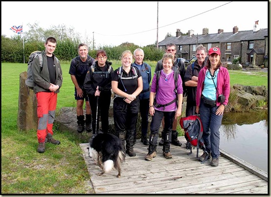
East Lancs LDWA group at Affetside

Soon afterwards we were zooming through Jumbles Country Park, beside Jumbles Reservoir on an overcast late summer's day, with the dark green foliage waiting patiently for the first autumn frosts and winds.  Luckily the impending monsoon – the most intense September storm in the UK for over thirty years – didn’t arrive until just after we finished the walk.  As I write, 72 hours later, the rain has just stopped in Manchester!

After a while we encountered the bogs and marshes of Longworth Moor.  Dave strode through them, pausing occasionally to wait for the rest of us as we picked our way through the dry bits.

An empty house, in the middle of nowhere near Old Man's Hill, had apparently recently been emptied of all contents of value before being abandoned by its owners and no doubt left to optimistic lenders to fight over its future.

Lunch was taken on a convenient couple of benches on the Witton Weavers Way path between Darwen Moor and Turton Moor.

Between the benches, a rather poorly hidden geocache in a plastic box held some modern artifacts, and a stone plaque mysteriously engraved "JPS LEFT MA??? 1894 ____ 1923" could perhaps be a relic from the area's recent industrial past, but I couldn’t find any reference to it in this wordy treatise.

Barbara made a short speech whilst we celebrated the 40th Anniversary with tea, brownies and jelly babies.

Barbara gives a speech at Turton Moor

Cathy then tried to end her days in a ditch, but Jake and Ken managed to drag her out (see slideshow for picture).  Ken had already taken a dramatic tumble when he fell off the path, and several others had also succumbed to the force of gravity in a variety of mishaps.  I’ve already noted the aging profile of LDWA members; that was clearly in evidence today, albeit we only had one walking stick between us.

In true LDWA (Irregulars excepted) style, we strode past the Strawbury Duck and its ghostly residents (nobody else looked back).

The Strawbury Duck and its ghostly residents

We continued to trail in Dave's wake on the ascent to Edgworth Moor, with Winter Hill clearly in view beyond one of the many reservoirs around here.

Bull Hill, a HuMP, could have been the high point of this walk, but the LDWA isn't a 'bagging' group, so we skirted around the hill, which was possibly just as well as a convention of trail bikes was being held on the summit.

Eventually we reached the second cross, The Pilgrims' Cross on Holcombe Moor (see the top of this posting).  Even Dave stopped to admire it, but I don’t think anyone else spotted the ghostly apparition on its top.

Peel Tower soon came fully into view, before our final descent of the day.

Dave looks towards Peel Tower

We headed quickly towards a rival group, but not even Dave could catch them, though he did briefly overhaul the lady in jeans who was just ahead of us at this point.  It must have been scary for her!

"Time for another break" announced Jake, just as the jeans lady had been caught. That meant more brownies and jelly babies in the shelter of the tower.  There was a moderately keen wind up on Holcombe Moor today. 

Dave was soon dashing off again. He had very soggy feet by now.

Towards the end of our 25 mile 'stroll'.

The golden turrets below Peel Tower, in Ramsbottom, house a Muslim education centre from where delegates are apparently often seen around the tower, but not today.

It’s not far back to Tottington from here, and after a peculiar diversion through an overgrown field we rejoined the ‘proper’ route near where the last checkpoint is situated on the Challenge walk.  Thankfully there was no maniacal barber masquerading as a Master Plumber to deflect our attempt to finish the walk before the rain, which we could see for the last hour or so, reached us.  So the final section was achieved at a good amble, past a pig called Pepper, bringing to an end at 5.30pm this excellent day out in fine company. 

I just wish I’d taken a photo of of Dave washing his feet in a bowl of hot water (from a flask brought specifically for that purpose) after finishing the walk.

There’s a 37 image slideshow here, for anyone interested.

Here's an approximation of the 25 mile (40 km) route with about 1000 metres ascent - taking 9 hours including an hour's breaks.

The Two Crosses route - 25 miles, 1000 metres ascent, in 9 hours

Monday, 24 September 2012

Friday 21 September 2012 – Ingleborough with Mick and Gayle

Mick and Gayle descending from Ingleborough

An email received from Mick and Gayle on Wednesday evening triggered this most enjoyable day trip to Ingleborough.

My day started with a visit to Bernie Bond, to deliver the photos taken when we met him and the lovely Janet on 21 July.  Janet was at work, but Bernie kindly handed me a copy of ‘British Mining No 76 – Ingleton Coalfield’, a glossy monograph of the Northern Mine Research Society that traces the history of the coalfield from 1600 to its final abandonment in 1940.  Bernie’s interest in the coalfield stems from his love of caving and from the discovery that on moving to Ingleton in 1983 he was living in a house formerly occupied by a colliery manager.  Bernie made a huge contribution to the research that has resulted in the monograph, which I shall enjoy reading.  Thanks Bernie.

Apart from a short stroll from Thornton Barn, where M&G had parked their van, to Ingleton, this was a repeat of the walk Sue and I enjoyed on 3 January 2009 – an anticlockwise circuit ascending Ingleborough via Crina Bottom and returning via Chapel-le-Dale, Scales Moor and Beezley Falls, for which we again managed to avoid paying, having arrived after the kiosk had shut.  [The ‘Waterfall Walk’ is over private land and a charge of £5 is now made for the privilege of enjoying this excellent short walk.]

Today we saw just two people on Ingleborough before the final haul to the summit, from where a large group of very old people was descending, and various others were milling around on the top, some looking muddy enough to be on a ‘Three Peaks’ walk.  Rather inconveniently, the final shower before a period of a few days’ good weather arrived as we approached the summit.  Never mind, it wasn’t too inclement to take this self-timed photo.

No wonder your hands got cold, Gayle!

Martin, Gayle and Mick on Ingleborough Summit

The furthest peak visible from the summit of Ingleborough is Manod Mawr in Snowdonia, 103 miles (166 km) away.  We couldn’t spot that today, but many other landmarks were visible through the stiff breeze.

Once away from the summit we just saw a few folk approaching the summit, a workman at the chapel, a photographer on Scales Moor, and a family engaged in trying to fall into the river at Beezley Falls, so we had the paths more or less to ourselves.  Which was just as well at one juncture when my trowel came in handy.

Up on Scales Moor, Mick was wondering how long the limestone pavement exposed after the last ice age 12,000 years ago would take to be completely ‘grassed over’.

Mick on the Scales Moor limestone pavement, with Whernside behind

Not in our lifetime, I suspect.

Especially not this glacial erratic, seen here with Ingleborough behind.

Boulder on Scales Moor

Those interested in such erratics and their formation may be interested in this Wikipedia link, and those interested in this region of North Yorkshire may enjoy reading a short document from the National Park Authority on the Yorkshire Moors and Fells.

We passed an isolated tree and, given the rather poor lighting, a hopeful photographer.

Tree and photographer on Scales Moor

There has been a fair amount of rain here in recent days, so unsurprisingly the River Doe was in spate.

On the Ingleton Waterfall Walk near Beezley Falls

There are more ‘waterfall’ images in this slideshow, should anyone be interested.

Here’s our route – about 22.5 km, with 800 to 900 metres ascent (depending on whether you believe Garmin or Anquet) taking about 7 hours.

Our Ingleborough route - 22.5 km, 900 metres ascent, 7 hours approx

Here’s the Garmin version of data: