Sue and Martin in Mallorca 2019

Sue and Martin in Mallorca 2019
On the Archduke's Path in Mallorca

Sunday, 12 February 2012

Another Ski Weekend

Martin makes it to the Fire Tower

This is the weekend of the Canadian Ski Marathon, which Sue and I have taken part in on several occasions, as has Helen.  But this year we have left the heroics to Ken, Lester and Michael, who are aiming to complete the full 160km in two days, including an overnight camp at around minus 20C, for which they must carry all the gear for the full distance.

No sooner had Ken left the house on Friday afternoon …. when the cat’s away ….

A Lobster Supper

Saturday saw Helen staying at home to digest her lobster, whilst Sue and I embarked on our traditional trip to the Fire Tower, from P12 by Meech Lake, up trails 40 and 24 to Ridge Road, and on to the Fire Tower.

It was cold – around minus 16C all day, but as you can see from the header photo, we made it to the Fire Tower.  This is the western limit of Gatineau Park’s groomed trails.  Those who wish to continue have to bushwhack from here.  The Fire Tower served as an observation post for fire rangers for around 30 years, from the 1940s, until it was succeeded by more sophisticated methods of fire prevention, such as air patrols and lightning detection.

McKinstry Cabin lies 2.5 to the east of the Fire Tower, so it provided shelter for a tea break, then on our return journey, for lunch.

McKinstry Cabin

There’s no bird feeder at McKinstry – perhaps it’s just a bit too far away for the re-supply vehicles.  But there is a good fuel store for the wood burning stove.

The wood shed at McKinstry

There’s also the regulation outhouse.  We couldn’t manage without these essential buildings!

The outhouse at McKinstry

The trails were fast today.  This is what can happen if you take a corner at excessive speed.  Luckily, no lasting damage was done.

Crash!

As has been the norm on this trip, the sun shone virtually all day from a crystal clear sky.  Below is a skier on his way along Ridge Road, at the point where our route heads down to the left along trails 24 and 40, back to Meech Lake.  In today’s icy conditions, care was needed on the final shaded sections.  Despite the grooming it can be icy in places after a prolonged period of not so cold, sunny weather with no precipitation.

Trail Number 1 - Ridge Road

Sunday, saw us (me, Sue and Helen) back at P3 for a short ski in cool minus 10C conditions.  Here’s one of the few images I took, this one whilst rattling down Gatineau Parkway over a motorway bridge, on the way back towards P3 and Ottawa.  The image, like most taken on this trip, doesn’t adequately convey the impression of steepness.

Gatineau Parkway on a Sunday morning

Sue sadly has to leave for home tomorrow, but Susan and Roy should have turned up in Chelsea, and hopefully by the time we get back from Sunday Dinner with them tonight, Ken will have returned victorious from the Ski Marathon, sporting a ‘Gold Bar’ in recognition of his achievement.

Friday, 10 February 2012

Après Ski, and the Wakefield Triangle

Les Saisons Cafe, Chelsea

Today (Friday) Helen joined Sue and me for a couple of hours’ respite from our ‘beach holiday’, by way of a whizz around the 17 km ‘Wakefield Triangle’.  This is a circuit from P17 – along trail 51 to P19 (Philippe) then back along trail 53.  Trail 53 is a favourite, as it’s one of the few trails in Gatineau Park that passes through open countryside, though that often means the groomed track is blown over with spindrift that the woodland trails don’t suffer from.

You can see from the photo of Sue on this trail that today wasn’t so sunny – there were sunny intervals, but not at the time I took the picture that would demonstrate the open countryside.  It was above freezing, so our violet wax only worked intermittently, some of the trail being cool in the shade, but some of it having turned to ice in the sunshine.

Sue on Trail 53

A planned trip to Wakefield (the town – in Quebec – ha!) was abandoned in favour of delicious hot chocolate and carrot cake at Les Saisons Cafe (pictured above) in Chelsea, where we were able to conduct other essential business next door at ‘The Pub’.

Penguin Hill

Skiers ascending Penguin Hill to the point where it is joined by Trail 30

Today I dropped Sue (exhausted from 5 days’ skiing) and Helen (exhausted from 2 days at work) at the Spa in Chelsea, then parked up at P8, a few metres down the road at the other end of Chelsea.

This put me in a great position to try out part of the 51 km Gatineau Loppet route.  Don’t worry, I only went 32 km today, but I did check out the steepest of the hills on the Loppet route, the 200 metre ascent of Penguin Hill, pictured above near the point at which it is joined by Trail 30.  As you can see, the sun beat down yet again and the temperature rose to a positively balmy 2C.

You might wonder, like I did - ‘Penguin’ – seems an unusual name for a geographic feature lying about eleven thousand kilometres from the nearest penguin habitat.

Apparently it used to be called Excelsior Hill, excelsior being the Latin for ‘higher’.  But it seems that the road currently known as Gatineau Parkway (a ski trail in winter) follows the route of something called the Penguin Trail, and that name has devolved to the steep hill that comprises the start of the trail currently known as trail 1, leading steeply up to Ridge Road.

Skiers in the 1920s were looking for a way to avoid bushwhacking from where the bus dropped them off, to a lodge at Camp Fortune that was used as a base for cross country skiing.

To fill this evident need, in stepped Joe Morin, the Ottawa Ski Club’s Director of Trails.

Continuing with one of Charles Hodgson’s well researched pieces:

“The Penguin Trail was short, spanning considerably less than a kilometre, but it was memorable. This is because Joe Morin claimed to have found a penguin in the snow just as they were finishing the trail. He caught it, put it in his backpack and skied it in to Camp Fortune where he and his Night Riders nursed it back to health. They made a sort of mascot of it and claimed that it must have walked from the southern hemisphere and that’s why it was so tired. Other people were sceptical and arranged for a visit by — as the 1943 Ottawa Ski Club Guide puts it — “learned and bespectacled ornithologists” to disprove the unlikely claim. The bird however, having regained its strength, flew out the window before the bespectacled doubters could inspect it and Joe maintained his claim that it had indeed been a penguin.”

He goes on to observe that:

“Modern day Park users may be aware that a penguin is a flightless bird. This undercuts Joe’s authority in the event of the bird leaving on the wing, though it may give a small degree of support to the “walking-thus-tired”  theory.”

Charles provides further fascinating historical background here, which can be summarised along the lines that a ‘pingouin’ was perhaps found – that’s the French name (and the location is in French speaking Quebec) for a Razor billed auk, a bird that can fly but which looks much like a penguin and inhabits the north east Canadian coast, sometimes getting lost and finding its way quite far inland — albeit perhaps not walking.

The ‘Razor billed auk’s trail’ or ‘Razor billed auk Hill’ would sound a bit odd wouldn’t it?

Thursday, 9 February 2012

Lac Philippe

Sue at the eastern end of Lac Philippe - 8/2/12

With Ken and Helen both at work today, Sue and I headed out on a cold, clear morning to P17 (Wakefield) and a 24 km circuit.

First of all we followed the groomer (which remained out of sight) up trail 52.  It’s about 8 km to the junction with trail 50.  Pristine conditions, but the abrasive icy snow soon removed our violet wax and saw us herring-boning up the slightest of inclines.  Here, Sue tries (and nearly fails) to demonstrate the technique.

Herring boning on trail 52 Waxing skis at trail 52/50 junction

By the time the junction with trail 50 was reached more wax was needed to see us on our way to Lac Philippe (pictured at the head of this posting) without too much of the ‘one slide forward, two slides back’ routine that seems to feature at times of thawing, re-freezing, and no new precipitation.

We aren’t complaining though, it’s lovely to be under pure blue skies in weather that’s not too cold (just two layers of clothing needed).

When we reached Renaud Cabin (below) it was deserted apart from a roaring fire, which meant that our sandwiches were quickly toasted on the cast iron of the fireplace.

Toasting the sandwiches at Renaud Cabin

Renaud Cabin

Bluejays monopolised the feeder, with black squirrels and woodpeckers nipping in from time to time.  Red squirrels and the smaller birds appeared after everyone else had gorged themselves on the fresh seeds, probably left by whoever had lit the fire.

A couple arrived, and a chat and an hour later we were back off to P17, via trails 54, 50, 51 and 53 – all very pleasant after we had rewaxed our skis for a second time.

Wednesday, 8 February 2012

Shilly-Shallying at Shilly-Shally

Sue Silly-Shallys outside Shilly-Shally Cabin - 7 Feb 2012

OK Gibson, put your hands up, you are to blame for this entry, for most of the content of which I have to thank Charles Hodgson and the Guide Gatineau website.

As Charles says, “anyone who walks, bikes or skis the Ridge Road in Gatineau Park knows the intimate little cabin named Shilly-Shally.

It’s located less than half a kilometre north-west of where Ridge Road crosses the Fortune Parkway, a spot known to us as ‘Gossips’ Corner’.  Keogan shelter is nearby on the south-east side of the Parkway.

Shilly-Shally is a phrase meaning “unsure” and is thought to have arisen more than 300 years ago from people saying “Shall I? Shall I?” That’s according to The Oxford English Dictionary at least.

But apparently the Gatineau Park cabin wasn’t exactly named for that reason.

Before skiers took to the Gatineau Hills, farmers tried to eke out a living along Ridge Road and one of their old buildings eventually became a snug retreat for lucky skiers. At first though as a ski cabin, Shilly-Shally was not open to the public but rented out each year for what is reported to have been the princely fee of $15 per season.

There are a few theories as to why the cabin is called Shilly-Shally.

One is that it represents a halfway point along the trail and might be a place where skiers decided whether it was worth going the whole way or turning back.

This would tie into a meaning of indecision but begs the question of “half way to where?”

Shilly-shally occupies a place on the periphery of where Ottawa Ski Club skiers ventured. It seems unlikely that it was considered a significant halfway point along the Ridge Road since skiers would have to ski the entire way back along Ridge Road; plus, in the early years, Ridge Road was still a road—in use by sleighs, rutted and not always the first choice of skiers.

Another theory also relates to a meaning of “unsure” and I like this one better. The NCC only stopped leasing Shilly-Shally for private use two or three decades ago and so there are people still alive who leased it and one of these—Sheila Thomson—has her own tale about why the cabin is called Shilly-Shally.

She and several other teenage girls were some of the earlier skiers using the cabin and what they were unsure about was how to get the wood stove going.

Here’s what she says:

“In the 1940s my father repaired this old ramshackled building that was where Shilly-Shally is now for some of our friends to stay and it was a group of teenaged girls who didn’t know how to take care of themselves; the stove smoked and they didn’t know how to cut the wood. So he called the place Shilly-Shally and the name stuck. It was a kind of pun of “chilly chalet” because it didn’t keep warm.”

The image below was found in the 1958/59 Ottawa Ski Club Year Book and entitled “Shilly-Shally cabin, near Mud Lake.””

Shilly-Shally Cabin - 1958

So the present cabin is probably quite modern…

Now then, that’s enough Shilly-Shallying around for one day!

The Khyber Pass

The Khyber Pass, above Shilly Shally Cabin

Today’s (Tuesday’s) exertions took Sue, Tim and me (Ken and Helen having both gone to work) to P7, Kingsmere, for a sunny 22 km ski, mainly along Ridge Road.

Here, two popular cabins, Shilly-Shally and Huron, are linked by a steepish hill, pictured above, that is known as the Khyber Pass.  It was quite difficult to climb in today’s icy conditions, but a joy to descend later in the day.

Shilly-Shally was host this morning to this lone red squirrel, and to nuthatches, woodpeckers and chickadees (like great tits) on the feeder.

Red Squirrel at Shilly Shally

It always seems strange to me that red, black and grey squirrels appear to live happily side by side over here, whereas in the UK the red squirrels are perceived to be an oppressed minority.  Perhaps it’s all to do with habitat.

It was about minus 6C in the Park today, with wind chill taking the temperature to around minus 15C.  However, in the calm of the trees under a warm sun it was very pleasant.  Here, Sue luxuriates in the sunshine shortly before an arduous passage along icy trail 1B, on which we worked up an appetite for lunch at Huron Cabin.

Ridge Road

It was really noticeable today how friendly everyone was compared with the weekend ambience amongst visitors to Gatineau Park.  It’s much nicer here mid week, though at weekends you are much more likely to bump into someone you know…

Monday, 6 February 2012

Monday 6 February 2012 – A Short Ski from P3

A view to Ottawa from Gatineau Parkway near P3

Just 15 minutes from home, Parking Lot P3, on the eastern edge of Gatineau Park, is just about our closest trail head.  It’s not generally a preferred venue despite the good trails, as there are no convenient cabins for lunch stops.  But today we just wanted a brief bit of exercise to punctuate what is essentially our annual ‘beach’ holiday.  So Helen joined Sue and me for a 12 km saunter from P3, along #5 for a while, then back along Gatineau Parkway.

You can see from the above picture how close these cross-country ski trails are to the centre of Ottawa.  The image below is just five minutes further along the trail, after diving off onto #5, still very close to the centre of town.

Sue and Helen head along trail number 5

So, we enjoyed another sunny day on the trail.  It was however unseasonably warm, rising to around 6C in Ottawa, a record for this time of year.  At least it didn’t rain, though!

Back at home, it’s probably colder, but the season of unhappy news continues.  Dot (my mother) has made a habit of falling over kerbs and is back in hospital recovering from her second hip replacement within twelve months.  We wish her a speedy recovery.  Meanwhile our condolences go to Pam, whose husband Len has died after a long illness.

We are pleased however to hear that John, who I visited on my way to Tyndrum a couple of weeks ago, has been putting ‘Poor Michael’ through his paces, and we also hope that Sue’s aunt and uncle, Rachael and Frank, have enjoyed their own cross-country skiing trip to northern Italy.  They are possibly, in their own understated sort of way, the fittest of the lot of us.  Keep it up, R+F!

Ski Weekend

Sue and Martin at the Champlain Lookout in Gatineau Park

It has been a lovely weekend in Gatineau Park.  I’ve written more than enough about our recent trips to this area – here – so this year it’ll just be a few pictures and some brief notes.

After our 18 hour journey on Friday, including a two hour delay at Newark and subsequent immaculate views of New York after dusk, Sue and I were pleased to don skis for enjoyable trips with Helen into the Park.  Conditions were gentle – minus 7C on Saturday, minus 5C (but cloudier) on Sunday.  Care with feet meant that last year’s severe blisters weren’t repeated; ‘kill or cure’ cured my knee injury; and Sue’s neck problem didn’t prevent her from enjoying being back on her planks.

Bohemian Waxwings were out in force in view of the header picture, taken on the escarpment above Ottawa, at Champlain Lookout, but the only deer we saw was a carcass.

Ski conditions are excellent, but may not stay that way, so there were lots of folk out this weekend.  On Saturday we parked at P9 and enjoyed a 17 km trip around the Burma Road to the Lookout, and on to Huron Cabin, which was quite busy, as you can surmise from the ski rack shown below.  Conditions for our return to P9 down Fortune Parkway were fast, reaching a steady 30kph in the groomed tracks.  Which is quite exciting!

Skis outside Huron Cabin

Sunday saw us squeezing into P16 and taking a 15 km there and back (with 19 km knobs on for me) route down trail 50 to the junction with trail 52, before returning via Herridge Cabin, where Sue and Helen are pictured below, on a somewhat greyer day than Sunny Saturday.  Ken and Michael joined us there for lunch, having set off earlier on a final short (30 km) training outing for next week’s Canadian Ski Marathon, which the rest of us are giving a miss this year.

Helen and Sue outside Herridge Cabin

Saturday, 4 February 2012

Friday 3 February 2012 – British Mountains

A British Mountain View

We passed over here yesterday.  A fine view.  But where is it?

Anyway, it looks like a fantastic weekend for strapping on the crampons, grabbing the ice axes, and having fun.

Enjoy!

Thursday, 2 February 2012

Jacob – 9 Months, and reports of a New Arrival

Jake - 9 months

The old Vaude papoose has been lent to a friend, and last Saturday Jake graduated to a new transportation system, in which he sits in a backpack, facing forwards.  We’ve known children object to this, but he was inserted without complaint, looked around for a while, then went to sleep, like his mum (Kate) used to do in a more rudimentary version of this kit.

He’s just been woken in order to be transferred to a car seat, and Sue managed to capture this ‘not too grumpy’ image.

Meanwhile, on 1 February (yesterday) Kate’s cousin Ellie managed to ‘cough up’ her own little boy after a couple of hours hard work in her living room, making me a Great Uncle (for the second time, actually).  Congratulations, Ellie.

Tuesday, 31 January 2012

Friday 27 January 2012 – A Long Preston Amble

Martin, with Attermire behind

I pottered up to Long Preston for a morning stroll with Heather, of TGO Challenge fame.  It had snowed overnight above around 250 metres, but everything was rather soggy and sunshine was intermittent at best.  I’ve been looking enviously at all the wonderful photos from people who managed to get out on the following day (Saturday), but hey – we had a nice walk, and my knee survived.

Only a few pictures were taken, and those worth retaining were all taken from about the same spot – a small col to the east of Sugar Loaf Hill, from where the rugged outline of Attermire Scar provides a stunning backdrop, and there are also good views back down towards Ribblesdale.

Heather, and the view to Attermire

Our brief glimpse of the sun at this, our far point of the walk, was soon eclipsed by the blackness of a rain laden sky which thankfully kept its counsel (just about) until we were able to take cover in Heather’s house, where tasty Welsh rarebit and salad was comfortably washed down with a welcome mug of tea.

Looking back to Black's Plantation

On the way back to Long Preston we passed The Hawes, a 100 acre site where native broadleaf woodland was planted in 2003.  The site, which Heather thinks has recently changed owners, is intended to attract a wide variety of wildlife, and welcomes visitors.

Further along the track, Bookilber Barn, wrecked for many years after a fire, has been converted into luxury holiday accommodation for up to 12 people.  Strangely, I’m unable to get any idea of prices from its website!

Here’s the route we took – a very amenable little excursion from Long Preston - 14km, 270 metres ascent, taking a leisurely 3 hours.

Our route: 14km, 270 metres ascent, around 3 hours

Thanks for your company, Heather, I enjoyed this short outing.

The rest of the pictures are here.

Monday, 30 January 2012

Thursday 26 January 2012 – Audlem to Nantwich – A Stroll along the Shropshire Union Canal

The Shropshire Union Canal near Audlem

Dave and I had planned this little excursion over some Christmas jollities, and our plans actually came to fruition, with Andrew joining us for a short stroll alongside a canal.

The 12.05pm 'number 73' from Nantwich bus station took about 25 minutes to deliver us to St James' Church in Audlem. Outside the Gothic church, which dates from around 1278, is a pillared buttermarket, built in 1733, next to which is a 'bear stone', to which a bear was chained whilst men paid fees for their dogs to bait it.

St James' Church, Audlem, plus Buttermarket and bear stone

There are plenty of pubs in Audlem.  Today we chose the Shroppie Fly, a former granary warehouse that has only relatively recently been converted into a pub.  The bar is made out of the original Shroppie Fly – a grain carrying barge that used to work the canal.  A log fire roared in the middle of the lounge.  Good ale, and bacon and egg butties, prepared us for the cool but bright weather outside, but we were still reluctant to venture from the cosy warmth…

The large crane outside the pub is a relic from the past – it was used for loading and unloading, involving the canal and a now defunct railway.  In days past a cheese boat sailed to Manchester; every Saturday morning local farmers would cart their cheeses down here for loading.

The Shroppie Fly

Lock 13, just outside the pub, is the lowest of a flight of locks that descends into Audlem from the south, ensuring good business for Audlem's hostelries, and especially this one.

Today’s stroll was basically just along the towpath, in a northerly direction to Nantwich.  The sun was on our backs, casting long shadows.  Beyond Moss Hall – a timber-framed manor house dating from C17 - clear views to the north east on this cool January day drew the eye as far as the western edges of the Peak District.

A view from the Shropshire Union Canal near Audlem

A Thomas Telford aqueduct sees the canal over the River Weaver, far below, with an information board disclosing a few of the birds you can expect to spot hereabouts.  Today there were large groups of Canada Geese, mallards, moorhens, kestrel, sparrowhawk, mute swans, rooks, crows, wood pigeons, starlings, numerous hedgerow birds, and back in Nantwich the brief sighting of an unmistakable Little Grebe or ‘Dabchick’.

A new marina has opened on the west bank of the canal.  Lots of boats are clearly stored there for the winter, and some were being lovingly maintained/restored as we passed by.  Further on, this lone tree, home to a few rooks or carrion crows, caught my eye.

A lone tree on the west bank of the Shropshire Union Canal

Milestones are judiciously placed to nudge travellers along their way…

At the height of the canal era, fast ‘fly-boats’ would speed along here, between Birmingham and Ellesmere Port, carrying up to 25 tons of goods such as butter, cheese, ham and grain from the farming communities, and coal, timber and limestone from industrial centres.  To make the journey as fast as possible they travelled through the night, with the aid of huge oil lamps.

Canalside milestone

The Shropshire Union Canal Society has provided frequent facilities for 'cruisers' – on this stretch there’s a whole series of picnic benches with frames for disposable BBQs - making no doubt for a leisurely and convivial summer's evening scene.

Picnic benches - courtesy of the Shropshire Union Canal Society

Half way along our walk we encountered a top secret diversion. It was a difficult job, but after some debate we cracked the code and successfully worked out the secret hieroglyphic that pointed us towards the ‘bunker’.

Which way to the Top Secret Bunker

Sadly, the location (see map below) is so secret that people only seem to be able to find the place at weekends during the winter months.  It was locked up and we were unable to spy on any secret goings on.  The Secret Bunker would however provide an interesting diversion should this walk be attempted at a weekend or in the summer.  The website is quite fun in itself!

Soon we were back beside the canal, heading towards Nantwich again and passing under the railway before taking a right turn away from the canal.

Arriving at a pedestrian crossing, in the absence of a lollipop man a decision was made not to attempt to cross in front of the traffic.

Whoosh!

A pleasant stroll through the market town of Nantwich, where St Mary's Church is known by some as the 'Cathedral of South Cheshire' returned us to our cars, judiciously placed in a leafy suburb next to a welcoming tea shop (aka chez Dave and Maggi).

St Mary's Church, Nantwich

Here’s our route – 14 km in about 3 hours:

Our route - 14 kn, in 3 hours

Very enjoyable too – here’s a slideshow with some of the same text and a few more images.

Sunday, 29 January 2012

A Weekend in Tyndrum – 21/22 January 2012

On the breezy summit of Meall Odhar (656m)

Oops, I’ve got a week behind!  Sorry!

Annual trips to Canada and a variety of other factors have resulted in the winter bunkhouse weekends that I was in the habit of organising being missed for the last few years.  That’s a shame, as they were enjoyable affairs.  But this year our visit to Canada is later than usual, so I was delighted to be able to tag along on this XXL Hillwalkers Club weekend based at the By The Way Hostel in Tyndrum.

A leisurely journey up north in constant rain (perhaps the reason for the lack of traffic) on Friday afternoon was punctuated for me by afternoon tea and Shirley’s excellent carrot cake, with John in Kilmarnock.  Well worth the effort.  We were classmates at Guisborough Grammar School and hadn’t crossed paths for nearly 13 years.  John’s garage is a motor cycle museum – the WW1 bike he is currently working on looked magnificent.

Anyway, I was soon enjoying a giant burger and chips in the Real Food Cafe, in the excellent company of a number of XXLers.

By Saturday morning it was still raining and clearly blustery high up.  Twenty or so of us set off in different directions, mainly with modest objectives, all carefully letting others know where we were going.  I joined a small group whose plan was to venture to the summits of two nearby 2000 foot hills, Meall Odhar and Fiarach, having decided that my original aim to get to the loftier 3053 ft summit of Beinn Chabhair was perhaps a little optimistic.

Those who hadn't started in waterproofs soon rectified their omissions as our group of seven took the forest track towards Cononish, the site of a proposed gold mine, then up over easy rough ground to an obvious fire break. Meall Odhar lurked easy looking above.

Through the firebreak, we ascended for a distance of about 200 metres, keeping to the left of the stream, before taking a right and a left and rising to a long rake left onto an open hillside with fine views towards Beinn Dubhchraig, Ben Oss and Ben Lui.

"Grim up there!" muttered Alastair, who with Margriet not feeling too well, strained to keep the group together.

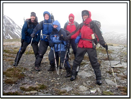
After a while, six of us reached Meall Odhar summit - 656 metres – pictured above.  Margriet assures us that she also made it to the top, a bit late, but she did join us later for lunch.

Meall Odhar summit - 656 metres - a trifle breezy

That's Beinn Ghuirn (880 metres) in the background - I think Jerry made it to that summit before the wind strengthened (it was merely breezy at this point).

We soon turned tail – looking ahead to our next objective, Fiarach, whose 652 metre summit presented itself as an easy looking little bobble on the near horizon.

Lunch was taken in a sheltered spot at the foot of the firebreak.

The convex slopes of Fiarach soon beckoned for all apart from Margriet - “I’ve already been up there” she announced “I’m going to have a relaxing afternoon”.  The rest of us safely negotiated a nail biting river crossing (see map below) before meandering up the easy convex slopes of Fiarach.

By now it was rather windy; we tried to stay in the lee of the wind, heading past a small waterfall towards a high point in the distance.

We reached that high point. The wind pinned us down. It was still about 500 metres across the plateau to the true summit, with very little more ascent.  Alastair and I waited for the others to arrive.  He crawled over to them.  I tried to stand – a mistake - and twisted my knee with the sickening tweak that indicates real damage, as I was blown across the hillside. Luckily, we had deliberately chosen this easy hill with no significant crags.

I watched as Simon retreated on hands and knees in search of less extreme conditions.  Meanwhile, Alison’s rucksack had been opened by the wind.  Its contents floated around the top of the hill for a while before mainly being recovered by a manically crawling rescue party.

It was a challenge to move anywhere - Alastair reckoned the wind was around 70 mph.

Crawling away from near the summit of Fiarach, where we got pinned down

Trying to escape from being pinned down, we mainly crawled/bumslid to a slightly calmer area before descending on easier ground.

I struggled with my sprained knee, and was glad to (eventually) reach the relative calm of the valley and the easy West Highland Way path, from which there were good views back to Meall Odhar and Beinn Ghuirn.

In 1306 the Battle of Dalrigh took place near here.  Clan MacDougall’s warriors defeated Robert the Bruce and in the process gained a royal jewel called the Brooch of Lorn.  Robert the Bruce had recently killed the Red Comyn, a rival to the Scottish Throne.  After losing the battle of Methven in June 1306 he fled into the Highlands, eventually making his way into MacDougall territory. Unfortunately for Robert the chief of the MacDougalls was a relative of Red Comyn. A simple stone bench beside the West Highland Way marks what is believed to be the site of the battle.

Nearby is the ‘Loch of the Legend of the Lost Sword'. It is said that Robert the Bruce ordered his men to fling their weapons into the loch to lighten their load. Amongst the weapons were his massive sword, which was reputed to have been between five and nine feet in length.

The Loch of the Legend of the Lost Sword

We soon passed a vegetation-free scar that marks the site of a lead crushing plant; minerals that leached into the ground have prevented vegetation from growing for many years in this area that is rich with minerals.  The proposed gold mine at Cononish is indeed just ‘up the road’.

It was something of a relief to return to the sanctity of the hostel by 4pm, leaving plenty of time to prepare for a most enjoyable ‘Burns Supper’.  We discovered that only those with modest aspirations for the day had succeeded in their objectives, and others had like us failed to reach summits that barely exceed 2000 feet.  Our aspirant Munroists had all been driven back at around 700 to 800 metres.

Here’s our route: 18km, approx 1000 metres ascent, 6hrs 45mins.

Our route: 18km, approx 1000 metres ascent, 6hrs 45mins

Stuart's Burns Night Speech made for a perfect grace, before we were tucking into an excellent Burns Supper and the camera took cover for the night.  This was the camera that was recently ‘drowned’ following its dunking in a sink for a few minutes after a mountain bike ride.  Total immersion in a bowl of rice seems to have revived it.  Today was too wet for me to risk a more pricey possession!
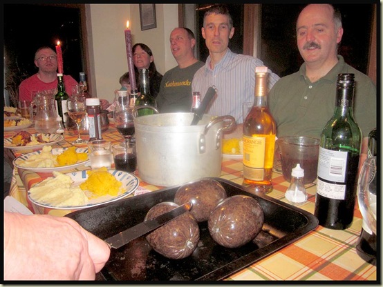
A Burns Night grace

Sunday 22 January – saw me leaving for home after breakfast.  The sprained knee needed rest, not exercise.

It also benefited from frequent stops, this one just about catching sunrise over the Crianlarich Hills.

Sunrise over the Crianlarich Hills

The David Stirling Memorial - unveiled in September 2011- celebrates the 70th Anniversary of the formation of the SAS (Special Air Services) Regiment, with new plaques in remembrance of the Regiment’s casualties.
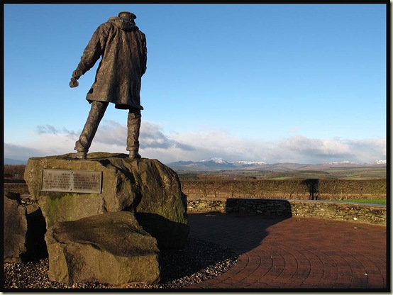
The David Stirling Memorial

The Memorial enjoys a fine panoramic view to the west, which for a short period will grace the head of these pages.

Readers will be pleased to hear that my sprained knee is slowly improving.  I hope it recovers as well as the Ixus 105 camera that was used for Saturday’s photos.  There’s an album covering the whole weekend that can be viewed as a Picasa slideshow (39 images) here.

This will, I’m sure, be remembered for some time as a trip when numerous folk who had climbed all the Munros, many of them in winter conditions, failed to summit the small hillock known as Fiarach.  Few can boast of such a dramatic failure!