Sue and Martin in Mallorca 2019

Sue and Martin in Mallorca 2019
On the Archduke's Path in Mallorca

Monday, 12 May 2008

Monday 12 May 2008 - TGO Challenge Day 4 - Plan - Coire na Cloiche to Cougie

Today’s report is here; the planned route and statistics are shown below:

1 Coire na Cloiche
2 Ridge at 795 metres
3 An Socach
4 Col at 1100 m
5 Mam Sodhail
6 Carn Eighe
5 Mam Sodhail
4 col at 1100 m (NH 116 247) – Coire Leachavie
7 beyond Affric Lodge
8 Allt Garbh
9 Allt an Laghair
10 Cougie (B&B)

Statistics
26 km
1370 metres ascent
11.2 hours
(3 Munros)


Report
Back to Index

Sunday 11 May - TGOC Day 3 - The Wrong Side of the Road - Luxurious Hotel to Coire na Cloiche

Actual: 20km, 1320 metres ascent
As planned, except that we ascended Sgurr nan Ceathreamhnan by tomorrow's 795 metre col in preference to the 875 metre col, to which there was no obvious path. That added about 1 km and 100 m ascent to our planned day.
Time 8 hours 55 mins including 2 hours 25 mins stops.
No of Challengers seen: 0
No of SYHA wardens looking for Cameron McNeish: 1


Last night we did our best to fill our massive room with steaming laundry, but to be honest the last couple of days hadn't really stretched our wardrobes.

More of a problem was how to keep our fresh supplies of CCS, retrieved from the sanctity of Cluanie Inn's wine cellar, cool.

The timing of the hotel breakfast dictated a lie in, so we were extremely well fed and well rested, with much lighter pockets, by the time we left at 9am to trudge past some dessicated road kill up the surprisingly unboggy path to Alltbeithe SYHA and our first scheduled CCS point.


But would there be anyone with whom to share the Chocolate Caramel Shortbread?

A few messages before I continue, as it's hard enough to make these entries, let alone respond to comments:
Thank you for your comments, Aktoman and Theo. Yes Theo, we had a most pleasurable and sociable evening on Thursday at Kintail Lodge, and we really were heading east and the other lemmings were clearly heading for the wrong cliffs!
But as you can see from today's header, we have erred ourselves, having progressed all of 300 metres east in nearly 20 km of walking! Scary, at that rate this could take all year!
To Two Yards of Lard (great blog BTW), yes the Pyrenees are wonderful - we could tell you more if you care to join us on Tuesday 27 May - see the evenings link on topwalks.com.

Back to today (or whatever day in the past this is before anyone reads it...)

We lingered at Cluanie to send a message to WD, wondering how he was faring this year. Was he testing a 'Spot' gadget? Had he tested it yet? We told him it was raining, but by the time we got outside it had stopped.
T-shirts were duly deployed for the stroll to Alltbeithe, passing swallows, deer (live and road kill), wagtails, cuckoos, pipits, tadpoles, crows, a vole, wheatears, dog violets, wood anemone, lazy butterwort (ie not in flower), lesser celandine, and more.
I wished I had my copy of Hostile Habitats on board (excluded due to weight restrictions) - but that would probably have made this entry even more boring.

Just before Alltbeithe we met a couple of chaps, first humans of the day, who told us the mountain weather forecast gave an 80% chance of the Munros being clear. So they were heading up in the hope that the cloud would lift above its current level of 400 metres.

The bridge to Alltbeithe SYHA (in the background)

We spent an hour in the hostel with Steve, the warden. He had seen many TGOCers but thought we would be the last through his patch this year. So no takers for the CCS (except Steve), so we now have a CCS mountain!

Where WAS Mike the Knipe??

Steve seemed quite upset and concerned that Cameron is not doing the Challenge this year, and asked us to pass on his message to Mr McNeish - 'There's a pot of tea waiting for you at Alltbeithe next year'. (That's if Steve doesn't do the Challenge himself.)

We continued on from the ecological, conservationist miracle that masquerades as an SYHA hostel, up a good path to the cloud at 400 metres. Steve had jested when he saw that we were determined to stick to our planned route into the clag - 'You never know, you might get an inversion.' Some hope, we thought.

Mackerel fillets in a hot (should read 'tasty') chilli dressing, and almost inedible 'School Bars', bought because they seemed too good to be true at the Outdoors Show, helped speed us on our way to the planned camping spot.

I'd never been here before, but the map had done its job and produced a choice of flat pitches in the heather with the sound of running water nearby. With visibility down to 10 metres we couldn't see the latter.

So the tent went up and off we went to bag a new Munro for Sue. It was only 2.30 so we had to do something, despite not being able to see much beyond our noses. Would we ever find the tent again?

After going to the wrong col - which was really the right col - and deploying full waterproofs to combat the wet mist, we got up to about 1000 metres when the sky brightened. Eureka, Steve's hunch had been right and we suddenly popped out of the mist. The top 100 metres of our hill, Sgurr nan Ceathreamhnan, was bathed in sunshine.

A few distant peaks poked out of the cloud, including Carn Eige, but not the hills to the south of Alltbeithe that the lads we met this morning were climbing. There were 10 people on top when we arrived, huddled above the sea of cloud as if marooned on a small island. It was calm and warm. There was a trace of Orange, so I tried valiantly to post the picture attached here.


But it was not to be. The 30 minutes we spent up there was however most enjoyable.

Blogger with arms not quite long enough. Must take a 'blogging pole' next time?

Eventually we strolled back down into the cloud and fumbled our way into camp around 6 pm, leaving plenty of time for a leisurely evening and more verbal diarrhoea from yours truly.

Next day: Day 4
Plan
Report
Back to Index

Sunday, 11 May 2008

Sunday 11 May 2008 - TGO Challenge Day 3 - Plan - Cluanie Inn to Coire na Cloiche

Today’s reort is here; the planned route and statistics are shown below:

1 Cluanie Inn
2 Path junction
3 Leave A87
4 Allt a’ Chaorainn
5 Alltbeithe YHA
6 Coire na Cloiche (camp)
7 Ridge at 875 metres
8 Sgurr nan Ceathreamhnan
7 Ridge at 875 metres
6 Coire na Cloiche (camp)

Statistics
19 km
1300 metres ascent
8.7 hours
(1 Munro)

Report
Back to Index

Saturday, 10 May 2008

Saturday 10 May - TGOC Day 2 - A 12.5 km Ridge - Ridge Camp to Cluanie Inn

Sue on the ridge - misty but warm

Actual: 18km, 1282 metres ascent
Again, the route was exactly as planned, time 8 hours 25 mins including 1 hour 55 mins stops.
No of Challengers seen: 2 - a Skipp and a Boston, both heading west. Scary!

Yesterday two folk passed by late on, as we were washing up. We assume they had done the whole ridge. They should have made it down just before dark.
We felt good to be high on the ridge in excellent camping weather - no wind, no midges, no ticks, no cuckoos, a blanket of cloud to keep us warm, and fine views. We didn't envy these people. Nor did we envy Robert Slade, who we met yesterday and who intended to do the whole ridge then. We had noticed him start by heading up the path to The Saddle, then he joined the correct path by a devious route, before thrutching up the steep hillside rather than follow the well graded stalkers path on which we encountered him for the last time.
More haste, less speed, is a phrase that comes to mind.
We wish Robert well and hope that his misplacements remain minor.

A short walk from camp last night revealed a spectacular gash in the hillside as we looked down towards the coast - brilliant.

Despite dire warnings about the possible lack of water on the ridge, I was always confident about our camping spot being well supplied. As it was, we pitched just close enough to the stream to be lulled to sleep, but not so close that it kept us awake.

The morning seemed bright, but closer inspection revealed that we were engulfed in a cloud. By the time we struck camp at 8am we were still in the cloud, but it was warm and windless so t-shirts were soon deployed.

As we approached the first Munro summit of the day two lads from Dunfermline caught us up and joined us for a chinwag with a ptarmigan on the summit. This seemed to disorientate them. After 20 minutes they set off in the direction from which they had arrived!
'Hang on, shouldn't you be going this way?' We pointed to our own line of departure.
We set off whilst they had a great debate, hunched over their map and compass. Ten minutes later they passed us again.
'You'll be pleased to learn that you're heading in the right direction', they informed us before disappearing into the mist in search of Dave Skipp (on our instructions, of course).

By the time we reached our third Munro of the day the mist was clearing and we had views towards both Cluanie and Glen Quoich. We spotted a figure coming towards us.

'Going to Montrose?' It asked.
'Yes, Roger, and you?'
'Of course!'
'Do you realise you're going the wrong way, Roger?'
'Oh'
'Yes!'
'Well I have this gadget' -points to big orange box called 'Spot' on his breast plate - 'All I have to do when I get lost is press this button and a helicopter will come and rescue me.'
'So it tells you where you are?'
'No, it tells someone in America where I am and they arrange for me to be rescued' - 'Don't be silly, if I knew where I was I wouldn't need to be rescued, would I?'
'No, why don't you get a GPS?'
'Good idea.'
And so, after accusations of Dave Skipp, who we had expected to meet, having 'nicked my route' this mutant form of Dave Skipp, known as Roger Boston, headed off happily towards the west coast.
(Scuse the poetic licence, Roger, we know you were in full control!)

The weather cleared further and we enjoyed a lunch with a view from the lofty vantage point of Aonach air Chrith.
A lone figure slowly toiled up the hill towards us from the east.

'Hello Dave'
'Yes I know, I'm going the wrong way, those lads from Dunfermline told me!'
'Good, Roger's also going the wrong way and he's just ahead of you.'
'Who's Roger?'
'He's that strange man from Elgin - he's just ahead of you.'
'I had a litre of whisky but I drank a lot of it last night.'
'That's probably why Roger's overtaken you then!'
'Who's Roger?'
...and so we left Dave to enjoy his 'wrong way round' skip to Montrose.

They were the only two Challengers seen today. After the encounter with Dave we saw a few day walkers, one group of whom obediently waited for us to exit a narrow section of the ridge, then politely doffed their caps as we went by.
Wow!

Then we passed an elaborately drawn arrow - the lads from Dunfermline later told us they had drawn it to save us from getting lost - and a carefully drawn message in the mud from Dave, imaginatively entitled 'Hi Martin'.

More pictures from the superb ridge - what a contrast between the 'phone camera and the Canon S70!
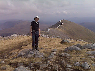
The descent to Cluanie was tedious but direct, and thankfully uneventful.

We dutifully checked in with Roger Smith at TGO Control before sinking into a hot bath, a sumptuous meal, and a comfy bed, in roughly that order.

We head into Affric tomorrow, probably outside the great Orange empire, so you may not hear from us for a while (apart from our automated route plans, which may get out of phase with our daily reports).

Bye for now!

Next day: Day 3
Plan
Report
Back to Index

Saturday 10 May 2008 - TGO Challenge Day 2 - Plan - Creag nan Damh to Cluanie Inn

Today’s report is here; the planned route and statistics are shown below:

1 Wild camp
2 Sgurr an Lochain
3 Sgurr an Doire Leathain
4 Maol Chinn-dearg
5 Aonach air Chrith
6 Druim Shionnach
7 Creag a’ Mhaim
8 Coirean an Eich Bhric
9 A87 main road
10 Cluanie Inn

Statistics
18 km
1300 metres ascent
8.6 hours
(6 Munros)

Report
Back to Index

Friday, 9 May 2008

Friday 9 May - TGOC Day 1 - Life After Denis - Shiel Bridge to Ridge Camp

Actual: 16km, 1287 metres ascent
Route was exactly as planned, time 6 hours 50 mins including 1 hour 20 mins stops.
No of Pidgeons seen: one staggeringly large one.


Setting off

There are 66 people starting from Shiel Bridge. This made it a busy place last night, so I can't mention everyone. It was good to chat to John (former 'Deputy Dawg') and Stef; it was nice to see Doug Bruce again, and Bernie and Pauline Marshall, and Dave Skipp (to be congratulated on imminent parenthood) was in great form - he had a long day in prospect and would be having an early night. Denis saw to it that Dave was still going strong in the pub at 11.30. Dave doesn't drink in halves.

Today we met some more Challengers, and Sue tried to entice them with her Chocolate Caramel Shortbread (CCS), a batch of which was placed next to the signing out sheets.

'Hello' said one charmer 'I'm Lilo Lil'.
'Where's your lilo?'
'I'll show it you later...'

Anyway, back to last night. Some of us managed to escape from the alcoholic haze generated by Denis, to view a lovely, if cloudless, sunset in lovely clear evening light. The Kintail Lodge Hotel did us proud with some good food, and everyone got to bed 'happy'.

So dragging ourselves out of bed this morning may have been a problem but for a timely good luck message from Weird Darren that doubled as an alarm call. Darren dropped out in style through illness last year and is nervous. But he has a more sensible route this year, and a more reliable companion, and I'm sure he will be fine.

If Darren's call hadn't got us up, Bernie's sizzling bacon (we were staying in the Trekkers Lodge where you can self cater) would have done.

The hotel breakfast was adequate, and by 9am we were ready to leave.

Since then we have met just one Challenger, Robert Slade, a first timer who found last night's spirit of camaraderie in the bar just a little daunting.

We have spent the day in t-shirts. It was hot. An 8 km road walk, despite the pretty carpet of violets and lousewort, isn't the best way to start the Challenge, but it did get us efficiently to the point where we could stroll easily up the stalkers path to Bealach Duibh Leac, breaking the 700 metre climb with long elevenses and lunch stops.

From there it was an easy stroll to our first summit - the Corbett - Sgurr a' Bhac Chaolais. On the way down we saw two other Challenger like people approaching from a strange direction around the side of the hill over very rough ground. We left them to it and they didn't follow us along the ridge, preferring to descend into Glen Quoich.

By now it had clouded over, with spots of rain, but the weather held for long enough to allow us over our first Munro summit of the South Cluanie Ridge, including a bit of easy scrambling.

Ten minutes later we were down at 755 metres, setting up camp on a sward of flat grass beside a babbling brook exactly where we had planned to be.

We were fully installed by 5 o clock, so tonight we have plenty of time to cook, read and write. Hence the verbosity of this entry! They may be shorter in future.

Sue admires her first batch of Angel Delight, our delicious camp dessert...

Blogger sets off, looking for a signal before dusk

Next day: Day 2 - Plan Report Index

Friday 9 May 2008 - TGO Challenge Day 1 - Plan - Shiel Bridge to Creag nan Damh

Today's report is here; the planned route and statistics are shown below:

1 Kintail Lodge Hotel – Shiel Bridge
2 leave road to ascend by Allt MhĂ lagain
3 Bealach Duibh Leac
4 Sgurr a' Bhac Chaolais
3 Bealach Duibh Leac
5 Creag nan Damh
6 Wild camp by stream at NG 986 111

Statistics:
16 km
1300 metres ascent
7.8 hours
(1 Corbett)(1 Munro)


Report
Back to Index

Thursday, 8 May 2008

Thursday 8 May - Coast to Coast in 7 Hours

It's 6.30 am and ScotRail's smart new bicycle friendly train is whisking us on time to Aberdeen under a blue sky tinged with haze, with early morning mist blanketing the fields.

The yellow of the rape has been replaced by the less vibrant yellow of fields of daffodils. It looks like a fine crop.

Not a Challenger in sight until we reach Elgin, where more heavy rucksacks appear.

Bright yellow gorse flashes past, stunningly beautiful against the deep blue sky. Pigeons and crows peck the freshly ploughed fields. Cherry blossom and bright white blackthorn provide a welcome contrast with the predominant yellows.

Reaching Inverness, gravitating to the café a number of Challengers exchange greetings. We are suddenly in the company of hallowed names:
Colin Tock - in his breeches and red socks, looking more than ever like Walter Poucher without the perfume;


Fowkes and Towers clans feature here

the Towers twins from Settle - still going strong at 75;
Bernard and Margaret Fowkes, on their 16th crossing - Bernard is this year's oldest male Challenger, he is 80 in June;
Moray Allan and David Lynch, very jolly chaps on just their second crossing;
Markus Petter, from Austria, who is going to spend a couple of days in Applecross before reaching his starting point.
Geoff Reed, on his 5th crossing after a 10 year gap. The airline he travelled up on gave him a bottle of champagne on arrival at Inverness. He was already carrying 18 kilos. So he drank it. All of it. Geoff likes a drink. He retired yesterday.
Nearly everyone we have met seems to like a drink actually...

Nallo Lady had time to make an unscheduled distribution of CCS (Chocolate Caramel Shortbread) to this fine band of people before we boarded the Kyle train.

Passing lagoons with eider ducks, our transport now determinedly tried to leave the east coast. Buzzards and other birds of prey hovered hungrily above new born lambs.

But we steadily lost our new found friends as they disembarked at Achnasheen and all stations to Kyle.

Then we were alone again, with only the cuckoos and Bob Phillips for company.

Compared with three weeks ago everything is very green, and free from its white blanket. Primroses line the hedgerows.
The Cuillins shimmer in the heat as we take the short bus journey to Kintail Lodge Hotel to bag a bed for the night.

A lazy afternoon ensues.

Then Denis Pidgeon arrives. He is writing a book about his escapades with another blogger, Alan Sloman.

Blogs are allergic to Pidgeons!

But we did escape briefly to capture the Kintail Lodge Hotel in the evening light, before a fine sunset, marred only by the total absence of any cloud.


Next day: Day 1
Plan
Report
Back to Index

Wednesday 7 May - Blue Skies

Blue Skies and a blazing sun kept us company all day as we sped up to Scotland. We diverted briefly to the Lake District for coffee with Judy and Andy at their wonderful house above Grange over Sands. On a clear day they can see the summit of Snowdon, nearly 100 miles away, from their living room.

Then we lunched in the company of Tebay's greedy mallards and gulls, before continuing in the heat past comatose cows and siesta loving sheep along the increasingly quiet motorway.

Bright yellow gorse and even brighter rape were our companions for the latter part of the journey.

The Little Mermaid provided an excellent fish supper whilst Old + St Andrews Church glistened in the evening sun behind the Guildhall, which dates from 1763.

Then we enjoyed a stroll on the beach in the evening sun, before adjourning to Alison's immaculate flat in Bents Road and the comfort of her excellent Marlborough Sauvignon Blanc.

Well, we've reached Montrose. Where next?

Next Day
Back to Index

Wednesday, 7 May 2008

Tuesday 6 May 2008 - Long Distance Walkers and Orion Marches

Daryl May finished his JOGLE walk at the end of April. This true gentleman contacted me immediately to let me know and thank me for taking the trouble to seek him out. It was my pleasure, Daryl. Alan Sloman did likewise, was treated likewise, and has recorded his feelings here. I completely agree with Alan’s thoughts.

Also ‘on the road’ at present are Gayle and Mick, heading north on their LEJOG. For a bit of daily entertainment I recommend Gayle’s humorous entries. They are doing well, already having reached the Offa’s Dyke path.

Thomas, another American acquaintance, called me from York last week. It was good to hear from him (I still have to report on our travels together last year). By now he should be progressing smoothly along the West Highland Way in his inimitable septuagenarian fashion. Good on you Thomas, I hope the sun is shining and you are making lots of new friends.

That brings me to ‘Orion Marches’. That Michael Roberts’ book of poetry referred to in my blog of 30 November.
Jim Perrin’s article in June’s TGO magazine brought it back to me. The lines he quotes from ‘The Green Lake’ are favourites of mine:

The mountain lake mirrors the hills, and the white clouds
Move in a blue depth, the hut stands empty:
No one appears all day, nothing disturbs
The symphony of ice and yellow rock and the blue shadow.
And at dusk the familiar sequence: the light
Lingering on the peak; and near the horizon
Apricot-coloured skies, then purple; and the first stars;
An hour of bustle in the hut, and then silence.

But Jim is trying to relate the poem to the remote bothies found in the UK. Like me, he would often prefer to camp outside rather than endure the dark, hovel-like interiors. But the poem is not about those sorts of places. It’s about Alpine Huts, with guardians, where climbers rise early and return late; where it’s too rocky and icy to camp outside. These are great places of companionship, with huge ‘mountain meals’ prepared by the guardian and his family.
Great places.
I met Thomas at one of them – Lagazuoi – in the Dolomites. The character is often provided by the people who run them; that’s why we stay there, we are made to feel welcome. Unlike the hovels that masquerade as bothies in the UK. I don’t like them (how did you guess), but some hostels in the UK are wonderful. You need go no further than Gerry’s, in Achnashellach, to discover this fact.
As for Alpine refuges, it’s not quite the type Michael Roberts wrote about in ‘The Green Lake’, but the Marialles Refuge below Mt Canigou in the Pyrenees is one of many that hold wonderful memories – five of us staying, speaking three different languages, but with common interests and goals. The evening featured a wonderful stew from the lady guardian, who then embarked on a reading from a book about a Buddhist priest in Thailand. “Très philosophique” she said!

Today’s postcard is the early morning view from that Refuge prior to our ascent of Canigou the following day (13 September 2004).

Sunday, 4 May 2008

Sunday 4 May 2008 - The Pyrenees Revisited

This afternoon we had the pleasure of meeting Andy and Jan.
This summer Andy is planning to walk the Pyrenees High Level Route (HRP) with his friend Gaz. They intend to blog about it here. Andy is an experienced backpacker and well up to the challenge, but he still needs to finalise his maps and gear. We hope he benefited from the visit to see what we took with us in 2004, listen to our reminiscences, and view the 79 images that Sue made into a slide show for her colleagues at the time (that alone took an hour!). They only have Ton Joosten’s Cicerone guide at present, and are aware that despite containing much useful information this guide does not endear Mr Joosten to others. We strongly recommended that Andy and Gaz obtain a copy of Georges VĂ©ron’s ‘Pyrenees High Level Route’ book – the latest English translation of which is a 1991 Gastons-West Col Publication. This is a superb guide book, by the man who devised the HRP, that includes much alternative and wet weather route advice; the Cicerone guide is twice the weight and describes a single route with variable accuracy and little mention of alternatives.
We will be happy to help Andy and Gaz further should they need that, but at present we have them to thank for helping us to re-live a wonderful couple of months in 2004.
I do intend to put more on the web about that trip, probably within this blog. Meanwhile, see here for details of our planned and actual routes, blogged to the spreadsheet at the time, together with reports on a couple of the more interesting days.
The ‘postcard’ for today was taken at our wild campsite beside Lac d’Ansabère on 6 August 2004. The sun was on the tent until 8.30, eagles nested above us, vultures were feeding on an unseen carcass in the valley below. There was no sign or trace of any other humans as we lazed in the sun, transfixed by the lovely reflections in the lake.
Happy Days indeed.

Friday, 2 May 2008

Friday 2 May 2008 - TGO Challenge - all ready to go

Well, the train tickets have been purchased and arrived efficiently in less than 24 hours, the kit has been put in a pile (see above), the food supplies have been strategically stashed, the chocolate caramel shortbread (CCS) has been baked, route cards have been printed, accommodation booked, etc, etc.
So we are ready with almost a week to spare.
Amazing!
Our planned route and kit lists are here.
And, if you like, you can follow our blog as we amble across Scotland, starting next Friday (9 May), distributing CCS in our wake.
Some estimated statistics, just to fill out this entry,
with 2007 actuals in red:
Distance - 325 km (203 miles) / 343 km (214 miles)
Ascent - 12730 metres / 12942 metres
Munros - 16 / 2
Corbetts - 3 / 8
Grahams - 1 / 2
Marilyns - 0 / 1

Forgive me, but I'm sure I've missed something - it must be harder than this...
Perhaps you'll let me know?

...Thanks Theo - Estimated number of pubs visited = 10 (minimum) / 7 (so a more sociable route this year)

Thursday 1 May 2008 - Tegg's Nose

This evening, after a quick beer in the Leather's Smithy, Sue, Andrew and I headed down to Bottoms reservoir, built in 1850 to 'water' the people of Macclesfield, with a maximum depth of 32 feet and a capacity of 34 million gallons. It was a lovely clear sunlit scene.

Ahead of us Tegg's Nose loomed large. A number of cyclists were enjoying the fine bright evening. Our route took us along the Gritstone Trail into Tegg's Nose Country Park.

As we ascended the views opened out - across the Cheshire plain, past Jodrell Bank, to the mountains of North Wales; the Shropshire hills stood out to the south; the Cat and Fiddle Inn, on the Macclesfield to Buxton road, looked very close, and the frequently visited summit of Shutlingsloe was illuminated by the evening sun above the trees of Macclesfield Forest.

A lot of work seems to have been put into the Tegg's Nose experience, not least a series of attractive signs and information boards. Not a mark of graffiti in sight. Some walk commentaries are here.

The image below depicts the following:
"The story starts in a warm, tropical sea 350 million years ago when Britain formed part of a landmass on the equator. This time was called the Carboniferous Period.
Life was plentiful in the clear, warm water. Corals and shelled animals lived and died, their remains forming the limestone of the central Peak District.
These idyllic tropical conditions did not last forever."

Duly humbled, we continued on past more recent relics from Tegg's Nose's days as a quarry.
It has been a quarry for some time, perhaps as far back as the fifteenth century.

There is some display machinery that used to work in the quarry. A small stone crusher (pictured), a crane and a big square thing that’s actually an old stone saw that used to be run by a steam engine.

The quarry supplied stone for stone kerbs, flagstones and stone cobbles. Some of the time it was quite small scale. Other times, teams of men worked the quarry extensively. There’s evidence of a railway track around the quarry. The rubble was dropped over the end of the nose below what is now a viewpoint.
Between 1928 and 1934, Tegg’s Nose stone was used to widen the promenade at Douglas on the Isle of Man. (Just thought I'd share that fascinating snippet with you!)
During the last war, the Americans came with big lorries and pneumatic drills and quarried for aggregates to make runways. The pneumatic drills were popular with the locals as they gave them a break from blasting, which had a nasty habit of throwing stone into the surrounding valleys...

The sun set as we strolled past the Visitor Centre along the ridge that used to lead to the Setter Dog pub where the quarrymen used to celebrate their continuing good health after visits from the doctor. Most of them were dead from silicosis by the age of 50. Sadly, with the quarrymen long gone, the pub has recently demised and is now 'Peak cyclesport', which may be an excellent cycle shop.

Our route now headed across fields to Warrilowhead Farm, situated in an imposing position on the side of a hill, then over slightly marshy ground to Ashtreetop.
Darkness was gaining on us as we stumbled over some final stiles, across a tarmac road and into the depths of Macclesfield Forest. Luckily, bearing left at a wider track, we soon reached an old barn known as Dimples, from where the brightly chipped main route through the forest led us gently down to the metalled road that links Forest Chapel with Langley. This used to be part of a Royal hunting forest and subject to very strict laws, but is now under Water Board ownership, and a valued public amenity.

Before long we were enjoying more beer in the Leather's Smithy, with the landlady (unusually, and strangely) being jealous of our outing on this wonderfully fine and clear evening.

The 7 km route, with 300 metres of ascent and taking about two hours, is shown below.

Thursday 1 May 2008 - Victoria Cave and Sugar Loaf Hill

This afternoon I set off up Constitution Hill from the bustling market place of Settle, on a breezy, sunny day.

I lunched next to a family of weasels in a field beyond Banks Lane, overlooking the pretty village of Langcliffe. Ingleborough lurked in the background, the hat on its summit occasionally dipping below its brow.


The brightly lit summit of Penyghent appeared through the bars of a gate.


A group of twenty elderly hikers in big boots and full waterproofs tramped towards me from the direction of this moss laden wood. But it didn't rain today, and my Roclites didn't ship any water, so the garb of these plodders remains a mystery.

I headed up a cart track, past a barn, to a junction where a newly laid path led up to Jubilee Caves. I chose not to visit them, turning instead to the right towards Victoria Cave.

Information from 'Out of Oblivion' indicates that Victoria Cave was discovered by chance by a dog chasing a fox in 1837 and since then has been completely excavated.
Within the cave’s thick clay deposits, scientists found an amazing record of climate change in the Dales over thousands of years.
Victorian excavators were particularly fascinated by ‘bone caves’ where there might be a possibility of finding evidence for the earliest humans along with long extinct animals. Victoria Cave certainly had plenty of animal bones. The earliest, at 130,000 years old, included those of hippos, narrow-nosed rhino, elephants and spotted hyenas. They date to an Upper Pleistocene interglacial when the climate was much warmer than today.
It seems as if at that time, the hyenas were using the cave as a den and dragging scavenged bones back to it. No evidence was found for human activity during this period.
The glaciers then returned and from 120,000 to around 12,000 years ago the cave gradually filled with layer upon layer of clay deposited as the glaciers periodically melted.
After the last Ice Age the cave was used by hibernating brown bear. In amongst the animal bones of reindeer was an 11,000 year old antler harpoon point, the first evidence for people in the Yorkshire Dales.
For archaeologists, the Roman layers were even more interesting. Here a collection of unusual bronze and bone artefacts were found, including brooches and coins. The unusual nature of some of the finds has led archaeologists to believe that the cave was being used as more than just a storage place or shelter for craft workers. It may even have been some sort of shrine.

I hadn't brought a torch, and soon came to a dark dead end. I decided (for reasons of not having a torch) not to go up to nearby Attermire Cave, whose keyhole like door leads to a high winding passage, followed by a long crawl into a lofty chamber containing a pool.
Worth a visit sometime...

My route took me south, ignoring a prominent cairn at 440 metres and soon dropping to a path junction where tracks led determinedly east towards Malham, and west directly back to Settle.
The path rose gently to reveal a wonderful panoramic view behind me to the north.

I left the path to ascend Sugar Loaf Hill, pointed out to me earlier by Heather on our walk around Long Preston. Here's the view towards Pendle Hill from its 370 metre summit.

A sharp descent brought me quickly down to a tarmac road, High Hill Lane. Heading towards Settle, I quickly turned left down Lord Elphus Lane, past a wood, towards the pleasures of Cowpasture Plantation, from where this rural scene had replaced the views of rugged limestone outcrops.

A right turn before reaching Lodge Farm took me along a good path towards Settle.

Mint sauce had been on my mind for the entire walk!

I'd done about 10 km, with 350 metres of ascent, and had taken about 2½ hours. The route is shown below.