

Sue and Martin's Big Adventure
Day 7 - Sunday 1 August 2004 - Stage 6
Postcard Summary (on yesterday's card)
Very
wild camp to Col
Long hot day. Storm at camp at 1035
metres – 9.75 hours, 24 km, 1200m ascent
Sitting in the tent after a storm
listening to cowbells. Today has been
hot again and we’ve climbed further. The
route included some of the Santiago di Compostella pilgrimage route, so we saw
loads of people. It’s interesting finding
water sources, and with one dry today we had to raise a manhole cover to obtain
water!
Diary Entry (by Martin)
Up at dawn on another hot day. To be our longest yet. Started at 7.45 after rising as usual at 7. High mountain in the east not visible. Followed Véron's route, more or less, all day.
Up at dawn on another hot day. To be our longest yet. Started at 7.45 after rising as usual at 7. High mountain in the east not visible. Followed Véron's route, more or less, all day.
Last night was
another sheet sleeping bag only night for most of the night. Very hot despite
being on top of a ridge in a strong breeze. Lots of horse bells all night.
Ascended Errola, 907 metres, 8 o'clock, 25°C - breezy.
By 8.15 we were at Col de Méharroztegui. Annoying horse flies here and for a lot of today. Quite a few bites. Our four litre supply of water from les Aldudes was finally finished beyondCol deTeilary, but on reaching
Col
A Frenchman
helpfully tried to point out the interesting bits of our route ahead. 26°C.
Lots of grasshoppers around today, and hunting platforms - huge ladders up to 'tree
houses' in the tree tops. Used presumably for shifting game birds towards the
gunners in the shooting butts lining the hillsides next to the woods.
By 8.15 we were at Col de Méharroztegui. Annoying horse flies here and for a lot of today. Quite a few bites. Our four litre supply of water from les Aldudes was finally finished beyond
 |
| Shooting butt on the ridge |
We have seen
some alpine plants, eg spring (like) gentians, from the start, but today some
familiar saxifrages and thistles and other alpine plants became more evident.
We reached the hill fort summit of Lindux, on the border - 1220 metres -
highest summit yet at 11 am. A very windy 29°C here. Strong southerly wind.
Horses on the summit. They seem to choose high points to look miserable at
during the day, then descend to feeding areas lower down at night.
From here there were extensive views of our route back as far as La Rhune. On a good day theAtlantic should be visible from here. So we travailed
pleasant beech woods to get to Col
From here there were extensive views of our route back as far as La Rhune. On a good day the
 |
| Looking back to the Roland Memorial |
This is
apparently a very historic site, but we don't know why. The next 4 km was up a
metalled road to Col Lepoeder. We met huge numbers of people here. Just as well
I had accomplished my first alfresco ablution earlier.
 |
| The road to Col Lepoeder |
We are on GR65 and GR11, the former being a pilgrim route to Santiago de Compostella, and lots of people are doing it. Later we meet a French couple doing GR11, a Dutch couple doing nothing in particular, and a lone Englishman lost on GR11. Laurie-like, he had a rucksack and an old bag to supplement it. (Laurie - RIP - was a friend of ours who completed a section of the HRP wearing two rucksacks. On one day when Dave and I had arrived in Gavarnie , set up camp, showered, and gone to a restaurant, Laurie stumbled into the restaurant with all his baggage. "Ah" exclaimed the French "your porter has arrived!")
We met many
people on the descent to a 1380 metre col. Before this we had lunched in a shady
glade on the way up to Lepoeder, on the road from which there were good views
of Roncesvalles and its huge looking
monastery.
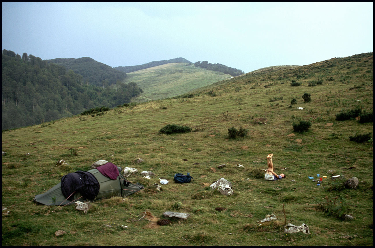 |
| Camp site near Col d'Orgambidé |
Stats
and route (Viewranger):
25
km, 1250 metres ascent, 9.75 hours

5 comments:
I presume that is Sue in the odd posture in the last photo - what was going on there?
Yoga?...
Oh!
Yoga. That would, naturally, be after a gentle run to warm down?
Of course...
Post a Comment