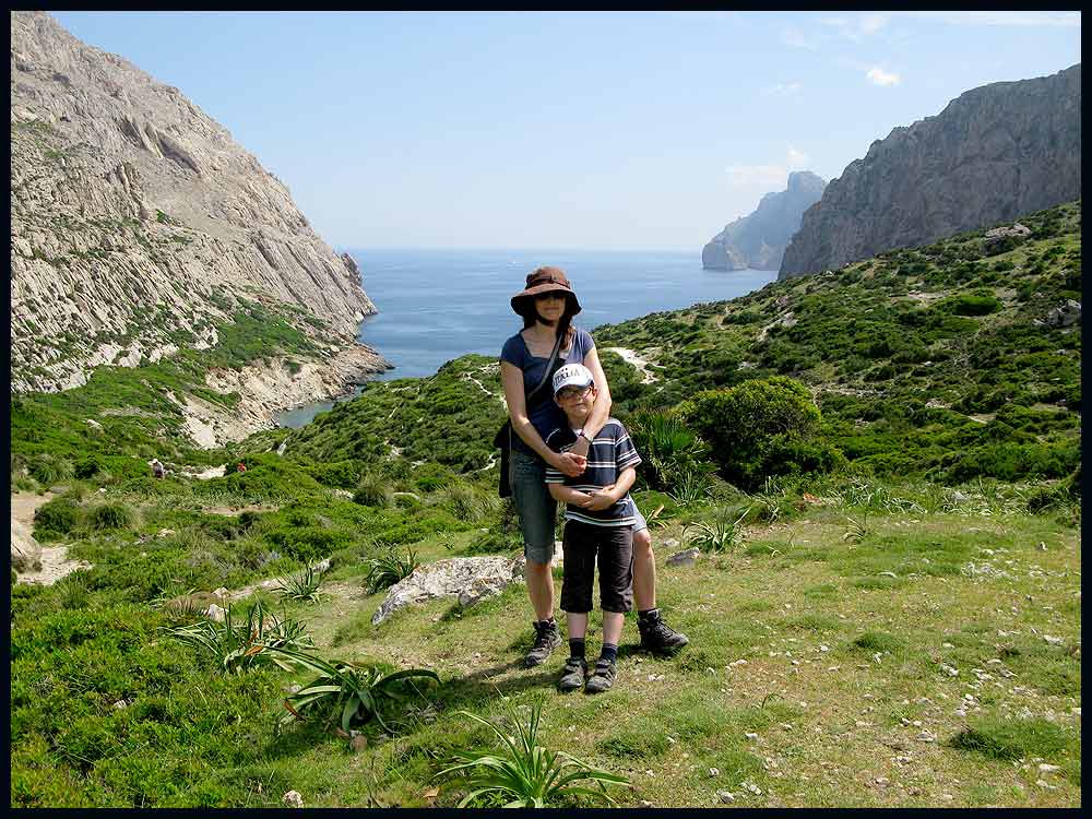
Sue and Martin in Mallorca 2019

Sue and Martin in Mallorca 2019
On the Archduke's Path in Mallorca

Saturday, 19 June 2010

Thursday 17 June 2010 – Standedge to Crowden – Blue Skies on the Pennine Way

Gayle kindly provided the impetus for today’s little excursion.  We met her at 9.30 at Standedge and left her around 3 pm at Crowden, to return home whilst she continued towards Bleaklow to enjoy a wild camp by Torside Brook.

We chose a good day to join her on her FAT (Football Avoidance Trip), the weather being typical  for the UK in June – why would anyone wish to be elsewhere at this time of year?

Sue and Gayle stride out from Standedge

At Black Moss Reservoir we chose an easy route across White Moss and Wessenden Head Moor, rather than the more undulating Pennine Way route.

New flagstones across White Moss are giving the previously heavily eroded moorland a chance to recover.  Gayle was puzzled by the vocal opposition she had heard to such flagged paths; but I’m convinced that the majority of us are in favour of properly constructed pathways across such moorland, enabling the eroded vegetation to recover.

Newly laid flagstones on Black Moss

The white bags on White Moss contain bundles of heather and seeds, to help with the regeneration of the natural moorland.

Heather bales and seeds

The short section across Wessenden Head Moor to join the Pennine Way before Black Hill is little used and would be very boggy in wet weather.  But with the current paucity of Pennine Rain, Sue and I found it quite easy to hop across any damp patches in our trail shoes, though Gayle got slight ingression due to wearing Flip8s (which she likes, but which do at all times attempt to act as sponges).

An anxious curlew wheeled around us.

Curlew

We spotted this prone object beside the path, and realised the cause for concern, before hurrying on.

Curlew chick

The summit of Black Hill was a sun trap today.

Norman, doing the Pennine Way on a B&B basis, but with a bigger rucksack than Gayle, kindly took this photo for us.

Black Hill summit

Gayle was astounded by how much the area, which used to be a 365 days a year quagmire, had recovered since her previous visit two years ago.  Her observations are here.

The sceptics would have us walking through deep bog in a 100 metre wide section of eroded moorland.  I like this newish path towards Dun Hill.

The path to Dun Hill

A long lunch stop in the sunshine followed, and then a buzzing helicopter dropped a team to attend to a lady with a twisted ankle.

As we descended past Laddow Rocks towards Crowden, numerous Mountain Rescue personnel rushed past, in various states of breathlessness.  We half expected a medic to be following them up in case they collapsed themselves.

A busy aircraft ‘motorway’ was in operation above us – obviously no volcanic ash problem today!

Eventually, at around 3pm, the path to Polly (our car) led down past the ice-cream haven called Crowden, whilst Gayle’s route to Glossop (she never did get there) headed off in the other direction.

So sadly our ways parted, but it had been an excellent little outing.

Parting ways at Crowden

Gayle’s report is here, and her Black Hill observations are here.

Our 15 km route (see below), with 350 metres of ascent, took a leisurely 5.5 hours, though Mr Slowman Naismith would have cut nearly two hours of that time!

The day's route - 15km, 350 metres ascent, 5.5 hours

The full slideshow (29 images) is here.

Wednesday, 16 June 2010

Stalwart TGO Challenger Models 2011 Dress Code

TGO Challenge 2011 Dress Code Presumably TGO Control approves of this dress code, which should enable the Austrian Challenger, Markus, to feel more at home than usual in Scotland next year.  Though Markus had threatened to attend in a kilt.

This was brought to my attention by one of the early Challenge bloggers, who will no doubt be spending a couple of weeks next May chasing around Scotland looking for cheese and wine parties, as explained by another stalwart outdoors blogger in his 30 May 2010 posting.  [Having managed nine wild camps on this year’s Challenge without meeting a single other Challenger, I have to admit to being somewhat baffled by the latter posting.]

Thank you, everyone, and I hope you’ll forgive me for borrowing the image in order to convey this important news.

Monday, 14 June 2010

Saturday 12 June 2010 – A Trip to Dunham Massey

Dunham Massey House
The House looked good, on a busy day at this National Trust property.

Sue and I enjoyed a 5 km stroll around the grounds and along the canal.  The ponds are full of Yellow Water Lily.

A pond full of Yellow Water Lily

The fallow deer range in colours from white to very dark brown.

Fallow deer at Dunham Massey

One stag was lying a few metres away from a family who had set up a badminton court.  He was studying them closely!

The spectator

It was a lovely day for eating outdoors, but we had a commitment, so delayed the BBQ for a day.  No photos from that, as it was abandoned due to ‘inclement weather’!

Sods Law!

Sunday, 13 June 2010

Mallorca – 29 May to 5 June 2010 – Casa (Villa) Galvany

In the garden at Casa Galvany

Here’s a final posting for our recent trip to Mallorca.

There’s a full slide show (218 images) here.

Highlights (100 images) are here.

Images in and around Casa Galvany (27) are here.

Our trip was organised through James Villa Holidays.

It wasn’t a walking trip as such.  But earlier starts could have taken us to some higher parts of the island, where the temperatures would probably have been amenable.  It was pretty hot where we were near sea level.

We used a Cicerone guide and also a Discovery Walking Guide and map; this conveniently links in with the walks, which are numbered on the 1:40000 scale map.  I also found this Guide useful on a visit in November 2006.

It’s a lovely part of the world.

Friday, 11 June 2010

Thursday 10 June 2010 - A Great British Ridge Walk - Number 22 – Helvellyn by Striding Edge and descent via Swirral Edge

A planned (at very short notice) stravaig over Place Fell was foiled by a ‘steering rack that was leaking hydraulic fluid faster than that leaky oil rig in the Caribbean’. 

So, no Pie Man or Bruno today.

But I couldn’t let this stop me from enjoying a day in the hills, especially as I now have my own independent means of transport.  Just as well, as Sue was to enjoy her first taste of work for many months today.

Some folk I’d bumped into on this year’s TGO Challenge just happen to live by the start of a Great British Ridge Walk, which coincides with the start of the aborted stravaig.  Moreover, Marian was happy to join me for a day in the hills.

So after a leisurely coffee in Patterdale with Mike and Marian, the two of us set off along an exclusive route to Lanty’s Tarn and thence to the fellside above Miresbeck.

Bluebells seemed to be getting the better of a section of bracken steeped hillside, but for how much longer, I wondered?

Bluebells

The forecast had predicted that the low cloud would clear.  The ‘Place Fell’ plan would have seen us out of the cloud for longer than this back-up plan, as demonstrated by this last view to Glenridding and across Ullswater to Place Fell, before we entered the thin cloud.

Glenridding, Ullswater and Place Fell

It wasn’t unpleasant, though gloves and a windproof top were deployed for a while.  We traversed Striding Edge in a fairly purist manner, Marian being an accomplished climber, meeting and parting with a variety of folk who were avoiding the ‘airier’ sections.  Eventually a large party of schoolchildren, queuing to descend the final steep little chimney gully before the easy ascent to the summit of Helvellyn, briefly held us up.  We were happy to wait, but their attentive leaders insisted on us passing through.

Once on the summit plateau, we passed the Gough Memorial, erected in 1890 after both Walter Scott and Wordsworth had alluded to the death of Charles Gough in their poetry.  The memorial reads:

Beneath this spot were found in 1805
The remains of Charles Gough
Killed by a fall from the rocks 
His dog was still guarding the skeleton

Today the wind was light.  Nobody would fall.  A happy bunch munched in the mist at the trig point.

Helvellyn Summit

Marian and I didn’t attempt to locate the other memorials, one of which commemorates the first landing of an aircraft on a British mountain on 22 December 1926.  We headed down Swirral Edge and on to Catstycam, where we enjoyed Part Two of a lunch that had been commenced in a sheltered spot above Bleaberry Crag.

The route down the steep north west ridge of Catstycam seems to have become popularised since Marian last used it (I’d never been there before – I think), and a clear path ran most of the way down.  We paused for a while after emerging from the mist below a steep, slippery section above Kepple Cove Dam, abandoned in October 1927 after after a cloudburst caused it to burst, resulting in devastation to Greenburn lead mines and Glenridding.

  Kepple Cove Dam

Marian, on the lower slopes of Catstycam

After traversing a disused leat (an open watercourse conducting water to a mill, etc) to join the path from Red Tarn, we descended to Glenridding Beck, where a group of helmeted youngsters were in the beck, making their way up the gorge.

We found some Starry Saxifrage and Cuckoo Flower here, as well as this little cutie, who turned out to be a champion jumper.

A common frog

The cloud never really cleared, despite the encouraging forecast, but Rake Cottages, on the Greenside Road, did seem to be basking in their own little private oasis of sunshine.  I’m sure they deserved it.

A Glint of Sunshine over Glenridding

Near Lanty’s Tarn, Marian pointed out the small Round-leaved Sundew plants.  They were everywhere!

Round-leaved Sundew

Well, not here, but I am probably standing on some Tormentil whilst posing for this photo with an Ullswater backdrop.

A dull day, with Ullswater

I’m glad that Marian could join me today.  We enjoyed a good chat – the opportunity for that eluded me for most of the TGO Challenge – spotted a few items of interest, and I would never have discovered her excellent routes between Patterdale and Lanty’s Tarn, returning down one of which we passed a rich collection of wild flowers and some exotic trees.  You’ll have to go to the short slide show to see them, if you’re interested…

Here’s an overview of today’s route.  Bill Birkett’s version starts from Glenridding, but the start and finish at Patterdale has lots to commend it.  It was about 16 km, with 1100 metres of ascent, and took 6.5 hours, though you could easily knock an hour of that timing.

Our route - approx 16 km, 1100 metres ascent, in a leisurely 6.5 hours

We saw not so much bird life, but lots of wild flowers today, including:
Bluebells
Bugle
Buttercups
Butterwort
Cuckoo Flower
Greater Stitchwort
Herb Robert
Lousewort
Common Milkwort
Wavy Bittercress* (Cardamine flexuosa)
Round-leaved Sundew
Starry Saxifrage
Tormentil
Umbellifers - various, including Pignut* (Conopodium majus)
Wild Pansy
Wood Speedwell* (Veronica montana)

* = as subsequently confirmed by Marian.

Tuesday, 8 June 2010

Thursday 8 June 2006 – Dinas Fach and Newgale Sands, from Dinas Fawr

Dinas Fach and Newgale Sands from Dinas Fawr
I didn’t get out much today, but I can offer this glimpse of a trip that topwalks.com’s archive simply refers to as ‘cloudless’. 

The whole week was cloudless.  We walked from Milford Haven to Trefin.

It was a busy time….trips, work, etc.

Must write it up sometime!

But for now I’m happy to recall that cloudless day from exactly four years ago, when six of us walked from Little Haven to Solva, via a long stop in the Duke of Edinburgh Inn at the end of Newgale Sands, where we sought refuge from the blistering heat. 

The UK coastline certainly takes some beating, especially in places like Pembroke and the South West Coast Path.

Monday, 7 June 2010

Monday 7 June 2010 - Back at Home


It’s not so bad though. The proud swans of Lymm have been busy in our absence, and the swifts arrived much earlier than they did last year – they’ve been living under the eaves of our house since mid May. This morning a large family of newly fledged great tits enjoyed a spell in the garden, where the flowers are blooming nicely.

Saturday, 5 June 2010

CĂºber Reservoir


Here we are at CĂºber Reservoir on another hot, cloudless day.

Luckily we were up near 700 metres, so the heat wasn't as stifling as it would have been lower down.

The walk was only 3 km, with no ascent, so that made life easy.

Can anyone identify the peak in the background?

Sent using BlackBerry® from Orange

Friday, 4 June 2010

A Trip to L'Havanor


The Pixies demanded an 'at home' day. So Sue and I disobeyed by heading off (the statutory 15 minute drive) along the SĂ³ller road as far as Mortitx.

Today's 3 hour, 11 km stroll with about 350 metres ascent was along a good track with fine views.

Starting from the Mortitx vineyard, it soon crossed a stile to pass an allegedly dangerous cave system accessed through a locked door, before meandering through groves of ancient olive groves (pictured) with a Mediterranean backdrop.

The cloudless day may have been sultry at sea level, but up at heights of 300 to 500 metres it was very pleasant. As long as you didn't move too fast.

On the way to L'Havanor are two dams on the Torrent de Comes. The 'torrent' was scarcely a dribble today, though both the small reservoirs were reasonably full. The upper dam was being patrolled by a large blue dragonfly that was seeing off all other visitors from its personal feeding ground.

Beyond the dams the track undulated past a surprisingly flat ploughed field before reaching a fine viewpoint. We lingered there, well beyond the branch path that led down to the small L'Havanor house (Rifugi), absorbing the views before returning by the way we had arrived.

The countryside hereabouts is rough and rugged, but surprisingly green, with lots of spring flowers still in bloom. The sea was mirror-like today. Flat calm. It's an area where there's a breeding programme for rare Black Vultures, and that's what the ever closer black specks in the azure sky that were floating towards us near the end of our walk turned out to be.

Superb.

Sent using BlackBerry® from Orange

Thursday, 3 June 2010

The BĂ³quer Valley


Today we enjoyed another little escapade from the rigours of living in Casa Galvany, situated just below Puig de Maria, with its dovecote, budgie sanctuary, 'goldfish' pond, exotic pot plants, BBQ area, pool, pizza oven (not yet used) orange, lemon and fig trees and neighbouring horses, sheep and chickens.

This time our customary 15 minute (or less) drive took us to the pleasant resort of Port de Pollença. Our 'there and back' stroll comprised all of 6 km and less than 200 metres ascent. We headed up the BĂ³quer Valley, through a narrow defile to the broad 80 metre Coll del Moro, before descending to a small stony beach speckled with patches of tar and strewn with piles of flotsam.

However, the narrow bay (pictured beyond Hazel and Andrew) is unspoilt and in today's fine, hot, windless weather proved irresistable to Sue and Al, who retained more modesty than some of our European neighbours who had also found the prospect of a swim irresistable despite their lack of equipment.

The rest reserved their swimming energy until after lunch in the shallower waters of Puerto Pollença, whilst I replenished our supplies of Vino Collapso Rosé (aka Faustino V11 Rioja 2009) ready for later consumption by pool and BBQ.

It's a tough life!

Sent using BlackBerry® from Orange

Wednesday, 2 June 2010

Parc Natural de S'Albufera


Apparently Pliny wrote about the Night Herons we saw here today being sent to Rome as a gastronomic delicacy.

These days it is such species as the Crested Coot (pictured - very similar to a common Coot, but with two red headlamps and a bluish beak) that are sent here from places like South America to set up breeding colonies in a bid to avoid extinction.

The wetlands were drained for agriculture in C19. What land was left has now been restored and turned into the Mediterranean's largest wetlands nature reserve.

Apart from the Night Herons and Crested Coots we saw quite a few of the remaining 301 different species to be found here. Presently there are numerous egrets and other herons, lots of ducks and grebes, many small waders, and small birds like the Sardinian Warbler.

Fish jump in the rivers and lakes. Ospreys and other birds of prey soar high above, no doubt awaiting suitable opportunities.

It's flat. We stayed at sea level today. For the heat...

Sent using BlackBerry® from Orange

Tuesday, 1 June 2010

The Ascent of El Calvari


The Pixies counted 408 steps up Pollença's Via Crucis (pictured), a carved stone stairway lined by ancient cypress trees which ascends El Calvari (Calvary Hill) to the north of the town centre.

At the top some religious art from the Neanderthal Period surrounds a much revered C13 statue of Mare de Deu del Peu de la Creu (Mother of God at the Foot of the Cross) in a simple, courtyarded chapel.

Lunch at La Scalinata restaurant back down in one of the main squares seemed to take up most of the rest of the day...

The BBQ is warming up for a long evening.

The ascent data for this week's trip, if you hadn't noticed, has gone from 300 metres on day 1, to 200 metres on day 2, to about 100 metres today. Snorkeling equipment has been laid out by one member of the party in anticipation of the continuing trend.

Sent using BlackBerry® from Orange

Monday, 31 May 2010

The Ascent of Puig de l'Aguila


Today's ambitious target was the 214 metre summit of 'Eagle Peak'. It's a short stroll from Cala Barques, in Cala de Sant Vicenç.

The walk up the gently graded and finely constructed old track passes an ammunition store tunnel which was good fun with the Pixies. It goes at least 30 metres into the mountain before opening into chambers with a short circular route between them.

Our little group is pictured close to the summit, which Sue and I then visited on a hot and blustery day before recommencing our determined bout of R + R.

Kate appears to have hidden her body behind Andrew so as to create the scary impression of a child with two heads.

Believe me, it's as scary as it looks!

Sent using BlackBerry® from Orange

Sunday, 30 May 2010

The Ascent of Puig de Maria


Here's the view from this ascent towards the market town of Pollença.

We are happily installed in Villa Galvany with Al, Hazel and the Pixies, from where this modest summit is just an hour's stroll.

After the intimacy of Pollença's Sunday market, Al and I enjoyed the quiet 300 metre ascent to the Santuari de la Mare de Deu des Puig, home to various religious houses from 1348 to 1988.

Nowadays, luckily, it's a bar-restaurant-refuge. We enjoyed a beer, chatted to the goats, tried to peer down to our villa (failed, it was too close) and explored the chapel and its magnificent refectory.

Then it was back to the villa to test its impressive barbecue.

All very relaxing...

Sent using BlackBerry® from Orange

Saturday, 29 May 2010

Raining in Timperley


But it's 25C at dusk after a sunny day here.

The wine is cooling.

Even the red wine.

The cheese is on its way.

Life is good. Let the R + R commence.

Sent using BlackBerry® from Orange

TGO Challenge 2010 – Index and Links

Glencoe from Beinn na Caillich on 18 May 2010
I’m inserting this entry now, to be completed when I return from the next trip.  It will index all this year’s Challenge postings to make them more readable, and will include links to other blogs, slideshows, web pages, etc.

In the meantime, if you wish to view the entries chronologically you can click here, go to the oldest posting, and rather tediously scroll upwards for newer postings.

I’d like to thank those who have made kind comments on the rather hurried postings made as I tried to maximise my enjoyment of long days in the hills over the past couple of weeks.  They really are appreciated.  You are not the only readers – in addition to the thirty or so ‘followers’ the readership doubled from its normal 100 page loads a day over the duration of the Challenge. 

The photo was a self-timed effort taken from the summit of Beinn na Caillich, just after 7 am on Tuesday 18 May, featuring the Pap of Glencoe.

Friday, 28 May 2010

A Tale of the Unexpected

Route of the Year Award - 2010! Chuffed?

Yes, just a bit.  But congratulations to all those short-listed for this unheralded new award.  I’m sure their routes were every bit as well planned as mine in their varying ways.

Wow!

TGO Challenge 2010 - Day 14 - A Wet Day around Montrose

Having walked Day 14's route on Day 13, an enjoyable and relaxing time was had around Montrose with Graham B, chatting to both old friends and complete strangers as they drifted in to the Park Hotel from their various finishing points.

We popped out to St Cyrus, in the hope of a stroll along the beach. But the heavens opened. The café by the bus stop had been expecting its annual surge in business a week earlier, so they were relieved to get it today. My 'ploughmans' was excellent. A stream of Challengers passed through before heading to the bus stop. A lucky trio - Andrew, John and Norma - all part of this year's 'Lochailort Tribe' enjoyed being delivered to the door of the Park in Graham's charabanc.

More of the same - rain, chats, to and fro from the camp site, refreshments, etc, until the bar gradually filled prior to the traditional Thursday evening dinner attended by over 200 Challengers and the great and good from TGO magazine.

MC Roger Smith conducted proceedings impeccably as always, with all Challengers in the room being called upon to take a bow according to the number of Challenges they have completed, plus a special mention of certain individuals, absent friends and overseas participants.

Then special awards to those who had just completed their 10 crossings - including Mike Knipe, the infamous Pie Man of Crook Town, followed by just two awards for those who completed their 20th crossings this year - to a very Proud Scotsman and an equally proud (not to say eloquent) Englishman from Settle.

After that, before more time in the bar and a very late stagger back to the camp site - a surprise - a new award.

More of that later.

So, that's almost it. The 31st TGO Challenge is nearly over. Stragglers will arrive on Friday and proceedings will draw to a close. Then preparations for next year's event will swing into process. It's a year round job for Roger Smiith, the stalwart organiser of the event.

I should also mention Cameron McNeish's announcement that Emily Rodway will shortly be taking over from him as editor of TGO magazine. Cameron will become 'Editor at Large', whatever that is.

There will be a short further posting and the insertion of an index and a few more images and tidying up of information, with links to a web page and a slide show. It'll be a couple of weeks before that happens. In the meantime I plan to rest and recuperate in sunnier climes far away from the Montrose Rain, which seems strangely absent from today's snap of a small section of the final camp - it's an illusion!

Sent using BlackBerry® from Orange

Thursday, 27 May 2010

TGO Challenge 2010 - Day 13 - Tarfside to Montrose - Dash to the Bash

Distance walked: 43 km (Cumulative: approx 340 km, 212 miles)
Metres ascent: 400 (Cumulative approx 15,600 metres
Time taken: 11.1 hours including 2.7 hours stops
No of TGO Challenges now completed: 4

A leisurely start saw me strolling down to The Retreat (aka Glenesk Folk Museum) for breakfast with Tim and Kate.

Then it was on down the picturesque Esk valley, along pleasant paths in good company (Tim, Kate, Bernie, Martin, Jeremy and others) to Edzell. The last section, on my own through beech glades beside a river gorge, was particularly scenic.

A field ginnel led to the main street, where rucksacks outside the Tuck Inn revealed one of the Challenge's favourite pots of gold. Lunch, with Steve Gough and later joined by many others, including Alan Kay, who was the first person I encountered on my first Challenge three years ago, was sumptuous, delicious and lengthy. The chocolate nut sundae was wonderful.

It's not far to North Water Bridge from here, and despite the leisurely day so far it was only 2pm. Phone messages indicated there may be a small 'Bash' tonight with Heather T-S and others, with Heather having to leave for home early on Thursday.

It would be rude not to make the effort to say hello to an old friend...

So, a quick change of gear, on a full tank of fuel, saw me zooming on, past North Water Bridge, along the planned route, almost exactly as shown on the previous posting, to the dunes at Montrose.

Of all my approaches to the coast, this was the most direct and had the least road walking. Very satisfactory, with nice woodland interludes between quiet lanes, though there was a narrow passage of prickly gorse towards the end.

It also provided a last taste of solitude before the Fleshpots of Montrose and next week's partying with the Pixies of Hale.

A storm that hit me for an hour or two after passing North Water Bridge eased sufficiently for me to take a self-timed picture at my finishing point.

The firm sand steadily became softer as I approached the camp site via an increasingly laborious 3 km plod down the deserted beach, its pristine sands glistening in the low sun. Then it started to rain again. Quite hard. So when the camp site was finally reached at around 6.45pm it was good to see the familiar faces of David Albon and Heather T-S and accept their offer of porch space for the rucksack whilst I whipped up the Phreerunner.

Graham Brookes also arrived after a 'bagging' trip in the Arrochar area, so after saying hello to him, experiencing a warm dribble in the 'shower', and gathering my few valuables, I set off to The George for a beer with a select band of Heather, David, Skippy and Julie. Numerous other Challengers were enjoying the George's good food, but we were to move on.

It was a short stroll to the excellent 'Indian Cottage' restaurant, where we saw the day out in style. This included an 'awards ceremony' during which David Albon conducted a 'toast' for all Challengers present, depending on the number of times they have finished. Cameron McNeish's table yielded the largest number of 'first timers' (including Cameron), with today's toasts culminating in one for Skippy and Humphrey, who had just completed their ninth crossings.

The picture is of Julie, David and Heather, who all finished today (Wednesday), at Montrose camp site in Thursday morning's sunshine.

Sent using BlackBerry® from Orange

Thursday 27 May 2010 - TGO Challenge Day 14 - Plan – North Water Bridge to Montrose

Martin’s planned route and statistics for today are shown below:

1 North Water Bridge
2 South of Marymill
3 Hillside
4 Dunes at Montrose (THE END)
5 Montrose Campsite

Statistics
16 km
119 metres ascent
5.0 hours

TGO Challenge 2010 - Day 14 - Plan

Wednesday, 26 May 2010

We Tucked Inn

In more ways than one!

How Sue and I managed to miss this place two years ago remains a mystery.

Sent using BlackBerry® from Orange

Wednesday 26 May 2010 - TGO Challenge Day 13 - Plan - Tarfside to North Water Bridge

Our planned route and statistics for today are shown below:

1 Tarfside
2 Bridge at Millden Lodge
3 Dalbog
4 Path junction
5 Bridge at Gannochy
6 Bridge at Edzell
7 Track junction
8 North Water Bridge Campsite – 30 metres (NO 649 662)

Statistics
26 km
273 metres ascent
8.6 hours


TGO Challenge 2010 - Day 13 - Plan

TGO Challenge 2010 - Day 12 - Glen Clova Hotel to Tarfside - An 'Alpine Pass' Day

Distance walked: 21.5 km
Metres ascent: 930
Time taken: 8.5 hours including 1.5 hours stops
No of Challengers' tents at Tarfside: 50

Tea in bed, provided by Brian. What a star!

Then a full Scottish and a wander up to Loch Brandy as one of a long line of ants heading for Tarfside.

Today's light was lovely. Bright from the start, with long views through the clear atmosphere. The Montrose Basin beckoned enticingly, with the sea looking very close now. In the other direction, Lochnagar stood out almost as much as Meikle Pap, which looked extremely papy from Green Hill.

Whilst the majority headed by the Alpine Pass technique (up and down by the fastest possible route), I managed a further 90 metre climb up to The Goet. Marian and Mike kept me company, then after I'd enjoyed a final high level brew on the 16th and final Corbett of my trip, Jeff and Joke turned up. All four of them were heading on along the ridge, on a walk marred by new 'deer management' electric fences.

Meanwhile I returned to the Muckle Cairn path, where I found Jeremy, Peter, Jayme and Natasha enjoying a nap. I'd thought I would have a lone journey at 'the back of the field' but this little group provided excellent company for the whole afternoon.

"We are going high" they announced. A yomp over Burnt Hill commenced, leaving a much shorter road section than on my plan. All very convenient and sociable.

Not so good for the red grouse I accidentally trod on; didn't damage her but a couple of eggs were broken. I've never done this before, and hope it never happens again.

We arrived at St Drostans in time to get tea, but too late to order a meal - the potatoes had run out. So the tents went up in the village field and food was ordered from The Retreat's excellent delivery service.

A night in the Masons followed, no doubt giving rise to as much dehydration for some as their walking activities had done earlier.

Sent using BlackBerry® from Orange

Tuesday, 25 May 2010

Loch Brandy, from the ascent of Green Hill

...On a beautiful Highland morning...

...After a long lie in and a full (just one sausage) Scottish.

Just to confirm there are others walking today, it's Will Hinkamp, all the way from Los Angeles, who has just managed to enter the frame.

Sent using BlackBerry® from Orange

Tuesday 25 May 2010 - TGO Challenge Day 12 - Plan – Glen Clova Hotel to Tarfside

Martin’s planned route and statistics for today are shown below:

1 Glen Clova Hotel
2 Green Hill
3 The Goet (Ben Tirran) (Corbett)
4 Muckle Cairn
5 Glenlee
6 Tarfside – 200 metres (NO 491 797)

Statistics
23 km
953 metres ascent
9.4 hours
(1 Corbett)

TGO Challenge 2010 - Day 12 - Plan

TGO Challenge 2010 - Day 11 - The Old Boathouse at Loch Beanie to Glen Clova Hotel - The Last Long Day

Distance walked: 31.5 km
Metres ascent: 1500
Time taken: 11.6 hours including 2.5 hours stops
No of Challengers seen: 4, plus lots at Clova

An early start paid dividends today. The birds were singing as I strolled beside Loch Beanie in the early light, leaving 30 kg man snoozing contentedly.

Lumpy tussocks gave way to easy paths and a short section of road before the gentle climb up Badandum Hill. The views from the summit were extensive, but the experience of being at the edge of a storm is my overriding memory of this summit. Whilst others were receiving a dousing in the middle of the storm, my waterproofs were on and off like yo-yos and at one point I had one wet and one dry side. I was truly at the edge of the bad weather.

The route down to the ruin at Kilbo was rough and slow. Time there for brunch. I could swear I saw the ghost of the Pie Man appear through The Glack of Balquhadar and pick his way down towards me. The gait was his, the deathly black tights as well, but does he have a blood red jacket? He was 200 metres away. I regretted not having brought my binoculars.

My brunch hollow by the stream was actually off the main Kilbo path, which I rejoined at the top of a plantation after taking a shortcut up wheel tracks that I'd misconstrued as the path.

Three likely lads appeared, coming down the hill into Glen Prosen. The third, fourth and fifth Challengers I'd seen. Bill, Alex and John, first timers from Dollar and Comrie, all in their sixties. Well done lads!

Another figure lumbered up from behind me. Steve Gough, who had only seen three other Challengers before today. He was heading towards Clova, but not by my Munro infested route. We chatted for a while before I left him to nip packless up my first Munro of the trip, Mayar. I've been up it a few times before, but after the stormy weather the day had turned out nice, so I just couldn't bring myself to walk past this nearby summit. It turned out that it was Steve who had been impersonating the ghost of the Pie Man.

"This is my 143rd Munro", enthused the young lady on the summit, "I hope to do them all within another five years." I looked at her more closely. 'Is Kylie really a Munro bagger, or are my eyes deceiving me?' I thought. Looking nervously behind me, I saw the deathly shadow of the ghost of the Pie Man...

"Keep off, she's mine" whispered the wind...

My planned route would have left me dumping the rucksack to visit Driesh, my second Munro of the day, then heading down through The Shank of Drumfollow to Glen Doll, followed by a long road walk down Glen Clova. This foolish plan was discarded. The rucksack, pretty light now, with just a few remnants of provisions, could come with me to the 947 metre summit of Driesh, high point of the whole trip, then over the Hill of Strone and down the broad ridge to Clova.

It was an excellent choice, avoiding the foot pounding road walk, despite some rather lumpy tussocks on the final descent to Clova, where the bunkhouse and hotel are fairly brimming with Challengers.

I'm sharing a room with Susan and Brian from Liverpool, and have enjoyed helping in drinking Big Lusty May's naughty bits dry with John and Norma, from Great Eccleston, who I last saw at Lochailort.

Life is good, as on the entire trip. It's sociable now, as well.

Sent using BlackBerry® from Orange

Monday, 24 May 2010

A View from Hill of Strone (850 metres) towards Driesh

Mayar and Driesh have now been climbed, and I decided to take Graham B's advice and take a short cut over this hill (nearly said 'little' but they all seem big just now). It cuts out the road walk and maintains the 'off-piste' theme of this trip.

Have already met someone who is staying at Clova. Tonight's posting could be a short one.

Sent using BlackBerry® from Orange

Rain Wind and Sun

All at once on Badandun Hill (740 metres).

Sent using BlackBerry® from Orange

Monday 24 May 2010 - TGO Challenge Day 11 - Plan – Loch Beanie to Glen Clova Hotel

Martin’s planned route and statistics for today are shown below:

1 Loch Beanie
2 Col beyond Loch Beanie
3 Possible camping spot by wood
4 Road junction - Dalvanie
5 Fergus
6 End of path
7 Minor col
8 Badandun Hill (Graham)
7 Minor col
9 Path
10 Kilbo
11 Path to Mayar
12 Mayar (Munro)
11 Path to Mayar
13 Shank of Drumfollow
14 Dreish (Munro)
13 Shank of Drumfollow
15 Glendoll Lodge
16 Campsite (closed)
17 Glen Clova Hotel – 240 metres (NO 326 731)

Statistics
36 km
1514 metres ascent
15.0 hours
(2 Munros, 1 Graham)

TGO Challenge 2010 - Day 11 - Plan

Last Wild Camp of the Trip

By Loch Beanie (just out of shot to the left).

Photo courtesy of Brian.

Sent using BlackBerry® from Orange

TGO Challenge 2010 - Day 10 - Wild Camp by Allt na Leacainn Moine to the Old Boathouse at Loch Beanie - Rain and Shine

Distance walked: 27 km
Metres ascent: 1209
Time taken: 12.2 hours including 2.8 hours stops
No of Challengers seen: 0 (this is getting boring!)
No of NZ fishermen camping next to me: 1 (Brian)

It's a beautiful evening here at Loch Beanie. I'd worried about this camp site as Colin (vetter) seemed a little unsure, but there's plenty of flat space where he surmised, by the Old Boathouse, to make this last wild camp a memorable one. I'm watching Brian try to catch his supper whilst two love birds look on with amusement without pausing in their amorous intentions. It's very frustrating for Brian as all he can catch is weed and all we can hear on this perfectly still evening is jumping fish.

The morning started fine. I opened the tent to see orange early light diffusing through a veneer of mist.

However, as I shouldered the pack the mist thickened, and, to cut a long story short, it rained for three hours. It rained properly, not just short showers as on earlier days. This made my yomp up Creag nan Gobhar, then Ben Vuirich (at 903 metres nearly a Munro) a little taxing. Occasional sightings of blue sky held good omens but didn't affect the ferocity of the rain. As I left Vuirich's summit the nearby Corbett Top appeared, so I went up there in the hope of getting a view. The mist beat me, so I headed down to Daldhu for a second breakfast (of lunch provisions).

Some miserable looking DOE kids hobbled past. Their supervisor followed. We chatted. The children had not appreciated the unexpected rain.

A rickety bridge at Creag Loisk led to more rough ground before the Upper Lunch Hut was reached. Here I joined the Cateran Trail, remaining on it for most of the rest of the day.

Lunch comprised a breakfast, lunch actually having been eaten for breakfast.

By now my sunburnt arms from yesterday were stinging in today's bright sunshine, the clouds having finally evaporated. Rather than use valuable sun tan cream (perhaps a re-supply visit yesterday to Blair Atholl would have been wise) I chose to call in at the Spittal of Glenshee Hotel. It has changed hands since last year and has become 'walker friendly', with a 20% discount for Challengers. Some have actually been seen go through here! I bought a meal. It was 3 pm. Cyclists on a 200 km endurance ride were passing through, getting their cards signed in the hotel and testing its soft drink resources.

The change of hands is good news.

Then, on along the Cateran Trail and up to this delightful spot by Loch Beanie, where Brian, originally from Christchurch, arrived shortly after my tent was set up. He's walking the Cateran Trail and is using New Zealand survival techniques. That means he has a surfeit of clothes, food and sundry survival equipment. But he has no fish. There is too much weed in the loch despite the love-bird swans doing their best to eat it. Brian admits he has a thing or two to learn about lightweight backpacking. But "I can carry it, so what's the problem, I have everything I need" he observes "anyway it only weighs 30 kg". I look at him in amazement. He's a strapping lad, yes, but 30 kg...?

I try to lift Brian's rucksack, already lightened by removal of his tent. I fail! It really is extremely heavy, and he's doing up to 20 miles a day.

Good to meet you Brian; have fun with your UK backpacking exploits.

The evening passed quickly. My worry about upsetting Gayle with frivolous comments on these pages has been eased by a series of text messages - she knows a wind-up when she sees one; I shouldn't have worried...

Today's yomping has been closely attended by trilling curlew and anxious lapwings. I've been careful to avoid standing on any nests. And this morning, whilst in the cloud, I noticed lots of 'cloudberry' - abundant but not yet in flower in these parts.

We are camped a few metres from another sad reminder of our own mortality. A large cairn with a plaque:

Heather (Hepburn) Halhead
1956 - 2001
Beloved Wife and Mum

Tomorrow I join a 'trade route' ('trade = easy) where there's an outside chance I may meet some other Challengers. You see, it's not all hard stuff for me - I think I'll wind down with some easy days. Have to get there first, of course.

Sent using BlackBerry® from Orange

The Spittal of Glenshee

For the first time in four TGO Challenges, my route is going to intersect with a previous one. A couple of miles will be duplicated.

A shame really.

Sent using BlackBerry® from Orange

Sunday, 23 May 2010

Sunday 23 May 2010 - TGO Challenge Day 10 - Plan – Watershed at NN 974 656 to Loch Beanie

Martin’s planned route and statistics for today are shown below:

1 Watershed at NN 974 656
2 Creag nan Gobhar
3 Ben Vuirich (Corbett)
4 Daldhu
5 Bridge at Creag Loisk
6 Track junction by lunch hut
7 Spittal of Glenshee
8 Westerton of Runavey
9 Boathouse at Loch Beanie – 410 metres (NO 156 685)

Statistics
27 km
1179 metres ascent
11.4 hours
(1 Corbett)

TGO Challenge 2010 - Day 10 - Plan

TGO Challenge 2010 - Day 9 - Loch Tummel Inn to Wild Camp by Allt na Leacainn Moine (NN 979 659) - Cool Mountain Air

Distance walked: 24.5 km
Metres ascent: 1119
Time taken: 9.25 hours including 1.75 hours stops
No of Challengers seen: 0
No of Day Walkers coming down Ben Vrackie: approx 50 - the first walkers seen since Tuesday am in the Mamores (excluding Arbroath Spacemen)
No of Cool Mountain Summits: 1

"That's a long way down the road" Amanda observed, looking at the 11 km thin blue line on my map to Garry Bridge, "why don't you use the footpath to Blair Atholl? It starts next door."

I looked up the road to 'next door'. Sure enough, "Blair Atholl" announced the green footpath sign.

The map confirmed that by taking this route to Killicrankie rather than my planned route I would be walking just 3 km along a minor road rather than 11 km along a main road, the overall distance remaining similar and the height gain being slightly less by the Blair Atholl route, with the promise of better views.

A 'no-brainer'. Thank you Amanda. She and Tom run the establishment that is the 200 year old Loch Tummel Inn. They were very disappointed in having been forced to close the previous day because of Scottish Power having turned off their supply for most of the day. They apologise to any disappointed Challengers.

Those people rightly deserve to be disappointed. I sampled as much of the menu as I could and found myself asking about the recipes.

"Chefs' own" Tom explained, "one them is from Gleneagles and the other trained as a pastry chef under Gary Rhodes."

So, after the best part of a day spent luxuriating in the lovely surroundings of Loch Tummel and Schiehallion, and waiting patiently for my 8.30 breakfast (I suppose it's only reasonable to start late if you work late into the evening running a busy restaurant) I set off along the footpath to Blair Atholl, fortified by the bacon, egg, haggis, black pudding, mushrooms, tomato, potato scone and (just one) sausage that constituted their excellent Full Scottish Breakfast.

As yesterday, when it actually rained as I took the tent down, low cloud dominated the early morning, slowly raising its cloak to produce another warm sunny day.

Great!

The footpath was well marked with Scottish Rights of Way Society signs and finger posts. The reflections in Loch Tummel were replaced by views in mature woodland, the paths lined with wood anemones, wood sorrel, speedwell, etc. Only one short section was akin to a forest 'ride' in Snowdonia.

Shorts were deployed.

The woodland route reached pretty Loch Bhac, from where a footpath across open moorland provided an easy heathery stroll down to Blair Atholl, the ugly scar of the Munro baggers' route up Carn Liath (Beinn a' Ghlo) drawing ever closer.

Butterwort, tormentil, vetches, milkwort and speedwells were all in flower. Perhaps I know why...

It was Hot.

Cool Mountain Air was required.

My route provided the solution. After a quiet lane lined by a plethora of brightly coloured flowers, and lunch at the Killiecrankie Visitor Centre (it's a shame I didn't get to walk up the riverside path from Garry Bridge, but I've done that a few times, and the route via Blair Atholl was in all other respects superior) I set off up a well marked path up Ben Vrackie. As the traffic noise from the A9 slowly subsided, so did the air temperature, making it feel like a high Alpine day. Delightful.

Suddenly I started meeting people, for the first time on the hill in four days. One of them explained why:

"It's the only decent hill that you can walk up from the door of any B&B in Pitlochry. And it's a well constructed path."

Anyway, it was very pleasant on top, where I lingered for a while before donning trouser legs and gaiters for the 5 km yomp past herds of deer to this delightful 8th wild camp of the trip (pictured).

The deer are very noisy, I hope I'm not in their way.

Talking of yomping, I've worked out that out of 9 days so far I've walked the equivalent of 5 days on pathless terrain. Perhaps it is a truly exclusive route...

There's more yomping tomorrow. And a Fleshpot. Will I see my third Challenger?

Now for a few messages and a gear supplement:

Gayle, are you inferring that my friends, my fellow bloggers, are taking 'girlie' routes. Tut tut! The hit squad will be after you! I have however noted that one of my fellow bloggers has wimped out of crossing the Fords of Avon. Maybe he's lost his crutches? Yes, I'm sure. That Must be the reason.

Geoffrey, I'm not really against trial (or is it 'trail' bikes), other than the numpties who bring them into disrepute in the Peaks and Dales. But I've seen ancient, fragile paths ripped to shreds by them during the course of this trip.
As for the crutches - see below.

Nick, you can't tell me in one breath that you are going to live in Zug, and in the next breath you won't be fit enough for TGOC 2011! The two don't compute.

Gear:

I'm not a gear freak, and I don't think going light is necessarily the most comfortable way to travel. But I'm lucky, I seem to be happy to carry more to stay comfy. I've not bought anything significant specifically for this year's backpacking trips, but I'll comment on the following fairly recent acquisitions:

Thermarest NeoAir (short) - I didn't get on well with this at first and nearly re-sold it. But I have to say that on this dry trip, with seven successive wild camps, it has been brilliant. So in dry weather, on flat pitches, it's great.

Pacerpole Crutches - I find these much easier on my wrists than the Lekis that I lost in Italy. Crutches are of course a Necessity of Life, Geoffrey, when your knees have had as many bits taken out or exchanged as mine have done.

Scarpa Infinity boots. Like last year's equally comfy Asolo Fugitives, these have now spent many days sloshing through boggy, pathless terrain. Unlike the Fugitives they are still keeping my feet dry.

John West seared tuna fillets - an excellent addition to flavoured 'pasta n sauce'.

Aquagear Water Filter (now 'Travel Tap') - a provider of much peace of mind, even if it does encourage laziness regarding the sourcing of spring water.

Golite Quest rucksack - ok in good weather, really annoying in bad weather, for which I find the slightly heavier Karrimor Jaguar better because it has a tent compartment. Is there anything like the Quest on the market that has a tent compartment, which is really useful on wet days?

Alpkit titanium tent pegs - as recommended by Gayle and Mick - for complete peace of mind in a storm.

Sent using BlackBerry® from Orange

Saturday, 22 May 2010

The River Garry at Killiecrankie

Have followed a girlie's route this morning. Very nice! Can I come with you next year please, Gayle? (Whose routes by definition are all 'girlie'...)

It's hot down here, though. Need to gain height.


Sent using BlackBerry® from Orange

Saturday 22 May 2010 - TGO Challenge Day 9 - Plan – Loch Tummel Inn to Watershed at NN 974 656

Martin’s planned route and statistics for today are shown below:

1 Loch Tummel Inn
2 Campsite
3 Road junction
4 Garry Bridge
5 Killicrankie
6 Path junction
7 Ben Vrackie (Corbett)
8 Meall Breac
9 Watershed at 440 metres (NN 974 656)

Statistics
23 km
1221 metres ascent
10.1 hours
(1 Corbett)

TGO Challenge 2010 - Day 9 - Plan

A Fine Place for an episode of R + R

Judging by the colour of the sky, today should be a good one as I watch the mist clear from the glassy loch and the martins hoovering up the insects.

Sent using BlackBerry® from Orange

Friday, 21 May 2010

TGO Challenge 2010 - Day 8 - Wild Camp looking towards Schiehallion to Loch Tummel Inn - A Rest Day

Distance walked: 18 km (Cum 191 km / 119 miles)
Metres ascent: 364 (Cum 10480 m / 32300 feet)
Time taken: 4.8 hours including 1.1 hours stops
No of Challengers seen: 0
Amount of clothing washed: All

Enjoyed a lie in then headed down through a cloud inversion, past a female black grouse on her nest (I got to within a metre - she'd have pecked me rather than leave), then strolled along the B846 road for a while, beside the tumbling waters of the River Tummel, before hitting forest tracks at Easter Bohespic.
In contrast to the uplands of previous days, the riverside woods were full of the twitter of songbirds, whilst oyster catchers, grouse and chickens competed for space in the neighbouring fields.

Wood sorrel and primroses lined the hedgerows.

The pinewoods after Easter Bohespic were a little oppressive on the hot day, but the scent of fresh pine was gorgeous.

A long brew stop and early consumption of my last tin of fish was enjoyed overlooking Loch Tummel and Schiehallion.
A great spot.

After a further diversion by way of a phone call home whilst I had a signal, the inevitable happened. It was just 12 noon when I reached Loch Tummel Inn - much earlier than originally planned. That gave me time for a tasty lunch outside, watching goldcrests in the fir trees and the reflection of hills in the placid waters of Loch Tummel, before setting out on the task of washing all my clothes. There aren't many. It didn't take long!

Annoyingly, there's no phone signal inside, but whilst lunching outside I perused the activities of some of my fellow bloggers.

(Since I've hardly met anyone, this is the closest I can get by way of a feel for how others are getting on.)

I'm not going to insert links (until back home) but you can easily Google them or pick them up from the TGO Challenge message board (to which I can't seem to respond to comments using this phone, but thanks Gibson for the mention).

The blog report will certainly 'mature', but here's my current take on them, and no criticism should be inferred - I know it's much harder to make postings on the move than it is from your keyboard at home.

'London Backpacker' (George) seems marooned on Day 2 - where 'Tales from the Riverbank' hint at an easy, low level, meander across Scotland.

Bellavist (Aussie Mike) tells of a wild camp at Glen Tromie yesterday - a brief report on a long day, but I can't see any evidence of what he got up to during the intervening week.

Alan Sloman's reports are punchy, entertaining and up to date. The F16s (was that what they were?) flew very low yesterday - far below me - they must have been quite scary for those beneath them. Whilst Alan may be putting more energy into blogging than into actually walking, he has at least tried to go high - baulked by the bad timing of the only two poor bits of weather on the Challenge. He has bagged a Munro, which is more than I've done. That's 1:0 to you Alan. Well done!

Phil Turner is up to his Day 4 (Tuesday) and seems marooned in the Monadliath with Humphrey, no doubt at one of Humphrey's many 'secret places'. So they may never be found. His blog is hard to view on this Blackberry phone.

'Sheddweller' (new to me) is up to his Day 5 (also Tuesday). He must be in a completely different climate to me. He has been cold! With two sleeping bags and a down jacket! Is his blog a work of fiction, I wonder? Or has he forgotten to bring a tent/shed? He seems to be on a low level route with lots of roads and erratic distances. A novice?

Litehiker (Geoff), who I met on the train, is blogging like a professional and is up to his Day 6 (Wednesday). He has rushed across on an easy, low level, route - choosing to ignore even easy summits like the one from the top of the Burma Road. He has reached Loch Morvich and will next report on his Cairngorm crossing - by the easiest route available, I presume. Is Geoff's route much of a challenge for such an experienced backpacker? I think not, but he seems to be enjoying it.

Steve Horner is supposed to be blogging, but it appears I am not authorised to access his website!

Sectionhiker (an American) has posted a route but doesn't seem to be blogging about his progress along it.

UKmase - another on the list, but he doesn't seem to be posting anything.

So there don't appear to be many of us active, just Geoff and Sheddweller, and maybe George, on low level routes, Phil Turner lost in the Monads, me taking my (excessively?) exclusive high line, and dear old Alan pretending he's Paul Theroux. His blog is the pick of the bunch, and it's impressive that he's doing it whilst carrying on various other nefarious activities. He must be keeping 'his man' busy.

I'll do a gear report tomorrow, but after this afternoon's rest in the sun beside Loch Tummel, and this evening's sumptuous feast...

Zzzzzzz

Sent using BlackBerry® from Orange

Friday 21 May 2010 - TGO Challenge Day 8 - Plan - Duinish to Loch Tummel Inn

Martin’s planned route and statistics for today are shown below:

1 Duinish
2 Col by Gualann Sheileach
3 Creag a Mhadaidh (Graham)
4 Bridge (I hope!)
5 End of ‘path’ (if there is one)
6 Beinn a’ Chuallaich (Corbett)
7 B846 at Drumglas
8 Road junction
9 Track junction
10 Track junction
11 Track junction
12 Loch Tummel Inn – 220 metres (NN 818 602)

Statistics
30 km
1151 metres ascent
12.3 hours
(1 Corbett, 1 Graham)

TGO Challenge 2010 - Day 8 - Plan