Sue and Martin in Mallorca 2019

Sue and Martin in Mallorca 2019
On the Archduke's Path in Mallorca

Friday, 23 September 2011

Wednesday 21 September 2011 – Around Wilderspool

A stained glass window in St Thomas' church, Stockton Heath 

Sue and I didn’t think anyone would join us on this evening walk, which should have started in ‘just about daylight’ if it hadn’t been raining.  So after a futile rummage in the car park for unlikely participants, the two of us wandered past St Thomas’s church in Stockton Heath, by way of a ‘cut through’ to a swing bridge over the Manchester Ship Canal.

The church was lit from inside, making its stained glass windows very pretty from the graveyard.  Interestingly, we would have recognised the religious scenes from Turan’s descriptions last week of the frescos in Cappadocia, had we not already known the stories behind them.

By the time we started the walk proper, by the swing bridge over the A49, it was more or less dark, at 7.30 – the nights are drawing in!

Swing Bridge over the Manchester Ship Canal at Stockton Heath

The rain had stopped and as we looked west down the arrow of the Ship Canal to the last gleam of light from the sunset, it was evident that the skies were clear over Liverpool.

Manchester Ship Canal at dusk

Over the bridge we turned left along the Trans Pennine Trail, a pleasant footpath that after a while turned away from the Ship Canal and its carousing swans to arrive at a bridge (Chester Road).

After crossing the bridge, we turned right down a path that leads between the River Mersey and the Runcorn to Latchford Canal, dodging puddles and bats in the darkness.

A railway bridge was soon reached, and with it an unlikely (in the dark) pedestrian footbridge over the Mersey, right next to the busy railway line, where we seemed to be cheek by jowl with the remnants of the day’s commuters.

We seemed to leave all trace of civilisation for a while as we turned left again to follow a riverside path through a heavily scented forest of Himalayan Balsam.  Before leaving the river and following the path over waste ground towards a very smart Go-Karting warehouse, we admired Crosfields’ Transporter Bridge, the only bridge of its type built for rail traffic (one truck at a time).  It was the last of its type and operated from 1916 to 1964.

This is very close to the centre of Warrington, but it took us a while to fumble our way past Bank Quay Station and along Slutchers Lane, where we turned left through the first ginnel to reach the ‘Village’ complex, beyond which another bridge over the Mersey led to a roundabout, across which we took a back lane running parallel with the A49, past an old malt kiln with diamond panes. 

Soon a gap in some railings by a community centre led to a green space and an easy stroll through wet grass with starry views, to Gainsborough Road, whence a left and a right took us back to the start of the walk, and this old ‘signpost’.

An 1896 milestone on the A49 road at Stockton Heath

In our haste, and in the dark, we failed to notice the old terraced houses in Greenalls Avenue, built for the workers at the now defunct brewery of the same name.

Here’s our route – a mere 7 km in 1.5 hours, but a very pleasant outing in remarkably rural surroundings considering we were virtually in the centre of a large town.

Our route - 7km in 1.5 hours

Thursday, 22 September 2011

Tuesday 20 September 2011 – The Salford Trail (Part 4)

John and Reg sinking into Little Woolden Moss
Reg had kindly offered to join me for a repeat of ‘Part 4’ of the Salford Trail, a ‘Plod’ that I’d missed earlier in the year.  I can’t find a report on the LDWA website – perhaps someone can direct me to it….
Anyway, John came along as well as Reg, on a drizzly September morning.  (I think John had been appointed to mind Reg’s wallet after a recent incident.)  Luckily the 11.00 am starting time coincided nicely with the ending of the drizzle, so soon after setting off from Irlam Station we were able to stash our waterproofs for the rest of the walk and enjoy weather that was as dry as Reg and I had recently enjoyed in Kandersteg and Turkey respectively.
Our route followed the second half of Roy Bullock’s suggested ‘Part 4 – Worsley to Cadishead’ of the ‘Salford Trail’, as described on his website.  I’ve ‘borrowed’ some of Roy’s text in the description below.
From Irlam Station we headed up the road to a church, where a left turn down a lane soon brought us to a footpath to our left through fields.  This continued west, past Rosebank Farm and on to a lane via a stile. 
A turn right along the lane took us past Woolden View Farm and over the M62 Motorway, passing Birch Tree Farm, Little Haven and Ring Pit Farm. 
On the way we passed some fine fields of turf and wondered whether the grass would finish up under footballers’ boots.

Turf near Ring Pit Farm
The surface became less motorable and the path continued through a wooded area.
Reg and John plod on towards Little Woolden Moss
There were plenty of birds around, including a bevy of collared doves.  Reg has seen ‘twitchers’ hereabouts, so it could be home to a variety of species.  We soon emerged onto a large peat bog fringed by heather.
Little Woolden Moss - a peat bog
At the edge of the bog it is clearly signposted showing the pathway as turning to the right and skirting the edge of the bog to a point which is in a direct line ahead, where there is a stile. My maps show the path and right of way as a straight line over the bog, but newer maps show the new route around the outer edge of the bog. Peat extraction has eliminated the original route, and it seems that recent work has also destroyed the new path. Walking over the peat was a little arduous, with the loose ground being soft and springy, and the peat coming up to our ankles (see top picture). At least, despite recent rain, it wasn’t muddy!
Roy reports that there are ‘hares in these parts… living above ground in what is called a ‘form’, which is a small hollow in the ground. The hare digs a shallow resting hollow or "form" out of a moss hummock on the bog, which it lies in during the day. The form is dug out slightly more at one end than the other - the deeper end accommodates the hare's large and powerful hind quarters. The form is usually orientated so that the hare can sit with its back to the wind.’
We saw no hares today*, but  I did spot a certain piece of farm machinery that may be of interest to Alan R, who will no doubt provide a name and serial number (no need for the Latin name, Alan!) in due course.
A rare species of tractor
After slogging our way around the moss, we soon reached a track that passed a number of farms close together. These were Moss Lodge Farm, Red House Farm, and White Gate Farm on the right and Platt House Farm on the left. At the end of the lane a left turn took us past another farm, Moss Side Farm.   Recently planted crops were clearly benefitting from the rich soil hereabouts.
Salford crops - September 2011
After a walk along the road, a signpost points to the right over a metal footbridge and immediately after that another signpost points to the left. This is the extreme edge of Salford at its border with Astley. We took the second path to the left, past Moss House Farm, now finding ourselves on the route of the Glazebrook Timberland Trail, an eleven mile route from Pennington Flash to Irlam, not to be confused with the Mersey Valley Timberland Trail, a 22 mile route from Runcorn to Lymm.
Time for lunch.  We all found small perches in this rather decrepit place… mine was a bit springy!
Lunch on the Salford Trail near Moss House Farm
The Himalayan Balsam was starting to fade in places, but not here.
Himalayan Balsam (Impatiens glandulifera)
From this most scenic of lunch spots, we plodded off in a steady southish direction in improving weather, strolling parallel with Glaze Brook, across which a nearby farm had a variety of strange beasts in its garden.
Holcroft Hall
Is this really Salford?
Field near Glaze Brook, Salford John near Glaze Brook, Salford Crops near Glaze Brook, Salford
After a while we passed Little Woolden Hall, which looks rather run down, not the Salford Mansion I’d expected!  Here’s all I can find out about it:

”Little Woolden Hall has a house with a small park and a ruin on the site. It is linked by a system of tracks to brick fields and willow beds. By the late-19th-century the ruin seems to have disappeared and the area around the house was simplified in design. The associated landscape had also been greatly developed as woodland.”
Little Woolden Hall
Soon after that the path re-crossed the M62 motorway and passed Great Woolden Hall Farm, though it doesn’t really look all that ‘great’.  Remarkably, this is by the site of an Iron Age ‘promontory’ fort. (Elsewhere it’s described as a ‘hillfort’, but there is not a hill in sight around here!)  It was apparently occupied in three phases during the period 500 BC to AD 200. During this period it possibly became an enclosed settlement containing stock pens and industrial sites.
Great Woolden Hall Farm
Just beyond here, a friendly horse greeted us in much the same way as on 20 December 2007, but I think it was a different animal this time!

Pony by Great Woolden Hall Farm
Then it was under the railway line and through open land beside the rather substantial waters of Glaze Brook.
Meadow land beside Glaze Brook
The final ginnels leading to the A57 road passed by some fine allotments, from where it was just a short walk back to Irlam Station.
Allotments near Glaze Brook
‘Part 4’ therefore passes through some remarkably ‘countrified’ Salford landscapes, but finishes amongst industrial buildings such as  Lanstar’s waste reclamation plant,
Lanstar waste reclamation plant
and the Royal Arms’ ABA Boxing venue, where certain Hollywood film stars have been immortalised on a small verandah.

Hollywood stars in Salford
Here’s our route – approximately 15km, with 60 metres (if that!) of ascent, which took us a very leisurely 4 hours.

The Salford Trail (Part 4) - 15 km, 60 metres ascent, 4 hours
Thanks for returning to this venue, Reg, it was much appreciated.
That just leaves ‘Part 1’ for me to complete.  Links to my other Salford Trail reports are given below:
Part 2
Part 3
Part 5
*but last time I was here, I did see ‘rabbits’!

Wednesday, 21 September 2011

Hell & High Water – from the Mikron Theatre Company

The cast of the Mikron Theatre Company

On Monday evening I had the pleasure of a visit to the Waterside Arts Centre in Sale, where the Mikron Theatre Company, pictured above, performed ‘Hell & High Water’, their accomplished portrayal of the early history of the Bridgewater Canal, which is of course the ‘Waterside’ next to Sale.

Their current tour programme (September and October 2011) is here, and if ‘Beer Street’ is anything like as entertaining as ‘Hell & High Water’, that show is also worth a visit.

Enjoy!

Great Moments in Life – The Brew

The Brew

17 May 2011 – Elevenses in Rannoch Forest, on Day 5 of the TGO Challenge.

Tuesday, 20 September 2011

Sunday 18 September 2011 – Exploring the Monsal Trail Tunnels – A Circuit from Taddington

Ascending from Litton Mill towards Taddington

Today some 22 'random' folk assembled in the vicinity of the well hidden church at Taddington for a 10am start on a fine late summer’s day.

Amazingly, everyone who had said they were coming either turned up or excused themselves, and we started early!

With leaves changing colour, autumn seemed imminent, but shorts and t-shirts were still (slightly) in evidence as we set off through a ginnel beside Daybreak Cottage which leads over a stile and into fields.

Leaving Taddington over a series of stiles
Taddington was soon left behind as we
gently ascended to Sough Top.  A poor gate vault, employing the ‘inflated stomach technique’ was used by one of the more eccentric members of the party to ‘bag’ a summit that appeared to be atop an industrial mound.  A trig point (438 metres) was then ‘collected’.

The day was dull, with sunny periods, but warm and very sociable as we chatted our way along the easy path through fields of stubble towards Chelmorton, the descent to which village passed through some woods that provided camouflage for those in need (there are no public toilets in Taddington).

Bank Pit Spring was a highlight of the path to Chelmorton.  Historically the source of the village’s water supply, it was known as the ‘Illy-Willy Water’, and lies at the end of Grove Rake, an important former lead mining site.  The trough is the first of what used to be a series of water supply troughs down the main street of the village.  These were replaced in the late 19th century by  a 10,000 gallon tank which has now itself become redundant.

The 13th century church that we passed on our left stands at a height of over 350 metres and may be the highest parish church in England.

It was a bit too early to take advantage of refreshments at the Church Inn in Chelmorton, despite some enticing smells.

After a right turn along some easy farm tracks, and then along thinner field paths, we found ourselves high above the deep cleft of Deep Dale, into which it’s a steep, slithery descent.

This is an SSSI (Site of Special Scientific Interest), where mining activities of bygone days have left many relics at the different levels of the mines.  In spring there are banks of orchids to enjoy.  Today, knapweed and scabious were much in evidence, as we looked down Deep Dale towards Topley Pike quarry, a source of limestone aggregate, which dates from 1907.

There's what appears to be a cave to explore at the foot of the steep slope.  This is not in fact a cave but a short mine level that has been driven into a calcite vein. Up until the late 1970's the level was apparently almost full of crystal-clear water giving it the name of Pool Cave. The level was subsequently drained by mine explorers to see if it continued for any distance into the dale side.  In fact the level soon ends at small rubble filled hole in the floor.

Deep Dale is a rough place to walk down, but not a patch on the infamous Monk’s Dale.  Earlier in the year, bloody cranesbill and clustered bellflower would have been in flower here.  They may be still, but I didn’t notice any, nor did we linger to investigate the sites of mining history.  The scarce cistus forester moth may be seen feeding on rock rose that grows in the dale, but we didn’t spot it today.

After escaping from the slithery stones of Deep Dale and crossing the A6, an easy road leads under the railway and into Wye Dale, where a new café heralds the start of the Monsal Trail, which this year has celebrated the re-opening of the tunnels along its course to Bakewell, meaning that cyclists can now enjoy the pleasures of the trail alongside the walkers, who for many years have had to use footpaths to get around the closed tunnel sections.

Elevenses were late – it was after 12.15 when we eventually halted beside the end of the Monsal Trail and set about demolishing a whole batch of Sue’s chocolate caramel shortbread, after discovering that a) only three of our party actually wanted to buy a drink - most had flasks
b) an enticing piece of grass with a picnic bench just across the river was Strictly Private, and
c) there were no toilets.

Never mind, Anne enjoyed herself in a tree house, anyway.

Anne seeks refuge in a tree house

We were now on the disused railway line that used to link Derby with Manchester.  The line was opened in 1863, when some people saw it in the same light as many of us now view wind farms.  For example, Ruskin wrote about it: 'There was a rocky valley between Buxton and Bakewell, once upon a time, divine as the Vale of Tempe... You Enterprised a Railroad through the valley - you blasted its rocks away, heaped thousands of tons of shale into its lovely stream. The valley is gone, and the Gods with it; and now, every fool in Buxton can be in Bakewell in half an hour, and every fool in Bakewell at Buxton; which you think a lucrative process of exchange – you Fools everywhere'.

The tunnels have recently been carefully restored, enabling cyclists as well as walkers to enjoy the 8.5 mile track to Bakewell, so with horses, walkers and cyclists it can get a bit crowded.  However, even on this busy Sunday most of the cyclists were sedate and courteous, with just one bunch of youths bucking that trend.  There were no horses to be seen.

Unlike in the days between the line being closed and the tunnels being shut, now that they have reopened, the tunnels are nicely lit during daylight hours.

We passed above Chee Dale, another SSSI, with many flowers, and butterflies like the dark green fritillary.  Bridget spotted a dipper, but the spotted flycatchers and redstarts mentioned on the information board remained elusive.

East Buxton Lime Kilns were opened in 1880 and were in use until 1944, some giant buttresses having been added in the 1920’s.  They are very spacious inside and produced about 50 tons of rather caustic lime each day.

I chose this spot for lunch.  It was one o’clock after all.  The grass was damp, but most seemed to manage fine.
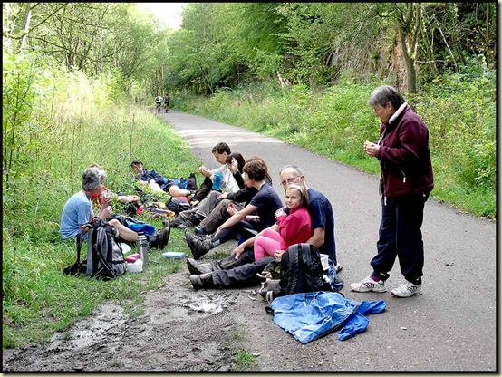
Lunch by the Monsal Trail

Fran and Stephanie arrived on their bikes - "You know it's only a few minutes walk to a much better place to stop at Miller's Dale Station" she suggested.

"We're happy enough" chirped some voices from the woods.

However, two renegades continued on regardless and found a more comfortable location, equipped with benches, ice cream van and toilets. 

Lunch at Miller's Dale station

Miller’s Dale station was once the largest on the line – situated at an important junction where passengers from Buxton could make connections with the express trains running between London and Manchester.  Whilst the line dates from 1863, it had just two platforms until 1905, when an extra three platforms were added, together with a second viaduct.  The station even had its own Post Office.

After another short break at what should really have been our lunch stop (and a suitable alternative starting point for the walk) we continued on past Miller’s Dale Quarry and The Litton Mill Railway Cutting – both SSSI’s in their own right, the latter being cut into an ancient lava flow front dating from around 330 million years ago.

My brain is starting to hurt with all this technical stuff!

At Litton Mill we left the railway for a while and passed the restored mill building, which looks much better than it did a few years ago.

The sun shone as we passed through Miller’s Dale, with coots, dabchicks and mallard all assuming their customary poses as we passed along the pleasant riverside path at Water-cum-Jolly, heading towards Cressbrook Millpond and its wall of rock.

A mystery duck:  Goosander, Long-tailed duck??Goosanders are common around here, but what's this bird, seen on the millpond? A long-tailed duck?


After crossing back over the river Wye via bridge by the weir at Cressbrook, the views open out as the path ascends back up to the railway line
, with the buildings of Monsal Head on the horizon in the near distance.  For those desiring a slightly longer walk, it would be easy to include Monsal Head on an extended itinerary.  It has good views and facilities.

Looking back towards the smart buildings of Cressbrook, it’s hard to imagine that they date from 1787 – rebuilt by Richard Arkwright junior after Richard Arkwright senior’s original 1779 mill had burnt down in 1785.  The mill’s heyday was in the 19th century, but it continued to produce high quality cotton for the lace making industry until 1965.

Looking back to Cressbrook from the Monsal Trail

Now we turned right, heading up through Cressbrook Tunnel, at 800 metres the longest tunnel on this section of line.  The track emerges into a short section of daylight with excellent panoramic views that some of us haven't enjoyed since the tunnels were closed many years ago.  Then it disappears again, into Litton Tunnel.

Cressbrook Tunnel

Tunnel Rules: Do Not Touch the Sides (you may get dirty!)  Do Not Enter if Unlit (you may get dirty!) Keep Left (or you may be run over!) Horses (may spook you!)

Exiting Litton Tunnel

We left the railway for a second and final time, saying goodbye to Fran and Stephanie, who had been monitoring our progress on their bikes, to ascend Priestcliffe Lees, another SSSI, where pansies, leadwort and orchids are said to abound.  We just found some sheep, happily grazing on the late summer vegetation.
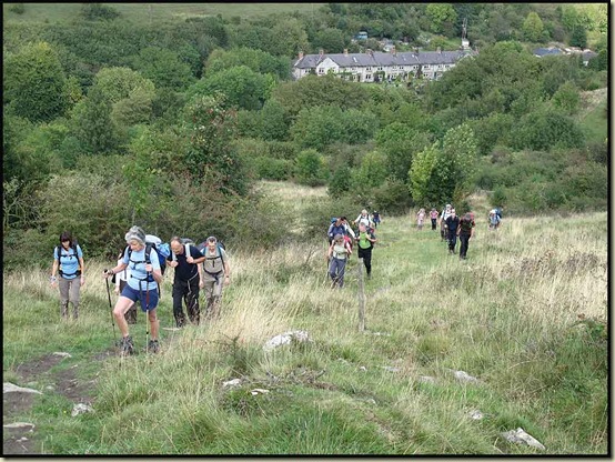
 Ascending from Litton Mill towards Taddington

It was a steep ascent, but everyone seemed happy, and some pleasant field paths then took us across the deep cleft of High Dale and back to Taddington by 4.15.

 On the last lap - across the fields to Taddington

Anyone starting from Miller’s Dale could maybe enjoy a break at the Queens Arms in Taddington, but with Sunday suppers to prepare, our party had dispersed by 4.30.

Our route is shown below – it’s about 20km (12.5 miles) with 450 metres ascent, taking around 6 hours.

Our route - 20km, 450 metres ascent, in around 6 hours

If anyone is interested, the full slide show is here.

For another pleasant six hour walk in this area see here.

Finally, thank you – everyone – for coming along; it was great to see some of you for the first time in ages, and to enjoy the company of such an eclectic mix of people.

Monday, 19 September 2011

The Millennium Trilogy – Stieg Larsson

The Stieg Larsson Millennium Trilogy

They told me “you won’t be able to put them down”.

I like ‘a good thriller’ every now and then.

‘They’ were correct.

Wednesday, 14 September 2011

Göreme Open Air Museum

Some were surprised that this World Heritage site was not on KE's itinerary for our tour. So after breakfast this morning, Susan, Roy, Sue and I set off to find out why.

Arriving just after the 8am opening time, after a twenty minute walk from the hotel, we found our way around the site compromised by early coach parties. By the time we left, about 20 coaches were in the car park for the fairly small site. A tour guide's nightmare. But the four of us managed fine, squeezing into the small Byzantine churches with their comparatively well preserved frescos.

Pictured, is the frontage of the museum's most famous church, Karanlik Kilise, the 'Dark Church'. Apparently it's one of Turkey's finest surviving churches, taking its name from the fact that it originally had very few windows. The lack of light has preserved the vivid colour of the frescos, the upper of which have been spared by iconoclastic Muslim vandals in an era preceding the boom in tourism from the 1980s.

Pottering around the museum, views were enhanced from time to time by hot air balloons that were floating as close as they could to the rock pyramids that house the churches and homes that were occupied until around the 1920s.

By 10am we were back at the hotel, Turan received his generous tip, and our party, lacking 'Cookpot' Jane, 'Geordie' Anne (left for an earlier flight) and 'Tumbling' Tessa (stayed for a later flight), was soon on the road for a last journey in the bus, to Kayseri airport.

Now in Istanbul, we are down to five in number, as eight of the party are having a few days here. Sue and I have just Alan, Dave and Lil for company as we embark on a spending spree in an effort to dispose of our remaining 9Lire!

So it's goodbye from Turkey. I'll be adding an index page in due course, and a link to a slide show, and maybe a few comments (and edits) in response to those I haven't yet seen or haven't yet been made. It was great to have been on such an enjoyable, friendly, well organised and well led trip. We will miss you all. Do keep in touch.

Sent using BlackBerry® from Orange

Tuesday 13 September 2011 - Ihlara Valley

This unexpected valley lies well hidden on the northern fringes of Mount Hasan - the volcano from which vast quantities of ash, aeons ago, landed to consolidate into the tufa that humans have subsequently carved into towns.

We reached the entrance to the valley after an hour and a half in the bus. A river runs through the wooded gorge in which pistachio trees - which only normally grow in the far east of Turkey - flourish along with poplars and willows.

Apart from habitation built into the walls of the canyon, the highlight of this area is the early Christian churches that have been carved into the rock and are adorned with frescos that have sadly been defaced. Today's picture shows Carey and Sue at the entrance to one of these churches.

Yesterday we saw a snake on our path, and a pair of Egyptian vultures soaring over the phallic towers of eroded tufa. Today someone thought they saw humming birds, but they were more likely to be willow warblers. On the other hand, Humming Bird Moths were busy feeding on the flowers that lined our lush surroundings. There was lots of chickory. The sun beat down.

Lunch was taken at a friendly restaurant on the river, before a trip to Selime ('amazing monastic complex hewn into the rock') was outvoted in favour of 'free time' back in Göreme.

Whilst the last two days have been a gradual wind down after the comparative rigours of trekking, they have been harder for Turan, who has much more to organise, without any support from Elif, without whom leading our group of sixteen has been likened to trying to herd cats. Elif was an effective backmarker.

Apart from that, Turan has toothache. I can sympathise.

After watching a beautiful moonrise, we've enjoyed another good meal at a local restaurant and have waved goodbye to Jane, who at 9.30pm jumped onto a bus that should deliver her to Izmir by tomorrow morning.

This excellent trip is drawing to a close.

Sent using BlackBerry® from Orange

Tuesday, 13 September 2011

Monday 12 September 2011 - Göreme Village

Sue and nine others rose early for a balloon ride over the 'Fairy Chimneys' of Cappadocia. Those of us who suffer from vertigo or lacked the desire to spend £145 on an hour in the sky enjoyed a lavish breakfast. Chips and boiled eggs featured prominently.

The balloonists returned elated from their experience.

Once everyone had reassembled, we hopped on the bus for a short ride to Zelve. Until the 1950s Zelve was home, for many centuries, to people who had built caves out of the solidified ash (tufa) from volcanic eruptions millions of years ago. Then the cave dwellers were rehoused in a new town at the behest of the 'far sighted' Turkish government. That has opened the old town to tourism, and we spent some time doing just that - being tourists. It was a very interesting place, with homes, churches, bakeries, etc all carved out of the rock at several different levels in three separate valleys.

After a welcome tea break we walked over a small hill to admire the spectacular fairy chimneys of Pasabaglari (pictured), before a short bus ride took us into the Red Valley for a splendid lunch at Kizilvadi Restaurant, next to Üzümlü Church which is built into the rock and has old frescos.

After ravioli and pickles and other tasty offerings, Tessa went back on the bus with Recep - she is wounded from her many falls - whilst the rest of us enjoyed a short walk back to Çiner Hotel, through the weird rock scenery of the Red Valley.

Alan and I then savoured a trip to a carpet factory that apparently stocks 1700 carpets (can that be true?), before we all enjoyed a meal at a nearby restaurant carved out of the rock.

Sent using BlackBerry® from Orange

Monday, 12 September 2011

Sunday 11 September 2011 - Lake Karagol (2800 metres) to Göreme Village via the Maden Gorge and a bus via Derinkuyu

Approx 12km, 1200m descent, 3.75 hours including stops. Then a bus ride.

Omelette with sausage was Adem's (yes, I've been spelling his name wrong for a week) parting gift to the squad, with Karen now recovered from her stomach bug.

Today's walk was entirely downhill, through the impressive Maden Gorge (pictured). Starting at 9am along a Jeep track - actually a mine road, we soon saw our bags pass by before we left the security of the dusty track in favour of a rocky, pathless descent into the fine gorge. Dippers flitted up and down, and a family of 'chukkas' (partridge) strolled back up the bank after going down for a drink.

It was rough going, and increasingly hot under the burning sun. Some were relieved when we came upon a bulldozed track used when pipes were laid to divert water from the gorge for use as a nearby town's drinking water.

Our eight day trek then came to a gentle close as the valley widened and flattened, passing fields of stubble and a picnic spot with benches (and picnickers) before the Demavend Travel bus came into sight.

Our last picnic lunch was taken beside a grey brook under a line of poplar trees dividing two fields of stubble. Turan stalked a couple of hoopoe in the field and got some good pictures of them with his Nikon.

After a short bus ride back to the village of Demirka where we started our trek over a week ago, we met the Jeep and said goodbye to both Ramazan and Elif, who could return home to her family before starting a new academic year at Istanbul University. She had proved a friendly and able assistant to Turan over the past week, and we had enjoyed her company.

A half hour bus journey on good roads led to the rather ordinary small town of Derinkuyu. This town's 'secret' is its ancient underground city, dating from around 400BC or earlier. It's one of at least 300 underground settlements, where local people took refuge from marauding Crusaders and others.

The city is like a small inverted skyscraper, at least 60 metres deep, with seven floors, lots of interconnecting passages, food stores, kitchens, stalls for animals, a winery, a church, a missionary school and much more, all serviced by a number of ventilation chimneys disguised as wells. It was fascinating to visit, and much more extensive than the catacombs we have seen in Alexandria.

A tea shop provided refreshments before we continued our short journey to Göreme, where Çiner Hotel is our base for the next couple of days. On the way we passed through an area of the 'Fairy Chimneys' for which Cappadocia, of which Göreme is at the centre, is famous. These are rock columns and pyramids that have been converted into all manner of buildings.

Our own agenda involved getting thoroughly clean after eight days of trekking. This was achieved by way of a local Turkish Bath, or by the hotel's efficient showers, according to preference. A few beers, etc, and a tasty buffet concluded the day.

Sent using BlackBerry® from Orange

Sunday, 11 September 2011

Saturday 10 September 2011 - A walk from the Yedigoller Plateau to Lake Karagol (2800 metres) via Kalesi Pass (3500 metres)

Approx 13km, 600m ascent, 6.75 hours including stops.

Whirling choughs joined the sun today in rousing us from another good night's sleep, though apparently there were a few gusts of wind that disturbed some of the group.

After a good omelette, etc for breakfast, we made our butties and, before setting off at 9am, tipped Mahmut and Bekir, who have served us well. Tessa may have added to Mahmut's tip - she was the only one of us to be served coffee in bed!

A winding path over easy ground led to a sizable lake (pictured) which is apparently the second largest on the Yedigoller Plateau. There were views across to the two peaks we have summited, shown in the above picture, and Carey took another opportunity for a swim - he's just in the picture. It took him some time to warm up afterwards; perhaps he should have taken his clothes off. Some wag suggested he take 'hyperthermia pills', another retorted that "his engine is too hot for that". Carey can fly along at a pace that puts the rest of us to shame when he wants to.

A zigzagy ascent past a large herd of sheep, many of which were rams, led to a col and a minor summit (Düzkir Peak - 3517 metres) just above the Kalesi Pass. Here we stopped for some time despite a cool nagging breeze. This cool wind had appeared overnight and has meant that today's rest stops have been cooler and shorter, though not unpleasant.

It was too early for lunch so we continued for another hour, first descending steeply down a ridge on a loose path. Whilst not difficult, the path challenged a few comfort zones, so Turan's very measured pace at the head of the snake was sensibly slow.

This was our last 'wilderness' lunch, just below 3000 metres in a wonderful rocky landscape. Up to eleven Griffon vultures were soaring in the distance, and Turan thinks a lone golden eagle also cruised past.

A final 100 metre ascend took us to picturesque Yildiz (Star) Lake, where Sue captured a mountain reflection on her memory card. There was evidence of moles here - giant moles judging by the size of the piles of earth. This would normally be a good spot for a long break, but today's cool breeze soon had us shouldering our sacks for the short descent to camp at 2800 metres, beside Lake Karagol, at the end of a Jeep track.

Tea was efficiently served by Adam, and all our favourite biscuits appeared alongside the tasty Turkish Delight. The smiling face of Bekir, who we thought we had paid off this morning, reappeared to refill our glasses. He had taken the horses back to Sokulupinar with our bags and had come round with them to this camp in the Jeep with Ramazan.

A Long-legged Buzzard soared around the cirque that houses our stony campsite. It's stony because it's a new site, and has not yet seen the irrigation and grass sowing of our previous sites. As the popularity of trekking in the Taurus Mountains increases, such sites are under constant development. Having said that, we have seen only one other party of trekkers in eight days, plus just a few independent travellers.

Adam's soup was delicious, as always, and he and Ramazan served up a delicious main course of deep fried trout and rice. This was slightly disrupted by the appearance of some ibex near camp. Dessert was very sweet but equally delicious tulumba. Sadly Karen missed all this as she has a 'tummy problem' and has taken to her bed.

Sent using BlackBerry® from Orange

Friday 9 September 2011 - A walk from the Yedigoller Plateau to an Unnamed Peak (aka DKSK -3650 metres) and back

Approx 12km, 700m ascent, 5.5 hours including stops.

After a surprisingly warm, still, windless night at 3100 metres, with the only noise coming from the two Daves, someone who tried to trample our tent at 6am, and someone who tried to enter it half an hour later, the sun hit the tent before 7am and had warmed things nicely by the time we got up.

We are on the route to the toilet, and judging by all the clumping feet we were about the last to rise, on yet another 'blue sky day'.

Ann and Breda decided to have a day off, so of the six who decided not to climb Mount Emler yesterday, only four - the two Daves, Joanna and Lil - returned up the path to the col and on to the summit today. Turan went with them and they enjoyed a good day out, completing the there and back route in about six hours.

That was 'Day 7 - Climb Emler Peak' according to the KE itinerary.

The rest of us, having climbed that peak yesterday, could enjoy an 'optional' additional walk. Our horseman, Bekir, knew the way, so he led us up to the unnamed peak that we can see from near the campsite. Elif assumed her usual position at the rear. Her trousers are looking even more battered than Tessa's shorts (which takes some doing). We had an amusing incident with the shepherds a couple of days ago when one of them said to Turan (in Turkish) "You can leave her behind" - pointing to Elif. Elif is a mountain guide in her own right and acknowledged the compliment in Turkish, to the embarrassment of the shepherd, who then addressed her as 'sister'.

The more or less pathless route led across scree and a few minor rock bands before reaching a ridge that led to the summit. Far below us was a glacial moraine with a few patches of ice revealing the residue of the glacier within the bounds of the moraine. Carey lagged behind, then zoomed on ahead, returning down under his own steam. The youth preferred his own company today.

From the views (today's picture is of the camp site early this morning) you would perhaps conject that there is very little life in this barren area. But there is life. The rock crevices and even their shaley surfaces are full of life. Today Sue photographed a number of Alpine plants, and a large flock of snow finches entertained us with their acrobatics near the summit.

It was a great spot. We dallied there for about an hour then headed down a quick descent route. A superb scree run, joyfully led by Bekir. Everyone managed fine as we descended, quite sportingly at times, as there were intervening rock bands and narrow skittery paths to negotiate.

A sting in the tail took us over an unexpected knoll, then down steep rock, past the horses to the camp site. It had been a great circular route, taking from 9.15am to 2.45pm. We could see the other four descending with Turan and some back up transport (one of our horses is unwell), about half an hour behind us. They joined us for tea with Mahmut, our jolly chef, who unfortunately has a tedious case of heartburn.

The rest of the sunny afternoon was spent relaxing, though Carey, Sue, Alan and Elif braved the icy waters of the nearby lake.

Others used various means of cleaning themselves, from a rudimentary drippy cold shower to baby wipes. The clever people (Roy and Susan) had left a bucket of cold water to warm in the sunshine. It works!

Today some threatening clouds appeared and we even had some brief periods of shade! Cloud hung over part of tomorrow's route, but by dusk it had become fluffy and disparate. Hopefully the weather will hold.

Despite Mahmut's heartburn he prepared another tasty dinner for us - soup, couscous with stew and salad, melon, beer, tea, etc, after which the cool of the evening drove us back to our sleeping bags, following a lengthy game of Uno.

NB Whilst I think these postings from Turkey are transmitting, albeit there was no signal at the 'top camp' so several days will be posted at the same time, no comments are getting through to us here, so if anyone has made a comment we probably won't see it until we get home.

Sent using BlackBerry® from Orange

Thursday 8 September 2011 - Sokulupinar (2000 metres) to the Yedigoller Plateau (3100 metres) via the Celikbuyduran Pass and Emler Peak (3723 metres)

Approx 16km, 1750m ascent, 8.75 hours including stops.

A fine mountain walk on another day of wonderful weather as the sun hammered down on our group of eighteen, now that Carey and Dave, who appears to have made a miraculous recovery despite being told by the village doctor to rest for three days, had rejoined the party.

Breakfast at 7am was a bit earlier than usual, but as we are going to sleep at around 10pm, and it gets light at 6am, it presented no problems to anyone except Jane, who tells us she lives in the shadow of a viaduct and is known at home as 'The Bag Lady of Hammersmith'.

Turan had laid on a special breakfast - Adam, who we wouldn't see for a couple of days, had manufactured a scrambled egg with mince and peppers dish.

After leaving our kit bags in a big pile, lunches were made - we manufacture our own from a wide selection of ingredients and fresh bread from the village, before setting off at 8am.

The climb to the col at 3450 metres took around six hours at Turan's 'steady' pace, including a long lunch and sunbathing break at a spring just below the col.

On the well graded ascent we were passed by our five or so ponies, carrying about five kit bags each and sundry other stuff. They looked happy, and are no doubt loved by their gentle owner.

It felt remote up at the pass, with barren landscapes in most directions, and jagged peaks backed by bright blue skies.

Turan's suggestion that last night had everyone scampering to their beds was discussed. The majority were in favour of a further 300 metre ascent to Mount Emler on this fine day. Turan wanted to keep the group together. Some felt unable to continue upwards. We would all therefore have to go down. Turan recognised some dissatisfaction with the decision and wisely split the large group into two. Six tired people descended to camp with Elif, reaching it by 3.30, for an early shower. The rest of us strolled on upwards for another hour, reaching the summit at 3pm.

It's a fine viewpoint with great views of the south side of Mount Demirkazik (the highest summit in the range) and of the distant volcanic peaks of Erciyes and Hasan, near Kayseri.

Many photos were taken and entries were made in the summit book - buried in a plastic bag under a pile of rocks. The cool wind we had encountered lower down wasn't really evident here.

The prospect of tea at camp eventually drew us away from our fine perch, and we headed back down another skittery path to the col. The 'skitters' took a further toll on Tessa's shorts; she is quite proud of her record of bum slides (five to date) and always comes up smiling.

Some small Saxifrage plants distracted us briefly, but it was a fairly speedy descent (pictured) from the col over bare rock with a shingly veneer, that drew us past a small lake to our neatly positioned campsite.

Mahmut is our cook here. A very jolly chap.

Swim club comprised Carey, who apparently had a quick dip, but the water is no doubt cool up here at 3100 metres.

The day finished with a history lesson from Turan - an overview of Turkish history and a little explanation of the 'Kurdish Problem'. I will not try to repeat the lesson here.

Dinner had been served soon after the sun went down at 6.15, after which it cools down quite a bit at this height. So although we have an enclosed dining tent, most folk had drifted off to the warmth of their sleeping bags by 9pm.

Sent using BlackBerry® from Orange

Thursday, 8 September 2011

Wednesday 7 September 2011 - Sokulupinar (2000 metres) to Dipsiz Lake (2950 metres) and back

Approx 22km, 1000m ascent, 8.5 hours including stops.

Last night's late sun was countered by this morning's late sun. It didn't hit the camp site until after we had set off at 8.40am up the track past the cave.

Breakfast included 'borek' a calzone with cheese enclosed in the toasted dough. All of Adam's making and delicious. We have a good cook.

After an hour we reached the end of the jeep track by a spring and a flock of sheep guarded by dogs. A large flock of snow finches flitted from place to place in the neighbourhood. A nearby wheatear pecked away unconcernedly, scorning the antics of the finches.

From there, a good mountain path past St John's Wort and other Alpine flowers, many with fleshy leaves to retain moisture in the dry conditions, led all the way up to our destination - a high lake, seriously depleted at this time of year through evaporation, surrounded by a mountain cirque.

It took 4.5 hours to get there. We were down to 16 today as Dave had been ordered to rest and Carey had been encouraged to spend a day with Ramazan, our Jeep driver. This would enable him to enjoy an exploration of the nearby village and gain a better insight into the local culture.

The sun beat down from a dark blue sky all day. Sunglasses were worn. Lunch was taken beside the lake.

On the descent we were invited into a shepherd family's tent, where a twelve year old boy, Mohammed, laid out a selection of his mum's knitted socks and gloves, etc. There was much interest and after a little bargaining the Welsh Witches splashed out 50 New Turkish Lire on some snazzy footwear for their coven. The tent was fairly spacious, with a small kitchen area and a blue tarpaulin over a roof constructed of wooden slats and used as a sort of cupboard. A felt overcoat was produced and Mohammed delighted his audience by demonstrating its use as a sleeping bag. Like any respectable household, this one required guests to remove their shoes before entering.

On leaving the tent, some of us moved quickly down the valley on skittery scree, past a veritable garden of Autumn Crocuses. It wasn't as steep as the stuff that had yesterday claimed at least seven fallers and ripped Tessa's shorts.

Three tents were pitched near the next spring at 2500 metres, beyond which a steep gully led towards the peaks that the tents' owners were scaling. They were not walkers.

We waited here, and lower down above the Jeep track and sheep pasture, just in case Turan wanted us to pass the sheep as one group, to minimise dog risk. He did want that, and he single-handedly saved us from being ravaged by four 4-legged enforcers, using a mixture of Turkish swear words and two walking poles.

Soon we encountered our Jeep, with Ramazan and Carey, who grinned and hijacked Joanne and Tessa for an early shower. Most of the rest of us carried on down past spent spurge and asphodel for tea and Turkish Delight that took the entire cap off one of my teeth.

Meanwhile, Sue, Susan and Roy decided to explore the cave near the campsite. It turned out to be an overhang full of sheep droppings.

After another lovely sunset (pictured), we enjoyed more of Adam's cooking before a controversial suggestion from Turan sent most of the group scampering to bed.

Sent using BlackBerry® from Orange

Wednesday, 7 September 2011

Tuesday 6 September 2011 - Sari Memedin Yurdu (1800 metres) to Sokulupinar (2000 metres)

Approx 11km, 700m ascent, 7 hours including stops and searches.

Another 'blue sky' day. After paying off our assistant cook and assembling for the now routine 9 o'clock start, we strolled up the Emli Valley, welcoming the shade from the cedar trees with their light coloured pointy-up cones. It was a hot day.

The switchback path, if you can call a single five kilometre zigzag that, took us along a sandy path, past thistles and spurges, gently up to about the same height as yesterday - 2500 metres. On the way, Tessa lost the mouthpiece of her platypus (piped drinking system), and a search party set off back to comb the area in which it had been spotted. This took some time. The seven strong vanguard led by Turan hadn't noticed the incident, which was hidden from their view. So it was a relieved Turan, who had returned down the trail to investigate, when I explained the problem (I'd gone on to meet him). The rest of the vanguard, sadly, didn't buy my 'We saw a Mountain Lion' story!

Before this incident, on the turn of the switchback, a needle of rock came into view. "I want to climb that" announced Sue. "You can't" asserted Turan. So she made do with the above photo.

After passing a large German group heading in the opposite direction, the only people we have encountered on the trail, we continued along a high path to a succulent spring. Time for lunch, with a welcoming cool breeze.

Dave 'my knee's gone pop' wasn't with us today - he took the easy route in the jeep, so it was just seventeen who continued along a lovely contouring path via a distinctive rocky tor, followed by some entertainingly skittery scree, to our destination - a host of two tone green tents in an even greener field that is subject to constant irrigation by way of a sprinkler.

En route we saw a Kestrel hover and dive, passed some 'French tents', my nose had a bleed, and Turan became the proud owner of a secondhand high heeled shoe.

The campsite is in a splendid position with a fine mountain backdrop as well as views across a deep valley towards the continuing chain of mountains to the west.

After our 4pm arrival, and 30 minutes of tea and biscuits and Turkish Delight, most of us set about washing off the dust and grime of the day. Some used the campsite showers, as usual - unheated; Sue and I chose the garden sprinkler. Interesting!

Time flew by. A 'marmot' was spotted in camp. It looked more like a ferret to me. Turan explained that in his youth he would catch these poor beasts by pouring water down their burrows and then chasing the soggy animals that emerged, weighed down by their wet fur, to exhaustion. I expect they were then savoured as a breakfast titbit in much the same way as Sue downed her grasshopper delicacy for breakfast along with this morning's boiled egg.

Sunset was magical, with pink light on the mountains above us, and great opportunities to capture silhouettes against the setting sun.

Dinner in the large open tent with its trestle table for 18, was the usual jolly gathering, after which some of us managed to stay up until after 9pm!

Sent using BlackBerry® from Orange

Tuesday, 6 September 2011

The Internet in Turkey

I've been surprised to get a signal in the 'High Taurus', but the internet connection is somewhat 'flaky'.

I'm doing my best, but don't be surprised if I go off air for a while.

The picture is of Sue's breakfast.

Have fun

Martin

Sent using BlackBerry® from Orange

Monday 5 September 2011 - A Mountain Walk from Sari Memedin Yurdu (1800 metres)

Approx 6km, 700m ascent, 6.5 hours including stops.

Another 9am start for this circular stroll into the mountains shown in yesterday's photo, from our 'pre-set' camp site at 1800 metres in the Emli Valley.

Overnight, wolves were howling and Daves were snoring.

During breakfast the sun hit the camp and normal clothing (t-shirts) was resumed.

So we enjoyed a sunny 700 metre ascent to our lunch stop, and an equally sunny descent back to camp to complete the short circuit.

Today's picture of Carey illustrates the magnificent scenery hereabouts, but fails to capture the image of a Golden Eagle soaring over the mountain tops.

That was first thing, as we left 'Fly Camp' as it is rightly known, in Mediterranean weather. The stony path soon became strewn with Autumn Crocuses, and Turan spotted ibex in the distance. They are not as tame here as in the Maritime Alps as they are hunted, but we saw more females with their young as we approached our lunch spot at the day's high point around 2500 metres.

A Red-fronted Serine drank from the spring at this point, which like a number of locations hereabouts used to be the summer home of up to ten local families - tending their sheep high in the mountains to avoid the summer heat in their villages.

Martins, Flycatchers, Pinks, Spurges and much more by way of flora and fauna entertained us on the way down. During this time, Carey suffered a gear failure - one of his borrowed but brand new Pacerpoles lost its tip. Oops! Meanwhile one Dave managed to roll over some rather prickly thistles in his attempt to become a pin cushion. Ouch! The other Dave suddenly ground to a halt - "My knee's gone 'pop'" he exclaimed. Oh dear! His dodgy digit was dutifully bandaged and Lil nursed him down to safety.

By 3.30 we were back at camp, supping tea and debating how best to 'shower'. Most people seemed to choose the 'bucket and hose' system.

By and by, dinner was served. "Enjoy your grasshopper soup" announced Adam with a wry smile. (Actually, not knowing Turkish, I have no idea what he said!)

A few beers later, Uno, a card game - an adult version of 'snap' - was attempted, using the South Wales school of Double Dutch rules. Amongst the eleven who played, friends were won and lost...

Sent using BlackBerry® from Orange

Monday, 5 September 2011

Sunday 4 September 2011 - Marti Mahallesi to Sari Memedin Yurdu (1800 metres)

Approx 10km, 300m ascent, 5 hours including stops.

After a warm night at 1600 metres I woke to a 6am call to prayers. Some had been woken to an earlier call at 5.30! A lie in and gear sort until breakfast at 8 was in order. This is a holiday. A leisurely trip. No 'Alpine' starts are planned.

Breakfast of water melon, cheese salad, bread and the usual accompaniments, and sausage omelette (did I tell you the area is famous for its sausages), was washed down with copious tea and coffee by the assembled group, now fully recovered from its jet lag, early start, and misplaced baggage/passport/hotel.

Here's the cast:
Martin and Sue - the Timperley Travellers
Susan and Roy, fellow TGO Challengers, seeking refuge from Hurricane Irene's devastation in their home town of Glastonbury, Connecticut
Dave and Elizabeth (Lil) from Hexham
Dave and Joanna from Harlow
Jane 'Egg' seeking refuge from the rigours of a yacht on the Bosphorus, and an audience for her tales of 'storm and tempest on the TGO Challenge 2011'
Alan, erstwhile TGO Challenger and landlord of the Greyhound in Burston (Staffordshire)
Tessa from Bowdon, who works in Leeds but lives very close to us
Anne from Newcastle, a University worker
Breda, Karen and Ann, seeking refuge from the autumnal ambience of South Wales
Carey, assistant editor of TGO Magazine, our junior member, a member of the Paparazzi - seeking a cover shot for the magazine
Turan - our local leader on this KE Adventure Travel trip
Elif, Turan's assistant, a budding rock climber
Adam, our cook - by far the most important member of our team
Various other 'assistants' and their own assistants...

We left in the bus at around 9 o' clock and after 5-10 minutes were dropped off at the start of a walk that took us across dusty scrubland with prickly plants under a hot sun.

There was no path, but the going was easy. By and by we paused for elevenses in the shade of a large rock. Beyond here, Sue found a friend - a giant grasshopper that over the next 500 metres wandered nonchalantly all the way down from her hat to regain terra firma.

Whilst late in the season, there are still a fair number of plants in flower including Carline like thistles and a variety of mullein.

We continued over desert like scrub with fine mountain views. The scenery hereabouts is very 'Dolomitic', with steep rock faces towering above us. A rough descent into a deep gorge - Kazkali Bogazi - delivered us to a lunch spot near a bolted rock climb. "I've been up there" commented Elif, Turan's demure assistant, who was clearly contracted to act as 'sweeper' for our group. A small group of climbers studiously ignored our noisy group.

Moving off again, our 18 strong band took another good hour to reach our campsite by around 2.15.

Time for tea and biscuits.

It's a lovely spot. A formal campsite with facilities and several 'camping fields'. We have the best of these (pictured), with a huge mountain backdrop. There's a large open tent to the right of the photo in which our meals are served.

A relaxing afternoon and evening were enjoyed by all, featuring a lengthy meal and culminating in Turan's exposition of 'the sky at night'.

Mark and Alan - thanks for your respective comments. I have Will's book 'In View of Monte Viso', Mark - an Alpine classic.

Ken - only three of us went down to that crumbling brickwork - even Reg declined to do that! It's a shame, but there really does seem to be no current use for the fine viaduct.

Sent using BlackBerry® from Orange

Sunday, 4 September 2011

Saturday 3 September 2011 - Demirka

Here we are at a camping place in the village of Demirka. (Photo taken 'tomorrow morning'.)

The journey from Reading, where Ian kindly put us up last night before dashing off to Leysin himself, started with a 3.30am taxi ride and ended after a two and a half hour bus ride from Kayseri, via another bus ride and two Turkish Airlines flights - Heathrow to Kayseri via Istanbul.

It was quite a smooth journey for most of us, but Carey had a bit of an epic yesterday in Istanbul - due to 'disappearing' luggage, passport and hotel...

All is now well though, and all 16 of us plus guides and cook are happily installed in a flotilla of tents, and have enjoyed an excellent dinner.

We flew over arid looking terrain, to Kayseri, which is famous for sofas, sunflower, sausages and potatoes. It's a thriving metropolis whose inhabitants live mainly in ugly blocks of flats.

Beyond there, the bus ride took us past fields of golden stubble, potatoes and sweetcorn, in an area that looks much more fertile from the ground than from above.

We rose from about 1100 metres to this plateau at 1600 metres, and finished about 4km from the home of Touran, KE Adventure Travel's local guide - our 'leader' for the next ten days.

Whilst settling into the tents, we enjoyed watching the late sunlight on the mountains to our east. They tower over 2000 metres above us. From here they look like barren Alpine peaks, a bit like certain of the Dolomites. We'll get a closer look tomorrow, when I'll also find time to say a few more words about the cast of sixteen who are embarking on this TGO Magazine '2011 Readers Trek'.

Sent using BlackBerry® from Orange